elm creek · champlin - corcoran - dayton ... updated river hydraulics and/or volume ... dated...
TRANSCRIPT
CHAMPLIN - CORCORAN - DAYTON - MAPLE GROVE - MEDINA - PLYMOUTH - ROGERS
elm creek Watershed Management Commission
ADMINISTRATIVE OFFICE 3235 Fernbrook Lane Plymouth, MN 55447 PH: 763.553.1144 FAX: 763.553.9326 email: [email protected] www.elmcreekwatershed.org
TECHNICAL OFFICE Hennepin County
Dept. of Environment & Energy 701 Fourth Ave S Suite 700
Minneapolis, MN 55415-1600 PH: 612.348-7338 • FAX: 612.348.8532
Email: [email protected]
January 3, 2018
Representatives Elm Creek Watershed Management Commission Hennepin County, MN
The meeting packets for these meetings may be found on the Commission’s website: http://elmcreekwatershed.org/pages/Meetings/
Dear Representatives:
A regular meeting of the Elm Creek Watershed Management Commission will be held on Wednesday, January 10, 2018, at 11:30 a.m. in the Mayor’s Conference Room at Maple Grove City Hall, 12800 Arbor Lakes Parkway, Maple Grove, MN.
Please email Tiffany at [email protected] to confirm whether you or your Alternate will be attending the regular meeting.
Thank you.
Regards,
Judie A. Anderson Administrator JAA:tim Encls: Meeting Packet
cc: Alternates Joel Jamnik TRPD
HCEE Diane Spector Clerks
BWSR Met Council Official Newspaper
MPCA DNR
Z:\Elm Creek\Meetings\Meetings 2018\01 Notice_reg meeting.docx
Item 01

A = Action item E = Enclosure provided I = Informational update available at meeting RPFI ‐ removed pending further information R = Will be removed RP= Information will be provided in revised meeting packet….. D = Project is denied AR awaiting recordation *in meeting packet
**available at meeting CHAMPLIN - CORCORAN - DAYTON - MAPLE GROVE - MEDINA - PLYMOUTH - ROGERS
elm creek Watershed Management Commission ADMINISTRATIVE OFFICE 3235 Fernbrook Lane Plymouth, MN 55447 PH: 763.553.1144 • FAX: 763.553.9326 Email: [email protected] www.elmcreekwatershed.org
TECHNICAL OFFICE Hennepin County
Dept. of Environment and Energy 701 Fourth Ave S Suite 700
Minneapolis, MN 55415-1600 PH: 612.348-7338 • FAX: 612.348.8532
Email: [email protected]
AGENDA January 10, 2018
1. Call Regular Meeting to Order. a. Approve Agenda.* 2. Consent Agenda. a. Minutes last Meeting.* b. Treasurer’s Report and Claims.* 3. Open Forum. 4. Action Items.
a. Project Reviews – see Staff Report.* b. 2017 Work Plan.**
5. New Business. a. Cost Share Policy.* 1) 2017 CIP.* 6. Grant Opportunities and Updates. a. Fish Lake Internal Phosphorus Loading Control. b. Rush Creek Headwaters Subwatershed Assessment.* 7. Education. a. Education and Outreach Update.* b. FLARA Water Quality Grant.** 8. Elm Creek Watershed‐wide TMDL. 9. Watershed Management Plan. 10. Communications. 11. Project Reviews – also see Staff Report.* 12. Other Business. 13. Adjourn. Z:\Elm Creek\Meetings\Meetings 2018\01 agenda.docx
Item 01a

A = Action item E = Enclosure provided I = Informational update available at meeting RPFI ‐ removed pending further information R = Will be removed RP= Information will be provided in revised meeting packet….. D = Project is denied AR awaiting recordation *in meeting packet
**available at meeting CHAMPLIN - CORCORAN - DAYTON - MAPLE GROVE - MEDINA - PLYMOUTH - ROGERS
Project Reviews. (See Staff Report.*)
a. 2013‐046 Woods of Medina, Medina.
b. 2014‐015 Rogers Drive Extension, Rogers.
c. 2015‐004 Kinghorn Outlet A, Rogers.
d. AR 2015‐030 Kiddiegarten Child Care Center, Maple Grove.
e. 2016‐002 The Markets at Rush Creek, Maple Grove.
f. 2016‐004 Park Storage Place, Corcoran.
g. 2016‐005W Ravinia Wetland Bank Plan, Corcoran.
h. AR 2016‐026 Faithbrook Church, Dayton.
i. 2016‐040 Kinghorn 4th Addition, Rogers.
j. 2016‐047 Hy‐Vee Maple Grove #1 (Hy‐Vee Maple Grove North).
k. AR 2016‐052 The Woods at Rush Creek, Maple Grove.
l. E R 2017‐002 RDO Site Plan, Dayton.
m. AR 2017‐014 Laurel Creek, Rogers.
n. AR 2017‐016 Territorial Woods, Maple Grove.
o. AR 2017‐017 Mary Queen of Peace Catholic Church, Rogers.
p. AR 2017‐019 Medina Senior Living Community, Medina.
q AR 2017‐021 Hindu Society of MN Staff Housing, Maple Grove.
r. 2017‐028W Fehn Meadows Wetland Bank, Corcoran.
s. AR 2017‐029 Brayburn Trails, Dayton.
t. 2017‐030 Brindle Path, Medina.
u. 2017‐031 Bass Lake Crossing, Corcoran.
v. AR 2017‐034 Plymouth Memory Care, Plymouth.
w. 2017‐035 Weston Woods PUD, Medina.
x. 2017‐036 Enclave at Elm Creek, Plymouth.
y. AR 2017‐037 Corcoran L‐80 Lift Station MCES Project 808520, Corcoran.
z A I 2017‐038 Bass Lake Estates, Corcoran.
aa. 2017‐039 Rush Creek Apartments, Maple Grove.
ab. E R 2017‐040 Capitol Beverage, Rogers.
ac. 2017‐044 Reserve at Medina 2nd Addition, Medina.
ad. 2017‐045 Fish Lake Estates, Maple Grove.
af. 2017‐046W Wessell Property Wetland Delineation, Corcoran.
ag. 2017‐047W Newman Property Wetland Delineation, Corcoran.
ah. 2017‐048W Ebert Parcel Wetland Delineation, Corcoran.
ai. 2017‐049W Rolling Hills Wetland Delineation, Corcoran.
aj. 2017‐050W Ernie Mayer Wetland/floodplain violation, Corcoran.
ak. A E 2017‐051 Mallard South 2nd Addition, Rogers.
al. E 2017‐052W John Meister Ditch Cleaning, Corcoran ‐ formerly 2015‐031W
am. A I 2017‐053 Corcoran Community Solar, Corcoran.
an.
ao.
ap.
aq.
ar.
as.
Item 01a

CHAMPLIN - CORCORAN - DAYTON - MAPLE GROVE - MEDINA - PLYMOUTH - ROGERS
elm creek Watershed Management Commission ADMINISTRATIVE OFFICE 3235 Fernbrook Lane Plymouth, MN 55447 PH: 763.553.1144 • FAX: 763.553.9326 Email: [email protected] www.elmcreekwatershed.org
TECHNICAL OFFICE Hennepin County
Dept. of Environment and Energy 701 Fourth Ave S Suite 700
Minneapolis, MN 55415-1600 PH: 612.348-7338 • FAX: 612.348.8532
Email: [email protected]
Technical Advisory Committee and
Regular Meeting Minutes December 13, 2017
I. A meeting of the Technical Advisory Committee (TAC) for the Elm Creek Watershed Management Commission was convened at 10:05 a.m., Wednesday, December 13, 2017, in the Mayor’s Conference Room, Maple Grove City Hall, 12800 Arbor Lakes Parkway, Maple Grove, MN.
In attendance were: Kevin Mattson, Corcoran; Rick Lestina and Mark Lahtinen, Maple Grove; Kaci Fisher, Hakanson‐Anderson, Medina; Ben Scharenbroich, Plymouth; Andrew Simmons, Rogers; James Kujawa, Jason Swenson, and Kirsten Barta, Hennepin County Dept. of Environment and Energy (HCEE); Brian Vlach, Three Rivers Park District (TRPD); Jeff Weiss, Barr Engineering; and Judie Anderson, JASS.
Not represented: Champlin and Dayton.
Also present: Brad Martens, Corcoran; Doug Baines, Dayton; Dusty Finke and Elizabeth Weir, Medina; and Suzanne Jiwanni and Rita Weaver, MnDNR.
II. Elm Creek FEMA Updates.
A. The Federal Emergency Management Agency (FEMA) has awarded the MnDNR a grant to update the Special Flood Hazard Areas (SFHAs) in the Twin Cities HUC8 watershed. The scope of the grant depends on individual river reaches, but in most cases includes
1. Updated hydrology, either through modeling or use of statistical methods 2. Updated river hydraulics and/or volume analyses 3. Creating the floodway and floodplain shapefiles and x‐section shapefiles 4. Creating depth grids 5. Development of Work Maps 6. A project narrative describing the above activities
B. Pass‐through grants can be provided so that watershed organizations can complete some or all of these tasks. FEMA would like to leverage existing data wherever possible so Twin Cities WMOs within the HUC8 watershed are being approached to see if they have any data that can support this effort. Since leveraged data will reduce overall project cost, WMOs that can provide data will be offered remaining funds allotted for that watershed to be used for such activities as flood risk reduction or communication activities.
C. A map* of the FEMA Study Areas in the Elm Creek hydrologic boundary was distributed. It shows which reaches should be studied using approximate or detailed methods.
D. Work can begin as soon as the pass‐through grant paperwork with the state is completed. All deliverables must be submitted to the MnDNR by April 2020. The Scoping Document* outlines a suggested intermediate timeline.
E. Total funds for each HUC watershed have been established between FEMA and the DNR. The cost estimates are based on MnDNR staff developing new hydrologic and hydraulic models using HEC‐HMS and HEC‐RAS,
Item 02a

elm creek Watershed Management Commission TAC and Regular Meeting Minutes – December 13, 2017 Page 2
CHAMPLIN - CORCORAN - DAYTON - MAPLE GROVE - MEDINA - PLYMOUTH - ROGERS
delineating all floodplains and x‐section shapefiles, and developing the depth grids. These cost estimates will not be provided to the WMOs and the amount of the grant will not exceed the FEMA‐negotiated costs for each WMO. Any unused funds can be passed through to the WMO to complete other flood risk reduction activities. These activities must be pre‐approved by MnDNR staff.
F. Technical Staff will work with the MnDNR to put together a draft scope of work and cost estimate for review by the MnDNR staff. It will be brought back to the Commission at their January meeting for further discussion and a decision. Should it be decided that HCEE staff will do the work, Swenson will be the lead and overflow project review work will be performed by Weiss.
III. Rules and Standards.
In the meeting packet was a copy of a letter* addressed to the TAC/Commission from the City of Corcoran dated December 7, 2017, regarding proposed revisions to the Commission’s rules and standards.
A. Abstraction Standards. Discussions at previous TAC meetings have resulted in the following considerations: (proposed changes are shown in parenthesis) 1. Increase soil amendment credit from 0.5” to 0.75” over area amended. 2. Land preservation through additional buffer or undisturbed forest or grassland ‐ increase credit from 0.5” to 0.75” over area amended. 3. Disconnecting impervious areas. 4. Capture and reuse – volume per Ramsey‐Washington Stormwater Reuse Calculator. 5. Soluble phosphorus filtration media – iron filings, etc. 6. Filtration/biofiltration at 2x abstraction volume. (2.2” filtered volume, increased from 1:1 ratio (1.1” filtered volume)
Objective is to prioritize abstractions that truly result in volume decreases offsite, while allowing for device to meet poor soil conditions.
B. The members also discussed Standards that would be used prior to approval of filter basin or would be handled through the city review process. Items discussed included underdrains, observation/cleanouts, utility trace wires, marking stakes and animal guards for daylighted underdrains, use of filter fabric, irrigation requirements, and actual phosphorus removals for the various abstractions.
The TAC recommended that the Commission adopt the soil amendment/preservation and buffer credit increase to 0.75”, but that the filtration/biofiltration volume remain at 1.1”.
IV. Capital Projects.
The City of Medina has submitted the Hickory Drive Stormwater Improvement Project for inclusion on the Commission’s CIP. The estimated project cost is $225,000, with the Commission’s share being 25%, or $56,250. The members agreed by consensus to move this project forward.
V. Wetland Conservation Act (WCA) LGU.
The Commission currently serves as the local government unit (LGU) for the Wetland Conservation Act (WCA) for the cities of Champlin and Corcoran. Currently these cities are invoiced by the Commission for Staff time to review and service wetland violations within their boundaries.
Champlin has agreed to take over full LGU responsibility for WCA on January 1, 2018. The City of Corcoran has requested that the Commission continue in its role as LGU until January 1, 2019, since a budget to serve in this capacity has not been approved by the City for 2018. Motion by Kujawa, second by Lestina to recommend the Commission approve Corcoran taking over the LGU duties for their jurisdiction in 2019. Motion carried unanimously.
Item 02a

CHAMPLIN - CORCORAN - DAYTON - MAPLE GROVE - MEDINA - PLYMOUTH - ROGERS
elm creek Watershed Management Commission TAC and Regular Meeting Minutes – December 13, 2017 Page 3
VI. The meeting of the Technical Advisory Committee was adjourned at 11:35 a.m.
I. A regular meeting of the Elm Creek Watershed Management Commission was called to order at 11:50 a.m., Wednesday, December 13, 2017, in the Mayor’s Conference Room, Maple Grove City Hall, 12800 Arbor Lakes Parkway, Maple Grove, MN, by Chairman Doug Baines.
Present were: Sharon Meister, Corcoran; Doug Baines, Dayton; Joe Trainor, Maple Grove; Elizabeth Weir, Medina; Fred Moore, Plymouth; James Kujawa, Jason Swenson and Kirsten Barta, Hennepin County Dept. of Environment and Energy (HCEE); Brian Vlach, Three Rivers Park District (TRPD); Jeff Weiss, Barr Engineering; and Judie Anderson, JASS.
Not represented: Champlin and Rogers.
Also present: Brad Martens and Kevin Mattson, Corcoran; Mark Lahtinen, Maple Grove; Ben Scharenbroich, Plymouth; and Andrew Simmons, Rogers.
A. Motion by Weir, second by Moore to approve the revised agenda.* Motion carried unanimously.
B. Motion by Weir, second by Meister to approve the minutes* of the November 8, 2017 regular meeting. Motion carried unanimously.
C. Motion by Moore, second by Weir to approve the December Treasurer’s Report and Claims* totaling $25,874.23. Motion carried unanimously.
II. Open Forum.
Martens recapped the Open House held on December 7 to present the Rush Creek Subwatershed Assessment project to local residents. He stated that approximately 60‐70 attended the meeting and the information was well received.
III. Action Item.
Motion by Moore, second by Weir to approve Non‐Waiver of Liability Insurance Coverage.* Motion carried unanimously.
IV. Technical Advisory Committee (TAC) Update. (Also refer to pages 1‐2 of these minutes.)
A. Revisions to the Commission’s rules and standards were discussed by the TAC members. The TAC recommended that the Commission adopt a soil amendment/preservation and buffer credit increase to 0.75”, and that the filtration/biofiltration volume remain at 1.1”. Motion by Moore, second by Weir to approve the TAC’s recommendations. Motion carried unanimously.
B. The Commission serves as the Wetland Conservation Act (WCA) LGU for the cities of Champlin and Corcoran. Champlin has agreed to take on the role of WCA LGU for their jurisdiction beginning on January 1, 2018. Motion by Weir, second by Trainor that the Commission relinquish the role of WCA LGU for the City of Corcoran on January 1, 2019. This motion was withdrawn.
Motion by Moore, second by Trainor authorizing the Commission to invoice back to the affected city(ies) all costs related to its role as the LGU for the WCA, effective January 1, 2019. Motion carried unanimously.
C. Capital Projects. The City of Medina has submitted the Hickory Drive Stormwater Improvement Project for inclusion on the Commission’s CIP. The estimated project cost is $225,000, with the Commission’s share being 25%, or $56,250. The project includes installation of a stormwater pond for a 8.3‐acre drainage area and stabilization of approximately 300 linear feet of gully erosion. Motion by Weir, second by Trainor to add this project to the Commission’s CIP. Motion carried unanimously.
Item 02a

elm creek Watershed Management Commission Regular Meeting Minutes – December 13, 2017 Page 4
CHAMPLIN - CORCORAN - DAYTON - MAPLE GROVE - MEDINA - PLYMOUTH - ROGERS
V. New Business.
Project Review 2017‐050 Ernie Mayer Wetland/Floodplain Violation, Corcoran.* A potential wetland violation has occurred on parcels operated by Ernie Mayer. An initial site inspection confirmed the wetland violation. An access road was constructed from Larkin Road into these parcels and appears to be constructed within MN Wetland Conservation Act jurisdictional wetlands. In addition, this work was done in the Rush Creek floodplain. A Technical Evaluation Panel (TEP) met on‐site on December 11. They will help the LGU (the Commission) and DNR determine the extent of the violation. The Hennepin County Soil Conservation District will then develop the restoration order for the DNR Conservation Officer to issue to the landowner for any violation that has occurred on the site. A Cease and Desist Order was issued.
VI. Grant Opportunities and Updates.
A. Internal Phosphorus Loading Control in Fish Lake project.
Vlach gave a PowerPoint presentation of the alum treatment that occurred September 18‐21, 2017. Alum was applied to 120 acres of Fish Lake at depths greater than 20 feet. A total of 95,349 gallons of alum (22 alum trucks) was applied to the lake. The applicator, HAB Aquatic Solutions, set up a website (http://fishlakealum.com), providing daily updates of the project and an opportunity for folks to submit their questions about the project.
The Fish Lake Area Residents Association (FLARA) hosted a media event on September 20. Baines attended the event representing the Elm Creek Commission. There were approximately 10‐15 homeowners in attendance. There were also presentations by HAB Aquatic Solutions and Three Rivers Park District (TRPD) about the project followed by a boat tour in order to observe the alum application. The CCX news media video is available at: https://www.youtube.com/watch?v=Mt1gYo5lGtw
The next steps include collecting sediment cores to determine the alum dosage calculations in 2018 and continuing to monitor the lake to determine the effectiveness of the first treatment. The second treatment will occur in the spring of 2019. The estimated cost for two treatments is $300,000; the first treatment cost $176,379. Project funding sources include the BWSR Clean Water Fund Grant, the City of Maple Grove, FLARA, TRPD, and the Commission.
B. Rush Creek Headwaters Subwatershed Assessment project. In November, Wenck staff completed the first draft of analysis with ACPF (Agricultural Conservation Planning Framework; model inputs: lidar, soils, land use) and PTMApp (Prioritize resources and issues impacting them, Target specific fields to place BMPs, Measure pollutant reduction and BMPs) tools, reviewed the initial model results at a Core Team meeting, created website content, and prepared for the December open house at the City of Corcoran.
In December, Wenck staff facilitated the Open House and will complete a second round of analysis with ACPF and PTMApp tools to prioritize BMPs. They will also continue to prepare website content.
VII. Education.
A. Included in the packet was the December WMWA (West Metro Water Alliance) update.*
1. WMWA has switched over its email distribution system for the WaterLinks e‐newsletter from Hennepin County to MailChimp. In order to keep receiving WaterLinks (or to newly subscribe), go to westmetrowateralliance.org/contact.html to sign up.
2. The Basset Creek WMO and the City of Plymouth both recently hosted salt applicator workshops, mostly attended by city staff and only a few private applicators.
3. WMWA is currently discussing options to assist property owners with rain gardens and native plant conversions. Two options being considered are 1) funding two hours of on‐site technical assistance for owners who take the Metro Blooms Landscaping workshop; and/or 2) providing reimbursement for the cost of purchasing native plants up to a certain amount, say $100. These ideas are still under development.
Item 02a

elm creek Watershed Management Commission Regular Meeting Minutes – December 13, 2017 Page 5
CHAMPLIN - CORCORAN - DAYTON - MAPLE GROVE - MEDINA - PLYMOUTH - ROGERS
4. WMWA is also planning to continue facilitating native plant sales by linking up native growers with community events such as festivals and farmer’s markets. WMWA would pay any booth fees charged for the event and sponsor and advertise the event; the grower would be free to sell plants.
5. Wenck Staff met with Patience Caso (HCEE) and two Master Water Steward students who live in Robbinsdale and are interested in learning more about the watersheds and how they can help foster citizen engagement. masterwaterstewards.org/
6. Website/Social Media. The website Google Analytics for November 2017 as well as the Facebook insights for the last 28 days for Shingle Creek and WMWA were attached to the update.
7. The next WMWA meeting is scheduled for 8:30 a.m., Tuesday, January 16, 2018, at Plymouth City Hall. Commissioners are encouraged to attend.
B. “Road salt is polluting our water. Here’s how we can fix it,” MPR News.*
C. On November 14, 2017, Baines attended the Lake Effect: Protecting Water through Innovative Collaboration,* part of the Moos Family Lecture Series sponsored by the Freshwater Society. Speaker Kathy Lake is the Pollution Prevention Manager for the Madison Metropolitan Sewerage District. She discussed her innovative approach to addressing seemingly intractable, watershed‐wide pollution issues. Baines praised the presentation, which was co‐sponsored by the Elm Creek Commission.
VIII. Communications.
IX. Other Business.
A. Weir inquired as to the status of the manure management ordinance. Barta will continue to work to create guidance on this issue.
B. The following projects are discussed in the December Staff Report.* ("W" denotes wetland project.)
1. 2013‐046 Woods of Medina, Medina. 2. 2014‐015 Rogers Drive Extension, Rogers. 3. 2015‐004 Kinghorn Outlet A, Rogers. 4. 2015‐030 Kiddiegarten Child Care Center, Maple Grove. 5. 2016‐002 The Markets at Rush Creek, Maple Grove. 6. 2016‐004 Park Place Storage Site Plans, Corcoran. 7. 2016‐005W Ravinia Wetland Bank, Corcoran. 8. 2016‐026 Faithbrook Church, Dayton. 9. 2016‐040 Kinghorn 4th Addition, Rogers. 10. 2016‐047 Hy‐Vee Maple Grove #1, Maple Grove. 11. 2016‐052 The Woods at Rush Creek, Maple Grove.
12. 2017‐002 RDO Site Plan, Dayton. 13. 2017‐013W 20417 Larkin Road, Corcoran. 14. 2017‐014 Laurel Creek, Rogers. 15. 2017‐016 Territorial Woods, Maple Grove. 16. 2017‐017 Mary Queen of Peace Catholic Church, Rogers 17. 2017‐019 Medina Senior Living Community, Medina. 18. 2017‐021 Hindu Society of MN Staff Housing, Maple Grove. 19. 2018‐022 CSAH81 and CSAH101 and 13 Intersection Improvements, Rogers. 20. 2017‐027W Mill Pond Restoration, Champlin. 21. 2017‐028W Fehn Meadows Wetland Bank, Corcoran. 22. 2017‐029 Brayburn Trails, Dayton. 23. 2017‐030 Brindle Path, Medina.
Item 02a

elm creek Watershed Management Commission Regular Meeting Minutes – December 13, 2017 Page 6
CHAMPLIN - CORCORAN - DAYTON - MAPLE GROVE - MEDINA - PLYMOUTH - ROGERS
24. 2017‐031 Bass Lake Crossing, Corcoran. 25. 2017‐034 Plymouth Memory Care, Plymouth. 26. 2017‐035 Weston Woods of Medina PUD. 27. 2017‐036 Enclave at Elm Creek, Plymouth. 28. 2017‐037 L‐80 Lift Station MCES, Corcoran. 29. 2017‐038 Bass Lake Estates, Corcoran. 30. 2017‐039 Rush Creek Apartments, Maple Grove. 31. 2017‐040 Capitol Beverage, Rogers. 32. 2017‐044 Reserve at Medina 2nd Addition, Medina. 33. 2017‐045 Fish Lake Estates, Maple Grove. 34. 2017‐046W Wessell Wetland Delineation, Corcoran. 35. 2017‐047W Newman Wetland Delineation, Corcoran. 36. 2017‐048W Ebert Parcel Wetland Delineation, Corcoran. 37. 2017‐049W Rolling Hills Wetland Delineation, Corcoran. 38. 2017‐050W Ernie Mayer Wetland/floodplain violation, Corcoran.*
C. Adjournment. There being no further business, motion by Weir, second by Moore to adjourn the meeting. Motion carried unanimously. The meeting was adjourned at 12:59 p.m.
Respectfully submitted,
Judie A. Anderson, Recording Secretary JAA:tim Z:\Elm Creek\Meetings\Meetings 2017\12 TAC and Regular Meeting Minutes.docx
Item 02a
RULE D ‐ STORMWATER MANAGEMENT RULE G ‐ WETLAND ALTERATION RULE E ‐ EROSION AND SEDIMENT CONTROL RULE H – BRIDGE AND CULVERT CROSSINGS RULE F – FLOODPLAIN ALTERATION RULE I – BUFFERS Italics indicates new information indicates enclosure
CHAMPLIN • CORCORAN • DAYTON • MAPLE GROVE • MEDINA •PLYMOUTH • ROGERS
elm creek Watershed Management Commission
ADMINISTRATIVE OFFICE 3235 Fernbrook Lane Plymouth, MN 55447 PH: 763.553.1144 FAX: 763.553.9326 email: [email protected] www.elmcreekwatershed.org
TECHNICAL OFFICE Hennepin County
Environment and Energy Dept 701 Fourth Ave S Suite 700
Minneapolis, MN 55415-1600 PH: 612.348-7338 • FAX: 612.348.8532
Email: [email protected]
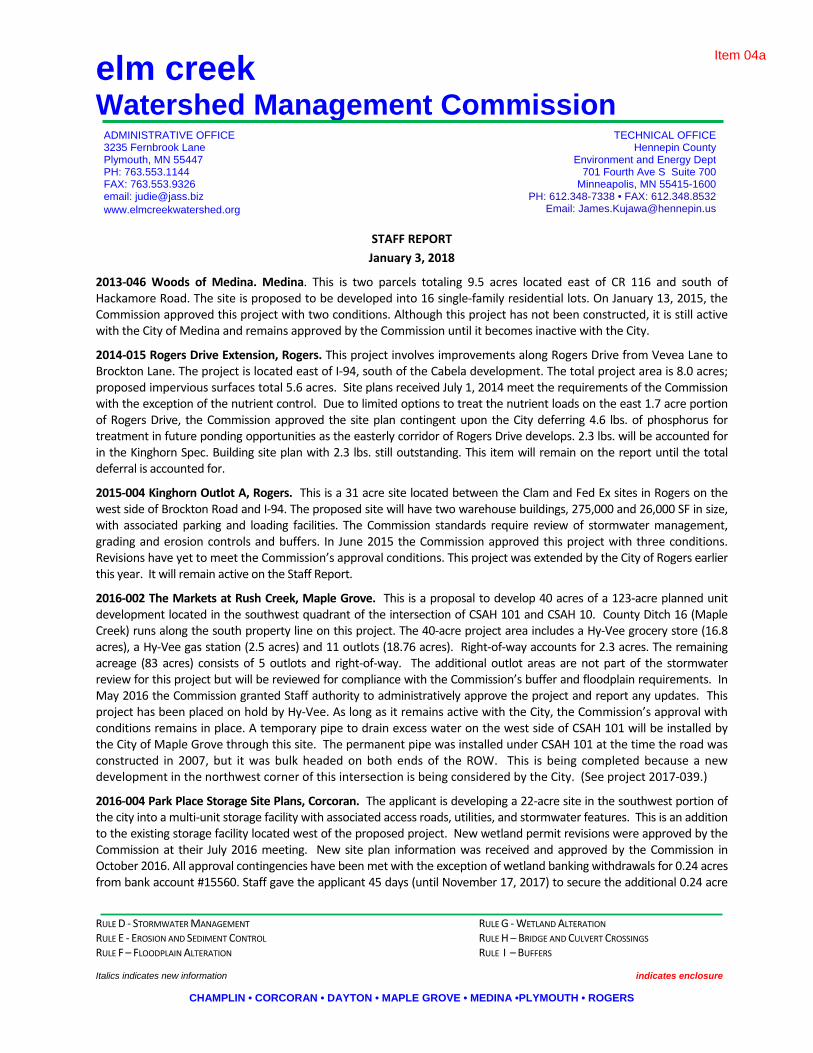
STAFF REPORT January 3, 2018
2013‐046 Woods of Medina. Medina. This is two parcels totaling 9.5 acres located east of CR 116 and south of Hackamore Road. The site is proposed to be developed into 16 single‐family residential lots. On January 13, 2015, the Commission approved this project with two conditions. Although this project has not been constructed, it is still active with the City of Medina and remains approved by the Commission until it becomes inactive with the City.
2014‐015 Rogers Drive Extension, Rogers. This project involves improvements along Rogers Drive from Vevea Lane to Brockton Lane. The project is located east of I‐94, south of the Cabela development. The total project area is 8.0 acres; proposed impervious surfaces total 5.6 acres. Site plans received July 1, 2014 meet the requirements of the Commission with the exception of the nutrient control. Due to limited options to treat the nutrient loads on the east 1.7 acre portion of Rogers Drive, the Commission approved the site plan contingent upon the City deferring 4.6 lbs. of phosphorus for treatment in future ponding opportunities as the easterly corridor of Rogers Drive develops. 2.3 lbs. will be accounted for in the Kinghorn Spec. Building site plan with 2.3 lbs. still outstanding. This item will remain on the report until the total deferral is accounted for.
2015‐004 Kinghorn Outlot A, Rogers. This is a 31 acre site located between the Clam and Fed Ex sites in Rogers on the west side of Brockton Road and I‐94. The proposed site will have two warehouse buildings, 275,000 and 26,000 SF in size, with associated parking and loading facilities. The Commission standards require review of stormwater management, grading and erosion controls and buffers. In June 2015 the Commission approved this project with three conditions. Revisions have yet to meet the Commission’s approval conditions. This project was extended by the City of Rogers earlier this year. It will remain active on the Staff Report.
2016‐002 The Markets at Rush Creek, Maple Grove. This is a proposal to develop 40 acres of a 123‐acre planned unit development located in the southwest quadrant of the intersection of CSAH 101 and CSAH 10. County Ditch 16 (Maple Creek) runs along the south property line on this project. The 40‐acre project area includes a Hy‐Vee grocery store (16.8 acres), a Hy‐Vee gas station (2.5 acres) and 11 outlots (18.76 acres). Right‐of‐way accounts for 2.3 acres. The remaining acreage (83 acres) consists of 5 outlots and right‐of‐way. The additional outlot areas are not part of the stormwater review for this project but will be reviewed for compliance with the Commission’s buffer and floodplain requirements. In May 2016 the Commission granted Staff authority to administratively approve the project and report any updates. This project has been placed on hold by Hy‐Vee. As long as it remains active with the City, the Commission’s approval with conditions remains in place. A temporary pipe to drain excess water on the west side of CSAH 101 will be installed by the City of Maple Grove through this site. The permanent pipe was installed under CSAH 101 at the time the road was constructed in 2007, but it was bulk headed on both ends of the ROW. This is being completed because a new development in the northwest corner of this intersection is being considered by the City. (See project 2017‐039.)
2016‐004 Park Place Storage Site Plans, Corcoran. The applicant is developing a 22‐acre site in the southwest portion of the city into a multi‐unit storage facility with associated access roads, utilities, and stormwater features. This is an addition to the existing storage facility located west of the proposed project. New wetland permit revisions were approved by the Commission at their July 2016 meeting. New site plan information was received and approved by the Commission in October 2016. All approval contingencies have been met with the exception of wetland banking withdrawals for 0.24 acres from bank account #15560. Staff gave the applicant 45 days (until November 17, 2017) to secure the additional 0.24 acre
Item 04a

RULE D ‐ STORMWATER MANAGEMENT RULE G ‐ WETLAND ALTERATION RULE E ‐ EROSION AND SEDIMENT CONTROL RULE H – BRIDGE AND CULVERT CROSSINGS RULE F – FLOODPLAIN ALTERATION RULE I – BUFFERS Italics indicates new information indicates enclosure
CHAMPLIN • CORCORAN • DAYTON • MAPLE GROVE • MEDINA •PLYMOUTH • ROGERS
Staff Report January 3, 2018 Page 2
credits. The applicant has requested some additional time to secure these credits due to a specific bank site expected to be certified by BWSR in the next 60 days. Staff approved the request. They are working toward an agreement with the Murray Ball Wetland Bank in Greenfield.
2016‐005W Ravinia Wetland Replacement Plan, Corcoran. In February 2016, Lennar Corporation submitted a Wetland Banking Concept Plan for Phase II of the Ravinia Development. This plan was withdrawn in favor of an onsite wetland replacement plan. At their December 2016 meeting the Commission approved Staff’s findings and recommendations dated January 10, 2017. Final wetland impacts will be 1.22 acres. Wetland credits created on site will be 4.01 acres. Excess credits of 0.11 acres are proposed to be used on Lennar’s Laurel Creek development in Rogers (2017‐014). All contingency items that were part of Commission’s approval have been met. Construction on the site began last spring. Vegetation planting and management took place throughout 2017. Barr Engineering was contacted by the Commission to provide monitoring to ensure the replacement meets the performance standards of the approved plans. Monitoring will begin in 2018.
2016‐040 Kinghorn 4th Addition, Rogers. This is a 13.7‐acre parcel located in the northwest corner of the intersection of Brockton Lane and Rogers Drive. An industrial warehouse with 8.8 acres of new impervious area is proposed for the site. The plan includes the use of a NURP pond and a biofiltration basin to meet Commission requirements for rates, water quality and abstraction. The adjacent site is likely to be developed in the near future and some of the stormwater features were oversized to accommodate future development. In November 2016 the Commission approved the project with the following conditions: 1) approval of only this phase; future phases will need additional review and approval; 2) final modifications to the hydrologic modeling; 3) additional details are provided for a proposed water re‐use system; 4) an O&M Plan for the pond and biofiltration basin is completed and recorded on the final plat; 5) modification of the storm sewer system to maximize the area draining to the NURP pond; and 6) receipt and review of wetland‐related documentation if wetlands are present. Condition #1 required no action, so has been met. Condition #2 has been met for the current design; however, any future modifications to the design will require additional review. Conditions #3‐6 remain outstanding and are expected to be addressed during final design. Staff has been in contact with the project engineer to receive an update, but no new information has been provided. 2016‐047 Hy‐Vee North Maple Grove. The applicant is proposing to disturb 13 acres of a 20.4‐acre site located at the northeast corner of Maple Grove Parkway and 99th Avenue for the purpose of constructing a grocery store, fuel station, convenience store and parking facilities. Staff sent preliminary review comments and requested revisions on December 14. In their findings dated January 10, 2017, Staff recommended approval of this project subject to 1) receipt, approval, and recordation of an Operations and Maintenance Plan for the pond and the iron‐enhanced filtration system, 2) revisions for items relating to buffer requirements and erosion and sediment control as enumerated in the findings, and 3) receipt of a signed and dated final plan set. The Commission approved Staff’s recommendations at their January 11, 2017 meeting with the additional requirement that the Commission receive and comment on a WCA impact notice. No new information has been received to date.
2017‐002 RDO Dayton Site Plan. This is a commercial development proposal on a 25.6± acre plot located between I94 and Holly Lane. The project will develop the south 16 acres, to create about 7.6 acres of impervious cover. This project was approved with conditions by the Commission at their March 8, 2017 meeting. The City approved the PUD in May. The applicant has decided not to begin construction until spring 2018 and requested an extension to December 31, 2017, for the project’s approval conditions set by the Commission at their March meeting. Revised site plans dated December 14, 2017 were reviewed and approved by Staff. All the required conditions set forth by the Commission were met. This item will be removed from the report.
2017‐028W Fehn Meadows Wetland Bank, Corcoran. The owner of this 63‐acre parcel would like to pursue a potential wetland banking project during development. This site is located south of CR 117 between Trail Haven and Cain Roads. An initial wetland bank scoping document was provided to the Commission as LGU for the City of Corcoran. This will be reviewed with BWSR to determine if the site is a good candidate for their Wetland Banking Program. If so, the next
Item 04a

RULE D ‐ STORMWATER MANAGEMENT RULE G ‐ WETLAND ALTERATION RULE E ‐ EROSION AND SEDIMENT CONTROL RULE H – BRIDGE AND CULVERT CROSSINGS RULE F – FLOODPLAIN ALTERATION RULE I – BUFFERS Italics indicates new information indicates enclosure
CHAMPLIN • CORCORAN • DAYTON • MAPLE GROVE • MEDINA •PLYMOUTH • ROGERS
Staff Report January 3, 2018 Page 3
phase of the process will be a Concept Banking Plan Application. The final phase would be the final Wetland Banking Plan. A TEP was held on‐site on July 6, 2017. Findings were provided to the applicant and BWSR.
The site design is undergoing major changes. Until another scoping or concept design is submitted, this item will be removed from the report.
2017‐030 Brindle Path, Medina. This is a 40‐acre site proposed for 68 single family lots. It is located just north of the Polaris Headquarters. Staff provided preliminary comments to the City. This item will remain on the report as a placeholder until an application is received.
2017‐031 Bass Lake Crossing, Corcoran. This is two parcels, 48.5 total acres, located north of the intersection of CR 10 and Larkin Road. M/I Homes is proposing to develop the two parcels into 97 single‐family residential homes. As proposed, the project will require 0.3303‐acre of jurisdictional wetland fill within 5 separate wetland locations. The review will be for complaince with the Commission rules D, G, and I. The Commission approved this project and wetland replacement plan per Staff and TEP recommendations at their November meeting. All the contingent recommendations have been met. A $75,000 escrow has been placed with the Commission until all the wetland credits have been purchased per the approved wetland replacement plan.
2017‐035 Weston Woods, Medina. This is an 80 acre townhome development located northeast of Chippewa Road and Mohawk Drive. Staff will provide preliminary comments to the City and this item will remain on the report as a placeholder until plans are received.
2017‐036 Enclave at Elm Creek, Plymouth. This is a 73‐acre parcel located on CSAH 101 and Prairie Creek Road, about 3/4 miles north of TH 55. The property will be developed into 111 residential lots and a new school site. Stormwater, grading and erosion control plans were submitted for the residential portion of the property. Only stormwater management plans for the future school site were submitted for review. The residential portion of this development looks good. But, a large component of the stormwater managment (2.1 lbs/year of phosphorus removals and 46,452 CF of abstraction) for this 73‐acre area is dependent on construction of the school site on the south 1/3 portion of the property. The school site grading and stormwater management system was provided as a concept only. Staff is working with the City of Plymouth to provide assurance to the Commission that the limiting stormwater components will be handled by the City if the school site is not constructed to meet Commission standards. If available, a recommendation for a decision will be provided to the Commission at their October meeting. An alternative to meet the Commission’s requirements has been proposed, but not prefereed by the applicant. The applicant and city agreed to an escrow submittal in lieu of meeting the City and Commission’s stormwater management requirements at this time. The escrow will be held until the applicant meets said requirements or the school site is developed. This item was approved by the Executive Committee of the Commission in October 2017. It will remain on the report until the stormwater management requirements are met by the school district or the applicant.
2017‐038 Bass Lake Estates, Corcoran. This is a proposed residential development consisting of 55 single family lots and one commercial lot on a 40‐acre site. The project is located west of the intersection of Bass Lake Road (CR 10) and County Road 101. 55 villa‐style homes are proposed for the residential portion of the site and a storage facility is proposed for the commercial portion of the site. The Commission will review this site for conformance to rulex D, E, F, and I. There are several large items remaining for the applicant to address before Staff will make a recommendation, including the submital of abstraction calculations and water quality calculations. Revised plans and calculations were submitted on November 27, 2017. Staff is currently reviewing the revised plans and will be making a recommendation at the Commission’s January meeting. Updated review materials will be distributed at the meeting.
2017‐039 Rush Creek Apartments, Maple Grove. This project is located in the southwest quadrant of the intersection of Bass Lake Road (CSAH 10) and Troy Lane (CSAH 101). The project area is 8.2 acres in size and includes two phases of construction. Phase I is 236 apartment units on 6.0 acres located on Lot 1, Block 1, Southwest Crossroads 2nd Addition. Phase II is a future 76‐unit apartment building located on 2.2 acres in Outlot C of this development. The Commission will review this project for conformance to rules D, E and I. Fndings with no recommendations dated November 15,
Item 04a

RULE D ‐ STORMWATER MANAGEMENT RULE G ‐ WETLAND ALTERATION RULE E ‐ EROSION AND SEDIMENT CONTROL RULE H – BRIDGE AND CULVERT CROSSINGS RULE F – FLOODPLAIN ALTERATION RULE I – BUFFERS Italics indicates new information indicates enclosure
CHAMPLIN • CORCORAN • DAYTON • MAPLE GROVE • MEDINA •PLYMOUTH • ROGERS
Staff Report January 3, 2018 Page 4
2017, have been provided to the applicant and City. The applicant requested and was granted an extension to the deadline (per MN statute 15.99) for a decision of December 31, 2018.
2017‐040 Capitol Beverage, Rogers. This is a 76,700 SF expansion to an existing building. Stormwater management for this expansion (fully developed condition) was approved by the Commission under project 2004‐005 (Thorpe Distribution). The City of Rogers requested, and staff has agreed to the use of the existing stormwater management for this expansion. This was based on prior city approvals for this site with the expectation of the project being staged as was and is being proposed. Revised plans dated December 18, 2017 meet the Commission’s requirements. Staff administratively approved this site plan. This item will be removed from the report.
2017‐044 Reserve at Medina 2nd Addition, Medina. An erosion control review of the plans for the final buildout of this addition of the Reserve at Medina project originally approved under permit #2013‐002. This addition is located southeast of Hackamore Road and Pinto Drive (CR116), immediately east of the First Addition, and will allow for the construction of 46 new single‐family homes. The plans are in conformance with the previously approved project, and require small modifications in order for Staff to complete its administrative review. Staff has not received updated plans as of this date and will be checking in with the applicant.
2017‐045 Fish Lake Estates, Maple Grove. This is a small subdivision located at the intersection of the Weaver Lake Road entrance ramp to east bound I94 and Fish Lake Road East. The application is considered incomplete at this time because the Commission has not received authorization from the City of Maple Grove to proceed with its review. The City has concerns with the lot layout, wetland impacts and stormwater mangement. No new information has been received as of this report.
2017‐046W Wessell Property Wetland Delineation, Corcoran. This is a wetland delineation received for the Commission’s review and decision for a 155‐acre site located in the NW quadrant of Hackamore Road and CSAH 116. The WCA application notice has been issued. The application is considered incomplete at this time. Staff met with the delineator on the site and walked the wetland boundries. Staff requested additional historic aerial photo reviews and the complete report prior to a final decision. Neither have been received.
2017‐048W Ebert Parcel Wetland Delineation, Corcoran. This application is not considered complete. It was submitted without a final delineation report. The applicant requested the LGU look at the site prior to freeze up. Once a final report is received Staff will notice the delineation and move forward with the application.
2017‐049 Rolling Hills Road Wetland Delineation, Corcoran. This application is not considered complete. It was submitted without the final delineation report. The applicant requested the LGU look at the site prior to freeze up. Once a final report is received Staff will notice the delineation and move forward with the application.
2017‐050W Ernie Mayer Wetland/floodplain violation, Corcoran. It came to the Commission’s attention that a potential wetland violation occurred on the following properties in Corcoran 1) 2811923410009, 2) 2811923130002, 3) 2711923220002 4) 2711923230002. Alll parcels appear to be operated by Mayer.
An initial site inspection appears to confirm the wetland violation. An access road was constructed from Larkin Road into these parcels. The road appears to be constructed in MN Wetland Conservation Act jurisdictional wetlands within the Rush Creek floodplain. A Technical Evaluation Panel (TEP) met on December 11 to visit the site and advise the Local Government Unit (ECWMC) as to the extent of the violation (if any) and the development of a restoration order for any violation that has occurred on this site.
The WCA and floodplain issures are still in the discovery stage by Commission staff. Besides the roadway work and its impacts, additional wetland drainage appears to have occurred on these parcels. A wetland determination based on historic aerial photos and the antecedent precipitation conditions at the time the photos were taken is being done by Staff. Information on floodplain impacts, DNR wetland impacts, ditch impacts and ACOE is also being pursued.
2017‐051 Mallard South 2nd Addition, Rogers. This is a 1.5 acre parcel proposed to be replatted for a 9‐unit townhome development. It was originally approved as 12 townhome units in 2001. Because of the change in platting, the site
Item 04a

RULE D ‐ STORMWATER MANAGEMENT RULE G ‐ WETLAND ALTERATION RULE E ‐ EROSION AND SEDIMENT CONTROL RULE H – BRIDGE AND CULVERT CROSSINGS RULE F – FLOODPLAIN ALTERATION RULE I – BUFFERS Italics indicates new information indicates enclosure
CHAMPLIN • CORCORAN • DAYTON • MAPLE GROVE • MEDINA •PLYMOUTH • ROGERS
Staff Report January 3, 2018 Page 5
must conform to the Commission’s 3rd Generation Stormwater Management Plan. Staff recommends the Commission approve the revised site plans dated December 22, 2017 pending compliance with the Commission’s operation and maintenance standards on the rain garden/bio‐filtration basin.
2017‐052 John Meister Wetland Exemption, Corcoran. Meister requested and was granted an exemption to maintain an existing ditch system on the west side of CSAH 116 at Meister Road.
2017‐053 Sunrise Solar Garden, Corcoran. Plans were received for this project on December 27, 2017, and Staff is planning to bring the review before the Commission at the January meeting. The project proposes to construct a 5 Megawatt Solar Facility on an 80‐acre site located northwest of the intersection of County Roads 50 and 19. Staff met with the applicant prior to the application to discuss the site on December 20. The project proposes to place solar panels across much of the site, including through several lower quality wetlands and their associated buffers, which will be a discussion point for the Commission. Otherwise, the site proposes minimal grading to install the panels and associated infrastructure.
FINAL RECORDINGS ARE DUE ON THE FOLLOWING PROJECTS: 2015‐030 Kiddiegarten Child Care Center, Maple Grove. This project was approved by the Commission at their December 9, 2015 meeting. If the City of Maple Grove does not take over the operation and maintenance of the underground system and the sump catch basins, an O&M agreement for the underground trench/pond system must be approved by the Commission and the City and recorded with the title.
2016‐026 Faithbrook Church, Dayton. Approved August 10, 2016, with the stipulation that an approved O&M plan be recorded with the property within 90 days following final plat approval. Per his August 31, 2017 email, Jason Quisberg has indicated that construction is significantly complete, although some vegetation establishment remains. The City still has an escrow in place which will be held until the maintenance agreement is finalized and recorded.
2016‐052 The Woods at Rush Creek, Maple Grove. At their March 2017 meeting, the Commission approved Staff’s findings and recommendations dated February 15, 2017. Outstanding items are the biofiltration pond, O & M plans, and recording.
2017‐014 Laurel Creek, Rogers. At their June 14, 2017 meeting the Commission approved Staff findings dated June 13, 2017, in which they recommended approval of this project with four conditions. All contingency items have been provided with the exception of the O&M agreement which is being negotiated by the City as to whether the City or the HOA will be responsible for the operation and maintenance of the stormwater management facility. In his August 31, 2017 email, Andrew Simmons responded that the O&M agreement is still being negotiated. 2017‐016 Territorial Woods, Maple Grove. This is a 21 acre site located at 13763 and 14033 Territorial Road. The development is proposing to construct a 98‐unit apartment building and 69 townhome units. Staff review is for compliance to the Commission’s rules D, E and I. This item was approved at the September 2017 Commission meeting contingent upon receipt of an O & M agreement meeting the Commission’s rules. The agreement was approved by the City and is in the process of being recorded.
2017‐017 Mary Queen of Peace Catholic Church, Rogers. At their June 14, 2017 meeting the Commission granted Staff approval authority pending satisfactory compliance with Staff’s findings dated June 16, 2017. All items from the findings have been completed with the exception of the operation and maintenance agreements for the stormwater facilities. In his August 31, 2017 email, Andrew Simmons responded that he has the O&M agreement in hand, just awaiting recordation.
Item 04a

RULE D ‐ STORMWATER MANAGEMENT RULE G ‐ WETLAND ALTERATION RULE E ‐ EROSION AND SEDIMENT CONTROL RULE H – BRIDGE AND CULVERT CROSSINGS RULE F – FLOODPLAIN ALTERATION RULE I – BUFFERS Italics indicates new information indicates enclosure
CHAMPLIN • CORCORAN • DAYTON • MAPLE GROVE • MEDINA •PLYMOUTH • ROGERS
Staff Report January 3, 2018 Page 6
2017‐019 Medina Senior Community, Medina. This item was approved at the Commission’s September 2017 meeting subject to conditions. All of the conditions have been met with the submission of revised plans, with the exception of the final recordings of the O&M agreements and easements.
2017‐021 Hindu Society of MN, Maple Grove. At their June 14, 2017 meeting, the Commission approved this project per Staff’s recommendations. All the recommendations have been met with the exception of the O&M plan agreements.
2017‐029 Brayburn Trails, Dayton. At their August 2017 meeting the Commission approved Staff’s findings dated August 2, 2017 with five conditions. All of the conditions have been met with the submission of revised plans, with the exception of the final recordings of the O&M agreements and easements.
2017‐034 Plymouth Memory Care, Plymouth. This project is a new Senior Living Facility located on a 4.7 acre parcel located northwest of CR 101 and Medina Road. The project will replace one single family home located on the site. Stormwater, grading and erosion control plans were submitted for review. This project was approved by the Commission at its September 2017 meeting subjec to the receipt of an O&M agreement acceptable to the Commission.
2017‐037 Corcoran L‐80 Lift Station, Corcoran. Staff recommended the Commission approve this project contingent upon the project meeting the Commission wetland buffer requirements. This item was approved by the Executive Committee of the Commission in October 2017. Revised plans meet the Commission’s buffer requirements with the exception of the final easment recordings.
BUFFERS: Deadline for compliance has passed and anyone who has not responded or gotten their property into compliance will be referred to BWSR for enforcement. Cities interested in who will be referred to the state may request a list for their city only.
Item 04a

eelm creekWatershed Management CommissionADMINISTRATIVE OFFICE TECHNICAL OFFICE3235 Fernbrook Lane Hennepin County Public WorksPlymouth, MN 55447 Department of Environment and EnergyPH: 763.553.1144 701 Fourth Ave. South, Suite 700E-mail: [email protected] Minneapolis, MN 55415
PH: 612.348.7338E-mail: [email protected]
CHAMPLIN • CORCORAN • DAYTON • MAPLE GROVE • MEDINA • PLYMOUTH • ROGERS
Capitol BeverageRogers, Project #2017-040
Project Overview: This is an existing 12.4-acre commercial development within the Rogers Industrial Park located at the northeast corner of South Diamond Lake Road and George Weber Drive. This site was previously reviewed and approved by the Commission under project #2004-005. In 2004 the Commission approved a site plan that included the fully developed condition(9.5 acres of impervious area). At that time, approximately ½ of the site was constructed. This new submittal will increase the impervious area from ~6.5 acres to 8.8 acres. Because of previous assessments against this property, the City of Rogers is requesting this site begrandfathered in with the original approved stormwater management plan. Based on that request,our review will be for compliance with the original stormwater management plan approvals and with the Commission's erosion and sediment control standards.
Applicant: ARCO National Construction, Attn. Kale Odom, 900 W. Rock Hill Road, St. Louis, MO. 63119. Phone: 314-963-0716. Email: [email protected]
Engineer/Agent: Stark Engineering, Attn. Wayne Stark. 320 2nd Avenue N., Sauk Rapids, MN 56379. Phone: 320-249-2611. Email: [email protected]
Exhibits:1) ECWMC Request for Plan Review and Approval received September 13, 2017.2) Project review fee, $937.50 for 3.75 acres of commercial redevelopment area per
ECWMC fee schedule.3) City of Rogers stormwater management plan compliance letter for Lot 1, Block 1, Rogers
Industrial Park 15th Addition.4) ECWMC 2004-005 project file. 5) Site plans, Capitol Beverage Sales L.P. dated September 17, 2017 with last revision date
of December 18, 2017.a. Sheet C 0.1, Certificate of Survey, L1, B1, Rogers Industrial Park Fifteenth.
Existing Conditionb. Sheet C1, Site and Utility Planc. Sheet C2, Removal Pland. Sheet C3, Specificatione. Sheet C4, Detailsf. Sheet C5, SWPPP Narrativeg. Sheet C6, Grading & Erosion Control Plan
04a item ab
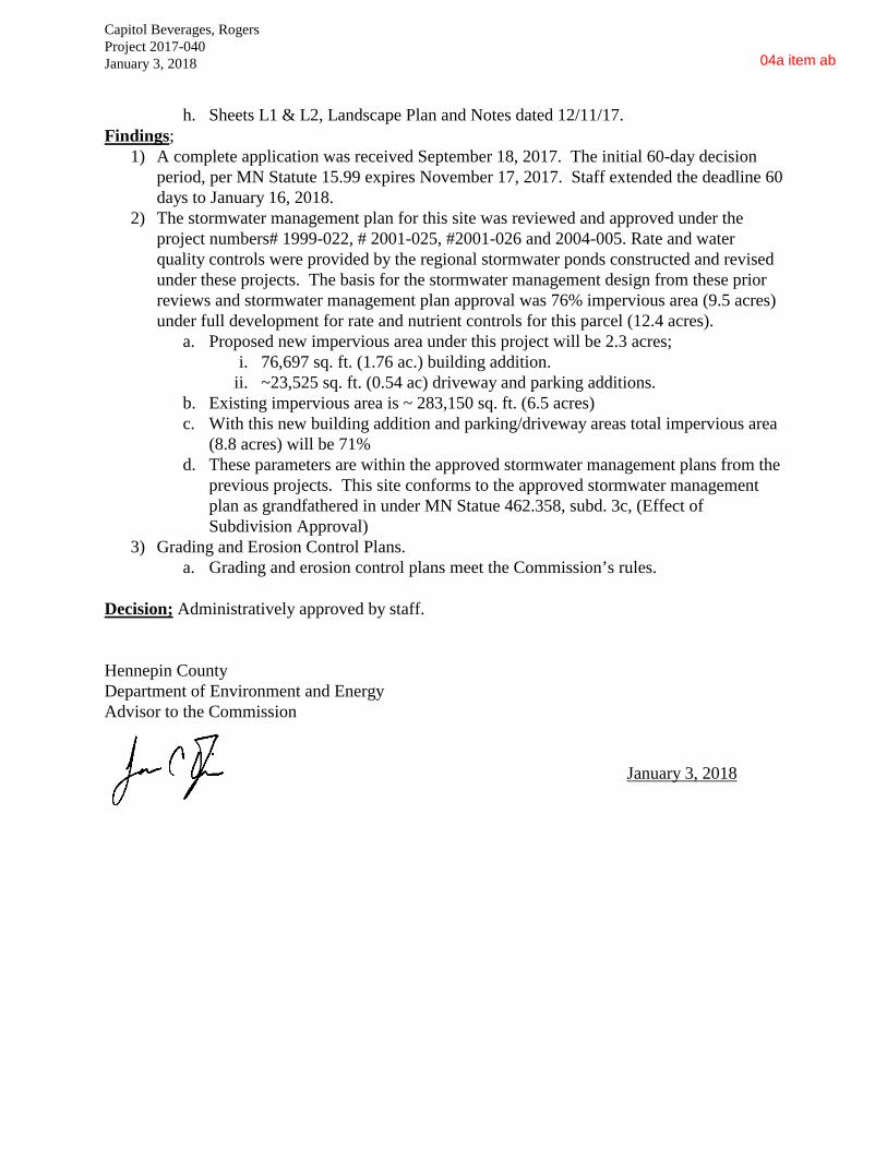
Capitol Beverages, RogersProject 2017-040January 3, 2018
h. Sheets L1 & L2, Landscape Plan and Notes dated 12/11/17.Findings;
1) A complete application was received September 18, 2017. The initial 60-day decision period, per MN Statute 15.99 expires November 17, 2017. Staff extended the deadline 60 days to January 16, 2018.
2) The stormwater management plan for this site was reviewed and approved under the project numbers# 1999-022, # 2001-025, #2001-026 and 2004-005. Rate and water quality controls were provided by the regional stormwater ponds constructed and revised under these projects. The basis for the stormwater management design from these prior reviews and stormwater management plan approval was 76% impervious area (9.5 acres) under full development for rate and nutrient controls for this parcel (12.4 acres).
a. Proposed new impervious area under this project will be 2.3 acres;i. 76,697 sq. ft. (1.76 ac.) building addition.
ii. ~23,525 sq. ft. (0.54 ac) driveway and parking additions.b. Existing impervious area is ~ 283,150 sq. ft. (6.5 acres)c. With this new building addition and parking/driveway areas total impervious area
(8.8 acres) will be 71%d. These parameters are within the approved stormwater management plans from the
previous projects. This site conforms to the approved stormwater management plan as grandfathered in under MN Statue 462.358, subd. 3c, (Effect of Subdivision Approval)
3) Grading and Erosion Control Plans.a. Grading and erosion control plans meet the Commission’s rules.
Decision; Administratively approved by staff.
Hennepin County Department of Environment and EnergyAdvisor to the Commission
January 3, 2018
04a item ab

Capitol Beverages, RogersProject 2017-040January 3, 2018
Project Area
Expansion Area
04a item ab

Capitol Beverages, RogersProject 2017-040January 3, 2018
Expansion Area
04a item ab

elm creek
Watershed Management Commission ADMINISTRATIVE OFFICE TECHNICAL OFFICE 3235 Fernbrook Lane Hennepin County Public Works Plymouth, MN 55447 Department of Environment and Energy PH: 763.553.1144 701 Fourth Ave. South, Suite 700 E-mail: [email protected] Minneapolis, MN 55415 PH: 612.348.7338 E-mail: [email protected]
CHAMPLIN • CORCORAN • DAYTON • MAPLE GROVE • MEDINA • PLYMOUTH • ROGERS
Mallard South 2nd Addition Rogers, Project #2017-051
Project Overview: This is a 1.5 acre parcel located north of Diamond Lake Road at the end of Harvest Circle. It is proposed to be replatted from an approved 3-building, 12 unit townhome development into a detached 9-unit townhome development. The site is part of the Mallard South plat approved by the ECWMC in 2001 under project 2001-041. Because of the change in platting, the site will have to conform to the Commission’s 3rd Generation Stormwater Management Plan. Applicant: Novak-Fleck Inc., 8857 Zealand Ave. N., Brooklyn Park, MN 55445. Phone: 763-424-4955. Email: [email protected] Agent: Horst Graser. Phone: 612-716-4431. Email: [email protected]. Engineer: Pioneer Engineering, 2422 Enterprise Drive, Mendota Heights, MN 55120. Phone: 651-681-1914. Email: pioneereng.com. Exhibits:
1) A complete ECWMC Request for Plan Review and Approval received December 1, 2017 with project review fee of $200 for 1.5 acres of high density residential development.
2) Mallard South 2nd Addition project narrative and hydrology report from Pioneer Engineering dated October 18, 2017.
3) Mallard South 2nd Addition Preliminary & Final Plat Construction Plans dated October 18, 2017, as revised December 22, 2017.
a. Sheet 1 of 6, Cover Sheet b. Sheet 2 of 6, Legend Sheet c. Sheet 3 of 6, Existing Conditions d. Sheet 4 of 6 Preliminary Plat e. Sheet 5 of 6 Grading & Erosion Control Plans f. Sheet 6 of 6, Site and Utility Plan g. Sheet L1, Landscape Plan.
4) ECWMC project file 2001-041 for Mallard South
Findings; 1) A complete application was submitted on December 1, 2017. The 60-day timeline for a
decision per MN Statute 15.99, expires January 30, 2018.
04a item ak

Mallard South 2nd Addition, Rogers 2017-051 December 28, 2017
2) This area was approved by the ECWMC on September 12, 2001 under project 2001-041, Mallard South. The whole development was mass graded at that time. This section of Mallard South was graded for the future construction of 3- townhome buildings with 4 units per building, but was never built. With the change in market conditions, the developer wishes to replat the 1.5 acres to conform and construct 9 detached townhome buildings.
a. Total impervious surface will increase by 0.09 acres (0.52 acres for 12 unit’s vs 0.61 acres for 9 units).
b. Phosphorus (NURP) and rate controls (per the Commission’s 1st Generation SWMP) were met with stormwater basin construction during the mass grading.
c. With the plat change and increase in impervious areas, the site will have to conform to our 3rd Generation SWMP abstraction requirements. Basin size and drawdown details meet the Commission’s standard as follows;
i. A rain garden with a drain tile under drain (bio-filtration basin) is proposed to meet the Commission abstraction requirements.
1. Volume treatment necessary per EC requirements=350 cubic feet 2. Volume treatment proposed = 1,750 cubic feet (750 cu.ft. voids in
engineered fill and 1,000 cu. ft. between basin floor and outlet) 3. Drawdown time for 1,750 cubic feet = 18 hours
ii. D & U easements are shown over the stormwater facilities on the preliminary plat sheet 4 of 6.
iii. The responsible party for the long term operation and maintenance of the stormwater facilities must be identified. If the HOA is responsible for said work, an agreement approved by the City and ECWMC is required to be placed on the property title. A copy of the recorded agreement must be provided to the ECWMC.
d. Erosion and sediment control plans meet the Commission’s rules.
Recommendation: Approval pending compliance with the Commission’s operation and maintenance standards on the rain garden/bio-filtration basin (item 2c.iii.)
Hennepin County Department of Environment and Energy December 28, 2017 Advisor to the Commission Date
04a item ak

Mallard South 2nd Addition, Rogers 2017-051 December 28, 2017
Mallard South 2nd Addition
04a item ak

Mallard South 2nd Addition, Rogers 2017-051 December 28, 2017
Project Area
Grading Plan
04a item ak
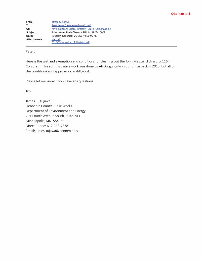
From: James C KujawaTo: Peter Leuer ([email protected])Cc: Kevin Mattson; Maass, Timothy (DNR); [email protected]: John Meister Ditch Cleanout PID 1411923410002Date: Tuesday, December 26, 2017 9:29:00 AMAttachments: Map.pdf
2015-031w Notice_of_Decision.pdf
Peter, Here is the wetland exemption and conditions for cleaning out the John Meister dich along 116 inCorcoran. This administrative work was done by Ali Durgunoglu in our office back in 2015, but all ofthe conditions and approvals are still good. Please let me know if you have any questions. Jim James C. KujawaHennepin County Public WorksDepartment of Environment and Energy701 Fourth Avenue South, Suite 700Minneapolis, MN 55415Direct Phone: 612-348-7338Email: [email protected]
04a item al-1
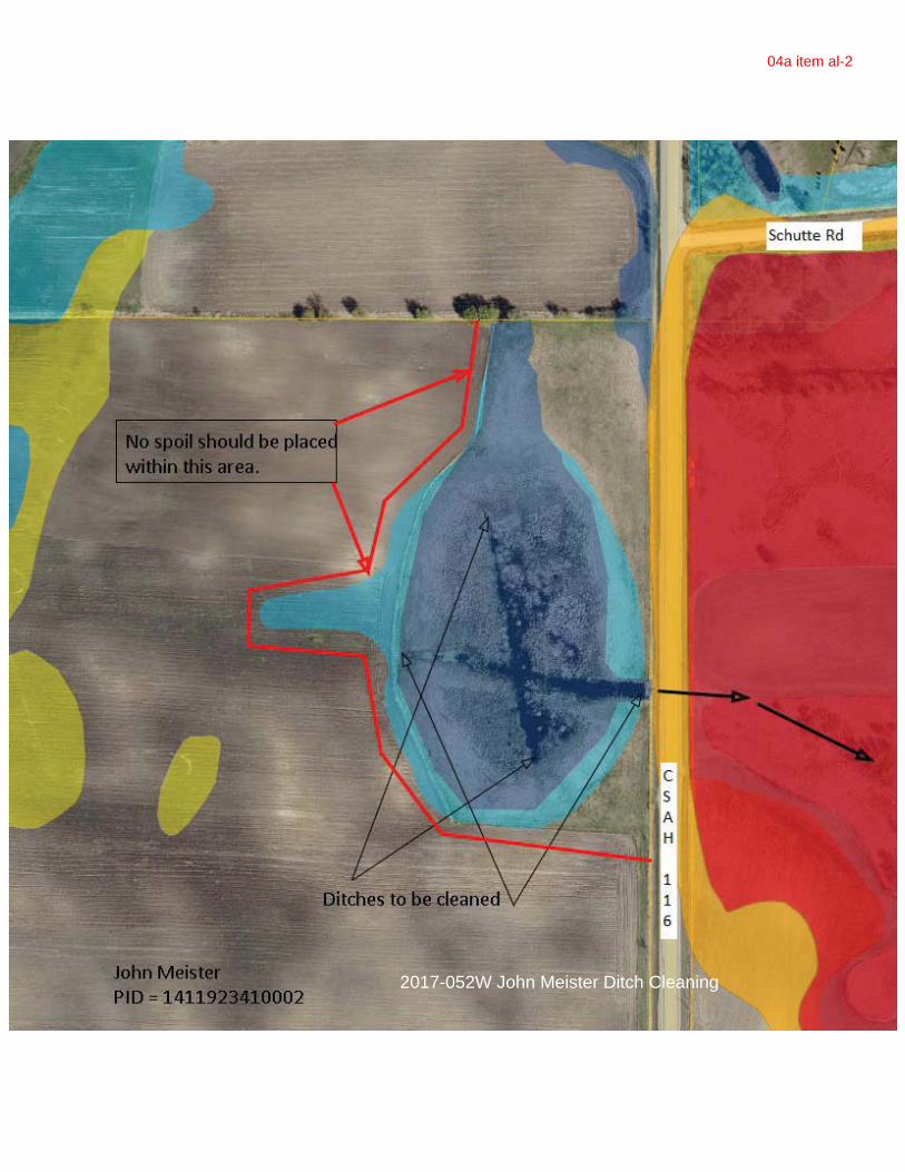
2017-052W John Meister Ditch Cleaning
04a item al-2

eelm creekWatershed Management CommissionADMINISTRATIVE OFFICE TECHNICAL OFFICE3235 Fernbrook Lane Hennepin County Public WorksPlymouth, MN 55447 Department of Environment and EnergyPH: 763.553.1144 701 Fourth Ave. South, Suite 700E-mail: [email protected] Minneapolis, MN 55415www.elmcreekwatershed.org PH: 612.596.1171
E-mail: [email protected]
CHAMPLIN • CORCORAN • DAYTON • MAPLE GROVE • MEDINA • PLYMOUTH • ROGERSS:\EMD\DEMCON\CORR\DURGUNOGLU\_WATERSHEDS\ELM_CRK\PLAN_REVIEW\2017\2017-02 RDO, Dayton\2017-02 RDO_1 .docx
RDODayton, Project #2017-002
Project Overview: The 25.6-acre commercial project site is located north of Interstate 94 and southwest of the intersection of Holly Ln N and Territory Road in Dayton. A farmstead is locatedat the center of the site, while the remaining area is agricultural row crops. The proposed project is 16.00 acres, with 7.61 acres of impervious surface and will include a new building structure, paved parking, and new gravel areas adjacent to the buildings. The remaining approximately 10 acres on the north side of the site will be platted for future development and is not subject to the Elm Creek Watershed Commission review now. Our review will be for compliance to the Commission’s 3rd generation standards and rules.
Applicant: Proffutt Limited Partnrtship. – c/o Ted Sanders, 700 South 7th Street, Fargo, ND58103. Phone: 701-551-0534. Email: [email protected].
Agent/Engineer: Houston Engineering, Inc. – c/o Stan Hanson, P.E., 1401 21st Ave N, Fargo, ND58102. Phone: 701-237-5065. Email: [email protected]
Exhibits:1) ECWMC Request for Plan Review and Approval received January 12, 2017 (City
authorization is Jan 11, 2017).2) Project review fee of $3,705 on January 12, 2017.3) Complete plan was received on February 14, 2017.4) RDO Addition Preliminary Plat.5) RDO Equipment Co., PROffutt Ltd. Partnership, Preliminary PUD Development Plans
(dated December 14, 2017)1.............Cover Sheet2.............Legend3.............Existing Conditions4……….Demolition Plan5.............Grading Plan6.............Point Plan7……….Paving Plan8.............Utility Plan9-11 .......Planting Plan
04a item l

RDO Page 2Dayton, Project 2017-002December 27, 2017
12 - 14 ...Erosion Control Plan17 – 21...Details
6) Stormwater Design Report, dated December 13, 2017 and signed by Stan Hanson, P.E.7) Summary of RDO Dayton 2016 Wetland Delineation (January 16, 2017).8) ECWMC project review dated February 28, 20179) ECWMC meeting minutes from March 14, 2017
Findings;10) A complete application was received on February 14, 2017. The initial 60-day review
period expires April 16, 2107. The applicant requested and received an extension to 15.99decision deadline to December 31, 2017.
11) The entire site will be routed to the proposed pond at the south side of the property. The pond will outlet with a culvert under I-94, flow south along the I-94 ditch and discharge into the large wetland complex east of the Hindu Temple (confluence of North and South Fork Rush Creeks).
12) Rule F. Floodplain Alteration does not pertain to this project. There are no established FEMA or ECWMC flood plains within the project corridor.
13) Rule G. Wetland Alteration. City of Dayton is the Local Government Unit administering the Wetland Conservation Act of Minnesota. No wetlands were observed on the site.
14) Rule I. Buffer requirements. The site has no wetlands and therefore Rule I is not applicable.
15) Rule E. Erosion and Sediment Control meet the Commission’s requirements.
16) Rule D. Stormwater Management will be provided by the proposed pond and the 850-ft long soil amended swale along the west side of the development. The pond is designed to treat runoff from the entire 16 acres. Runoff from the rooftops and the north driveway will be directed to the swale. The swale will be constructed with amended soils and will have 4 rock check dams, 1.5 feet deep, located at every 150 feet, to increase the runoff retention in the swale.
17) The pond outlet will be equipped with a 10” orifice at 920.0’ and a weir opening at 922.5’inverts. The entire 2-year runoff volume is contained below the weir, and passes through the 10” orifice.
18) Stormwater rate control.a) The post-development stormwater runoff rates for the 2-, 10- and 100-year events meet
the standards and are shown below:
StormEvent
Exist ingDischarge Rate (cfs)
Proposed Discharge Rate (cfs)
2-year 18.29 3.1810-year 33.40 6.41100-year 66.09 26.17
19) Volume analysis:The volume abstraction requirement for 1.1” of runoff from 7.28 acres of new impervious surface (7.608 acres total minus 0.328 existing farmstead) is about 33,025 cubic feet. Soils
04a item l

RDO Page 3Dayton, Project 2017-002December 27, 2017
are not conducive for infiltration. The applicant is proposing to build an 850-foot swale with soil amendment. The surface area of the soil amendment is 19,016 square feet. This provides 8,979 cubic feet of abstraction credit (0.5 inch credit over the soil amendment area). The applicant also is proposing a 14-inch deep amended soil (standard is 8 inches). Additional 1.5’ high check dams will help retain the runoff in the swale longer and facilitate filtration. It is estimated that the amount of water retained in the swale system is approximately 28,524 cubic feet. Staff believes that the applicant has done a good faith effort in addressing volume controls with the constraints of the site.
20) Water quality and nutrient analysis:a) The existing nutrient analysis for the 16.0 acres is 15.52 pounds of phosphorus per year.
This is estimated based on the following current land use: cropland = 15.424 acres; grassland = 0.232 acres.
b) The post-development nutrient load is 41.36 pounds/year, before BMPs.
c) Based on the PondNet model, the NURP pond will remove 27.3 lbs./year of phosphorus. Post-development phosphorus discharge will be 14.06 lbs./year. This meets the nutrient reduction standard.
d) The existing TSS estimates were not provided at the time this report was written. The post-development TSS before the BMPs were estimated by P8 as 4,780 lbs./year. The BMPs will provide about 60% of reduction. The post-development TSS loads with the proposed BMPs will be 1,978 lbs./year.
Water Quality (Nutrient and TSS) and Runoff Volume SummaryDevelopment Name: ....................................... RDO, DaytonTotal Parcel Area: ........................................... South 16 acres of the entire 25.6 acresTotal Disturbed (“Buildable”) Area: ............... 14.5 acresTotal Impervious Area: ................................... 7.6 AcresReview Month/Year: ....................................... February 2107Nearest Downstream Surface Water: .............. North Fork and South Fork Rush Creek confluence
within 0.5 miles southeast.
Condition TP Load (lbs./yr)1
TSS Load (lbs./yr)1
Abstraction volume (ac-ft)2
Filtered Volume at
2-yr Event (ac-ft)2
Pre-development (baseline) Load 15.52 NA
0.67 ---Post-development Without Mitigation 41.36 4,780
Post-development With Mitigation 14.06 1,978Net Change (“baseline” compared to “post-development with mitigation”) -1.46 -
1 Average annual values 2 With 14” soil amendment and rock check dams.
21) The City of Dayton has taken the operation and maintenance responsibility of the stormwater management facilities that are placed under drainage and utility easements.
04a item l

RDO Page 4Dayton, Project 2017-002December 27, 2017
Decision:
The ECWMC approved, with conditions, the site plans dated February 10, 2017. The conditions for approval were met with the site plan revisions dated December 14, 2017. Approved.
Hennepin County Department of Environment and Energy
December 27, 2017
James C. KujawaTechnical Advisor to the Commission
04a item l

RDO Page 5Dayton, Project 2017-002December 27, 2017
SITE LOCATION
04a item l

RDO Page 6Dayton, Project 2017-002December 27, 2017
AERIAL PHOTO
04a item l

RDO Page 7Dayton, Project 2017-002December 27, 2017
GRADING PLAN
04a item l

Adopted April 11, 2012 Z:\ELM CREEK\THIRD GENERATION PLAN\COST SHARE POLICY_APRIL 2012F.DOC
Elm Creek Watershed Management Commission Cost Share Policy
To facilitate implementation of improvement projects within the watershed, the Elm Creek Watershed Management Commission’s Joint Powers Agreement (JPA) and Section V of its Second Generation Watershed Management Plan provide for a Capital Improvement Program (CIP). The JPA also describes how the costs of capital projects shall be allocated.
The Management Plan proposes to share the cost of high-priority watershed capital improvements and demonstration projects through the CIP. High-priority watershed capital improvements are those activities that go above and beyond general city management activities and are intended to provide a significant improvement to the water resources in the watershed. To be considered for inclusion in the CIP, projects must be identified in a Commission-adopted management plan, approved TMDL, or member local stormwater plan or CIP.
In order to identify projects for inclusion on its Capital Improvement Program, the Elm Creek Watershed Management Commission will accept city proposals for cost-share projects until March 15 of every year. Following that date, the Commission’s Technical Advisory Committee will review and score the submittals and make a recommendation regarding additions and revisions to the Commission’s existing CIP at their regular May meeting.
The Commission has developed a set of criteria by which proposed projects will be scored, with those projects scoring a certain minimum number of points on the submittal form screening questions advancing to a prioritization stage. (Refer to the Commission’s Capital Improvement Program Standards and Guidelines.)
Prior to consideration for funding, a feasibility study or engineering report must be written for the proposed project. The city acting as the lead agency for a proposed project will be responsible for the development of and the costs associated with the feasibility study/engineering report.
The Commission has elected to fund capital projects through an ad valorem tax levy. Under the authority provided by MN Stat 103B.251, Subd. 5, the Commission has the authority to certify for payment by the county all or part of the cost of an approved capital improvement. The Commission will pay up to 25 percent of the cost of qualifying projects. This amount will be shared by all taxpayers in the watershed, with the balance of the project cost being shared by the local government(s) participating in or benefiting from the improvement.
a. The Commission’s maximum annual share of an approved project is up to $250,000. 1) The Commission’s share will be funded through the ad valorem tax levy – spread across
all taxpayers within the watershed. 2) The Commission will use a maximum annual levy of $500,000 as a working guideline.
b. The cities’ share will be a minimum of 75% of the cost of the project. The basis of this
apportionment will likely be unique to each project. The 75% share will be apportioned to the cities in the following manner or in some other manner acceptable to them. For example, 1) The area directly benefiting from the project will be apportioned 25% of the cost of the
project. This will be apportioned to cities based on the proportion of lake or stream frontage.
2) 50% of the cost of the project will be apportioned based on contributing/benefiting area.
c. The cities will each decide the funding mechanism that is best suited to them for payment of their share, for example through special assessments, storm drainage utility, general tax levy, or watershed management taxing district.
d. Funding from grant sources may also be used to help pay the costs of the capital projects.
Item 05a

Technical Memo
Wenck | Colorado | Georgia | Minnesota | North Dakota | Wyoming
Toll Free 800-472-2232 Web wenck.com
To: Elm Creek WMO Commissioners From: Diane Spector, Wenck Associates, Inc. Date: January 3, 2018 Subject: Rush Creek Headwaters SWA Status Report This report details Rush Creek Headwaters Subwatershed Assessment project progress through December 2017. On December 7, 2017 Wenck, Hennepin County, JASS, and City of Corcoran staff attended an Open House to which all the property owners living in the Corcoran portion of the Study Area were invited. According to the sign‐in sheets, attendance was approximately 50. Scattered at tables around the room were large‐format aerial photos of each of the six management units as well as an overview aerial of the study area. Attendees were encouraged to mark up the figures with information about known problems and issue, and observations about conditions in their area. Staff circulated among the tables to discuss and answer questions. A comment sheet was provided for attendees to record their concerns and comments as well as to sign up to participate in future small group meetings or to get email updates about the project. They could also sign up to receive more information about residential or agricultural BMPs. About 20 sheets were filled out, and 8 attendees were interested in future small group meetings. Comments from the marked‐up figures and the comment forms will be added to the “Problems and Issues” figure in the report. Budget status: Budget* $56,700.00Through 11/30/17 $28,739.52 12/1/17 – 12/31/17 $2,731.78 Balance $25,228.70 *For Wenck Associates services only, excluding JASS or Hennepin County services Activities December 2017:
• Prepare large format aerial figures and handouts for and attend Open House at City of Corcoran
• Review input from Open House • Update BMP cost estimates
Item 06b

2 Z:\Elm Creek\Grant Opportunities\Rush Creek Headwaters SWA Grant 2017\M-December 2017 Status Report.docx
Expected January‐February 2018 Activities:
• Complete second round of analysis with ACPF and PTMApp tools to prioritize BMPs • Review SWAT model runoff and loading data from Three Rivers to estimate BMP load
reductions • Meet with Core Team late January to review prioritization scheme and range of BMP costs
and removals • Meet with TAC in February to review prioritized BMPs and • Prepare website content
Item 06b

Technical Memo
Wenck Associates, Inc. | 7500 Olson Memorial Highway | Suite 300 | Plymouth, MN 55427
Toll Free 800-472-2232 Main 763-252-6800 Email [email protected] Web wenck.com
To: Shingle Creek/West Mississippi WMC Commissioners From: Diane Spector Date: December 8, 2017 Subject: Education and Outreach Update WMWA A reminder that WMWA has switched over its email distribution system for the WaterLinks e‐newsletter from Hennepin County to MailChimp. If you wish to keep getting it (or to newly subscribe), go to westmetrowateralliance.org/contact.html and sign up. The next issue of Water Links will be out in the 1st quarter of 2018 and will feature late winter, early spring‐related content. WMWA is currently discussing options for assisting property owners with rain gardens and native plant conversions. Two options being considered are 1) funding two hours of on site technical assistance for owners who take the Metro Blooms Landscaping workshop; and/or 2) providing reimbursement for the cost of purchasing native plants, up to a certain amount, say $100. These ideas are still under development. The next WMWA meeting is Tuesday, January 16, 2018 at Plymouth City Hall. WMWA is also planning in 2018 to continue facilitating native plant sales by linking up native growers with community events such as festivals and farmer’s markets. WMWA would pay any booth fees charged by the event sponsor and advertise the event and the grower would be free to sell plants. Website/Social Media The website Google Analytics for December 2017 and January‐December 2017 for the Shingle Creek/West Mississippi Commissions are attached, as are the Facebook insights for the last 28 days for both Shingle Creek and WMWA. As a reminder, Reach is the number of times a post was viewed in a Facebook feed, Engagement is an action‐ a click, comment, share, or reaction. It was a slow month for social media..
Item 07a

2
Shingle Creek FB Metrics Last 28 days: 106 total Likes, 146 Reaches, 25 Engagements.
Item 07a

3
West Metro Water Alliance (WMWA) Metrics Last 28 days: 120 total Likes, 150 Reaches, 74 Engagements
Item 07a

Dec 1, 2017 - Dec 31, 2017SCWM
Pageviews
754% of Total: 97.80% (771)
Unique Pageviews
602% of Total: 97.41% (618)
Pageviews by Landing Page
Landing Page Pageviews
475
92
26
25
19
18
14
13
11
9
Pageviews and Unique Pageviews by Page
Page Pageviews UniquePageviews
214 165
67 51
63 56
45 34
34 34
31 25
30 14
27 23
24 18
21 18
/
/twin-lake-carp-management.html
/minutes--meeting-packets.html
/studies.html
/staff.html
/maps.html
/twin-lake-next-steps.html
/tmdls.html
/standard-details.html
/shingle-creek-commissioners.html
/
/twin-lake-carp-management.html
/minutes--meeting-packets.html
/rules-and-standards.html
/staff.html
/twin-lake-next-steps.html
/carp-tracking.html
/maps.html
/shingle-creek-commissioners.html
/contact-us.html
© 2018 Google
All Users100.00% Sessions
Shingle Creek WMC
All Web Site Data GO TO REPORT
Item 07a

Jan 1, 2017 - Dec 31, 2017SCWM
Pageviews
9,522% of Total: 97.11% (9,805)
Unique Pageviews
7,736% of Total: 96.70% (8,000)
Pageviews by Landing Page
Landing Page Pageviews
6,813
501
260
224
219
123
115
105
104
103
Pageviews and Unique Pageviews by Page
Page Pageviews UniquePageviews
3,213 2,519
842 733
682 605
399 347
348 189
291 267
283 232
246 187
229 182
199 165
/
/minutes--meeting-packets.html
/maps.html
/carp-tracking.html
/twin-lake-carp-management.html
/staff.html
/standard-details.html
/meetings.html
/biochar-filters.html
/rules-and-standards.html
/
/minutes--meeting-packets.html
/rules-and-standards.html
/maps.html
/carp-tracking.html
/staff.html
/contact-us.html
/twin-lake-carp-management.html
/shingle-creek-commissioners.html
/standard-details.html
© 2018 Google
All Users100.00% Sessions
Shingle Creek WMC
All Web Site Data GO TO REPORT
Item 07a