ekip activity: our nation’s native peoples - amazon s3€¦ · conduct short research projects...
TRANSCRIPT

Activity instructions
Our Nation’s Native Peoples
Essential Question: Who lived in this land before it was called the United States, are they still here, and where can we find evidence of Native Peoples in our communities or in federal lands and waters?
Learning objectives: 1. Students will understand that Native
Peoples are not all the same and that each has its own language and customs.
2. Students will understand that many Native Peoples lived on this continent before European immigration and their descendants still live here today.
3. Students will conduct short research projects to learn how Native Peoples influenced the naming of federal lands and waters.
common core skills: • Write narratives to develop real or imagined
events
• Refer to details and examples when drawing inferences from the text
• Conduct short research projects
• Gather relevant information from print and digital sources
time required: Two 40-minute class periods, plus prep and homework time
Materials: Naming Places by Their Appearance activity sheet, Stories of the “Devils Tower” activity sheet (Lexile 760L), Native Place Names activity sheet, History of Place Names resource sheet (Lexile 870L),
Vocabulary: Native Peoples, indigenous, sacred, immigration, constellation, planisphere, expansion, archaeological, treaty
Connections Between Native Peoples and Federal Lands and Waters resource sheet, Kiowa Story of the Seven Sisters resource sheet, Internet access, U.S. map, maps of local area or state
Getting Prepared: 1. Research the history of your name and
the names of a few of the students in your class. The day before you do the lesson, have students ask their parents about the history of their first and/or last names.
2. R eview a U.S. map and note two or three locations that have Native names.
3. R ead articles on the following topics related to Devils Tower National Monument:
• G eologic formation of the landform: nps.gov/deto/learn/nature /geologicformations.htm
• H ow the national monument got its name: nps.gov/deto/learn /historyculture/index.htm
• T he Native Peoples of the Northern Plains’ proposal to change the name to Bear Lodge National Monument: argusleader.com/story/news /2015/07/12/tribes-seek-change -name-devils-tower/30063421/
• Updates about the proposal: nps.gov /deto/learn/historyculture/index.htm
• The Obama administration’s recent renaming of Mount McKinley to its Native name Denali: usatoday.com /story/news/politics/2015/08/30 /obama-rename-nations-tallest -mountain/71426656
4. C ontact a fourth-grade teacher at a tribal school and inquire about setting up a cultural exchange program with your students. A list of Bureau of Indian Education schools can be found at bie .edu on the “Schools” tab or you may
contact a public school located on reservation lands.
5. R eview the resources at honoringtriballegacies.com and nmai .si.edu/environment/teachers.aspx to support further lessons on Native Peoples.
cLAss Period 1
Getting started: 1. Begin by explaining that names have a
history. Names may be connected to a language or a group of people or a special event or memory. Ask students what they learned from their parents about the history of their names. Explain that place names also have a history. Place names can provide evidence of who lived in an area long before we were born as well as provide insight into the special meanings of those places to earlier inhabitants. Many place names in the United States reflect the Native Peoples who lived here before the arrival of European immigrants. Today, some Native Peoples live on reservations, while others live in cities and towns across the United States. Even when they live away from their Native area or reservation, Native Peoples usually hold dual citizenship in both the United States and their own Native tribe or Nation.
2. Ask students to look at a U.S. map or regional map and identify some place names that they think may come from Native Peoples and Native languages. Ask students to imagine what they think those names mean. Explain that many Native place names identify specific characteristics of the land, commemorate sacred grounds or places where special events may have happened, or reflect the community of people who lived there.
3. Continue the discussion by asking students if they can think of some names of places that describe the characteristics of that

Activity instructions
Our Nation’s Native Peoples(continued)
area. Some examples might be “Blue Lake,” “Green Valley,” “Stony Hill,” and “Grand Canyon.” Tell students that federal lands and waters contain many locations that have Native place names. Many of these place names are connected to the prominent land or water features. Pass out the Naming Places by Their Appearance activity sheet. Have students read the meaning of the place names on the activity sheet and match the names with the images. (Answers: 1. B, 2. D, 3. E, 4. C, 5. A)
Getting engaged: 4. Tell students that they will now learn more
about the Native place names in federal lands and waters. Pass out the History of Place Names resource sheet. Have students break into groups and discuss the names and locations that interest them most. As a class discuss anything the students notice about the histories. Ask: What do these place names tell you about the people who lived or live in those places? What do these place names tell you about the land? Does learning the history of these place names change the way you think about the land in our nation? Why or why not?
5. E xplain that names are not the only significant element of Native culture. There are currently 566 different groups of Native Peoples federally recognized in the United States. Each group has its own languages, cultural practices, and community structures. Separate students into groups of three or four. Direct students to select one of the federal land and water locations on the History of Place Names resource sheet. Explain that they will make informational brochures or posters about the Native history related to their chosen location.
6. Pass out the Connections Between Native Peoples and Federal Lands and Waters resource sheet. Have students follow the instructions on the resource sheet to complete research for and create their brochure or poster. If your students would like a challenge, pass out the Native Place Names activity page and have them complete the word search.
extending the Learning: 7. Ask students where they think Native
Peoples live today. Discuss their findings from their research activity. Ask: What do you think life is like for young Native Peoples your age? If you have identified a tribal school to work with for a pen-pal program, introduce the program to your class. Communication can be by mail, email, or web chat. You may also consider setting up a live interactive meeting through videoconference or other web-based technology. Have students write a report about what they learned about their pen pals, including where they live, what tribe they are from, where they go to school, and what they like to do. Have students learn about the place names where their pen pals live. The students can continue their correspondence for a short time or for the whole school year.
cLAss Period 2
Getting started: 1. Project an image of the landform
commonly known as Devils Tower on the board or show the class the photo on the resource sheet. Have the class locate the landform on a map. Students can use an Internet map tool to locate the monument and can also look at satellite images of the landform. Note the shape, texture, location, and surrounding landscape of the landform in the images. Have students describe what they are seeing. Have students speculate what it might be like
to encounter this landform for the first time. Provide a scientific explanation of how Devils Tower was formed, using the information at nps.gov/deto/learn /nature/geologicformations.htm.
2. Discuss with students how the Devils Tower National Monument got its current name. You may refer to this article as needed: nps.gov/deto/learn /historyculture/index.htm. Explain that the name selected by the federal government was chosen based on what is believed to be a misunderstanding of the Native Peoples’ name Bear Lodge. Ask students if they have ever had their names mispronounced or misunderstood. Allow students to express how that made them feel. Ask students to speculate why the name of this place is important to Native Peoples.
Getting engaged: 3. Read aloud Kiowa Story of the Seven
Sisters on resource sheet 3. Explain that storytelling is very important to many Native Peoples’ cultures. It is customary for elders to share stories with the community that they heard when they were children. The children listen closely to these stories and think about the lessons they can learn from them. The best sources for listening to or reading Native stories are the people who have experienced them.
4. Discuss the story as a group. Ask the class to think about the following questions:
• Why did the seven sisters jump onto the rock?
• How did the rock save the seven sisters?
• Why do the Kiowa people call this rock Tso-aa?
5. Pass out the Stories of the “Devils Tower” activity sheet. Look at the photo of

Activity instructions
Our Nation’s Native Peoples(continued)
Tso-aa (tree rock). Can you describe this landform? What features of the landform remind you of the story?
6. Have the class read through the Arapaho legend of the landform on the activity sheet. Then ask them to answer the questions at the bottom of the page. Additional narratives of Native Peoples’ legends about the landform can be found at nps.gov/deto/learn/historyculture /sacredsite.htm. Discuss students’ answers with the class.
extending the Learning: 7. To extend the learning, stargaze. If you
have an opportunity, have the class find the seven sisters (the constellation Pleiades) in the night sky. Many federal land and water areas offer night-sky and stargazing programs. You can find opportunities in your area at recreation
.gov. If your class cannot gather at night, use an online application or website such as google.com/sky to locate the constellation. A planisphere (star locator wheel) is available in the Junior Ranger Night Explorer booklet at nature.nps .gov/night/assets/docs/JuniorRanger NightExplorer_2015.pdf along with several other age-appropriate stargazing activities. Students can draw pictures of the constellation in the night sky or an illustration of one of the Native Peoples’ legends about the constellation Pleiades and the landform at Devils Tower National Monument.
8. Discuss with students the current proposal by Native Peoples to change the name of Devils Tower National Monument to Bear Lodge National Monument. Information about the proposal can be found at nps.gov/deto/learn/historyculture /index.htm. Explain that the Obama
administration recently made an executive decision to change the name of a mountain in Alaska formerly known as Mount McKinley, after a former president, to Denali, which means “the high one” in the language of the Athabascan people of Alaska. Have students discuss whether they think the name of Devils Tower National Monument should be changed. Allow students to present arguments in favor of or against the change. Consider having the class write a letter to the president or a congressional representative supporting the class’s opinion.
9. If you have not passed out the family sheets, download them from scholastic .com/everykid. Distribute them to students so their families may take advantage of the free passes to visit federal lands and waters. Visit recreation .gov to find a location near your school and plan a trip for your class!

1.
4.
❏
❏
❏
❏
❏
Student Activity Sheet 1
Naming Places by Their Appearance Many place names identify prominent characteristics of landforms. Use the meanings of these Native place names to match them with the correct images of the federal land and water areas pictured below.
Write the letter of the photo that matches these place names:
chattahoochee-Ocone national Forest, GA Chattahoochee is Creek for “picture rocks” or “marked rock.”
3. Kasha-Katuwe tent Rocks national Monument, nM Kasha-Katuwe is Pueblo for “white cliffs.”
2 . nisqually national Wildlife Refuge, WA Nisqually is Twalshootseed for “people of the grass.”
cape hatteras national Seashore, nc Hatteras is Algonquin for “sparse vegetation.”
5 . denali national Park, AK Denali is Athabascan for “the high one.”
_________________
________________
_____________
_______
_______
________
__________
_______________
__________
___________________
________________ _______
____________________________________ ____________________________________ ____________________________________
____________________________________ ____________________________________ ____________________________________
____________________________________ ____________________________________ ____________________________________
____________________________________ ____________________________________ ____________________________________
____________________________________ ____________________________________ ____________________________________
____________________________________ ____________________________________ ____________________________________
____________________________________ ____________________________________ ____________________________________
____________________________________ ____________________________________ ____________________________________
____________________________________ ____________________________________ ____________________________________
____________________________________ ____________________________________ ____________________________________
____________________________________ ____________________________________ ____________________________________
____________________________________ ____________________________________ ____________________________________
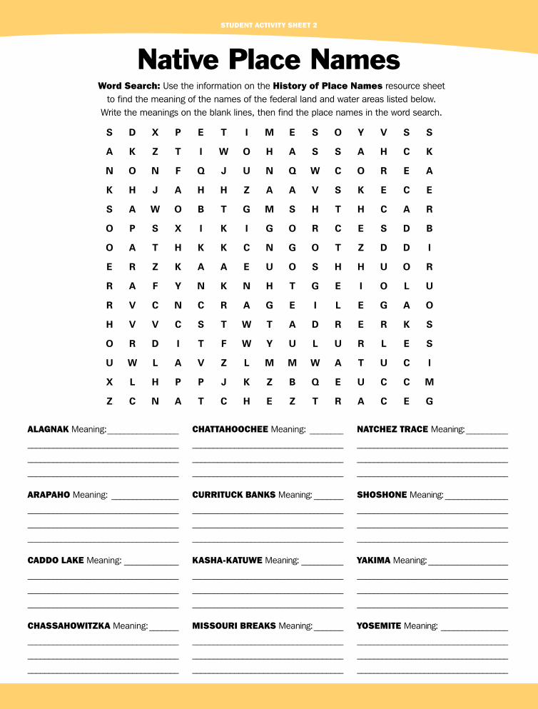
Student Activity Sheet 2
Native Place Names Word Search: Use the information on the history of Place names resource sheet
to find the meaning of the names of the federal land and water areas listed below. Write the meanings on the blank lines, then find the place names in the word search.
S D X P E T I M E S O Y V S S
A K Z T I W O H A S S A H C K
N O N F Q J U N Q W C O R E A
K H J A H H Z A A V S K E C E
S A W O B T G M S H T H C A R
O P S X I K I G O R C E S D B
O A T H K K C N G O T Z D D I
E R Z K A A E U O S H H U O R
R A F Y N K N H T G E I O L U
R V C N C R A G E I L E G A O
H V V C S T W T A D R E R K S
O R D I T F W Y U L U R L E S
U W L A V Z L M M W A T U C I
X L H P P J K Z B Q E U C C M
Z C N A T C H E Z T R A C E G
ALAGnAK Meaning: chAttAhOOchee Meaning: nAtcheZ tRAce Meaning:
ARAPAhO Meaning: cuRRitucK BAnKS Meaning: ShOShOne Meaning:
cAddO LAKe Meaning: KAShA-KAtuWe Meaning: yAKiMA Meaning:
chASSAhOWitZKA Meaning: MiSSOuRi BReAKS Meaning: yOSeMite Meaning:

Student Activity Sheet 3
Stories of the “Devils Tower” People all over the world have stories that explain how the earth was made. Each people’s stories reflect their cultures and their communities. The Native Peoples of the Northern Plains have more than one story to explain how the landform at the Devils Tower National Monument in Wyoming was created. You heard the story of the Kiowa People in class. Now read the story from the Arapaho below and answer the questions that follow.
Arapaho
An Arapaho family was camped at Bears Tipi. The family had seven children, five boys and two girls. The boys often made trips to other tribes. The two girls decided between themselves that the one who found the rib of a buffalo should receive the most gifts from the brothers. After a long search one of the girls found a buffalo rib. When she picked it up, she turned into a bear. The bear-girl made big scratches on her sister’s back and told her, “If you tell, the dogs will howl and I will know that you have told.” The sister told her brothers anyway. When they heard the dogs howl, they became scared and started to run.
The bear-girl heard the dogs howling and ran after them. The girl who told was carrying a ball in her hand. She dropped it and accidentally kicked it. The ball bounced up on the big, high rock. The bear-girl reached over her sister’s shoulder to grab the ball, but she slipped. She made very big scratches on the big rock as she fell. She tumbled onto her sister and broke her sister’s chest. The bear-girl climbed to the top of the big, high rock and told her family that seven stars in the shape of a diamond would appear in the east. She said the first star out would be off to one side and would be brighter than the other stars. This first star would be called Broken Chest Star. From this time on, the Arapaho called this big, high rock Bears Tipi.
—Adapted from a story told to Dick Stone by Sherman Sage, 81 years old, interpreted by Otto Hungary
think it through 1. What did the Arapaho call the landform known as Devils Tower National Monument? According to this story, how did the
landform get its current shape and appearance?
2. How do both the Kiowa and Arapaho stories incorporate the seven stars that appear over the monument?
3. Describe some elements that are similar between the two stories.
4. Describe some elements that are different between the two stories.

RESOURCE SHEET 1
History of Place Names Alagnak Wild River, Alaska
The Alagnak River is located in the Katmai National Park and Preserve in Alaska. The river begins at Kukaklek Lake. It empties into another river called the Kuichak River. Alagnak
probably comes from the Yupik language. It is thought to mean “making mistakes” or, maybe, “wild raspberry.” Sometimes people call it Branch River because it has so many branches.
Arapaho National Forest, Colorado
In the 1800s, the Arapaho People were great buffalo hunters. They lived across a large area of land. The southern border of their land stretched across New Mexico, Oklahoma, and Kansas. The
northern border of their land was in Wyoming and South Dakota. Originally, the Arapaho named themselves Inûna-ina, meaning “our people.” Since then, they have been given many names by other Native Peoples and Europeans. Today, they call themselves Arapaho or Arapahoe.
The Yupik People are from southern and central Alaska. For thousands of years, they traveled most of the summer. They carried lightweight portable homes with them as they traveled. In the winter, they built part of their homes underground. They used special seal or walrus intestines for windows. Today, the Yupik usually live in modern houses, but some choose to live in traditional houses.
In 1878, the Northern Arapaho moved to the Wind River Reservation in Wyoming. They share this reservation with the Eastern Shoshone. The Southern Arapaho live on the Cheyenne-Arapaho Reservation in Oklahoma. Like all Native Peoples, the Arapaho also live outside of the reservations. Today the Arapaho live in cities and towns across the United States. There might even be Arapaho or other Native Peoples in your school.
Caddo National Wildlife Refuge, Texas
The Caddo People were farmers and traders for more than a thousand years. They created a great pathway of trails across Texas, Louisiana,
Oklahoma, and Arkansas. These trails helped them travel throughout their land. They also used the trails to trade with other Native Peoples and European settlers. The El Camino Real de las Tejas is a National Park Service trail. It follows some of the Caddo People’s trails. The name Caddo may come from the word
Kadohadacho, which means “real chiefs” in the Caddo language. The Caddo People no longer live on a reservation. Today, many Caddo citizens live in Oklahoma while others work or go to school in other areas of the United States. Even when they live away from their Native area or reservation, Native Peoples usually hold citizenship in both the United States and their own Native tribe or Nation.
Chassahowitzka National Wildlife Refuge, Florida Chassahowitzka means “hanging pumpkin place” in the Seminole language. The Seminole People speak two different languages, Maskókî and Mikisúkî. In the 1800s, the Muscogee People
(also known as the Creek People) fought against the U.S. government to protect their land. The U.S. government used these wars to take large amounts of Muscogee land in Georgia and Alabama. After the wars, the Muscogee People were forced
to move to Oklahoma by the U.S. government. Some Muscogee took their families and fled south to Florida. In Florida, they joined other Native Peoples who lived there and became a new people called the Seminole. U.S. troops attacked the Seminole People in Florida many times, but the Seminole were never defeated. The original name for the Seminole is yat’ siminoli, which means “free people.”

RESOURCE SHEET 1
History of Place Names(continued)
Chattahoochee National Forest, Georgia
The word Chattahoochee is thought to mean “red river,” “picture rocks,” or “marked rock” in the Lower Muscogee language. The term picture rocks may be connected to the ancient rock carvings in the
Chattahoochee-Oconee National Forest. The ancient rock carvings are related to stories told by the Cherokee and Muscogee (Creek) peoples. These two groups lived nearby, but they were forced to move to Oklahoma by the U.S. government in the 1830s.
Currituck Banks Reserve, North Carolina Currituck Banks Reserve is off the coast of North Carolina. This land was taken from Native Peoples in the 1600s, before the United States was a
country. Currituck is believed to be from an Algonquin word that means “land of the wild goose.” Historians have learned about
Most of the carvings on the rocks relate to Cherokee stories. The Cherokee People who live in Oklahoma today are known as the Cherokee Nation. The Cherokee People who escaped the forced move became the Eastern Band of Cherokee Indians in North Carolina. Other Cherokee People have moved to places all over the world.
life on the island from artifacts found in archaeological digs. Images of the artifacts can be viewed at kiscrapbook .knottsislandonline.com/indianslarry.html. This website also has drawings imagining what Native Peoples in the area may have been like.
Kasha-Katuwe Tent Rocks National Monument, New Mexico Kasha-Katuwe means “white cliffs” in the Keresan language. These cliffs are tent-shaped rock forms that look like white tipis. The Keresan language is spoken by the People of
Pueblo de Cochiti. The People of Pueblo de Cochiti still speak their ancient language. They also continue to care for the land and water in their area. Today, they are trying to clean up the polluted land behind the Cochiti Dam.
Conservation is very important to many Native Peoples across the United States and beyond. The Akwesasne Mohawk of New York, the Campo Kumeyaay of California, the Leech Lake Ojibwe of Minnesota, and the Lummi Nation of Washington State are all working hard to protect the environment. It is important to many Native cultures to keep the environment healthy for future generations.
Missouri Breaks National Monument, Montana
The upper Missouri River is surrounded by valleys and ravines that are sometimes called “breaks.” These “breaks” are how the Missouri Breaks got its name. The Missouri River was
named after the Native People who lived on the banks of the river. Most of the year they lived in earth-covered houses. Sometimes, in the summer, they lived in tipis. The word Missouri is from the group’s name. Missouria means “big canoe people” in the Siouan language.
The smallpox disease killed many of the Missouria just before Lewis and Clark visited their country in 1804. The Missouria People who survived joined with the Otoe. The Otoe had also survived a smallpox outbreak. The combined group was called the Otoe-Missouria. The U.S. government forced the Otoe-Missouria to move many times. The Otoe-Missouria finally ended up in Oklahoma, where many still live today. Some Otoe-Missouria live in other parts of the United States, including New Jersey, California, Hawaii, and Alaska.

RESOURCE SHEET 1
History of Place Names(continued)
Natchez Trace Parkway, Mississippi, Alabama, and Tennessee
The people of the Natchez Nation were the ancestors of the “original” Muscogee (Creek) people. W’Nahx’-Chee means “fast warrior(s)” in the Natchez language. Natchez is pronounced Nah’-Chee, Nauche, or W’Nahx’-Chee. The Natchez Trace was originally a trail that ran
through the lands of the ancient Natchez. The trail was more than 440 miles long. It started in what is now Natchez, Mississippi, and ended in Nashville, Tennessee.
The Natchez People are known for large mounds they built
Shoshone National Forest, Wyoming The Shoshone are a large group of Native Peoples whose languages are all related. The Commanche of Texas speak a language that is nearly the same as that of the Shoshone. Shoshone means “high
growing grasses.” Years ago, the Shoshone roamed most of the
out of earth. Some of these mounds are so large that they look like small pyramids. We don’t know all the reasons the Natchez built these mounds. Ancient artifacts show that some of the mounds were built for ceremonies. Other mounds were used as foundations for buildings. A list of these mounds can be found at nps.gov/nr/travel/mounds/sitelist.htm. The Natchez disappeared hundreds of years ago, but many Native People from the South claim to be their descendants.
western United States hunting buffalo and small game. They also collected wild plants and roots. Today, most of the Shoshone People live on reservations in California, Nevada, Oregon, Wyoming, and Idaho. Stories about the Shoshone are told today by several modern authors.
Yakima River Canyon, Oregon and Washington The Yakima River and the canyon it runs through are named after the Yakama People. Some scholars believe Yakama means “a growing family” in the Sahaptin language. Other
scholars believe it means “black bear.” The Yakama, or Yakima, have lived in the same area for
perhaps thousands of years. Years ago, they had a large territory near the Cascade Mountains and the Columbia River. As non-Indians moved into their homeland, the Yakama signed a number
of treaties with the U.S. government. Areas of their original land were taken and their territory grew smaller and smaller. Today, the Yakama still live near the Columbia River. After losing several special places, they live in a much smaller space than their ancestors did. They have kept a section of their homeland as a reservation. The Yakama are working to restore the fish populations in the Yakima River. The Yakama Nation operates fruit orchards and farms, cuts trees for lumber, and manages a casino and event center.
Yosemite National Park and Yosemite Wilderness, California The name Yosemite comes from the Miwok People of California. The Southern Miwok called it Yohhe’meti and the Central Miwok called it Yos s e’meti. Both words mean “those who kill.”
They must have thought the mountains or the people who lived there were very dangerous! The Miwok tell many stories about the Yosemite area. There are many groups of Miwok (also spelled Me-wuk) People still living in the same area in spite of difficult circumstances.
For nearly a hundred years the Miwok and other Peoples
of California were pushed from their homelands and forced to wander. From 1909 until after 1934, the U.S. government established very small reservations for about 74 of these California Native Peoples. They called the reservations “Rancherias.” Some of the Me-Wuk Rancherias near the Yosemite area are the Buena Vista Me-Wuk Rancheria, the Chicken Ranch Me-Wuk Rancheria, and the Jackson Rancheria. There are also the Sheep Ranch Rancheria, Shingle Springs Rancheria, and Tuolumne Rancheria. Some of the Miwok run hotels and casinos today. Also, many of these Native Peoples live and work in cities nearby.

RESOURCE SHEET 2
Connections Between Native Peoplesand Federal Lands and Waters
Make a detailed poster or brochure that explains the Native history related to a federal land or water location. To make your poster or brochure, start by completing the research steps below. Then use your research to share what you learned with your class!
RESEARCH
Step 1 Select a federal land or water location from the History of Place Names resource sheet.
Step 2
Go to recreation.gov to research:
Step 3
Research the Native Peoples related to the location. Be sure to take notes on:
Step 4 Print out an image of the location.
MAKE YOUR POSTER OR BROCHURE
Step 1 Title your poster or brochure with the name of your chosen federal land or water location.
Step 2 Add the research details listed above about your location and the Native Peoples related to that location.
Step 3 Paste a printout or drawing of your chosen location to your poster or your brochure.
• t he major land and water features at your chosen location, for example: beach/seashore, historic site, wilderness, river, forest, grassland, lake/reservoir, mountains, wetlands, trail
• the meaning of the federal land or water location’s name
• the history of the Peoples’ name
• the language the Peoples speak
• where the Peoples lived in the past
• where the Peoples live today
• a n important element of the Peoples’ culture
• t hree unique details about the Peoples’ community, practices, or history

RESOURCE SHEET 3
Kiowa Story of theSeven Sisters
The Kiowa people were camped near a stream. There were many bears nearby. One day, seven little girls were playing away from the camp, and some bears began to chase them. The girls ran toward the camp and jumped on top of a low rock just before the bears caught up with them. One of the girls prayed to the rock, “Rock take pity on us, rock save us!” The rock heard them and began to grow, pushing the girls up higher and higher. When the bears jumped to try to reach the girls, they scratched the rock. Each time they scratched the rock, they broke their claws and fell onto the ground. The rock kept growing higher and higher, and the bears kept jumping
at the girls until they were pushed up into the sky. The seven little girls are now seven little stars up in the sky. If you stand on this high rock in the middle of the night in wintertime, you will see the seven stars right over the rock. Because the stars always appear in a group, they are called a constellation. In some cultures, this seven-star constellation is called the Pleiades, which means “seven sisters” in Greek. When the Kiowa people came to look for their seven little girls, they found the bears’ claws, turned to stone, all around the base of the rock. The Kiowa call this rock Tso-aa, meaning tree rock, possibly because the rock grew tall like a tree.
—Adapted from a story told by I-See-Many-Camp-Fire-Places, Kiowa soldier at Fort Sill, Oklahoma, 1897