either of the joint publishers of this leaflet
TRANSCRIPT
English Heritage
1 Waterhouse Square 138 - 142 Holborn London EC1N 2ST United Kingdom
0870 333 1181
www.english-heritage.org.uk/discover/maritime/
Mary Rose Trust College Road HM Naval Base Portsmouth
PO1 3LX
02392 750521
www.maryrose.org
For further information, please contact either of the joint publishers of this leaflet:
Chart 2625 © Crown Copyright
England Registered Charity No: 277503
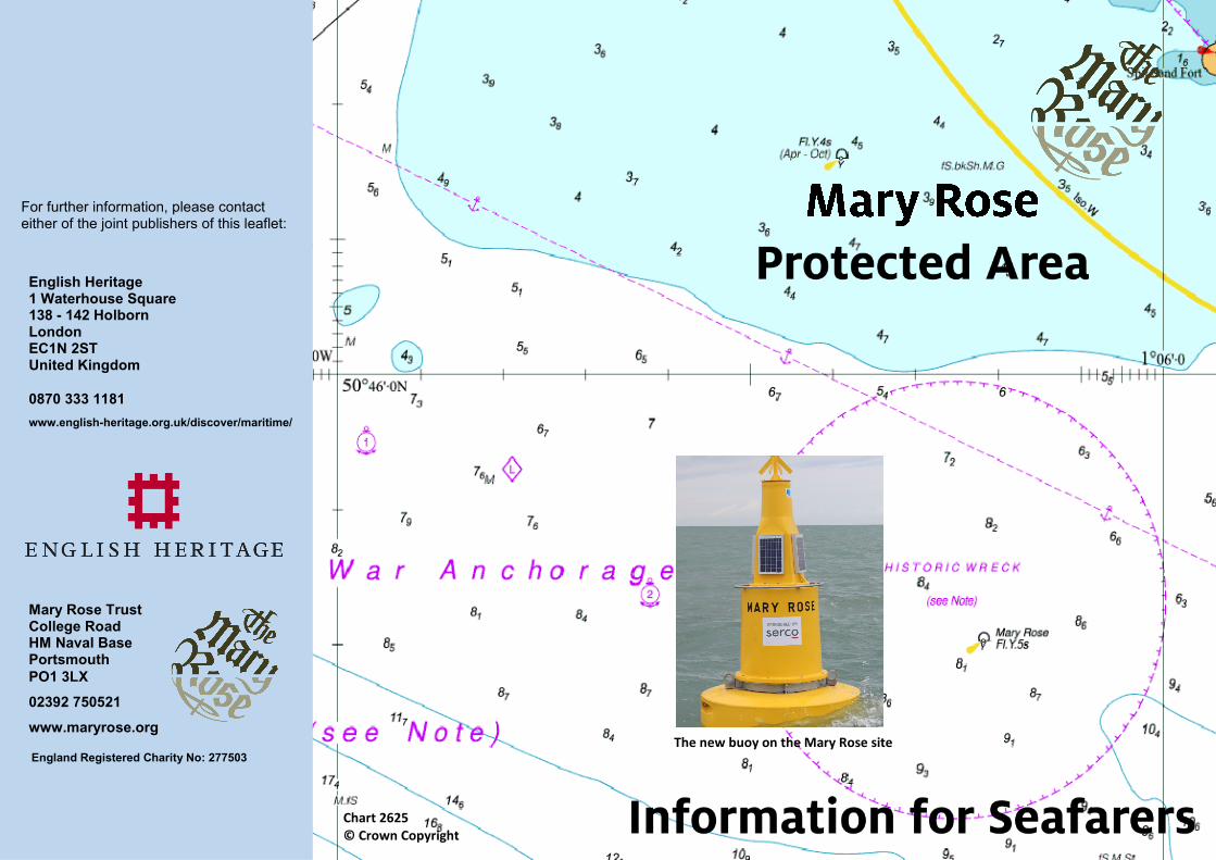
The new buoy on the Mary Rose site
What is still left on the seabed?
Why should you avoid the area? Fishing gear or anchors could become snagged on the lines, chains and
sinkers that we have on the seabed and you could lose your gear
Anything dropped on the seabed, whether anchors, fishing gear, lobster
pots or trawls could either damage remaining timbers or objects or will
disturb the sediments that are protecting them
Gear could also snag on the scientific instruments that we have placed
on the wreck site and would damage or destroy the instruments and
prevent us collecting data
It is illegal under the ‘Protection of Wrecks Act (1973) to interfere with
the seabed within a 300m radius of the wreck buoy (see any of the
Solent charts for details)
It is unlawful to damage any part of the wreck or to deposit any gear
which may obstruct access to any part of the Mary Rose
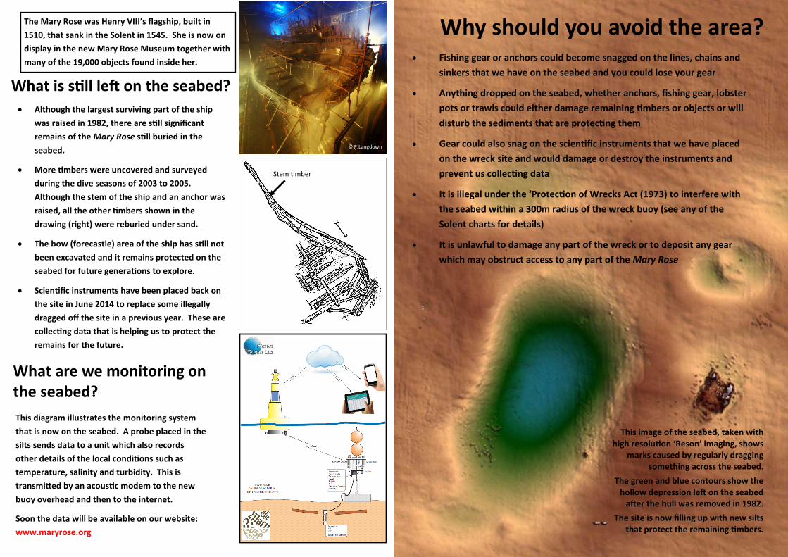
This image of the seabed, taken with high resolution ‘Reson’ imaging, shows
marks caused by regularly dragging something across the seabed.
The green and blue contours show the hollow depression left on the seabed
after the hull was removed in 1982.
The site is now filling up with new silts that protect the remaining timbers.
Although the largest surviving part of the ship
was raised in 1982, there are still significant
remains of the Mary Rose still buried in the
seabed.
More timbers were uncovered and surveyed
during the dive seasons of 2003 to 2005.
Although the stem of the ship and an anchor was
raised, all the other timbers shown in the
drawing (right) were reburied under sand.
The bow (forecastle) area of the ship has still not
been excavated and it remains protected on the
seabed for future generations to explore.
Scientific instruments have been placed back on
the site in June 2014 to replace some illegally
dragged off the site in a previous year. These are
collecting data that is helping us to protect the
remains for the future.
What are we monitoring on the seabed?
This diagram illustrates the monitoring system
that is now on the seabed. A probe placed in the
silts sends data to a unit which also records
other details of the local conditions such as
temperature, salinity and turbidity. This is
transmitted by an acoustic modem to the new
buoy overhead and then to the internet.
Soon the data will be available on our website:
www.maryrose.org
Stem timber
The Mary Rose was Henry VIII’s flagship, built in
1510, that sank in the Solent in 1545. She is now on
display in the new Mary Rose Museum together with
many of the 19,000 objects found inside her.
© P.Langdown