east midlands na to film - natural england
TRANSCRIPT

Natural Areasin the East Midlands Region
helping to set the regional agenda for nature


East Midlands Region Introduction
3
Regional strategies and policydocuments are being drawnup by the newly-created
Regional organisations. These arerequired to encompass the protectionand management of the environmentby applying the principles ofsustainable development.
This document has been producedby English Nature, the Governmentbody that promotes the conservationof wildlife and natural featuresthroughout England. It is for use bythe Regional Development Agency,the Government Regional Officeand the Regional Chambers, whenmaking Regional policy. We hopethat it will provide a starting pointfor discussion with our network ofRegional Lead Teams, who canprovide valuable support, and linksinto wider partnerships.
The conservation of nature is a keytest of policy in all three facets ofsustainable development, the social,the economic and the environmental.While its role in the environment isself evident, it also has socialimplications through the spiritual,cultural and recreational value ofpeople’s experience of the naturalworld; and economic implicationsthrough the provision of exploitableresources and the attractiveness toinvestors of high qualityenvironments.
If we are serious about achievingsustainable development, thenunderstanding the priorities for theconservation of the biodiversity andEarth heritage resource of the Regionis therefore essential. This report is afirst step towards that understanding,and provides the basis for integrating
Introduction
local and national priorities for natureinto the Regional decision-makingframework. It contains information ofdirect relevance to the developmentof Regional Planning Guidance andSingle Programming Documents tosupport the delivery of EuropeanUnion Structural Funding,regeneration funding and othereconomic and social programmes.
The Ministry of Agriculture, Fisheriesand Food, the Environment Agency,the country forestry organisations,local authorities and statutory andother agencies involved in land useand land management issues will alsofind it relevant and, we hope, of value.
We envisage that this document cantherefore be used at a number of keypoints within the Regional strategy-making and planning process.
Peveril Castle, Castleton, Derbyshire. Peter Wakely/English Nature

East Midlands Region Introduction
4
Claxby Chalk Pit, Lincolnshire. Jane Ostler/English Nature
Natural Areas as aRegional framework for natureEnglish Nature has divided England into a series of Natural Areas. Theirboundaries are based on the distribution of wildlife and naturalfeatures and the land use patterns andhuman history of each area. They donot follow administrative boundaries but relate instead to variations in thecharacter of the landscape. They reflectour cultural heritage and are central toEnglish Nature’s organisational strategy Beyond 2000.
We worked with the CountrysideCommission (soon to become theCountryside Agency) to identify a jointapproach to the characterisation of thecountryside into locally distinctive unitscalled character areas. Where the wildlife and natural features are similarbetween adjacent character areas we have merged them into one Natural Area - so, a Natural Area may containseveral character areas that are consideredto be different landscape types.
Natural Areas offer a more effectiveframework for the planning andachievement of nature conservationobjectives than do administrativeboundaries. Although they are not formaldesignations they are now recognised inGovernment Planning Policy Guidance(PPG) and other statutory advice.
Within this framework, we have, with our key partners in the Region, identified the chief threats to, andopportunities for, nature conservation.Together, we have defined a range ofissues, and set associated objectives that we believe provide a starting pointfor Regional action to protect and manage our biodiversity and geologicalassets. These objectives are set out in the sections which follow.
Relevant Government Planning Policy Guidance (PPG)
PPG 7: The Countryside: environmental quality and economic andsocial development
PPG 9: Nature ConservationPPG 11: Regional Planning GuidancePPG 12: Development Plans and Regional Planning Guidance
(presently under review)PPG 13: Transport
Department of the Environment, Transport and the Regions Policy Guidance: Policyappraisal and the environment (DETR, 1998).

wildlife, and sit within the farmlandwhich dominates the East Midlandslandscape - where a number ofimportant species such as brown hareand lapwing can be found.
The distribution of wildlife and thetexture of the landscape are theproduct of complex interactions.The basic physical qualities of therock, soil and climate have set thescene, but the detail has been, andwill continue to be, shaped throughhuman activity which is driven byeconomic, social, and environmentalforces.
Our ability to exploit theenvironment for economic gain isbeginning to jeopardise our presentand future well-being. Since ourdecisions can have far-reachingeffects on present and future
generations, we need to look at howwe can act to maintain and improveboth our local and globalenvironments. There is no doubtthat work at the Regional level can bea powerful force in steering localagendas for environmental action,whilst providing strong links tonational and internationalprogrammes.
Sustainable development requiresintegration, rather than balance ortrade off. Decision makers need tobuild environmental and socialcriteria into the heart of theirpolicies and programmes - andensure that they are given the sameweight as economic considerationsat the beginning of the process. Thisis what is meant by integration, andcontrasts with the more familiarsituation, where proposals are drawn
Objectives forsustainabledevelopment andnature conservation inthe East MidlandsRegion
The East Midlands is a region ofdramatic, and often sharp, contrasts.Dense urban populations can befound in and around the majormetropolitan centres of Derby,Leicester, Northampton andNottingham, traditionally linked tocoal, textiles and the heavy industries.The East and West of the Region arerural, and Lincolnshire is one of themost sparsely populated counties inEngland. Agriculture is the dominantland use and underpins the ruralbase. For instance, the East MidlandsRegion produces 30% of the nationalvegetable crop and 40% of the bulbsand flowers.
The diverse landscape supports acharacteristic combination of wildlifeand geological heritage. The Regionvaries from the rugged upland moorsand limestone dales of the PeakDistrict, through theNottinghamshire coalfield, the greatclay vale of the Trent, the ridges ofthe Lincoln Cliff limestone and thechalk of the Wolds, to the flat fertilesilts of the Lincolnshire CoastalPlains and the sand dunes of theLincolnshire coast and the Wash.
The Peak National Park in the westand the Lincolnshire coast and theWash in the east, have an outstandingdiversity of special wildlife habitatsand species that are very rare, and ofvery high quality, of which the Regioncan be justifiably proud. RutlandWater and Sherwood Forest are alsoof international importance for their
East Midlands Region Introduction
5
35 LincolnshireWolds
Natural Areas covered in the East Midlands Region report
Regional boundary
101 Bridlingtonto Skegness
25 DarkPeak
29 SouthWestPeak
24Coal
Measures
24
30 WhitePeak
32Sherwood
31 DerbyshirePeak Fringeand LowerDerwent
23 SouthernMagnesianLimestone
36 LincolnshireCoast andMarshes
102The
Wash
37 The Fens
38 Lincolnshireand RutlandLimestone39 Charnwood40 Needwood
and SouthDerbyshireClaylands
44 Midland ClayPastures
45 RockinghamForest
52 West AnglianPlain
54 Yardley-WhittlewoodRidge
33Trent
Valley &Rises
34 NorthLincolnshireCoversandsand ClayVales

land as much as possible, whileensuring that the quality of towns orcities is maintained or improved.The challenge will be to determinewhich patterns and locations ofdevelopment prove mostsustainable.
Conserving and enhancing naturecan be compatible with developmentand, whilst the built environment hasfewer designated sites, Local NatureReserves, pocket parks, green spaceand even private gardens, are theonly contact the majority of peoplehave with nature. They are alsoimportant reservoirs of biodiversity.
Another essential role will be playedby those charged with the designand implementation of policy andprogrammes for forestry, agriculture,water and recreation. Farming isthe East Midlands Region’s majorland use. The habitats described inthe following chapters are
predominantly part of agriculturalmanagement systems. Farmland
therefore provides a major
source of opportunity for habitat
creation and maintenance, and
species protection and
enhancement. Its importance is
reflected in the issues and
objectives that are listed at the
start of each section.
The intensification of agriculture,and associated decline in traditionalland management, combined withthe huge growth of the major townsand cities, has resulted in thereclamation and loss of much of thelowland semi-natural habitat of valueto wildlife in the East MidlandsRegion. The semi-natural habitatsthat remain are often small andisolated and are adversely affected byagricultural practices and pressurefrom development, including the useof pesticides and fertilisers, run-off ofpollutants from industrial andhousing estates, and the lowering ofwater tables through drainage andabstraction. Similar pressures ofagricultural intensification, notablyovergrazing, inappropriate burningregimes and a move from traditionalgrassland management, are appliedto the wildlife of the uplands.
The populations of birds, mammalsand plants which rely on theagricultural systems themselves havealso plummeted. Major prioritiestherefore include: the sensitivemanagement of existing habitats;increasing the area of existinghabitats and re-establishing the linksbetween them; and restoring theconditions in which the wildlife ofcereal fields and pasture can alsothrive.
up against economic criteria aloneand are only weighed against theirenvironmental impact when they areabout to be implemented.
The basic means for many of theRegional level structures andorganisations to act will be throughthe planning process for builtdevelopment and infrastructure.Planners have a key role inincorporating economic,environmental and social factors intodecisions about where to put homes,jobs, shops and leisure facilities. Inthis way, demands on land, theenvironment and nature can bemanaged more sustainably.Regional Planning Guidance will bewritten to help with this process.
Current government policyencourages investment in urbanareas and existing centres ratherthan out of town sites. This meansre-using previously developed urban
East Midlands Region Introduction
6
Rutland Water.Peter Wakely/English Nature

East Midlands Region Introduction
7
Glossary
BAP: Biodiversity Action Plans for habitats and species.
Biodiversity: Simply means the variety of life onearth. It covers everything from human beings to oaktrees, bacteria to blue whales. Many Regions havealready produced or are working on BiodiversityAudits and Action Plans which begin to catalogue andsummarise their wealth of wildlife. This documentcomplements these and other initiatives, includingwork on Local Agenda 21 and Local BiodiversityAction Plans, and existing Nature ConservationStrategies.
Earth heritage: We have a rich and diverse heritageof rocks, fossils, minerals and land forms. Theprotection and management of these features is anintegral part of nature conservation.
European Union Habitats and Birds Directives
requires the Government to designate and protectsome of the most important areas for wildlife. Theyare or will be classified as Special Protection Areas(SPAs) and/or Special Areas of Conservation (SACs).These sites are also Sites of Special Scientific Interest(SSSIs) but meet specific criteria for internationalimportance. In the case of marine SACs the SSSIdesignation only applies down to the low water mark.
Habitat: is the natural home of any plant, and whereanimals feed, breed and rest.
Statutory guidance from the Secretary of State
to the Regional Development Agencies (RDA)
includes: Sustainable Development; Rural Policy;Regional Economic Strategies. White Papers
include: Building Partnerships for Prosperity; TheUnited Kingdom Sustainable Development Strategy;Rural White Paper; Urban White Paper.
Sustainable development: was defined by the 1987World Commission Report on Environment andDevelopment as “development which meets the needsof the present without compromising the ability offuture generations to meet their needs”. It is oftendescribed as a ‘three legged stool’ whose legs compriseenvironmental, economic and social. If any one ofthem is missing as a consideration in decisions, thestool will topple.
Specific Relevant application contents
Sustainable We have sought to set biodiversity development and Earth heritage in the context
of sustainable development - andto define the latter as a process ofintegration.
Providing Descriptive text which outlines the context natural character of the Region.
Identifying Specific issues and objectives issues and written for direct inclusion inobjectives policy documents and/or
distillation into policy to protectand enhance nature.
Links to Key Natural Areas are named ininternational each section in order to ensure site designations that national priorities for habitat and biodiversity conservation are taken into
account. They are identified assupporting nationally importantconcentrations of a habitat orEarth heritage feature and/orinternational sites (SpecialProtection Areas and Special Areasof Conservation) and biodiversityhabitats and species.
Benchmarks A checklist is provided (Annex 1) for nature to make an assessment of the
contribution of policies, projectsand programmes to the delivery ofsustainability in relation to nature.
Key contact The English Nature contact points addresses are provided for the
Region, including the RegionalLead Team, together with a list ofsources of information (Annex 2).
How the contents of the report may be applied

East Midlands Region Earth heritage
8
richest sites in Britain for fossilisedmammals, fish, birds and evidence ofprehistoric man. Upper Carboniferousrocks dominate the landscape of theCoal Measures which was furthershaped by the extensive miningindustry based on numerous coalseams which were formed fromancient peat deposits. Clays, sandsand gravels deposited during recentglaciations cap the landscape.
Earth heritage
The Southern MagnesianLimestone area ischaracterised by a
Magnesian Limestone escarpmentwhich runs from south of Sheffieldto the Durham coast. Characteristicgorge and cave deposits containevidence of human occupationmaking this a key area for examiningthe early habitation of the BritishIsles. Creswell Crags is one of the
Issue: site protection● Protect sites from the threat
of landfill.● Review proposals for
aggregate extraction and veinmineral working against natureconservation objectives.
● Discourage cliff-topdevelopment which mayrequire future damaging coastprotection works.
Issue: maintenance of existingresources● Maintain existing geological
sites by:◗ agreeing the conservation ofexposures in working anddisused quarries withextraction companies;
◗ ensuring appropriatemanagement of sites (e.g. byremoving overgrowth).
Issue: recreation and education● Encourage local caving
organisations to be responsiblefor cave systems by undertakingcave conservation plans.
● Promote responsible fossilcollection and protectvulnerable sites.
● Promote the geologicalresource by: ◗ explaining the influence ofgeology on local habitats andscenery through on siteinterpretation usingsignboards, leaflets and trailguides, etc;
◗ assessing and promoting
the educational and researchvalue of sites.
Key issues andobjectives
Beacon Hill, Leicestershire. Steve Clifton/English Nature

East Midlands Region Earth heritage
9
The Bridlington to Skegness coast isalmost entirely underlain by finegrained limestones, however thenature of the area has beendetermined by the thick layer ofclays and gravels deposited on top ofthe limestone during the last IceAge. The Lincolnshire Wolds,Lincolnshire Marsh and Coast andLincolnshire and Rutland Limestoneare all characterised by a thickdeposit of Chalk overlying
Main Earth heritagefeatures of key NaturalAreas
23. Southern Magnesian
Limestone
● Permian MagnesianLimestone of the YorkshireProvince
● Pleistocene stratigraphy andvertebrates
● Early settlement bypalaeolithic man
24. Coal Measures
● Namurian and Westphalianstratigraphy andsedimentology
● Economic resource -Westphalian Coal Measures
● International importance -proposed stratotype andestablished type localities
● Plant fossils
25. Dark Peak
● Upper Carboniferousstratigraphy and sediments
● Landslips and their geologicalcontext
● Quaternary development ofthe Pennines
2324
25
30
24
3337
5239
30. White Peak
● Exposures showingCarboniferous stratigraphy
● Karst features such as cavesystems and dry valleys
● Mineralisation of theCarboniferous limestone
● Influence on the landscape andscenery
33. Trent Valley and Rises
● Precambrian rocks, Caledonianigneous rocks and associatedmineral veins
● Exposures of Triassic rocks● River Trent terraces and
associated river gravels andfossils
37. The Fens
● Upper Jurassic clays andassociated deposits withimportant fossil faunas
● Upper Jurassic fossil-richlimestones including coral reefsand associated deposits atUpware
● Complex sequence of Holocenedeposits representing variedenvironments and recording adetailed story of recent sea leveland climatic changes
39. Charnwood
● Precambrian fossils and rocks● Caledonian igneous rocks and
associated mineral veins● Precambrian hills and
associated summit tors● Deep river gorges
52. West Anglian Plain
● Fossil rich limestones and clay● Oxford Clay exposures in
brickpits of importance forpalaeontology and stratigraphy
● Quaternary river terrace gravelswith important fossil faunas
sandstones, ironstones and clays.The Chalk is only well exposed onthe south bank of the Humber.Lower and middle Jurassic limestoneoverlain by clays and a semi-continuous sheet of wind-blownsand characterise the northern partof the North LincolnshireCoversands and Clay Vales, to thesouth the sands are absent and onlythin bands of limestone are found inthe clays.
The distinctive White Peak scenery,of which the dales and caves arenotable features, results from theweathering and erosion of theunderlying CarboniferousLimestone. Volcanic activity duringthe Carboniferous Period resulted inthe production of a number of lavaflows. Later volcanic activity duringthe Permian resulted in theemplacement of several sills, whileheated metal-rich brines produced

the mineral veins in the rock. To thenorth of, and forming a horseshoearound the White Peak limestonesare the high moors of the Dark Peakand South West Peak. Thesesandstones formed in great riverdeltas. Subsequent glaciation in theSouth West Peak and Dark Peak hasresulted in the distinctive gritstonescenery. The Derbyshire PeakFringe and Lower Derwent hasnumerous ridges and dales as aresult of its mix of limestones, shalesand sandstones of CarboniferousAge.
The Sherwood area is characterisedby a low sandstone escarpmentrunning from north to south,underlain by the East PennineCoalfield. This sandstone extendsunder the Needwood and SouthDerbyshire Claylands where it iscovered by thick deposits of claysresulting in a generally low-lyinglandscape.
The peaks of Charnwood are formedfrom ancient Precambrian rockswhich are internationally famous fortheir soft-body fossils. Volcanicactivity in the area resulted in theinjection of diorites which form thebasis for the Leicestershire quarryingindustry. Later erosion under semi-arid conditions led to the formationof red sandstone rocks and thewhole area has been lowered by rivererosion. Precambrian rocks extendunder the Trent Valley and Riseswhere they have been intruded bygranites. The Precambrian rocks andintrusions are overlain by theSherwood Sandstone, andsubsequent glacial deposits nowform the low-lying flat landscape ofthe area.
The Midland Clay Pastures areunderlain by clays, silts, sands,
East Midlands Region Earth heritage
10
Charnwood Lodge, Leicestershire. Peter Wakely/English Nature

Oxford Clay, internationally famousfor its fossil fauna. The Fens are alsodominated by clays, and underlainby Oxford Clay. Of particular note isan isolated mass of richlyfossiliferous limestone containingcoral reefs. Glacial activity scouredout the Fen basin and the Wash,leaving a deposit of sands, gravelsand clays. Recent Holocene depositscreated the uniform peat or silt soilsthat characterise the area today.
limestones and ironstones whichhave been extensively quarried. The limestone is blanketed by thickglacial deposits which form theheavy clay soils characteristic ofRockingham Forest and the Yardley-Whittlewood Ridge.
The West Anglian Plain ischaracterised by ancient river-terracegravels and underlain by Jurassicclays, the uppermost of which is the
East Midlands Region Earth heritage
11
Dovedale, Derbyshire. Peter Wakely/English Nature

East Midlands Region Freshwater
12
The rivers in the south of theRegion, for example the Ise inRockingham Forest and the Nene inThe West Anglian Plain, have acharacteristic clay river flora.Charnwood is notable for its fast-flowing, acidic streams with shinglebanks and stream margins, whichsupport nationally scarceinvertebrates.
Natural Areas where the rivers havebeen over-managed and are a lessvaluable wildlife resource, includethe Yardley - Whittlewood Ridge,Lincolnshire and Rutland Limestoneand Sherwood.
The Region has outstanding openwaters which are predominantlyreservoirs and gravel pits. These areon an important route for migratingbirds and are key locations forwintering wildfowl. The largest,Rutland Water, is a SpecialProtection Area for winteringgadwall and shoveler and regularlysupports over 20,000 waterfowl.
Many lakes and flooded quarriesthroughout the Region are important
Freshwater
Rivers and streams are asignificant feature of theEast Midlands Region,
particularly the Rivers Trent andSoar which characterise the TrentValley and Rises. Their manytributaries flow across adjacentNatural Areas, and one, the RiverEye, is an SSSI for its plantcommunities.
Chalk-rich rivers and streams are apriority BAP habitat. Those that risein the Lincolnshire Wolds support arich fauna. Some cross the NorthLincolnshire Coversands and ClayVales before feeding the Humber,most notably the Rivers Bain andAncholme.
The characteristic upland streams ofthe Dark Peak and South West Peakare important water resources, oftencontrolled by reservoirs. The fewrivers of the White Peak are of highwater quality but subject to lowsummer flows. These are the onlysites in the world for the Derbyshirefeather moss, a BAP species. TheRiver Lathkill in the White Peak is anSSSI.
Issue: water quality
● Maintain high water qualityby:◗ improving sewagetreatment where necessary;
◗ preventing contaminationfrom minewater;
◗ safeguarding allwatercourses, particularlymesotrophic water bodies,from agricultural and urbanrun-off.
Issue: water quantity
● Maintain river levels andflows by:◗ reducing abstractions; ◗ restoring historic flows.
Issue: lack of or inappropriatemanagement
● Manage water and watersidehabitats appropriately by:◗ re-establishing naturalwaterside habitats;
◗ reducing grazing ofwaterside margins.
● Balance recreational andwildlife objectives,particularly in canals andlakes.
● Protect plant and animalcommunities from theinfluence of introducedspecies.
Key issues andobjectives
River Lathkill, Derbyshire. Peter Wakely/English Nature

East Midlands Region Freshwater
13
populations in Britain, and the southof the Region are of high priority forwater vole conservation. Watervoles also occur in The Fens andTrent Valley and Rises but arescarce and declining elsewhere.
The River Dove in the White Peakforms part of the Peak District Dalescandidate Special Area ofConservation (SAC) for itspopulation of white-clawed crayfish.The head waters and tributaries ofthe Soar and rivers in The Fens andMidland Clay Pastures also supportpopulations of the white-clawedcrayfish. Elsewhere in the Region ithas declined rapidly following theintroduction of the American signalcrayfish.
The brook lamprey and bullhead areboth found throughout the Region.The spined loach has an importantstronghold in the Trent Valley andRises in habitats ranging from riversto gravel pits.
Other BAP species foundthroughout the Region includegreat-crested newts, with importantpopulations in the Fens, WestAnglian Plain and the White Peak,and pipistrelle bats, which areparticularly associated with pondsand rivers. The ribbon-leavedwater-plantain is found in The Fensand the grass-wrack pondweed inthe Derbyshire Peak Fringe andLower Derwent and Trent Valleyand Rises.
eutrophic standing waters andprovide a refuge for waterfowl(unless under high recreationalpressure).
Mesotrophic standing waters in theNorth Lincolnshire Coversands andClay Vales, Southern MagnesianLimestone, Trent Valley and Risesand Charnwood are valuable fortheir wetland plant communities andpillwort, the nationally scarceaquatic fern.
Ditches feature strongly in theLincolnshire Coast and Marshes andThe Fens where they are importantfor their flora. Once common fieldpools and dew ponds have nowdeclined.
Naturally fluctuating water bodiesare a priority BAP habitat and occurin the Lincolnshire Coast andMarshes. The Tetney Blow Wellsare a nationally important example.
Canals are a valuable standing waterhabitat in the East Midlands Region.In the Trent Valley and Rises theGrand Union, Ashby, Chesterfieldand Grantham Canals are all SSSIs.Canals also occur in the DerbyshirePeak Fringe and Lower Derwent.Some canals in the South West Peakand the Coal Measures support thefloating water-plantain, a priorityBAP species.
The White Peak, which formerly hadone of the highest water vole
Characteristic habitats ofkey Natural Areas
33. Trent Valley and Rises
● Significant rivers and streams● Man-made reservoirs
(mesotrophic and eutrophicstanding waters)
● Flooded gravel pits,predominantly along theTrent (mesotrophic andeutrophic standing waters)
● Numerous canals
37. The Fens
● Large, slow-flowing rivers anddrains
● Ditches and drains within wetgrasslands, some of botanicalsignificance
● Occasional ponds and borrowpits (some mesotrophic standingwaters)
● Flooded gravel pits (somemesotrophic standing waters)
NB Priority BAP habitats in italic
3337
Candidate Special Areas of Conservation
● Peak District Dales (White Peak)
Special Protection Areas
● Rutland Water (Trent Valley and Rises)

East Midlands Region Inland rock
14
habitats ideal for lichens, mosses,liverworts and ferns.
Limestone screes are a feature ofmany dale sides in the White Peakand support a diverse range of plantsand animals that are adapted tosurvive extreme water stress: speciesinclude the limestone fern and pill
Inland rock
The most important inlandrock habitats of the EastMidlands Region are
confined to the White Peak, DarkPeak and the South West Peak, withthe White Peak being the mostsignificant Natural Area. There aremany disused quarries throughoutthe Region that provide open rock
Issue: rock removal
● Avoid extensive use of stoneand scree for creating newfootpaths and walls.
Issue: recreation
● Control rock and boulderclimbing and scree running toprotect rock surfaces, theirvegetation and nesting birds.
● Consider the impact offootpaths and new tracks oninland rock habitats.
Issue: agriculture
● Establish grazing regimeswhich:◗ benefit the vegetation;◗ minimise damage to rocksurfaces, particularly scree.
Key issues andobjectives
Gang Mine, Derbyshire. Peter Wakely/English Nature

East Midlands Region Inland rock
15
species Brachythecium appleyardiae,an English endemic.
Metal-rich or ‘calaminarian’grasslands occur on soils with levelsof heavy metals that are toxic tomost plant species. In this Regionsuch sites are associated with pastmining activities. In the White Peak,many former lead mines and theirassociated spoil heaps support thesegrasslands but reworking fordifferent minerals is reducing theirnumber every year. The mostsignificant site is Gang Mine, acandidate Special Area ofConservation (SAC), notable for its
woodlouse, Armadillidium pulchellum.The development of vegetation onthe screes is influenced by the size ofthe rock fragments and theirstability. Succession to ash scrub isa problem on larger sizes of screeand on screes where grazing occursthe animals can physically damagethe habitat.
Limestone cliffs are alsocharacteristic of the White Peak.With their sheer, fissured faces andinaccessible ledges they supportnationally scarce plants such as therustyback fern, wall whitlowgrass,Jacob’s-ladder and the BAP moss
Candidate Special Areas of Conservation
● Gang Mine (White Peak )
Special Protection AreasNone
Alport Castle, Peak District National Park. Tony Warne/English Nature
wide variation in aspect and soiltoxicity. Floristically this is therichest such site in the UK,characterised by spring sandwort,alpine pennycress, moonwort and arange of specialised lower plants andinvertebrates.
The gritstone edges and boulderslopes of the Dark Peak and SouthWest Peak are home to the Killarneyfern (a priority BAP species) and anassemblage of lichens some of whichare nationally scarce. The peregrinefalcon and the raven, dependent onsecluded edges for nesting, arefound both in the Dark Peak and theWhite Peak.
Outcrops of igneous rock inCharnwood support regionallyimportant lichen communities.
Characteristic habitats ofkey Natural Areas
30. White Peak
● Extensive limestone screesand rock faces
● Scattered metal-rich spoilheaps supporting‘calaminarian’ grasslands
NB Priority BAP habitats in italic
30

East Midlands Region Bog, fen and swamp
16
most but not all of the Region.The many invertebrates, breedingwaders and plants associated withbog, fen and swamp communities inthe Region, and particularly TheFens, include the BAP species greaterwater-parsnip, reed bunting, bittern,the longhorn beetle Oberea oculata,the ground beetles Pterostichusaterrimus and Panageus crux major,Desmoulin’s whorl-snail and a leafbeetle, Cryptocephalus exiguus.
Bog, fen and swamp
Fragments of fen are foundthroughout the Region, mostnotably in the Lincolnshire
Wolds, where there is fen meadow,and The Fens where the onlyremaining areas of peat fen occur.This is dominated by purple moor-grass and is often species rich.Reedbeds are associated with fensand reservoirs, particularly atRutland Water in the Trent Valleyand Rises and at disused quarries,clay and gravel pits in, for instance,the Lincolnshire Coast and Marshesand the West Anglian Plain. Smallareas of swamp occur throughout
Issue: loss of habitat
● Re-establish bog, fen andswamp habitat by:◗ restoring the water levels;◗ creating large, wetreedbeds;
◗ removal of encroachingtrees and scrub.
Issue: inappropriate management
● Manage existing bog, fen andswamp by:◗ reducing burning andgrazing of blanket bogs;
◗ cutting reedbeds to benefitrare species associated withthem (e.g. bittern).
Issue: water
● Enhance water quality andsoil water levels through:◗ control of agriculturaldrainage and reduction infertiliser run-off;
◗ sustainable management
of water abstraction.
Key issues andobjectives
Baston Fen, Lincolnshire. Allan Drewitt/English Nature

The flushes associated with thecloughs and river valleys of theSouth West Peak, Dark Peak andDerbyshire Peak Fringe and LowerDerwent are predominantly acidicwith mosses, soft-rushes and smallsedges. The BAP species reedbunting is associated with theseflushes. Flushes and their associatedfen habitats are an importantresource in the White Peak but arescarce due to the pervious quality ofthe limestone. Elsewhere in theRegion they are very restricted.
Extensive areas of blanket bog, apriority BAP habitat characterisedby hare’s-tail cottongrass withheather and wavy hair-grass, occuracross the Dark Peak and South
Flushes and springs are small areasof emerging ground water foundthroughout the Region among bogs,wet grassland, upland heath and fen.They are highly vulnerable tochanges in water quality andquantity. The most species-richflushes are those fed by the basicsprings associated with limestone,supporting plant species such asgiant horsetail, meadowsweet,opposite-leaved golden-saxifrage,marsh marigold and importantinvertebrate communities. Thesebase-rich flushes occur in theLincolnshire and RutlandLimestone, Lincolnshire Wolds,Southern Magnesian Limestone andthe Lincolnshire Coversands andClay Vales.
Candidate Special Areas of ConservationNone
Special Protection Areas
● South Pennine Moors (Dark Peak; South West Peak)
Aylestone Meadows, Leicester. George Barker/English Nature
East Midlands Region Bog, fen and swamp
17
West Peak. Long-term overgrazing,burning, drainage, acid rain andpollution have led to reduceddiversity of plant and animalcommunities, increased areas of peaterosion and the loss of some speciesthat are characteristic of morenatural ecosystems. Neverthelessthese upland areas are ofinternational importance for a rangeof birds. Red grouse, curlew andgolden plover still breed there andpart of the South Pennine MoorsSpecial Protection Area is found inthe Dark Peak and South West Peak.Raised bog, also a priority BAPhabitat, only occurs in a small areain the Dark Peak.
Characteristic habitats ofkey Natural Areas
37. The Fens
● Small, scattered areas of relictfen
● Purple moor-grass and rushpastures
● Small areas of marsh, saw-sedge, swamp and reedbedhabitats
NB Priority BAP habitats in italic
37

East Midlands Region Woodland
18
The East Midlands Region asa whole is not well wooded,and woodland is virtually
absent from the Fens, LincolnshireCoast and Marshes and LincolnshireWolds in the east, and the Dark Peakin the west. The Region is
characterised by lowland oak andmixed deciduous woods. Sessile oakis generally found on thinner, lightersoils and is associated with speciessuch as small-leaved lime and birch.Pedunculate oak with ash and hazeltends to occur on deeper, wetter soils.
Woodland
Issue: loss of habitat● Create new broadleaved
woodland around existing blocksand link small, isolated fragments(e.g. along river corridors).
● Protect ancient and semi-naturalwoodland.
Issue: commercial woodland● Restructure large conifer
plantations through:◗design plans to improve
conservation value;◗restoration of nativebroadleaved trees on ancientwoodland sites.
● Identify appropriate areas fornew commercial woodland which:◗enhance landscape characterand ecological interest;
◗ avoid conflict with otherconservation aims.
Issue: management● Encourage appropriate
woodland development through:◗ promotion of the ForestryCommission Woodland GrantsScheme;
◗transfer of arable and improvedgrassland to forestry;
◗encouraging local use ofproducts from semi-naturalstands (e.g. charcoal).
● Encourage establishment of deermanagement groups.
● Promote recreational activitieswhich are sensitive to natureconservation objectives.
Issue: loss and neglect of hedges● Protect existing hedgerows using
legislation.● Restore and re-establish
hedgerow boundaries to link
existing fragments using locallynative species.
Key issues andobjectives
Veteran oak, Calke Abbey, Derbyshire. Peter Wakely/English Nature

East Midlands Region Woodland
19
Ancient woodland occurs inrelatively high density throughoutCharnwood, the east of the TrentValley and Rises, Coal Measures,Yardley - Whittlewood Ridge,Rockingham Forest and SouthernMagnesian Limestone. The woodson the Southern MagnesianLimestone include species at thesouthern edge of their range such asbaneberry. Those at the northernedge of their range include green-flowered helleborine, wood barleyand the nationally scarce large-leaved lime.
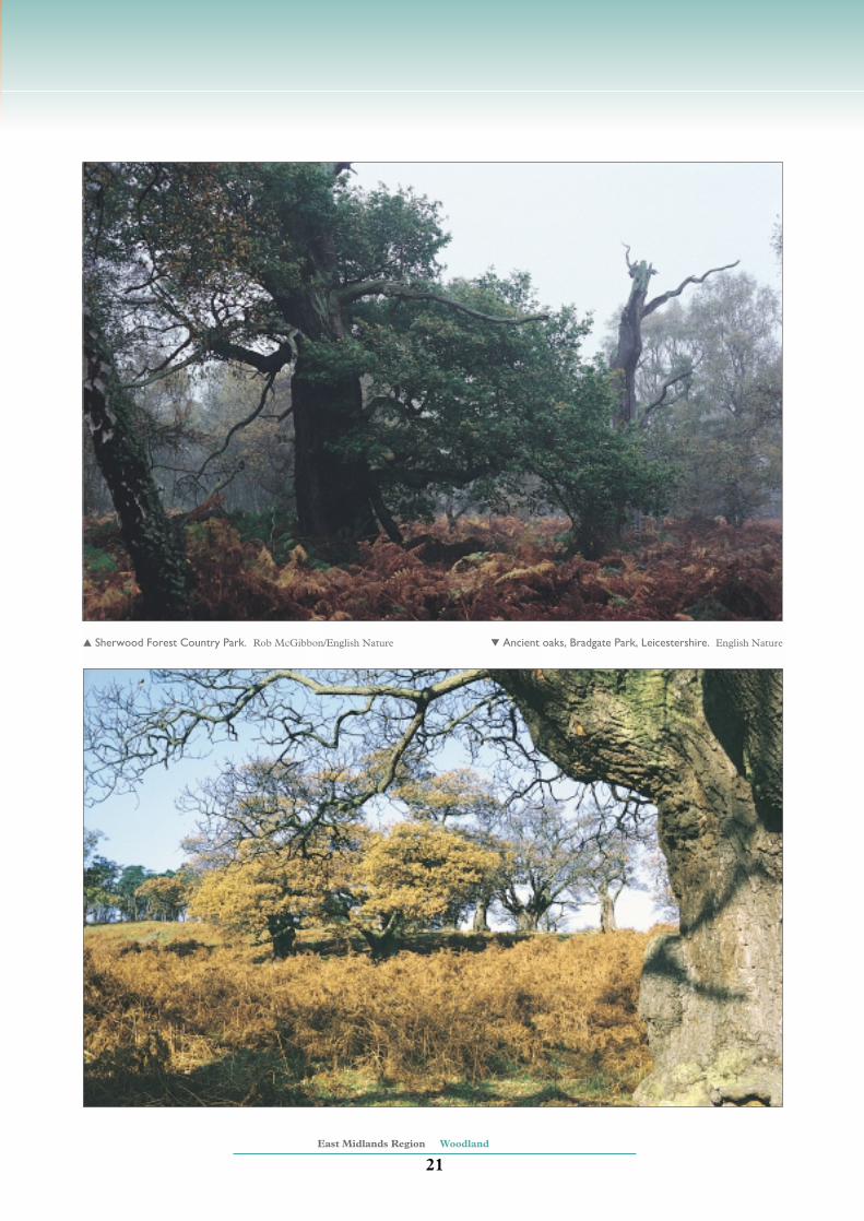
The North Lincolnshire Coversandsand Clay Vales are sparsely woodedin the north, but have a relativelyhigh density of ancient woodland inthe south, of which the small-leavedlime woods around Bardney are aNational Nature Reserve (NNR).The Birklands and Bilhaughwoodland in Sherwood includes aremnant of the historic SherwoodForest. The site is a candidateSpecial Area of Conservation (SAC),being one of the most importantexamples of old oak woodland onsandy soil in the UK. Both thepedunculate oak and sessile oak arepresent in mixed-age stands. Thesite also has a notably richinvertebrate fauna and a diversity offungi. The remains of other ancientforests occur in Rockingham Forestand at Leighfield Forest in the TrentValley and Rises.
There are areas of lowland woodpasture and parkland throughout thecentre and south west of the Regionespecially in the Trent Valley andRises, Charnwood and Sherwood.Many of these, such as ClumberPark in Sherwood and Calke Abbeyin the Trent Valley and Rises,contain very old ‘veteran’ trees ofsignificance for bats, invertebrates
Candidate Special Areas of Conservation● Peak District Dales Woodland (White Peak)● Birklands and Bilhaugh (Sherwood)
Special Protection AreasNone
Characteristic habitats ofkey Natural Areas
23. Southern Magnesian
Limestone
● Fragments of lowland oak andmixed deciduous woods
● Lowland wood pasture andparkland
● Small areas of wet woodlandwith alder
24. Coal Measures
● High density of lowland oakand mixed deciduous woodswith ash and lime
● Extensive conifer plantations● Locally important lowland wood
pasture and parkland● Some areas of wet woodland
associated with alder● Significant hedgerows
30. White Peak
● Upland lime-ash dalesidewoodland
33. Trent Valley and Rises
● Scattered fragments of ancientsemi-natural woodlandincluding lowland oak andmixed deciduous wood
● Nationally important lowlandwood pasture and parkland
● Widely distributed wet woodlandwith alder, willow and ash
● Significant hedgerows
34. North Lincolnshire
Coversands and Clay Vales
● Important concentrations oflowland oak and mixed deciduouswood, particularly limewoods
● Extensive conifer plantations inthe north of the area
● Wet woodland including oak/alderwoods on riversides and fen-edgegravels
● Ancient semi-natural woodlandon Coversands
● Significant hedgerows
52. West Anglian Plain
● Lowland oak and mixeddeciduous wood
● Numerous ancient coppice woods
54. Yardley-Whittlewood Ridge
● Extensive lowland oak and mixeddeciduous woodland
● Ancient lowland wood pasture andparkland
NB Priority BAP habitats in italic
23
24
24
30
33
34
52
54

rivers, streams and lake margins inall Natural Areas throughout theRegion except the West AnglianPlain and Yardley-WhittlewoodRidge.
Some extensive areas of coniferplantation are present in the Region,particularly in the Coal Measures,Sherwood and North LincolnshireCoversands and Clay Vales.Although largely consisting ofintroduced conifers these canprovide habitats for some nativespecies, particularly birds of preysuch as goshawk. Some plantationscontain the remains of formerheathland and support nightjar.They are ideal potential areas forheathland re-creation.
BAP species associated withwoodland in the Region includespotted flycatcher, pipistrelle bat,barbastelle bat, lesser horseshoe bat,argent and sable moth and the
dormouse, which has a particularassociation with large ancientwoodlands.
Hedgerows occur throughout theEast Midlands Region. Those of theLincolnshire Coast and Marshes,Trent Valley and Rises andCharnwood are considered the mostsignificant. Hawthorn is generallythe main constituent of hedgerows,with associated species varyingacross the Region. For example, inSherwood gorse, broom, brackenand large oaks are characteristic.Hedgerows and their margins are akey habitat for wildlife such as birds,bats, butterflies and moths. BAPbird species which depend onhedgerows and occur in the Regionare the linnet, bullfinch, tree sparrowand song thrush.
East Midlands Region Woodland
20
and lichens. Charnwood has goodexamples of sessile oakwoods andparkland on the more acidic soils.
There are areas of upland mixed oakand upland mixed ash woodland inthe valley sides and cloughs of theWhite Peak, Dark Peak and SouthWest Peak. The most notable is thePeak District Dales Woodland in theWhite Peak which is a candidateSAC for the lime-ash ravine forest.This is a habitat dominated by ashwith wych elm, lime and sycamoreand is typically found on coarsescree, steep rocky slopes and inravines. This site has richinvertebrate and plant communities,including species such as rockwhitebeam. Upland mixed oak is apriority BAP habitat and small areasare also found in the DerbyshirePeak Fringe and Lower Derwent.
Wet woodland characterised by alderand willow is a feature of many
Birklands and Bilhaugh, Nottinghamshire. Peter Wakely/English Nature
East Midlands Region Woodland
21
▲ Sherwood Forest Country Park. Rob McGibbon/English Nature ▼ Ancient oaks, Bradgate Park, Leicestershire. English Nature

East Midlands Region Lowland grassland and heath
22
Lowland heath has become anationally andinternationally rare habitat
after changes in agriculture haveseen large areas of heathlandconverted to grassland, arable landor conifer plantations. There arenationally important heathcommunities in Charnwood,Sherwood and the NorthLincolnshire Coversands and ClayVales, that are different both fromeach other and from the heathlandsof southern England. The heath
communities of Sherwood arecharacterised by a mosaic ofheathers (including local variantssuch as hoary ling), acid grassland,bracken and acid shrubs such aspetty-whin and dwarf gorse. Mostof the heath in the NorthLincolnshire Coversands and ClayVales is associated with parched acidgrassland, sand dunes andcalcicolous grassland. These sitesprovide an important habitat forlichens, mosses and invertebrates,particularly beetles, flies and moths
Lowland grassland and heath
Issue: opportunities for habitatcreation
● Create or restore grasslandand heaths on farmland andsecondary woodland,particularly where this linksexisting fragments.
● Implement existingheathland re-creationstrategies.
Issue: lack of appropriatemanagement
● Promote appropriatemanagement through:◗ extensive, low-intensitygrazing on grasslands andheaths;
◗ controlled burning or scrubclearance on heaths;
◗ sensitive watermanagement on wet sites.
Issue: pressure for agriculturalintensification
● Avoid further loss of habitatdue to agriculturalintensification by:◗ encouraging traditional,low-intensity agriculture;
◗ promoting the uptake ofagri-environment and otherenvironmental supportschemes;
◗ creating cereal fieldmargins to halt decline inarable plant species.
Key issues andobjectives
Bagthorpe Meadows, Nottinghamshire. Steve Clifton/English Nature

East Midlands Region Lowland grassland and heath
23
such as the Portland Moth. TheCharnwood heaths, which lie on hardacidic rocks, include upland speciessuch as bilberry and crowberry. TheCoal Measures, Trent Valley andRises and Lincolnshire and RutlandLimestone have small but distinct,scattered areas of heath. Dry lowlandheath is absent from the rest of theRegion.
Small areas of wet heath characterisedby cross-leaved heath, purple moor-grass and cottongrass occur on theNorth Lincolnshire Coversands andClay Vales, Sherwood andCharnwood. Wet heath is very rarethroughout the rest of the Region.
Red hemp-nettle. Chris Gibson/English Nature
Characteristic habitats ofkey Natural Areas
30. White Peak
● Extensive lowland calcareous(limestone) grassland
● Some areas of tall herbgrassland on limestone
● Scarce unimproved neutralgrassland
● Some areas of lowland dry acidgrassland
32. Sherwood
● Scattered mosaics of lowlandheath and lowland dry acidgrassland
● Small amounts of wet heath
33. Trent Valley and Rises
● Significant areas of floodplaingrazing marsh including agroup of important lowlandhay meadow sites
● Dry and wet unimprovedneutral grassland
34. North Lincolnshire
Coversands and Clay Vales
● Significant areas of parched(dry) acid grassland
● Extensive, nationallyimportant lowland heath
● Small areas of lowlandcalcareous grassland associatedwith disused quarries
● Significant, fragmented areasof species-rich dry neutralgrassland
37. The Fens
● Wet neutral grassland,including washlands andfloodplain grazing marsh
● Some unimproved neutralgrassland
NB Priority BAP habitats in italic
30
37
34
33
32
Candidate Special Areas of Conservation
● Peak District Dales (White Peak)
● Barnack Hills and Holes (Rockingham Forest)
● Grimsthorpe Park (Lincolnshire and Rutland Limestone)
Special Protection AreasNone
The priority BAP species associatedwith heathland in the Region includethe Deptford pink and nationallyimportant numbers of breedingnightjar and woodlark.
Across the Region most of thegrassland has been agriculturallyimproved by fertilisers and drainageand is no longer species-rich. Theremaining grassland can be broadlyclassified into four categories;limestone grassland, wet grassland,neutral grassland and acidic grassland.Of these the limestone grassland is themost species-rich, both for plants andinsects such as beetles, flies andmoths. The White Peak is ofoutstanding importance for itsgrassland communities, particularlyon limestone and BAP species foundthere include the chalk carpet mothand light-feathered rustic moth.

The Peak District Dales in theWhite Peak are a candidate SpecialArea of Conservation (SAC) fortheir extensive surviving areas ofspecies-rich chalk and limestonegrassland. The Southern MagnesianLimestone area is notable for havinga substantial proportion of thenationally scarce MagnesianLimestone grassland which differsfrom other limestone grassland inthe Region, for example in the WhitePeak, being characterised by bluemoor-grass. The losses of lowlandlimestone grassland have beenconsiderable, and only small areasnow remain. Nevertheless, theLincolnshire and Rutland Limestonehas nationally important areas,including Grimsthorpe which is acandidate SAC for the early gentian,here at its most northerly location.
East Midlands Region Lowland grassland and heath
24
Disused quarries across the Regioncan be important sites for limestonegrassland.
Wet grasslands and floodplaingrazing meadows often have a densenetwork of ditches and a distinctivevegetation which can withstandbeing waterlogged. They support awide variety of invertebrates and areimportant for breeding andwintering birds. The Trent Valleyand Rises supports relatively largeareas of species-rich floodplaingrazing meadow, particularly atLoughborough Big Meadow whichis the third largest site of this type inEngland and is a mediaeval Lammasmeadow. Significant areas of wetgrassland remain along theLincolnshire Coast and Marshesbetween Cleethorpes and Skegness
which are of value for theirconservation, historical andlandscape features. The important‘washlands’ of The Fens aredeliberately flooded to preventrivers, such as the Nene, Ouse andCam, from overtopping. TheNeedwood and South DerbyshireClaylands have notable wetgrassland associated with the RiversTrent and Dove. Elsewhere thereare still important wet grasslandsassociated with river valleys such asthat of the lower Soar. Suchgrasslands continue to be drainedand converted to arable land.
Dry neutral grassland includes oldpermanent pasture and traditionalhay meadows which are species-richand now very scarce nationally.Lowland hay meadows are found
Green-winged orchids, Muston Meadows, Leicestershire. Peter Wakely/English Nature

scattered throughout the Region,particularly in the White Peak, WestAnglian Plain and the Trent Valleyand Rises where Muston Meadowsis an NNR. Some enclosed haymeadows and pastures remain in theMidlands Clay Pastures and theNeedwood and South DerbyshireClaylands.
There are considerable areas ofacidic grassland in Charnwood,Sherwood and the NorthLincolnshire Coversands and ClayVales, often in association withlowland heath. It also occurs on thepoor soils of dale sides in the WhitePeak. In the LincolnshireCoversands the acid grasslandoccurs on wind-blown glacial sands.
The cereal field margins in theRegion are generally poor forwildflowers. The Natural Areahaving the highest number ofwildflower species associated witharable land is the West AnglianPlains, where the moss Weissiarostellata, a BAP species, is found.The red hemp-nettle, cornflower,small-flowered catchfly andshepherd’s-needle are other BAParable plants found in the Region.BAP animals associated with cerealfield margins and grasslands in theRegion are the grey partridge,skylark, turtle dove, corn bunting,tree sparrow and the brown hare forwhich the south and east of theRegion is of high importance.
Some arable land on theLincolnshire Coast and Marshes isof national importance for birds,particularly pink-footed geese andwigeon, which feed in cultivatedfields, and golden plover andlapwing, which feed and roost herein winter.
East Midlands Region Lowland grassland and heath
25
Heathland, Lincolnshire. Steve Clifton/English Nature
East Midlands Region Upland grassland and heath
26
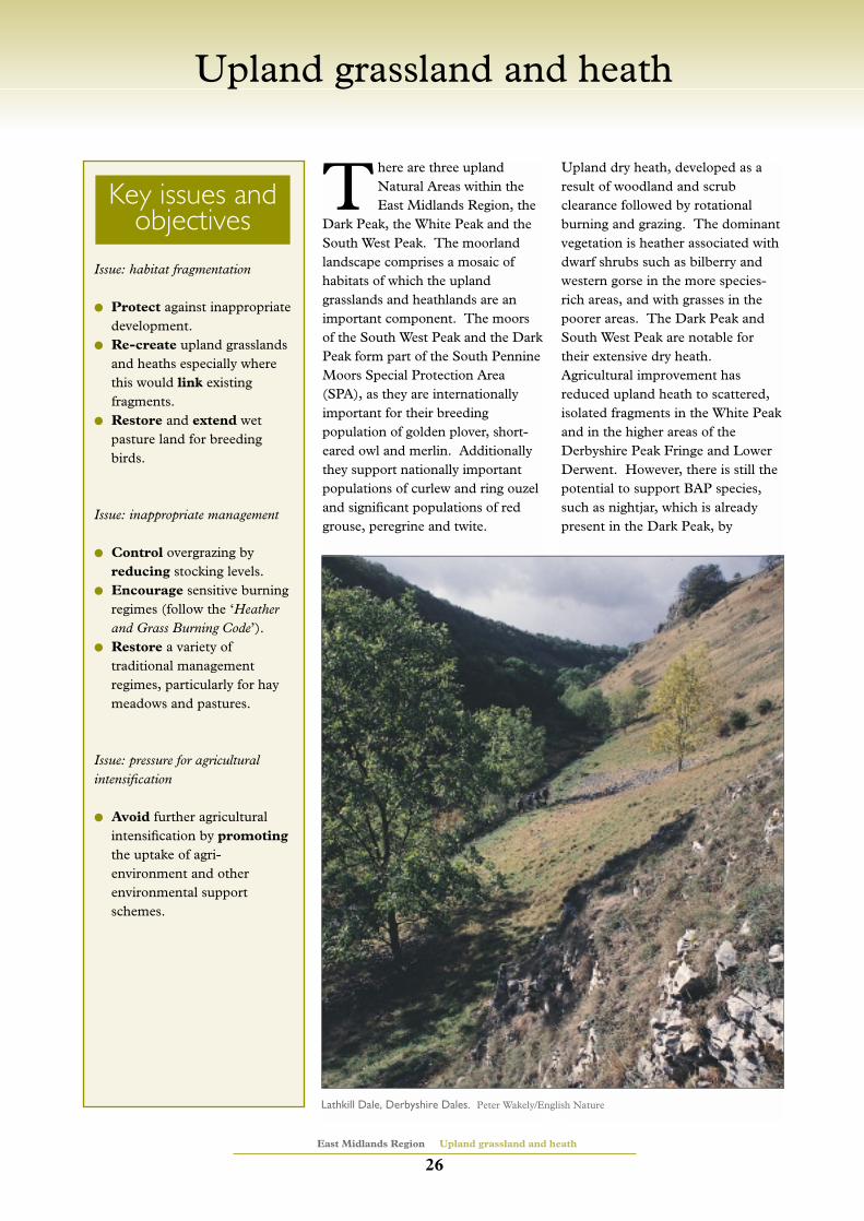
There are three uplandNatural Areas within theEast Midlands Region, the
Dark Peak, the White Peak and theSouth West Peak. The moorlandlandscape comprises a mosaic ofhabitats of which the uplandgrasslands and heathlands are animportant component. The moorsof the South West Peak and the DarkPeak form part of the South PennineMoors Special Protection Area(SPA), as they are internationallyimportant for their breedingpopulation of golden plover, short-eared owl and merlin. Additionallythey support nationally importantpopulations of curlew and ring ouzeland significant populations of redgrouse, peregrine and twite.
Upland dry heath, developed as aresult of woodland and scrubclearance followed by rotationalburning and grazing. The dominantvegetation is heather associated withdwarf shrubs such as bilberry andwestern gorse in the more species-rich areas, and with grasses in thepoorer areas. The Dark Peak andSouth West Peak are notable fortheir extensive dry heath.Agricultural improvement hasreduced upland heath to scattered,isolated fragments in the White Peakand in the higher areas of theDerbyshire Peak Fringe and LowerDerwent. However, there is still thepotential to support BAP species,such as nightjar, which is alreadypresent in the Dark Peak, by
Upland grassland and heath
Issue: habitat fragmentation
● Protect against inappropriatedevelopment.
● Re-create upland grasslandsand heaths especially wherethis would link existing fragments.
● Restore and extend wetpasture land for breedingbirds.
Issue: inappropriate management
● Control overgrazing byreducing stocking levels.
● Encourage sensitive burningregimes (follow the ‘Heatherand Grass Burning Code’).
● Restore a variety oftraditional managementregimes, particularly for haymeadows and pastures.
Issue: pressure for agriculturalintensification
● Avoid further agriculturalintensification by promoting
the uptake of agri-environment and otherenvironmental supportschemes.
Key issues andobjectives
Lathkill Dale, Derbyshire Dales. Peter Wakely/English Nature

East Midlands Region Upland grassland and heath
27
nationally-scarce lichen Cladoniafragilissima also occur. The WhitePeak has a very limited upland acidgrassland resource.
Bracken is associated with someareas of species-poor acidicgrassland which, in association withheather moorland and pasture,support breeding birds such as twite,ring ouzel and whinchat.
The northern brown argus butterfly,a priority BAP species, is associatedwith upland grassland and heath inthe White Peak.
Other species-poor areas of uplandgrassland are generally of low con-servation status but there is potentialfor restoration to a more valuableheath or upland woodland habitat.
increasing the areas of heath andlinking the fragments.
Upland wet heath, characterised bycross-leaved heath, cranberry andbog asphodel is very restricted andonly found in parts of the SouthWest Peak and Dark Peak. This isalso a priority BAP habitat.
Upland acid grasslands are especiallywell developed in the UnitedKingdom. The South West Peakand Dark Peak have extensive areasof upland acid grassland includingareas that are species-rich. Theseare of high conservation value andare characterised by grasses, such assheep’s fescue and common bent,sedges, fungi and wildflowers, likeharebell. In the Dark Peak thepriority BAP species skylark and the
Characteristic habitats ofkey Natural Areas
29. South West Peak
● Extensive dry upland heath● Species-rich upland acid
grassland● Limited ares of wet upland
heath
NB Priority BAP habitats in italic
Candidate Special Areas of ConservationNone
Special Protection Areas
● South Pennine Moors (South West Peak; Dark Peak)
Fieldscape near High Peak, Derbyshire. Peter Wakely/English Nature
29

The East Midlands Region’scoastline, which includesparts of the Wash and the
Humber Estuary, is characterised bysandy and muddy beaches withsaltmarsh and sand dunes. Much ofthis coastline is of internationalimportance for waterfowl, for whichit is classified as a Special ProtectionArea (SPA), and for coastal habitats
such as Gibraltar Point, a candidateSpecial Area of Conservation (SAC)for its sand dune habitats.Substantial parts of the coast, suchas the Wash, Gibraltar Point and theSaltfleetby and TheddlethorpeDunes, are designated as NationalNature Reserves. The Wash is oneof the most extensive estuarinesystems in the UK and is a candidate
Maritime
East Midlands Region Maritime
28
Issue: maintenance of coastal processes● Allow natural, dynamic coastal
processes to operate by:◗ avoiding hard sea defenceswhere these would interruptthe natural flow of sedimentsand destroy habitats, exceptwhere important settlementsand economic concerns areidentified;
◗ developing soft engineeringoptions such as managedrealignment and creation ofsaltmarsh/mudflat;
◗ safeguarding offshoresediment sources throughlimiting or reducing marineaggregate winning andminimising navigationaldredging and ensuring thatuncontaminated dredgedsediment is not removed fromthe system;
◗ protecting areas of highbiodiversity and fragile reefstructures from offshoredevelopment and exploitation.
Issue: water quality● Maintain high water quality by:
◗ reducing inputs of untreatedsewage effluents;
◗ reducing contamination fromindustrial discharges andagricultural run-off.
Issue: recreation and tourism● Avoid detrimental impacts on
key wildlife features bypromoting recreation andtourism that are environmentallysensitive.
Issue: fisheries● Work towards sustainable
fisheries management, especiallyin sensitive areas.
Key issues andobjectives
The Wash. Peter Wakely/English Nature

East Midlands Region Maritime
29
SAC and an SPA. Despite historicland claims the Wash, together withthe North Norfolk Coast, forms oneof the most important estuarinehabitats in the UK.
Cliffs are not a strong feature of thecoastline. Low chalk cliffs atHunstanton provide a breedingground for seabirds, such as fulmar,and support a narrow fringe ofdiverse cliff-top grassland. The softcliffs of the Bridlington to Skegnesscoast are continually eroding andprovide 40% of the sediment in theHumber Estuary and also supplysediment for the coastline as farsouth as Skegness. This process isfundamental to the maintenance offeatures such as saltmarsh which are
a first line of flood defence andimportant wildlife habitats.
Saltmarshes form on sheltered coastsand the Wash has more saltmarshthan any other estuarine system inthe country. The entire range ofsaltmarsh is represented, frompioneer glasswort beds, throughmiddle marsh to upper saltmarsh,where sea-lavenders and sea-purslaneform a saltmarsh scrub at the highwater mark. This scrub zone alsosupports sea wormwood, a foodplant for the larvae of the scarce pug-moth. Transitions are oftentruncated by man-made seadefences, particularly in the Washwhere the amount of upper saltmarshis restricted. Extensive areas of
Characteristic habitats of key Natural Areas
101. Bridlington to Skegness
● Sandy beaches fringe most ofthe coast
● Continuous coastal sand dunes ● Extensive soft cliffs at
Holderness● Substantial intertidal sand and
mudflats along the northLincolnshire coast
● Some, but not extensive,saltmarsh and small coastalvegetated shingle structures
● Small area of saline lagoons
102. The Wash
● Very large areas of intertidalsand and mudflats
● Extensive areas of saltmarsh● Sand dune systems at the
mouth of the Wash includingcalcareous dunes at GibraltarPoint
● Small area of saline lagoons● Sand and coastal vegetated
shingle on the shorelines● Widely distributed Sabellaria
spinulosa reefs● Scarce seagrass beds
NB Priority BAP habitats in italic
101
102
Candidate Special Areas of Conservation● North Norfolk Coast and Gibraltar Point Dunes (The Wash; plus
Old Hunstanton to Sheringham in the East of England Region)
● The Wash and North Norfolk Coast (The Wash; plus Old
Hunstanton to Sheringham in the East of England Region)
Special Protection Areas● The Wash (The Wash)
● Humber Flats, Marshes and Coast (Bridlington to Skegness; plus
Humber Estuary in the Yorkshire and the Humber Region)
Saltfleetby, Lincolnshire. Mike Henchman/English Nature

characteristics of such lagoons wheresaltwater influences are exerted.Small areas of saline lagoon arefound along the Wash and on theBridlington to Skegness coast.
The coastline is characterised byshallow seas, mainly less than 20mdeep, with the sea bed fromBridlington to Skegness graduallydipping to the East. The subtidalcommunities are diverse and aremainly on sands and gravels.Extensive reefs formed by the sandworm Sabellaria spinulosa are foundoffshore. In the Wash, where theseabed communities in the deeper,central part are more diverse, thereare also important nursery groundsfor plaice, cod and sole.
The sandflats and mudflats,saltmarsh, grazing marsh, shingleand reedbeds of the East Midlandscoastline are of outstandingornithological significance. TheWash supports the largest numbersof migrating and wintering waterfowlof any site in the UK and is one ofthe most important staging andwintering sites on the east Atlanticflyway network. The HumberEstuary is one of the top ten wildfowlsites in Europe. Birds which occur ininternationally important numbersare breeding little tern andoverwintering dark-bellied brentgeese, pink-footed geese, golden andgrey plovers, shelduck, knot, dunlin,bar-tailed godwit, pintail, redshank,oystercatcher and curlew.
Donna Nook, on the Lincolnshirecoast, is an important site for greyseals with common seals alsorecorded. About 80% of the Britishpopulation of common seal breed inthe Wash. Both grey and commonseals are BAP species. Harbourporpoises are occasionally seen offGibraltar Point.
East Midlands Region Maritime
30
middle and pioneer saltmarsh arepresent. Although these are not veryrich botanically they provide grazingfor large flocks of wintering birds andshelter for breeding birds, and arepart of the SPA. Saltmarshes are notvery extensive along the openBridlington to Skegness coast.
The sand dunes which form anextensive system along the NorthLincolnshire Coast from Cleethorpesto Saltfleetby and Theddlethorpe arepart of the Humber Flats, Marshesand Coast SPA. The sand dunes atthe mouth of the Wash and atGibraltar Point are part of the Washand North Norfolk Coast andGibraltar Point Dunes candidateSAC. The priority BAP speciesnatterjack toad occurs at GibraltarPoint and at Saltfleetby -Theddlethorpe Dunes NNR. Thedunes are characterised by seasandwort, sea rocket, prickly saltwortand the rare rock sea-lavender. Thedunes change from mobile wind-blown sand on the foreshore tostabilised systems with dune slacks,often rich in orchids. The dunethread-moss, a BAP species, is found
on damp dune slacks. Coastal dunesare also important for theirinvertebrate populations whichinclude numerous rarities such as thedune tiger beetle and starwort moth.At Gibraltar Point and SnettishamSpit, shingle ridges supportspecialised vegetation of nationalimportance.
The Wash has the second largestarea of intertidal sandflats andmudflats in the UK. Sandyintertidal flats predominate andinclude extensive fine sands anddrying banks of coarse sand. Softermudflats occur in the upper flats andsheltered areas inshore. Marineinvertebrate communities here arecharacterised by polychaete worms,bivalves and crustaceans, whilstunusual plant communities includeseagrass beds.
Saline lagoons provide a specialisedhabitat where species such as therare lagoon sand worm, lagoon sandshrimp and spiral tasselweed arefound. Natural saline lagoons arevery rare, but many other poolsbehind sea defences have
Gibraltar Point, Lincolnshire. Peter Wakely/English Nature

plan, nature conservation strategyor priority setting document fornature; any Government PlanningPolicy Guidance or RegionalPlanning Guidance; LocalDevelopment Plans/UnitaryDevelopment Plans/StructurePlans/etc?
● Is there active contribution to theresolution of Natural Area issuesand the delivery of UK, Regionaland Local Biodiversity Action Plantargets and Natural Area objectives?
● Has there been an appraisal of theenvironmental impact of policies,plans and programmes withinregional strategic documents?(See: the eight step approach inDepartment of the Environment,Transport and the Regions PolicyGuidance: ‘Policy Appraisal andthe Environment’, DETR 1998)
Biodiversity and Earthheritage● Will any areas with
local/national/internationaldesignation for natureconservation be affected ordirectly damaged?
● Is there scope for theenhancement of biodiversitythrough the provision of:opportunities for achieving thetargets for priority habitats andspecies in the context of UK,Regional and Local BiodiversityAction Plans; improved habitatand/or the creation of additionalhabitat for plants and animals,appropriate to the local character?
● Will any non-designated habitatsuch as woodland, grassland andother vegetation, linking habitats
Annex 1: Benchmarks for nature
The conservation of nature isa key test of sustainabledevelopment. The list
below provides a set of questions tobe applied as positive indicators forbiodiversity and Earth heritage,where relevant strategies, policies,projects and programmes are underconsideration. These may includedevelopments such as agriculturalimprovement or intensification,coastal and flood defence works andwater abstraction, as well as builtdevelopment or infrastructure suchas roads, rail and energy.
Policy links● Is there compatibility with
relevant policies within: anylocal/regional Biodiversity ActionPlan, sustainable development
East Midlands Region Annex 1
31
Children at Gibraltar Point, Lincolnshire. English Nature

development that impacts onnatural processes; etc.)
● Is there scope for the enhancementof geological interest? (e.g.Through the improvement ofgeological exposures or features;the creation of additional geologicalexposures or features, etc.)
Environmental goodpractice for nature ● Has an environmental impact
assessment been carried out?● Will post implementation impacts
be assessed and managed byregular review and monitoringprogrammes?
Communityinvolvement for nature● Will all sections of the community
be consulted as part of thedecision making process?
● Have the needs of localcommunities for access to, andexperience of, nature been takeninto account?
● Does the project help vulnerable,disadvantaged or excluded groups
to gain access to nature andwildspace?
● Will there be a contribution toimproving the quality of life bylocal inhabitants, for example:through improved general accessto nature, but in particular on footor by public transport?
● Will local distinctiveness fornature be valued, and communityand cultural identity bestrengthened?
● Will community enterprises fornature be encouraged?
(Modified and adapted from a documentproduced by the Environment & EnergyManagement Team, Government Office forthe South West).
such as trees, hedges, grass strips,ditches, that may be destroyed, orfragmented be fullycompensated/mitigated for?
● Do any plant and tree plantingprogrammes use an appropriatemix of species native to theNatural Area in question?
● Will any habitat be in danger ofabandonment, under management,change or intensification ofmanagement? (e.g. Overgrazing,loss of crop rotations and arable-pasture mosaics; shift from springsown to autumn sown cereals, lossof winter stubbles, application ofartificial fertiliser, etc. - leading toimpacts on associated farmlandspecies)
● Will any habitat be in danger of asecondary or indirect damage? (e.g.Wetland or aquatic habitats andecosystems in danger of drying out,loss or degradation as a result ofover-abstraction of surface andgroundwaters, pollution andeutrophication of surface andgroundwaters; development in aflood plain which may requirecanalisation of watercoursesimpacting on river valley wetlandsand aquatic ecosystems; coastal
East Midlands Region Annex 1
32
Rushup Edge, High Peak, Derbyshire.Peter Wakely/English Nature
Designated areasNational/International Nature Conservation Designations:
Sites of Special Scientific Interest (SSSI)National Nature Reserves (NNR)Special Protection Areas (SPA)Special Areas of Conservation (SAC)Ramsar Sites
Local Nature Conservation Designations (often non-statutory butrecognised in local plans, PPG and other similar documents):
Sites of Importance for Nature Conservation (SINC - locally other termsmay be used)Local Nature Reserves (LNR)Regionally Important Geological/Geomorphological Sites (RIGS)Non-statutory nature reserves

English Nature. In prep. Overview ofcoastal habitats by Natural Area.English Nature, Peterborough.
Gardiner, A.J. 1996. Freshwaterwetlands in England. A NaturalAreas approach. English NatureResearch Report No. 204. EnglishNature, Peterborough.
Grice, P.V., Brown, A.F., Carter, I.C.and Rankine, C.A. 1994. Birds inEngland: a Natural Areas approach.English Nature Research Report No.114. English Nature, Peterborough.
Jefferson, R.G. 1997. Lowlandgrassland in Natural Areas. Nationalassessment of significance. EnglishNature Research Report No. 171.English Nature, Peterborough.
King, A., Glasser, N., Larwood, J.,Littlewood, A., Moat, T. and Page,K. 1996. Earth heritageconservation in England: a NaturalAreas perspective. English NatureResearch Report No. 158. EnglishNature, Peterborough.
Kirby, K. and Reid, C. 1997.Preliminary nature conservationobjectives for Natural Areas.Woodland and forestry. EnglishNature Research Report No. 239.English Nature, Peterborough.
Michael, N. 1996. Lowlandheathland in England. A NaturalAreas approach. English NatureResearch Report No. 170. EnglishNature, Peterborough.
Mitchell-Jones, A.J. and Gent, A.H.1997. Priority Natural Areas formammals, reptiles and amphibians.English Nature Research Report No.242. English Nature, Peterborough.
Porley, R. and McDonnell, A. 1997.Rare and scarce vascular plants andbryophytes in Natural Areas. EnglishNature Research Report No. 267.English Nature, Peterborough.
Reid, C.M., Kirby, K.J. and Cooke,R.J. 1996. A preliminary assessmentof woodland conservation in Englandby Natural Areas. English NatureResearch Report No. 186. EnglishNature, Peterborough.
Sanderson, N.A. 1998. A review ofthe extent, conservation interest andmanagement of lowland acidgrassland in England. Volume I:Overview. English Nature ResearchReport No. 259. English Nature,Peterborough.
Sanderson, N.A. 1998. A review ofthe extent, conservation interest andmanagement of lowland acidgrassland in England. Volume II:County Descriptions. English NatureResearch Report No. 259. EnglishNature, Peterborough.
All available free from the EnquiryService, English Nature,Northminster House, PeterboroughPE1 1UA Tel. 01733 455101 Fax. 01733 568834.
Natural Areas CD-ROM.
Available, priced £15, from TelelinkLtd., PO Box 100, Fareham,Hampshire PO14 2SX Tel. 01329331300 Fax. 01329 330034.
Natural Area Profiles
The individual profiles used in thisreport are available from the LocalTeam, address and telephone numbershown on the back cover, or can befound on English Nature’s web pageat www.english-nature.org.uk.
Annex 2: Sources of information
Each Natural Area has anassociated profile whichcontains the issues and
objectives specific to that ecologicalunit. These have already beenpassed on to our key partners,including local authorities. Thecomplete set of profiles for Englandis available from English Nature’slocal teams on a CD-ROM.
National overviews of habitats,species and earth heritage
Brown, A.E., Burn, A.J., Hopkins,J.J. and Way, S.F. (Editors). 1997.The Habitats Directive: selection ofSpecial Areas of Conservation in theUK. Joint Nature ConservationCommittee Report No. 270. JointNature Conservation Committee,Peterborough.
Drake, M., Clements, D., Eyre, M.,Gibbs, D. and Kirby, P. 1998.Invertebrates and their habitats inNatural Areas. Volume 1: Midlandand Northern Areas. English NatureResearch Report No. 298. EnglishNature, Peterborough.
Drake, M., Clements, D., Eyre, M.,Gibbs, D. and Kirby, P. 1998.Invertebrates and their habitats inNatural Areas. Volume 2: SouthernAreas. English Nature Research ReportNo. 298. English Nature,Peterborough.
Drewitt, A.L., and Manley, V.J.1997. The vegetation of themountains and moorlands ofEngland. English Nature ResearchReport No. 218. English Nature,Peterborough.
English Nature 1997. Wildlife andfresh water, an agenda for sustainablemanagement. English Nature,Peterborough.
East Midlands Region Annex 2
33

1 North Northumberland Coastal Plain2 Border Uplands3 Solway Basin4 North Pennines5 Northumbria Coal Measures6 Durham Magnesian Limestone Plateau7 Tees Lowlands8 Yorkshire Dales9 Eden Valley10 Cumbria Fells and Dales11 West Cumbria Coastal Plain12 Forest of Bowland13 Lancashire Plain and Valleys14 Southern Pennines15 Pennine Dales Fringe16 Vale of York and Mowbray17 North York Moors and Hills18 Vale of Pickering19 Yorkshire Wolds20 Holderness21 Humber Estuary22 Humberhead Levels23 Southern Magnesian Limestone24 Coal Measures
25 Dark Peak26 Urban Mersey Basin27 Meres and Mosses28 Potteries and Churnet Valley29 South West Peak30 White Peak31 Derbyshire Peak Fringe and Lower Derwent32 Sherwood33 Trent Valley and Rises34 North Lincolnshire Coversands and Clay Vales35 Lincolnshire Wolds36 Lincolnshire Coast and Marshes37 The Fens38 Lincolnshire and Rutland Limestone39 Charnwood40 Needwood and South Derbyshire Claylands41 Oswestry Uplands42 Shropshire Hills43 Midlands Plateau44 Midland Clay Pastures45 Rockingham Forest46 Breckland47 North Norfolk48 The Broads
49 Suffolk Coast and Heaths50 East Anglian Plain51 East Anglian Chalk52 West Anglian Plain53 Bedfordshire Greensand Ridge54 YardleyƒWhittlewood Ridge55 Cotswolds56 Severn and Avon Vales57 Malvern Hills and Teme Valley58 Clun and North West Herefordshire Hills59 Central Herefordshire60 Black Mountains and Golden Valley61 Dean Plateau and Wye Valley62 Bristol, Avon Valleys and Ridges63 Thames and Avon Vales64 Midvale Ridge65 Chilterns66 London Basin67 Greater Thames Estuary68 North Kent Plain69 North Downs70 Wealden Greensand71 Romney Marshes72 High Weald
73 Low Weald and Pevensey74 South Downs75 South Coast Plain and Hampshire Lowlands76 Isle of Wight77 New Forest78 Hampshire Downs79 Berkshire and Marlborough Downs80 South Wessex Downs81 Dorset Heaths82 Isles of Portland and Purbeck83 Wessex Vales84 Mendip Hills85 Somerset Levels and Moors86 Mid Somerset Hills87 Exmoor and the Quantocks88 Vale of Taunton and Quantock Fringes89 Blackdowns90 Devon Redlands91 South Devon92 Dartmoor93 The Culm94 Bodmin Moor95 Cornish Killas and Granites96 West Penwith
97 The Lizard98 Northumberland Coast99 Tyne to Tees Coast100 Saltburn to Bridlington101 Bridlington to Skegness102 The Wash103 Old Hunstanton to Sheringham104 Sheringham to Lowestoft105 Suffolk Coast106 North Kent Coast107 East Kent Coast108 Folkestone to Selsey Bill109 Solent and Poole Bay110 South Dorset Coast111 Lyme Bay112 Start Point to Land’s End113 Isles of Scilly114 Land’s End to Minehead115 Bridgwater Bay116 Severn Estuary117 Liverpool Bay118 Morecambe Bay119 Cumbrian Coast120 Solway Firth
48
58
24
84
88
87
86
85
86
86115
61
94
9796
91
89
92
83
82
90
95
60
59
112
116
111
114
113
93
62
82
87
10881
7577
72
80
71
109
74
73
76
110
63
65
104
106
64
67
53
52 51
50
4956
55
54
79
78
57
69
105
6870
66
47
46
41
45
44
4342
39
40
34
2930
3635
37
38
32
3133
23
21
22
25
26
28
27
24
18
119
100
6
5
1
2
4
15
10
8
11
9
3120
7
13
12
14
99
17
1619
20
117
118
98
101
102
103
107
Grid North
KeyCounty boundaryCharacter Area boundary (NaturalAreas consist of one or moreCharacter Areas)
Based upon the Ordnance Survey 1:10000 maps with permission of the controller of Her Majesty’s Stationery Office. © Crown Copyright Revised to December 1996

Des
igne
d by
Cor
al D
esig
n M
anag
emen
t. P
rint
ed b
y R
uddo
cks,
Lin
coln
on
Evo
lve
Silk
, 75%
rec
ycle
d po
st-c
onsu
mer
was
te, 2
5% v
irgi
n fib
re, E
CF
. 2M
English Nature is the government agency that champions wildlife andnatural features throughout England.This is one of a range of publications published by Publicity & Marketing,English Nature, Northminster House, Peterborough PE1 1UAWeb site: http://www.english-nature.org.uk
ISBN 1 85716 452 0 © English Nature 1999
East Midlands Team
(Regional Lead Team)The MaltingsWharf RoadGranthamLincolnshireNG31 6BH
Tel. 01476 568431Fax. 01476 570927
Natural Areas for which they lead:
32 Sherwood
33 Trent Valley and Rises
34 North Lincolnshire Coversands and
Clay Vales
35 Lincolnshire Wolds
36 Lincolnshire Coast and Marshes
38 Lincolnshire and Rutland Limestone
39 Charnwood
102 The Wash
West Midlands Team
Attingham ParkShrewsburyShropshireSY4 4TW
Tel. 01743 709611Fax. 01743 709303
Natural Areas for which they lead:
40 Needwood and South Derbyshire
Claylands
English Nature Local Teams in the East Midlands Regionand Natural Areas for which they lead
Bedfordshire, Cambridgeshire
and Northamptonshire Team
Ham Lane HouseHam LaneNene ParkOrton WatervillePeterboroughPE2 5UR
Tel. 01733 405850Fax. 01733 394093
Natural Areas for which they lead:
37 The Fens
44 Midland Clay Pastures
45 Rockingham Forest
52 West Anglian Plain
54 Yardley-Whittlewood Ridge
Peak District and Derbyshire
Team
Manor BarnOver HaddonBakewellDerbyshireDE45 1JE
Tel. 01629 815059Fax. 01629 815091
Natural Areas for which they lead:
25 Dark Peak
29 South West Peak
30 White Peak
31 Derbyshire Peak Fringe and Lower
Derwent
North and East Yorkshire Team
Genesis Building 1Science ParkUniversity RoadHeslingtonYorkYO10 5ZQ
Tel. 01904 435500Fax. 01904 435520
Natural Areas for which they lead:
101 Bridlington to Skegness
Humber To Pennines Team
Bullring HouseNorthgateWakefieldWF1 3BJ
Tel. 01924 387010Fax. 01924 201507
Natural Areas for which they lead:
23 Southern Magnesian Limestone
24 Coal Measures