earth & space science chapter 2 mapping our world
TRANSCRIPT
Earth & Space ScienceChapter 2
Mapping Our World
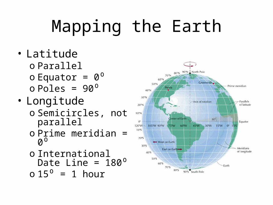
Mapping the Earth• Latitude
o Parallelo Equator = 0⁰o Poles = 90⁰
• Longitude o Semicircles, not
parallelo Prime meridian = 0⁰ o International Date
Line = 180⁰o 15⁰ = 1 hour
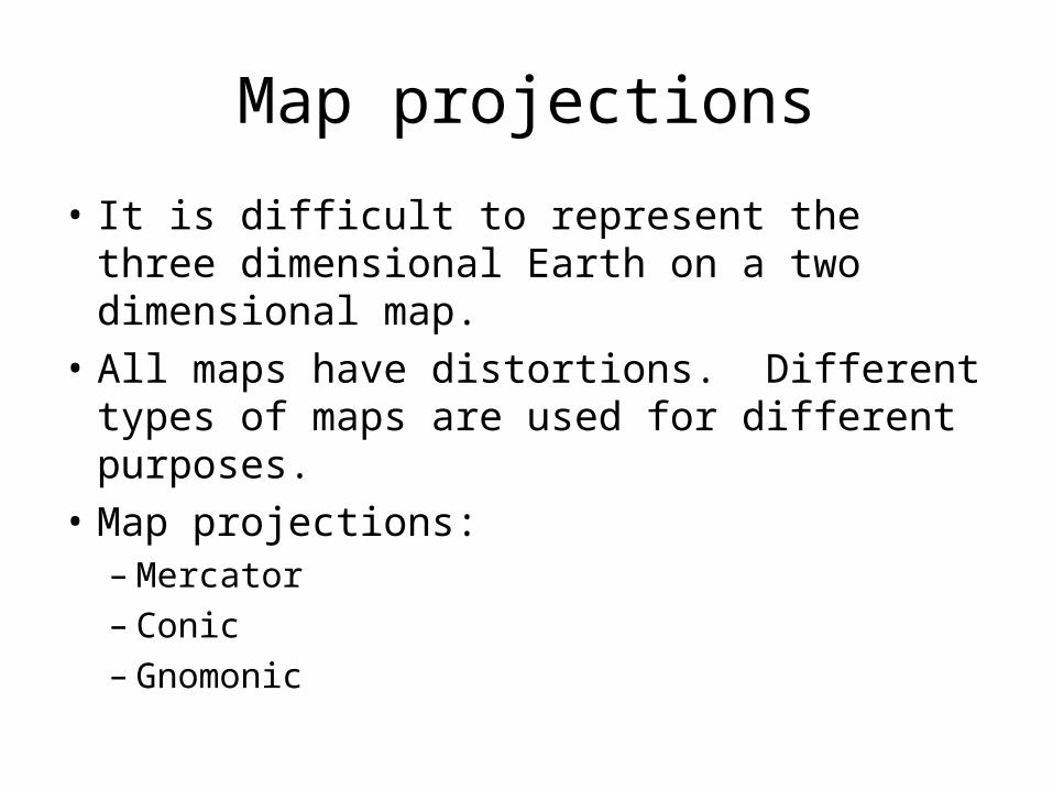
Map projections
• It is difficult to represent the three dimensional Earth on a two dimensional map.
• All maps have distortions. Different types of maps are used for different purposes.
• Map projections:– Mercator– Conic– Gnomonic
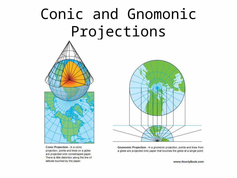
Conic and Gnomonic Projections
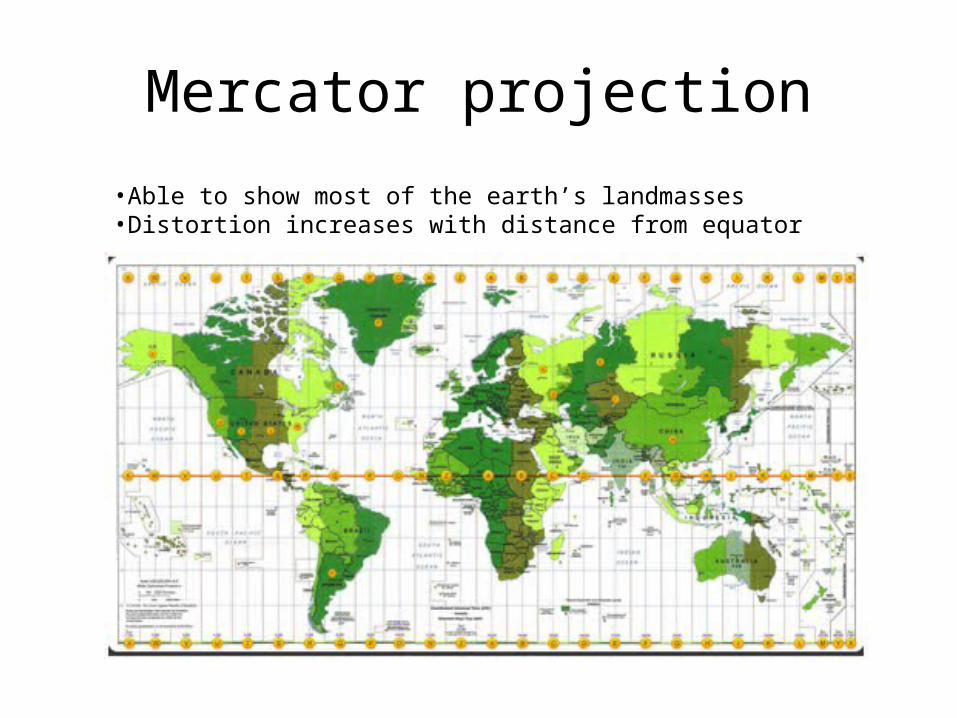
Mercator projection
•Able to show most of the earth’s landmasses•Distortion increases with distance from equator
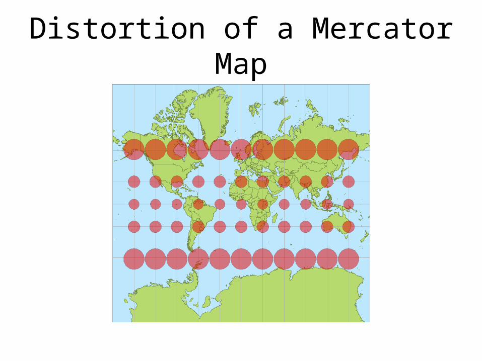
Distortion of a Mercator Map
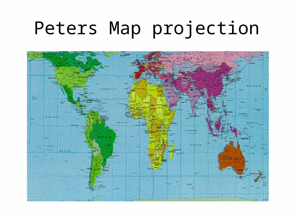
Peters Map projection
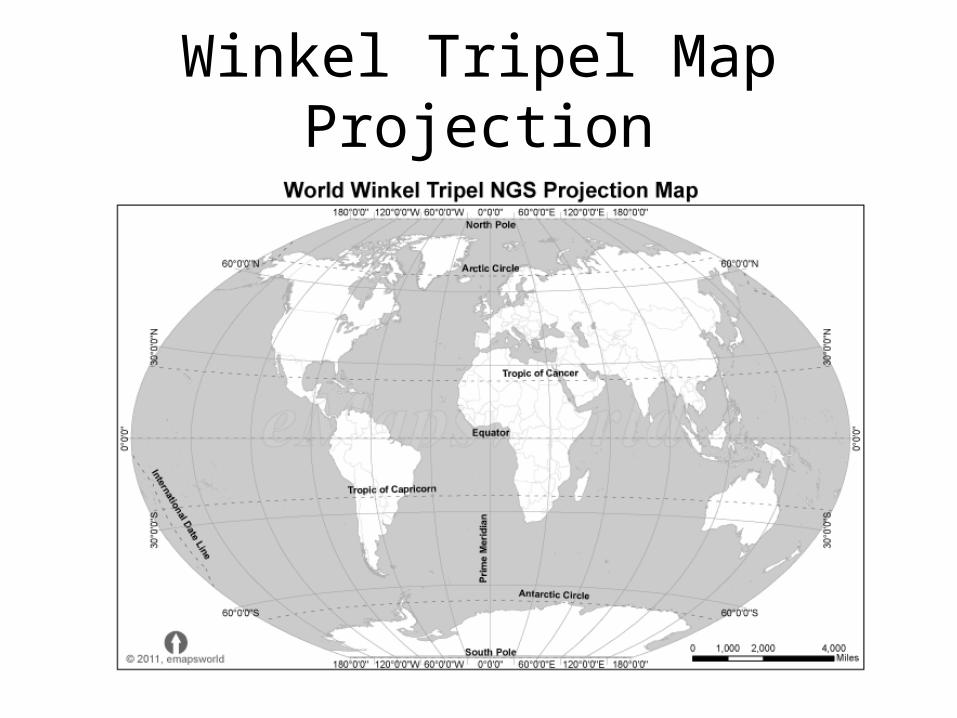
Winkel Tripel Map Projection
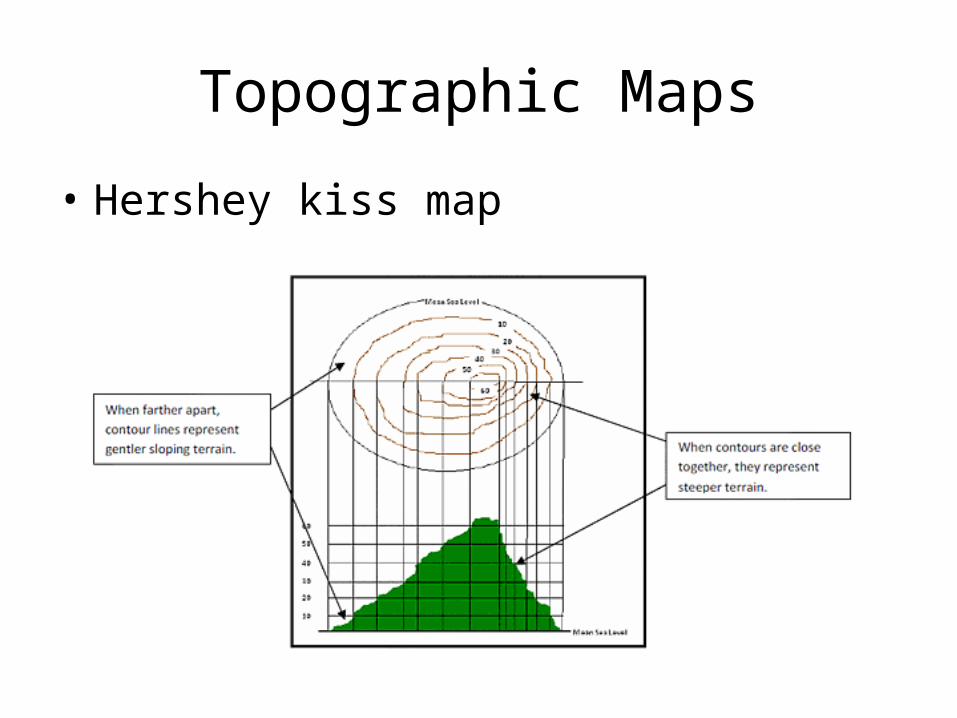
Topographic Maps
• Hershey kiss map
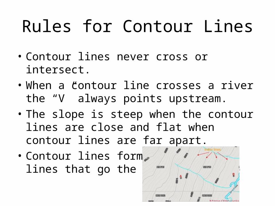
Rules for Contour Lines
• Contour lines never cross or intersect.• When a contour line crosses a river the “V”
always points upstream. • The slope is steep when the contour lines are
close and flat when contour lines are far apart.
• Contour lines form loops or are lines that go the edge of the map
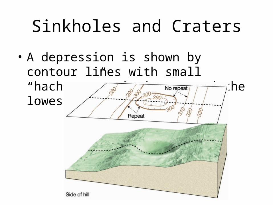
Sinkholes and Craters
• A depression is shown by contour lines with small “hachures” pointing toward the lowest point.
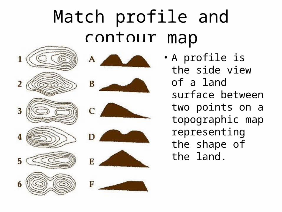
Match profile and contour map
• A profile is the side view of a land surface between two points on a topographic map representing the shape of the land.
Remote Sensing
• Landsat Satellite: – visible and infrared radiation– Scan Earth’s entire surface in 16 days
• TOPEX/Poseidon– High frequency radar signals– Ocean floor and sea level mapping from satellite
• Sea Beam– Sonar (sound waves) ocean floor mapping from a
ship
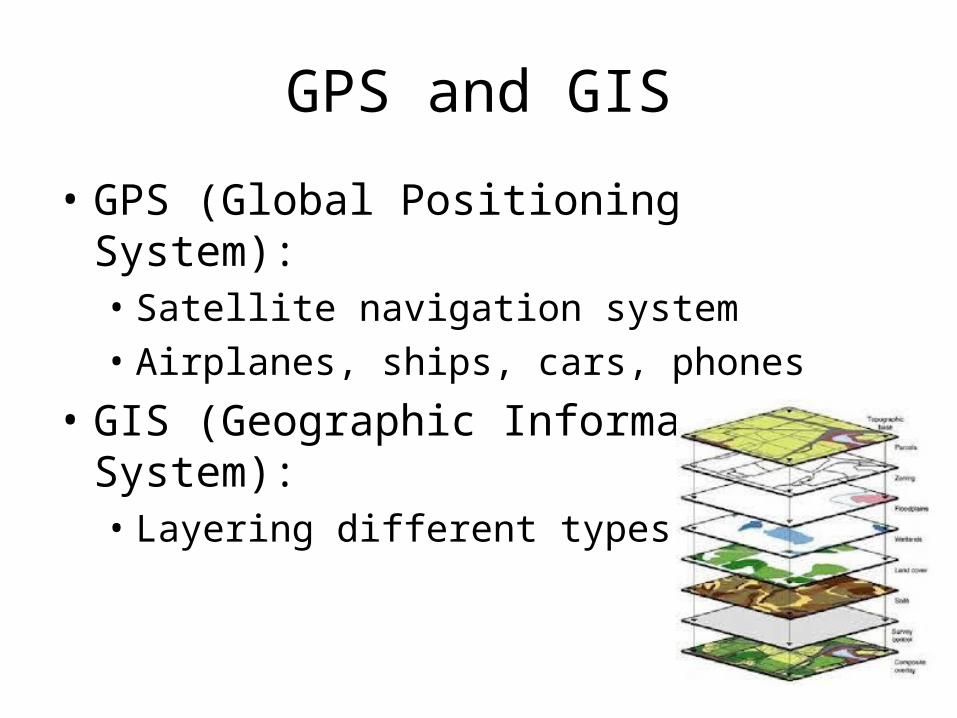
GPS and GIS
• GPS (Global Positioning System):• Satellite navigation system• Airplanes, ships, cars, phones
• GIS (Geographic Information System): • Layering different types of maps