e-navigation underway 2013 iho s-100: an essential ...€¦ · maritime spatial planning and...
TRANSCRIPT

E-NAVIGATION UNDERWAY 2013
IHO S-100: an essential contribution to Maritime Spatial Planning and e-Navigation
Gilles Bessero, Director
International Hydrographic Organization

IHO S-100: an essential contribution to
Maritime Spatial Planning and e-Navigation
The harmonized collection, integration,
exchange, presentation and analysis of
marine information on-board and ashore by
electronic means to enhance berth to berth
navigation and related services for safety
and security at sea and protection of the
marine environment MSC 85/26/Add.1 - Annex 20
A public process of analyzing and
allocating the spatial and temporal
distribution of human activities in marine
areas to achieve ecological, economic,
and social objectives that are usually
specified through a political process.
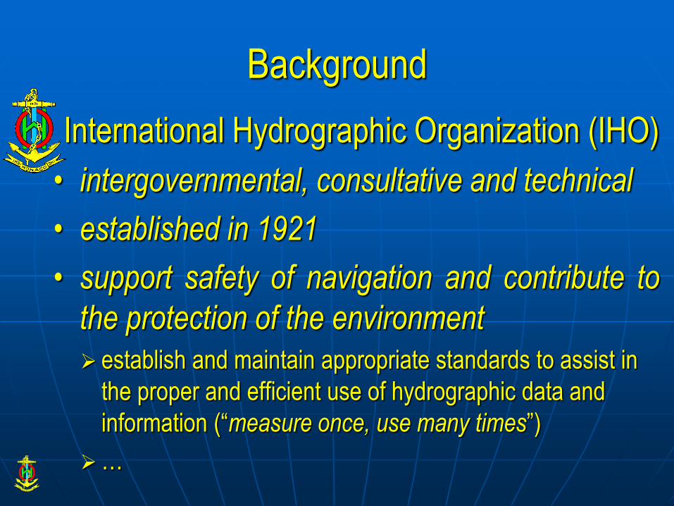
Background
International Hydrographic Organization (IHO)
• intergovernmental, consultative and technical
• established in 1921
• support safety of navigation and contribute to
the protection of the environment establish and maintain appropriate standards to assist in
the proper and efficient use of hydrographic data and
information (“measure once, use many times”)
…

Background
• 1987: adoption of IHO “CEDD” format
• 1992: 1st edition of IHO publication S-57
Transfer Standard for Digital Hydrographic Data
• 2000: publication of S-57 Edition 3.1
evolution of S-57 driven by ECDIS/ENC development
currently “active” but “frozen”
• 2001: development of a new standard begins

S-100 provides a contemporary hydrographic geospatial data standard that
can support a wide variety of digital data sources, products and services
Description of S-100

Data content separated from the carrier (file format)
Note: S-57 data model embedded in ISO/IEC 8211 encapsulation
Manageable flexibility
Alignment with ISO 191xx series of current geospatial information standards - interoperable with other domains
ISO-conforming web-based registry
Specifies methods and tools for data management, processing, analyzing, accessing presenting and transferring data between different users, systems and locations
Description of S-100

Registry
• A registry is the information system
on which a register is maintained.
Registry = collection of registers
Registers
• A register is simply a managed list. It is easier to maintain than a fixed document, because new items can be added as needed to the register, and existing items in the register can be clarified, superseded or retired.
Register = collection of tables
Description of S-100

Product Specifications Register
– Description of which elements from
FCD and other registers are used to
define a data exchange standard
– IHO ENC product specification
– real-time tidal height exchange
standard
– sea ice product specification
– ship reporting exchange standard
– VTMS route definition product spec.
– …..
Feature Concept Dictionary (FCD) Register
– Register containing definitions on how to
digitally describe and encode any piece of
information – a buoy
– a sounding
– a ship position
– a radio service
– …..
Description of S-100

Product Specification
A product specification is a description of all the features, attributes and relationships of a given application and their mapping to a dataset. It is a complete description of all the elements required to define a particular geographic data product.
• product identification
• data content and structure
• coordinate reference system
• data quality
Description of S-100
• data capture
• data maintenance
• portrayal
• encoding
• product delivery

Domains
Within the Feature Concept, the Portrayal and the Metadata Registers each entry is assigned to a recognised domain. The purpose of designating domains and a related Domain Control Body is to ensure that the key stakeholders (as represented by the domains) are consulted in any subsequent proposals to adjust items contained in a Register.
Description of S-100
Domains of Feature Concept Dictionary Register:
• nautical charts
• nautical publications
• inland ENCs
• port ENCs
• sea ice coverage
• marine information overlays

References
• S-100 - Universal Hydrographic Data Model
Edition 1.0.0 - January 2010
• S-99 - Operational Procedures for the Organization and Management of the S-100 Geospatial Information Registry
Edition 1.0.0 - January 2011
Revision (Edition 1.1.0) to be published in February 2013
Description of S-100

IMO e-Navigation strategy identifies the need for “an internationally agreed common data structure” (CMDS) that allows information to be exchanged, read and interpreted by ship-borne and shore-based ICT systems.
It is foreseen that CMDS development will be an incremental process driven by user requirements.
S-100 agreed as an appropriate baseline standard for creating a framework for e-Navigation data access and services under the scope of SOLAS.
IMO has agreed the establishment of an IMO/IHO Harmonization Group on Data Modelling to lead future work in that direction.
Test beds carried out or in progress using S-100 based data models
S-100 and e-Navigation

Maritime Spatial Planning relies on the existence of a Marine Spatial Data Infrastructure (MSDI)
SDI = range of activities, processes, relationships and physical entities that, taken together, provide for integrated management of spatial data, information and services
S-100 and Maritime Spatial Planning

MSDI support myriad uses:
• Habitat mapping & heritage assessment
• Conservation assessment & designation
• Site selection (e.g. renewable energy and oil & gas extraction)
• Route optimisation
• Vessel location and disposal monitoring
• Homeland security and defence
• Aggregates extraction
• Fisheries regulation
• Coastal protection & shoreline management
• Licensing & consent evaluation
• Emergency planning & management
• Survey planning & execution
S-100 and Maritime Spatial Planning

Main MSDI element = information content
Reference information = “base map”
MSDI = base map + thematic layers
S-100 offers the appropriate framework for the development of standardized MSDI products and services
S-100 and Maritime Spatial Planning

S-100 • Edition 1.0.0 - January 2010
• Section on portrayal registers under development
• Approval of Edition 2.0.0 foreseen in 2014
• Further evolution required to support service-centric model
Product Specifications
• Focus on geospatial products
Status and Perspectives
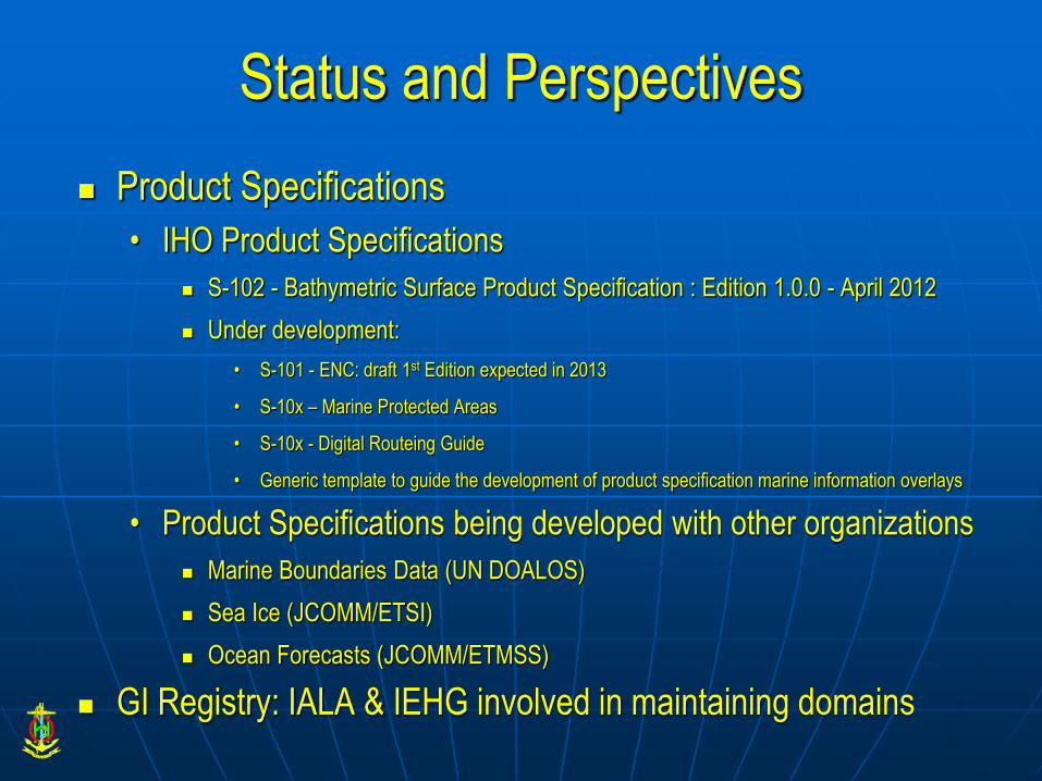
Product Specifications
• IHO Product Specifications
S-102 - Bathymetric Surface Product Specification : Edition 1.0.0 - April 2012
Under development:
• S-101 - ENC: draft 1st Edition expected in 2013
• S-10x – Marine Protected Areas
• S-10x - Digital Routeing Guide
• Generic template to guide the development of product specification marine information overlays
• Product Specifications being developed with other organizations
Marine Boundaries Data (UN DOALOS)
Sea Ice (JCOMM/ETSI)
Ocean Forecasts (JCOMM/ETMSS)
GI Registry: IALA & IEHG involved in maintaining domains
Status and Perspectives

Time scale for the take-up of S-100?
• E-Navigation
Little enthusiasm for moving to S-101 in the near future
• Overhead associated with dual S-57 and S-101 ENCs
• Cost of upgrading ECDIS
Key driver: availability and appeal of S-100 based products & services associated with e-Navigation
• MSDI applications
S-102 registered in the EU Inspire framework
Development of web map services to provide access to S-102 high precision bathymetry products
Ability to use S-100 to model non-geographic information?
• Successful exploration of the feasibility of an S-100 based PS for notice of arrival and pilot requests
Status and Perspectives

S-100 offers the appropriate open framework for
supporting the development of e-Navigation and
Maritime Spatial Planning efficiently
The IHO welcomes any initiative to share, use and
expand this framework for the benefit of the maritime
stakeholders
The IHO will help and advise … if asked.
Conclusion

Questions? For more information: http://www.iho.int
S-100 GI Registry:
http://registry.iho.int/s100_gi_registry/home.php
IHO Contact: [email protected]