dynamical downscaling of precipitation – part...
TRANSCRIPT

DYNAMICAL DOWNSCALING OF PRECIPITATION – PART II:COMPARISON WITH RAIN GAUGE AND HYDROLOGICAL DATA
Teitur Arason1,2, Jóna Finndís Jónsdóttir3,Ólafur Rögnvaldsson4,5,† and Haraldur Ólafsson1,2,4,5
1University of Iceland, Reykjavík, Iceland2Icelandic Meteorological Office, Reykjavík, Iceland
3formerly at the Hydrological Service, National EnergyAuthority, Reykjavík, Iceland
4Institute for Meteorological Research, Reykjavík, Iceland5Bergen School of Meteorology, Geophysical Insitute,
University of Bergen, Norway†Corresponding author: [email protected],
Orkugarður, Grensásvegur 9, 108 Reykjavík
ABSTRACTAtmospheric flow over Iceland has been simulated for the period Jan-uary 1961 to July 2006, using the mesoscale MM5 model driven byinitial and boundary data from the ECMWF. Firstly, a systematic com-parison of results to observed precipitation has been carried out. Un-dercatchment of solid precipitation is dealt with by looking only atdays when precipitation is presumably liquid or by considering theoccurrence and non-occurrence of precipitation. Away from non-resolved orography, the long term means (months, years) of observedand simulated precipitation are often in reasonable agreement. Thisis partly due to a compensation of the errors on a shorter timescale(days). Probability of false alarms (model predicts precipitation, butnone is observed) is highest in N-Iceland, particularly during win-ter. The probability of missing precipitation events (precipitation ob-served but none is predicted by the model) is highest in the summerinland in N-Iceland. Secondly, model output is used as input to theWaSiM hydrological model to calculate and compare the runoff withobserved runoff from six watersheds in Iceland. It is found that modelresults compare favourably with observations.
INTRODUCTIONThe 6–hourly ERA40 re-analysis of the ECMWF have been dynamically

downscaled for the period 1961–2006 using the numerical model MM5 (Grellet al., 1995). The modelling approach is described in detail in Rögnvaldsson etal. (2007, 2008).
Climatological downscaling of precipitation is of use for hydrological pur-poses. The MM5 model, using a similar setup as used in this study, is in opera-tional use in Iceland for production of short to medium range weather forecasts.Although a hydrologist and a weather forecaster would both like to be able topredict precipitation, their interests lie on different timescales.
In this paper we use output from the MM5 model as input to the WaSiMhydrological model (Jasper et al., 2002) for the same six watersheds as used forvalidation purposes by Rögnvaldsson et al. (2007) and compare the simulateddischarge with observed discharge. We also evaluate the quality of the simu-lations by comparing them to rain gauge measurements. This can be done bycomparing long term means (months, years) of simulated and observed precip-itation. Such a comparison would be of use to a hydrologist but of somewhatlimited value for a forecaster. We therefore set out to making comparisons thatwould assess strong and weak points of the simulations to aid forecasters. Wewant to know how the errors in the simulated precipitation relate to other me-teorological factors and if the performance depends on the temporal resolutionof the data and geographical location. The work should shed a light on whichaspects need improving. Increased understanding of the limitations of the sim-ulations on a short timescale will also be beneficial for their use in hydrologicalpurposes.
This paper begins with a short description of rain gauge data used in thisstudy and how simulated precipitation compares to observations. Following isa comparison of modelled discharge to observed discharge and concluding re-marks.
RAIN GAUGE DATAThe dynamic downscaling of ECMWF data, using version 3–7–3 of the
MM5 model, has been compared to precipitation observations from synopticstations for the sub-period 1987 2003. Precipitation is measured twice per dayon the chosen synoptic stations, at 09 and 18 UTC. The MM5 output was savedevery 6 hours, at 00, 06, 12 and 18. The shortest comparison period is therefore24 hours (from 18 to 18). That period will from now on be referred to as an"event" in this paper.
The model output from a grid point can be considered as an area averagedprecipitation over an area of 64 km2. Therefore we do not expect the simula-

tions to agree with measurements in areas with topography that is not resolvedby the model. When comparing simulated and observed precipitation we mustalso bear in mind the general problems of precipitation observations. The mostsignificant of these is the large undercatchment of solid precipitation in coldand windy climate, as in Iceland (Førland et al., 1996). Undercatchment ofsolid precipitation is dealt with by looking only at days when precipitation ispresumably liquid (summer or temperature criteria) or by considering the oc-currence and non-occurrence of precipitation.
COMPARISON WITH OBSERVED PRECIPITATIONFigure 1 shows the relative error of the simulations, (mm5-obs) / obs, for the
summer months June, July and August (JJA). It can be seen that the model
Figure 1: A topographic map of Iceland showing relative difference between simulated andobserved accumulated precipitation, (mm5-obs) / obs. Each coloured circle corresponds to asynoptic weather station. Station names are included at the stations referred to in this paper.The colour of the circle denotes the relative error in the simulations (colourbar to the right)for the summer months June, July and August (JJA). The blue boxes enclose a few stations onflat land in S-Iceland where the observations and simulations are in reasonable agreement. Thered boxes draw attention to stations in N-Iceland where the model overestimates precipitation,despite these stations being on flat land. Stations that have huge overestimation, which is almostcertainly due to non-resolved orography, are enclosed in black boxes.
behaves differently in N- and S-Iceland for stations in flat land (minimal effectof non-resolved orography). For stations on flat land in the South, the simula-tions and observations are in an overall reasonable agreement (see stations inblue boxes in Fig. 1). The model does however underestimate precipitation in

flows from the SE (not shown). The model overestimates the precipitation forflat land stations in the North (red boxes in Fig. 1). This is particularly true innortherly flow. For stations situated in orography that is obviously not resolvedby the model (black boxes in Fig. 1), the somewhat expected result of huge rel-ative errors is clearly visible.
Figure 2: Data from Stórhöfði, S-Iceland, accumulated 24 hour precipitation [mm] (observedand simulated) for November 1992. Blue colour denotes the amount of mm5 underestimationand red denotes the mm5 overestimation.
The 24 hour precipitation amounts (observed and simulated) for November1992 at Stórhöfði, S-Iceland, is shown in Fig. 2. The sums of observed andsimulated precipitation for this month are almost identical. It is however clearthat the agreement of the monthly sums is in large part due to compensation ofthe errors on a daily timescale. We define a "false alarm" event as a period of24 hours (from 18 to 18) where there is some precipitation in the simulations(rmm5 > 0.1) but the observations are dry (robs ≤ 0.1). Figure 3 shows thepercentage of events that fall into the false alarm category on each of the stationsduring the winter months December, January and February (DJF). Comparisonwith maps from the other seasons (not shown) reveals that there is increasedprobability of false alarms in winter, most notably for inland areas in N-Iceland.In Fig. 4 all false alarm events at Staðarhóll have been categorized according towind direction. We see that most of the precipitation during false alarm eventsis associated with southerly winds.
A "missing" event is defined as a 24 hour period where the simulations aredry (rmm5 ≤ 0.1) but the observations are wet (robs > 0.1). Figure 5 shows thepercentage of missing events during the summer months (JJA) at each of theobservation stations. There is higher probability of missing events during sum-mer than in winter (map not shown). In Fig. 6 the precipitation during missing

Figure 3: Ratio [%] of "false alarms" (mm5 wet, obs dry) during winter (DJF).
Figure 4: All "false alarm" events from Staðarhóll, NE-Iceland. The horizontal axis shows binsfor 16 wind directions. The vertical axis shows the accumulated precipitation in each bin.

Figure 5: Ratio [%] of "missing" events (mm5 dry, obs wet) during summer (JJA).
Figure 6: All "missing" events from Staðarhóll, NE-Iceland. Horizontal axis shows bins for 16wind directions. The vertical axis shows precipitation sum in each bin.
events (only observed precipitation) at Staðarhóll has been grouped into bins ofdifferent wind direction and the precipitation in each bin added up. Again wesee that southerly winds (lee side) are the main culprit.
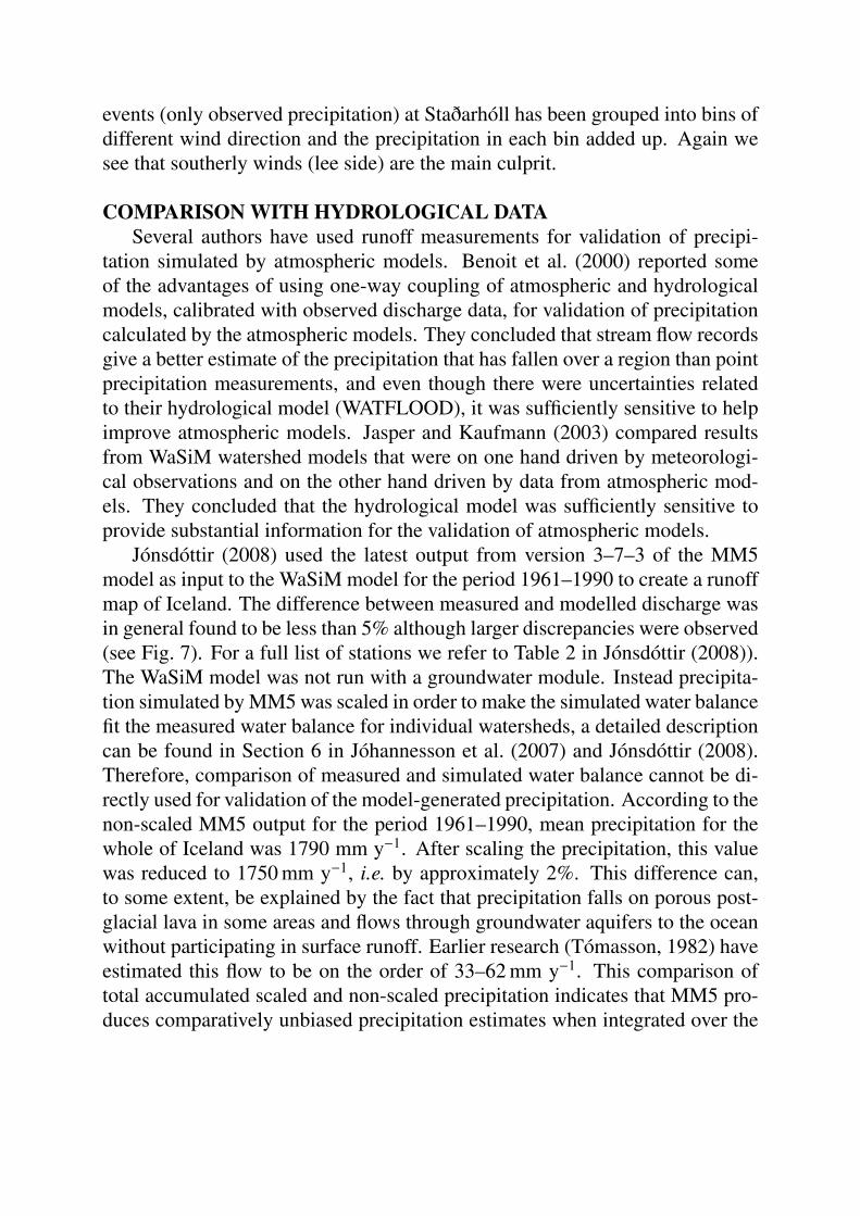
COMPARISON WITH HYDROLOGICAL DATASeveral authors have used runoff measurements for validation of precipi-
tation simulated by atmospheric models. Benoit et al. (2000) reported someof the advantages of using one-way coupling of atmospheric and hydrologicalmodels, calibrated with observed discharge data, for validation of precipitationcalculated by the atmospheric models. They concluded that stream flow recordsgive a better estimate of the precipitation that has fallen over a region than pointprecipitation measurements, and even though there were uncertainties relatedto their hydrological model (WATFLOOD), it was sufficiently sensitive to helpimprove atmospheric models. Jasper and Kaufmann (2003) compared resultsfrom WaSiM watershed models that were on one hand driven by meteorologi-cal observations and on the other hand driven by data from atmospheric mod-els. They concluded that the hydrological model was sufficiently sensitive toprovide substantial information for the validation of atmospheric models.
Jónsdóttir (2008) used the latest output from version 3–7–3 of the MM5model as input to the WaSiM model for the period 1961–1990 to create a runoffmap of Iceland. The difference between measured and modelled discharge wasin general found to be less than 5% although larger discrepancies were observed(see Fig. 7). For a full list of stations we refer to Table 2 in Jónsdóttir (2008)).The WaSiM model was not run with a groundwater module. Instead precipita-tion simulated by MM5 was scaled in order to make the simulated water balancefit the measured water balance for individual watersheds, a detailed descriptioncan be found in Section 6 in Jóhannesson et al. (2007) and Jónsdóttir (2008).Therefore, comparison of measured and simulated water balance cannot be di-rectly used for validation of the model-generated precipitation. According to thenon-scaled MM5 output for the period 1961–1990, mean precipitation for thewhole of Iceland was 1790 mm y−1. After scaling the precipitation, this valuewas reduced to 1750 mm y−1, i.e. by approximately 2%. This difference can,to some extent, be explained by the fact that precipitation falls on porous post-glacial lava in some areas and flows through groundwater aquifers to the oceanwithout participating in surface runoff. Earlier research (Tómasson, 1982) haveestimated this flow to be on the order of 33–62 mm y−1. This comparison oftotal accumulated scaled and non-scaled precipitation indicates that MM5 pro-duces comparatively unbiased precipitation estimates when integrated over the

Figure 7: Measured and simulated (WaSiM /MM5) mean discharge [m3s−1] at the watershedgauges. Dashed line indicates a perfect fit, solid line represents the linear best fit between themeasured and simulated discharge.
whole of Iceland.Table 1 compares observed and modelled discharge from six watersheds that
are not much affected by groundwater flow (the same discharge stations as usedfor validation of an earlier MM5 model version by Rögnvaldsson et al., 2007;cf. Table 1 and Fig. 2). Here, un-scaled precipitation is used in the hydrologi-cal modelling in order to obtain an independent validation of the precipitationgenerated by MM5. For four out of six watersheds, the difference in the waterbalance is reduced when the newer version of the MM5 model is used comparedwith the results obtained with the earlier model version. The relative differencebetween the simulated and observed water balance is in the range −8 to 13%,with four of the six values in the range −4 to 5%, indicating a satisfactory per-formance of the model.
CONCLUSIONSThe numerical model MM5, run at a horizontal resolution of 8 km, has been
used to downscale over Iceland the 6-hourly analysis of the ECMWF over a pe-riod of 46 years. A systematic comparison with observed precipitation for thesub-period 1987–2003 has been presented as well as comparison of simulateddischarge with observed discharge. The main results are:

Table 1: Comparison of observed and simulated discharge [m3s−1] at six discharge stationsusing unscaled modelled precipitation from versions 3-5 and 3-7 of the MM5 model. Notethat the simulation periods are not the same for the two model versions. Hence, the measureddischarge can differ somewhat between the columns corresponding to the two versions. Thedischarge stations are, respectively; Vatnsdalsá river, Norðurá river, Fossá í Berufirði river,Hvalá river, Fnjóská river and Hamarsá river. The simulation periods are, respectively; 1963–2001, 1971–2001, 1963–2001, 1976–2001, 1976–2001 and 1991–2004.
MM5 V3-5 MM5 V3-7Station # Qmeas Qcalc Difference Qmeas Qcalc Difference
45 12.3 13.4 8.9% 10.3 10.8 5.0%128 29.4 32.2 9.7% 22.4 25.3 13.0%148 9.1 10.4 14.3% 8.2 7.9 −4.0%198 26.8 25.4 −5.2% 15.5 15.3 −1.0%200 48.4 53.9 11.4% 39.6 40.3 2.0%265 19.6 20.8 6.1% 19.9 18.4 −8.0%
• Away from non-resolved orography, long term (months, years) sums ofsimulated precipitation are quite correct in the south but too high in thenorth. This is partly due to compensating errors on a smaller time scale(days).
• Probability of false alarms (model predicts precipitation, but none is ob-served) is highest in N-Iceland, particularly during winter.
• Probability of missing precipitation events is highest in the summer inlandand on the lee side of Iceland in southerly flows.
• Precipitation is underestimated in SE flows in SW-Iceland but precipita-tion is overestimated in northerly flows in N-Iceland. This cannot only beexplained by non-resolved orography.
• Simulated discharge compares favourably with observed discharge for themajority of observation sites, indicating a satisfactory performance of themodel.
REFERENCESFørland, E. J., Allerup P., Dahlström B., Elomaa E., Jónsson T., Madsen H.,Perälä J., Rissanen P., Vedin H. and Vejen F. 1996. Manual for operational cor-rection of Nordic precipitation data. DNMI Report No. 24/96 Klima, 66 pp.

Benoit, R., Pellerin P., Kouwen N., Ritchie H., Donaldson N., Joe P. and SoulisE. D. 2000. Toward the use of coupled atmospheric and hydrologic models atregional scale. Mon. Wea. Rev., 128(6), 1681–1706.Grell, G. A., Dudhia J. and Stauffer D. R. 1995. A description of the fifth-generation Penn State/NCAR Mesoscale Model (MM5). NCAR Tech. NoteNCAR/TN-398+STR, 138 pp.Jasper, K., Gurtz J. and Lang H. 2002. Advanced flood forecasting in Alpinewatersheds by coupling meteorological observations and forecasts with a dis-tributed hydrological model. J. Hydrol., 267, 40–52.Jasper, K., and Kaufmann P. 2003. Coupled runoff simulations as validationtools for atmospheric models at the regional scale. Q. J. R. Meteorol. Soc., 129,673–692.Jóhannesson, T., Aðalgeirsdóttir G., Björnsson H., Crochette P., Elíasson E.B., Guðmundsson S., Jónsdóttir J. F., Ólafsson H., Pálsson F., RögnvaldssonÓ., Sigurðsson O., Snorrason Á., Sveinsson Ó. G. B., Thorsteinsson Th. 2007.Effect of climate change on hydrology and hydro-resources in Iceland. Rep.OS-2007/011, National Energy Authority, Reykjavík.Jónsdóttir, J. F. 2008. A runoff map based on numerically simulated precipita-tion and a projection of future runoff in Iceland. Hydrol. Sci. J., 53(1) February2008.Rögnvaldsson, Ó., Jónsdóttir J. F. and Ólafsson H. 2007. Numerical simulationsof precipitation in the complex terrain of Iceland—Comparison with glaciolog-ical and hydrological data. Meteorol. Z., 16(1), 71–85.Rögnvaldsson, Ó. and Ólafsson H. 2008. Dynamical downscaling of precipi-tation – Part I: Comparison with glaciological data. Proceedings of the XXVNordic Hydrological Conference, Reykjavík, Iceland.Tómasson, H. 1982. Vattenkraft i Island och dess hydrologiska förutsätningar(Hydropower in Iceland and its hydrological prerequisites). In: Den nordiskehydrologiske konferense, NHK-82, Förde 28.–30. juni 1982. Rep. OS-82059/VOD-10, National Energy Authority, Reykjavík.