dritte ebene anette blaser project manager senate ... · pdf fileproject part-financed by the...
TRANSCRIPT
Klicken Sie, um das Titelformat zu bearbeiten
• Klicken Sie, um die Formate des Vorlagentextes zu bearbeiten
• Zweite Ebene• Dritte Ebene• Vierte Ebene• Fünfte Ebene 1
Berlin, 23. Mai 2007 Slide
GNSS Symposium Berlin, 11-14 November 2008
Anette Blaser Senate Department for Urban Development Expert for EU Affairs, Secretary of the Berlin, Germany
EUPOS
EUPOS-IRC
Anette Blaser
Berlin, Germany
InterRegional Cooperation
Project Manager Senate Department for Urban Development
Project part-financed by European Union International EUPOS® Steering Committee
1

Klicken Sie, um das Titelformat zu bearbeiten
• Klicken Sie, um die Formate des Vorlagentextes zu bearbeiten
• Zweite Ebene• Dritte Ebene• Vierte Ebene• Fünfte Ebene 2
Berlin, 23. Mai 2007 Slide
GNSS Symposium Berlin, 11-14 November 2008
Anette Blaser Senate Department for Urban Development Expert for EU Affairs, Secretary of the Berlin, Germany
INTERREG III C
• Interregional cooperations • •
•
and cohesion
EU-funded Programme
Sharing knowledge and experience To strengthen economic and social cohesion in the EU To improve effectiveness of policies and instruments for regional development
Project part-financed by European Union International EUPOS® Steering Committee
2
Klicken Sie, um das Titelformat zu bearbeiten
• Klicken Sie, um die Formate des Vorlagentextes zu bearbeiten
• Zweite Ebene• Dritte Ebene• Vierte Ebene• Fünfte Ebene 3
Berlin, 23. Mai 2007 Slide
GNSS Symposium Berlin, 11-14 November 2008
Anette Blaser Senate Department for Urban Development Expert for EU Affairs, Secretary of the Berlin, Germany
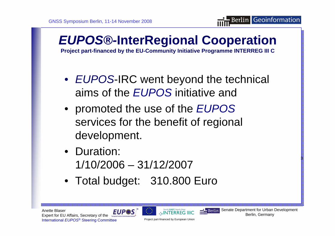
EUPOS®-
• EUPOS-IRC went beyond the technical aims of the EUPOS initiative and
• EUPOS services for the benefit of regional development.
•
• 310.800 Euro
InterRegional Cooperation Project part-financed by the EU-Community Initiative Programme INTERREG III C
promoted the use of the
Duration: 1/10/2006 – 31/12/2007 Total budget:
Project part-financed by European Union International EUPOS® Steering Committee
3

Klicken Sie, um das Titelformat zu bearbeiten
• Klicken Sie, um die Formate des Vorlagentextes zu bearbeiten
• Zweite Ebene• Dritte Ebene• Vierte Ebene• Fünfte Ebene 4
Berlin, 23. Mai 2007 Slide
GNSS Symposium Berlin, 11-14 November 2008
4
li
EUPOS• Germany, Lead Partner
•
FÖMI Satellite Geodetic Observatory • Poland
• Latvia
•
• Serbia
• Bulgaria
• Romania
Senate Department for Urban Development Berlin, Germany
Anette B aser Expert for EU Affa rs, Secretary of the
-IRC Partner Institutions
Berlin Senate Department for Urban Development Hungary Institute of Geodesy, Cartography and Remote Sensing
Head Office of Geodesy and Cartography
University of Latvia, Institute of Geodesy and Geoinformation and Riga Geometrs Lithuania Institute of Geodesy of Vilnius Gediminas Technical University
University of Novi Sad, Faculty of Technical Sciences
Bulgarian Academy of Sciences, Institute of Water Problems
National Agency for Cadastre and Land Registration
Project part-financed by European Union International EUPOS® Steering Committee
Klicken Sie, um das Titelformat zu bearbeiten
• Klicken Sie, um die Formate des Vorlagentextes zu bearbeiten
• Zweite Ebene• Dritte Ebene• Vierte Ebene• Fünfte Ebene 5
Berlin, 23. Mai 2007 Slide
GNSS Symposium Berlin, 11-14 November 2008
Anette Blaser Senate Department for Urban Development Expert for EU Affairs, Secretary of the Berlin, Germany
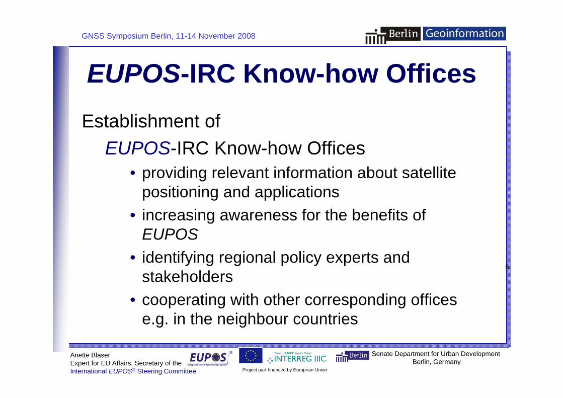
EUPOS-IRC Know-how Offices Establishment of
EUPOS-IRC Know-how Offices • providing relevant information about satellite
positioning and applications • increasing awareness for the benefits of
EUPOS • identifying regional policy experts and
stakeholders • cooperating with other corresponding offices
e.g. in the neighbour countries
Project part-financed by European Union International EUPOS® Steering Committee
5
Klicken Sie, um das Titelformat zu bearbeiten
• Klicken Sie, um die Formate des Vorlagentextes zu bearbeiten
• Zweite Ebene• Dritte Ebene• Vierte Ebene• Fünfte Ebene 6
Berlin, 23. Mai 2007 Slide 6
li
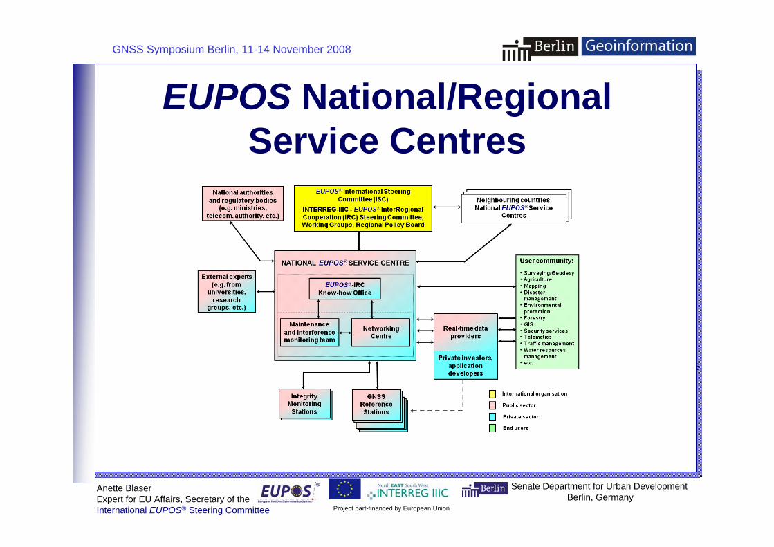
EUPOS National/Regional Service Centres
GNSS Symposium Berlin, 11-14 November 2008
Senate Department for Urban Development Berlin, Germany
Anette B aser Expert for EU Affa rs, Secretary of the
Project part-financed by European Union International EUPOS® Steering Committee

Klicken Sie, um das Titelformat zu bearbeiten
• Klicken Sie, um die Formate des Vorlagentextes zu bearbeiten
• Zweite Ebene• Dritte Ebene• Vierte Ebene• Fünfte Ebene 7
Berlin, 23. Mai 2007 Slide
GNSS Symposium Berlin, 11-14 November 2008
Anette Blaser Senate Department for Urban Development Expert for EU Affairs, Secretary of the Berlin, Germany
EUPOS-IRC Regional Policy Board
Establishment of a Regional Policy Board (RPB), which shall guarantee that the activities of EUPOS are put long-term in relation to regional development activities. Members of the RPB shall become high-level decision-makers from several fields of regional development in the partner countries.
Project part-financed by European Union International EUPOS® Steering Committee
7

Klicken Sie, um das Titelformat zu bearbeiten
• Klicken Sie, um die Formate des Vorlagentextes zu bearbeiten
• Zweite Ebene• Dritte Ebene• Vierte Ebene• Fünfte Ebene 8
Berlin, 23. Mai 2007 Slide
GNSS Symposium Berlin, 11-14 November 2008
Anette Blaser Senate Department for Urban Development Expert for EU Affairs, Secretary of the Berlin, Germany
EUPOS
There are several fields in which satellite positioningcan contribute to a sustainable regional development,
environmental protection, disaster management forexample in the case of floods, land surveying,cadastre management, cartography or GISapplications.
•
• for the regions
-based Applications
e.g. urban and rural planning, traffic management,
Demonstration of the technologies in pilot application which show the relevance for the regional development.
Study on DGNSS applications which have a significant impact
Project part-financed by European Union International EUPOS® Steering Committee
8
Klicken Sie, um das Titelformat zu bearbeiten
• Klicken Sie, um die Formate des Vorlagentextes zu bearbeiten
• Zweite Ebene• Dritte Ebene• Vierte Ebene• Fünfte Ebene 9
Berlin, 23. Mai 2007 Slide
GNSS Symposium Berlin, 11-14 November 2008
9
li
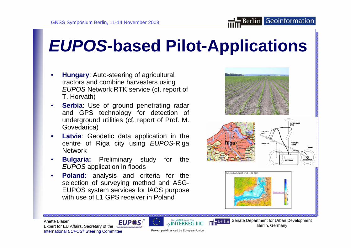
EUPOS• Hungary
EUPOS
• Serbiadetection of
Govedarica) • Latvia
centre of Riga city using EUPOS-Riga
• Preliminary study for the EUPOS application in floods
• Poland: analysis and criteria for the
Senate Department for Urban Development Berlin, Germany
Anette B aser Expert for EU Affa rs, Secretary of the
-based Pilot-Applications : Auto-steering of agricultural
tractors and combine harvesters using Network RTK service (cf. report of
T. Horváth) : Use of ground penetrating radar
and GPS technology for underground utilities (cf. report of Prof. M.
: Geodetic data application in the
Network Bulgaria:
selection of surveying method and ASGEUPOS system services for IACS purpose with use of L1 GPS receiver in Poland
Project part-financed by European Union International EUPOS® Steering Committee

Klicken Sie, um das Titelformat zu bearbeiten
• Klicken Sie, um die Formate des Vorlagentextes zu bearbeiten
• Zweite Ebene• Dritte Ebene• Vierte Ebene• Fünfte Ebene 10
Berlin, 23. Mai 2007 Slide 1
GNSS Symposium Berlin, 11-14 November 2008
Anette Blaser Senate Department for Urban Development Expert for EU Affairs, Secretary of the Berlin, Germany
Agriculture
Gate-tBuilding Industry Onli truct l
Forestry Automated harvestLogistics t t t tainer t
Mining
/ Conversion
t
tt
Surveying tasks (not described, since well-known)
Study on DGNSS Applications Automatic laying of drainage pipes Field and weed mapping
Air Transport Landing approach at airports o-gate operation in airports
ne monitoring of the movements of s ures contro of building machines Flood Protection Flood mapping and modelling of a flooded area
ing machines in the forestry industry Automatic sa ellite-suppor ed con ainer positioning system on a con erminal
Maritime Transport / Inland Navigation Satellite integrated technology for the creation of digital maps and lake charts Navigation in inland waterway transport and for coastal shipping Excavator control in coal mining Positioning of drill holes in oil production
Environmental Protection Dynamic air pollution cadastre Documentation of nature reserves
Public Utility Industry Remote maintenance and documentation of pipelines Rail Transport Kinematical track surveying in rail transporRoad Transport Airborne collection of traffic data for traffic monitoring during events
ADAS-Advanced Driver Assis ance Systems in road traffic Co-operative systems for road traffic management; car- o-car communication
Project part-financed by European Union International EUPOS® Steering Committee
0
Klicken Sie, um das Titelformat zu bearbeiten
• Klicken Sie, um die Formate des Vorlagentextes zu bearbeiten
• Zweite Ebene• Dritte Ebene• Vierte Ebene• Fünfte Ebene 11
Berlin, 23. Mai 2007 Slide 1
GNSS Symposium Berlin, 11-14 November 2008
Anette Blaser Senate Department for Urban Development Expert for EU Affairs, Secretary of the Berlin, Germany
Conclusions •
• • EUPOS. •
augmentation services is not self-evident. • EUPOS services provide a basis infrastructure in
sixteen CEE countries • EUPOS
EUPOS potential. • EUPOS countries are going to continue their activities based on
the project results. •
GNSS technology is used by many people, mainly for car navigation. Full potential is not yet tapped. User know not enough the possibilities of systems like Compatibility between neighbouring ground-based
The uniform
-IRC operation enforced the awareness creation for the
The project results are available at the EUPOS web page http://www.eupos.org
Project part-financed by European Union International EUPOS® Steering Committee
1

Klicken Sie, um das Titelformat zu bearbeiten
• Klicken Sie, um die Formate des Vorlagentextes zu bearbeiten
• Zweite Ebene• Dritte Ebene• Vierte Ebene• Fünfte Ebene 12
Berlin, 23. Mai 2007 Slide 12
li
Dipl.-Ing. Anette Blaser Senate Department for Urban Development
D-10707 Berlin, Germany Phone: +49 30 9012 7412 Fax: +49 30 9012 3709 E-Mail: [email protected]
GNSS Symposium Berlin, 11-14 November 2008
Senate Department for Urban Development Berlin, Germany
Anette B aser Expert for EU Affa rs, Secretary of the
Thank you for your attention!
Fehrbelliner Platz 1
Project part-financed by European Union International EUPOS® Steering Committee