draft smith and minor islands aquatic reserve management plan
TRANSCRIPT

Smith & Minor Islands
Aquatic Reserve Management Plan
October 2010
N
A
T
U
R
A
L
R
E
S
O
U
R
C
E
S

Acknowledgements Washington State Department of Natural Resources Peter Goldmark, Commissioner of Public Lands Bridget Moran, Deputy Supervisory, Aquatic Lands Orca Straits District David Roberts, Assistant Division Manager Brady Scott, District Manager Aquatic Resources Division Kristin Swenddal, Aquatic Resources Division Manager Michal Rechner, Assistant Division Manager, Policy and Planning Kyle Murphy, Aquatic Reserves Program Manager Betty Bookheim, Environmental Specialist Michael Grilliot, Marc Hershman Marine Policy Fellow, Aquatic Reserves Program Associate
GIS and Mapping Michael Grilliot, Marc Hershman Marine Policy Fellow, Aquatic Reserves Program Associate
Communications Aaron Toso, Communications Director Abbey Corzine, DNR Communications Principal Authors Kyle Murphy, Aquatic Reserves Program Manager Michael Grilliot, Marc Hershman Marine Policy Fellow, Aquatic Reserves Program Associate Betty Bookheim, Natural Resource Scientist
Aquatic Reserves Technical Advisory Committee, 2009 Brie Van Cleve, Washington State Department of Fish and Wildlife Dr. Alison Styring, The Evergreen State College Dr. Joanna Smith, The Nature Conservancy John Floberg, Cascade Land Conservancy Phil Bloch, Washington State Department of Transportation Smith & Minor Islands Aquatic Reserve Planning Advisory Committee, 2009 Aaron Terada, Washington State Parks Betty Bookheim, Natural Resource Scientist Dave Peeler, People For Puget Sound Dick Toft, Island County Marine Resources Committee Jennifer Meyer, NAS Whidbey Island Ken Urstad, Puget Sound Anglers Kevin Ryan, USFWS Kyle Murphy, Aquatic Reserves Program Manager Matt Kukuk, Island County Public Health Michael Grilliot, Marc Hershman Marine Policy Fellow, Aquatic Reserves Program Associate Morgan Schneidler, Puget Sound Partnership Sara Woehrman, WSU Island County Beach Watchers Steve Ellis, Whidbey Audubon Society Copies of this report may be obtained from the Washington State Department of Natural Resources Aquatic Reserves Program or copied from the web page. Contact Information Aquatic Reserves Program Manager Phone: 360-902-1100 E-mail: [email protected] Web: www.dnr.wa.gov Cover Photo: Smith and Minor Islands,
The Wild Fish Conservancy

Smith & Minor Islands Environmental & Scientific Aquatic Reserve
Management Plan

Smith & Minor Islands Aquatic Reserve Management Plan Page ii
Table of Contents Figures… ................................................................................................................................ iv
Acronyms ............................................................................................................................... iv
1. Executive Summary ........................................................................................................... 1
2. Introduction ....................................................................................................................... 2
I. Washington’s Department of Natural Resources ................................................................... 2 II. Aquatic Reserves Program ..................................................................................................... 2
Legal Authorities for Establishing State Aquatic Reserves ................................................. 4 III. Smith & Minor Islands Aquatic Reserve Boundary ............................................................... 4
Legal Boundaries ................................................................................................................ 4 IV. Purpose of the Smith & Minor Islands Aquatic Reserve Management Plan .......................... 5
Adaptive Management ........................................................................................................ 5 V. Smith & Minor Islands Area Ownership ................................................................................ 6 VI. Relationship to Federal, State, Local, and Tribal Management .............................................. 8
Smith & Minor Islands Aquatic Reserve ............................................................................. 8 Tribal Interests at Smith and Minor Islands ....................................................................... 8 The National Wildlife Refuge System .................................................................................. 8 Ebey's Landing National Historic Reserve ......................................................................... 9 Washington State Parks and Recreation Commission ........................................................ 9 Navy Region Northwest .................................................................................................... 10 Local Land Use Designations ........................................................................................... 10
3. Smith & Minor Islands Aquatic Reserve ........................................................................... 12
I. Site Characterization ............................................................................................................ 12 A. Geographic Description .............................................................................................. 12 B. Ecosystem Description ................................................................................................ 12 C. Physical Processes ....................................................................................................... 12
Habitat Characteristics ......................................................................................................... 17 Fish and Wildlife Resources ................................................................................................ 18 Conservation Targets ........................................................................................................... 22
II. Current Conditions ............................................................................................................... 23 III. Potential Future Impacts ....................................................................................................... 24
Future Land Use Scenarios .............................................................................................. 25 Commercial and Recreational Shellfish Harvest and Aquaculture .................................. 26 Water and Sediment Quality and Hydraulic Modifications .............................................. 26 Energy, Pipeline, or Transmission Line Rights of Ways ................................................... 26 Wind Energy Facilities ..................................................................................................... 27 Oil Spill Scenarios ............................................................................................................ 27 Naval Activity ................................................................................................................... 27 Recreational Use and Mooring Buoys .............................................................................. 27 Climate Change Scenarios ................................................................................................ 28
IV. Archeological, Cultural and Historic Resources .................................................................. 28 Ebey's Landing National Historical Reserve .................................................................... 28 Smith Island Light Station................................................................................................. 29
4. Management Goals & Objectives ...................................................................................... 30
I. Desired Future Conditions ............................................................................................. 30
5. Management Actions ......................................................................................................... 34
I. Resource Protection, Enhancement, and Restoration ........................................................... 34
Smith & Minor Islands Aquatic Reserve Management Plan Page iii
A. Protection .................................................................................................................... 35 B. Enhancement ............................................................................................................... 35 C. Restoration .................................................................................................................. 36
II. Research and Monitoring ..................................................................................................... 37 A. Data Gap Identification and Baseline Inventory ......................................................... 37 B. Trend Monitoring ........................................................................................................ 38 C. Research ...................................................................................................................... 39
III. Environmental Education ..................................................................................................... 40 IV. Allowable Uses .................................................................................................................... 41
A. Adjacent Aquatic lands and Uplands .......................................................................... 41 B. Resource Protection, Enhancement, and Restoration ................................................. 41 C. Research and Monitoring ............................................................................................ 41 D. Environmental Education & Public Access ................................................................. 41 E. Existing Use Authorizations ........................................................................................ 41 F. Commercial and Recreational Fishing ........................................................................ 42
V. Other Uses ............................................................................................................................ 42 6. Implementation Guidance ................................................................................................. 44
I. Smith & Minor Islands Aquatic Reserve Implementation Committee ................................. 44 Proposal Evaluation Criteria ........................................................................................... 45 Committee Decisions ........................................................................................................ 45
7. Glossary ............................................................................................................................ 46
8. Reference Literature ......................................................................................................... 56
Appendix A – Observed Species Lists ................................................................................... 59
Appendix B – Maps ............................................................................................................... 73
Appendix C – Historical Information .................................................................................... 87
Appendix D – Legal Description of Smith & Minor Islands Aquatic Reserve ....................... 90

Smith & Minor Islands Aquatic Reserve Management Plan Page iv
Figures Figure 1 – Smith & Minor Islands Aquatic Reserve and Vicinity vii Figure 2 – Washington State Aquatic Reserves 3 Figure 3 – Smith and Minor Islands Region General Ownership 7 Figure 4 – Regional water masses and subareas of Puget Sound: 1)
Northern Puget Sound, 2) Whidbey Basin, 3) Main Basin, 4) Hood Canal, and 5) Southern Puget Sound. From Gustafson, et al. (2000)16
Figure 5 – Seasonal Patterns of winds over western Washington. From Downing (1983) 17
Acronyms DNR Washington State Department of Natural Resources MRC Marine Resources Committee NHR National Historic Reserve NOAA National Oceanographic and Atmospheric Administration NPS National Parks Service NBK Naval Base Kitsap PSAMP Puget Sound Ambient Monitoring Program RCW Revised Code of Washington SEPA State Environmental Policy Act USFWS United States Fish and Wildlife Service WAC Washington Administrative Code WDFW Washington State Department of Fish and Wildlife WSU Washington State University

Smith & Minor Islands Aquatic Reserve Management Plan Page v
Figure 1: Smith & Minor Islands Aquatic Reserve and Vicinity

Smith & Minor Islands Aquatic Reserve Management Plan Page 1
1. Executive Summary The Smith & Minor Islands Aquatic Reserve is established as an environmental and scientific reserve to ensure protection of the unique habitats and species identified in the area. This plan identifies the habitats and species in the reserve and the management actions that will be employed by the Department of Natural Resources (DNR) to conserve these resources with the management emphasis on environmental protection above all other management actions. In general, within its statutory authority, DNR will approve new uses that have been demonstrated to be consistent with the reserve’s goals, objectives, and management actions described in chapters 2, 4, and 5 respectively and support the desired future conditions. There are a number of uses currently authorized within the aquatic reserve that are outlined in Chapter 5. This management plan does not apply to private tideland or upland property owners. DNR management authority extends only to the state owned aquatic lands. The following management goals have been established for the reserve:
1. Preserve, restore, and enhance the functions and natural processes of aquatic nearshore and subtidal ecosystems of the aquatic reserve.
2. Identify, survey, and monitor sensitive habitats, species and natural processes and provide and support opportunities for scientific research.
3. Support and provide opportunities for outdoor education and interpretive studies.
4. Collaborate with other reserve management partners, programs, and management actions to ensure connectivity across the Aquatic Reserve Program.
The management plan will be reviewed and updated as necessary every ten years throughout the 90-year term of the reserve designation. Changes in ecosystem condition and existing uses of state-owned aquatic lands will be included in the updates. Research and monitoring data will be used to guide DNR and the Implementation Committee in determining whether management actions are meeting the goals and objectives of the reserve. If management actions are not supporting the objectives of the reserve, they will be modified, monitored, and evaluated during the following 10-year review process in accordance with adaptive management strategies.
Smith & Minor Islands Aquatic Reserve Management Plan Page 2
2. Introduction
I. Washington’s Department of Natural Resources
DNR manages about 2.6 million acres of state-owned aquatic lands. This includes 1,300 miles of tidelands, 6,700 acres of harbor areas (established in the state constitution), all of the submerged lands below extreme low tide, and freshwater shorelands and bedlands of navigable water bodies. In addition there is an undetermined amount of freshwater shorelands and bedlands that may be navigable and fall under DNR management. DNR is directed by the Revised Code of Washington (RCW) to manage state-owned aquatic lands to provide a balance of public benefits that include encouraging public access, fostering water-dependent use, ensuring environmental protection, and utilizing renewable resources. In addition, DNR is directed to generate revenue from state-owned aquatic lands when it is consistent with the other public benefits. Also, DNR is to manage the state’s sensitive aquatic lands and, when necessary, remove them from conflicting uses. As part of this authority, under Washington Administrative Code (WAC) 332-30-151 DNR can establish environmental, scientific, and education aquatic reserves. The Smith & Minor Islands Aquatic Reserve was confirmed as a reserve candidate in 2008 and established as an environmental and scientific aquatic reserve in 2010 to conserve and enhance important habitats and species and promote research and monitoring. II. Aquatic Reserves Program In an effort to promote preservation, restoration, and enhancement of state-owned aquatic lands that provide benefits to the health of native aquatic habitats and species in the state of Washington, DNR established the Aquatic Reserves Program. By examining past success in site-based conservation, the Aquatic Reserves Program can help ensure that aquatic reserve status is applied when it is the most appropriate management tool. Three types of aquatic reserves may be established through the Aquatic Reserves Program: environmental, scientific, or educational. An Aquatic Reserve may be designated as one or any combination of the three types. The objectives for each

Smith & Minor Islands Aquatic Reserve Management Plan Page 3
reserve category can be found in the Aquatic Reserve Program Implementation and Designation Guidance, on DNR’s webpage www.dnr.wa.gov. DNR and its partners will manage each reserve in a manner consistent with the goals, objectives, management actions, and desired future conditions in each site-specific management plans. Figure 2: Washington State Aquatic Reserves

Smith & Minor Islands Aquatic Reserve Management Plan Page 4
Lega l Authoritie s for Es tablis h ing S ta te Aqua tic Res erves The constitutional authority for proprietary management of state-owned aquatic lands is derived from Articles XV and XVII of the Washington State Constitution. DNR is directed by state legislature in RCW 79.100 through 79.145 to manage the state-owned aquatic lands to provide a balance of public benefits that include encouraging public access, fostering water-dependent use, ensuring environmental protection, and utilizing renewable resources. In addition, DNR is directed to generate revenue from state-owned aquatic lands when consistent with the other legislatively directed public benefits. RCW 79.105.030 identifies environmental protection, the overarching goal of the Aquatic Reserves Program, as one of the DNR’s primary directives for the management of state-owned aquatic lands. RCW 79.10.210 further authorizes DNR to identify and withdraw from all conflicting uses public lands that can be utilized for their natural ecological systems. WAC 332-30-151 directs DNR to consider lands with educational, scientific, and environmental values for aquatic reserve status, and identifies management guidelines for aquatic reserves. WAC 332-30-106(16) defines environmental reserves as sites of environmental importance, which are established for the continuance of environmental baseline monitoring and/or areas of historical, geological, or biological interest requiring special protective management. WAC 332-30-106(64) defines scientific reserves as sites important for scientific research projects and/or areas of unusually rich plant and animal communities suitable for continuing scientific observation. III. Smith & Minor Islands Aquatic Reserve
Boundary The Smith & Minor Islands Aquatic Reserve encompasses approximately 36,308 acres of state-owned DNR managed tidelands and bedlands. The reserve boundary includes the western coast of Whidbey Island from the northern boundary of Joseph Whidbey State Park to just south of the southern boundary of Fort Ebey State Park. The reserve boundary extends seaward, perpendicular to the shoreline, from just south of the southern boundary of Fort Ebey State Park to a depth of 200 ft (61 m). It then extends northwest to the 200 ft (61 m) bathymetric contour southwest of Partridge Bank, and follows the 200 ft (61 m) bathymetric contour north to a point northwest of Smith and Minor Islands. The boundary then runs east, north of Smith and Minor Islands, connecting with Whidbey Island at the northern boundary of Joseph Whidbey State Park. Section 3 of this document provides a more thorough geographic, physical, and biological description of the Smith & Minor Islands Aquatic Reserve. Lega l Boundaries For a complete legal description of the Smith & Minor Islands Aquatic Reserve boundaries please refer to Appendix D.
Smith & Minor Islands Aquatic Reserve Management Plan Page 5
IV. Purpose of the Smith & Minor Islands Aquatic Reserve Management Plan
This plan describes the habitats and species identified for conservation in the aquatic reserve and the actions that will be implemented to protect these resources. The plan also describes research goals for the aquatic reserve and identifies future research needs. The management emphasis will place protection of these resources and potential research needs above other management actions. The Smith & Minor Islands Aquatic Reserve Management Plan has been developed in accordance with the State Environmental Policy Act (SEPA). This plan will serve as DNR’s primary management guidance for the 90-year term of the reserve. Every ten years after the adoption of the plan, it will be reviewed and, if necessary, updated with current scientific, management, and site-specific information. During the development of each subsequent update, DNR will work with other jurisdictions, Tribes, interest groups, adjacent landowners, and local citizens to establish cooperative management for activities within and adjacent to the reserve—activities that promote conservation, research, enhancement and restoration of habitats and species within the reserve. Decision making and planning regarding management of the aquatic reserve will be guided primarily by the following three sections of this plan, generally described here:
3. Smith & Minor Islands Aquatic Reserve: This serves as an introduction to the site. Resource characteristics are identified and current ecological conditions are described for the site. Habitat and species conservation targets are identified and future impacts and data gaps are also identified in this section.
4. Management Goals and Objectives: This section identifies the desired future ecological conditions and research targets. Goals and objectives are also identified that will aide in site management decision making.
5. Management Actions: This section describes various management actions to be taken that will allow the desired future ecological conditions and research goals to be achieved. Opportunities for protection, enhancement, restoration, and research will be identified. Monitoring of ecological conditions will be discussed, and prohibited and allowable uses of the site will be established.
Adaptive Management ‘Adaptive management’ is a systematic process for continually improving site management by learning from the results of past management actions. To ensure that the future conditions of the aquatic reserve site are met and adaptive management is being implemented, the management plan will be reviewed and updated every ten years throughout the 90-year term of the reserve designation. Adaptive management

Smith & Minor Islands Aquatic Reserve Management Plan Page 6
will help DNR integrate changes in scientific knowledge concerning the site, conditions of habitats and species, and existing uses of state-owned aquatic lands. Knowledge gained from research and monitoring activities also will be used to guide DNR in determining if management actions are meeting the goals and objectives of the reserve. If management actions are not successfully contributing to the goals and objectives for the reserve, then they will be modified, monitored, and evaluated during the following 10-year review process. DNR will include new scientific findings in management plans, and new inclusions and adaptations will not be restricted to every 10 years. V. Smith & Minor Islands Area Ownership While all lands within the Aquatic Reserve are managed by DNR, adjacent public and private lands will interact with the species and habitats found within the aquatic reserves. This section identifies ownership of lands adjacent to the Aquatic Reserve. Washington State Parks owns and operates two State Parks adjacent to the reserve: Joseph Whidbey State Park near the northern boundary of the reserve, and Fort Ebey State Park near the southern boundary of the reserve. Island County operates Libbey Beach Park just north of Point Partridge. Numerous private upland parcels exist adjacent to the reserve on Whidbey Island. DNR will attempt to work cooperatively with these property owners to ensure proper protection for the Aquatic Reserve. Four private tideland parcels exist on the western coastline of Whidbey Island adjacent to the current aquatic reserve boundary. Four additional parcels adjacent to the reserve are owned by Washington State Parks. Washington State Parks maintains leases for two state-owned DNR managed tideland parcels within the reserve boundary. One parcel, extending ¼ mile offshore, adjacent to Joseph Whidbey State Park is removed from general lease by commissioner’s order app. no. 10597. One parcel, extending ¼ mile offshore, adjacent to Fort Ebey State Park is to be cooperatively managed by DNR and Washington State Parks as per lease 20-011334. Smith and Minor Islands are owned and operated by the U.S. Fish and Wildlife Service (USFWS) as part of the San Juan Islands National Wildlife Refuge.

Smith & Minor Islands Aquatic Reserve Management Plan Page 7
Figure 3: Smith and Minor Islands Region General Ownership
Smith & Minor Islands Aquatic Reserve Management Plan Page 8
VI. Relationship to Federal, State, Local, and Tribal Management
The successful management of the Smith & Minor Islands Aquatic Reserve will require coordination and collaboration with public and private entities as well as local, state, federal, and tribal governments, and non-government organizations. The following provides information regarding ongoing management interests at or near the Smith & Minor Islands Aquatic Reserve. Protec tion Is land Aqua tic Res erve DNR has developed, in coordination with local, state, federal, and tribal governments, and non-government organizations, a management plan for the Protection Island Aquatic Reserve. The reserve is located about 8 miles southwest of the Smith and Minor Islands Aquatic Reserve and includes the shorelines around Protection Island, Dallas Bank, and the northern shores of Miller Peninsula and the northwestern shores of the Quimper Peninsula. The site contains a diverse assemblage of habitats and species including; eelgrass and kelp beds, rocky shorelines, sea urchins, scallops, sea cucumbers, crabs, reef dwelling and demersal ground fish, salmon and forage fish. The designation of an Aquatic Reserve surrounding Protection Island, in close proximity to the Smith and Minor Islands Aquatic Reserve provides some level of habitat connectivity for several species that are found at both locations, particularly foraging seabirds, marine mammals, and perhaps salmonids. Future research could be conducted to study this possible relationship. Tribal Interests at Smith and Minor Islands The following Tribes have either established or asserted a claim to usual and accustomed treaty fishing areas in the Smith and Minor Islands region:
• Lummi • Port Gamble S‘Klallam • Suquamish • Swinomish • Tulalip
Conservation goals and management activities identified in this management plan are not intended to impair any reserved Tribal treaty rights or be in conflict with Tribal, natural resource, or cultural interests. DNR will continue to engage in a government-to-government dialog with the Tribes to ensure that treaty rights are upheld, and that historical and cultural ties to the Smith and Minor Islands region are maintained. The National Wildlife Refuge System The National Wildlife Refuge System is a federal program housed within the U.S. Department of the Interior, USFWS. The system was established by President Theodore Roosevelt in 1903. The Refuge System is charged with maintaining the
Smith & Minor Islands Aquatic Reserve Management Plan Page 9
biological integrity, diversity and environmental health of the natural resources under protection for the benefit of present and future generations of Americans The San Juan Islands National Wildlife Refuge, which includes Smith and Minor Islands, consists of 83 rocks, reefs, grassy islands, and forested islands totaling almost 450 acres scattered throughout the San Juan Islands region of northern Puget Sound. The San Juan Islands National Wildlife Refuge was set aside to protect colonies of nesting seabirds, including Pigeon Guillemots, Double-crested Cormorants, and Pelagic Cormorants, along with recognized seal haul-outs. In order to help maintain the natural character of these islands, all the refuge islands except Matia and Turn are closed to the public. All refuge islands in the San Juan National Wildlife Refuge are designated wilderness with the exception of Smith, Minor, and Turn Islands and the five acre designated camping area on Matia Island. Smith and Minor Islands provide wildlife observation and photography as well as potential research opportunities. Protection Island National Wildlife Refuge, about 14 miles south-southwest of Smith & Minor Islands Aquatic Reserve, is located near the mouth of Discovery Bay in the Strait of Juan de Fuca in Jefferson County, Washington. Approximately 70 percent of the nesting seabird population of Puget Sound and the Strait of Juan de Fuca nest on the island, which includes one of the largest nesting colonies of Rhinoceros Auklets in the world and the largest nesting colony of Glaucous-winged Gulls in Washington. The island contains one of the last 2 nesting colonies of Tufted Puffins in the Puget Sound area. About 1,000 harbor seals depend upon the island for a pupping and rest area. Like many of the islands in the San Juan Islands Refuge, Protection Island is closed to the public, yet still provides wildlife observation, photography, site-seeing, and research opportunities. A 200 yd (183 m) buffer around the island is closed to the public year-round. Ebey's Landing National Historic Reserve Ebey’s Landing National Historic Reserve (NHR) is a non-traditional unit of the National Parks Service (NPS), the first unit of its kind in the system, with most of the land under private ownership. Ebey’s Landing NHR is discussed in more detail in Section 3-IV. Washington State Parks and Recreation Commission According to its mission, "The Washington State Parks and Recreation Commission acquire, operate, enhance and protect a diverse system of recreational, cultural, historical and natural sites. The Commission fosters outdoor recreation and education statewide to provide enjoyment and enrichment for all and a valued legacy to future generations." The Washington State Park System includes over 100 developed parks including 20 marine parks. Three State Parks are adjacent to or near the Smith & Minor Islands Aquatic Reserve, Joseph Whidbey State Park, Fort Ebey State Park, and Fort Casey State Park. Joseph Whidbey State Park is a 112-acre day-use park with 3,100 ft (945 m) of coastline on the western side of Whidbey Island. Fort Ebey State Park is a 645-acre camping park on Whidbey Island that provides opportunities for various activities including bird-

Smith & Minor Islands Aquatic Reserve Management Plan Page 10
watching, surfing, seaweed and shellfish harvesting, paragliding, fishing, hiking, and biking. Fort Casey State Park is a 467-acre marine camping park that offers many of the same activities as Fort Ebey State Park as well as boating access to Puget Sound via Admiralty Inlet. The State Parks adjacent to and near the Smith & Minor Islands Aquatic Reserve provide seabird nesting and rearing habitat, ecologically preserved coastal-upland ecosystem connectivity, and environmental education opportunities. Navy Region Northwes t Navy Region Northwest is the Navy’s third largest fleet concentration area. Command Navy Region Northwest includes the installations, Naval Air Station Whidbey Island, Naval Station Everett, Naval Base Kitsap (NBK) Bremerton, NBK Bangor, and Naval Magazine Indian Island. The region is home to approximately 31,000 active duty members, 16,000 civilian employees, 6,000 drilling reservists, and 42,000 family members. Naval maneuvers are conducted in the Smith & Minor Islands Aquatic Reserve and the surrounding region from any one of the naval installations. Naval Air Station, Whidbey Island was commissioned as an active U.S. Navy installation on 21 September 1942. Naval Air Station, Whidbey Island is composed of two bases, the Seaplane Base, near the edge of the city of Oak Harbor, and Ault Field, northwest of the Seaplane Base. Naval Station Everett is the Navy's most modern facility and home to two destroyers, three frigates, one aircraft carrier, and two Coast Guard cutters. NBK is the largest naval organization in Navy Region Northwest, and it is composed of installations at Bremerton, Bangor, and Keyport, Washington. NBK provides support for 15 submarines and surface ships including an aircraft carrier and eight SSBN trident submarines. Naval Magazine Indian Island comprises the entirety of the 2,716-acre Indian Island located on the northeast corner of Washington State’s Olympic Peninsula and provides ordnance logistics support to the Pacific Fleet and the joint services in peace and war. The Navy has a small arms range on the western side of the Naval Air Station Whidbey Island where the danger zone extends into the Smith & Minor Islands Aquatic Reserve. The Navy has proposed to establish markers and buoys to demarcate the boundary of the danger zone (Appendix B, Figure 12). The Aquatic Reserves Program will continue to work with the Navy on establishing these markers to ensure the safety of the public that use the region. Local Land Use Designations While the reserve site is not adjacent to any future urban growth areas as designated by the Island County Comprehensive Plan, the proposed update of the Island County Shoreline Master Plan classifies the shoreline of and adjacent to the reserve as one of six developmental designations. The comprehensive plan limits residential development to a density which exemplifies the designation and policy of the shoreline designation within which they are located. Additionally, the Island County critical areas ordinance currently requires a 75 ft (23 m) setback/vegetated buffer from marine shorelines. Uplands adjacent to

Smith & Minor Islands Aquatic Reserve Management Plan Page 11
the site fall into four shoreline categories: natural, conservancy, rural and shoreline residential. Natural environments are relatively free of human influence and are classified as free from development. Conservancy environments permit minimal development that maintains the aesthetic, cultural, ecological, historic, and recreational resources of the region. Rural Environments are low density areas that allow primarily agricultural development but also include large residential lots, natural buffer zones between high density use areas, and lands with potential agricultural use. Shoreline residential environments have been modified from the region’s natural state by residential development and allow densities greater than rural environments (Island County Planning & Community Development, 2008). Presently, almost 200 single-family residences are located along the eastern boundary of the reserve on western Whidbey Island. There is currently a tidal dependant public boating access to the Strait of Juan de Fuca direct from Hastie Lake Rd. The majority of the reserve is designated as Aquatic Environment. Aquatic Environments, relative to the aquatic reserve, include all marine areas seaward of the ordinary high water mark and are subject to the environmental management policies of the Island County Comprehensive Plan Shoreline Management Element. Some of the management policies of this designation are consistent with the state aquatic reserve designation and may support reserve goals for environmental protective. In 2003, the Island County Commission established the Admiralty Inlet Marine Stewardship Area, including the waters west of Whidbey Island from Deception Pass in the north to Possession Point in the south, to help focus greater awareness and education on the unique marine assets of Island County waters. Their purpose is education and voluntary change, and the Island County Marine Resources Committee (MRC) and Washington State University (WSU) Beach Watchers are working on educational and outreach programs for voluntary stewardship. Potential impacts to the reserve from local land use designations are discussed in section 3 of this plan. DNR will work with the local governments and Tribes to address those impacts through shoreline master plan development and other mechanisms.

Smith & Minor Islands Aquatic Reserve Management Plan Page 12
3. Smith & Minor Islands Aquatic Reserve
I. Site Characterization The Smith & Minor Islands Aquatic Reserve (Figure 1) contains diverse physical habitats that include: sand and gravel beaches, mixed gravel and cobble beaches, sand and gravel flats, and extensive intertidal and subtidal vegetation. These habitats are recognized as essential contributors to the reproductive, foraging, and rearing success of many fish and bird species. A primary goal for creating the Smith & Minor Islands Aquatic Reserve is the preservation of the largest Nereocystis (bull kelp) beds in Washington State, bordering the western side of Smith Island. Because of nearby bull kelp bed losses around Protection Island (due to unknown factors), and uncertainty regarding factors near Smith & Minor Islands, the protection of the bull kelp beds is a critical resource issue in the Smith & Minor Islands region and statewide (Nightingale, 2000). The following section provides an overview of the environmental and natural resource characteristics for the Smith & Minor Islands Aquatic Reserve and the adjacent areas. Physical and biological characteristics within or adjacent to the reserve, including physical processes, habitat, species, water and sediment quality are summarized in the following section. Understanding the processes and functions in the Smith & Minor Islands region will help guide decisions regarding aquatic land management that influence the reserve and its associated ecological relationships. A. Geographic Description The Smith & Minor Islands Aquatic Reserve is located in northern Puget Sound in northwestern Island County and the most eastern extent of Jefferson County. The Eastern boundary includes state-owned DNR managed tidelands adjacent to Whidbey Island between the northern boundary of Joseph Whidbey State Park and the Southern Boundary of Fort Ebey State Park. The reserve boundaries extend seaward from Whidbey Island to include Smith and Minor Islands as well as Partridge Bank out to the 200 ft (61 m) bathymetry contour (Figure 1). The total acreage of the reserve is approximately 36,308 acres.
B. Ecosystem Description Smith Island, and approximately 5,500 acres of adjacent marine habitat, was identified as a high priority biological diversity area by the Nature Conservancy Puget Trough/Georgia Basin Ecoregional plan in 2002 and contains DNR marine

Smith & Minor Islands Aquatic Reserve Management Plan Page 13
priority habitats, including intertidal and subtidal zones, deepwater tidal habitats, consolidated substrates, and vegetated marine estuarine habitats that captures high biological diversity, important biological and physiochemical process, vulnerable habitats, life stages, and populations, and species of special concern. This area was the top ranked site in the East Strait of Juan de Fuca region identified in DNR’s Priority Marine Sites for Conservation in the Puget Sound (Washington State Department of Natural Resources, 2006). C. Physical Processes The Smith and Minor Islands region experiences a mid-latitude marine west coast or modified Mediterranean climate, characterized by cool, wet winters and warm, dry summers (Downing, 1983). The Pacific Ocean acts as a temperature moderator while changing pressure systems determine the overall wind direction. Temperatures rarely reach the 90s or fall into the teens in the region. Additionally, the Olympic Mountains act as a barrier to air masses traveling through the region leaving the area in its rain shadow. As a result, the town of Oak Harbor just east of the reserve, receives about 18 in (45.7 cm) of rain per year (The Weather Channel Interactive, Inc., 2010). Repeated glaciations, the last retreating about 12,000 years ago, have shaped Smith and Minor Islands and the surrounding region into a complex environment that promotes dynamic oceanographic processes. Smith and Minor Islands are glacial till islands that were formed by the deposition of glacially eroded sediment over thousands of years. Similarly, the area’s bathymetry was formed by glacial scouring and subglacial meltwater erosion (Booth, 1994). Glacial and meltwater scouring has left Puget Sound with a number of basins connected by sills and ridges constricting water flow from one basin to the next (Figure 4). Smith and Minor Islands experience a semi-diurnal tidal cycle, with a mean range of 5.35 ft (1.63 m) according to the nearest tidal station at Port Townsend (Davies, 1964; National Oceanic and Atmospheric Administration, 2005). The project area is also highly exposed to the prevailing winds of the region. As a result, winds travelling over the Strait of Juan de Fuca have an average wind direction and wind speed of 199o (SSW) and 9.4 knots (National Data Buoy Center, 2009). Greatest wave heights in the reserve area occur when winter storm winds combine with the large fetch distance provided by the Strait of Juan de Fuca (Figure 5). The tidal and wind patterns of the eastern strait are significant influences on circulation patterns of the region. General circulation in the strait is characterized as a normal mean circulation pattern in a fjordal estuary with seaward surface flow of diluted seawater in the upper layer and an inshore flow of saline oceanic water at depth (Collias, 1974; Thomson, 1994; Gustafson, et al., 2000). Concentrations of nutrients are consistently high throughout most of Puget Sound largely due to the flux of oceanic water entering the basin (Harrison, Mackas, Frost, Macdonald, & Crecelius, 1994; Gustafson, et al., 2000). The complex bathymetry in Admiralty Inlet interrupts natural oceanic inflow from the Pacific Ocean through the Strait of Juan de Fuca and the fresher water outflow from Puget Sound. Nutrient rich waters are driven to the surface where they nourish

Smith & Minor Islands Aquatic Reserve Management Plan Page 14
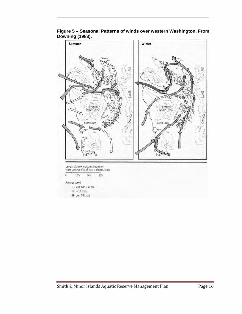
the phytoplankton based food web. During summer upwelling conditions, this source-water originates from the slope region, where it is both high in nutrients and low in oxygen. Once into the Strait, it flows along the bottom, mixing slightly with mid-depth waters, and eventually encountering the island channels and sills south and east of Victoria (VENUS, 2004). Nearshore processes within and adjacent to the reserve appear intact with only a few areas of human modification (Appendix B, Figure 10). The majority of the project area is adjacent to dramatic high bluffs; the beaches below appear to be well-nourished and sustained by intact nearshore processes. A few small portions of the shoreline include low bluff areas with shoreline armoring. Strong tidal currents and wave regime in the waters of Admiralty Inlet and the eastern portion of the Strait of Juan de Fuca drive the littoral drift processes on Smith and Minor Islands and western Whidbey Island. The regions littoral drift appears mostly intact, with possible disruption in the low bluff area characterized by hard shoreline armoring, particularly the area off of Whitecap Lane. The high bluffs of the region serve as feeder bluffs providing a healthy supply of shoreline sediment along the drift sectors.

Smith & Minor Islands Aquatic Reserve Management Plan Page 15
Figure 4 – Regional water masses and subareas of Puget Sound: 1) Northern Puget Sound, 2) Whidbey Basin, 3) Main Basin, 4) Hood Canal, and 5) Southern Puget Sound. From Gustafson, et al. (2000).
Smith & Minor Islands Aquatic Reserve Management Plan Page 16
Figure 5 – Seasonal Patterns of winds over western Washington. From Downing (1983).

Smith & Minor Islands Aquatic Reserve Management Plan Page 17
Habitat Characteristics The habitat characteristics and associated communities in the reserve area are influenced by the interaction of oceanic marine waters with shorelines, intertidal areas, and benthic substratum substantially exposed to wind waves and strong currents. This dynamic physical regime and associated processes, along with a minimal amount of human intervention, supports a high level of biodiversity and species richness and provides the sustenance for productive habitat areas. The extensive aquatic vegetation – eelgrass (Zostera marina) and seagrass (Phyllospadix spp.) beds, voluminous macroalgal beds, including the largest Nereocystis (bull kelp) bed in Washington State, are recognized as essential contributors to the reproductive, foraging, and rearing success of many bird and marine mammal species that frequent the region (Rigg, 1915; Helen Berry, pers. comm. 2010). A range of diverse substrates, including sandy tidal flats, sand and gravel beaches, and high energy gravel and cobble beaches also contribute to high quality essential habitat for numerous species of fish, invertebrates, resident and migratory birds, and marine mammals. In addition, the unique and remote habitat on Smith and Minor Islands supports a sandy isthmus that connects the islands during lower tides, a small lagoon, and the large subtidal flat that sustains the huge bull kelp bed. Coarse gravel and cobble dominant beaches are prevalent along the exposed shoreline of Whidbey Island with scattered boulders promoting stable settling habitat for more sessile fauna and flora. Along some upper intertidal areas, a band of fine pebble (pea gravel) to coarse sand substrate provides the essential habitat for spawning surf smelt. Other substrates, such as hard pan, concrete, and riprap exist in a small number of upper intertidal and backshore areas. The majority of subtidal substrates are moderately diverse with varying amounts of sandy bottoms, mixed sand, gravel and cobble substrates, as well as hard bottom areas, with a minimal amount artificial substrate, such as a few pilings. Sand, silt and clay mixed with organic soils form the substrate components in the scant salt marsh area. A rich and complex community of submerged vegetation persists along the shore of Whidbey Island and in areas around Smith and Minor Islands. Eelgrass and surfgrass extend along the western shoreline of Whidbey Island, sometimes in mixed beds or adjacent to one another (Appendix B, Figure 9). Surfgrass beds also occur in pockets on the north side of Smith and Minor Islands while eelgrass is noted in subtidal videography in patches around the islands. Large brown kelp mixes with prolific red, brown, and green macroalgae forming extensive beds in lower intertidal and shallow subtidal areas. Gaps with finer unconsolidated substrate provide a foothold for patches of seagrass to emerge amongst the profusion of macroalgae. Salt marsh habitat is present along the rim of the small lagoon on Smith Island where the dominant vegetation types include pickleweed (Salicornia virginica) and saltgrass (Distichilus spicata). The narrow backshore berms are subjected to salt spray and infrequent inundation promoting a different plant community that includes dune grass (Leymus mollis), gumweed (Grindellia integrifolia), yarrow (Achillea sp.), and Silver burweed (Ambrosia chamissonis). These plants are also present in small zones along West Beach and scattered along the foot of the bluffs.

Smith & Minor Islands Aquatic Reserve Management Plan Page 18
Fis h and Wild life Res ources As discussed in the preceding section, much of the aquatic lands within the reserve and the associated waters support spawning, rearing, and foraging habitat for numerous fish, migratory and resident bird and marine mammals and marine invertebrate species. Extensive aquatic vegetation, diverse substrates, and intact physical and ecological processes within the upland-marine interface provide for productive habitat areas. Fish Large mixed sand and gravel tidal flats in this area contain productive microalgae and macroalgae providing important habitat for juvenile fish species, for example salmonids and their prey resources (i.e. harpacticoids, copepods, and amphipods). Juvenile chum (Oncorhynchus keta) and chinook salmon (O. tshawytscha) are known to inhabit the nearshore waters of Whidbey Island during spring out-migrations. These are likely Skagit and Samish River-derived stocks. No published information exists on the occurrence of bull trout (Salvelinus confluentus) in the reserve area. However, the area is located in the proposed critical habitat for coastal bull trout. As part of the West Whidbey Nearshore Fish Use Assessment, juvenile salmon were found to use shore zone areas within the reserve from February through August. In 2005 and 2006 juvenile chum and pinks were the most abundant salmonids documented from beach seining surveys. Also, wild juvenile chinooks were documented in the area from May through August, with peak catches in both years in July. Abundances of wild and hatchery chinook were similar in 2005, while there were much fewer hatchery chinook in 2006 (Wait, Buehrans, & Trim, December 2006). The large kelp beds in the proposed reserve provide important habitat for juvenile rockfish, a species covered under DNR’s Aquatic Habitat Conservation Plan. The demersal habitats surrounding the islands and banks also support lingcod, rockfish, halibut, kelp greenling, cabezone, salmon, and large cetaceans. Marine flatfish such as starry flounder (Platichthys stellatus), rock sole (Pleuronectes bilineatus), and sand sole (Psettichthys melanostictus) typically use shallow flats closer to shore, however English sole (Pleuronectes vetulus) also are present, and most of these species may remain nearshore even as adults. Forage fish spawning habitat, particularly for surf smelt (Hypomesus pretiosus), is present along Whidbey Island beaches adjacent to and within the reserve. Approximately 15% of the total reserve shoreline, concentrated near Swantown, is documented surf smelt spawning habitat (Appendix B, Figure 1). These beaches were used regularly by surf smelt during the spawning season for the span of a three year study from 2001 – 2003. (Dan Penttila, pers. comm. 2010). Surf smelt (Hypomesus pretiosus) and Pacific sand lance (Ammodytes hexapterus) use a band of fine pebble to coarse sand substrate in the upper intertidal zone to lay their eggs. Although there is suitable surf smelt spawning substrate along the outer beaches of Whidbey Island, this current swept side is relatively lacking in surf smelt spawning use compared to other similar regimes. “Although this substrate is suitable for surf smelt spawning

Smith & Minor Islands Aquatic Reserve Management Plan Page 19
along the current swept western Whidbey beaches, it is relatively lacking of surf smelt spawn compared to other similar regimes.” Comparatively, it is “a bit exposed and rough for sand lance, and not typical sand lance spawning habitat; they generally need a finer-grained substrate.” (Dan Penttila, pers. comm. 2010). The area is used as a corridor and milling area for herring and sand lance but to no greater degree than anywhere else in the eastern straits region. The habitat along west Whidbey has not been sampled for herring spawn because there are no pre-spawning holding grounds in close vicinity and there is no historical documentation to warrant grappling samples (Kurt Stick, pers. comm. 2010). The relatively high energy regime and beach substrate is not considered suitable habitat for sand lance spawning, although surveys have not been conducted specifically for sand lance in this area (Dan Penttila, pers. comm. 2010). Surf smelt constitute a major portion of the diets of salmon, seabirds, marine mammals, and other fish, as do many of the fish caught in the beach seining project carried-out by the Island County Beach Watchers and the Wild Fish Conservancy. A comprehensive list of fish species observed within the reserve boundaries is located in Appendix A. Birds Smith and Minor Islands and surrounding nearshore and deepwater habitats are important Puget Sound seabird nesting and foraging habitat. The islands are a National Wildlife Refuge established primarily to serve as breeding grounds and winter sanctuary for birds. The combination of soil conditions on the islands and the exposed bluffs along western Whidbey Island provide prime habitat for burrow-nesting birds, such as Pigeon Guillemots. Their isolation from non-native predators and limited human disturbance make the islands one of the most important seabird nesting locations in Washington State. Seabird and shorebird species nesting on Smith Island include: Glaucous-winged Gulls, Double-crested Cormorants, Pigeon Guillemots, Black Oystercatchers, Tufted Puffins, and Rhinoceros Auklets (USFWS, 1989). Smith and Protection Islands are the sole remaining areas in Puget Sound where Tufted Puffins nest and Protection Island is the third largest Rhinoceros Auklet nesting colony in North America (Scott Pearson, pers. comm. 2010). The rich nearshore waters surrounding the islands and banks provide foraging habitat for a large segment of Protection Islands’ Rhinocerous Auklets. Caspian Terns also fish these waters, and in late summer and early fall, Bonaparte’s and Mew Gulls roost and forage in the area. Bald Eagles have a large and increasing presence in the area, including the only ground nesting pair in the state on Minor Island. The presence of spit/berm habitat on the islands also provides unique nesting areas for seabirds. Seasonal DNR priority bird use of the area includes: Harlequin Duck, Marbled Murrelet, Brown Pelican, and Common Loon. Other birds that frequent the waters include Horned and Western Grebes, Long-tailed Ducks, Barrow’s and Common Goldeneyes and Common Murres. (See Appendix B, Figures 4, 5, 7, and 8 for distribution maps).

Smith & Minor Islands Aquatic Reserve Management Plan Page 20
The Whidbey Island shorelands adjacent to the aquatic reserve include Fort Ebey State Park, Joseph Whidbey State Park, and Ebey's Landing National Historical Reserve, which are prime locations on the Pacific Flyway, attracting many migratory species of shorebirds and waterfowl in search of food and shelter. The massive high bluffs and less accessible beaches extending south from West Beach to Fort Ebey State Park also provide exceptional habitat for burrow-nesting birds, as well as a safe refuge for molting seaducks. Large congregations of Harlequin Ducks use the remote nearshore area in the early spring while molting. The beach area is also of particular importance in the spring for migrating Whimbrels and in fall through winter for flocks of Sanderlings (Steve Ellis, pers. comm. 2010). Several of the species known to use this area meet the listing criteria for State Endangered, Threatened, or Sensitive Species including: the Tufted Puffin (Fratercula cirrhata), the Common Loon (Gavia immer), Brandt’s Cormorant (Phalacrocorax penicillatus), Bald Eagle (Haliaeetus leucocephalus), Peregrine Falcon (Falco peregrinus), Great Blue Heron (Ardea herodias), Osprey (Pandion haliaetus), Common Murre (Uria aalge), Western Grebe (Aechmophorus occidentalis), and Marbled Murrelet (Brachyramphus marmoratus). See Appendix A for a comprehensive list of species. Marine Mammals The isolated beaches of Smith and Minor Islands and their adjoining sand bar provide reliable refuge for harbor seals. Harbor seals use Smith and Minor Islands for beach haul-out, breeding, and pupping sites (Kevin Ryan, pers. comm. 2010). These sites are used year round as a resting site and serve as pup rearing sites from mid-June through mid-August. Elephant seals also use Minor Island for haul-out and nursery habitat. During the breeding season, the elephant seal population increases to 30 – 40 (Steve Jeffries, pers. comm. 2009). Stellar sea lions, federally listed as threatened, are known to haul-out on island beaches (Kevin Ryan, pers. comm. 2010) and occasionally California sea lions have been sighted here. The waters around Smith and Minor Islands are used by southern resident orcas, a DNR priority marine species also listed as endangered under the Endangered Species Act. Minke whales and gray whales are commonly sighted in the area, particularly in the spring and summer. During the summer of 2009, gray whales were observed feeding off the western Whidbey shore within the reserve area; not typical gray whale foraging habitat for this region. Other regular marine mammal inhabitants in the area include Dall’s porpoise and less commonly harbor porpoise. The shoreline also provides typical foraging habitat for river otters. The abundant kelp beds sometimes attract the occasional sea otter. Invertebrates Intertidal and subtidal unconsolidated mixed substrates within the reserve support diverse populations of intertidal clam species, geoduck, crabs, and large numbers of infaunal and epibentic invertebrates and macroalgae. Nearshore vegetated habitats also sustain an abundance of associated invertebrate species, such as, crabs, shrimps, other mollusks, mysids, amphipods, and a multitude of small crustaceans. These organisms as well as polychaetes (segmented marine worms), echinoderms (sea stars,

Smith & Minor Islands Aquatic Reserve Management Plan Page 21
urchins), marine gastropods (sea snails), and a myriad of others serve as a vital link in the food chain. Algae and seagrass provide the food supply for these smaller organisms and these “primary consumers” in turn become prey resources for fish and birds, thus supporting the local populations of fish, other birds, and mammals. The epibenthic biotic community in this area is species rich, abundant, and representative of the exposed beaches in the eastern Straits of Juan de Fuca. Some groups of invertebrates documented by the Beach Watchers surveys include polychaetes (worms), echinoderms (sea stars), mollusks (clams, snails), and crustaceans (crab, shrimp). Of these invertebrates, several are harvested commercially, such as Dungeness crab (Cancer magister), and geoducks (Panopea generosa). Non-native Fauna and Flora There has not been a comprehensive survey for non-native species in this area; limited information is available about the distribution of non-native marine species for Washington State’s marine waters. There are several species that are monitored and controlled throughout the inland marine waters of Washington State. Regional programs focus on invasive species such as, Spartina spp., of which there is minimal suitable habitat and no nearby sightings within the Smith & Minor Islands Aquatic Reserve (Washington State Department of Agriculture, 2010). In general, this type of current swept regime does not have suitable habitat for the commonly known and most invasive species. In 2007, Washington Department of Fish and Wildlife (WDFW) listed six species of non-native invasive tunicates for priority and secondary invasive management. (Washington Department of Fish and Wildlife, 2009). Dive groups throughout the Sound are engaged in noting occurrences and removal of some of these species where possible. While the habitat around the reserve is not conducive to invasion by most of these species, one species has been documented on boulders in the lower intertidal zone at Point Partridge (Beach Watchers, 2008). It is unknown if any of these species are present on Smith Island and other similar beaches along western Whidbey Island. (Washington Department of Fish and Wildlife, 2009). Other monitoring efforts have documented the presence of Sargassum muticum (Washington Shorezone Inventory, 2001). Sargassum muticum is considered an invasive brown alga, which competes for space with non-floating kelp and other large brown algae and can have a negative impact on abundance (Britton-Simmons, 2003). While the rigorous currents and wave regime do not support conditions for Sargassum becoming a dominant species in this area it has been documented at Point Partridge and in shorezone areas to the north and could be considered a potential threat. Although generally not considered a nuisance species, another non-native, the manila clam, is found in intertidal areas adjacent to and within the reserve.
Smith & Minor Islands Aquatic Reserve Management Plan Page 22
Conservation Targets The following conservation targets were identified through the designation process. Primary sources of target identification were the original site proposal application, recommendations made by the 2009 Aquatic Reserves Program Technical Advisory Committee, and the Smith & Minor Islands Planning Advisory Committee (Refer to Appendix A for a comprehensive listing of species). A. Unique Ecosystem Characteristics
a) Sandy beaches, spits, and “feeder bluff” shorelines – maintaining these features in an undisturbed condition supports nesting sea birds such as rhinoceros auklets and tufted puffins, as well as forage fish spawning habitat that provides food sources to sea birds, salmon, and marine mammals. b) Undeveloped glacial till islands and sandy bluffs of the nature exhibited within the reserve, the abundance and rarity of nesting seabirds, and the reserve site’s unique landscape position at the juncture of the Strait of Juan de Fuca seem rare among the known network of sites. c) Seagrass and kelp beds – support primary production and detritus based food webs in the vicinity of the reserve. Cryptic invertebrate species and rockfish juveniles depend on eelgrass and kelp for cover. Eelgrass and kelp buffer tidal currents allowing sediments suspended by storm waves to resettle more quickly than on shorelines without kelp or eelgrass. d) Benthic and open water habitats, including areas of high tidal activity - support region-wide biological diversity, and food production for birds, fish and marine mammals within the reserve.
B. Aquatic Vegetation and Habitat
a) Nereocystis kelp (Bull Kelp): Largest bed in Washington State.
b) Pristine benthic habitats support abundant and diverse submerged aquatic vegetation.
c) Kelp and macroalgae beds, seagrass beds and shallow sandy shelf support
fish, bird, and mammalian species forage and rearing areas.
Species: Nereocystis Kelp, Zostera marina, Phyllospadix spp., Desmerestia spp., Red algae, Brown algae, Green algae
C. Bird Populations
a) Pigeon Guillemots, Tufted Puffins, Glaucous-winged Gulls, Black Oystercatchers, and Double-crested Cormorants and Rhinoceros Auklets,
Smith & Minor Islands Aquatic Reserve Management Plan Page 23
who are supported by strong benthic and pelagic habitats, especially while breeding and rearing young.
b) Harlequin Ducks, Marbled Murrelets and various other sea ducks and are
supported over the winter.
Species: Pigeon Guillemots, Tufted Puffins, Rhinoceros Auklets, Marbled Murrelets, Harlequin Duck, Common Loon, Brants, Surf Scoters, Brown Pelican, Bald Eagle, Western Grebes, Horned Grebes, Pelagic Cormorant, Double-crested Cormorant, Red-necked Phalarope, Black Oystercatchers.
D. Marine Mammal Populations
a) Smith and Minor Islands are important seal pupping and haul-out sites due to the lack of predators and human disturbance.
b) Area around Smith and Minor Islands is an important feeding ground for Southern Resident J, K and L Orca Pods.
Species: Harbor seal, elephant seal, Stellar sea lion, Southern resident orcas, gray Whales, minke
E. Fish Populations a) Extensively used by resident rockfish populations (Copper, Quillback,
Brown and Puget Sound rockfish).
b) Area used extensively by juvenile salmonids from spawning rivers outside the region.
Species: Pacific herring, salmon, surf smelt, Pacific sand lance, Pacific cod, Lingcod, rockfish, Rock sole, greenlings, gadids
II. Current Conditions The current ecological condition of the site reflects a low degree of alteration from its natural state and is in overall excellent condition. The unique oceanographic conditions, along with the isolation and protection of Smith and Minor Islands have sustained productive and diverse populations of flora and fauna. There are currently no overwater structures within the reserve boundary along the Whidbey Island shoreline. The majority of the reserve area is adjacent to dramatically high bluff beaches; the beaches below the bluffs are unaffected by human alterations and are in excellent condition. However, farther north and along a low bluff area are three segments of beach with shoreline armoring, resulting in approximately 15% of the shoreline adjacent to the reserve having modifications. Since a large portion of the shoreline is currently protected because of adjacency to existing State and County Parks, little additional disturbance has occurred and nearshore processes appear to be properly functioning. Smith and Minor Islands are among the few remaining

Smith & Minor Islands Aquatic Reserve Management Plan Page 24
undeveloped glacial till islands in Puget Sound, and the surrounding waters harbor the largest floating kelp beds in Puget Sound. Littoral drift processes on Smith and Minor Islands and Whidbey Island within the project area are functionally intact with the possible exception of a low bluff area characterized by shoreline armoring. This small portion of the Whidbey shoreline includes an area characterized by residential structures close to the shoreline. Additionally, there are no waste discharge outfalls within or directly adjacent to the proposed reserve boundary. There are three man-made stormwater outfalls and one natural stormwater outfall adjacent to the reserve boundary on the Whidbey Island Shoreline (People for Puget Sound, 2009). With respect to ecological and physiochemical processes, this site is located in the tidal confluence of three major water bodies: Strait of Juan de Fuca, Admiralty Inlet and Rosario Strait. Strong tidal currents in the waters of Admiralty Inlet support upwelling of nutrient rich water to the surface where it supports phytoplankton blooms and concentration of forage fish. The nearshore environments within the proposed reserve boundaries support extensive eelgrass and kelp beds and the diversity of depths and bottom types throughout the reserve area are thought to also present opportunity for equally diverse subtidal habitats. The reserve also captures large unscathed bathymetric and substrate diversity. Smith Island contains rock, sand and gravel substrates, with varying exposure to currents, resulting in highly diverse flora and fauna (Washington State Department of Natural Resources, 2006). The extensive eelgrass and kelp beds, which are DNR marine priority habitats; the Smith/Minor Island unit contains one of the largest floating kelp beds in the state of Washington (Helen Berry, pers. comm. 2010). These habitats support lingcod, rockfish, halibut, kelp greenling, cabezone, salmon, and large cetaceans (Wayne Palsson, pers. comm. 2000). Kelp beds are an important habitat for juvenile salmon and rockfish, both of which are DNR priority marine species. The Puget Sound Salmon Recovery Plan for Water Resource Inventory Area 6 identifies the shoreline at Whitecap Lane (off of Hastie Lake Road) as a moderate habitat restoration priority for juvenile salmon (Island County Public Health, 2010). This is the low bluff area characterized with residential structures close to the shoreline and hard shoreline armoring discussed earlier. The Island County MRC performed an extensive cleanup of creosote debris along the western shoreline of Whidbey Island in 2006. The area includes sufficient habitat to support healthy populations of marine and terrestrial species that use the region.
III. Potential Future Impacts The Smith & Minor Islands Aquatic Reserve is susceptible to a number of potential future impacts stemming from expanding upland development to increasing recreational and commercial overwater use. While DNR only has the authority to

Smith & Minor Islands Aquatic Reserve Management Plan Page 25
manage state-owned tidelands and bedlands, other potential uses adjacent or near the reserve may have indirect impacts on the reserve and must be identified and acknowledged if a comprehensive management plan is to be developed. Construction of new hard shoreline armoring, marinas, and over water structures adjacent to or within the reserve is an ecological concern. These activities should be avoided in favor of more habitat friendly alternatives. It is difficult to predict other potential future activities that might pose a threat to the site. The fact that the site is relatively isolated from urban shoreline development could make it vulnerable to activities or land uses whose siting criteria prefer more remote sites, such as energy utilities, resorts and marinas, and some types of commercial aquaculture (finfish). Activities within the reserve that could increase risks of major disturbance or entrapment of birds or marine mammals, negatively affect water quality, or food web interactions on state-owned aquatic lands are of major concern. Management actions implemented within the reserve should explore this in detail, in close coordination with tribal representatives. Recreational and/or tribal fishing, crabbing and wildlife watching activities occur within and adjacent to the Smith & Minor Islands Aquatic Reserve. DNR supports those activities, consistent with the reserve’s goals. DNR does not regulate commercial or recreational fisheries, but has authority over activities that require leases on state-owned aquatic lands (bedlands and tidelands), including Geoduck wildstock harvest agreements. Review of the scope of these activities and potential target strategies will be explored during implementation of the management actions. Other potential threats to aquatic resources within the reserve include: future land use, commercial and recreational shellfish harvest and aquaculture, water and sediment quality and hydraulic modification, energy pipeline or transmission line rights of ways, wind energy facilities, oil spills, increased naval activity, increased recreational use and mooring buoys, invasive species, and climate change. Future Land Use Scenarios Some of the potential impacts of increased growth include ground water withdrawal, stormwater runoff, and sewage treatment. The population of Whidbey Island has increased dramatically in recent years. Nearby Oak Harbor had a population growth of 14.9% since 2000 and is projected to continue at this rapid growth rate. The current population of Oak Harbor is approximately 22,744 (2008 estimate). This growth is a potential area of anticipated future impact near the eastern portion of the Smith & Minor Islands Aquatic Reserve. Coupeville, while not an area of anticipated future growth impact, has grown at a rate of 9.6% since 2000 with a population of 1,888 (2008 estimate). The potential for further development along the eastern shore of Whidbey Island is moderate. Most of the Whidbey Island shoreline adjacent to the reserve is not already developed, and is designated as natural, conservancy and rural under the Island County Shoreline Master Program. While this will provide opportunity for limited development, Joseph Whidbey State Park and Fort Ebey State Park provide protection from development for a large portion of the shoreline adjacent to the reserve. Island County is updating its Stormwater Management Plan to
Smith & Minor Islands Aquatic Reserve Management Plan Page 26
accommodate proposed build-out and land use changes. However, the possibility of future outfalls from any unforeseen developments must be acknowledged. While future residential upland development is likely to occur along the Whidbey Island shoreline, buffers and setbacks required by local government development permits should reduce potential loss of riparian vegetation directly adjacent to the reserve. Additionally, construction of any new hard shoreline armoring and overwater structures has the potential to conflict with reserve goals for habitat protection. Partnerships with USFWS, WDFW, State Parks, and Clallam and Jefferson Counties will be needed to ensure adequate protection of natural resources. Education and outreach with adjacent property owners will also be necessary; in addition to partnerships with these agencies, assistance from Beach Watchers, MRCs and other volunteer organizations may be needed. Commercial and Recreational Shellfish Harvest and Aquaculture Harvest of wild geoducks is currently taking place within the reserve on a small scale, and will likely take place in the future. No conflicts with the reserve designation have been identified concerning the harvest of wildstock geoducks. However, commercial aquaculture of finfish and similar practices could lead to species protection conflicts, as birds and other species may be attracted to the farms and get entrapped in predator exclusion devices, or there could be negative water quality impacts. Commercial trawling of finfish has the potential for significant impacts and is currently prohibited. WDFW and Washington’s Treaty Tribe co-manage the state’s fisheries, therefore fisheries management is outside the scope of the Aquatic Reserves Program. Water and Sediment Quality and Hydraulic Modifications Other future uses that may conflict with reserve goals include tidal energy facilities. Proposals have been made to site tidal energy facilities in Admiralty Inlet. These have the potential for significant impacts to species health and diversity due to changes in tidal hydrology. The impacts to aquatic resources causes by various tidal energy designs are, as of yet, unknown. Therefore, tidal energy facilities should be prohibited in or directly adjacent to the reserve. This determination may be revised upon the documentation of measured impacts of the tidal energy generation process. No residual effects of past oil spills or other contamination have been documented in the region and are probably non-existent in the water and sediment column. Increased development could create a scenario for increased contaminant runoff during early fall rains when oil and other contaminant buildup are released from impervious surfaces into overland flow. Energy, Pipeline, or Transmission Line Rights of Ways Future cable or pipeline rights of ways, easements, or leases are a serious threat to the habitats in the Smith & Minor Islands Aquatic Reserve. There is currently one cable easement landing on the tidelands adjacent to Joseph Whidbey State Park operated by Ledcor Industries, Inc. There is also a lease operated by PC Landing Corporation that has a cable crossing in the southwestern portion of the aquatic reserve. The Smith &

Smith & Minor Islands Aquatic Reserve Management Plan Page 27
Minor Islands Aquatic Reserve should not allow new cable, pipeline, or other bedland disturbing uses s that are not consistent with the goals, objectives, and management actions of the aquatic reserve. Wind Energy Facilities Wind energy facilities have the potential for significant adverse impacts to birds and oceanographic currents if anchored in bedlands. Future lease activities within or adjacent to the reserve related to wind energy that could negatively impact the ecological, geomorphic, or oceanographic conditions, reduce native bird populations, or are not consistent with the goals, objectives, management actions, or future conditions described in this management plan should be prohibited. Oil Spill Scenarios Major shipping lanes traversing north/south and from the west operate adjacent to and within the boundary of the reserve (Appendix B, Figure 14). This shipping channel is heavily trafficked by oil tankers destined for Anacortes and Cherry Point. The Coast Guard has necessary procedures and technologies in place to significantly reduce the likelihood of oil spills or minimize spill volume. However, small scale spills have occurred in the past and the possibility exists for future spills. Washington Department of Ecology’s Oil Spill Response Plan established booming strategies to protect sensitive areas throughout the Sound. DNR will prioritize working with oil spill response partners to make sure the Smith & Minor Islands Aquatic Reserve is a preferred spill response target and possible spill response equipment location. Naval Activity Navy Region Northwest facilities and fleets extensively use the area around and possibly within the Smith & Minor Islands Aquatic Reserve. The Naval Air Station also has a flyway over the reserve. The Navy’s operations and maneuvers in the region have not been identified as having negative impacts on the aquatic resources within or adjacent to the reserve. DNR and the Navy should continue to work with and maintain open dialog to ensure the goals and objectives of the reserve continue to be met and, at the same time, do not interfere with matters of national security. Recreational Use and Mooring Buoys According to anecdotal information the reserve area is used for recreational boating, particularly the waters between Point Partridge and Partridge Bank. Due to close proximity to other desirable recreational boating destinations and possible expansion of residential developments and recreational fishing in the vicinity of the island, the potential for increased use and impacts exists. Increased boating traffic increases the likelihood of impacts of litter, and physical and chemical impacts to nearshore environment (including prop scour, chronic lubricant and fuel leakage, and shading of aquatic vegetation) as well as increased damage to submerged aquatic vegetation from anchoring, and gear loss. DNR supports the USFWS’s goal to establish a 200 yd (183 m) buffer surrounding Smith and Minor Islands that will prohibit boating activity in that zone, diminishing

Smith & Minor Islands Aquatic Reserve Management Plan Page 28
the likelihood of impact on and near the island from increased recreational boating activity. Climate Change Scenarios Global climate change is likely to impact the Smith & Minor Islands Aquatic Reserve area if future predictions of sea-level rise and increased storm events and flooding occur. Future sea-level rise due to anthropogenic climate change is expected to increase in the Puget Sound Region, and estimates regarding the northern Puget Sound indicate an annual increase of .04 - .1 in (1 - 2.5 mm) per year. A University of Washington Climate Impacts Group study places 2050 sea-level rise values for Puget Sound at 3.1 in (8 cm), 5.9 in (15 cm), and 21.7 in (55 cm) for low, moderate, and high scenarios respectively. 2100 values are 6.3 in (16 cm), 13.4 in (34 cm), and 50.4 in (128 cm) for low, moderate, and high scenarios respectively (Mote, Petersen, Reeder, Shipman, & Binder, 2008, p. p 10). This rise in sea-level is expected to result in increased coastal erosion, and potential disappearance of the connectivity of islands at low tides, as well as an appreciable reduction of the already diminishing land mass of these exposed islands. Changes in the tidal prism, current regime, and permanent inundation of salt marsh areas and vegetated spit/berm will significantly reduce the available habitat for nesting seabirds, as well as diminishing the availability of suitable haul-out and pupping areas for seals. IV. Archeological, Cultural and Historic
Resources According to the Washington Information System for Architectural and Archaeological Record Data, available on the Department of Architectural and Historical Preservation website, there are several upland sites adjacent to the proposed reserve boundaries; none of these sites are located on state-owned aquatic lands or on the beach. During late historic times, western Whidbey, Smith and Minor Islands and the surrounding area was occupied by two Coast Salish Lushootseed-speaking groups. The territories of the aboriginal Samish and Swinomish Tribes included lands on Whidbey Island and historic shellfish and fishing grounds. Several historically important sites have been identified in the region. However, no historical, archeological or culturally important sites have been identified within the reserve by the Washington Department of Archeology & Historic Preservation. Ebey's Landing National Historical Reserve Ebey's Landing National Historical Reserve, managed by the National Park Service, includes uplands, bluffs and beaches adjacent to the aquatic reserve’s boundary from Fort Ebey State Park to about 1/5 miles north (northern boundary of Ebey is in S24, T33N, R1W). The historical reserve was set aside by Congress in 1978 to preserve and protect a rural community and historic land uses existing when the first European-American settlers landed in the area.

Smith & Minor Islands Aquatic Reserve Management Plan Page 29
The reserve is a non-traditional unit of the National Park System, the first unit of its kind in the system, with most of the land under private ownership. A unit of local government, the Trust Board of Ebey's Landing National Historical Reserve, is charged with management as called for in the legislation creating the Reserve. The Trust Board is a partnership of local, state and federal governments working collaboratively to ensure the historic and natural resources of the reserve are protected for future generations to enjoy and experience. The NPS purchases development rights to key sites including portions of the original Ebey donation land claim. The NPS continues to work cooperatively with Washington State Parks, Island County and the Town of Coupeville for the on-going protection of the historic rural landscape. While most of the land in the Historical Reserve is privately owned there are two state parks within the boundaries of the Historical Reserve, Fort Casey and Fort Ebey state parks. Coupeville is the county seat for Island County government, and serves as a hub for tourist activities as well as holding town and county government offices, the island's hospital, and other special services and businesses. Smith Island Light Station Smith Island Light Station, located on Smith Island, is on both the Washington Historical Register and the National Register of Historic Places, and is owned by the US Coast Guard. The lighthouse was built in 1858 and abandoned in 1957, due to erosion threats. Very little evidence of the light stations presence remains on the island. While these sites will benefit to some extent from designation of the aquatic reserve, Ebey’s Landing is anticipated to benefit the most, as it includes the shorelines and beaches directly adjacent to the aquatic reserve. The aquatic reserve helps ensure that future uses will be compatible with natural and cultural resource protection.
Smith & Minor Islands Aquatic Reserve Management Plan Page 30
4. Management Goals & Objectives The primary focus in managing the Smith & Minor Islands Aquatic Reserve is to protect and restore the region’s natural biological communities, habitats, ecosystems and processes, and the ecological services, uses and values they provide to current and future generations. This section of the plan identifies the desired future conditions of the site and provides goals and objectives to help ensure that these desired conditions can be met. I. Desired Future Conditions
Desired Future Conditions describe the overall target conditions for a landscape and provide guidance for developing management goals and objectives. The following describes the future environmental conditions expected at the Smith & Minor Aquatic Reserve when the management goals and objectives in the plan are achieved. The Smith & Minor Islands Aquatic Reserve Management Plan ensures strong protection of the state-owned aquatic lands in an effort to prevent further habitat degradation. The plan also emphasizes restoration to reduce current habitat degradation and restore natural processes that support a healthy nearshore environment. Shoreline restoration efforts will lead to improved spawning and rearing habitat for important fish species such as salmon, herring, surf smelt and sand lance. Improved ecological conditions also should increase foraging opportunities for resident and migratory birds and waterfowl. Additionally, an emphasis on the removal of ghost nets, traps, and pots will reduce the mortality of species that use the region. Restoration of areas degraded by hard shoreline armoring would be appropriate to help restore shoreline sediment transport processes that create and sustain habitats, including forage fish spawning and juvenile salmon migration corridors. Removal of derelict gear benefits all species that migrate through the site. While the regional nearshore chapter of the Puget Sound Salmon Recovery Plan does not provide any specific project recommendations for restoration projects within the reserve, it does make a general prediction that estuarine restoration will deliver more juvenile salmon to adjacent nearshore areas, in turn supporting species that depend on salmon for food as well as the salmon themselves (Shared Strategy for Puget Sound, 2007). Emphasis also will be placed on building partnerships with adjacent land owners, land managers, and local stakeholder organizations in an effort to address potentially negative effects to the Smith & Minor Islands Aquatic Reserve from conditions of

Smith & Minor Islands Aquatic Reserve Management Plan Page 31
adjacent areas and continued public use. Efforts will focus on reducing water quality impacts to the aquatic reserve and the adjacent nearshore areas. Although the Smith & Minor Islands Aquatic Reserve is established as an environmental and scientific reserve, the accessibility of the site, via state-owned uplands, provides for environmental education opportunities with the local educational community, and such opportunities will be supported and fostered. To achieve these future conditions, the following goals and objectives have been adopted. The objectives are a product of the research, analysis, advisory committee meetings, and public input during the Smith & Minor Islands Aquatic Reserve management planning process. These objectives were developed for the exclusive management of the Smith & Minor Islands Aquatic Reserve. Goal One: Preserve, restore, and enhance the functions and natural processes of aquatic nearshore and subtidal ecosystems of the aquatic reserve and the faunal species that use the ecosystems. Objectives 1.1 Protect natural processes that promote region-wide biological diversity in the
regions marine environments by maintaining the low levels of alterations to the Smith & Minor Islands Aquatic Reserve.
1.2 Rely upon, and avoid interference with, those natural processes that result in the restoration and maintenance of natural conditions, native habitats, and native species diversity.
1.3 Identify areas containing outstanding examples of native biological communities and support any possible restoration efforts when necessary. Protection of these identified areas is a priority of the Smith & Minor Islands Aquatic Reserve.
1.4 Closely monitor public use and DNR activities for effects on natural, cultural, and scenic resources. Where impacts are inconsistent with program goals, change or restrict use/activity. Restore or enhance sites where necessary and when possible.
1.5 Identify partners to work with on facilitating emergency oil-spill response for the reserve area regarding planning, pre-response infrastructure, and funding.
1.6 Give high priority to the removal of harmful human induced disturbances by providing and supporting removal and cleanup efforts.
1.7 Protect unique oceanographic and geomorphic conditions that support conservation targets by planning management activities and future site developments to minimize alterations to documented drift cell, tidal, wind, and wave regimes.

Smith & Minor Islands Aquatic Reserve Management Plan Page 32
1.8 Support activities that preserve, restore, or enhance habitat used by faunal species or contribute to the protection or propagation of sensitive, threatened, or endangered species when appropriate.
Goal Two: Identify, survey, and monitor sensitive habitats, species and natural processes and provide and support opportunities for scientific research. Objectives 2.1 Establish a baseline inventory of current ecological conditions and the aquatic
habitats and species found in the reserve area.
2.2 Explore potential partnerships for water quality monitoring, and develop management actions in cooperation with adjacent landowners and land managers to address and reduce any potential impacts.
2.3 Develop long term monitoring plans to evaluate life characteristic trends of conservation targets and guide future management decisions.
2.4 Establish data collection and recording standards and facilitate availability of collected data in a data repository that can be added to and accessed by various research entities.
2.5 Establish partnerships with research organizations and institutions to facilitate the collection of a broader range of data and to promote research sharing and cooperation.
2.6 Coordinate with research partners to establish a group or panel to review current research and identify research needs within each partner’s organization and the reserve area.
2.7 Support climate change research opportunities pertaining to potential effects to conservation targets or the unique oceanographic and geomorphic conditions that support them.
Goal Three: Support and provide opportunities for outdoor education and interpretive studies. Objectives 3.1 Use interpretive information, such as educational signage, to convey
conservation ethics and stewardship etiquette of the reserve and enhance respect and understanding of the region’s resources and the purpose of protecting them.
3.2 Present allowable and other uses within the context of environmental education.
3.3 Support public

Smith & Minor Islands Aquatic Reserve Management Plan Page 33
Goal Four: Collaborate with other reserve management partners, programs, and management actions to ensure connectivity across the Aquatic Reserve Program. Objectives 4.1 Coordinate environmental education opportunities and partnerships with other
reserves education programs.
4.2 Ensure research and monitoring standards are consistent with other reserve management plans.

Smith & Minor Islands Aquatic Reserve Management Plan Page 34
5. Management Actions The Smith & Minor Islands Aquatic Reserve will be managed for the preservation of natural environmental conditions while encouraging low impact public use opportunities where such opportunities do not adversely affect the resource values the area is intended to protect. The management actions are intended to improve the ecological condition of the reserve and assist in the adaptive management process that occurs after the first 10 years of implementation. Management of marine resources will be conducted in accordance with the management actions identified in this plan. Since negative impacts to sensitive habitats and species within the reserve may also be attributed to activities over which DNR does not have explicit authority or control, DNR will seek cooperation and collaboration from other public and private entities, specifically local governments and citizens, regarding the management actions of the Smith & Minor Islands Aquatic Reserve. DNR will work cooperatively with the recognized Tribes in section 2, WDFW, Island County, and the City of Oak Harbor and others to incorporate relevant ‘best management practices’ into the management of the reserve. This section details the actions that should be carried out over the initial 10 years of reserve designation. The following actions address the goals and objectives identified in section 4. Reserve management actions can be divided into five primary categories:
I. Resource protection, enhancement and restoration II. Monitoring and research activities within the reserve
III. Environmental education
IV. Allowable uses of the reserve
V. Other uses within the reserve
I. Resource Protection, Enhancement, and
Restoration The Smith & Minor Islands Aquatic Reserve management actions are designed to maintain sensitive aquatic resources, plan for existing and future uses of state-owned

Smith & Minor Islands Aquatic Reserve Management Plan Page 35
lands, direct public use, and facilitate stewardship, research, and monitoring. Restoration activities will focus on re-establishing the natural processes and, where management is necessary and feasible, enhancing habitat and ecosystem quality or reversing and mitigating degradation.
The components of resource protection, enhancement, and restoration within the Smith & Minor Islands Aquatic Reserve are developed in the following sections.
A. Protec tion Protection of aquatic resources within the Smith & Minor Islands Aquatic Reserve is primarily achieved by restricting DNR authorizations that may harm, alter the naturally occurring condition, or further degrade the aquatic resources within the reserve. Where opportunities arise, DNR will partner with state and local governments, tribes, non-profit organizations, businesses and adjacent landowners to identify and implement protective practices within the Reserve and adjacent aquatic areas and uplands. When appropriate, DNR will facilitate the development of site-specific habitat protection plans.
Management Actions
1. Focus appropriate DNR partnerships on the placement of important habitat on adjacent aquatic lands into conservation easements when possible. Meets Objectives 1.1, 1.2, 1.3, 1.8
2. Emphasis will be placed on the acquisition of adjacent tidelands and shoreline property through gifts. Meets Objectives 1.1, 1.2, 1.3
3. Work with USFWS to ensure establishment and enforcement of a 200 yd (183 m) public exclusion zone around Smith and Minor Islands. Meets Objectives 1.1, 1.2, 1.3, 1.4, 3.2
4. Allow successional and other natural processes to operate unimpeded. Meets Objectives 1.1, 1.2, 1.3, 1.7
5. Close or restrict public use in critical habitat as required to protect the habitat. Meets Objectives 1.4, 1.8
6. Prioritize protection of the expansive kelp beds off Smith and Minor islands above all other uses. Meets Objectives 1.1, 1.2, 1.3
B. Enhancement DNR will facilitate and encourage the restoration of natural processes and habitats; however if restoration is not currently feasible or if habitat degradation needs to be addressed more quickly, enhancement of habitat and species may be conducted to prevent further degradation. When necessary, enhancement plans will be developed
Smith & Minor Islands Aquatic Reserve Management Plan Page 36
and will include involvement from all relevant parties including state and local governments, tribes, non-profit organizations, businesses and affected landowners.
Management Actions 1. Support emergency enhancement activities that mitigate the effects of oil-
spills. Meets Objectives 1.5, 1.8
2. Work with partners to identify potential enhancement activities that will support the management of the Reserve. Meets Objectives 1.4, 1.6
C. Res tora tion DNR Aquatic Reserves Program will, when necessary, develop restoration plans for specific areas and species in the Smith & Minor Islands Aquatic Reserve. DNR will partner with state and local governments, tribes, non-profit organizations and adjacent landowners, where possible, to assist in the development and guidance of restoration plans. Specific areas where restoration efforts are being considered and/or pursued by DNR follow.
Management Actions
1. Control invasive species populations to avoid habitat damage. Meets Objectives 1.3, 1.4
2. DNR Aquatic Reserves Program staff will evaluate and approve new proposals for restoration projects on state-owned aquatic lands. DNR Aquatic Reserves Program staff will support only those proposals that are consistent with the management of the reserve. Meets Objectives 1.3, 1.4, 1.5
3. DNR will support efforts to restore environments damaged by human-produced disturbances by removing derelict or ghost fishing gear, creosote pilings, derelict vessels, abandoned utilities, or any other human-created products that are damaging the aquatic environment and not promoting the goals and objectives of the reserve. Meets Objectives 1.4, 1.6, 1.8
4. DNR will support efforts to connect management activities with existing restoration projects and plans for the area. Meets Objectives 2.6, 4.2
5. Prioritize restoration projects that support the prosperity of endangered, threatened or sensitive species and habitat. Meets Objectives 1.1, 1.3, 1.4

Smith & Minor Islands Aquatic Reserve Management Plan Page 37
II. Research and Monitoring DNR will seek to partner with local and state governments, tribes, universities, non-profit organizations and the local community to identify and develop research projects within the reserve. All research activities that occur within Smith & Minor Islands Aquatic Reserve must not result in damage to the ecosystem and must meet the goals and objectives of the reserve. Identifying gaps in data collected of species assemblages, habitat distribution, and environmental processes within the Smith & Minor Islands Aquatic Reserve will help managers determine baseline conditions to help inform research at the site. After baseline conditions have been identified, continued monitoring for trends in habitat and species conditions should be conducted. Research can compliment trend monitoring by providing possible answers for why species, habitats, and processes may be declining or improving. The following sections further describe the different components of monitoring and research and identify management actions for each. There are three components to research and monitoring within the aquatic reserve:
A. Identification of data gaps, baseline inventory to fill gaps and establish standards for trend monitoring.
B. Trend monitoring to determine the effectiveness of management activities and document natural variation.
C. Research to better understand observed changes and the interactions between management activities and natural resource conditions.
A. Data Gap Identifica tion and Bas e line Inventory Effective adaptive management of aquatic resources within the Smith & Minor Islands Aquatic Reserve relies on having appropriate data. In order to gauge the success of management actions the current quality of the ecosystem needs to be established in a baseline inventory. Baseline inventory will document current conditions by combining existing data with inventories of resources and ecological processes that are not adequately documented. Through development of the management plan DNR has identified areas where data is not available, current or complete. The following data gaps are where baseline research will be concentrated. Management Actions
1. Identify and characterize harmful human induced disturbances, derelict or ghost commercial and recreational fishing, crabbing, and shrimping gear, derelict vessels, creosote pilings, abandoned utilities, or any other human-created product that is possibly damaging the aquatic environment and not promoting the goals and objectives of the reserve. Meets Objectives 1.6, 2.2
2. Partner with WSU’s Island County Beach Watchers to survey for possible forage fish spawning beach locations.

Smith & Minor Islands Aquatic Reserve Management Plan Page 38
Meets Objectives 2.1, 2.3, 2.4, 2.5
3. Continue supporting WSU’s Island County Beach Watchers and MRC intertidal sampling and eelgrass mapping efforts. Meets Objectives 2.1, 2.3, 2.5,
4. Collaborate with local, state, federal, and tribal governments, and local non-profits to inventory what data exists for the region and support a collective data repository. Meets Objectives 2.1, 2.4, 2.5, 2.6
5. Coordinate with private, governmental, and tribal partners, to continually identify data gaps and organize inventory efforts, data collection standards. Meets Objectives 2.4, 2.6
6. Identify native and sensitive habitat to prioritize inventory efforts. Meets Objectives 1.3, 2.1
7. Support efforts to identify valuable resources previously unknown to the region. Meets Objectives 2.1, 2.3, 2.6, 2.7
8. Establish a dataset cataloging current shoreline alterations and the condition of the shoreline on a drift cell scale, which will require data outside the reserve boundary. Meets Objectives 2.3
B. Trend Monitoring After baseline conditions have been identified, trend monitoring will be implemented to identify ecological trends that will be used to assess whether management actions attain or exceed the goals identified in this plan. Monitoring needs have been identified by the USFWS as a need to understand and sustain healthy populations of refuge wildlife and habitats, especially for seabirds. There is great potential for monitoring partnerships between DNR, refuge and sanctuary managers, and state parks that will provide information that can determine the need for alterations in management strategies over time. DNR will make building partnerships with local, state, and federal governments, tribes, local non-profits and business a priority to conducting trend monitoring. DNR will also support any opportunities that arise for citizen science. Current and future trend analysis data that will help guide and inform management of the aquatic reserve follows. Management Actions
1. Identify and monitor activities that have the potential for disturbing nesting sea birds and mammals. Meets Objectives 2.1, 2.3

Smith & Minor Islands Aquatic Reserve Management Plan Page 39
2. Monitor the effects of climate change (sea-level rise, ocean acidification, seasonal changes in salinity) on the aquatic resources within the reserve Meets Objectives 2.7
3. Conduct forage fish spawning surveys in partnership with WDFW and WSU Beach Watchers. Meets Objectives 2.1, 2.4, 2.5
4. Support and partner on monitoring programs in support of the reserve’s goals and objectives. Meets Objectives 2.6
5. Monitor the effects of shoreline armoring on the function and integrity of western Whidbey Island drift cells. Meets Objectives 1.7, 2.1
6. Focus monitoring efforts on the expansive native Nereocystis kelp beds west of Smith and Minor Islands. Meets Objectives 2.1, 2.4, 2.5
C. Res earch DNR will seek to partner with local and state governments, tribes, universities, non-profit organizations and the local community to identify and develop research projects within the reserve. All research activities that occur within Smith & Minor Islands Aquatic Reserve must not result in damage to the ecosystem and must be consistent with the goals and objectives of the reserve management plan. WDFW is conducting research on burrowing nesting seabirds at both Protection Island and Smith Islands that is funded by Puget Sound Ambient Monitoring Program (PSAMP) and Seadoc Society. USFWS have conducted long term research on seabirds here as well. Additional management actions may include: Management Actions
1. Work with anyone interested in proposing research in support of the reserve’s goals and objectives. Meets Objectives 2.1, 2.5
2. Support and partner with WSU’s Island County Beach Watchers intertidal sampling and data collection efforts. Meets Objectives 2.3, 2.4, 2.5
3. Ensure the scope of research and studies is appropriate for comprehensive management of the Smith & Minor Islands Aquatic Reserve. Meets Objectives 2.3, 2.5, 2.6

Smith & Minor Islands Aquatic Reserve Management Plan Page 40
4. Support research parameters characterized in a context that contribute to and are appropriate for between-site comparisons across the network of aquatic reserves and marine protected areas throughout Puget Sound. Meets Objectives 2.5, 2.6
5. Research opportunities exist within the reserve for studying oceanographic influences that affect the larger Salish Sea which is possible because this aquatic reserve is located at the confluence of three major waterways: Strait of Juan de Fuca, Admiralty Inlet, and Rosario Strait. Meets Objectives 2.7
6. Prioritize research proposals that focus on threatened or endangered species and habitat. Meets Objectives 1.1, 2.1, 2.3
7. Research the effects of the recreational harvest of kelp and other macro- algae. This could lead to increased education and enforcement of existing laws pertaining to seaweed collection. Meets Objectives 1.1, 1.4, 2.1, 2.3, 3.2
III. Environmental Education The Smith & Minor Islands Aquatic Reserve is not designated as an educational aquatic reserve; however, it is identified that existing partnerships and proximity to other protected environments presents a unique opportunity to support environmental education as a secondary objective. Environmental education will be developed, as opportunities arise, to enhance public awareness and care for the outstanding historic, cultural, geologic, ecological, and aesthetic values of the Smith and Minor Islands and western Whidbey Island region. When possible, interpretive materials that include tribal culture and history will be developed in consultation with local tribes. Management Actions
1. Support signage efforts, and provide funding when possible, at Joseph Whidbey and Fort Ebey State Park, public access points, and other areas, to convey conservation ethics and stewardship etiquette of the reserve. Meets Objectives 3.1, 3.2
2. Work cooperatively with local tribes, other natural resource agencies and/or private institutions to develop appropriate interpretive materials and activities. Meets Objectives 3.1
3. Support, and when possible partner with efforts of local environmental education stewards such as Service, Education, Adventure and Salish Sea Expeditions. Meets Objectives 3.1
Smith & Minor Islands Aquatic Reserve Management Plan Page 41
IV. Allowable Uses The only DNR authorizations currently in the Smith & Minor Islands Aquatic Reserve are tidelands management agreements with Washington State Parks and the Ledcor Industries, Inc. lease. These current authorized uses on state-owned aquatic lands will continue as the uses serve the goals and objectives and are consistent with the reserves management actions previously listed. Following are the only uses of state-owned aquatic lands that DNR will consider in the Smith & Minor Islands Aquatic Reserve: A. Res ource Pro tec tion , Enhancement, and Res tora tion Management Actions
1. Allow actions within the aquatic reserve if the proposed action supports the reserve management plan’s goals and objectives that protect, enhance, and restore the Smith & Minor Islands Aquatic Reserve will be allowed. Meets Objectives 1.1, 1.2, 1.3, 1.4, 1.5, 2.2, 2.6, 3.1
B. Res earch and Monitoring Management Actions
1. Work with proponents of research and monitoring programs within the aquatic reserve to ensure consistency with the reserve’s goals and objectives. Meets Objectives 1.1, 1.2, 1.3, 1.4, 2.2, 2.5, 2.7, 4.1, 4.2
C. Environmenta l Educa tion & Public Acces s Management Actions
1. DNR will partner with various entities to support environmental education opportunities associated with the Smith & Minor Islands Aquatic Reserve and to ensure and encourage sustainable public access to the reserve. Meets Objectives 3.1, 3.2, 4.1
D. Adjacent Aqua tic lands and Uplands Management Actions
1. Improve communication between other local, state, and federal agencies on permitting applications for activities in and adjacent to the reserve. Meets Objectives 1.1, 1.2, 1.4, 1.7, 2.5, 2.6, 3.1, 3.2, 4.1, 4.2
E. Exis ting Us e Authoriza tions The following existing leases within the Smith & Minor Islands Aquatic Reserve are consistent with the goals and objectives of the reserve. However, upon renewal of these leases, DNR will work with the lessee to ensure that continued implementation will serve the purpose of the reserve, the goals and objectives, and management actions described in chapters 2, 4, and 5 respectively and support the desired future conditions.

Smith & Minor Islands Aquatic Reserve Management Plan Page 42
1. Washington State Parks and Recreation Commission holds a tideland
withdrawal lease for lands adjacent to Joseph Whidbey State Park, Lease number: 20-010594
2. Washington State Parks and Recreation Commission holds a cooperative
management lease for lands adjacent to Fort Ebey State Park, Lease number: 20-011334
3. Ledcor Industries, Inc. holds an aquatic lands easement for a fiber optic
system from Pier 66 in Seattle to a landing on western Whidbey Island, just south of Joseph Whidbey State Park, and continuing to Victoria, B.C., Canada (Appendix B, Figure 13), Lease number: 51-070463. Contact DNR for more information.
F. Commerc ia l and Recrea tiona l Fis h ing DNR does not manage commercial or recreational fisheries except for the commercial wildstock geoduck fishery. Commercial and recreational fisheries within the reserve will continue to be managed by WDFW, responsible tribal governments, and DNR shellfish section staff (wildstock geoduck, recreational and tribal shellfish only).
V. Other Uses The Smith & Minor Islands Aquatic Reserve acknowledges that there are potential future authorizations that planners cannot foresee. This section address specific uses that should be monitored more directly and uses that have not been proposed yet. Regardless, all newly proposed uses must meet the management actions of the Smith & Minor Islands Aquatic Reserve Management Plan. The Smith & Minor Islands Aquatic Reserve should not allow new cable, pipeline, or other bedland disturbing uses that are not consistent with the management of the aquatic reserve. Tidal energy facilities should be prohibited in or directly adjacent to the reserve. This determination may be revised upon the documentation of measured impacts of the tidal energy generation process. Future lease activities within or adjacent to the reserve related to wind energy that could negatively impact the ecological, geomorphic, or oceanographic conditions, reduce native bird populations, or are not consistent with the goals, objectives, management actions, or future conditions described in this management plan should be prohibited Management Actions
1. New uses, unforeseen or not listed in the management plan, authorized on state-owned aquatic lands within the reserve must implement actions that

Smith & Minor Islands Aquatic Reserve Management Plan Page 43
primarily serve the purpose of the reserve, the goals and objectives, and management actions described in chapters 2, 4, and 5 respectively and support the desired future conditions. Meets Objectives 1.1, 1.2, 1.3, 1.4, 1.7, 2.6, 2.7, 3.1, 3.2, 4.2
2. Project proponents for new uses must clearly demonstrate and document consistency with the purpose of the reserve, the goals and objectives, and the management actions described in chapters 2, 4, and 5 respectively. Aquatic Reserves Program staff, in consultation with region staff will make determinations about the consistency of any proposed uses and will work with proponents when possible. Meets All Objectives
Smith & Minor Islands Aquatic Reserve Management Plan Page 44
6. Implementation Guidance The successful management of the Smith & Minor Islands Aquatic Reserve will require coordination and collaboration with public and private entities as well as local, state, federal, and tribal government, and non-government organizations. Review and evaluation of sound scientific and management information should guide the future development, restoration and protection decisions. To increase collaboration in decision making, DNR will consider forming a permanent Implementation Committee whose purpose would be to guide the implementation of this plan and coordinate decisions that will affect the long-term health of resources and ecosystems of the Smith & Minor Islands Aquatic Reserve. This section sets up the methods and time frames for the effective cooperative implementation and successful execution of the management actions of the Smith & Minor Islands Aquatic Reserves Management Plan. This includes the recruitment qualifications for potential members of the Smith & Minor Islands Aquatic Reserve Implementation Committee, hereafter referred to at the Implementation Committee, meeting timeframes, and committee decisions. I. Smith & Minor Islands Aquatic Reserve
Implementation Committee The Implementation Committee is charged with the cooperative implementation of the Smith & Minor Islands Aquatic Reserve Management Plan. This includes, but is not limited to the review of proposals for restoration, enhancement, research, monitoring, within the aquatic reserve; evaluation and recommendation of restoration, research, monitoring, and educational needs; identification of partnerships for management action implementation; evaluation and consideration of potential sources of funding for management action implementation. The Implementation Committee should meet every four months for a total of three times per year. The Implementation Committee will be selected by DNR by means of formal invitation letters and should consist of no more than 15 members from the following:
- Island County MRC - USFWS, San Juan Islands National Wildlife Refuge - Local citizen science organization - Local environmental education organization - Island County government - Tribal representation - Puget Sound Partnership

Smith & Minor Islands Aquatic Reserve Management Plan Page 45
- Shoreline landowner - WSP
Proposal Evaluation Criteria Each restoration, enhancement, research, or monitoring proposal presented to DNR pertaining to the aquatic lands within the Smith & Minor Islands Aquatic Reserve should be evaluated by the Implementation Committee. The Implementation Committee will evaluate how well each proposal meets the Smith & Minor Islands Aquatic Reserve Management Plan goals, objectives, and management actions discussed in sections 4 and 5. Each proposal should adhere to the proposal guidelines as described in management actions section 5-V-1 and 5-V-2. In addition to reviewing and evaluating proposals, the Implementation Committee should discuss the merits of different proposals, including, if appropriate, a statement of why a proposal should not be considered for acceptance.
Committee Decisions While management authority of the Smith & Minor Islands Aquatic Reserve remains with DNR; DNR will work with the Implementation Committee to develop informed recommendations pertaining to the management of the Smith & Minor Islands Aquatic Reserve.

Smith & Minor Islands Aquatic Reserve Management Plan Page 46
7. Glossary Adaptive Management: Refers to a process in which policy decisions are
implemented within a framework of scientifically driven experiments to test predictions and assumptions inherent in management planning. Analysis of results help managers determine whether current management should continue as is or whether it should be modified to achieve desired conditions.
Amphipod: Any of a large order of small, usually aquatic crustaceans with a laterally compressed body (for example, beach fleas).
Anadromous: Migratory fishes that spend most of their lives in the sea and migrate to freshwater to breed.
Aquaculture: The culture and/or farming of food fish, shellfish, and other aquatic plants and animals in fresh water, brackish water or salt water areas. Aquaculture practices may include but are not limited to hatching, seeding or planting, cultivating, feeding, raising, harvesting of planted crops or of natural crops so as to maintain an optimum yield, and processing of aquatic plants or animals.
Aquatic Lands: For the purposes of this publication, all state-owned tidelands and the bedlands of marine waters. Furthermore, aquatic lands mean all state-owned tidelands, shorelands, harbor areas, and the beds of navigable waters (RCW 79.105.060(1)). Aquatic lands are part of the public lands of the state of Washington and include many public places, waterways, bar islands, avulsively abandoned beds and channels of navigable bodies of water, managed by the department of natural resources directly, or indirectly through management agreements with other governmental entities.
Aquatic Reserves Program: The Aquatic Reserves Program is part of DNR’s efforts to promote preservation, restoration, and enhancement of state-owned aquatic lands that provide benefits to the health of native aquatic habitat and species and other resources in the state of Washington. DNR is to establish Aquatic Reserves to protect important native aquatic ecosystems on selected state-owned aquatic lands throughout the state. These are to be aquatic lands of special educational or scientific interest, or lands of special environmental importance (WAC 332-30-151).
Authorization instrument: A lease, material purchase, easement, permit, or other document authorizing use of state-owned aquatic lands and/or materials.
Avulsion: A sudden and perceptible change in the shoreline of a body of water. Generally no change in boundary lines occurs.

Smith & Minor Islands Aquatic Reserve Management Plan Page 47
Beach: The zone of unconsolidated material that extends landward from the low water line to the place where there is marked change in material or physiographic form, or to the line of permanent vegetation (usually the effective limit of storm waves). The seaward limit of a beach is the extreme low water line. A beach includes a foreshore and a backshore.
Bedlands or beds of navigable waters: For the purposes of this publication, those submerged lands lying waterward of the line of extreme low tide in navigable tidal waters.
Benthic zone: The benthic zone is the lowest level of a body of water, such as in an ocean or a lake. It is inhabited by organisms that live in close relationship with (if not physically attached to) the ground, called benthos or benthic organisms.
Benthic: Refers to organisms associated with the bottom of the sea, lake, or river.
Biological Diversity or biodiversity: The variety of life and its processes, including the variety of living organisms, the genetic differences among them, and the communities and ecosystems in which they occur. The System’s focus is on indigenous species, biotic communities, and ecological processes (“Regional biological diversity” is protected when habitat is provided to species that are becoming locally rare due to loss of habitat).
Biotoxin (marine): Marine biotoxins are poisons caused by microscopic toxin-producing algae (a type of phytoplankton) that naturally occur in marine waters, normally in amounts too small to be harmful. However, a combination of warm temperatures, sunlight, and nutrient-rich waters can cause rapid plankton reproduction, or "blooms."
Bivalve: Common term for pelecypods, members of the Mollusca in which the hard parts are composed of 2 sections fitting together to enclose a space that contains the soft part of the organism.
Bluff: An unvegetated high bank composed largely of unconsolidated deposits with a near-vertical face overlooking a body of water.
Cliff: A high, very steep to perpendicular or overhanging face of rock rising above the shore.
Coastal zone: The sea-land fringe area bordering the shoreline where the coastal waters and adjacent lands exert a measurable influence on each other.
Commerce: The exchange or buying and selling of goods and services. As it applies to aquatic land, commerce usually involves transport and a land/water interface.
Compatible use: A wildlife-dependent recreational or commercial use or any other use of a reserve that, in the sound professional judgment of DNR, will not materially interfere with or detract from the fulfillment of the goals and objectives or the purpose of the reserve. A compatibility determination, completed by the use proponent, supports the selection of compatible uses and identifies stipulations or limits necessary to ensure compatibility.
Smith & Minor Islands Aquatic Reserve Management Plan Page 48
Critical habitat: Those areas necessary for the survival of sensitive, threatened, and endangered species, as designated under the Federal Endangered Species Act and Washington State Forest Practices Rules.
Cultural resources: Archeological and historic sites and artifacts, whether previously recorded or still unrecognized, as administered by Department of Archaeology and Historic Preservation and protected under Title 27 of the Revised Code of Washington.
Demersal: Organisms living at or near the bottom of a sea or lake but having the capacity for active swimming.
Department of Archaeology and Historic Preservation: The state agency established to document and protect cultural resources.
Disturbance: Significant alteration of habitat structure or composition. May be natural (e.g. fire) or human-caused events (e.g. aircraft overflight).
Dredging: The deepening of a river channel, harbor, or other aquatic land by excavating bottom material for recreational, commercial, or environmental purposes.
Ecosystem Management: Management of natural resources using system-wide concepts to ensure that all plants and animals in ecosystems are maintained at viable levels in native habitats and basic ecosystem processes are perpetuated indefinitely.
Ecosystem: A dynamic and interrelating ecological community consisting of all the living and non-living components of the physical environment.
Educational reserves: Accessible areas of aquatic lands typical of selected habitat types which are suitable for educational projects.
Endangered Species (Federal): A plant or animal species listed under the Endangered Species Act that is in danger of extinction throughout all or a significant portion of its range.
Endangered Species (State): A plant or animal species in danger of becoming extinct or extirpated in Washington state within the near future if factors contributing to its decline continue. Populations of these species are at critically low levels or their habitats have been degraded or depleted to a significant degree.
Enhance site conditions: To intentionally re-create elements that existed on site before disturbance, or introduce new functions or characteristics to a site.
Environmental reserves: Areas of environmental importance, sites established for the continuance of environmental baseline monitoring, and/or areas of historical, geological or biological interest requiring special protective management.
Epibenthic: Pertaining to the environment and conditions of organisms living near the water bottom.
Extreme low tide: The line as estimated by the federal government below which it might reasonably be expected that the tide would not ebb. Also considered to be the lowest recorded tidal event over the National Tidal Datum Epoch.

Smith & Minor Islands Aquatic Reserve Management Plan Page 49
First class tidelands: The shores of navigable tidal waters belonging to the state lying within or in front of the corporate limits of any city, or within one mile thereof upon either side and between the line of ordinary high tide and the inner harbor line; and within two miles of the corporate limits on either side and between the line of ordinary high tide and the line of extreme low tide (RCW 79.105.060(4)). In general, the line of ordinary high tide is the landward boundary. The line of extreme low tide, or the inner harbor line where established, is the waterward boundary. To determine if the tidelands are within two miles of the corporate limits of a city, the distance is measured along the shoreline from the intersection of the corporate limit with the shoreline.
Gastropod: Any of a large class of mollusks, usually with a univalve shell or no shell and a distinct head bearing sensory organs, such as snails and slugs.
Gill Net: A type of fishing net utilized by commercial, tribal, and occasionally recreational fishing operations. These nets are the center of much controversy due to the high incidence of by-catch associated with their use.
Goal: Descriptive, open-ended, and often broad statements of desired future conditions that conveys a purpose but does not define measurable units.
Governmental entity: Means the federal government, the state, county, city, port district, or other municipal corporations or political subdivision thereof.
Habitat Restoration: Management emphasis designed to move ecosystems to desired conditions and processes, and/or to healthy ecosystems.
Habitat: The components of the ecosystem upon which a plant or animal species relies upon for some stage in its life cycle.
Highly Sensitive Areas: Areas of land and/or water containing features such as fragile soils and vegetation (grassy balds, wetlands), cultural deposits, and habitat for sensitive, threatened, and endangered species, as well as other areas where special management attention is needed to ensure that the legislative mandate to protect such resources is being met.
Intertidal: The intertidal zone is also known as the foreshore and is that area exposed to the air at low tide and submerged at high tide, for example, the area between tide marks. This area can include many different types of habitats, including steep rocky cliffs, sandy beaches or vast mudflats.
Inventory: Both a compilation of existing data on human uses, and the biology and geology of aquatic lands as well as the gathering of new information on aquatic lands through field and laboratory analysis. Such data is commonly presented in map form such as the Washington Coastal Atlas.
Island: A body of land entirely and customarily surrounded by water. Land in navigable waters which is only surrounded by water in times of high water, is not an island within the rule that the state takes title to newly formed islands in navigable waters.
Littoral zone: Also called the foreshore, or intertidal zone, and is the section of the coast that is periodically covered by high tides and exposed during low tides.

Smith & Minor Islands Aquatic Reserve Management Plan Page 50
Low-impact public use: Those "public recreation uses and improvements that do not adversely affect the resource values, are appropriate to the maintenance of the site in a relatively unmodified natural setting, and do not detract from long-term (natural) processes." (RCW 79.71.030)
Maintain site conditions: To protect natural site characteristics and ecosystem processes, such as wildlife habitat, soil conservation and succession of native plant communities.
Management Actions: Are derived from both Goals, and more so, specific objectives. A management action is a concise target statement of what will be achieved, how much will be achieved, when and where it will be achieved, and who is responsible for the work. Management Actions should be attainable and time-specific and should be stated quantitatively to the extent possible. If objectives cannot be stated quantitatively, they may be stated qualitatively.
Mean High Water (MHW): The average height of all the high tidal events reached during the year over a National Tidal Datum Epoch.
Mean Higher High Water (MHHW): The average of the highest high water events of each tidal day observed over the National Tidal Datum Epoch.
Mean Low Water: The average of all the low water events observed over the National Tidal Datum Epoch.
Mean Lower Low Water (MLLW): The average of the lowest low water events of each tidal day observed over the National Tidal Datum Epoch.
Migration: The seasonal movement from one area to another and back.
Mitigate: To minimize or compensate for potential adverse environmental impacts.
Monitor: The process of collecting and analyzing data to track changes of selected parameters overtime. A baseline is established and periodic measurements are taken to determine the extent and rate of change over time. Topics include: Beneficial and negative impacts of stewardship activities, natural events and public use.
Moorage facility: A marina, open water moorage and anchorage area, pier, dock, mooring buoy, or any other similar fixed moorage site.
Mysids: A group of crustaceans, also known as opossum shrimps, that feed upon small zooplankton.
Native Species: Species that normally live and thrive in a particular ecosystem.
Natural landscape elements: The natural watercourses, topography, hydrology and vegetation which comprise a particular site.
Natural processes: Phenomena that shape the landscape's appearance and habitat potential. At Smith & Minor Islands Aquatic Reserve, natural processes include: littoral drift processes fed by cliff and bluff erosion, relatively free movement of wildlife among a dynamic mosaic of the area’s terrestrial and marine habitats, and more.

Smith & Minor Islands Aquatic Reserve Management Plan Page 51
Nematodes: Non-segmented roundworms of the phylum Nematoda. They range widely in size and can be free-living or parasitic.
Neritic: Pertaining to the marine zone between low tides and the edge of the continental shelf, a depth of roughly 200 m. A neritic environment supports marine organisms, also described as neritic, that are capable of surviving in shallow water with moderate exposure to sunlight.
Non-point source discharge: Nonpoint source pollution generally results from land runoff, precipitation, atmospheric deposition, drainage, seepage, or hydrologic modification. Technically, the term "nonpoint source" is defined to mean any source of water pollution that does not meet the legal definition of "point source" in section 502(14) of the Clean Water Act (see definition of point source).
Objective: Objectives are derived from goals and provide the basis for determining management strategies. An objective is a target statement of what future conditions will be achieved. For the purposes of this document, objectives should be attainable and stated qualitatively.
Open moorage: Moorage slips and mooring floats that have completely open sides and tops.
Open water moorage and anchorage areas: Areas of state-owned aquatic lands leased for moorage and anchorage that do not abut uplands and do not include a built connection to the uplands. May contain mooring buoys, floating moorage docks, other moorage facilities not connected to the shoreline or anchorage areas in accordance with WAC 332-30-139(5).
Ordinary high tide: The same as mean high tide or the average height of high tide. In Puget Sound, the mean high tide line varies from 10 to 13 ft (3 to 4 m) above the mean lower low water datum (0.0).
Ordinary high water: The line of permanent upland vegetation along the shores of non-tidal navigable waters. In the absence of vegetation, it is the line of mean higher high water.
Pelagic zone: The pelagic zone is the part of the open sea or ocean and does not include the seafloor.
Percent slope: The direct ratio (multiplied by 100) between the vertical and the horizontal distance for a given slope; e.g., a 3-foot (1 m) rise in a 10-foot (3 m) horizontal distance would be a 30 percent slope.
Photic zone: The photic zone or euphotic zone is the depth of the water whether in a lake or an ocean that is exposed to sufficient sunlight for photosynthesis to occur. The depth of the euphotic zone can be greatly affected by seasonal turbidity.
Pinniped: A suborder of carnivores that are marine mammals, have flippers, and eat mostly fish and marine invertebrates (e.g., sea lions, seals).
Point source discharge: The term "point source" means any discernible, confined and discrete conveyance, including but not limited to any pipe, ditch, channel,

Smith & Minor Islands Aquatic Reserve Management Plan Page 52
tunnel, conduit, well, discrete fissure, container, rolling stock, concentrated animal feeding operation, or vessel or other floating craft, from which pollutants are or may be discharged. This term does not include agricultural storm water discharges and return flows from irrigated agriculture (taken from section 502(14) of the Clean Water Act).
Polychaetes: Any of a class (Polychaeta) of chiefly marine annelid worms (such as clamworms), usually with paired segmental appendages, separate sexes, and a free-swimming trochophore larva.
Preferred Alternative: This is the alternative determined [by the decision maker] to best achieve the reserves purpose, vision, and goals, addresses the significant issues, and is consistent with principles of sound aquatic land management.
Priority Species: Fish and wildlife species that the WDFW believe require protective measures and/or management guidelines to ensure their perpetuation. Priority species include the following: (1) State-listed and candidate species; (2) species or groups of animals susceptible to significant population declines within a specific area or statewide by virtue of their inclination to aggregate (e.g., seabird colonies); and (3) species of recreation, commercial, and/or tribal importance.
Public benefit: Means that all of the citizens of the state may derive a direct benefit from departmental actions in the form of environmental protection; energy and mineral production; utilization of renewable resources; promotion of navigation and commerce by fostering water-dependent uses; and encouraging direct public use and access; and generating revenue in a manner consistent with RCW 79.105.030.
Public lands: Lands belonging to or held in trust by the state, which are not devoted to or reserved for a particular use by law, and include state lands, tidelands, shorelands and harbor areas as herein defined, and the beds of navigable waters belonging to the state (RCW 79.02.010).
Public tidelands: Tidelands belonging to and held in public trust by the state for the citizens of the state, which are not devoted to or reserved for a particular use by law.
Public trust: Certain state-owned tidelands, shorelands and all beds of navigable waters are held in trust by the state for all citizens with each citizen having an equal and undivided interest in the land. The department has the responsibility to manage these lands in the best interest of the general public.
Public use beach: A state-owned beach available for free public use but which may be leased for other compatible uses.
Public use: To be made available daily to the general public on a first-come, first-served basis, and may not be leased to private parties on any more than a day use basis.
Public: Individuals, organizations, and groups; officials of Federal, State, and local government agencies; Indian tribes; and foreign nations. It may include anyone outside the core planning team. It includes those who may or may not

Smith & Minor Islands Aquatic Reserve Management Plan Page 53
have indicated an interest in reserve issues and those who do or do not realize that DNR decisions may affect them.
Rapid shoreline inventory: A survey of a defined section of shoreline detailing a set of physical and biological data that provides indicators of beach health and a better understanding of shoreline habitat and how it functions.
Restore site conditions: To recover natural features and processes that existed on site prior to disturbance.
Riparian: Relating to or living or located on the bank of a natural water course, such as a stream, lake or tidewater.
Runoff: That part of the precipitation from rain, snowmelt or irrigation that is not absorbed into the ground, instead often flowing over impervious surfaces, or directly into streams and other surface waters or land depressions.
Saturated: A condition in which the interstices of a material are filled with a liquid, usually water.
Scientific reserves: Sites set aside for scientific research projects and/or areas of unusually rich plant and animal communities suitable for continuing scientific observation.
Seabird: A group of birds that obtain at least some food from the ocean by traveling some distance over its surface. They also typically breed on islands and along coastal areas. Seabirds include gulls, alcids, pelicans, albatrosses, storm-petrels, and cormorants, among others.
Second class tidelands: The shores of navigable tidal waters belonging to the state, lying outside of and more than two miles from the corporate limits of any city and between the line of ordinary high tide and the line of extreme low tide (RCW 79.105.060(18)). In general, the line of ordinary high tide is the landward boundary. The line of extreme low tide is the waterward boundary. To determine if the tidelands are more than two miles from the corporate limits of a city, the distance is measured along the shoreline from the intersection of the corporate limit with the shoreline.
Sensitive, threatened, and endangered species: Plants and animals protected under the federal Endangered Species Act or state designation, with the species level of risk from lower to higher.
Shore: That space of land which is alternately covered and left dry by the rising and falling of the water level of a lake, river or tidal area.
Shoreline: The intersection of a specified plane of water with beach; it migrates with changes of the tide.
State Candidate Species: Defined in WDFW Policy M-6001 to include fish and wildlife species that the Department will review for possible listing as State Endangered, Threatened, or Sensitive. A species will be considered for designation as a State Candidate if sufficient evidence suggests that its status may meet the listing criteria defined for State Endangered, Threatened, or Sensitive.

Smith & Minor Islands Aquatic Reserve Management Plan Page 54
State Endangered Species: Defined in WAC 232-12-297, Section 2.4, to include "any wildlife species native to the state of Washington that is seriously threatened with extinction throughout all or a significant portion of its range within the state."
State Environmental Policy Act (SEPA): The state law that guides a public environmental review process to evaluate potential impacts of a proposed action or plan on the site or area.
State Sensitive Species: Defined in WAC 232-12-297, Section 2.6, to include "any wildlife species native to the state of Washington that is vulnerable or declining and is likely to become endangered or threatened throughout a significant portion of its range within the state without cooperative management or removal of threats."
State Threatened Species: Defined in WAC 232-12-297, Section 2.5, to include "any wildlife species native to the state of Washington that is likely to become an endangered species within the foreseeable future throughout a significant portion of its range within the state without cooperative management or removal of threats."
State-owned aquatic lands: Those aquatic lands and waterways administered by the department of natural resources or managed under department agreement by a port district. State-owned aquatic lands does not include aquatic lands owned in fee by, or withdrawn for the use of, state agencies other than the department of natural resources (RCW 79.105.060(20)).
Strategy: A specific action, tool, or technique or combination of actions, tools, and techniques used to meet unit objectives
Subtidal zone: Also called the sublittoral zone of the coast. The subtidal zone (below low water) is a band that is affected only during the negative tides which occur periodically throughout the year
Succession: The natural changes in vegetation and animal life that occur as a plant community recovers from disturbance and proceeds to climax. In forested sites, colonizing plants inhabit bare ground, longer-lived shrubs and trees replace colonizers, and shrub/tree dominance changes with the establishment of a stable and complex system.
Supralittoral zone: Also called the splash zone (above high water), this area of the beach or coast remains exposed the longest and whose inhabitants are only sprayed with water, although during episodic “flooding” it is covered by the tide.
Terminal: A point of interchange between land and water carriers, such as a pier, wharf, or group of such, equipped with facilities for care and handling of cargo and/or passengers (RCW 79.105.060(21)).

Smith & Minor Islands Aquatic Reserve Management Plan Page 55
Threatened Species (Federal): Species listed under the Endangered Species Act that are likely to become endangered within the foreseeable future throughout all or a significant portion of their range.
Threatened Species (State): A plant or animal species likely to become endangered in Washington State within the near future, if factors contributing to population decline or habitat degradation or loss continue.
Tidelands: Marine lands between the lines of ordinary high tide and the line of extreme low tide.
Uplands: Lands, including lakes, wetlands and streams, above the line of ordinary high tide.
Vessel: A floating structure that is designed primarily for navigation, is normally capable of self propulsion and use as a means of transportation, and meets all applicable laws and regulations pertaining to navigation and safety equipment on vessels, including, but not limited to, registration as a vessel by an appropriate government agency.
Water-dependent use: A use which cannot logically exist in any location but on the water. Examples include, but are not limited to, waterborne commerce; terminal and transfer facilities; ferry terminals; watercraft sales in conjunction with other water dependent uses; watercraft construction, repair, and maintenance; moorage and launching facilities; aquaculture; log booming; and public fishing piers and parks (RCW 79.105.060(24)).

Smith & Minor Islands Aquatic Reserve Management Plan Page 56
8. Reference Literature Booth, D. B. (1994). Glaciofluvial infilling and scour of the Puget Lowland,
Washington, during ice-sheet glaciation. Geology , 22, 695-698.
Collias, E. E. (1974). Atlas of physical and chemical properties of Puget Sound and its approaches. Seattle, WA: University of Washington Press.
Cook, C. (2008). Site Proposal Application for Smith/Minor Islands. Seattle: People For Puget Sound.
Davies, J. (1964). A Morphogenic Approach to World Shorelines. Zeitschrift fur Geomorphology , 8, 127-142.
Downing, J. (1983). The coast of puget sound: its processes and development. Seattle: Washington Sea Grant.
Downing, J. (1983). The Coast of Puget Sound: Its Processes and Development. Seattle: Washington Sea Grant.
Finlayson, D. ( 2006.). The geomorphology of Puget Sound beaches. Seattle: Washington Sea Grant Program.
Gabrielson, P., Widdowson, T., & Lindstrom, S. (2006). Keys to the Seaweeds and Seagrasses of southeast Alaska, British Columbia, Washington and Oregon. Vancouver: University of British Columbia.
Gelfenbaum, G. T. (2006). Coastal Habitats in Puget Sound: A research plan in support of the Puget Sound Nearshore Partnership. Seattle, Washington: U.S. Geological Survey.
Gustafson, R., Lenarz, W., McCain, B., Schmitt, C., Grant, W., Builder, T., et al. (2000). Status Review of Pacific Hake, Pacific Cod, and Walleye Pollock from Puget Sound, Washington. Washington D.C.: Dept. Commer.
Harrison, P. J., Mackas, D. L., Frost, B. W., Macdonald, R. W., & Crecelius, E. A. (1994). An assessment of nutrients, plankton, and some pollutants in the water column of Juan de Fuca Strait, Strait of Georgia and Puget Sound, and their transboundary transport. Can. Tech. Rep. Fish. Aquat. Sci. 1948.
Island County Planning & Community Development. (2008, July 1). Shoreline Management Element. Retrieved January 6, 2010, from Island County Comprehensive Plan: http://www.islandcounty.net/planning/pdf/Island20County20SMP.pdf
Smith & Minor Islands Aquatic Reserve Management Plan Page 57
Island County Public Health. (2010, March). Island County Public Health Documents. Retrieved April 8, 2010, from Island County Public Health: http://islandcounty.net/health/reg/documents/2010_WRIA6-SRFBProcedureManual_FINAL1.doc
Mills, C., & Hermans, C. (2008, August 8). UW Friday Harbor Laboratories Historical Timeline. Retrieved May 6, 2010, from University of Washington: http://faculty.washington.edu/cemills/FHLTimeline.html
Mote, P., Petersen, A., Reeder, S., Shipman, H., & Binder, L. (2008). Sea Level Rise in the Coastal Waters of Washington State. Seattle: University of Washington Climate Impacts Group.
National Data Buoy Center. (2009, February 10). NDBC Station 46088 Historical Data. Retrieved April 14, 2009, from http://www.ndbc.noaa.gov/station_history.php?station=46088
National Oceanic and Atmospheric Administration. (2005, November 23). Data Retrieval. Retrieved July 1, 2009, from http://tidesandcurrents.noaa.gov/data_menu.shtml?unit=0&format=Apply+Change&stn=9444090+Port+Angeles%2C+WA&type=Datums
National Oceanic and Atmospheric Administration. (2005, November 23). Data Retrieval. Retrieved January 6, 2010, from NOAA Tides & Currents: http://tidesandcurrents.noaa.gov/data_menu.shtml?unit=0&format=Apply+Change&stn=9444900+Port+Townsend%2C+WA&type=Datums
Nightingale, B. (2000). Summary Report: Literature and Data Search on the Status of Marine Resources in Jefferson County. Port Townsend, WA: Jefferson County Marine Resources Committee.
People for Puget Sound. (2009, April 22). Public Stormwater Outfalls to Puget Sound - People For Puget Sound. Retrieved April 22, 2010, from People For Puget Sound: http://pugetsound.org/programs/policy/stormwater/outfalls
Regents of The University of California. (2007). University of California: In Memorium, 1937. Retrieved May 6, 2010, from University of California: http://content.cdlib.org/view?docId=hb3s200523;NAAN=13030&doc.view=frames&chunk.id=div00004&toc.depth=1&toc.id=&brand=calisphere
Scott Pearson, P. J. (2009). Rhinoceros Auklet Burrow Counts, Burrow Density, Ocuupancy Rates, and Associated Habitat Variables on Protection Island, Washington: 2008 Research Progress Report. Washington Department of Fish and Wildlife, Wildlife Science Division. Olympia: Washington Department of Fish and Wildlife.
Shared Strategy for Puget Sound. (2007, January 19). PS Salmon Recovery Plan. Retrieved April 8, 2010, from NOAA's National Marine Fisheries Service: javascript:HandleLink('cpe_35682_0','CPNEWWIN:child^width=640,height=480,toolbar=1,location=1,directories=0,status=1,menubar=1,scrollbar

Smith & Minor Islands Aquatic Reserve Management Plan Page 58
s=1,resizable=1@CP___PAGEID=35684,/Salmon-Recovery-Planning/Recovery-Domains/Puget-Sound/upload/PS_Plan_Vol1.ZIP');
The Weather Channel Interactive, Inc. (2010, April 8). Monthly Averages for Oak Harbor, Wa - weather.com. Retrieved April 8, 2010, from The Weather Channel: http://www.weather.com/outlook/health/achesandpains/wxclimatology/monthly/USWA0309
Thomson, R. (1994). Physical oceanography of the Strait of Georgia-Puget Sound-Juan de Fuca Strait System. In R. C. . (Ed.), BC/Washington Symposium on the Marine Environment, January 13 & 14, 1994 (pp. 36-98). Can. Tech. Rep. Fish. Aquat. Sci. 1948.
VENUS. (2004, May 12). Summary of May 12 Juan de Fuca Workshop. Retrieved January 6, 2010, from VENUS - Victoria Experimental Network Under the Sea - University of Victoria: http://venus.uvic.ca/documents/JdFMay12Summary.pdf
Wait, M., Buehrans, T., & Trim, B. (December 2006). West whidbey Nearshore Fish Use Assessment 2005-2006. Wild Fish Conservancy. Duvall, WA: Wild Fish Conservancy.
Washington Department of Fish and Wildlife. (2009, June). Invasive Tunicate Species Management Program. Retrieved February 19, 2010, from Washington Department of Fish and Wildlife Aquatic Nuisance Species: http://wdfw.wa.gov/fish/ans/tunicates_bienniumreport2007-09.pdf
Washington Shorezone Inventory. (2001). DNR GIS Data. Retrieved April 1, 2010, from Washington State Department of Natural Resources: https://fortress.wa.gov/dnr/servicessa/dataweb/dmmatrix.html
Washington State Department of Agriculture. (2010). Spartina Eradication. Retrieved April 1, 2010, from Washington State Department of Agriculture: http://agr.wa.gov/PlantsInsects/Weeds/Spartina/docs/LegReport2007.pdf
Washington State Department of Natural Resources. (2006, June). Establishing a New State Aquatic Reserve. Retrieved April 8, 2010, from Washington State Department of Natural Resources: http://www.dnr.wa.gov/Publications/aqr_rsve_marine_sites.pdf

Smith & Minor Islands Aquatic Reserve Management Plan Page 59
Appendix A – Observed Species Lists The following lists are the various species of flora and fauna that have been identified by various organizations and individuals to use the area in and around the Smith & Minor Islands Aquatic Reserve. The following lists also identify the status of any species on the Washington State and Federal Sensitive, Threatened or Endangered Species lists. Species of Concern in Washington include those species listed as State Endangered, State Threatened, State Sensitive, or State Candidate, as well as species listed or proposed for listing by the USFWS or the National Marine Fisheries Service. For the purposes of this document, species of federal concern under the U.S. Endangered Species Act include those species listed as Federal Endangered, Federal Threatened, Federal Candidate, and Federal Concern. The following species lists identify: Birds, Fish, Invertebrates, Marine mammals and Marine vegetation.
Birds There are 78 bird species that have been identified to use the area in and around the Smith & Minor Islands Aquatic Reserve. Smith and Minor Islands are important nesting sites for Glaucous-winged Gulls, Double-crested Cormorants, Rhinoceros Auklets, Black Oystercatchers, and Tufted Puffins. Smith Island is one of only two areas in Puget Sound where Rhinoceros Auklets are concentrated. More than 95% of the North American population of Rhinoceros Auklets occurs in Washington, British Columbia, and southeast Alaska. In 2008, Pearson et al found that Protection Island, very close to Smith and Minor Islands, is the third largest breeding colony of Rhinoceros Auklets in North America. The concentration of such a large portion of the North American Rhinoceros Auklet population on Protection Island means this area has significant implications to the species as a whole (Scott Pearson, 2009). In 2007, PSAMP reported breeding pairs in the area had declined 30 percent between 1975 and 2000. In visits to Smith and Minor Islands in 2007 and 2008, Scott Pearson reported more Tufted Puffins using Smith Island to nest than Protection Island. He and his crew observed more puffins going in and out of burrows. In 2007, they did three separate counts for puffins recording 15, 21, and 11. In 2008, only two counts were done, documenting 25 and 18 puffins. This is also the only area in Puget Sound where Tufted Puffin nests have not been reduced from historical levels. Additionally, Pearson reported counts for several other regularly occurring populations of birds

Smith & Minor Islands Aquatic Reserve Management Plan Page 60
around Smith and Minor Islands. In 2008, an unusually high number of 28 Bald Eagles were recorded, 20 adults and 8 juveniles. Other counts include, a couple hundred Pigeon Guillemots, high counts of 35 Harlequin Ducks ( regularly occur on the island but don’t breed there), 400 Glaucous-winged Gulls (quite a few nesting there as well), 20 Double-crested Cormorants on the tower, 8-12 Oyster Catchers, and hundreds of Heerman’s and California Gulls using the kelp beds. (Scott Pearson, pers. comm. 2010). The Island County MRC is conducting a survey of Pigeon Guillemots that nest on the western shore of Whidbey Island. Common Name Scientific Name State Status Federal
Status Notes
Western Grebe Aechmophorus occidentalis Candidate None 2, 6
Northern Pintail Anas acuta 2, 6 American Wigeon Anas americana 2, 6 Green-winged Teal Anas crecca 2 Mallard Duck Anas platyrhynchos 2, 6 Great Blue Heron Ardea herodias 6 Ruddy Turnstone Arenaria interpres 6
Black Turnstone Arenaria melanocephala 2, 6
Greater Scaup Aythya marila 2, 6
Marbled Murrelet Brachyramphus marmoratus Threatened Threatened 2, 6
Brant Branta bernicla 2, 6 Canada Goose Branta canadensis 6 Bufflehead Bucephala albeola 2, 6 Common Goldeneye Bucephala clangula 2, 6
Barrow's Goldeneye Bucephala islandica 2, 6
Sanderling Calidris alba 6 Dunlin Calidris alpina 6 Western Sandpiper Calidris mauri 6 Pigeon Guillemot Cepphus columba 2, 6
Rhinoceros Auklet Cerorhinca monocerata 2, 6
Semi-palmated Plover
Charadrius semipalmatus 6
Killdeer Charadrius vociferus 6 Black Tern Chlidonias niger 2 Long-tailed Duck Clangula hyemalis 2, 6 American Crow Corvus 6
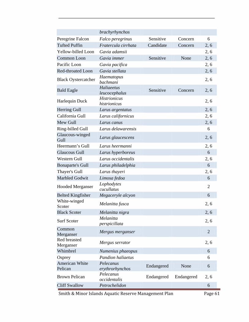
Smith & Minor Islands Aquatic Reserve Management Plan Page 61
brachyrhynchos Peregrine Falcon Falco peregrinus Sensitive Concern 6 Tufted Puffin Fratercula cirrhata Candidate Concern 2, 6 Yellow-billed Loon Gavia adamsii 2, 6 Common Loon Gavia immer Sensitive None 2, 6 Pacific Loon Gavia pacifica 2, 6 Red-throated Loon Gavia stellata 2, 6
Black Oystercatcher Haematopus bachmani 2, 6
Bald Eagle Haliaeetus leucocephalus Sensitive Concern 2, 6
Harlequin Duck Histrionicus histrionicus 2, 6
Herring Gull Larus argentatus 2, 6 California Gull Larus californicus 2, 6 Mew Gull Larus canus 2, 6 Ring-billed Gull Larus delawarensis 6 Glaucous-winged Gull Larus glaucescens 2, 6
Heermann’s Gull Larus heermanni 2, 6 Glaucous Gull Larus hyperboreus 6 Western Gull Larus occidentalis 2, 6 Bonaparte's Gull Larus philadelphia 6 Thayer's Gull Larus thayeri 2, 6 Marbled Godwit Limosa fedoa 6
Hooded Merganser Lophodytes cucullatus 2
Belted Kingfisher Megaceryle alcyon 6 White-winged Scoter Melanitta fusca 2, 6
Black Scoter Melanitta nigra 2, 6
Surf Scoter Melanitta perspicillata 2, 6
Common Merganser Mergus merganser 2
Red breasted Merganser Mergus serrator 2, 6
Whimbrel Numenius phaeopus 6 Osprey Pandion haliaetus 6 American White Pelican
Pelecanus erythrorhynchos Endangered None 6
Brown Pelican Pelecanus occidentalis Endangered Endangered 2, 6
Cliff Swallow Petrochelidon 6

Smith & Minor Islands Aquatic Reserve Management Plan Page 62
pyrrhonota Double-crested Cormorant
Phalacrocorax auritus 2, 6
Pelagic Cormorant Phalacrocorax pelagicus 2, 6
Brandt's Cormorant Phalacrocorax penicillatus Candidate None 2, 6
Red Phalarope Phalaropus fulicarius 6 Red-necked Phalarope Phalaropus lobatus 6
Wilson's Phalarope Phalaropus tricolor 6 Pacific Golden-Plover Pluvialis fulva 6
Black-bellied Plover Pluvialis squatarola 6
Horned Grebe Podiceps auritus 2, 6 Red-necked Grebe Podiceps grisegena 2, 6 Eared Grebe Podiceps nigricollis 2, 6 King Eider Somateria spectabilis 6 Northern Rough-winged Swallow
Stelgidopteryx serripennis 6
Parasitic Jaeger Stercorarius parasiticus 6
Pomarine Jaeger Stercorarius pomarinus 6
Caspian Tern Sterna caspia 2, 6 Common Tern Sterna hirundo 6
Ancient Murrelet Synthliboramphus antiquus 2, 6
Violet-green Swallow
Tachycineta thalassina 6
Greater Yellowlegs Tringa melanoleuca 6 Common Murre Uria aalge Candidate None 2, 6 Fish There are 75 fish species that have been identified to use the area in and around the Smith & Minor Islands Aquatic Reserve. The area within the reserve is rich with aquatic vegetation that fish rely on during various life stages.
Common Name Scientific Name State Status Federal Status Notes
Poacher Uniden. Agonidae spp. 1 Northern Spearnose Agonopsis emmelane 1

Smith & Minor Islands Aquatic Reserve Management Plan Page 63
Poacher Sturgeon Poacher Agonus acipenserinus 1 American Shad Alosa sapidissima 1
Pacific Sandlance Ammodytes hexapterus 1
Sablefish Anoplopoma fimbria 1 Bigfin Eelpout Aprodon cortezianus 1 Gray Starsnout Asterotheca alascana 1 Arrowtooth Flounder Atheresthes stomias 1
Roughback Sculpin Chitonotus pugetensis 1
Pacific Sanddab Citharichthys sordidus 1
Sanddab Uniden. Citharichthys spp. 1
Speckled Sanddab Citharichthys stigmaeus 1
Pacific Herring Clupea harengus pallasi Candidate Concern 1
Snailfish Uniden. Cyclopteridae (Liparidinae) spp. 1
Shiner Perch Cymatogaster aggregata 1
Spinyhead Sculpin Dasycottus setiger 1 Buffalo Sculpin Enophrys bison 1 Petrale Sole Eopsetta jordani 1 Pacific Spiny Lumpsucker Eumicrotremus orbis 1
Pacific Cod Gadus macrocephalus Candidate Concern 1
Rex Sole Glyptocephalus zachirus 1
Kelp Greenling Hexagrammos decagrammus 1
Whitespotted Greenling Hexagrammos stelleri 1
Flathead Sole Hippoglossoides elassodon 1
Spotted Ratfish Hydrolagus colliei 1 Surf Smelt Hypomesus pretiosus 1 Northern Sculpin Icelinus borealis 1 Hybrid Sole Inopsetta ischyra 1 Butter Sole Isopsetta isolepis 1 Southern Rock Sole
Lepidopsetta bilineata 1

Smith & Minor Islands Aquatic Reserve Management Plan Page 64
Northern Rock Sole
Lepidopsetta polyxystra 1
Rock Sole Uniden. Lepidopsetta spp. 1 Pacific Staghorn Sculpin Leptocottus armatus 1
Marbled Snailfish Liparis dennyi 1 Showy Snailfish Liparis pulchellus 1 Snake Prickleback Lumpenus sagitta 1 Blackbelly Eelpout Lycodes pacificus 1 Wattled Eelpout Lycodes palearis 1 Blackbelly Eelpout Lycodopsis pacifica 1 Slender Sole Lyopsetta exilis 1 Pacific Whiting (Hake) Merluccius productus Candidate Concern 1
Pacific Tomcod Microgadus proximus 1
Dover Sole Microstomus pacificus 1
Great Sculpin Myoxocephalus polyacanthocephalu 1
Great Sculpin Myoxocephalus polyacanthocephalus 1
Sailfin Sculpin Nautichthys oculofasciatus 1
Pink Salmon Oncorhynchus gorbuscha 10
Chum Salmon Oncorhynchus keta Candidate Threatened 10 Coho Salmon Oncorhynchus kisutch 10
Chinook Salmon Oncorhynchus tshawytscha Candidate Threatened 10
Chinook Salmon Oncorhynchus tshawytscha 1
Lingcod Ophiodon elongatus 1 English Sole Parophrys vetulus 1 Pacific Pompano Perrilus simillimus 1 Starry Flounder Platichthys stellatus 1 Plainfin Midshipman Porichthys notatus 1
Sand Sole Psettichthys melanostictus 1
Slim Sculpin Radulinus asprellus 1 Big Skate Raja binoculata 1 Sandpaper Skate Raja kincaidi 1 Longnose Skate Raja rhina 1 Pile Perch Rhacochilus vacca 1

Smith & Minor Islands Aquatic Reserve Management Plan Page 65
Grunt Sculpin Rhamphocottus richardsoni 1
Northern Ronquil Ronquilus jordani 1
Cabezon Scorpaenichthys marmoratus 1
Copper Rockfish Sebastes caurinus 1 Puget Sound Rockfish Sebastes emphaeus 1
Quillback Rockfish Sebastes maliger 1
Redstripe Rockfish Sebastes proriger Candidate None 1
Spiny Dogfish Squalus acanthias 1
Eulachon Thaleichthys pacificus Candidate None 1
Walleye Pollock Theragra chalcogramma Candidate Concern 1
Ribbed Sculpin Triglops pingeli 1 Blacktip Poacher Xeneretmus latifrons 1 Invertebrates There are 119 invertebrate species that have been identified within the Smith & Minor Islands Aquatic Reserve.
Common Name Scientific Name State Status Federal Status Notes
Dunce Cap Limpet Acmaea mitra 7 Aggregating Anemone
Anthopleura elegantissima 7
Sea Mouse Uniden. Aphroditidae spp. 1
California Arminid Armina californica 1
Glassy Sea Squirt Ascida paratropa 1 Smooth Acorn Barnacle Balanus crenatus 7
Acorn Barnacle Balanus glandula 7 Giant Barnacle Balanus nubilis 1 Graceful Crab (Male) Cancer gracilis 1
Dungeness Crab Cancer magister 1 Pygmy Rock Crab Cancer oregonensis 1, 7 Red Rock Crab Cancer productus 1, 7 Chaetopterid Chaetoptridae spp. 1

Smith & Minor Islands Aquatic Reserve Management Plan Page 66
Uniden. Broad Snow Crab Chionoecetes bairdi 1 Pink Scallop (Deep Ribs) Chlamys hastata 1
Pink Scallop (Smooth) Chlamys rubida 1
Pink Scallop Uniden. Chlamys spp. 1
Longhorned Decorator Crab Chorilia longipes 1
Sea Star Uniden. Class Asteroidea spp. 1
Snail Uniden. Class Gastropoda spp. 1
Crangonid Shrimp Uniden. Crangonidae spp. 1
Rose Sea Star Crossaster papposus 1 Gumboot Chiton Cryptochiton stelleri 7 Brown Barnacles Cthamalus dalli 7 Orange Sea Cucumber Cucumaria miniata 1, 7
Lion's Mane Jelly Cyanea capillata 1
Shrimp Uniden. Decapoda-Natantia spp. 1
White Gloved Leather Ascidian Didemnium sp. 7
Northwest Ugly Clam Entodesma navicula 7
Brooding Anemone Epiactis sp. 7
Shortscale Eualid Eualus suckleyi 1 Feather Duster Eudistylia sp. 7 False Ochre Star Evasterias troschelii 1 Oregon Hairy Triton
Fusitriton oregonensis 1
Pill Bug Isopod Gnorimosphaeroa oregonensis 7
Basket Star Gorgonocephalus caryi 1
Bread Crumb Sponge Halichondria sp. 7
Purple Sponge Haliclona sp. 7 Stalked Jelly Haliclystus stejnegeri 7 Purple Shore Crab Hemigrapsus nudus 7
Hairy Shore Crab Hemigrapsus oregonensis 7

Smith & Minor Islands Aquatic Reserve Management Plan Page 67
Northern Iridescent Worm Hemipodus borealis 7
Blood Star Henricia leviuscula 1 North Pacific Toad Crab Hyas lyratus 1
Rockweed Isopod Idotea wosnesenskii 7 Black Leather Chitons Katharina tunicata 7
Eelgrass Snail Lacuna sp. 7
Spiny Lebbeid Lebbeus groenlandicus 1
Six-Rayed Star Leptasterias hexactus 7 Checkered Periwinkle Littorina scutulata 7
Sitka Periwinkle Littorina sitkana 7 Black-Clawed Crab
Lophopanopeus bellus 7
Finger Limpet Lottia digitalis 7 Shield Limpet Lottia pelta 7 Banana Starfish Luidia foliata 1 Vermilion Star Mediaster aequalis 1 Gigantic Anemone Metridium farcimen 1 White Plumed Anemone Metridium senile 7
Northern Horse Mussel Modiolus modiolus 1
Sweet Potato Sea Cucumber Molpadia intermedia 1
Mossy Chiton Mopalia muscosa 7 Squat Lobster Mundia quadrispina 1 Eastern Softshell Mya arenaria 1 Sand Worm Nepthys sp. 7 Neptunea Uniden. Neptunea spp. 1 Tabled Whelk Neptunea tabulata 1 Frilled Dogwinkle Nucella lamellosa 7 Ribbed Dogwinkle Nucella ostrina 7 Giant Sea Spider Nymphon pixellae 1 Little Red Octopus Octopus rubescens 1 Sea Urchin Uniden.
Order Echinoidea spp. 1
Graceful Decorator Crab Oregonia gracilis 1
Long Armed Spiny Seastar Orthasterias koehleri 1
Smith & Minor Islands Aquatic Reserve Management Plan Page 68
Hairy Hermit Crab
Pagurus hirsutiusculus 7
Alaskan Hermit Crab Pagurus ochotensis 1
Steven's Hermit Pagurus stevensae 1 Dock Shrimp Pandalus danae 1 Sidestriped Shrimp Pandalus dispar 1
Alaskan Pink Shrimp Pandalus eous 1
Coonstriped Shrimp Pandalus hypsinotus 1
Ocean Pink Shrimp Pandalus jordani 1
Spotted Prawn Pandalus platyceros 1 Rough Patch Shrimp Pandalus stenolepis 1
Horned Shrimp Paracrangon echinata 1
Mud Nemertean Paranemertes peregrina 1
Red Sea Cucumber
Parastichopus californicus 1
Porcelain Crab Petrolisthes sp. 7 Pink Short Spined Seastar Pisaster brevispinus 1
Rock Oyster Pododesmus macrochisma 7
Slime Star Pteraster tesselatus 1 Orange Sea Pen Ptilosarcus gurneyi 1 Graceful Kelp Crab Pugettia gracilis 7
Kelp Crabs Pugettia producta 7
Sunflower Star Pycnopodia helianthoides 7
Warty Sea Squirt Pyura haustor 1 Stubby Squid Rossia pacifica 1 Butter Clam Saxidomus giganteus 1, 7 Sharpnose Crab Scyra acutifrons 1 Thatched Barnacle Semibalanus cariosus 7
Calcareous Tube Worm Serpula sp. 7
Morning Sun Star Solaster dawsoni 1 Stimpson's Sun Solaster stimpsoni 1

Smith & Minor Islands Aquatic Reserve Management Plan Page 69
Star Dwarf Glass Tube Worm Spirorbis sp. 7
Pallid Sea Urchin Stronglyocentrotus pallidus 1
Green Sea Urchin Strongylocentrotus droebachiensis 1
Red Sea Urchin Strongylocentrotus franciscanus 1
Barnacle Uniden. Subclass Cirripedia spp. 1
Red Beaded Anemone Tealia coriacea 7
Mask Limpet Tectura personna 7 Plate Limpet Tectura scutum 7 Lampshell Brachiopod
Terabratalia transversa 1
Thais Lamellosa Thais lamellosa 1 Hairy Gilled Worm Thelepus crispus 7
Tochni Nudibranch Tochuina tetraquetra 1
Lined Chiton Tonicella sp. 7 Orange Ribbon Worm
Tubulanus polymorphus 7
Christmas Anemone Urticina crassicornis 7
Smooth Stem Sea Whip Uniden. Virgularia spp. 1
Rough Piddock Zirfaea pilsbryi 7 Mammals There are 11 Marine Mammal species that have been identified to use the area in and around the Smith & Minor Islands Aquatic Reserve.
Common Name Scientific Name State Status Federal Status Notes
Northern Minke Whale
Balaenoptera acutorostrata 2, 3, 4
Northern Fur Seal Callorhinus ursinus 2, 3, 4 Gray Whale Eschrichtius robustus Sensitive None 2, 3, 4 Steller Sea Lion Eumetopias jubatus Threatened Threatened 2, 3, 4 White-sided Dolphin
Lagenorhynchus obliquidens 2, 3, 4
Northern Elephant Mirounga 2, 3, 4

Smith & Minor Islands Aquatic Reserve Management Plan Page 70
Seal angustirostris Killer Whale Orcinus orca Endangered Endangered 2, 3, 4 Harbor Seal Phoca vitulina 2, 3, 4 Pacific Harbor Porpoise Phocoena phocoena Candidate None 2, 3, 4
Dall's Porpoise Phocoenoides dalli 2, 3, 4 California Sea Lion
Zalophus californianus 2, 3, 4
Vegetation There are 50 species of marine vegetation that have been identified within the Smith & Minor Islands Aquatic Reserve.
Common Name Scientific Name State Status Federal Status Notes
PHYLUM RHODOPHYTA (Red Algae) Turkish Towel Seaweed
Chondracanthus exasperatus 5,11
Corallina frondescens 11 Graceful coral seaweed
Corallina vancouveriensis 11
Winged Rib Delesseria decipiens 11 Sea moss Endocladia muricata 11 Gel Weed Gelidium sp. 7 Jelly Moss Gloiopeltis furcata 11 Red Tar Spot Hildenbrandia sp. 7 Veined Blade Hymenena sp. 5 Bushy Turkish washcloth
Mastocapus jardinii complex 11
Turkish Washcloth Mastocarpus papillatus 5, 7,11
Black Tar Spot Mastocarpus petrocelis 7
Mottled Turkish washcloth Mazzealla oregona 11
Splendid Iridescent Seaweed Mazzealla splendens 5, 7,11
Coarse Sea Lace Microcladia borealis 7 Black Pine Neorhodomela larix 5, 7,11 Sea Brush Odonthalia floccosa 5, 7,11
Odonthalia lyallii 11
Flat Sea Brush Odonthalia washingtoniensis 5
Sea Laurel Osmundia spectabilis 5

Smith & Minor Islands Aquatic Reserve Management Plan Page 71
Red Ribbon Palmaria mollis 7,11
Sea Spatula Pleurophycus gardenerii 5
Sea Comb Plocamium cartilagineum 5
Red Nori Porphyra nereocystis 5 Brown Cellophane Porphyra sp. 7 Nori Porphyra spp. 5 Bleachweed Prionitis sp. 5
Black tassel Pterosiphonia bipinnata 11
Red Eyelet Silk Sparlingia pertusa 5
Whidbeyella cartilaginea 8
PHYLUM PHAEOPHYTA (Brown Algae) Sea Collander Agarum fimbriatum 5 Winged kelp Alaria marginata 5, 7,11 Fir Needle Analipus japonicus 5 Seersucker Kelp Costaria costata 5, 7 Triple-rib Kelp Cymanthere triplicata 5 Flattened Acid Kelp Desmarestia ligulata 5, 7
Stringy Acid Kelp Desmarestia viridus 5, 7 Feather Boa kelp Egregia menziesii 5, 7 Rockweed Fucus gardneri 5, 7
Split-blade Kelp Laminaria bongardiana 5
Sea Cauliflower Leathesia difformis 5 Bull Kelp Nereocystis leutkeana 5, 7
Sea Spatula Pleurophycus gardenerii 5
Woody-stemmed Kelp
Pterygophora californica 7,11
Sugar Kelp Saccharina latissium 5 Sea Cabbage Saccharina sessile 5 Southern Stiff-stiped Kelp Saccharina setchellii 5,11
Wireweed Sargassum muticum 5, 7 PHYLUM CHLOROPHYTA (Green algae) Green Rope Acrosiphonia coalita 5, 7 Dead Man's Fingers Codium fragile 5
Green Spongy Codium Setchellii 11

Smith & Minor Islands Aquatic Reserve Management Plan Page 72
Cushion Green Ribbon Enteromorpha spp. 5, 7 Sea Lettuce Ulva spp. 5, 7 PHYLUM ANTHOPHYTA (Flowering Plants) Scouler's Surfgrass Phyllospadix scouleri 11
Toothed Surfgrass Phyllospadix serrulatus 5, 7
Eelgrass Zostera marina 5 Notes (Data Sources): 1 - WDFW Trawl & Underwater Video Data 2 - WDFW, PSAMP 3 - Cascadia Research 4 - Orca Network 5 - Department of Natural Resources and Leal Dickson 6 - Island County Audubon Society 7 - Island County Beach Watchers 8 - Setchell and N. L. Gardner 9 - DNR Natural Heritage Program
10 - Wild Fish Conservancy 11 - WDFW (marine mammal program) 12 - Sandra Lindstrom, University of British Columbia
Smith & Minor Islands Aquatic Reserve Management Plan Page 73
Appendix B – Maps The following maps were created to better inform the development of the Smith & Minor Islands Aquatic Reserve Management Plan by identifying the species and habitat that use, and are in and around, the Smith & Minor Islands Aquatic Reserve. Figure 1 – Intertidal Spawning Habitat

Smith & Minor Islands Aquatic Reserve Management Plan Page 74
Figure 2 – Littoral Drift Classification

Smith & Minor Islands Aquatic Reserve Management Plan Page 75
Figure 3 – Floating Kelp Distribution

Smith & Minor Islands Aquatic Reserve Management Plan Page 76
Figure 4 – Bald Eagle Observations
Smith & Minor Islands Aquatic Reserve Management Plan Page 77
Figure 5 – Common Loon, Harlequin Duck, and Marbled Murrelet Observations

Smith & Minor Islands Aquatic Reserve Management Plan Page 78
Figure 6 – Geoduck Harvestable Tracts

Smith & Minor Islands Aquatic Reserve Management Plan Page 79
Figure 7 – Pigeon Guillemot Observations

Smith & Minor Islands Aquatic Reserve Management Plan Page 80
Figure 8 – Tufted Puffin and Rhinoceros Auklet Observations

Smith & Minor Islands Aquatic Reserve Management Plan Page 81
Figure 9 – Nearshore Surfgrass Presence

Smith & Minor Islands Aquatic Reserve Management Plan Page 82
Figure 10 – Percent Shoreline Modification
Smith & Minor Islands Aquatic Reserve Management Plan Page 83
Figure 11 – Shoreline Type

Smith & Minor Islands Aquatic Reserve Management Plan Page 84
Figure 12 – Navy Small Arms Danger Zone Proposed Markers
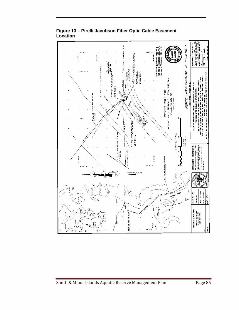
Smith & Minor Islands Aquatic Reserve Management Plan Page 85
Figure 13 – Pirelli Jacobson Fiber Optic Cable Easement Location

Smith & Minor Islands Aquatic Reserve Management Plan Page 86
Figure 14 – National Oceanographic and Atmospheric Administration (NOAA) Nautical Chart
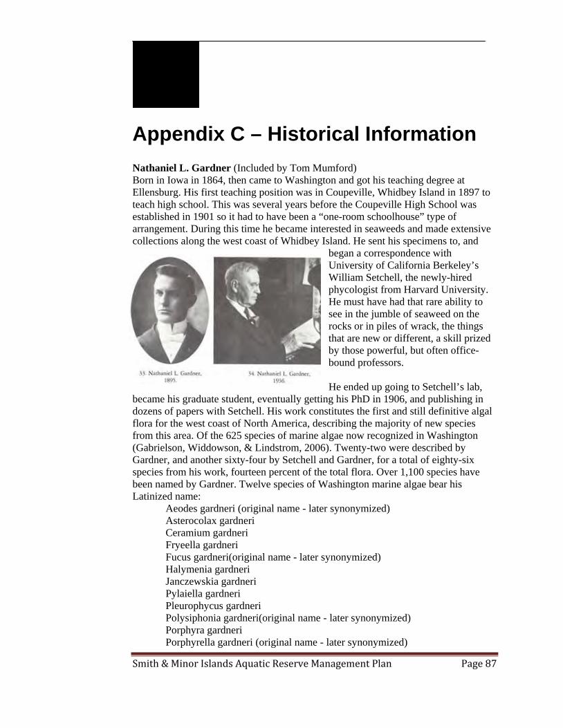
Smith & Minor Islands Aquatic Reserve Management Plan Page 87
Appendix C – Historical Information Nathaniel L. Gardner (Included by Tom Mumford) Born in Iowa in 1864, then came to Washington and got his teaching degree at Ellensburg. His first teaching position was in Coupeville, Whidbey Island in 1897 to teach high school. This was several years before the Coupeville High School was established in 1901 so it had to have been a “one-room schoolhouse” type of arrangement. During this time he became interested in seaweeds and made extensive collections along the west coast of Whidbey Island. He sent his specimens to, and
began a correspondence with University of California Berkeley’s William Setchell, the newly-hired phycologist from Harvard University. He must have had that rare ability to see in the jumble of seaweed on the rocks or in piles of wrack, the things that are new or different, a skill prized by those powerful, but often office-bound professors. He ended up going to Setchell’s lab,
became his graduate student, eventually getting his PhD in 1906, and publishing in dozens of papers with Setchell. His work constitutes the first and still definitive algal flora for the west coast of North America, describing the majority of new species from this area. Of the 625 species of marine algae now recognized in Washington (Gabrielson, Widdowson, & Lindstrom, 2006). Twenty-two were described by Gardner, and another sixty-four by Setchell and Gardner, for a total of eighty-six species from his work, fourteen percent of the total flora. Over 1,100 species have been named by Gardner. Twelve species of Washington marine algae bear his Latinized name:
Aeodes gardneri (original name - later synonymized) Asterocolax gardneri Ceramium gardneri Fryeella gardneri Fucus gardneri(original name - later synonymized) Halymenia gardneri Janczewskia gardneri Pylaiella gardneri Pleurophycus gardneri Polysiphonia gardneri(original name - later synonymized) Porphyra gardneri Porphyrella gardneri (original name - later synonymized)

Smith & Minor Islands Aquatic Reserve Management Plan Page 88
Gardner also had a hand in the origins of one of the premier marine stations in the world. As a graduate student in 1903, he accompanied Dr. Trevor Kinkaid in scouting out possible locations for what is now known as the Friday Harbor Laboratory (Mills & Hermans, 2008). He remained a teacher for most of his career, teaching in high schools and university, and also understood the importance of herbaria as a critical tool for the study of biodiversity. Obituary from the University of California: “Nathaniel Lyon Gardner, Associate Professor of Botany, Emeritus, and Curator of the Herbarium, Emeritus, for twenty-four years a member of the Academic Senate, died on Sunday, August 15, 1937, a little more than three years after his retirement. Born in Keokuk, Iowa, February 26, 1864, he attended the schools and high schools at or near his later home at Iowa Falls, and qualified himself as a teacher but interrupted this career to join an uncle in business in Tacoma, Washington. The panic of 1893 put an end to this activity, and after graduating from the normal school at Ellensburg, Washington, he obtained a teaching position at Coupeville, Island County, Washington, where he collected plants of all kinds and sent them to various authorities for naming. One result of his studies came to publication in the Seattle Times of June 20, 1900, and was entitled “The Forest of Washington.” Another result was that in April, 1897, after observing the abundant marine flora of the coasts of Whidbey Island, on which Coupeville is situated, he wrote to Professor W. A. Setchell of the University of California asking for directions for preparing specimens and for assistance in their identification. From this beginning there came about a cooperation and later a collaboration in the study of the seaweeds of the Pacific Coast of North America which was still in progress forty years later, at the time of Gardner's death. To prepare himself better for his work on the marine algae and other groups of the lower plants, Gardner attended the University of Washington and took the degree of Bachelor of Science in 1900. His connection with the University of California began in 1900, as Assistant in Botany, associated in the teaching work of W. J. V. Osterhout. In 1906 he accepted the headship of the department of biology of the Polytechnic High School of Los Angeles, a position which he held until 1913, with one year's leave of absence (1909-1910) to serve as Acting Assistant Professor of Botany at the University of California. From 1913 to 1923 Gardner performed the duties of Assistant Professor of Botany, and from 1923 to his retirement in 1934, those of Associate Professor of Botany at the University of California. In 1920 there were added to his titles and duties those of Curator of the Herbarium. In 1934 he was retired as Associate Professor of Botany, Emeritus, and Curator of the Herbarium, Emeritus. Gardner was chiefly interested in phycology, or, in general, the algae. He was a wonderfully efficient collector and student, in the field, laboratory, and herbarium. While the marine algae, or seaweeds, received the greater part of his attention, those
Smith & Minor Islands Aquatic Reserve Management Plan Page 89
of the fresh waters were by no means neglected. He paid some attention to fungi and was particularly successful in collecting the obscure hypogaeous forms, those growing well covered by leaves or even by thin layers of soil. Much of Gardner's publication was made with Setchell as collaborator, although the proportion of the work which was due to Gardner's effort was in many instances very large, and resulted in some thirty major papers being issued, very properly, under his name alone. On the fungi, although his experience was ample, he wrote but a single paper. On the difficult group of the blue-green algae he was a world authority, basing many of his conclusions as well as his general attitude towards so-called “polymorphism” on numerous and long-continued pure cultures. Concerning many of the obscure genera of the green algae he increased our knowledge of their relationships and their life histories. In the brown algae, his work on minute epiphytic forms disclosed a very considerable and unexpected population on the Pacific Coast, and among the larger forms such as the rockweeds he made most important additions to the knowledge of marine flora. At the time of his death he was still actively engaged in studying, both in the field and in the laboratory, Pacific Coast red algae, a large, complex, and perplexing group. His field methods were adequate and discriminating; his technique in microscopy was ever being improved to yield practical results; his culture methods were carefully carried out and often continued for years; and his coordinations were careful and based upon extensive data. He was a sound student of his subjects. As a teacher, he was minute and meticulous in method and exposition, succeeding better with smaller than with larger classes. Gardner's personality was neither expansive nor exuberant. His was a quiet nature, appreciative yet ever critical. Those who came to know him appreciated his sterling worth. He was a member of both scholarship societies, Phi Beta Kappa and Sigma Xi, and a Fellow of the California Academy of Sciences. In 1915 he married Edith Jordan, daughter of Chancellor David Starr Jordan of Stanford University, herself interested in intellectual and practical affairs, and who survives him” (Regents of The University of California, 2007).

Smith & Minor Islands Aquatic Reserve Management Plan Page 90
Appendix D – Legal Description of Smith & Minor Islands Aquatic Reserve A portion of the tidelands and bedlands owned by the State of Washington within Admiralty Inlet and the Strait of Juan De Fuca in Island County and in Jefferson County, Washington. Said tidelands are fronting and abutting the Jacob Ebey Donation Land Claim No. 47 and government lots 1 to 4 of Section 6, all in Township 31 North, Range 1 East, W.M; and government lot 4 of Section 31, government lot 1 of Section 18, government lots 1 to 4 of Section 7, and government lots 1 to 4 of Section 6, all in Township 32 North, Range 1 East, W.M.; and government lots 1 to 6 of Section 36, government lot 1 of Section 35, government lots 1 and 2 of Section 26, government lots 1 to 3 of Section 25, government lots 1 to 4 of Section 24, and government lots 1 to 3 of Section 13, all in Township 32 North, Range 1 West, W.M.; and government lot 1 of Section 31, government lots 1 to 3 of Section 32, government lot 3 of Section 29, all in Township 33 North, Range 1 East, W.M. The reserve parcel is further described as follows: Commencing at the northeast corner of said Section 32, Township 33 North, Range 1 East, from which, the east line of said Section 32 bears South 01°24’44” West as shown on that map titled Whidbey N.A.S. Boundary Map prepared by Washington State Parks and Recreation Commission dated January 31, 1974 and filed under application no. 20-10594 in the records of the Commissioner of Public Lands; thence North 51°32’42” West along the northeasterly boundary of said boundary map to the line of mean high tide fronting upon said government lot 3 of Section 29; thence northwesterly perpendicular to the said line of mean high tide to the line of extreme low tide; thence west-northwesterly 22,000 feet, more or less, to a geographic position with a latitude of 48°19’38.87” North and longitude of 122°47’44.29” West; thence northwesterly 11,000 feet, more or less, to a geographic position with a latitude of 48°20’16.29” North and longitude of 122°50’12.78” West; thence west-northwesterly 6,000 feet more or less, to a geographic position with a latitude of 48°20’24.61” North and longitude of 122°51’40.14” West; thence westerly along a line of said latitude of 48°20’24.61” North, 14,000 feet, more or less, to a position vertically at a bathymetric contour of minus 200 feet below mean lower low water along the westerly slopes of Partridge Bank; thence southerly, southeasterly, and southwesterly along said bathymetric contour of minus 200 feet below mean lower low water along the westerly slopes of Partridge Bank to an intersection with a latitude of 48°13’18” North; thence departing from said bathymetric contour on the

Smith & Minor Islands Aquatic Reserve Management Plan Page 91
westerly slopes of Partridge Bank, east-southeasterly 26,000 feet, more or less, to an intersection with a latitude of 48°12’30” North and a position vertically at said bathymetric contour of minus 200 feet below mean lower low water lying offshore of Fort Ebey State Park ; thence southeasterly along said bathymetric contour of minus 200 feet below mean lower low water to a point lying southwesterly and perpendicular to the line of mean high tide at the southwesterly meander corner between the said Jacob Ebey DLC No. 47 and the Isaac N. Ebey DLC No. 38 in said Township 31 North, Range 1 East, W.M. on the shores of Admiralty Inlet; thence departing from said bathymetric contour, northeasterly perpendicular to said line of mean high tide at the southwesterly meander corner between the said Jacob Ebey DLC No. 47 and the Isaac N. Ebey DLC No. 38 to the said meander corner; thence northwesterly, northerly, and northeasterly along said line of mean high tide 10 miles, more or less, to the Point of Beginning; EXCEPTING THEREFROM, the uplands known as Smith Island and Minor Island lying above the line of mean high tide. EXCEPTING THEREFROM, the following described second class tidelands sold by the State of Washington:
Those tidelands extending from mean high tide to extreme low tide sold to Frank J. Pratt, Jr. and Lena Kohne Pratt, Trustees for Robert Yenney Pratt, by that deed dated December 19, 1934 and filed at Volume 17, page 587 in State Records of Tideland and Shoreland Deeds at the Office of the Commissioner of Public Lands; ALSO, those tidelands extending from mean high tide to extreme low tide sold to Lena K. Pratt by that deed dated December 19, 1934 and filed at Volume 17, page 586 in State Records of Tideland and Shoreland Deeds at the Office of the Commissioner of Public Lands; ALSO, those tidelands extending from mean high tide to extreme low tide sold to the Foss Company by that deed dated April 16, 1937 and filed at Volume 18, page 133 in State Records of Tideland and Shoreland Deeds at the Office of the Commissioner of Public Lands; ALSO, those tidelands extending from mean high tide to mean low tide sold to Mary L. Hendrickson by that deed dated August 15, 1906 and filed at Volume 8, page 17 in State Records of Tideland and Shoreland Deeds at the Office of the Commissioner of Public Lands; ALSO, those tidelands extending from mean high tide to extreme low tide sold to James and Bertha Walkup by that deed dated November 18, 1957 and filed at Volume 22, page 582 in State Records of Tideland and Shoreland Deeds at the Office of the Commissioner of Public Lands; ALSO, those tidelands extending from mean high tide to extreme low tide sold to Theodore E. Ostrom by that deed dated September 6, 1956 and filed at

Smith & Minor Islands Aquatic Reserve Management Plan Page 92
Volume 22, page 430 in State Records of Tideland and Shoreland Deeds at the Office of the Commissioner of Public Lands; ALSO, those tidelands extending from mean high tide to extreme low tide sold to Peter and Emma Chaussee by that deed dated July 10, 1944 and filed at Volume 19, page 450 in State Records of Tideland and Shoreland at the Office of the Commissioner of Public Lands; ALSO, those tidelands extending from mean high tide to extreme low tide sold to Karl Koehler by that deed dated April 26, 1923 and filed at Volume 15, page 75 in State Records of Tideland and Shoreland Deeds at the Office of the Commissioner of Public Lands;
Said Smith & Minor Islands Aquatic Reserve subject to the following described authorizations:
SUBJECT TO an easement for submarine cables granted to Pirelli Jacobson, Inc. under authorization 51-070463. SUBJECT TO an easement for submarine cables granted to PC Landing Corporation under authorization 51-070810. SUBJECT TO an interagency agreement between the Washington Department of Natural Resources and Washington State Parks and Recreation under authorization 20-11334. SUBJECT TO an interagency agreement between the Washington Department of Natural Resources and Washington State Parks and Recreation under authorization 20-10594. SUBJECT TO a withdrawal from sale, lease, exchange, or private use by Chapter 76, Laws of 1953 for those second class tidelands fronting and abutting government lot 4 of Section 7, Township 32 North, Range 1 East, W.M., government lot 1 of Section 32, Township 33 North, Range 1 East, W.M., and government lot 1 of Section 13, Township 32 North, Range 1 West. W.M. SUBJECT TO the Puget Sound Vessel Traffic services area as shown on NOAA nautical charts.