
Web GIS in Agriculture
Land Use, Crop Management and
Planning
Kevin Knapp
Bryan Baker, Phd.

Two Case Studies
Two Custom Developed Web Applications
Both Integrate different technologies
Primary Requirement >>> 100% Web Based
1) Real-time Harvester Tracking and Yield Monitoring
2) Field Data Management & Fertility
Technology Platforms
•ArcGIS Server
-map services, geoprocessing services, image services
•Esri JavaScript API
•MS SQL Server and SQL Spatial
•Esri base maps and imagery
•Spatial Analysis
•Can be integrated with ArcGIS Online/Portal
Case Study 1: Real Time Harvest TrackingCustom GIS solution for tracking harvesters and aggravating harvested acres and
yield accross multiple growers and farms
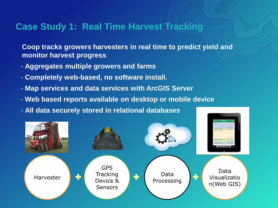
Case Study 1: Real Time Harvest Tracking
Coop tracks growers harvesters in real time to predict yield and
monitor harvest progress
• Aggregates multiple growers and farms
• Completely web-based, no software install.
• Map services and data services with ArcGIS Server
• Web based reports available on desktop or mobile device
• All data securely stored in relational databases
Harvester
GPS Tracking Device & Sensors
Data Processing
Data Visualization(Web GIS)
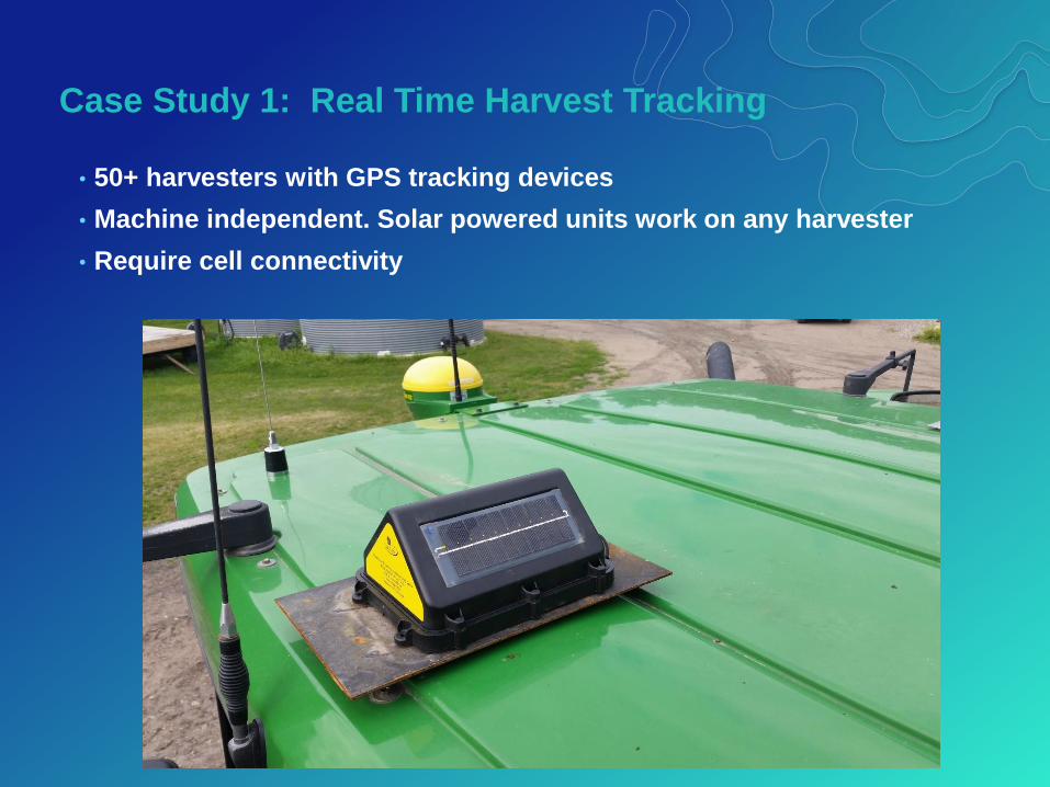
Case Study 1: Real Time Harvest Tracking
• 50+ harvesters with GPS tracking devices
• Machine independent. Solar powered units work on any harvester
• Require cell connectivity

Case Study 1: Real Time Harvest Tracking
• Database algorithms calculate harvested acres
• Eliminate turns, high speed, etc.
Case Study 1: Real Time Harvest Tracking
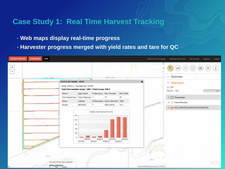
• Web maps display real-time progress
• Harvester progress merged with yield rates and tare for QC
Case Study 1: Real Time Harvest Tracking
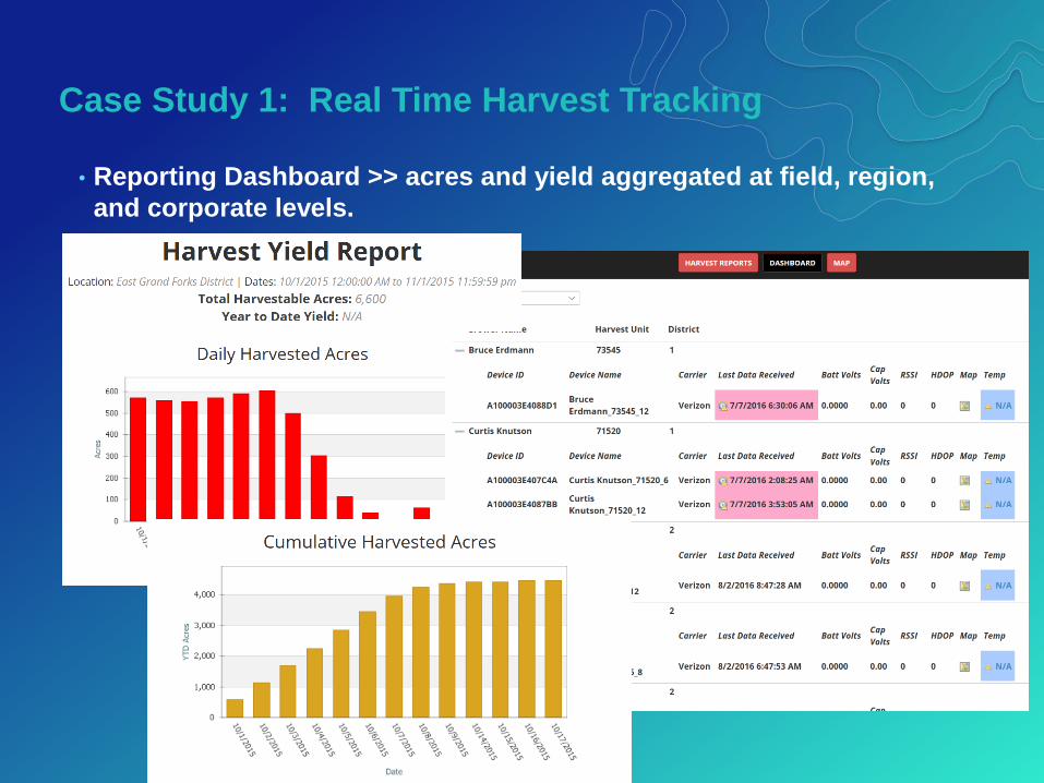
• Reporting Dashboard >> acres and yield aggregated at field, region,
and corporate levels.
End of season accuracy +- 3.5%
• Margin of error in acres caused by:• Slight GPS precision loss from diminishing solar power
• Incorrect tracking unit installation
• Non-linear harvesting around complex field boundaries
• Old and new database technology challenge:
mainframe vs. GIS and RDMS
• Time and manpower to police tracking devices
Harvest Tracking > Summary and Challenges

Case Study 2: Field Data & Fertility ManagementCustom GIS solution mapping field, fertility analysis, and prescriptions.
Case Study 2: Field Data & Fertility Management
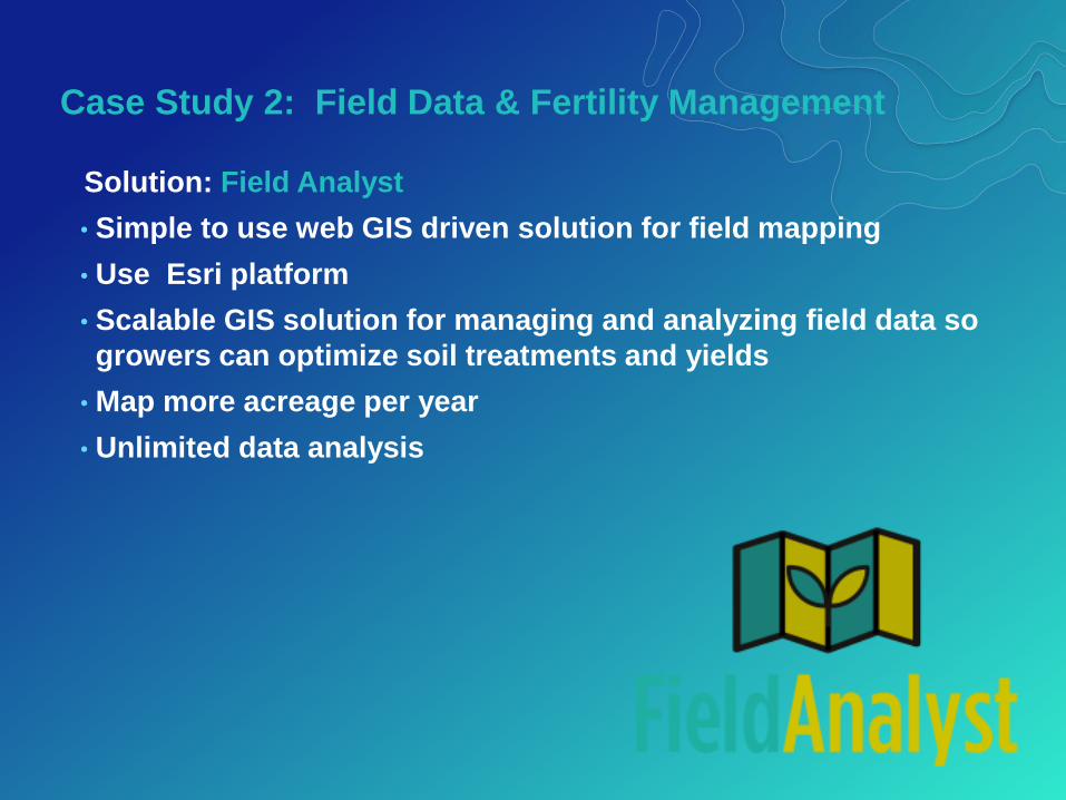
Solution: Field Analyst
• Simple to use web GIS driven solution for field mapping
• Use Esri platform
• Scalable GIS solution for managing and analyzing field data so
growers can optimize soil treatments and yields
• Map more acreage per year
• Unlimited data analysis

Case Study 2: Field Data & Fertility Management
Primary Project Driver >> Data
Growers want ownership and control of their data
My Farm
My Data

Case Study 2: Field Data & Fertility Management
• Store and manage field data
- Client > Farms > Fields meta-data
- Boundaries
- Sample points
- Management Zones
- Yield
- EC
- Imagery
• Generate Soil Fertility Maps
• Surface interpolations and managements zones
• Create Lime and Fertilizer Prescriptions
• Create Crop Zones and boundary splits online
• Manage Crop Plans and fertilizer rules
Case Study 2: Field Data & Fertility Management
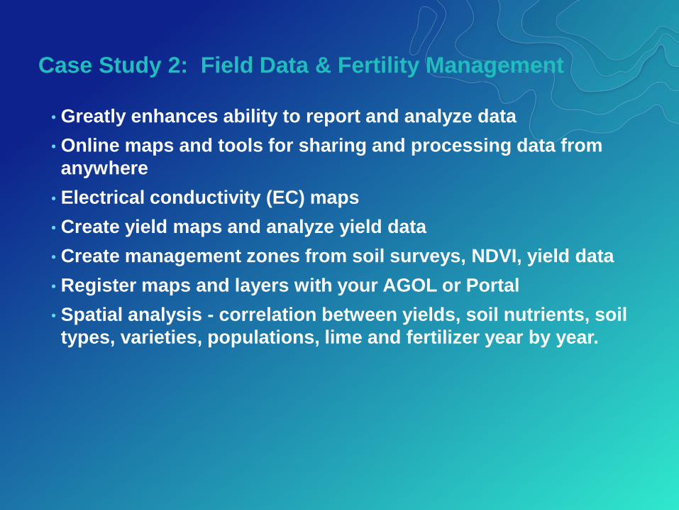
• Greatly enhances ability to report and analyze data
• Online maps and tools for sharing and processing data from
anywhere
• Electrical conductivity (EC) maps
• Create yield maps and analyze yield data
• Create management zones from soil surveys, NDVI, yield data
• Register maps and layers with your AGOL or Portal
• Spatial analysis - correlation between yields, soil nutrients, soil
types, varieties, populations, lime and fertilizer year by year.

Case Study 2: Field Data & Fertility Management
Drawbacks to rigid COTS products for field management:
• Independent providers don’t own their data.
• GIS data stored proprietarily, difficult to use with ArcGIS.
• Difficult to customize
• Prescriptions & treatments often require significant manual
editing
• Too many features
• Some systems antiquated – run on a 32-bit computer
• Limited spatial analysis and ad-hoc mapping features
Case Study 2: Field Data & Fertility Management
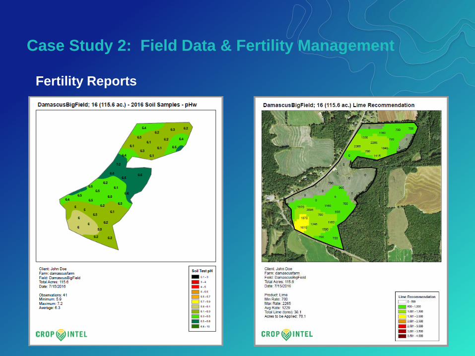
Fertility Reports
Case Study 2: Field Data & Fertility Management
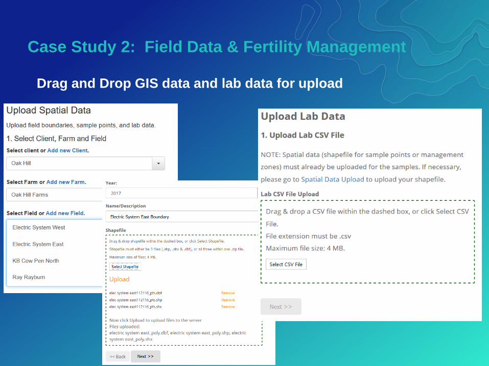
Drag and Drop GIS data and lab data for upload

Case Study 2: Field Data & Fertility Management
Soil samples and nutrient data management

Case Study 2: Field Data & Fertility Management
Create, view , edit lime and fertilizer prescriptions
Case Study 2: Field Data & Fertility Management
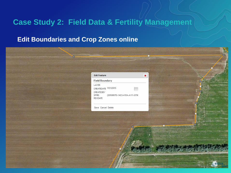
Edit Boundaries and Crop Zones online

• Data is the biggest commodity
• Data = high value to apply analytics
• Storing data optimally is critical (database design)
• Technologists & agronomists must work cloely together
- GIS & programming experts are not agronomists… and vice - versa
• Fundamentally a workflow exercise
• Surface interpolation method debates
Field Analyst Project > Summary and Challenges

Contact us with any questions!
Kevin Knapp
Bryan Baker
www.tierraplan.com
Thank You!


