Download - Scarborough Shoal
Metro Manila (CNN Philippines) — A chunk of rock appearing on the
ocean surface has now become the source of tension between the
Philippines and China.
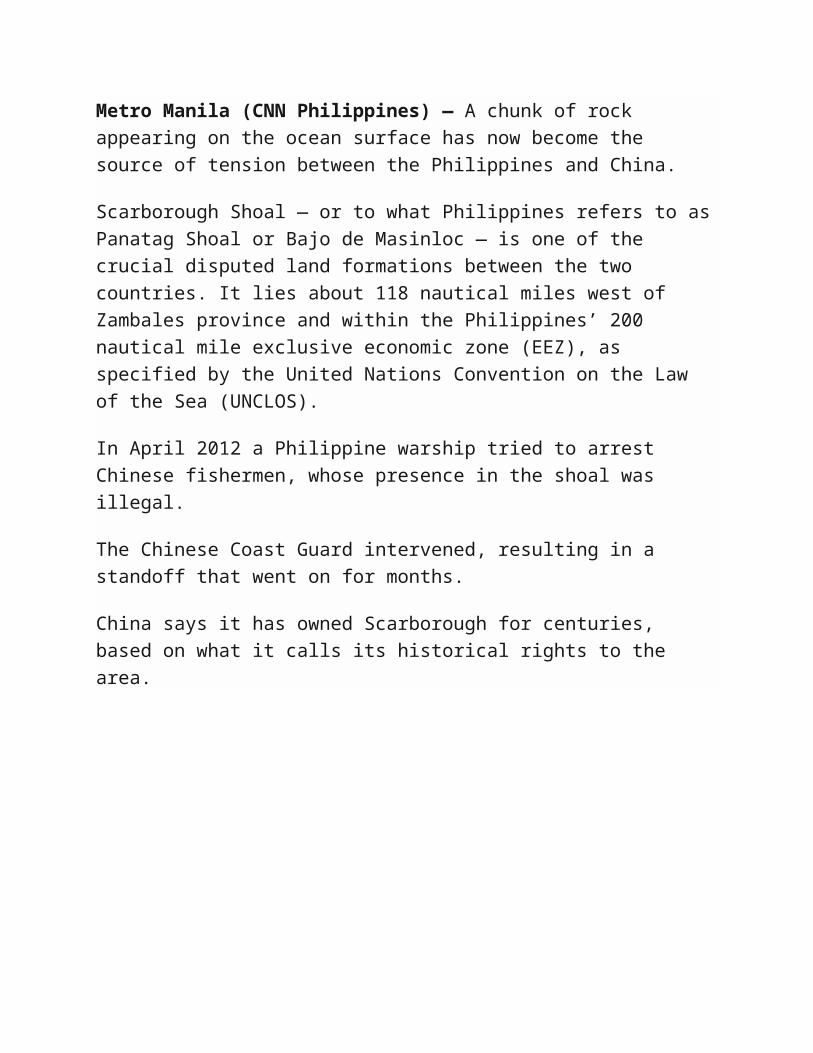
Scarborough Shoal — or to what Philippines refers to as Panatag Shoal or
Bajo de Masinloc — is one of the crucial disputed land formations between
the two countries. It lies about 118 nautical miles west of Zambales
province and within the Philippines’ 200 nautical mile exclusive economic
zone (EEZ), as specified by the United Nations Convention on the Law of
the Sea (UNCLOS).
In April 2012 a Philippine warship tried to arrest Chinese fishermen, whose
presence in the shoal was illegal.
The Chinese Coast Guard intervened, resulting in a standoff that went on
for months.
China says it has owned Scarborough for centuries, based on what it calls
its historical rights to the area.
But the oldest known map of the Philippines — the Velarde-Murillo Map of
1734 — shows Panatag Shoal, then called Panacot Shoal, as part of “Las

Islas Filipinas” or the Philippine islands which were then administered by
Spanish colonizers.
The 2012 standoff ended only after Manila and Beijing agreed to pull out.
But China did not stop. It sent its patrol ships back and eventually closed
off the shoal to Filipinos.
The move would set in motion the Philippine maritime case against China
before the Permanent Court of Arbitration in The Hague.
Bu no one knows the gravity of the situation like the fisherfolk of Masinloc.
Their only source of livelihood has been the shoal for as long as they can
remember.
And now they have been restricted to the area, they’re losing 300 thousand
pesos a week.

MANILA, Philippines – Google has quietly removed the Chinese name for a South China Sea shoal bitterly disputed by Beijing and Manila from its maps service, following an outcry from Filipinos.The Google Maps website on Tuesday referred to the rich fishing ground — a subject of a case lodged by the Philippines at an international arbitration tribunal — by its international name, Scarborough Shoal.The service had earlier labelled the shoal as part of China’s Zhongsha island chain, prompting an online campaign demanding that the Internet giant stop identifying the outcrop as part of Chinese territory.“We’ve updated Google Maps to fix the issue. We understand that geographic names can raise deep emotions which is why we worked quickly once this was brought to our attention,” Google’s office in Manila said in a statement.Scarborough Shoal lies 220 kilometres (140 miles) off the main Philippine island of Luzon and 650 kilometres from Hainan island, the nearest major Chinese land mass.China has controlled the shoal since 2012, following a brief standoff with the Philippines.Since then, the Philippines has accused the Chinese coast guard of harassing Filipino fishermen at the shoal, including robbing them of their catch at gunpoint earlier this year.Campaigns website Change.org began a petition last week to get Google Maps to drop the Chinese name of the shoal on its site. The petition drew close to 2,000 supporters.“China’s sweeping claim of (the) South China Sea under their nine-dash line purportedly historical boundary is illegal and is creating tension among nations,” the petition read.“Google maps showing this is part of Zhongsha island chain gives credence to what is plainly a territory grab that peace loving nations should stand against.”Last week, a United Nations-backed tribunal at The Hague started hearing a Philippine petition to declare illegal China’s maritime claims in the South China Sea that overlap those of the Philippines.On Monday, Filipino officials wrapped up arguments to convince the panel it had jurisdiction over the case, presidential spokeswoman Abigail Valte said.Justice Secretary Leila de Lima said the Philippines was “confident” the tribunal would assume jurisdiction.“We are doing this as a peaceful means to resolve the dispute. We can’t fight China economically, militarily and even politically. This is the way to do it,” de Lima told Manila broadcaster ABS-CBN on Tuesday.
Read more: http://globalnation.inquirer.net/126060/google-maps-removes-chinese-name-on-scarborough-shoal#ixzz3kLrNrClY Follow us: @inquirerdotnet on Twitter | inquirerdotnet on Facebook
Introduction
Ladies and gentlemen, good afternoon.
Thank you for your kind invitation to speak before you today on the occasion of the exhibit entitled
“Historical Truths & Lies: Scarborough Shoal in Ancient Maps.” It is indeed an honour to be asked to
deliver a piece on the heels of Senior Associate Justice Antonio T. Carpio’s excellent analysis
delivered a few months ago, and now echoing in the form of a map exhibit. But rather than attempt
to duplicate Justice Carpio’s research, allow me to share with you some additional thoughts,
snippets of historical facts, and documentary evidence that will round out the story he has been able
to tell. These are facts that are of public record, and readily available to all.
I will begin with the basic question of why a few rocks and a reef called Bajo de Masinloc
(Scarborough Shoal) is important to the Philippines. Then I shall show you the basis and evidence of
Philippine sovereignty over Bajo de Masinloc. I shall show you that we do have stronger evidence
and a better right to Bajo de Masinloc, notwithstanding China’s insistence on its claim. And then I
shall try to throw in some ideas meant to provoke a serious and sanguine conversation about what
the Philippines should do next in relation to our pending issues with China over Bajo de Masinloc.
The Importance of Bajo de Masinloc to the Philippines.
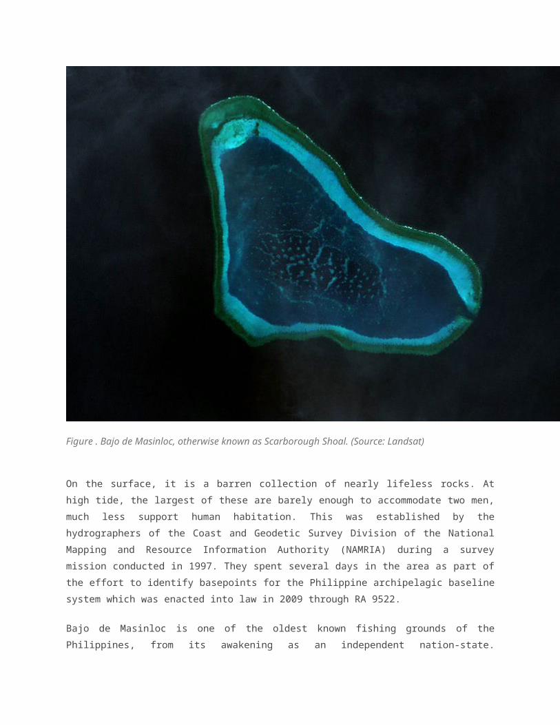
Bajo de Masinloc is a large coral atoll, about 10 miles in width, triangular in shape, located
approximate 124 nautical miles west of Luzon. Parts of the barely submerged reef are awash at low
tide, and some scattered rocks, from 0.3 to 3.0 meters high, are visible from a distance. South Rock,
located at the southeastern extremity of the shoal, is the highest and largest elevation. The reef
encloses a lagoon that varies in depth from 9 to 13 meters, but with many patches of as little as 1.7
meters depth. (Figure 1)

Figure . Bajo de Masinloc, otherwise known as Scarborough Shoal. (Source: Landsat)
On the surface, it is a barren collection of nearly lifeless rocks. At high tide, the largest of these are
barely enough to accommodate two men, much less support human habitation. This was established
by the hydrographers of the Coast and Geodetic Survey Division of the National Mapping and
Resource Information Authority (NAMRIA) during a survey mission conducted in 1997. They spent
several days in the area as part of the effort to identify basepoints for the Philippine archipelagic
baseline system which was enacted into law in 2009 through RA 9522.
Bajo de Masinloc is one of the oldest known fishing grounds of the Philippines, from its awakening
as an independent nation-state. Previously, it was known as Scarborough Shoal, and published
maps of the Commonwealth Period even included Scarborough Shoal among the natural resources
of the Philippine Islands, particularly in its inventory of fishing banks.
Today, Bajo de Masinloc is known for its significant contributions to sustaining marine life in the
West Philippine Sea, and the entire South China Sea. Philippine academic institutions like the
Marine Science Institute have conducted studies and carried out projects on the shoal since the late
1980s. As more scientific data became available, they realized the importance of Scarborough Shoal
as an offshore shelter, regeneration area, migration path, and food supply for the fisheries in, as well
as around, the South China Sea. Its importance can be plainly seen in satellite images of chlorophyll
concentrations in the water. Chlorophyll represents plankton, the base of the marine food chain;
where the plankton go, the fish follow. One satellite image demonstrates the biological linkage
between Bajo de Masinloc and the archipelago very clearly, showing a plume of plankton connecting
the reef to the country’s waters. (Figure 2)


Figure . Chlorophy concentrations in plankton in the South China Sea, overlaid on GoogleEarth. A
plume of plankton connects Bajo de Masinloc to the Philippines, indicating its biological linkage at
certain times of the year. (Source: NASA)
It is important to clarify that the Philippines’ interests in Bajo de Masinloc are not anchored on
petroleum potential. Data from petroleum exploration and international marine scientific research
activities have thus far convinced petroleum exploration companies that if any petroleum is to be
found in the South China Sea, it will be in areas closer to the coasts. The US Energy Information
Administration has identified the sedimentary basins that are of interest in the region, and these are
located around and immediately west of Palawan, particularly Recto (Reed) Bank. But in the middle
part of the South China Sea, including the area around Scarborough Shoal, the petroleum potential
is nil. Contrary to popular perception, current Philippine interests in resources there are not about
petroleum, but rather about more limited fishing interests. (Figure 3)

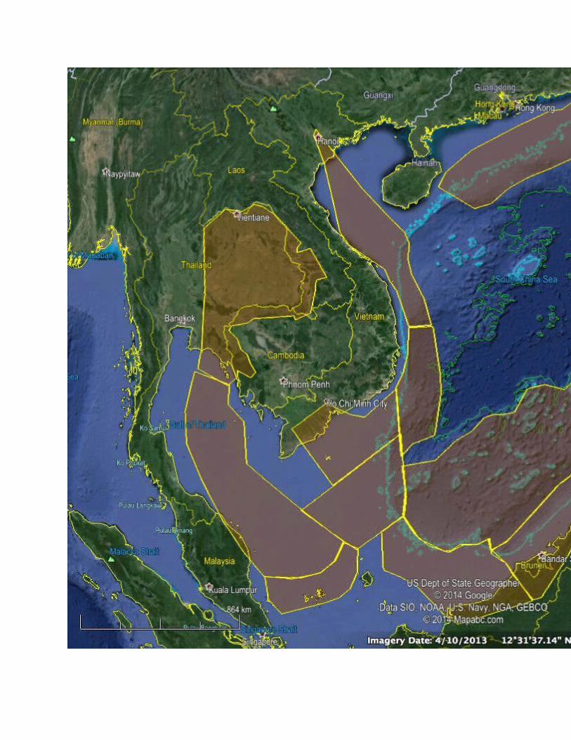
Figure . Sedimentary basins with prospective petroleum reserves, as identified by the US Energy
Information Administration, shaded in orange. Bajo de Masinloc is located in area with no petroleum
prospects. (Source: EIA)
However, we do share a broader interest with the international community, in the freedom of
navigation and full and free passage through the sea lanes of communication around Bajo de
Masinloc, as well as the air passage routes of commercial aircraft. Bajo de Masinloc is strategically
positioned as a vantage point from which to surveil shipping and air traffic in the South China Sea.
Data from Automatic Identification Systems on board ships trace major routes; every day, hundreds
of ships pass through the areas west and east of Bajo de Masinloc. Ships give it wide berth to avoid
the risk of groundings and collisions. At the same time, hundreds of commercial aircraft, especially
those that transit into or out of the Philippines, pass by or through the airspace of Bajo de Masinloc.
The fact that Bajo de Masinloc also lies directly adjacent to Manila and Subic emphasizes its
strategic importance for air and sea navigation. (Figure 4)
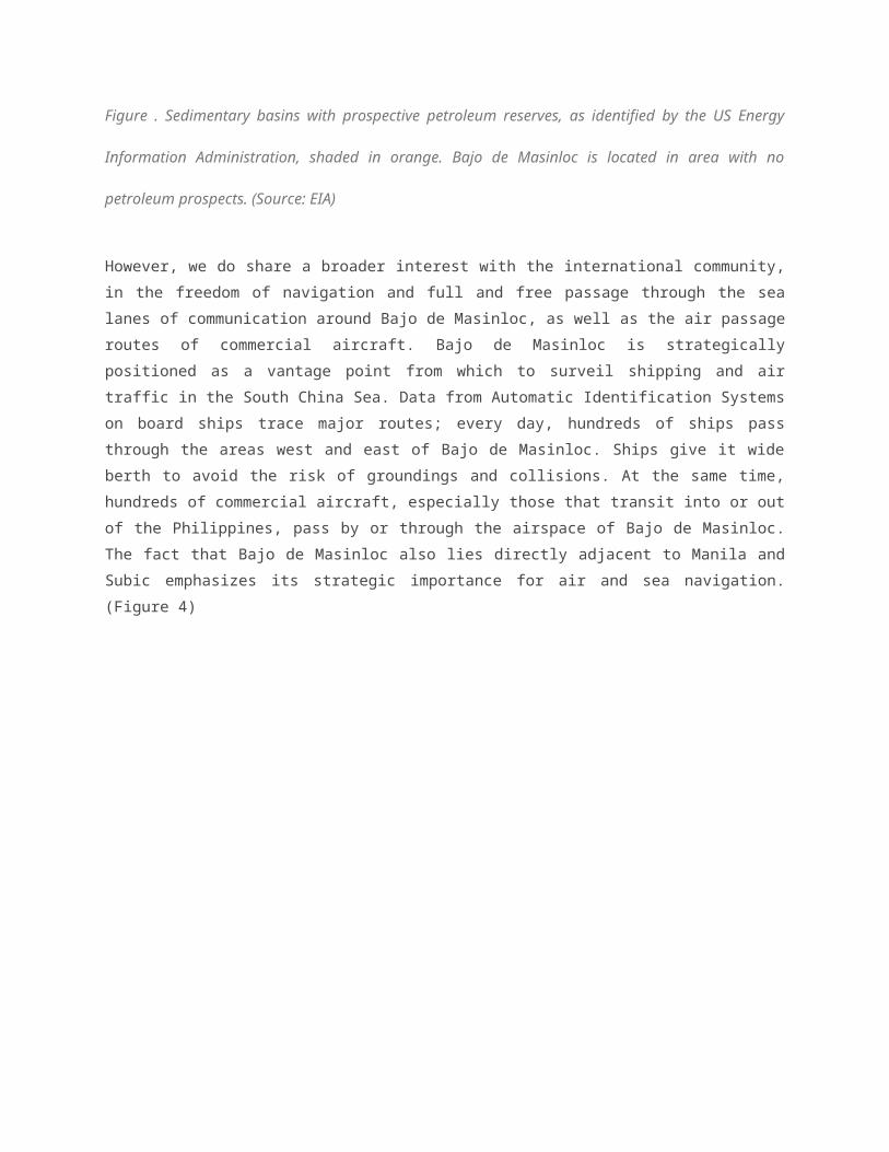

Figure . Sea routes (red) and air routes (green) through the West Philippine Sea and South China
Sea. Bajo de Masinloc is strategically located between such routes near Manila and Subic. (Source:
NCEAS, ICAO)
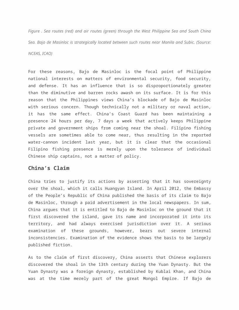
For these reasons, Bajo de Masinloc is the focal point of Philippine national interests on matters of
environmental security, food security, and defense. It has an influence that is so disproportionately
greater than the diminutive and barren rocks awash on its surface. It is for this reason that the
Philippines views China’s blockade of Bajo de Masinloc with serious concern. Though technically not
a military or naval action, it has the same effect. China’s Coast Guard has been maintaining a
presence 24 hours per day, 7 days a week that actively keeps Philippine private and government
ships from coming near the shoal. Filipino fishing vessels are sometimes able to come near, thus
resulting in the reported water-cannon incident last year, but it is clear that the occasional Filipino
fishing presence is merely upon the tolerance of individual Chinese ship captains, not a matter of
policy.
China’s Claim
China tries to justify its actions by asserting that it has sovereignty over the shoal, which it calls
Huangyan Island. In April 2012, the Embassy of the People’s Republic of China published the basis
of its claim to Bajo de Masinloc, through a paid advertisement in the local newspapers. In sum,
China argues that it is entitled to Bajo de Masinloc on the ground that it first discovered the island,
gave its name and incorporated it into its territory, and had always exercised jurisdiction over it. A
serious examination of these grounds, however, bears out severe internal inconsistencies.
Examination of the evidence shows the basis to be largely published fiction.
As to the claim of first discovery, China asserts that Chinese explorers discovered the shoal in the
13th century during the Yuan Dynasty. But the Yuan Dynasty was a foreign dynasty, established by
Kublai Khan, and China was at the time merely part of the great Mongol Empire. If Bajo de Masinloc
was indeed acquired by virtue of discovery, then such discovery could only be in the name of the
sovereign, the Mongol Empire. Perhaps it should therefore be claimed by the remnant of the Mongol
Empire, which is Mongolia, not China.
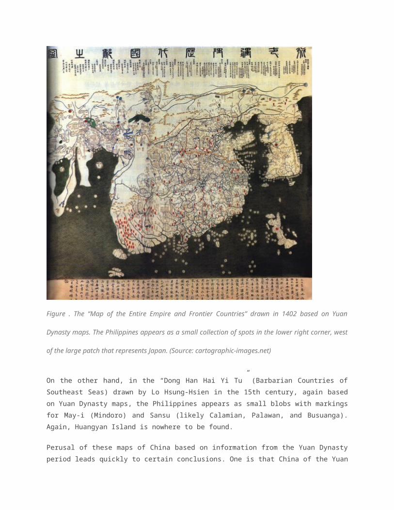
Be that as it may, as Justice Carpio points out and as seen on some of the maps in the exhibit, any
ordinary person can see how tenuous this claim is. “Huangyan Island” never appears as such in any
of the ancient maps of China, even after the Yuan Dynasty. We have two examples. In the “Hun Yi
Jiang Li Li Dai Guo Du Zi Tu” (Map of the Entire Empire and Frontier Countries) made by Quan Jin
in 1402, based on maps from the Yuan Period, the Philippines is included in the lower part of the
map. But, it appears as only as a collection of small vague patches, indicating only the largest
islands of Mindoro and parts of Palawan. Huangyan Island is not indicated at all. (Figure 5)
Figure . The “Map of the Entire Empire and Frontier Countries” drawn in 1402 based on Yuan
Dynasty maps. The Philippines appears as a small collection of spots in the lower right corner, west
of the large patch that represents Japan. (Source: cartographic-images.net)
On the other hand, in the “Dong Han Hai Yi Tu” (Barbarian Countries of Southeast Seas) drawn by
Lo Hsung-Hsien in the 15th century, again based on Yuan Dynasty maps, the Philippines appears
as small blobs with markings for May-i (Mindoro) and Sansu (likely Calamian, Palawan, and
Busuanga). Again, Huangyan Island is nowhere to be found.

Perusal of these maps of China based on information from the Yuan Dynasty period leads quickly to
certain conclusions. One is that China of the Yuan period actually had very little information of the
Philippines and its largest islands in terms of location, size, or shape. Chinese cartographers did not
even give the Philippines much importance, as compared with Japan, Taiwan, and Hainan. Second,
China at the time clearly did not have full and accurate knowledge of even the largest islands of our
archipelago. If it could not even determine the location, size, or shape of Luzon, then much less
could it identify the infinitesimal rocks and reef of Bajo de Masinloc. China could not possibly claim
discovery in this period, since information from the period itself is non-committal.
Furthermore, Chinese records tend to indicate the reverse. According to them, as early as the 7th
and 10th century, the ancestors of the Filipinos had established contact with China under the Tang
Dynasty 700 years before the Yuan. Thus China knew very well that the islands of the Philippines
were inhabited by coastal seafaring peoples. Chinese annals such as the “Chu Fan Chi” of Chau Ju
Kuo even speak in fear of the slave-raiding expeditions of the Visayans, reaching as far north as the
coast of Fujian Province. Thus, it was Philippine ancestors, not Chinese, who were the masters of
the Southeast Asian seas.
Chinese records also speak of a lucrative trade in metals, weapons, musical instruments and
jewellery reaching as far South as Butuan, one of the largest port polities of ancient times. These
port polities were flourishing at a time when China withdrew into itself and abandoned trade with the
outside world. It was the profitability of that trade that caused Chinese traders to lobby with their
reclusive government to allow trade missions to and from Southeast Asia, and this eventually bore
fruit.
So, if ever the Yuan Dynasty mariners came to the Philippines or any of its parts, it was because
they knew that our ancestors were already there. These were not journeys of discovery of hidden
places, but purposeful voyages to trade with known peoples and places.
As for the second basis of its claim, it bears noting that the name “Huangyan Island” was not on
Chinese maps of the South China Sea until about 1983. The feature is reportedly indicated for the
first time in the Chinese map of the South China Sea in 1935, and included as one of the features
listed by the Water Mapping Committee in the original version of the now infamous 9 dashed lines
map. The original map (containing 11 dashed lines), gave the reef the Sinicized name of
Scarborough. Thus the very first name given for a place discovered in ancient times was the
Chinese version of an English name given by English cartographers. This is stark evidence that as
late as 1947, China did not even know of the shoal, and only became aware of it from British
Admiralty charts.
In fact, Bajo de Masinloc does not receive any distinctly Chinese designation until it was renamed
Minzhu Reef. The problem, however, is that it is listed as part of the Nansha Qundao, or the Spratly
Islands. The Spratlys are a totally distinct group of islands some 260 nautical miles away from Bajo
de Masinloc. It is difficult to conceive of a proper and effective naming of a place when its location
does not even appear to be known. China did not call the place Huangyan Island until after 1983,
nearly 40 years later, after it sent its first recorded hydrographic survey to the area without informing
the Philippines. It is reasonable to surmise that the change in designation and grouping was a direct
result of that modern survey; and that it was only in 1977 that China actually reached Bajo de
Masinloc, and realized that it could be more than a reef.
The reason for its designation as an “island” is clear: it is the only feature above water in the
imaginary Zhongshe Qundao that supposedly lies between the Paracels and the Philippines. As
such, it is the only feature that can justify China’s claim to the existence of Zhongshe Qundao which
includes the completely-submerged Macclesfield Bank.
If the location of what China now calls Huangyan Island was not even known and fixed until 1983,
then it becomes eminently clear that the claim to continuous exercise of jurisdiction is
unsubstantiated. For China, Huangyan Island only came into existence in 1983, and it was nothing
more than a pinpoint on a map as far as its government was concerned. The only time it attempted
to exercise any kind of jurisdiction over Bajo de Masinloc was in 1994, when it issued a permit to an
amateur radio operator to set up an amateur radio station on the shoal, igniting the present day
dispute over it.
Philippine Sovereignty over Bajo de Masinloc
In law, when a dispute arises and is brought for resolution by a third party, a claimant must rely on
the strength of his own claim and not the weakness of the other’s. In a similar manner, we can now
consider the basis and nature of the Philippines’ rights over Bajo de Masinloc, not only by pointing
out the palpable weaknesses of China’s claims, but by stressing the stronger basis and evidence of
Philippine sovereignty and jurisdiction over the shoal.
Perusal of the public record reveals that Philippine sovereignty over Bajo de Masinloc is clearly
established beyond a shadow of doubt. It is the inevitable outcome of a process of consolidation of
jurisdiction through acts a titre de sourverain, exercised over a specific location beginning during the

Spanish colonial period and continuously exercised up until the present time. Such acts pre-date
China’s uncertain claim, which can only be presumed to have been made only in 1947 at the
earliest, when the Republic of China drew the original 11 dashed lines map and thereby enclosed
Bajo de Masinloc. And even then it was merely a claim on paper, not preceded or accompanied by
actual exercises of State power.
As demonstrated by Justice Carpio’s exhibit, ancient Chinese maps tended to ignore lands that lay
beyond China’s coast: ancient Chinese cartographers did not show a whole lot of detail beyond the
few names that pertained only to the largest islands in the Philippines like May-i. The absence of any
mark indicating Huangyan Island, indeed of the name Huangyan Island itself, in any of these ancient
maps is eloquent proof in itself. Such shortcomings in detail contrast with those of European maps of
the Philippines and Southeast Asia, as geographic knowledge of the region spread in the 17th
century. Bajo de Masinloc began appearing as an unnamed reef clearly associated with the island of
Luzon, often almost like a smudge under the notation “Punto de Mandato” (Point of Mandate). What
is important to note here is that from its initial appearance, Bajo de Masinloc is closely associated
with the Philippine archipelago.
In the 18th century, maps of Southeast Asia and the Philippines indicated three distinct reefs west of
Luzon, which soon acquired names in the famous Murillo Velarde map of the Philippine archipelago
published in 1734. These reefs were all located on approaches to Manila, all triangular in shape but
oriented differently, and from North to South, distinctly named in Tagalog as “Galit”, “Panacot”, and
“Lumbay”. Subsequent maps reflected the same information, though with varied distances relative to
the coast. They also acquired other names, such as Bajo de Bolinao, Bajo de Masinloc, and Bajo de
Miravela, respectively. Bajo de Masinloc was also called Maroona or South Maroona in other maps.
The multiple locations and different names may be understood as the result of inaccuracy of map-
making at the time; indeed, until the invention of the ship-board chronometer, it was very difficult for
ships to ascertain their position at sea through nothing more than the stars to guide them.
The imprecise position of the three reefs would soon be resolved, however, beginning with the
grounding of a British sailing ship, the HMS Scarborough, which was chartered by the East India
Company to transport tea between China and the British East Indies. On September 12, 1748, the
ship ran aground on Bajo de Masinloc. The captain’s log describes the near-tragedy that befell
the HMS Scarborough:
“At daylight, the rocks appeared frightful, though it pleased God the ship was on the sea side of the shoal, which is at least 2 leagues over and 8 long. On the east side of the shoal, the rocks are almost as high as those of Sicily, and a terrible sea breaks over them; on the west side, they are no bigger than a boat. They seemed to lie about North-Northwest and South-Southeast. I think the
Scarborough was near their north end, seeing the water blue to the northward of them, and rocks were seen Southeast by South 3 leagues from the ship.”
The grounding of the HMS Scarborough was a very significant cartographic event, as maps
published after the period were soon annotated with the mishap. The reef on which it grounded
appeared to be in a different location from that of either Panacot, Galit, or Lumbay, and there was
some uncertainty as to whether it was actually on Panacot or South Maroona reef, and some maps
portrayed it as an entirely different reef designated as “Scarborough Shoal.” There was some initial
debate as to which reef the HMS Scarborough struck, but eventually it was surmised that it could
only have been Panacot or Bajo de Masinloc (or South Maroona / Marsingola, as some British maps
called it).
It would take a few more decades before the debate would be settled, and the coordinates of
Scarborough Shoal could be fixed. In May 1792, the Malaspina Expedition, a major scientific
undertaking of the time, travelled through the South China Sea and was able to ascertain the exact
position of Scarborough Shoal. The expedition also verified that the other two reefs indicated in
previous maps did not actually exist, and all such markings could only have referred to Scarborough
Shoal. A translated extract, dated from May 4-6, 1792, from the expedition’s journal states:
“… under this supposition it will be necessary to exclude from the map of Mr. Dalrymple the shoal with that name which is located at the distance of 57 leagues from land, and to establish as the only and true Scarborough another one located in the same latitude, but nearer to it. …The exact position of this reef is very important because many vessels, national and foreign, have perished in it.”
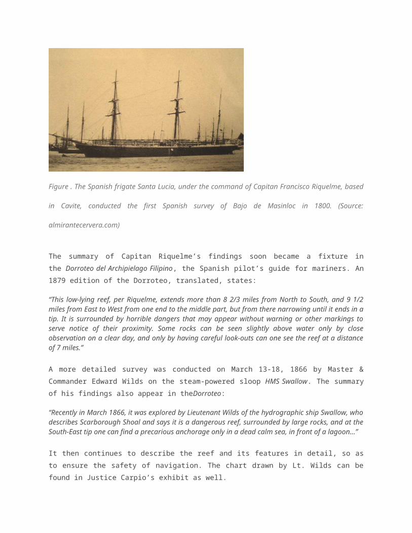
With the position of Bajo de Masinloc ascertained, and the absence of the other two reefs confirmed,
the Spanish naval squadron based in Cavite, under the command of General Alava, eventually sent
the frigate Santa Lucia led by Capitan Francisco Riquelme to carry out the first detailed Spanish
survey of the shoal in the year 1800. The Santa Lucia was among the first steam-powered vessels
that Spain introduced into the Philippine Islands to embark on its campaign against the Sultan of
Sulu and to suppress the Moro slave-raiding pirate bands that roamed Philippine waters. (Figure 6)

Figure . The Spanish frigate Santa Lucia, under the command of Capitan Francisco Riquelme,
based in Cavite, conducted the first Spanish survey of Bajo de Masinloc in 1800. (Source:
almirantecervera.com)
The summary of Capitan Riquelme’s findings soon became a fixture in the Dorroteo del Archipielago
Filipino, the Spanish pilot’s guide for mariners. An 1879 edition of the Dorroteo, translated, states:
“This low-lying reef, per Riquelme, extends more than 8 2/3 miles from North to South, and 9 1/2 miles from East to West from one end to the middle part, but from there narrowing until it ends in a tip. It is surrounded by horrible dangers that may appear without warning or other markings to serve notice of their proximity. Some rocks can be seen slightly above water only by close observation on a clear day, and only by having careful look-outs can one see the reef at a distance of 7 miles.”
A more detailed survey was conducted on March 13-18, 1866 by Master & Commander Edward
Wilds on the steam-powered sloop HMS Swallow. The summary of his findings also appear in
theDorroteo:
“Recently in March 1866, it was explored by Lieutenant Wilds of the hydrographic ship Swallow, who describes Scarborough Shoal and says it is a dangerous reef, surrounded by large rocks, and at the South-East tip one can find a precarious anchorage only in a dead calm sea, in front of a lagoon…”
It then continues to describe the reef and its features in detail, so as to ensure the safety of
navigation. The chart drawn by Lt. Wilds can be found in Justice Carpio’s exhibit as well.
Thus, by the 19th century, Galit and Lumbay no longer appeared in published maps, while Panacot
or Bajo de Masinloc acquired the name by which it became well-known internationally: Scarborough
Shoal. Its geographic position was already ascertained by coordinates of longitude and latitude, and

its association with the landmass of Luzon fixed. Spain began exercising search and rescue
jurisdiction over the shoal, assisting vessels in distress by sending ships from Manila.
That Spain began exercising jurisdiction at this time is very important. The end of the century saw
the transfer of the Philippines to the United States through two treaties of cession. While the Treaty
of Paris of 1898 described the Philippine Islands as being comprised of all the islands within an
irregular polygon, Spain also had sovereignty and jurisdiction over islands and places outside of the
lines of that polygon. These islands and places were clarified to have also been transferred to the
United States under the terms of the Treaty of Washington of 1900.
Thus, the American colonial government continued periodically to exercise jurisdiction over the
shoal, particularly through rescue and salvaging of ships in distress. One very well-documented
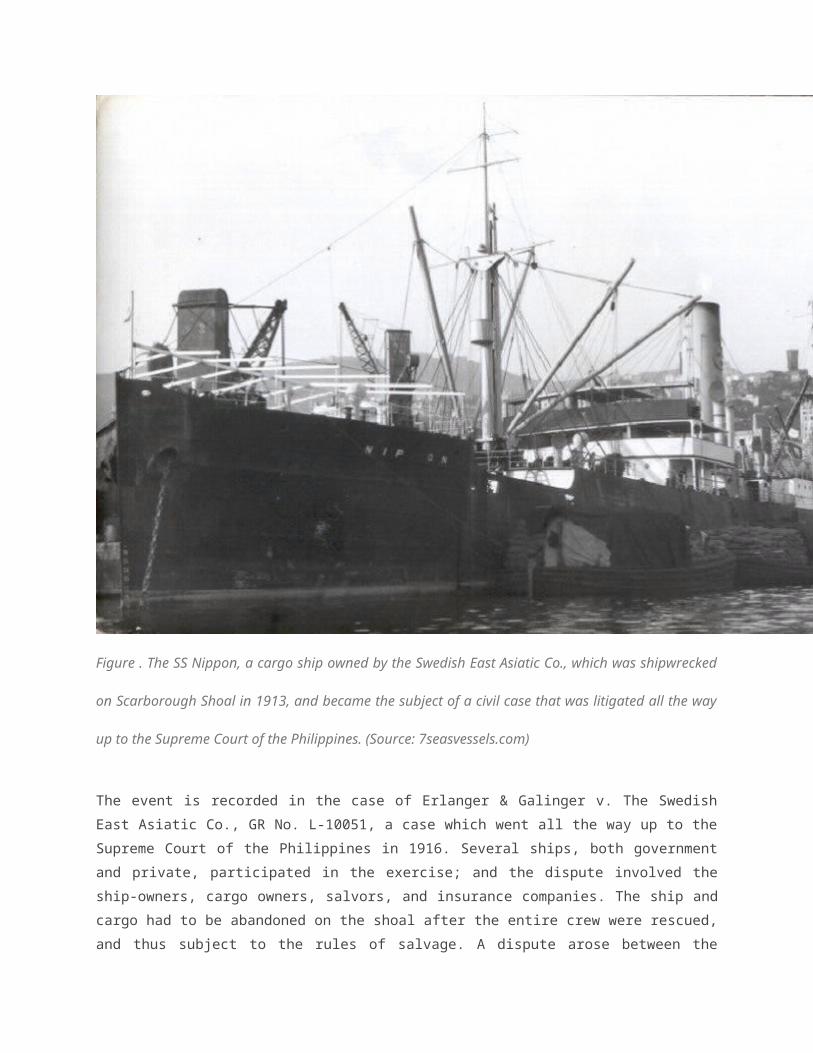
event took place in 1913, when the S.S. Nippon, a Swedish steamer carrying a valuable cargo of
copra, was wrecked on the shoal by a typhoon as the ship proceeded from Manila to Hong Kong.
The shipwreck demonstrated the exercise of a whole gamut of maritime jurisdictions: the ship’s crew
were rescued, the incident was officially investigated by Philippine maritime authorities, the ship
subjected to salvage law in the Philippines, and an official scientific study was conducted on the
effects of the sea on the ship’s cargo.
Figure . The SS Nippon, a cargo ship owned by the Swedish East Asiatic Co., which was
shipwrecked on Scarborough Shoal in 1913, and became the subject of a civil case that was litigated
all the way up to the Supreme Court of the Philippines. (Source: 7seasvessels.com)
The event is recorded in the case of Erlanger & Galinger v. The Swedish East Asiatic Co., GR No. L-
10051, a case which went all the way up to the Supreme Court of the Philippines in 1916. Several
ships, both government and private, participated in the exercise; and the dispute involved the ship-
owners, cargo owners, salvors, and insurance companies. The ship and cargo had to be abandoned
on the shoal after the entire crew were rescued, and thus subject to the rules of salvage. A dispute
arose between the owners and salvors as to the entitlement to compensation for salvage of the ship
and remaining cargo.
In resolving the case, the Supreme Court discussed every important detail of the event, thus
recording the evidence of exercise by the Philippines of various jurisdictions. This is one case where
the actions of a domestic court can have significant international implications. The facts narrated, as
well as the case itself, demonstrates the free and absolute exercise of governmental powers by the
Philippines, as well as the application of Philippine law to activities taking place on the shoal.
The rescue of the crew is also reported in the records of the US Coast and Geodetic Survey, which
dispatched 3 cutters, a scow, and the cableship Rizal to engage in salvage operations of the S.S.
Nippon over the course of several months. The report was transmitted to the US Government as part
of the report of the Governor-General of the Philippines.
Government administration is also demonstrated by the exercise of investigative powers over the
incident, as recorded in the reports of the Bureau of Navigation of the colonial government. The
Bureau of Science even conducted scientific research on the wreck, to observe the effects of the sea
on the cargo of copra while the ship was still on the shoal. The results were published in the official
scientific journal of the Government of the Philippine Islands.
Further evidence shows the consolidation of jurisdiction and sovereignty over the shoal.
Scarborough Shoal is listed in the official inventory of the Philippine Islands, assembled by the
American colonial government, which appears in the Census of the Philippine Islands published in
1918.
A few decades later, the very question of sovereignty over the shoal was tackled directly by the
Commonwealth Government. On December 6, 1937, Mr. Wayne Coy of the Office of the US High
Commissioner for the Philippines specifically asked Captain Thomas Maher, head of the US Coast
and Geodetic Survey, whether Scarborough Shoal had been claimed by any country. Capt. Maher
replied on December 10, 1937 that there was no information as to whether any nation, including the
British, had laid claim of sovereignty over the shoal. His office had no power to decide on the issue
of sovereignty, but noted that there was information available from previous Spanish and other
records, particularly the survey of the Santa Lucia in 1800. Captain Maher also said,
“If this survey would confer title on Spain or be a recognition of sovereignty, or claim for same without protest, the reef would apparently be considered as part of Spanish territory the transfer of which would be governed by the treaty of November 7, 1900.”
Captain Maher further suggested a new survey of the shoal, and the installation of a navigational
light.
Interest in formally claiming the shoal remained in succeeding months, with Jorge B. Vargas then
writing Mr. Couy to inquire as to the status of Scarborough Shoal. Mr. Vargas further expressly
stated that:
“The Commonwealth Government may desire to claim title thereto should there be no objection on the part of the United States Government to such action.”
Mr. Coy forwarded the letters to the Department of War, which in turn forwarded them to the
Department of State, in the United States. The resulting correspondence between the different
offices is very revealing. In a letter dated July 27, 1938, Secretary of State Cordell Hull informed
Secretary of War Harry Woodring, that:
“This Department has no information in regard to the ownership of the shoal other than that which appears in the file attached to the letter under reference. While the shoal appears outside the limits of the Philippine archipelago as described in Article III of the American-Spanish Treaty of Paris of December 10, 1898, it would seem that, in the absence of a valid claim by any other government, the shoal should be regarded as included among the islands ceded to the United States by the American-Spanish treaty of November 7, 1900.”
He continued:
“Accordingly, in the absence of evidence of a superior claim to Scarborough Shoal by any other government, the Department of State would interpose no objection to the proposal of the Commonwealth Government to study the possibility of the shoal as an aid to air and ocean navigation, provided that the Navy Department and the Department of Commerce, which are interested in air and ocean navigation in the Far East, are informed and have expressed no objection to the course of action contemplated by the Commonwealth Government.”
Subsequently, Acting Secretary of the Navy W.R. Furlong wrote Acting Secretary of War Louis
Johnson:
“It is noted that the Commonwealth Government of the Philippine Islands desires to study the possibilities of this reef, particularly as to its value as an aid to air navigation and with the possibility of later claiming title thereto should there be no objection on the part of the United States Government to the such [sic] action.
“The papers accompanying your letter which are returned herewith, have been carefully considered and this Department has no objection to the course of action contemplated by the Commonwealth Government.”
Then, on October 19, 1938, Secretary of Commerce Paul Frizzell wrote the Secretary of War:
“It is noted that the Commonwealth Government of the Philippines desires to study the value of Scarborough Shoal as an aid to air navigation with the possibility of later claiming title thereto. It is further noted that the Secretary of State will interpose no objection to the proposal of the Commonwealth Government, provided the Navy and Commerce departments express no objection.
“Please be advised that the Civil Aeronautics Authority sees no objection to the proposed action.”
The foregoing series of correspondence confirms the jurisdiction of the Philippines under the
Commonwealth Government, and lays the ground for the actual exercise of sovereignty in later year.
It is clear the United States considered itself to have acquired the shoal from Spain under the Treaty
of Washington of 1900, and thus had no objection to transferring the same to the Commonwealth. All
throughout the Commonwealth Period, the Philippine Government had always considered
Scarborough Shoal under its exclusive sphere of influence, marking it prominently in maps of the
Commonwealth and continuously exercising particularly maritime jurisdiction over the shoal. This is
seen in the Coast Pilot Guides issued by the US Coast and Geodetic Survey, and in search and
rescue operations on the shoal.
After the birth of the Republic of the Philippines in 1946, Bajo de Masinloc continued to be subject to
its power, which actually grew in intensity. In 1961, the Philippine Coast and Geodetic Survey sent a
hydrographic and topographic survey team to the shoal, led by Lieutenant Commander Antonio P.
Ventura. They spent four days mapping and sounding the shoal to produce a detailed chart of Bajo
de Masinloc and its environs. A hut with a tide and current station was also installed on the biggest
rock.
Two years after, in 1963, the local press reported on the rescue of the crew of the French vessel
Arsineo, which was shipwrecked on the shoal. A commercial vessel and a US Navy vessel brought
the crew to Manila. This was only one of many shipwrecks on the shoal throughout its entire history.
The Philippine Coast and Geodetic Survey was responsible for marking those shipwrecks on the
nautical charts, and earlier versions of Chart 4200 (containing the complete map of the archipelago)
clearly indicated both shipwrecks and navigational lights on the shoal.
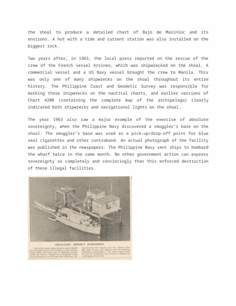
The year 1963 also saw a major example of the exercise of absolute sovereignty, when the
Philippine Navy discovered a smuggler’s base on the shoal. The smuggler’s base was used as a
pick-up/drop-off point for blue seal cigarettes and other contraband. An actual photograph of the
facility was published in the newspapers. The Philippine Navy sent ships to bombard the wharf twice
in the same month. No other government action can express sovereignty so completely and
convincingly than this enforced destruction of these illegal facilities.
Figure . An actual picture from the local newspapers, of the smuggler’s roost found and destroyed by
the Philippine Navy on Scarborough Shoal in October 1963. (Source: Ayala Museum)
Perhaps to discourage the re-establishment of the smuggler’s base, and to maintain a naval
presence around the shoal, the Philippines allowed the establishment of a US Naval Operating Area
covering a 20 mile radius around the shoal. This turned Scarborough Shoal into a target and
bombing range for the Philippine and US Navy. The whole world was notified of this fact through the
Coast Pilot Guides regularly issued by the Philippine Coast and Geodetic Survey.
Absolute sovereignty continued to be exercised well into the 1970s and 1980s, as shown by “Notice
to Mariners” issued by the Philippine Coast and Geodetic Survey and the Philippine Navy, warning
all ships of live fire exercises, including a missile firing exercise by the US Navy operating out of
Subic Bay, in the early 1980s.
All these exercises of sovereignty were uninterrupted and conducted peacefully and openly, without
protest from any country including China, all throughout this time, until as late as 1995, and even in
the summer of 1997 when the Coast and Geodetic Survey Division of NAMRIA conducted a GPS
survey of the shoal as part of its effort to identify points to be used to create the archipelagic
baseline system under UNCLOS.
It therefore becomes clear that contrary to China’s insistence, it was China, not the Philippines,
which only began asserting a claim to Bajo de Masinloc/Scarborough Shoal in the 1990s when it
issued a permit to amateur radio operators to establish and operate an amateur radio station

thereon. The incident was immediately protested by the Philippines at the time, and the radio station
removed. This is the event which initiates the Philippines-China dispute over Bajo de Masinloc,
flaring up again in 2002 and then culminating in China’s blockade of the shoal in 2012. It was only in
the 1990s when China actually and clearly claimed the shoal, and it was only in 2012 that it actually
asserted and exercised (albeit illegally) any form of jurisdiction thereon.
Summary and Observations
These lesser-known historical facts trump the published fiction that China has been propagating
lately in order to justify its current blockade of Bajo de Masinloc/Scarborough Shoal. Justice Carpio’s
map exhibit is indeed an important and timely critique of the very foundation of China’s claims, and is
complemented by the historical record that also clearly supports the Philippines’ sovereignty and
jurisdiction over the shoal.
In summary, the substance of this presentation is fairly simple. Scarborough Shoal is an integral part
of the Philippine archipelago, acquired and incorporated through a steady process of exercise of
acts à titré de souverain begun in the Spanish colonial period, that continued and amplified
throughout the American colonial period, and consolidated into full sovereignty by the time the
country was in transition from Commonwealth to independent Republic. By the 1960s, absolute
sovereignty was already being exercised and demonstrated very clearly, palpably, openly, and
publicly to the exclusion of every other country in the region, including China.
Permit me the indulgence of some parting observations. First, the 1898 Treaty of Paris and the 1900
Treaty of Washington are quite material and relevant not only for the Philippines, but also for the
United States, to which the Republic of the Philippines legally succeeded in sovereignty over all
rights and jurisdictions over the territories of the archipelago. From the American point of view in the
1930s, it appears that Spain had a “title or claim of title” over Bajo de Masinloc/Scarborough Shoal
which was acquired by the United States, which in turn saw fit to transfer to the Commonwealth of
the Philippines. The correspondence between the Commonwealth officials and the US Departments
of State, War, and Commerce clearly premise the Commonwealth’s acquisition of the shoal, and US
consent thereto, upon its inclusion within the terms of the 1900 Treaty of Washington. Clearly
therefore, the Philippines had been exercising exclusive jurisdiction over the shoal since at least the
19th century under Spain, and expanded such exercises in the 20th century under the United States
and as an independent republic. It did not only begin exercising jurisdiction in 1946: it was actually
continuing the exercise of pre-existing jurisdictions that matured into full sovereignty. In our
Constitutions, Scarborough Shoal is included as among the territories “over which the Government
of the Philippine Islands exercises jurisdiction” (1935 Constitution), then “by historic right or legal

title” (1973 Constitution), and then “all other territories over which the Philippines has sovereignty or
jurisdiction” (1987 Constitution).
Second, if Bajo de Masinloc/Scarborough Shoal was indeed included as part of the archipelago
transferred by the United States to the independent Republic of the Philippines, then it is arguably
Philippine island territory subject to American defense commitments under the Philippines-US
Mutual Defense Treaty. This is important in light of the most prominent means by which China now
asserts its claims to the South China Sea: through the use of its lightly-armed but large coast guard
vessels against foreign ships, and more recently trough reclamation activities.
Under present circumstances, the only thing that prevents legal commitments under the MDT from
being invoked are that there has not yet been “an armed attack…on the island territories under its
jurisdiction in the Pacific Ocean, its armed forces, public vessels or aircraft in the Pacific” per the
terms of the MDT. If China were to aggressively use its vessels in the same way as it did this year
with Vietnam, and ram or sink Philippine vessels, it could qualify as an armed attack that would
engage US defense commitments under Articles IV and V of the MDT.
If China were to attempt to install a station on, or undertake reclamation of, Bajo de
Masinloc/Scarborough Shoal to transform it into an artificial island, it would amount to nothing less
than a permanent taking of a piece of Philippine territory, and therefore be considered a direct threat
to the territorial integrity of the country. The Philippines would then be entirely justified in sending
public ships to impede or prevent such taking. If China then responds in the same way as it did with
Vietnam with respect to the oil rig HS 981, by deploying a protective fleet of ships to block and ram
such Philippine vessels, then it will thereby be carrying out a threat of an external armed attack while
actually taking the shoal. This then comes within the terms of Article III of the MDT, and the defense
commitments under the MDT may be invoked.
China’s continuing blockade of Bajo de Masinloc/Scarborough Shoal is thus skirting a very fine and
dangerous line; it has pushed the envelope to the point that just one mistake will qualify its actions
as an armed attack under the MDT. The question that must be asked and seriously considered now
is whether and how the Philippine Government is preparing for these scenarios and contingencies.
My third point is that the dispute over Bajo de Masinloc/Scarborough Shoal does not only concern
the few small rocks on the reef. Per the arbitration case filed by the Philippines, each rock is
admitted to be capable of generating a full 12 nautical mile territorial sea. There are reportedly six
rocks above water at high tide, 9 miles apart, on the reef. This creates a territorial sea area
equivalent to twice the total land area of the whole of Metro Manila. Given China’s refusal to
participate in the arbitration, it is clear that the dispute, and probably the blockade, will continue even
beyond the case’s conclusion. The Philippines must therefore be prepared to pursue its interest in
the shoal not only through litigation, but through every other available means possible. This bears
not only on the arbitration itself, but also upon the Philippines’ legal position as a whole and upon the
practical realities at sea. For as long as the blockade is maintained, there is a very high potential for
an unwanted incident that could lead to a serious escalation of the dispute. Surely, neither party
relishes the idea of an armed conflict, no matter how small or short.
The Philippines must necessarily proceed with the arbitration case since it has committed itself fully
to the process. But at the same time, it must keep its options open for addressing the other
continuing manifestations of the West Philippine Sea dispute, other than those already
encompassed in its case. Certain aspects will be subject to legal mechanisms, but other may not be.
And the Philippines would be well-advised to prepare to pursue its interests on all fronts, and by
whatever mechanisms may be available, in the near future and beyond.
This presentation is a small contribution on one of those fronts: the contest for knowledge, and the
search for truth, in the public sphere. I hope that every Filipino will join Justice Carpio and all of us
here in this difficult but worthy task.
Thank you very much.

Historical Truths and LiesScarborough Shoal in Ancient Maps
A Cartographic ExhibitBased on the 06 June 2014 Lecture of
Supreme Court Senior Associate Justice Antonio T. Carpio
Home Download
MAP 1. "Carta Hydrographica Y
Chorographica de las Yslas Filipinas" (8407x7734)Published in 1734 in Manila by the Jesuit Pedro Murillo, this is the oldest map that gives a name to "Panacot" shoal. "Panacot" is the Tagalog word for threat or danger. This map
names two Filipinos, Francisco Suarez who drew the map and Nicolas dela Cruz Bagay who engraved it. This map is considered the "mother of all Philippine
maps." This digital reproduction is from the U.S. Library of Congress (Catalog No.
2013585226; Digital ID g8060 ct003137)
MAP 2. Map attached to China's
Notes Verbale Nos. CML/17/2009 and CML/18/2009 (796x1096)
MAP 3. Official Chinese Map of the
South China Sea with the nine-dotted line (768x1269)
"Maps merely constitute information which varies in accuracy from case to case; of themselves, and by virtue
solely of their existence, they cannot constitute a territorial title, that is, a document endowed by
international law with intrinsic legal force for the purpose of establishing territorial rights." Burkina
Faso/Republic of Mali (1986 I.C.J. 554)
Thus, a state cannot enlarge its rights under international law by its own unilateral acts or domestic legislation. Yet, this is exactly what China did in 1947 when China drew
its nine- dashed line map in the South China Sea, claiming as basis historical facts.
Despite the irrelevance of historical facts to present-day maritime claims under the United Nations Convention on
the Law of the Sea, ancient maps of China made by Chinese authorities, Chinese individuals or foreigners,
and ancient maps of the Philippines made by Westerners,
Philippine authorities or individuals, vividly present the actual historical facts in the South China Sea.
MAP 4: "Hua Yi Tu" or Map of China
and the Barbarian Countries(4237x4500)Engraved in stone in Fuchang in 1136 AD during the Song Dynasty, this map of China was published in 1903(?) in France based on a rubbing of the stone engraving. The stone map is now in the
Forest of Stone Steles Museum in Xi'an, China.This map shows Hainan Island as the southernmost territory of China.The annotations on the sides of this map are not part of the stone engraving.
This digital reproduction is from the U.S. Library of Congress (Catalogue No.2002626771; Digital ID g7820 ct000284).
MAP 5. "DA MING HUN YI TU" or the
Great Ming Dynasty Amalgamated Map (895x786)Published in 1389(?) during the Ming Dynasty, this map is painted in color on silk.
The map shows Hainan Island as the southernmost territory of China.The original of the map is with the First Historical Archive of China in Beijing. This digital reproduction is from Wikimedia Commons, which sourced its copy from the library of the Hong Kong Baptist University. (http://geog.hkbu.edu.hk/
geog1150/chinese/catalog/am31_map1.htm).

MAP 6. "DA MING YU DI TU" or the
Atlas of the Ming Empire (6408x2160)Published between 1547 and 1559 by the Ming Dynasty. The map shows the then 13 provinces of China during the
Jianjing period. Taiwan is not included and Macau is not marked.The map shows Hainan Island as the southernmost territory of China.
This digital reproduction is from the U.S. Library of Congress (Catalog No. 2002626776; Digital ID g7820m gct00125).
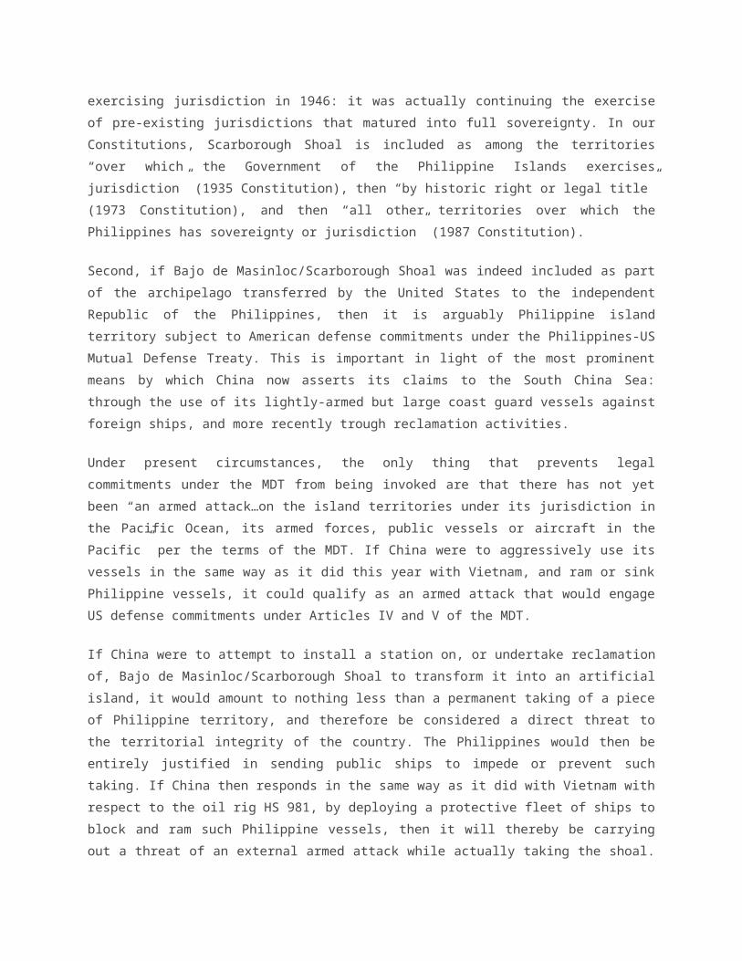
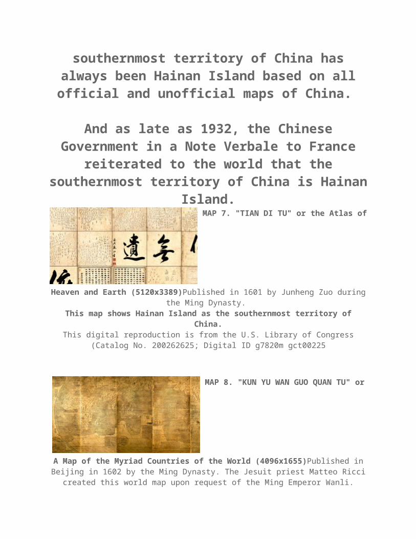
Since the start of the Song Dynasty in 960 AD until the end of the Qing Dynasty in 1912, or for almost a
millennium, the southernmost territory of China has always been Hainan Island based on all official and
unofficial maps of China.
And as late as 1932, the Chinese Government in a Note Verbale to France reiterated to the world that the southernmost territory of China is Hainan Island.
MAP 7. "TIAN DI TU" or the Atlas of
Heaven and Earth (5120x3389)Published in 1601 by Junheng Zuo during the Ming Dynasty.
This map shows Hainan Island as the southernmost territory of China.This digital reproduction is from the U.S. Library of Congress (Catalog No.
200262625; Digital ID g7820m gct00225

MAP 8. "KUN YU WAN GUO QUAN TU"
or A Map of the Myriad Countries of the World (4096x1655)Published in Beijing in 1602 by the Ming Dynasty. The Jesuit priest Matteo Ricci created this
world map upon request of the Ming Emperor Wanli. Ricci was assisted by Zhong Wentao, Li Zhizao, and other Chinese scholars.
This map shows Hainan Island as the southernmost territory of China.This digital reproduction is from the U.S. Library of Congress (Catalog No.
2010585650; Digital ID g3200 ex000006Za,b and g3200m gex00001).
MAP 9. "SELDEN MAP OF CHINA"This
map was bequeathed by John Selden to the Bodleian Library of the University of Oxford in 1659. Published sometime between 1606 and 1624 during the Ming
Dynasty. The maker of the map is an unknown Chinese. The map shows China, South Asia, Southeast Asia, and East Asia. The South China Sea is conspicuously
at the center of the map. This map shows Hainan Island as the southernmost territory of China.This digital reproduction is from the Bodleian Library of the University of Oxford
(http://seldenmap.bodleian. ox.ac.uk/map).
MAP 10. "DA QING WAN NIAN YI
TONG TIAN XIA QUAN TU" or The Great Qing Dynasty's Complete Map of

All Under Heaven (4352x2468)Published in China in 1811 by the Qing Emperor Jiaqing. This map shows Hainan Island as the southernmost territory of China. This digital reproduction is from the U.S. Library of Congress (Catalog No.
gm71005018; Digital ID g3200 ct003403).
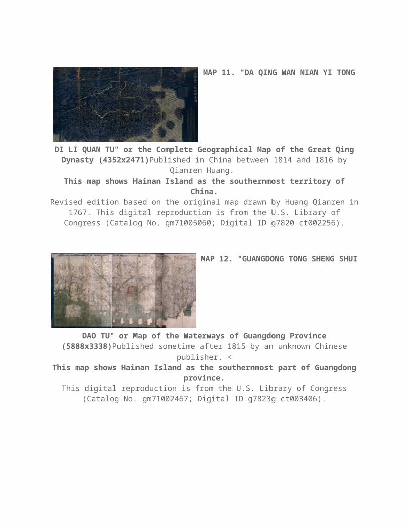
MAP 11. "DA QING WAN NIAN YI
TONG DI LI QUAN TU" or the Complete Geographical Map of the Great Qing Dynasty (4352x2471)Published in China between 1814 and 1816 by
Qianren Huang. This map shows Hainan Island as the southernmost territory of China.Revised edition based on the original map drawn by Huang Qianren in 1767.
This digital reproduction is from the U.S. Library of Congress (Catalog No. gm71005060; Digital ID g7820 ct002256).
MAP 12. "GUANGDONG TONG SHENG
SHUI DAO TU" or Map of the Waterways of Guangdong Province (5888x3338)Published sometime after 1815 by an unknown Chinese publisher.
<This map shows Hainan Island as the southernmost part of Guangdong
province.This digital reproduction is from the U.S. Library of Congress (Catalog No.
gm71002467; Digital ID g7823g ct003406).

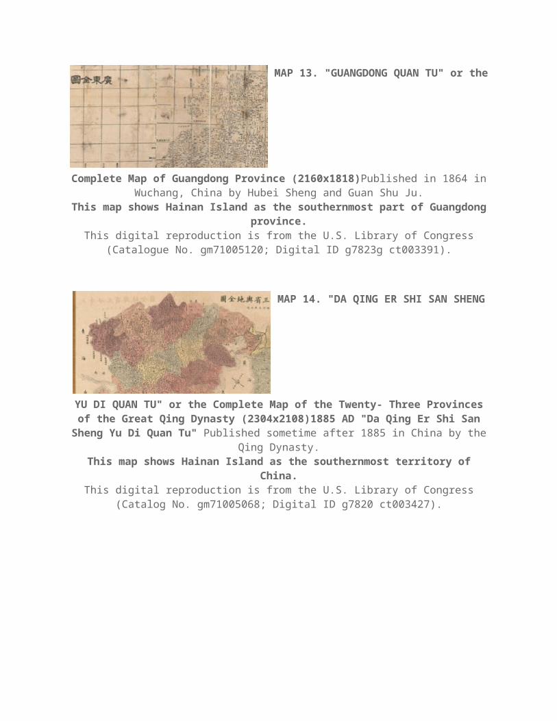
MAP 13. "GUANGDONG QUAN TU" or
the Complete Map of Guangdong Province (2160x1818)Published in 1864 in Wuchang, China by Hubei Sheng and Guan Shu Ju.
This map shows Hainan Island as the southernmost part of Guangdong province.
This digital reproduction is from the U.S. Library of Congress (Catalogue No. gm71005120; Digital ID g7823g ct003391).
MAP 14. "DA QING ER SHI SAN SHENG
YU DI QUAN TU" or the Complete Map of the Twenty- Three Provinces of the Great Qing Dynasty (2304x2108)1885 AD "Da Qing Er Shi San Sheng Yu Di Quan Tu" Published sometime after 1885 in China by the Qing
Dynasty.This map shows Hainan Island as the southernmost territory of China.
This digital reproduction is from the U.S. Library of Congress (Catalog No. gm71005068; Digital ID g7820 ct003427).
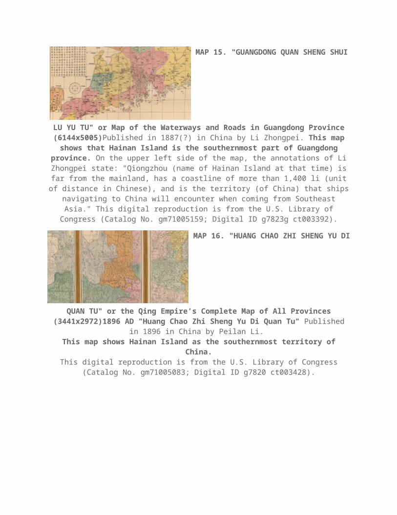
MAP 15. "GUANGDONG QUAN SHENG
SHUI LU YU TU" or Map of the Waterways and Roads in Guangdong Province (6144x5005)Published in 1887(?) in China by Li Zhongpei. This map
shows that Hainan Island is the southernmost part of Guangdong

province. On the upper left side of the map, the annotations of Li Zhongpei state: "Qiongzhou (name of Hainan Island at that time) is far from the mainland,
has a coastline of more than 1,400 li (unit of distance in Chinese), and is the territory (of China) that ships navigating to China will encounter when coming
from Southeast Asia." This digital reproduction is from the U.S. Library of Congress (Catalog No. gm71005159; Digital ID g7823g ct003392).
MAP 16. "HUANG CHAO ZHI SHENG
YU DI QUAN TU" or the Qing Empire’s Complete Map of All Provinces (3441x2972)1896 AD "Huang Chao Zhi Sheng Yu Di Quan Tu" Published
in 1896 in China by Peilan Li. This map shows Hainan Island as the southernmost territory of China.
This digital reproduction is from the U.S. Library of Congress (Catalog No. gm71005083; Digital ID g7820 ct003428).
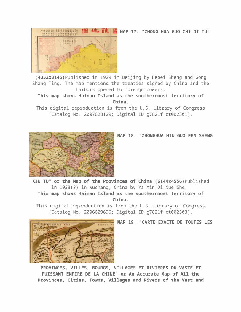
MAP 17. "ZHONG HUA GUO CHI DI TU"
(4352x3145)Published in 1929 in Beijing by Hebei Sheng and Gong Shang Ting. The map mentions the treaties signed by China and the harbors opened to
foreign powers.This map shows Hainan Island as the southernmost territory of China.
This digital reproduction is from the U.S. Library of Congress (Catalog No. 2007628129; Digital ID g7821f ct002301).

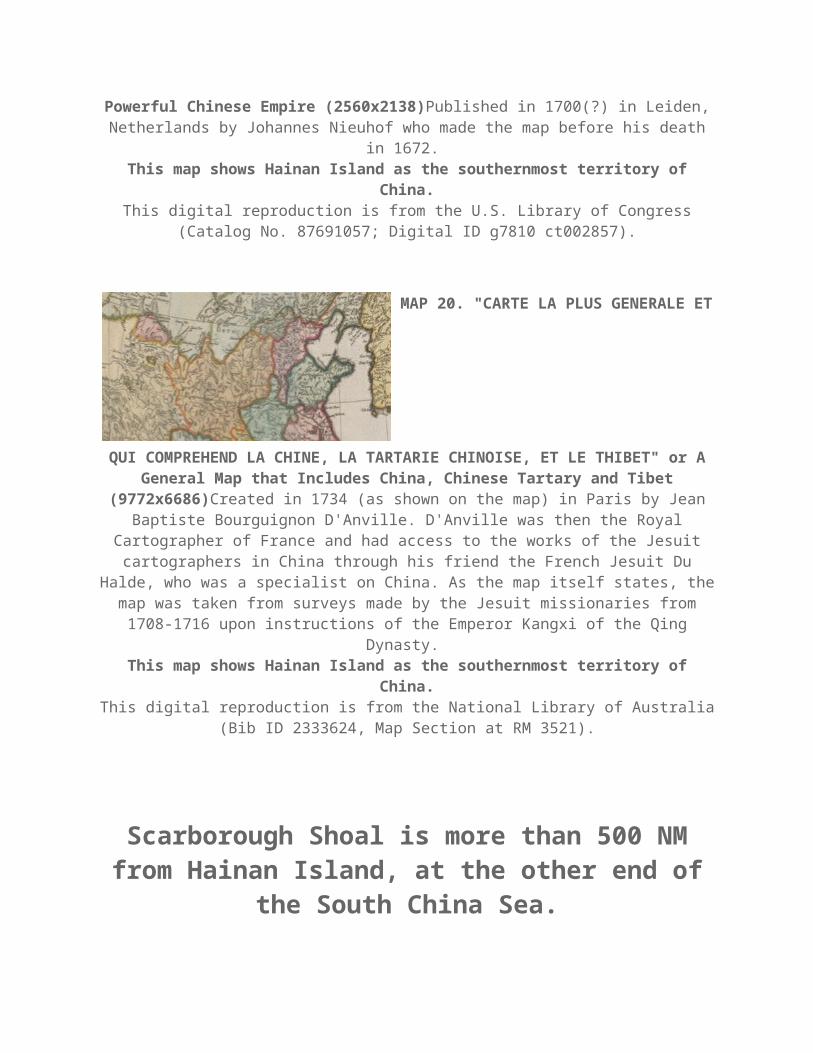
MAP 18. "ZHONGHUA MIN GUO FEN
SHENG XIN TU" or the Map of the Provinces of China (6144x4556)Published in 1933(?) in Wuchang, China by Ya Xin Di Xue She.
This map shows Hainan Island as the southernmost territory of China.This digital reproduction is from the U.S. Library of Congress (Catalog No.
2006629696; Digital ID g7821f ct002303).
MAP 19. "CARTE EXACTE DE TOUTES
LES PROVINCES, VILLES, BOURGS, VILLAGES ET RIVIERES DU VASTE ET PUISSANT EMPIRE DE LA CHINE" or An Accurate Map of All the
Provinces, Cities, Towns, Villages and Rivers of the Vast and Powerful Chinese Empire (2560x2138)Published in 1700(?) in Leiden, Netherlands by
Johannes Nieuhof who made the map before his death in 1672. This map shows Hainan Island as the southernmost territory of China.
This digital reproduction is from the U.S. Library of Congress (Catalog No. 87691057; Digital ID g7810 ct002857).
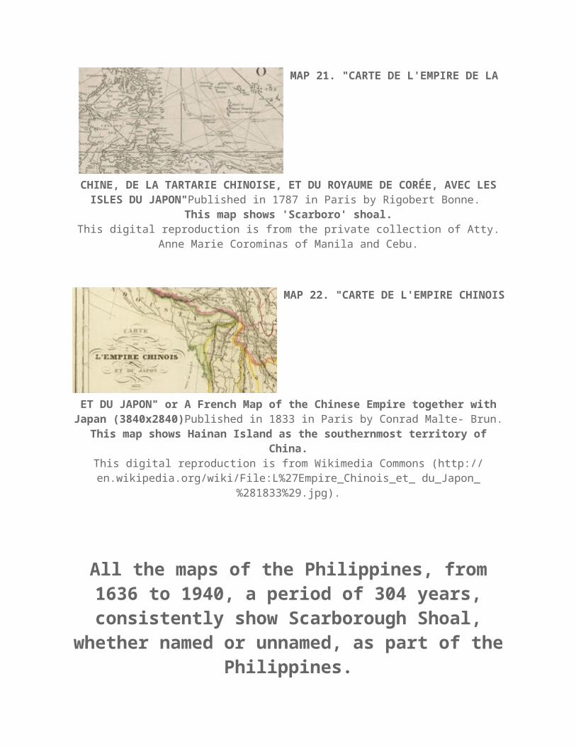
MAP 20. "CARTE LA PLUS GENERALE
ET QUI COMPREHEND LA CHINE, LA TARTARIE CHINOISE, ET LE THIBET" or A General Map that Includes China, Chinese Tartary and Tibet
(9772x6686)Created in 1734 (as shown on the map) in Paris by Jean Baptiste Bourguignon D'Anville. D'Anville was then the Royal Cartographer of France and
had access to the works of the Jesuit cartographers in China through his friend the French Jesuit Du Halde, who was a specialist on China. As the map itself
states, the map was taken from surveys made by the Jesuit missionaries from 1708-1716 upon instructions of the Emperor Kangxi of the Qing Dynasty.
This map shows Hainan Island as the southernmost territory of China.This digital reproduction is from the National Library of Australia (Bib ID
2333624, Map Section at RM 3521).
Scarborough Shoal is more than 500 NM from Hainan Island, at the other end of the South China Sea.
MAP 21. "CARTE DE L'EMPIRE DE LA
CHINE, DE LA TARTARIE CHINOISE, ET DU ROYAUME DE COREE, AVEC LES ISLES DU JAPON"Published in 1787 in Paris by Rigobert Bonne.
This map shows 'Scarboro' shoal.This digital reproduction is from the private collection of Atty. Anne Marie
Corominas of Manila and Cebu.
MAP 22. "CARTE DE L'EMPIRE
CHINOIS ET DU JAPON" or A French Map of the Chinese Empire together with Japan (3840x2840)Published in 1833 in Paris by Conrad Malte- Brun.
This map shows Hainan Island as the southernmost territory of China.

This digital reproduction is from Wikimedia Commons (http:// en.wikipedia.org/wiki/File:L%27Empire_Chinois_et_ du_Japon_%281833%29.jpg).
All the maps of the Philippines, from 1636 to 1940, a period of 304 years, consistently show Scarborough Shoal, whether named or unnamed, as part of the
Philippines.
MAP 23. "CHINA VETERIBUS SINARUM
REGIO NUNC INCOLIS TAME DICTA" (1536x1232)Published in Frankfurt in 1636 by map maker Matthaus Merian. This map shows China, Korea, Japan,
Taiwan and Northern Luzon. On the western side off the coast of Central Luzon, there is an
unnamed shoal below the words "P. de Mandato." The Spanish phrase "P. de Mandato" means the point of command - which implies there was a Spanish military garrison in that coastal place. The unnamed
shoal off this coastal place would later be called "Panacot" by the Jesuit Pedro Murillo.
This digital reproduction is from Barry Lawrence Ruderman Antique Maps, Inc. (http://www. raremaps.com/gallery/detail/36716).
MAP 24. "CARTE GENERALE DES
INDES ORIENTALES ET DES ISLES ADIACENTES" (1792x1219)Published in Paris in 1650 by the map maker Pierre Mariette.
On the western side off the coast of Central Luzon, there is an unnamed shoal below the words "P. de Mandato." This unnamed shoal
would later be called Panacot.This digital reproduction is from Barry Lawrence Ruderman Antique Maps, Inc.
(http://www. raremaps.com/gallery/detail/30701/Carte_ Generale_Des_Indes_Orientales_et_des_ Isles_Adi acentes/Mariette.html).
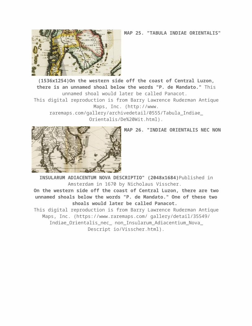
MAP 25. "TABULA INDIAE
ORIENTALIS" (1536x1254)On the western side off the coast of Central Luzon, there is an unnamed shoal below the words "P. de Mandato." This unnamed shoal would later be called Panacot.
This digital reproduction is from Barry Lawrence Ruderman Antique Maps, Inc. (http://www. raremaps.com/gallery/archivedetail/0555/Tabula_Indiae_
Orientalis/De%20Wit.html).
MAP 26. "INDIAE ORIENTALIS NEC
NON INSULARUM ADIACENTUM NOVA DESCRIPTIO" (2048x1684)Published in Amsterdam in 1670 by Nicholaus Visscher.
On the western side off the coast of Central Luzon, there are two
unnamed shoals below the words "P. de Mandato." One of these two shoals would later be called Panacot.
This digital reproduction is from Barry Lawrence Ruderman Antique Maps, Inc. (https://www.raremaps.com/ gallery/detail/35549/ Indiae_Orientalis_nec_
non_Insularum_Adiacentium_Nova_Descript io/Visscher.html).
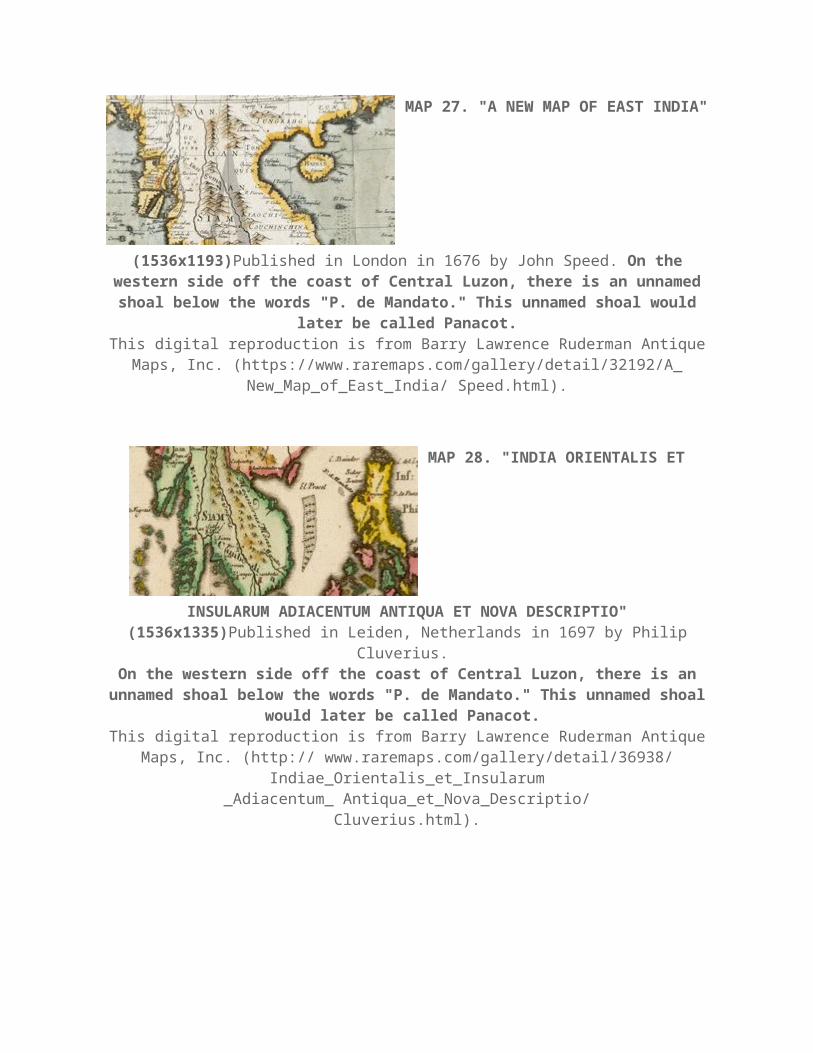
MAP 27. "A NEW MAP OF EAST INDIA"
(1536x1193)Published in London in 1676 by John Speed. On the western side off the coast of Central Luzon, there is an unnamed shoal below the words "P. de Mandato." This unnamed shoal would later be called
Panacot.This digital reproduction is from Barry Lawrence Ruderman Antique Maps, Inc. (https://www.raremaps.com/gallery/detail/32192/A_ New_Map_of_East_India/
Speed.html).
MAP 28. "INDIA ORIENTALIS ET
INSULARUM ADIACENTUM ANTIQUA ET NOVA DESCRIPTIO" (1536x1335)Published in Leiden, Netherlands in 1697 by Philip Cluverius.
On the western side off the coast of Central Luzon, there is an unnamed shoal below the words "P. de Mandato." This unnamed shoal
would later be called Panacot. This digital reproduction is from Barry Lawrence Ruderman Antique Maps, Inc.
(http:// www.raremaps.com/gallery/detail/36938/ Indiae_Orientalis_et_Insularum_Adiacentum_ Antiqua_et_Nova_Descriptio/
Cluverius.html).
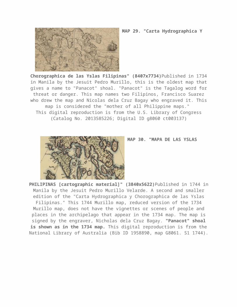
MAP 29. "Carta Hydrographica Y
Chorographica de las Yslas Filipinas" (8407x7734)Published in 1734 in Manila by the Jesuit Pedro Murillo, this is the oldest map that gives a name to "Panacot" shoal. "Panacot" is the Tagalog word for threat or danger. This map
names two Filipinos, Francisco Suarez who drew the map and Nicolas dela Cruz Bagay who engraved it. This map is considered the "mother of all Philippine
maps." This digital reproduction is from the U.S. Library of Congress (Catalog No.
2013585226; Digital ID g8060 ct003137)
MAP 30. "MAPA DE LAS YSLAS
PHILIPINAS [cartographic material]" (3840x5622)Published in 1744 in Manila by the Jesuit Pedro Murillo Velarde. A second and smaller edition of the "Carta Hydrographica y Chorographica de las Yslas Filipinas." This 1744 Murillo map, reduced version of the 1734 Murillo map, does not have the vignettes or scenes of people and places in the archipelago that appear in the 1734 map.
The map is signed by the engraver, Nicholas dela Cruz Bagay. "Panacot" shoal is shown as in the 1734 map. This digital reproduction is from the National
Library of Australia (Bib ID 1958890, map G8061. S1 1744).
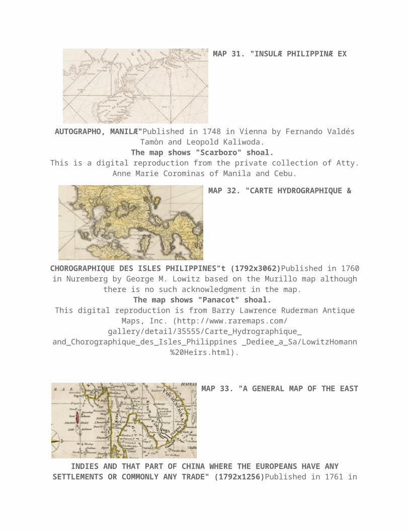
MAP 31. "INSULÆ PHILIPPINÆ EX
AUTOGRAPHO, MANILÆ"Published in 1748 in Vienna by Fernando Valdes Tamòn and Leopold Kaliwoda.
The map shows "Scarboro" shoal. This is a digital reproduction from the private collection of Atty. Anne Marie
Corominas of Manila and Cebu.
MAP 32. "CARTE HYDROGRAPHIQUE &
CHOROGRAPHIQUE DES ISLES PHILIPPINES"t (1792x3062)Published in 1760 in Nuremberg by George M. Lowitz based on the Murillo map although
there is no such acknowledgment in the map. The map shows "Panacot" shoal.
This digital reproduction is from Barry Lawrence Ruderman Antique Maps, Inc. (http://www.raremaps.com/ gallery/detail/35555/Carte_Hydrographique_ and_Chorographique_des_Isles_Philippines _Dediee_a_Sa/LowitzHomann
%20Heirs.html).
MAP 33. "A GENERAL MAP OF THE
EAST INDIES AND THAT PART OF CHINA WHERE THE EUROPEANS HAVE ANY SETTLEMENTS OR COMMONLY ANY TRADE" (1792x1256)Published in
1761 in London by the map maker Thomas Kitchin. The map shows "Panacot" shoal.
This digital reproduction is from Barry Lawrence Ruderman Antique Maps, Inc. (http://www.raremaps. com/gallery/detail/0176gh/A_General_Map_of_the_
East_Indies_and_that_Part_of_China_where_the_ Europeans/Kitchin.html).
MAP 34. "A NEW MAP OF THE
PHILIPPINE ISLANDS, DRAWN FROM THE BEST AUTHORITIES"Published in 1769 in London by Thomas Kitchin.
The map shows "Panacot" shoal. This digital reproduction is from the private collection of Atty. Anne Marie
Corominas of Manila and Cebu.
MAP 35. "EAST INDIES"
(6400x4581)Published in 1770 in London by Thomas Kitchin, the then Royal Hydrographer.
The map shows "Panacot" shoal. This digital reproduction is from the National Library of Australia (Bib ID
3620673, map-rm1424).
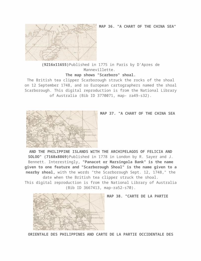
MAP 36. "A CHART OF THE CHINA
SEA" (9216x11655)Published in 1775 in Paris by D'Apres de Mannevillette.
The map shows "Scarboro" shoal.The British tea clipper Scarborough struck the rocks of the shoal on 12
September 1748, and so European cartographers named the shoal Scarborough. This digital reproduction is from the National Library of Australia (Bib ID
3770071, map- ra49-s32).
MAP 37. "A CHART OF THE CHINA SEA
AND THE PHILIPPINE ISLANDS WITH THE ARCHIPELAGOS OF FELICIA AND SOLOO" (7168x8869)Published in 1778 in London by R. Sayer and J.
Bennett. Interestingly, "Panacot or Marsingola Bank" is the name given to one feature and "Scarborough Shoal" is the name given to a nearby shoal, with the words "the Scarborough Sept. 12, 1748," the date when the
British tea clipper struck the shoal.This digital reproduction is from the National Library of Australia (Bib ID
3667413, map-ra52-s70).
MAP 38. "CARTE DE LA PARTIE
ORIENTALE DES PHILIPPINES AND CARTE DE LA PARTIE OCCIDENTALE DES PHILIPPINES"Published in 1781 in Paris by Gaitte, A.J. Two maps together forming a map of the Philippines, with upper left corner inset: Trombe Marine. Engraved by A.J. Gaitte and included in volume II of Le Gentil de la Galaisiere’s
voyage dans les Mers de L’Inde. The map shows B. de Masingolo. This is a digital reproduction from the private collection of Atty. Anne Marie Corominas of Manila
and Cebu.

MAP 39. "MAP OF THE PACIFIC OCEAN
BETWEEN THE COAST OF CALIFORNIA AND MEXICO AND JAPAN, PHILIPPINES, AND THE COAST OF CHINA" (20480x6172)Published in 1784
with the watermark PVL (Pieter van Ley). This map shows a shoal named "B. Mansiloc."
This digital reproduction is from the U.S. Library of Congress (Catalog No. 91680984, Digital ID g9230 Ih000015).
MAP 40. "ISOLE
FILIPPINE"(4608x5907)Published in 1785 in Venice by Antonio Zatta. This map is based on the Murillo map although there is no such acknowledgment in the
map. "Panacot" shoal appears on this map as in the Murillo map.
This digital reproduction is from Barry Lawrence Ruderman Antique Maps, Inc. (http:// www.raremaps.com/gallery/detail/33827).
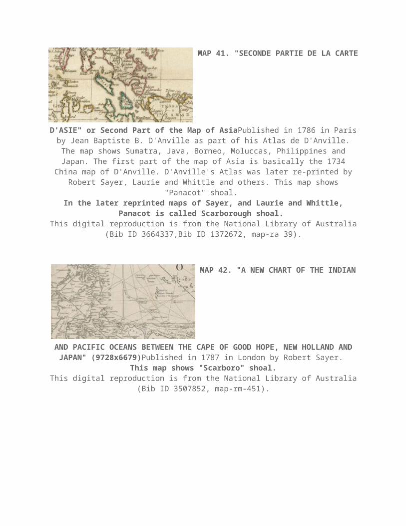
MAP 41. "SECONDE PARTIE DE LA
CARTE D'ASIE" or Second Part of the Map of AsiaPublished in 1786 in Paris by Jean Baptiste B. D'Anville as part of his Atlas de D'Anville. The map shows Sumatra, Java, Borneo, Moluccas, Philippines and Japan. The first part of the
map of Asia is basically the 1734 China map of D'Anville. D'Anville's Atlas was later re-printed by Robert Sayer, Laurie and Whittle and others. This map shows
"Panacot" shoal. In the later reprinted maps of Sayer, and Laurie and Whittle, Panacot is
called Scarborough shoal. This digital reproduction is from the National Library of Australia (Bib ID
3664337,Bib ID 1372672, map-ra 39).
MAP 42. "A NEW CHART OF THE
INDIAN AND PACIFIC OCEANS BETWEEN THE CAPE OF GOOD HOPE, NEW HOLLAND AND JAPAN" (9728x6679)Published in 1787 in London by Robert
Sayer. This map shows "Scarboro" shoal.
This digital reproduction is from the National Library of Australia (Bib ID 3507852, map-rm-451).
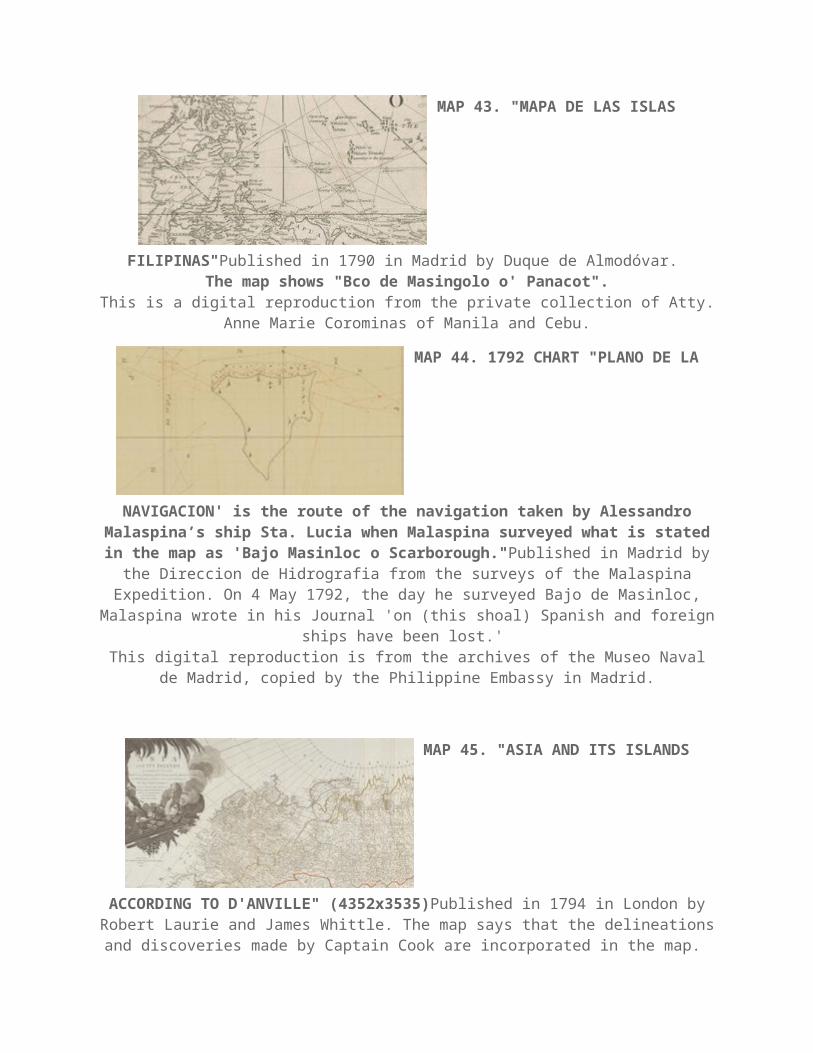
MAP 43. "MAPA DE LAS ISLAS
FILIPINAS"Published in 1790 in Madrid by Duque de Almodovar. The map shows "Bco de Masingolo o' Panacot".
This is a digital reproduction from the private collection of Atty. Anne Marie Corominas of Manila and Cebu.
MAP 44. 1792 CHART "PLANO DE LA
NAVIGACION' is the route of the navigation taken by Alessandro Malaspina’s ship Sta. Lucia when Malaspina surveyed what is stated in
the map as 'Bajo Masinloc o Scarborough."Published in Madrid by the Direccion de Hidrografia from the surveys of the Malaspina Expedition. On 4 May 1792, the day he surveyed Bajo de Masinloc, Malaspina wrote in his Journal 'on
(this shoal) Spanish and foreign ships have been lost.' This digital reproduction is from the archives of the Museo Naval de Madrid,
copied by the Philippine Embassy in Madrid.
MAP 45. "ASIA AND ITS ISLANDS
ACCORDING TO D'ANVILLE" (4352x3535)Published in 1794 in London by Robert Laurie and James Whittle. The map says that the delineations and
discoveries made by Captain Cook are incorporated in the map. The map shows "Scarborough" shoal.
This digital reproduction is from the National Library of Australia (Bib ID 2133866, map-rm 1865).
MAP 46."A NEW CHART OF THE CHINA
SEA AND ITS SEVERAL ENTRANCES" (7424x10819)Published in 1802 in London by Robert Laurie and James Whittle.
This map shows "Scarborough" shoal, with the words "Scarborough Sept. 12th, 1748 and "the Negroes Head."
This digital reproduction is from the National Library of Australia (Bib ID 3620691, map-rm 1425).
MAP 47. "CARTA GENERAL DEL
ARCHIPIELAGO DE FILIPINAS" (11776x8063)Published in 1808 in Madrid by the Direccion de Hidrografia from the surveys of the Malaspina Expedition. The shoal is called "Bajo de Masingloc" but the map also adds "o
Scarborough."This digital reproduction is from the archives of the Museo Naval de Madrid,
copied by the Philippine Embassy in Madrid.
MAP 48. "EAST INDIA ISLANDS ON
MERCATOR'S PROJECTION" (3072x2522)Published between 1814 and 1832 in London by Thomas Kelly.
The map shows "Scarboro" shoal.This digital reproduction is from the National Library of Australia (Bib ID
1493073, map-rm 2639).
MAP 49. "ASIA" (8960x6348)Published
in 1818 in Philadelphia, USA by John Pinkerton. The map shows "Scarborough" shoal.
This digital reproduction is from the U.S. Library of Congress (Catalog No. 2006636622, Digital ID g7400 ct1990).
MAP 50. "ISLAS FILIPINAS"
(10752x7992)Published in 1852 in Madrid by D. Antonio Morata and D. Francisco Coello.
This map shows "Bajo Masinloc."This digital reproduction is from the National Library of Australia (Bib ID
3639193, map-rm 1608).
MAP 51. "CARTA GENERAL DEL
ARCHIPIELAGO FILIPINO" (4096x2793)Published in 1867 in Madrid by the Direccion de Hidrograpfica, this map is entitled "Carta General del Archipielago
Filipino." This map shows "Bajo Masingloc o Scarborough." There is an inset of Scarborough shoal (1866 map of Commander Wilds) on the lower left
side of the map.This digital reproduction is from the archives of the Museo Naval de Madrid,
copied by the Philippine Embassy in Madrid.

MAP 52. "CARTA ESFERICA DEL
OCEANO INDIO" (11520x7753)Published in 1865 in Madrid by the Direccion de Hidrografia.
The map shows "B. Masingloc."This digital reproduction is from the National Library of Australia (Bib ID 122670,
map-rm 2237).
MAP 53. "PLANO DEL BAJO
MASINGLOC" (3072x2525)Published in 1866 by E. Wilds, the Commander of the English warship Swallow, this map is entitled "Plano del Bajo
Masingloc." This digital reproduction is from the archives of the Museo Naval de Madrid,
copied by the Philippine Embassy in Madrid.
MAP 54. "CARTA GENERAL DEL
OCEANO INDICO" (11520x7812)Published in 1871 in Madrid by the Seccion de Hidrografia.
The map shows "B. Masingloc."This digital reproduction is from the National Library of Australia (Bib ID
2823213, map-rm 2235).
MAP 55 . "CARTA GENERAL DEL
ARCHIPIELAGO FILIPINO" (4096x2680)Published in 1875 in Madrid by the Direccion de Hidrografia.
This map shows "B. Masingloc o Scarborough." This digital reproduction is from the archives of the Museo Naval de Madrid,
copied by the Philippine Embassy in Madrid.
MAP 56. "CARTA GENERAL DEL
OCEANO PACIFICO" (7424x10982)Published in 1897 in Madrid by the Seccion de Hidrografia.
This map shows "B. Masingloc o Scarborough."This digital reproduction is from the National Library of Australia (Bib ID
1449962, map-rm3380).
MAP 57. "ISLAS FILIPINAS - MAPA
GENERAL - OBSERVATORIO DE MANILA" (5120x6025)Published in 1899 in Washington, D.C. by the Jesuit Jose P. Algue and the U.S. Coast and Geodetic
Survey. The map shows "B. Masinloc."
This digital reproduction is from the Atlas de Filipinas, Internet Archive, Ohio State University Library, (https://archive.org/stream/

AtlasDeFilipinasColleccionDe30MapasTrabajadosPorDelineantes/ AtlasDeFilipinas#page/n27/mode/1up).
MAP 58. "MAP OF THE PHILIPPINE
ISLANDS" (12288.16811)Published in 1908 in Baltimore, MD U.S.A. by Caspar Hodgson.
The map shows "Scarborough" shoal.This digital reproduction is from the U.S. Library of Congress (Catalog No.
2013590196, Digital ID g8060 ct003965).
From the 1960s to the 1980s, U.S. military warplanes, together with Philippine Air Force warplanes, used Scarborough Shoal as an impact range when they
practiced bombing runs. Neither China nor any other country protested these bombing practices by American
and Philippine warplanes, despite worldwide prior Notices to Mariners, through the International Maritime Organization of the United Nations, to keep away from
Scarborough Shoal during the bombing practices.
MAP 59. "PHILIPPINE ISLANDS"
(10464x15155)Published in 1933 and reissued in 1940 in Washington, D.C. by the U.S. Coast and Geodetic Survey.
The map shows "Scarborough" shoal with depth soundings.This digital reproduction is from the U.S. Library of Congress (Catalog No.
2011592026; Digital ID g8061p ct003542).
If the Philippines can bomb a shoal repeatedly over decades without any protest from neighboring states, it
certainly must have sovereignty over such shoal.
MAP 1. "Carta Hydrographica Y
Chorographica de las Yslas Filipinas" (8407x7734)Published in 1734 in Manila by the Jesuit Pedro Murillo, this is the oldest map that gives a name to "Panacot" shoal. "Panacot" is the Tagalog word for threat or danger. This map
names two Filipinos, Francisco Suarez who drew the map and Nicolas dela Cruz Bagay who engraved it. This map is considered the "mother of all Philippine
maps." This digital reproduction is from the U.S. Library of Congress (Catalog No.
2013585226; Digital ID g8060 ct003137)
MANILA, Philippines - A book about the disputed Bajo de Masinloc or Scarborough Shoal, which
strengthens the Philippines' long-standing claim over the area, was launched on Wednesday.

A collaboration between the University of the Philippines Institute for Maritime Affairs and Law of the Sea
(UP IMLOS) and the National Mapping and Resource Information Authority (NAMRIA), the book "Bajo de
Masinloc (Scarborough Shoal): Maps and Documents" is a compilation of documents that prove the Shoal
has always been a part of the Philippine national territory.
"It's very timely because we're trying to convince the world especially the people in China that Bajo de
Masinloc has been historically part of the Philippines since 1636 and there is not a single official map,
ancient documents or ancient artficact showing China has ever set foot on Bajo de Masinloc," Associate
Justice Antonio Carpio said during the book launch.
China claims that the Scarborough Shoal is a part of its territory based on the nine-dash lines in the South
China Sea. The Shoal is located 124 nautical miles west of Zambales and is within the 200 nautical-mile
Exclusive Economic Zone of the Philippines, according to the Department of Foreign Affairs.
Carpio earlier noted that China's argument in its territorial claim over the West Philippines Sea has no
legal basis under international law.
READ: ‘No basis in China’s historical right over West Phl Sea’ | China bares first book on 9-dash
line
Headlines ( Article MRec ), pagematch: 1, sectionmatch: 1
UP IMLOS director Jay Batongbacal said that the United States recognizes that the Scarborough Shoal is
part of the territory of the Philippines, as signed by the US and Spain in the Treaty of Washington.
The treaty read, "Spain relinquishes to the United States all title and claim of title, which she may have
had at the time of the conclusion of the Treaty of Peace of Paris, to any and all islands belonging to the
Philippine Archipelago."
Batongbacal added that the maps included in the book dates back to the 1660s which support the
country's territorial claims.
"If our books were rockets launched at China, China would have been conquered," UP College of Law
Dean Danilo Concepcion said.
The book is not just for lawyers and policy makers, but for the general public as well to show the
documentary evidences of the country's exercise of jurisdiction and sovereignty over the Scarborough
Shoal or Bajo de Masinloc.
"Bajo de Masinloc has always been a part of Philippine territory and subject to exclusive jurisdiction," the
UP Law Dean concluded.


