
REPORT 1A
Analysis of needs and possibilities with
the technology of the future Part of R&D project “Infrastructure in 3D” in cooperation between Innovation Norge,
Trafikverket and TerraTec
2
Trafikverket
Postadress: 781 89 Borlänge
E-post: [email protected]
Telefon: 0771-921 921
Dokumenttitel: REPORT 1A, Analysis of needs and possibilities with the technology of
the future. Part of R&D project “Infrastructure in 3D” in cooperation between Innovation
Norge, Trafikverket and TerraTec
Författare: TerraTec
Dokumentdatum: 2017-11-01
Version: 1.0
Kontaktperson: Joakim Fransson, IVtdpm
Publikationsnummer: 2018:082
TM
ALL 0
004 R
ap
po
rt g
en
ere
ll v 2
.0

3
Contents
ANALYSIS OF NEEDS AND POSSIBILITIES WITH THE TECHNOLOGY OF THE
FUTURE ................................................................................................................................ 4
Introduction.................................................................................................................................... 4
Present-day situation ..................................................................................................................... 4
Future vision ................................................................................................................................... 4
Division of project........................................................................................................................... 5
Activity 1: Analysis of requirements and possibilities using the technology of the future ................... 6
Aim......................................................................................................................................................... 6
Status ..................................................................................................................................................... 6
Activity 2: Optimisation of data acquisition with Mobile Mapping Systems ......................................... 6
Aim......................................................................................................................................................... 6
Status ..................................................................................................................................................... 6
Activity 3: Innovative data acquisition from a vehicle with a phase scanner ........................................ 7
Aim......................................................................................................................................................... 7
Status ..................................................................................................................................................... 7
Activity 4: How well can critical underground structures be mapped using Ground Penetrating Radar?
7
Aim......................................................................................................................................................... 7
Status ..................................................................................................................................................... 7
Activity 5: Towards high precision data from airplane/helicopter (the focus will be on helicopter data
since that provides higher precision than airplane data) ...................................................................... 8
Aim......................................................................................................................................................... 8
Status ..................................................................................................................................................... 8
Activity 6: Innovative methods for georeferencing ............................................................................... 9
Aim......................................................................................................................................................... 9
Status ..................................................................................................................................................... 9
Activity 7: The future’s processing and data handling .......................................................................... 9
Aim......................................................................................................................................................... 9
Status ..................................................................................................................................................... 9
Activity 8: User-friendly and elegant management and visualisation of data ..................................... 10
Aim....................................................................................................................................................... 10
Status ................................................................................................................................................... 10
Activity 9: Input to the future’s national road database (NVDB) ........................................................ 11
Aim....................................................................................................................................................... 11
Status ................................................................................................................................................... 11
Activity 10: Cost analysis and price model .......................................................................................... 11
Aim....................................................................................................................................................... 11
Status ................................................................................................................................................... 11
Activity summary and descriptions ..................................................................................................... 12

4
Analysis of the present day, and the possibilities with the technology of the future
This project is a cooperation between Trafikverket, TerraTec and Innovation Norge. The
background and motivation for this project are described in the following sections. A list of
activities has been agreed between Trafikverket and TerraTec to fulfil the aims of this project.
Reports will be written in languages in the following order of preference: Swedish, English,
Norwegian. The reports, once delivered, will be publicly available for anyone who requests
them. Data delivered will be stored by Trafikverket.
Introduction
Trafikverket note that they use billions SEK every year on new constructions, building, and
maintenance of transportation networks in Sweden, and see the economic potential in having
better cooperation between technologists and economists. Trafikverket note that they wish to
invest in better coordination and utilisation of data internally, as part of Trafikverket’s
Research and Development program “Mer nytta för pengarna” (“More value for your
money”).
TerraTec has an aim to deliver ready-to-use tailor-made data to its customers, and is
constantly expanding the potential market for its data and services. TerraTec has high
technological and innovative competence, and was therefore a good partner for this project
with Trafikverket.
Present-day situation
The present-day situation is that roads are partially documented, using length-coordinates.
Objects underground are poorly documented or poorly positioned. Currently, there is no
holistic maintenance plan for the roads. Road signs, road markings, damage, wear, and
irregularities in the road surface are usually documented and repaired through separate
supplier agreements, done partly manually and partly through contractors, and organised
with different contact persons in Trafikverket. Development and rebuilding requires full data
acquisition and measurement of the relevant section of road or railway under investigation,
for substrate or engineering applications. Data are delivered but not necessarily used widely
enough internally, and visualisation of the data require professional knowledge and specialist
software.
Future vision
The future vision is that the road and surrounding objects will be fully documented in 3D as
point clouds, vector data and complete National Road Database (NVDB) data in absolute
(georeferenced) coordinates. In addition, structures below ground will be mapped and
correctly positioned, to mitigate for unwanted surprises when digging, such as expensive
power outages or water leaks.
5
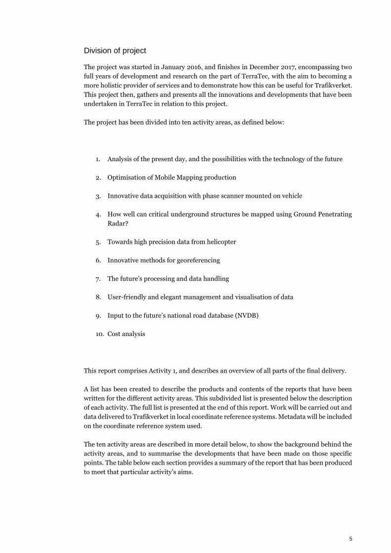
Division of project
The project was started in January 2016, and finishes in December 2017, encompassing two
full years of development and research on the part of TerraTec, with the aim to becoming a
more holistic provider of services and to demonstrate how this can be useful for Trafikverket.
This project then, gathers and presents all the innovations and developments that have been
undertaken in TerraTec in relation to this project.
The project has been divided into ten activity areas, as defined below:
1. Analysis of the present day, and the possibilities with the technology of the future
2. Optimisation of Mobile Mapping production
3. Innovative data acquisition with phase scanner mounted on vehicle
4. How well can critical underground structures be mapped using Ground Penetrating
Radar?
5. Towards high precision data from helicopter
6. Innovative methods for georeferencing
7. The future’s processing and data handling
8. User-friendly and elegant management and visualisation of data
9. Input to the future’s national road database (NVDB)
10. Cost analysis
This report comprises Activity 1, and describes an overview of all parts of the final delivery.
A list has been created to describe the products and contents of the reports that have been
written for the different activity areas. This subdivided list is presented below the description
of each activity. The full list is presented at the end of this report. Work will be carried out and
data delivered to Trafikverket in local coordinate reference systems. Metadata will be included
on the coordinate reference system used.
The ten activity areas are described in more detail below, to show the background behind the
activity areas, and to summarise the developments that have been made on those specific
points. The table below each section provides a summary of the report that has been produced
to meet that particular activity’s aims.
6
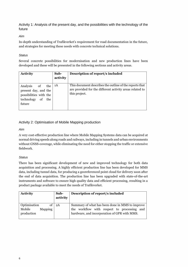
Activity 1: Analysis of the present day, and the possibilities with the technology of the
future
Aim
In-depth understanding of Trafikverket’s requirement for road documentation in the future,
and strategies for meeting these needs with concrete technical solutions.
Status
Several concrete possibilities for modernisation and new production lines have been
developed and these will be presented in the following sections and activity areas.
Activity Sub-
activity
Description of report/s included
Analysis of the
present day, and the
possibilities with the
technology of the
future
1A This document describes the outline of the reports that
are provided for the different activity areas related to
this project.
Activity 2: Optimisation of Mobile Mapping production
Aim
A very cost-effective production line where Mobile Mapping Systems data can be acquired at
normal driving speeds along roads and railways, including in tunnels and urban environments
without GNSS-coverage, while eliminating the need for either stopping the traffic or extensive
fieldwork.
Status
There has been significant development of new and improved technology for both data
acquisition and processing. A highly efficient production line has been developed for MMS
data, including tunnel data, for producing a georeferenced point cloud for delivery soon after
the end of data acquisition. The production line has been upgraded with state-of-the-art
instruments and software to ensure high quality data and efficient processing, resulting in a
product package available to meet the needs of Trafikverket.
Activity Sub-
activity
Description of report/s included
Optimisation of
Mobile Mapping
production
2A Summary of what has been done in MMS to improve
the workflow with respect to processing and
hardware, and incorporation of GPR with MMS.
7
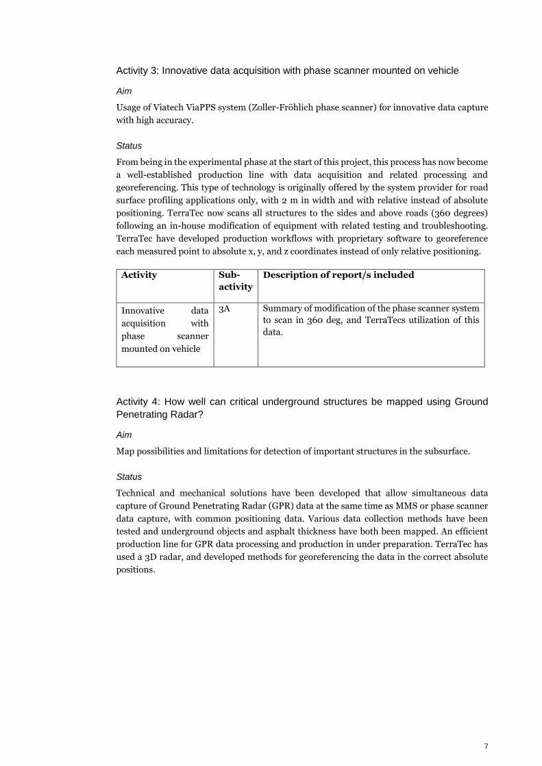
Activity 3: Innovative data acquisition with phase scanner mounted on vehicle
Aim
Usage of Viatech ViaPPS system (Zoller-Fröhlich phase scanner) for innovative data capture
with high accuracy.
Status
From being in the experimental phase at the start of this project, this process has now become
a well-established production line with data acquisition and related processing and
georeferencing. This type of technology is originally offered by the system provider for road
surface profiling applications only, with 2 m in width and with relative instead of absolute
positioning. TerraTec now scans all structures to the sides and above roads (360 degrees)
following an in-house modification of equipment with related testing and troubleshooting.
TerraTec have developed production workflows with proprietary software to georeference
each measured point to absolute x, y, and z coordinates instead of only relative positioning.
Activity Sub-
activity
Description of report/s included
Innovative data
acquisition with
phase scanner
mounted on vehicle
3A Summary of modification of the phase scanner system
to scan in 360 deg, and TerraTecs utilization of this
data.
Activity 4: How well can critical underground structures be mapped using Ground
Penetrating Radar?
Aim
Map possibilities and limitations for detection of important structures in the subsurface.
Status
Technical and mechanical solutions have been developed that allow simultaneous data
capture of Ground Penetrating Radar (GPR) data at the same time as MMS or phase scanner
data capture, with common positioning data. Various data collection methods have been
tested and underground objects and asphalt thickness have both been mapped. An efficient
production line for GPR data processing and production in under preparation. TerraTec has
used a 3D radar, and developed methods for georeferencing the data in the correct absolute
positions.

8
Activity Sub-
activity
Description of report/s included
How well can critical
underground
structures be mapped
using Ground
Penetrating Radar?
4A Summary of GPR surveying method and methods for
positioning of GPR data. "Ground Penetrating Radar"
4B Summary of project with GPR to find voids
underground.
4C Summary of project with GPR data acquisition at high
speed
4D Report on acquisition, processing and interpretation
of data from GPR data on railway.
Activity 5: Towards high precision data from helicopter
Aim
A typical point cloud of airborne data acquired by helicopter has a point density of 10-20
points/m2 with an accuracy of 7-10 cm. The aim is to achieve a point density of 50-100
points/m2 with an accuracy of 2-5 cm.
Status
TerraTec has developed a proprietary helicopter system with two RIEGL (VUX HA) laser
scanners and (Phase One IXU 1000) vertical camera, as well as two mid-sized cameras (Nikon
D810) for non-orthogonal/slanted images, that in many cases replace the need for direct
measurement on road or rail. Typical point density is 70-100 points/m2 with an accuracy of
2-3 cm in height. Vertical images provide GSD 2-5 cm and non-orthogonal/slanted pictures
provide GSD 1-3 cm.
Activity Sub-
activity
Description of report/s included
Towards high
precision data from
helicopter
5A Products and quality achievable by helicopterborne
data capture using Terratecs custom built system
L400
5B Comparison of terrain models from helicopterborne
system (L400) and mobile mapping (Optech Lynx)
5C Comparison of road surface analysis and vectorization
from helicopterborne system (L400) and mobile
mapping (Optech Lynx)

9
Activity 6: Innovative methods for georeferencing
Aim
High precision positioning and rotation data to be calculated in real-time and with post-
processing based on integrated measurement sensors, without the need for extensive field
data. For instance, in a tunnel, to go from 10-20 cm accuracy of the acquired field data after
significant field work and requirement for traffic stopping measures and a significant post-
processing time, to an accuracy of 2-3 cm with minimal fieldwork and a fast, semi-automatic
processing workflow.
Status
New components, based on SLAM algorithms, have been developed in TerraPos. These, and
additional developed software, have the potential to give us increased precision in tunnels,
urban environments and other challenging areas. Methods have been developed to use the
point cloud itself as a correction factor in positioning the point cloud, thus reducing the need
for additional surveying. Systematic measurements, analyses and post-processing methods
have been employed, as well as competence from several different fields to implement the
methods in practice.
Activity Sub-
activity
Description of report/s included
Innovative methods
for georeferencing
6A Terrapos for positioning of Mobile Mapping Systems
6B MSc thesis by Marianne Løvås on a developed SLAM-
algorithm and its applications in mobile mapping.
6C Test of and further development of the SLAM-
algorithm from subactivity 6B to correct for drift in
tunnels.
Activity 7: The future’s processing and data handling
Aim
High-performance automated processing workflows for all types of measurement data for
infrastructure in 3D, including vectorisation and object recognition.
Status
High-precision processing of data to a georeferenced point cloud has become an efficient
production line. In addition, a number of methods have been tested for detection of objects in
point clouds, intelligent classification and automated vectorisation. There are also
possibilities for automatic reading or recognition of signs.

10
Activity Sub-
activity
Description of report/s included
The future’s
processing and data
handling
7A Introduction: Extracting information from MMS data.
7B Automated mapping of road condition parameters.
Use of TopoDOT for vertical object recognition in
machine learning processes.
7C Automated mapping of road assets.
7D Automated recognition of objects (signs) in pictures -
prototype
Activity 8: User-friendly and elegant management and visualisation of data
Aim
Finalised data should be able to be read directly into Trafikverket’s National Road Database
(NVDB). In addition, the basis data in 3D should be visualised and managed so that not only
technologists but also economists and decision makers can clearly use and benefit from the
data.
Status
Both Trafikverket and TerraTec have been working on solutions for visualisation and portals
for data. Trafikverket has been using ORBIT software for their data management and
visualisation. TerraTec has provided data in formats that are compatible with ORBIT, and will
do so for this project. Data will be provided in local coordinate reference systems with meta-
data, and will be converted to other coordinate reference systems by Trafikverket upon import
into ORBIT.
Activity Sub-
activity
Description of report/s included
User-friendly and
elegant management
and visualisation of
data
8A Trafikverket are using ORBIT 3D for their visualisation
and sharing. We will deliver example data from
individual projects in formats that are compatible with
ORBIT. Summary of deliveries with example data from
individual sub-activities to be provided, in ORBIT-
compatible formats.
8B Visualisation regarding merging of data from
LIDAR+MMS+GPR, incl. Augmented Reality,
combination above and below ground.
11
Activity 9: Input to the future’s national road database (NVDB)
Aim
Develop a new standard or proposal for a new standard for Trafikverkets National Road
Database that fully utilises modern technology and opportunities.
Status
The project is well-suited to showcase the possibilities of new technology. It is important to
include enough foresight to show how 3D data can be used but keep a structure that is not too
complex to manage. A report has been produced to show the uses of MMS and LIDAR data in
NVDB.
Activity Sub-
activity
Description of report/s included
Input to the future’s
national road
database (NVDB)
9A Potential improvements/updates to NVDB using MMS
or LIDAR data.
Activity 10: Cost analysis
Aim
TerraTec to undertake a thorough cost analysis for optimisation of the production line and
identification of costly parts of the production line that need to be streamlined. Trafikverket
to analyse the total costs in relation to operation/maintenance/documentation of roads, and
the value of complete 3D-data, as well as the savings generated through use of new technology.
Status
Tests and analysis must be undertaken on a large scale to estimate the total costs and
associated uncertainty or risk for a realistic future volume of orders. At the same time,
information must be shared within Trafikverket so that not only technologists but also
economists, see the benefit of using new technology.
Activity Sub-
activity
Description of report/s included
Cost analysis 10A TerraTec will use ideal cases to visualize difference in
executive hours, value of data from the different
technological sensors versus traditional surveying.

12
Activity summary and descriptions
The full list of subdivided activities is presented below to provide an overview:
Activity Sub-
activity
Description of report/s included
Analysis of the
present day, and the
possibilities with the
technology of the
future
1A This document describes the outline of the reports that
are provided for the different activity areas related to
this project.
Optimisation of
Mobile Mapping
production
2A Summary of what has been done in MMS to improve the
workflow with respect to processing and hardware, and
incorporation of GPR with MMS.
Innovative data
acquisition with
phase scanner
mounted on vehicle
3A Summary of modification of the phase scanner system
to scan in 360 deg, and TerraTecs utilization of this
data.
How well can critical
underground
structures be mapped
using Ground
Penetrating Radar?
4A Summary of GPR surveying method and methods for
positioning of GPR data. "Ground Penetrating Radar"
4B Summary of project with GPR to find voids
underground.
4C Summary of project with GPR data acquisition at high
speed.
4D Report on acquisition, processing and interpretation of
data from GPR data on railway.
Towards high
precision data from
helicopter
5A Products and quality achievable by helicopterborne data
capture using Terratecs custom built system L400
5B Comparison of terrain models from helicopterborne
system (L400) and mobile mapping (Optech Lynx)
5C Comparison of road surface analysis and vectorization
from helicopterborne system (L400) and mobile
mapping (Optech Lynx)
Innovative methods
for georeferencing
6A Terrapos for positioning of Mobile Mapping Systems
6B MSc thesis by Marianne Løvås on the SLAM-algorithm
and its applications.
6C SLAM-algorithm for using objects as reference to
correct for drift in tunnels and urban areas.
7A Introduction: Extracting information from MMS data.

13
The future’s
processing and data
handling
7B Automated mapping of road condition parameters. Use
of TopoDOT for vertical object recognition in machine
learning processes.
7C Automated mapping of road assets.
7D Automated recognition of objects (signs) in pictures -
prototype
User-friendly and
elegant management
and visualisation of
data
8A Trafikverket are using ORBIT 3D for their visualisation
and sharing. We will deliver example data from
individual projects in formats that are compatible with
ORBIT. Summary of deliveries with example data from
individual sub-activities to be provided, in ORBIT-
compatible formats.
8B Visualisation regarding merging of data from
LIDAR+MMS+GPR, incl. Augmented Reality,
combination above and below ground.
Input to the future’s
national road
database (NVDB)
9A Potential improvements/updates to NVDB using MMS
or LIDAR data.
Cost analysis 10A TerraTec will use ideal cases to visualize difference in
executive hours, value of data from the different
technological sensors versus traditional surveying.

Trafikverket, 781 89 Borlänge. Besöksadress: Röda vägen 1.
Telefon: 0771-921 921, Texttelefon: 020-600 650
www.trafikverket.se


