
Regionalization of the Global Integrated Drought Monitoring and Prediction System (GIDMaPS) for
Afghanistan
Dr. Khadija Jawadi
Environmental Conservation Specialist Organisation of Afghanistan (ECSOA)
University of California, Irvine
National Academy of Science, Technology and Medicine (NAS)
December 2018

The importance of the drought topic
• In the past decades, Afghanistan has encountered several droughts which had terrible damage on climate, groundwater and surface water resources, agriculture sectors, forests and also pastures.
• Extreme droughts are expected to occur more frequently in the coming decades and this may cause major economic losses and social and environmental disasters.
• The Impacts of the drought in Afghanistan may extend to environment, economic and even society.
• The overall objective of this research is developing, validation and implementing a drought monitoring system for the Amu Darya and Kabul Basins in Afghanistan.
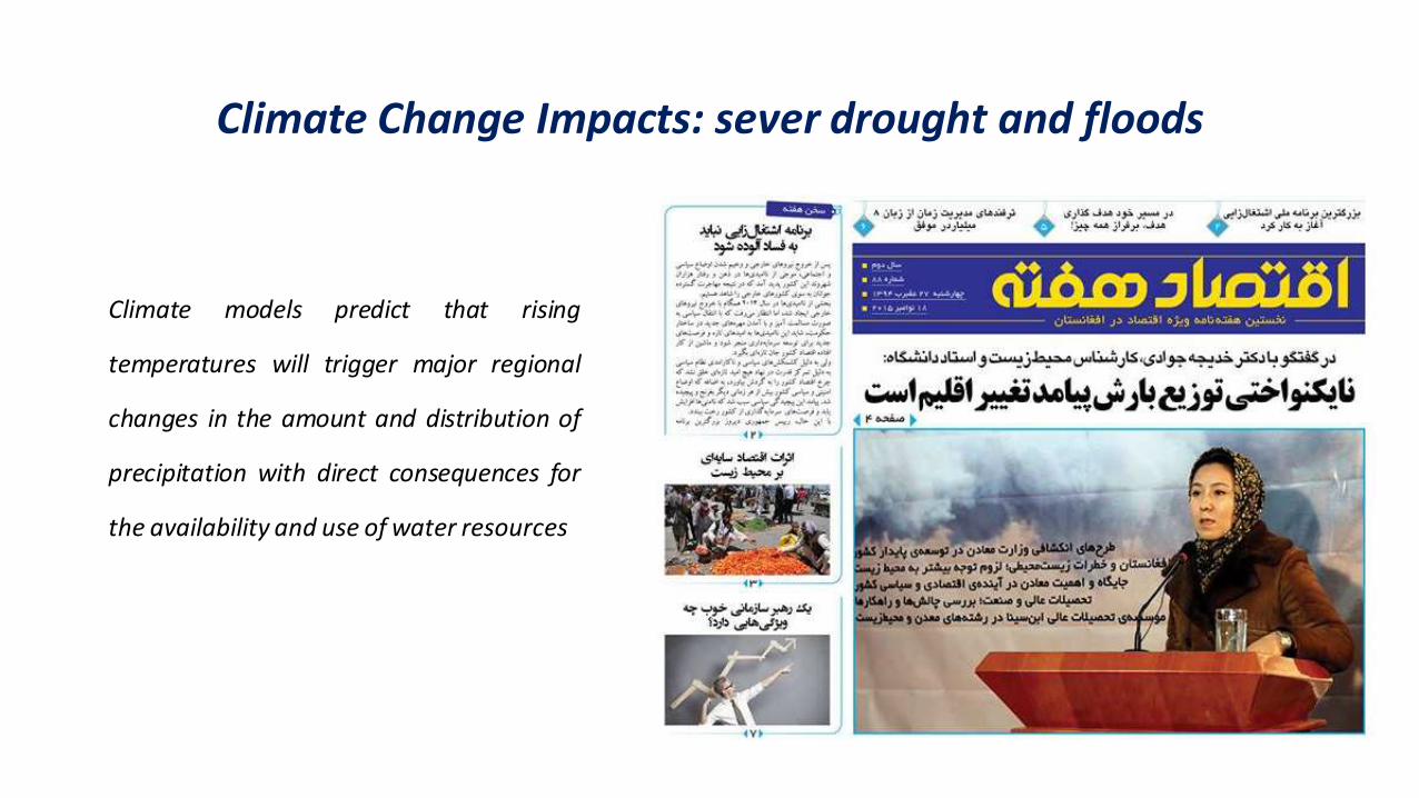
Climate Change Impacts: sever drought and floods
Climate models predict that rising
temperatures will trigger major regional
changes in the amount and distribution of
precipitation with direct consequences for
the availability and use of water resources

Temperature Rise in Afghanistan
Average Monthly Temperature and Precipitation in Kabul River Basin Location Map of the Study Area
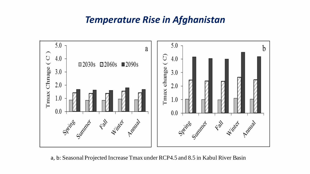
Temperature Rise in Afghanistan
a, b: Seasonal Projected Increase Tmax under RCP4.5 and 8.5 in Kabul River Basin

Implication of Drought in Transboundary Water Management:
Kabul River Basin (Indus)
Amu Darya River Basin
Harirod-Murghab river Basin
Helmand River Basin
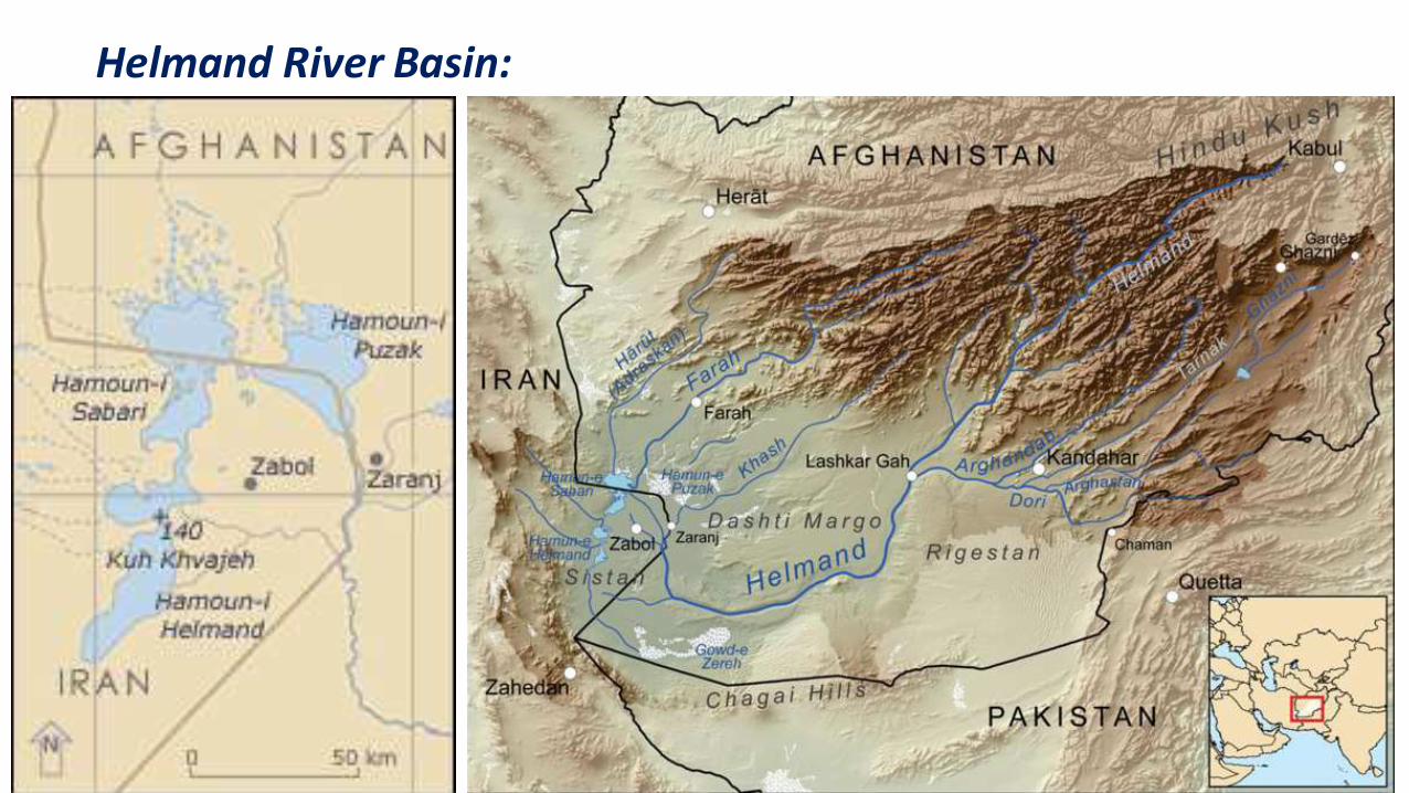
Helmand River Basin:

1976 Hamon Lakes 2001 Hamon Lakes

Kabul River Basin:

More Transboundary Water Tension in the Region Resulted form Drought
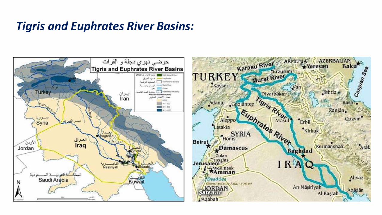
Tigris and Euphrates River Basins:

Horol- Azim River Basin
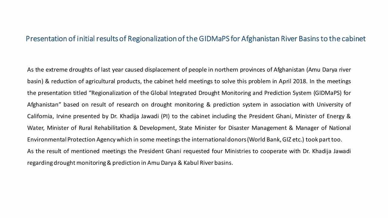
Presentation of initial results of Regionalization of the GIDMaPS for Afghanistan River Basins to the cabinet
As the extreme droughts of last year caused displacement of people in northern provinces of Afghanistan (Amu Darya river
basin) & reduction of agricultural products, the cabinet held meetings to solve this problem in April 2018. In the meetings
the presentation titled “Regionalization of the Global Integrated Drought Monitoring and Prediction System (GIDMaPS) for
Afghanistan” based on result of research on drought monitoring & prediction system in association with University of
California, Irvine presented by Dr. Khadija Jawadi (PI) to the cabinet including the President Ghani, Minister of Energy &
Water, Minister of Rural Rehabilitation & Development, State Minister for Disaster Management & Manager of National
Environmental Protection Agency which in some meetings the international donors (World Bank, GIZ etc.) took part too.
As the result of mentioned meetings the President Ghani requested four Ministries to cooperate with Dr. Khadija Jawadi
regarding drought monitoring & prediction in Amu Darya & Kabul River basins.
Presentation of initial results of Regionalization of the GIDMaPS for Afghanistan River Basins to the cabinet

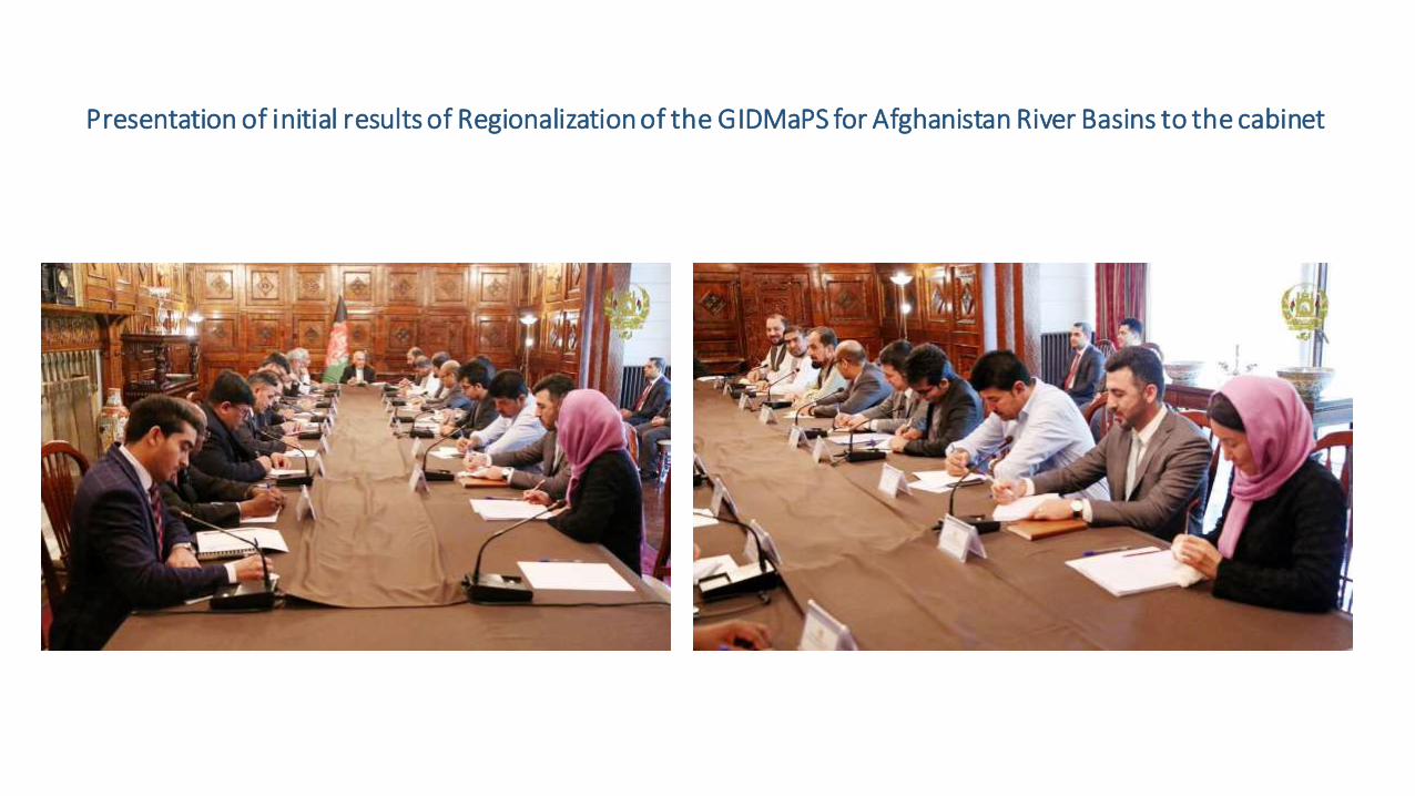
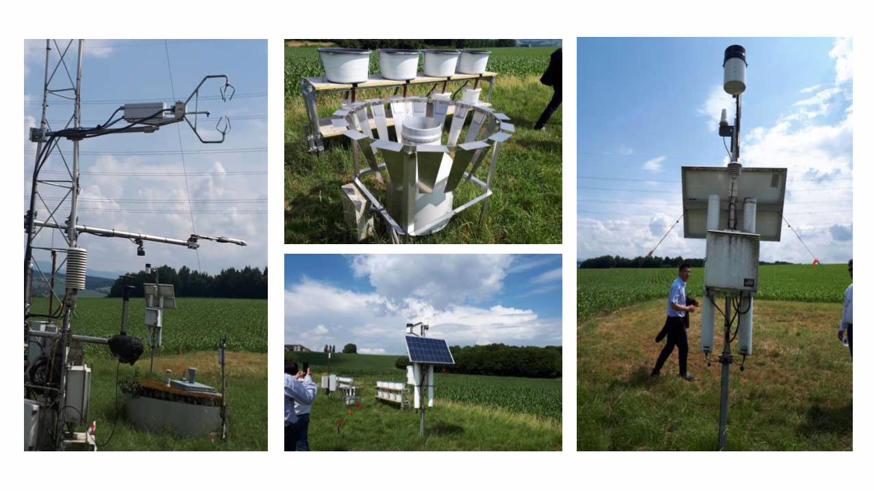
Local Hydro metrology Data Measurement Training:
The “Indus River Basin 3” workshop was held in Vienna, Austria. A presentation regarding “Kabul River” basin representing Afghanistan was presented by
Dr. Khadija Jawadi. attended the training for measurement of local Hydro metrology data parameters which were necessary for the model (GIDMaPS).
These parameters are precipitation evaporation, temperature, Soil moisture, wind speed and wind direction.


Visiting U.S Partner & University of California, Irvine
Dr. Khadija Jawadi had a visit with Dr. Agha Kouchak &
University of California, Irvine (UCI) to enhance the
development of the research. As the drought problem is an
important issue for President Ghani, Dr. Khadija Jawadi was
accompanied by Senior Advisor of President in infrastructure,
technology and human Capital affairs, Professor Homayoun
Qayoomi, on behalf of President Ghani.
Dr. Khadija Jawadi visited the department of
hydrometeorology & Remote sensing & the head of
department, Professor Soroushian regarding the study of
remote sensing data including precipitation & temperature for
Amu Darya & Kabul river basins.
At the end of the visit Professor Qayoumi thanked Dr. Agha
Kouchak & University of California, Irvine for cooperation on
behalf of President Ghani & hoped for more cooperation in
other Afghanistan River basins.
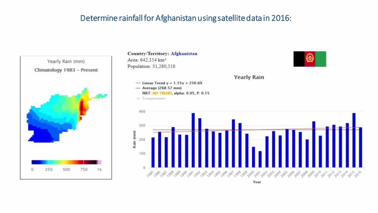
Determine rainfall for Afghanistan using satellite data in 2016:
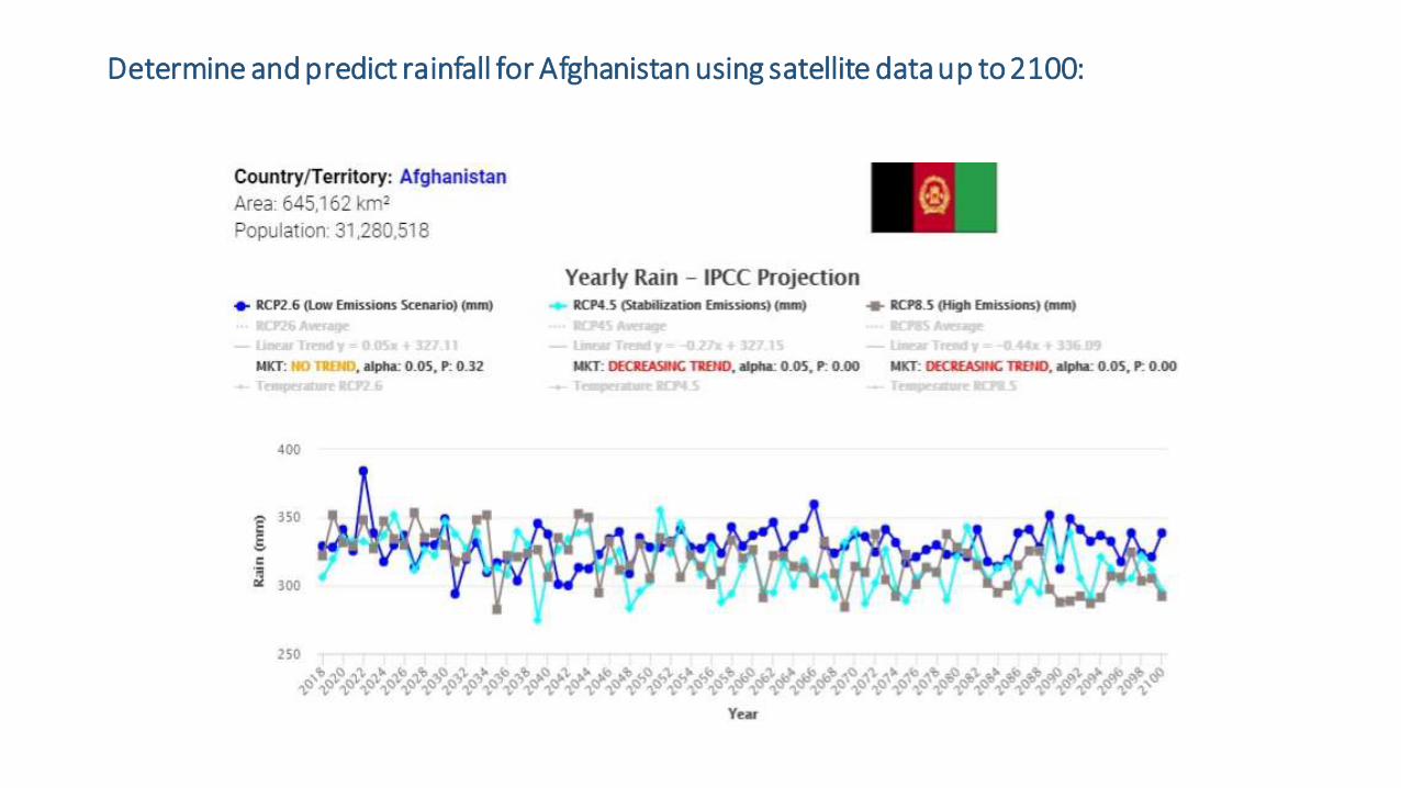
Determine and predict rainfall for Afghanistan using satellite data up to 2100:

An Integrated System for Global Read- time Precipitation Observation Using: PERSINN-CCS
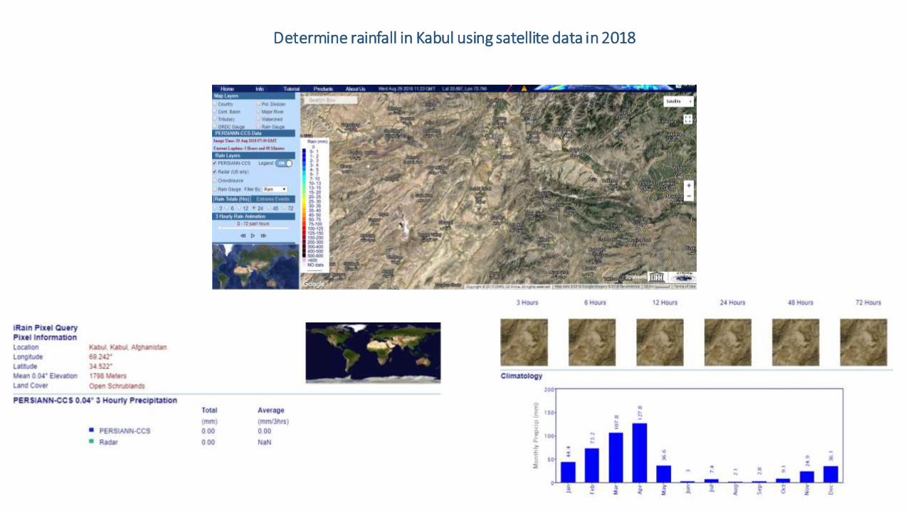
Determine rainfall in Kabul using satellite data in 2018

Determine rainfall in Mazar-e- Sharif using satellite data in 2018
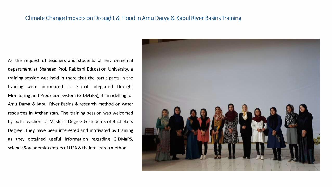
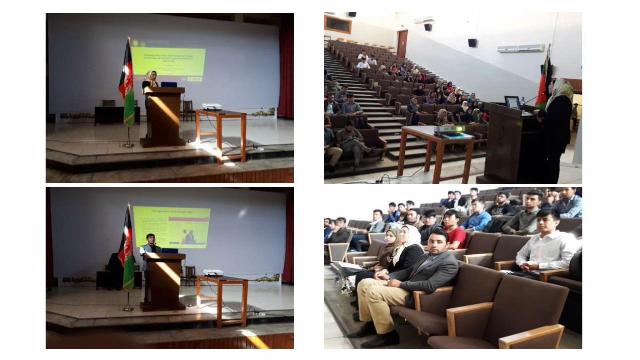
Climate Change Impacts on Drought & Flood in Amu Darya & Kabul River Basins Training
As the request of teachers and students of environmental
department at Shaheed Prof. Rabbani Education University, a
training session was held in there that the participants in the
training were introduced to Global Integrated Drought
Monitoring and Prediction System (GIDMaPS), its modelling for
Amu Darya & Kabul River Basins & research method on water
resources in Afghanistan. The training session was welcomed
by both teachers of Master’s Degree & students of Bachelor’s
Degree. They have been interested and motivated by training
as they obtained useful information regarding GIDMaPS,
science & academic centers of USA & their research method.

Joint Meeting with National Environmental Protection Agency (NEPA) & European Union Delegation to Afghanistan Regarding Climate Change & its Impacts on Afghanistan Droughts & Floods
As the PI project is “Regionalization of the Global Integrated Drought Monitoring and Prediction System (GIDMaPS) for
Afghanistan” for Amu Darya & Kabul River Basins, Dr. Khadija Jawadi was requested to cooperate and attend a joint meeting
with National Environmental Protection Agency (NEPA) and European Union (EU) delegation to Afghanistan regarding
confronting climate changes impact in Afghanistan. Dr. Khadija Jawadi provided information based on results of this research
project the will be used for developing policies and regulations to confront climate changes impacts & challenges in 34
provinces as priority for NEPA. These future policies and regulations will be applicable after authorizing by cabinet.

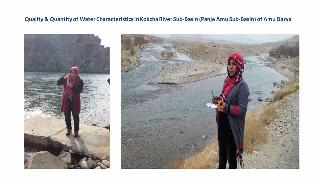
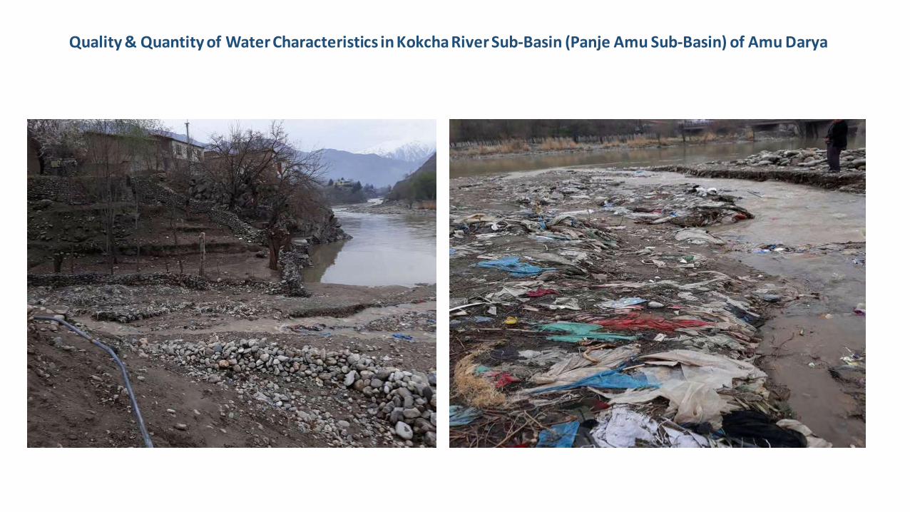
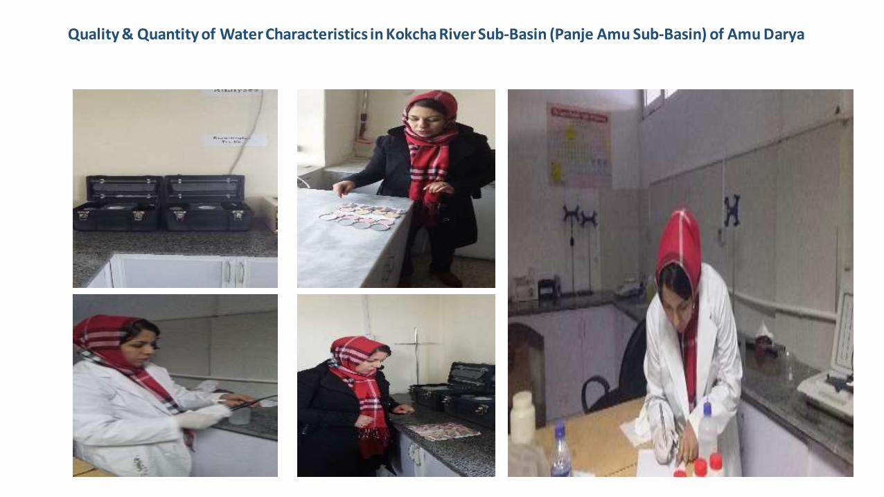
Presentation regarding study of Quality & Quantity of Water Characteristics in Kokcha River Sub-Basin (Panje Amu
Sub-Basin) of Amu Darya
Kokcha River (Panje Amu Sub-Basin) is one of Amu
Darya sub-basins, which does not have quantity
parameters to improve the information on Amu Darya
basin. Dr. Khadija Jawadi assisted by Mrs. Saadia Briz
obtained enough information regarding quantity
parameters of Panje Amu sub-basin by visiting related
areas. This area is considered insecure area as some
armed groups are active there. Mrs. Saadia Bariz with
her husband visited the area and took samples and
collected data periodic with different time segments
which these information provided to Ministry of Energy
and Water, Azad Islamic university and research
centers.

Quality & Quantity of Water Characteristics in Kokcha River Sub-Basin (Panje Amu Sub-Basin) of Amu Darya
Quality & Quantity of Water Characteristics in Kokcha River Sub-Basin (Panje Amu Sub-Basin) of Amu Darya
Quality & Quantity of Water Characteristics in Kokcha River Sub-Basin (Panje Amu Sub-Basin) of Amu Darya

Quality & Quantity of Water Characteristics in Kokcha River Sub-Basin (Panje Amu Sub-Basin) of Amu Darya
Quality & Quantity of Water Characteristics in Kokcha River Sub-Basin (Panje Amu Sub-Basin) of Amu Darya
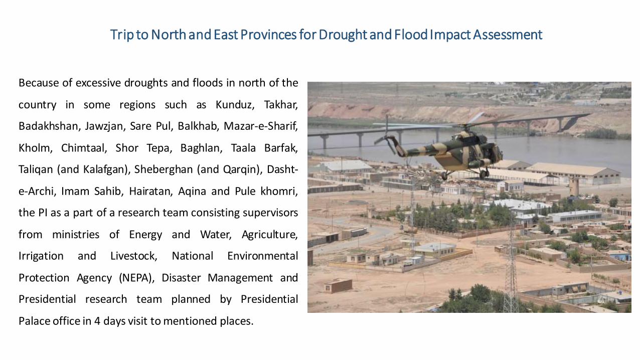
Trip to North and East Provinces for Drought and Flood Impact Assessment
Because of excessive droughts and floods in north of the
country in some regions such as Kunduz, Takhar,
Badakhshan, Jawzjan, Sare Pul, Balkhab, Mazar-e-Sharif,
Kholm, Chimtaal, Shor Tepa, Baghlan, Taala Barfak,
Taliqan (and Kalafgan), Sheberghan (and Qarqin), Dasht-
e-Archi, Imam Sahib, Hairatan, Aqina and Pule khomri,
the PI as a part of a research team consisting supervisors
from ministries of Energy and Water, Agriculture,
Irrigation and Livestock, National Environmental
Protection Agency (NEPA), Disaster Management and
Presidential research team planned by Presidential
Palace office in 4 days visit to mentioned places.

Route Map Trip to North and East Provinces for Drought and Flood Impact Assessment
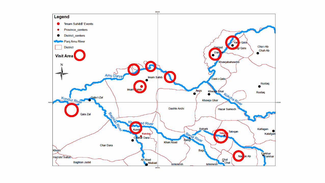

Trip to North and East Provinces for Drought and Flood Impact Assessment

Trip to North and East Provinces for Drought and Flood Impact Assessment

Participating in a Television Program regarding Climate Change, Droughts & Air Pollution
One of the challenges in Afghanistan specially Kabul city
is air pollution caused by burning fossil fuels (specially
coal) which causes inversion in winter. Inversion is one
of the Global Warming that causes consecutive
droughts in the country specially in Kabul and Helmand
river basins which is perceptible that was discussed in
Ariana Television Network (ATN) program for public
information.
https://www.youtube.com/watch?v=FPNHe-
dyQSs&t=10s

Project Objective:
The main objective of the activity includes:
• Developing, validation & implementing a drought monitoring system for Kabul and Amu Darya River
basins
• The overarching goal is to provide reliable information that can be used towards a multi-national drought
mitigation, risk management & planning strategy
• The system will provide data that can lead to a better understanding of the underlying drought processes
& their impacts in each river basin and sub-river basin
• By relying on output of this model the Governmental & Non- Governmental Organizations can invest on
the agricultural & industrial sector with more confidence & it will help on government decision makings in
agricultural sector to prevent financial damages in drought-hit regions.

Model Introduction:
The Global Integrated Drought Monitoring and Prediction System (GIDMaPS) is a drought monitoring and prediction system that provides near real-time drought information based on multiple drought indicators and input data sets
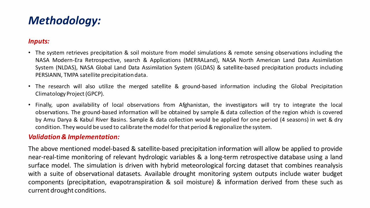
Methodology:
Inputs:
• The system retrieves precipitation & soil moisture from model simulations & remote sensing observations including the NASA Modern-Era Retrospective, search & Applications (MERRALand), NASA North American Land Data Assimilation System (NLDAS), NASA Global Land Data Assimilation System (GLDAS) & satellite-based precipitation products including PERSIANN, TMPA satellite precipitation data.
• The research will also utilize the merged satellite & ground-based information including the Global Precipitation Climatology Project (GPCP).
• Finally, upon availability of local observations from Afghanistan, the investigators will try to integrate the local observations. The ground-based information will be obtained by sample & data collection of the region which is covered by Amu Darya & Kabul River Basins. Sample & data collection would be applied for one period (4 seasons) in wet & dry condition. They would be used to calibrate the model for that period & regionalize the system.
Validation & Implementation:
The above mentioned model-based & satellite-based precipitation information will allow be applied to provide near-real-time monitoring of relevant hydrologic variables & a long-term retrospective database using a land surface model. The simulation is driven with hybrid meteorological forcing dataset that combines reanalysis with a suite of observational datasets. Available drought monitoring system outputs include water budget components (precipitation, evapotranspiration & soil moisture) & information derived from these such as current drought conditions.
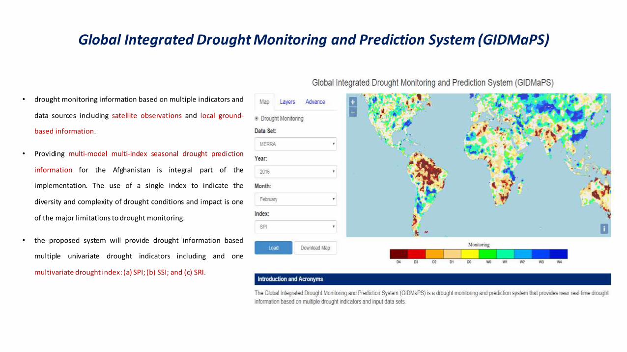
Global Integrated Drought Monitoring and Prediction System (GIDMaPS)
• drought monitoring information based on multiple indicators and
data sources including satellite observations and local ground-
based information.
• Providing multi-model multi-index seasonal drought prediction
information for the Afghanistan is integral part of the
implementation. The use of a single index to indicate the
diversity and complexity of drought conditions and impact is one
of the major limitations to drought monitoring.
• the proposed system will provide drought information based
multiple univariate drought indicators including and one
multivariate drought index: (a) SPI; (b) SSI; and (c) SRI.

Global Integrated Drought Monitoring and Prediction System (GIDMaPS)
D0: Abnormally Dry ; D1: Moderate Drought ; D2: Severe Drought ; D3: Extreme Drought ; D4:Exceptional Drought W0: Abnormally Wet ; W1: Moderate Wetness ; W2: Severe Wetness ; W3: Extreme Wetness ; W4:Exceptional Wetness

Amazon, Russia and the Horn of Africa droughts Major Event of 2010
D0 (abnormally dry), D1(moderate drought), D2 (severe drought), D3 (extreme drought), and D4 (exceptional drought)

Drought Monitoring of the Globe (Satellite Image )

Development impacts:
• Providing a validate & reliable source for drought monitoring & prediction which leads us to have a better water management in all sectors specially in agriculture sector.
• As Amu Darya and Kabul river basins are important sources of water in Afghanistan (or other neighbor countries) implementation of this project will increase national & regional cooperation on shared water resources
• A thriving economy led by the private sector (includes infrastructure, agriculture, alternative livelihoods and more traditional economic growth activities) Increasing public awareness and directing the society toward a democratic government with broad citizen participation.
• There is lack of data and knowledge on almost all aspects related to drought monitoring and prediction.
• Upgrading the institutional capacity for drought monitoring and prediction through this system would acquit this fault.

Figure displays an example of 2 months lead predicted drought likelihood of persistence for March 2013 using GIDMaPS (left) US Drought Monitor (USDM) observations (right).
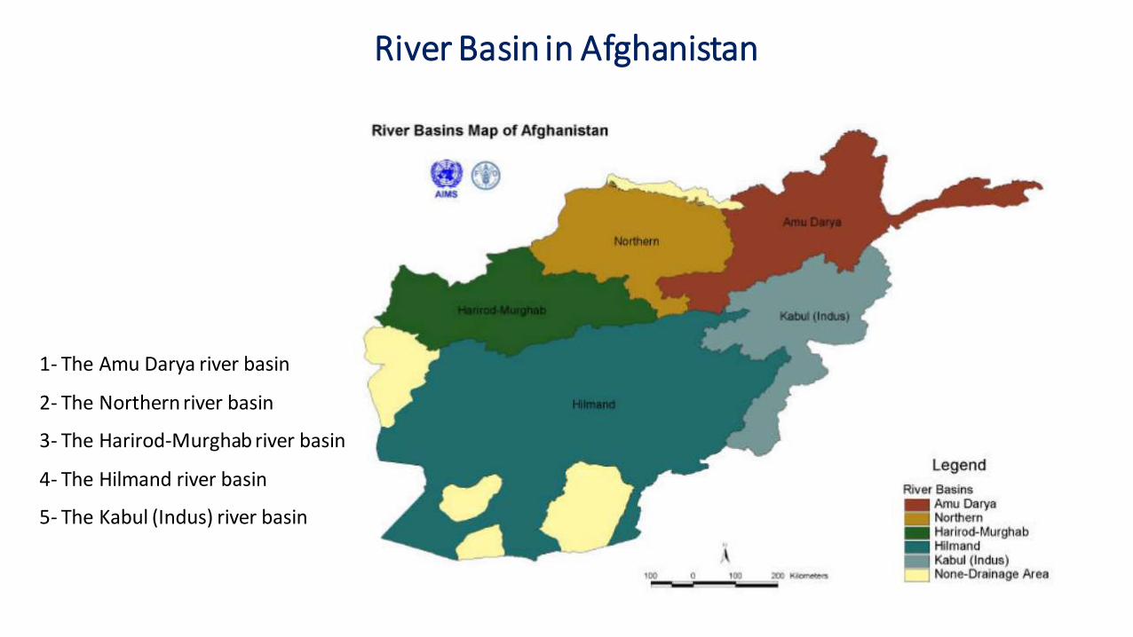
River Basin in Afghanistan
1- The Amu Darya river basin
2- The Northern river basin
3- The Harirod-Murghab river basin
4- The Hilmand river basin
5- The Kabul (Indus) river basin
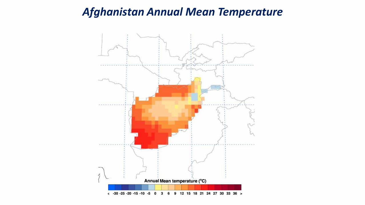
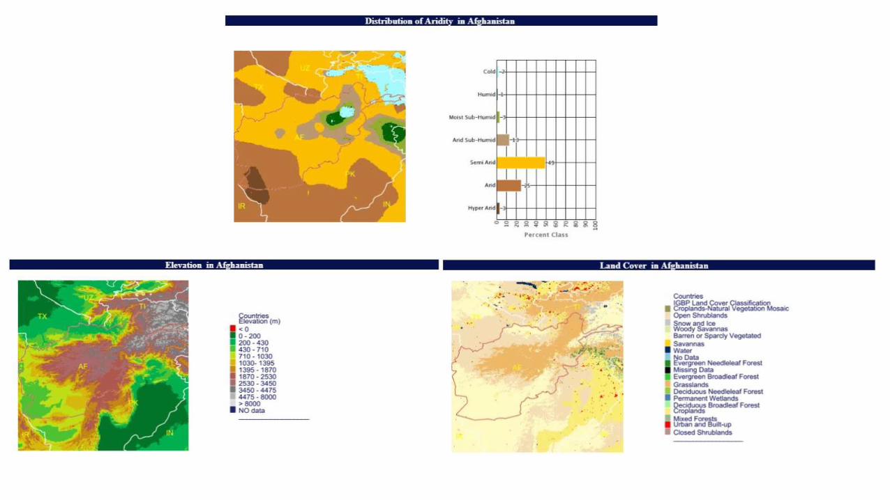
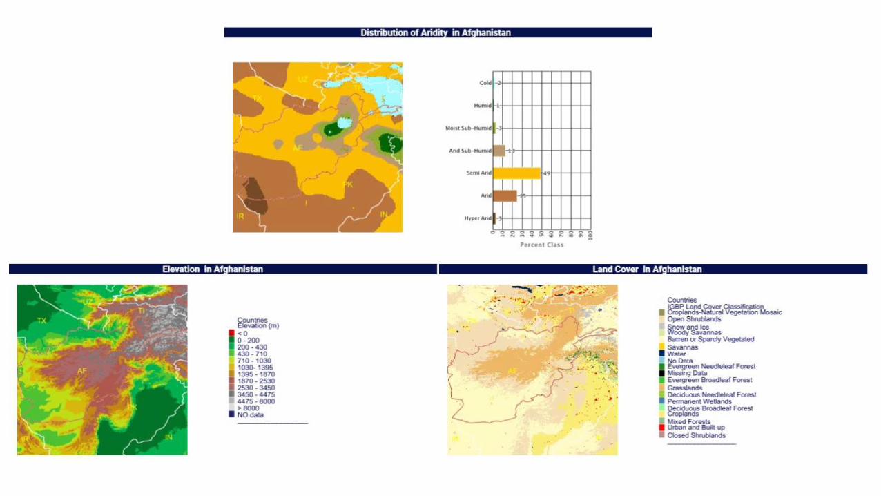
Afghanistan Annual Mean Temperature

Afghanistan Average Rainfall 1982-2011 Afghanistan Average Rainfall 2001-2015

Kabul River Basin:

North River Basin:
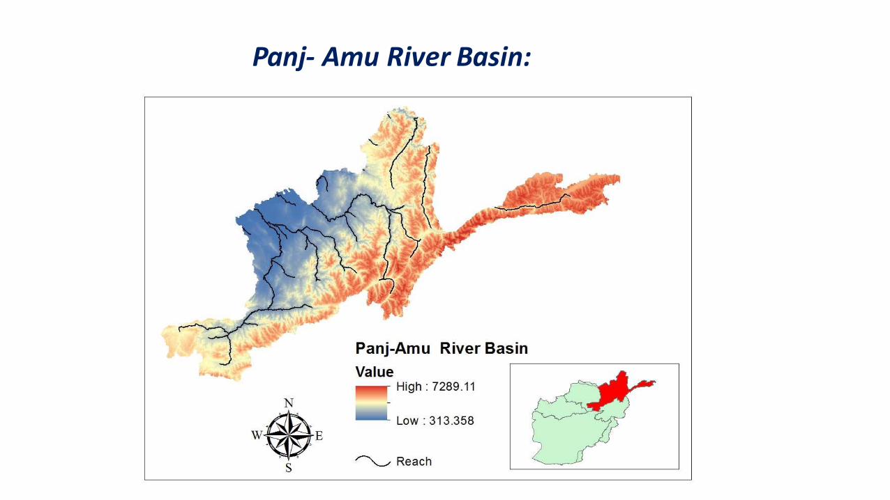
Panj- Amu River Basin:

Input Data:
The system retrieves precipitation and soil moisture from model simulations and remote sensing observations including : the NASA Modern-Era Retrospective analysis for Research and Applications (MERRA-Land; Reichle et al., 2011, 2012), NASA North American Land Data Assimilation System (NLDAS; Kumar et al., 2006), NASA Global Land Data Assimilation System (GLDAS; Peters-Lidard et al., 2007) and the Global Precipitation Climatology Project (GPCP; Adler et al., 2003) observations. The below table summarizes the available input data, source and the spatial resolution of observations.
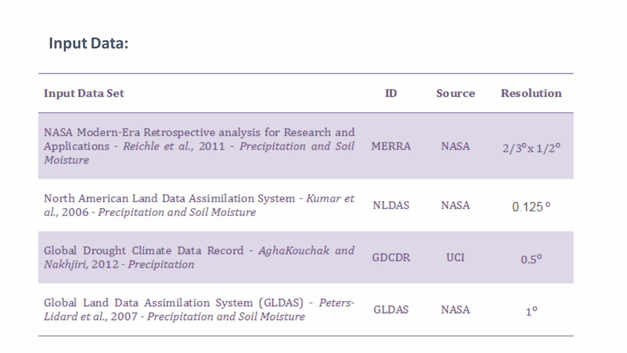
Input Data:
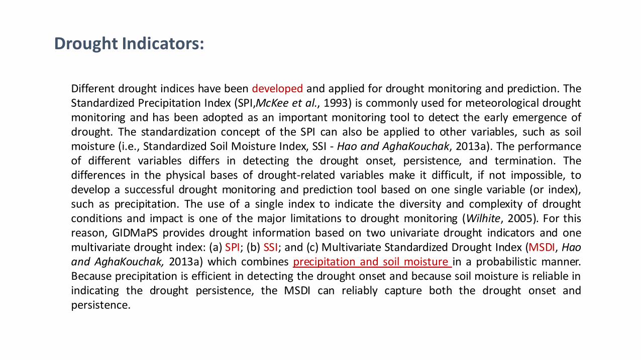
Drought Indicators:
Different drought indices have been developed and applied for drought monitoring and prediction. The Standardized Precipitation Index (SPI,McKee et al., 1993) is commonly used for meteorological drought monitoring and has been adopted as an important monitoring tool to detect the early emergence of drought. The standardization concept of the SPI can also be applied to other variables, such as soil moisture (i.e., Standardized Soil Moisture Index, SSI - Hao and AghaKouchak, 2013a). The performance of different variables differs in detecting the drought onset, persistence, and termination. The differences in the physical bases of drought-related variables make it difficult, if not impossible, to develop a successful drought monitoring and prediction tool based on one single variable (or index), such as precipitation. The use of a single index to indicate the diversity and complexity of drought conditions and impact is one of the major limitations to drought monitoring (Wilhite, 2005). For this reason, GIDMaPS provides drought information based on two univariate drought indicators and one multivariate drought index: (a) SPI; (b) SSI; and (c) Multivariate Standardized Drought Index (MSDI, Hao and AghaKouchak, 2013a) which combines precipitation and soil moisture in a probabilistic manner. Because precipitation is efficient in detecting the drought onset and because soil moisture is reliable in indicating the drought persistence, the MSDI can reliably capture both the drought onset and persistence.
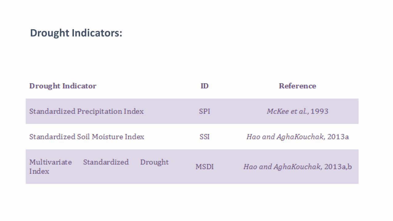
Drought Indicators:
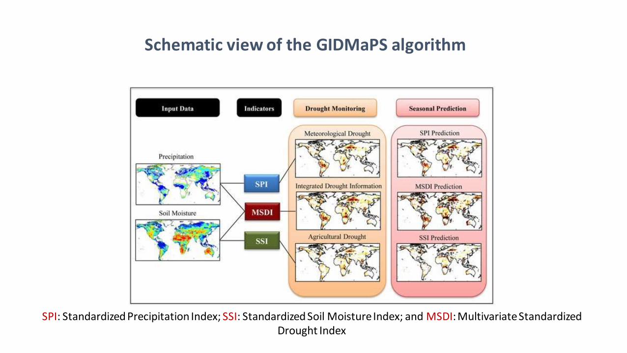
Schematic view of the GIDMaPS algorithm
SPI: Standardized Precipitation Index; SSI: Standardized Soil Moisture Index; and MSDI: Multivariate Standardized Drought Index
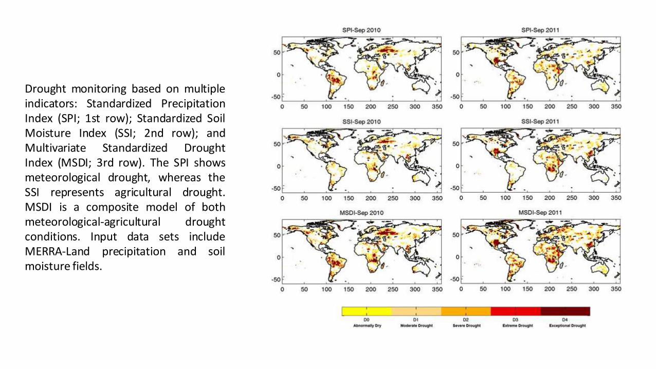
Drought monitoring based on multiple indicators: Standardized Precipitation Index (SPI; 1st row); Standardized Soil Moisture Index (SSI; 2nd row); and Multivariate Standardized Drought Index (MSDI; 3rd row). The SPI shows meteorological drought, whereas the SSI represents agricultural drought. MSDI is a composite model of both meteorological-agricultural drought conditions. Input data sets include MERRA-Land precipitation and soil moisture fields.

Primary drought prediction Result in some Province of Afghanistan
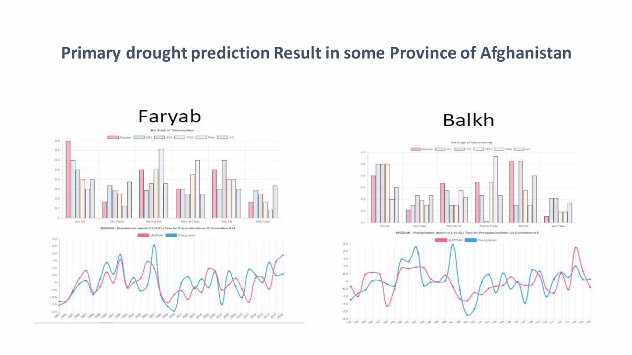
Primary drought prediction Result in some Province of Afghanistan
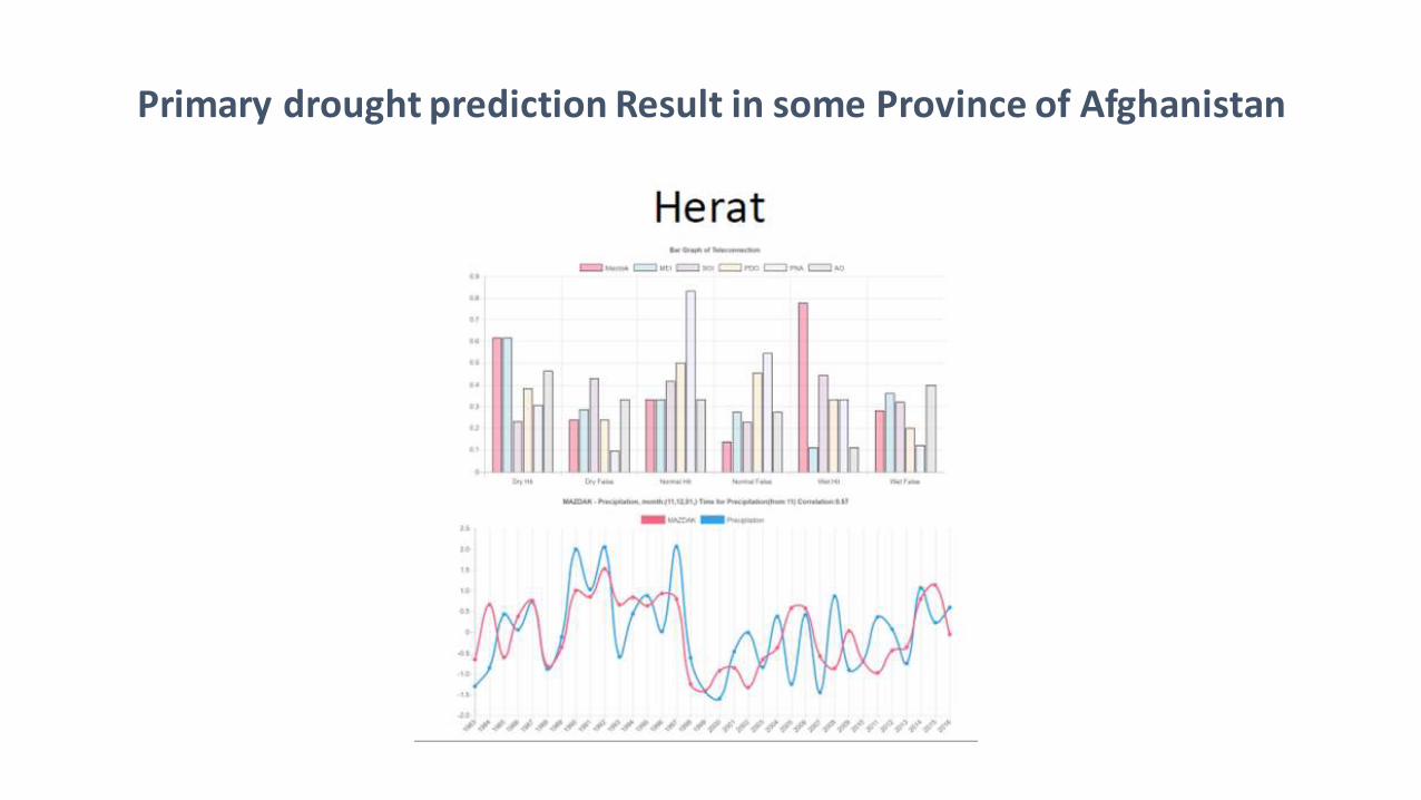
Primary drought prediction Result in some Province of Afghanistan
Challenges
• Lack of data availability and accessibility within governmental organization
• Lack of integration in research in Afghanistan and less governmental support
• Lack of capacity building programs for researcher to updates their skills visa training programs
• Insecurity in areas required site visit & sampling (shooting at provincial trip toward ) the researcher team ad governmental officials was an example of it

Thanks


