Download - Print chew chew chew
SCHOOL OF ARCHITECTURE, BUILDING AND DESIGN Bachelor of Science (Honours) in Architecture
THEORIES OF ARCHITECTURE AND URBANISM (ARC2224) (ARC61303)
Project Part B AN ILLUSTRATED ESSAY WITH A
COGNITIVE MAPPING
NAME Yap Kar Juen (Jason)
0313737
Lecturer Mr.Lam Shen Fei
SITE PJ, Section 4
Page � of �1 14
Content
History of Petaling Jaya PG 3
Introduction to site PG 4
Observation and Analysis of Circulation PG 5-8
Landmark and District PG 9
Path PG 10
Edge PG 11
Nodes PG 12
Conclusion PG 13
Reference PG 14
Page � of �2 14

History of Petaling Jaya
The government of Malaysia has
established a project of emerging a
new town in Malaysia back then during
the post-war period after the World
War II. The development started off
with Petaling Jaya as the satellite town
to reduce the urbanisation problems
and was design in accordance of the
British town planning principles, the
modern ideal city. The principles followed is to understand new town development
strategies, investigation of the changes in the passage of time and most importantly
housing typologies. Hence, the development of Petaling Jaya helps to improve the
unfriendly urban and dwelling with the study of housing typologies in order to
accommodate the rapid growing population of KL in 1953.
Page � of �3 14
1950’s
1960’s - 1980’s
1990’s
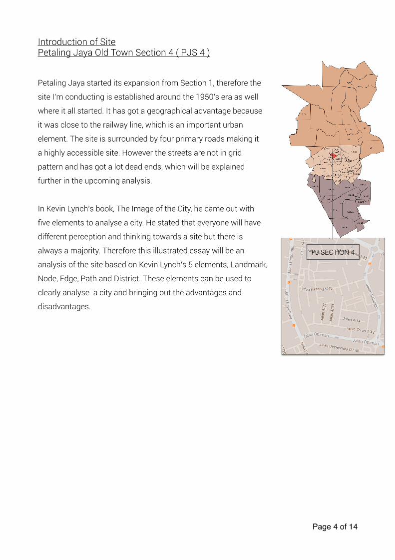
Introduction of Site Petaling Jaya Old Town Section 4 ( PJS 4 )
Petaling Jaya started its expansion from Section 1, therefore the
site I’m conducting is established around the 1950’s era as well
where it all started. It has got a geographical advantage because
it was close to the railway line, which is an important urban
element. The site is surrounded by four primary roads making it
a highly accessible site. However the streets are not in grid
pattern and has got a lot dead ends, which will be explained
further in the upcoming analysis.
In Kevin Lynch’s book, The Image of the City, he came out with
five elements to analyse a city. He stated that everyone will have
different perception and thinking towards a site but there is
always a majority. Therefore this illustrated essay will be an
analysis of the site based on Kevin Lynch’s 5 elements, Landmark,
Node, Edge, Path and District. These elements can be used to
clearly analyse a city and bringing out the advantages and
disadvantages.
Page � of �4 14
PJ SECTION 4
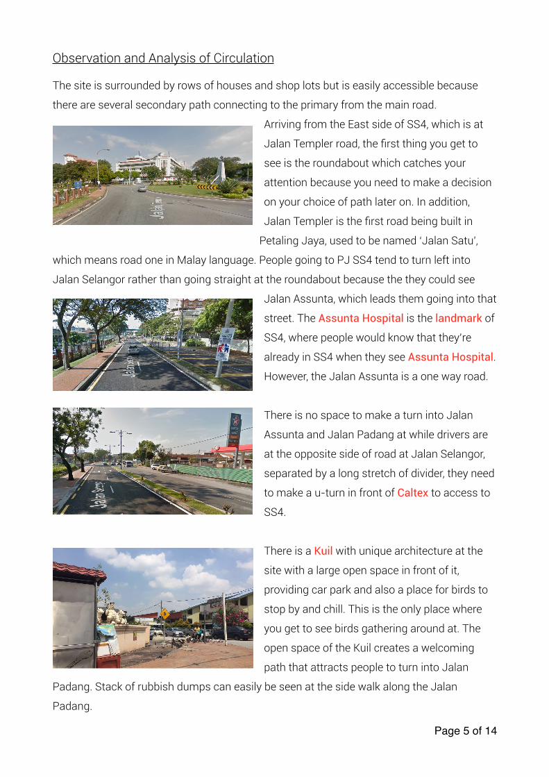
Observation and Analysis of Circulation
The site is surrounded by rows of houses and shop lots but is easily accessible because
there are several secondary path connecting to the primary from the main road.
Arriving from the East side of SS4, which is at
Jalan Templer road, the first thing you get to
see is the roundabout which catches your
attention because you need to make a decision
on your choice of path later on. In addition,
Jalan Templer is the first road being built in
Petaling Jaya, used to be named ‘Jalan Satu',
which means road one in Malay language. People going to PJ SS4 tend to turn left into
Jalan Selangor rather than going straight at the roundabout because the they could see
Jalan Assunta, which leads them going into that
street. The Assunta Hospital is the landmark of
SS4, where people would know that they’re
already in SS4 when they see Assunta Hospital.
However, the Jalan Assunta is a one way road.
There is no space to make a turn into Jalan
Assunta and Jalan Padang at while drivers are
at the opposite side of road at Jalan Selangor,
separated by a long stretch of divider, they need
to make a u-turn in front of Caltex to access to
SS4.
There is a Kuil with unique architecture at the
site with a large open space in front of it,
providing car park and also a place for birds to
stop by and chill. This is the only place where
you get to see birds gathering around at. The
open space of the Kuil creates a welcoming
path that attracts people to turn into Jalan
Padang. Stack of rubbish dumps can easily be seen at the side walk along the Jalan
Padang.
Page � of �5 14
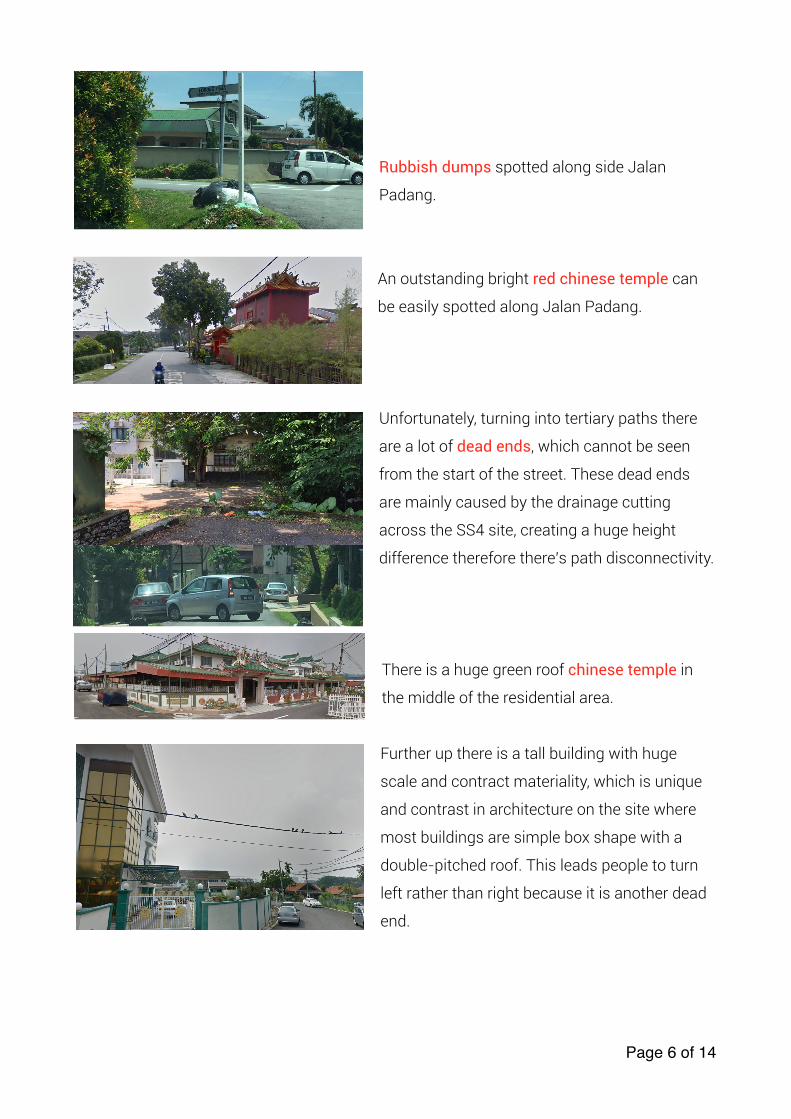
Rubbish dumps spotted along side Jalan
Padang.
An outstanding bright red chinese temple can
be easily spotted along Jalan Padang.
Unfortunately, turning into tertiary paths there
are a lot of dead ends, which cannot be seen
from the start of the street. These dead ends
are mainly caused by the drainage cutting
across the SS4 site, creating a huge height
difference therefore there’s path disconnectivity.
There is a huge green roof chinese temple in
the middle of the residential area.
Further up there is a tall building with huge
scale and contract materiality, which is unique
and contrast in architecture on the site where
most buildings are simple box shape with a
double-pitched roof. This leads people to turn
left rather than right because it is another dead
end.
Page � of �6 14
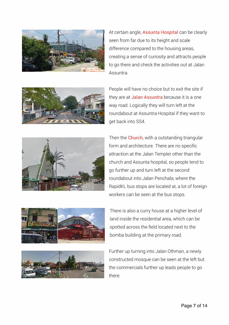
At certain angle, Assunta Hospital can be clearly
seen from far due to its height and scale
difference compared to the housing areas,
creating a sense of curiosity and attracts people
to go there and check the activities out at Jalan
Assuntra.
People will have no choice but to exit the site if
they are at Jalan Assuntra because it is a one
way road. Logically they will turn left at the
roundabout at Assuntra Hospital if they want to
get back into SS4.
Then the Church, with a outstanding triangular
form and architecture. There are no specific
attraction at the Jalan Templer other than the
church and Assunta hospital, so people tend to
go further up and turn left at the second
roundabout into Jalan Penchala, where the
RapidKL bus stops are located at, a lot of foreign
workers can be seen at the bus stops.
There is also a curry house at a higher level of
land inside the residential area, which can be
spotted across the field located next to the
bomba building at the primary road.
Further up turning into Jalan Othman, a newly
constructed mosque can be seen at the left but
the commercials further up leads people to go
there.
Page � of �7 14
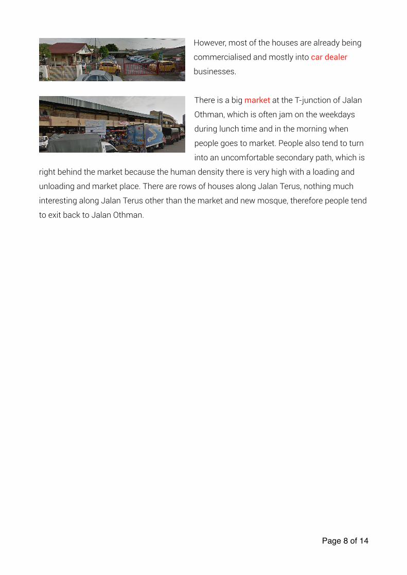
However, most of the houses are already being
commercialised and mostly into car dealer
businesses.
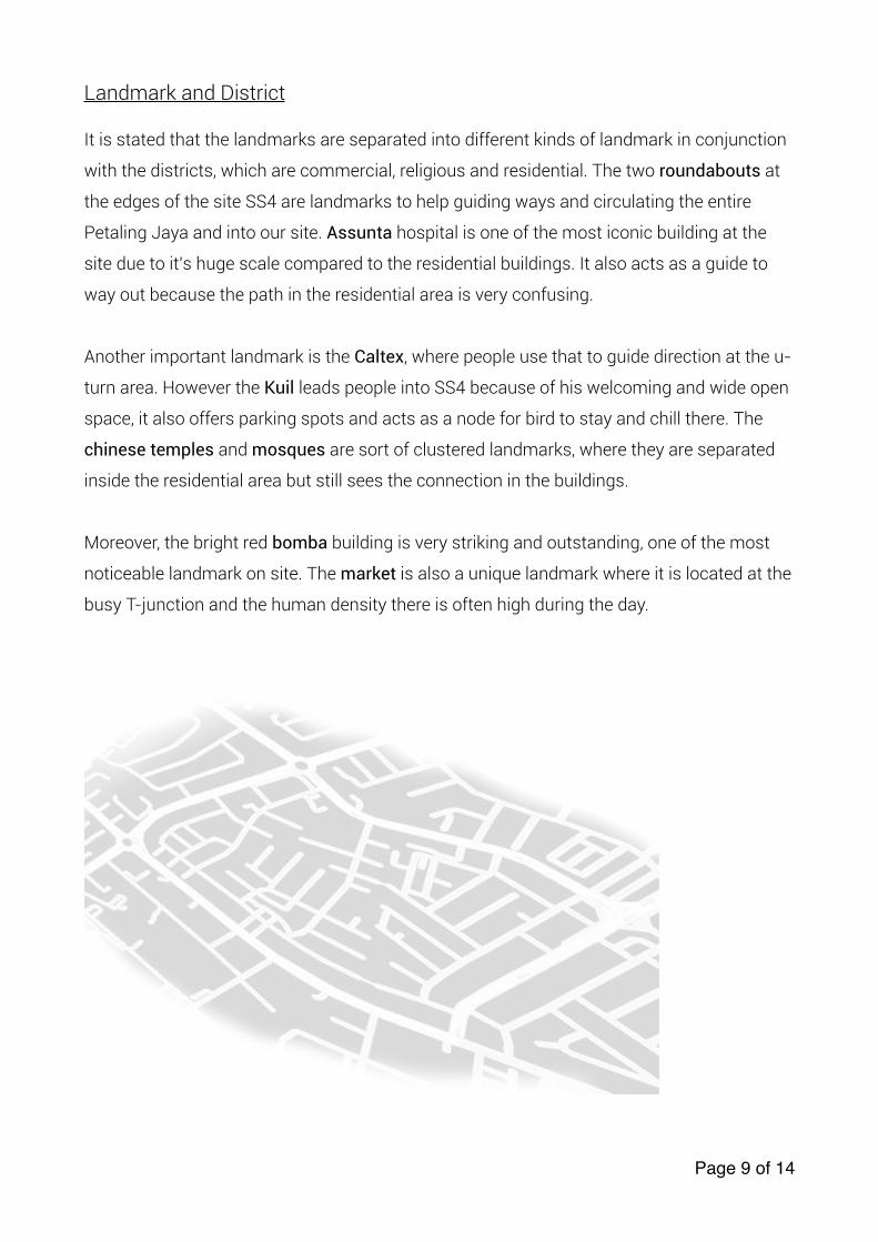
There is a big market at the T-junction of Jalan
Othman, which is often jam on the weekdays
during lunch time and in the morning when
people goes to market. People also tend to turn
into an uncomfortable secondary path, which is
right behind the market because the human density there is very high with a loading and
unloading and market place. There are rows of houses along Jalan Terus, nothing much
interesting along Jalan Terus other than the market and new mosque, therefore people tend
to exit back to Jalan Othman.
Page � of �8 14
Landmark and District
It is stated that the landmarks are separated into different kinds of landmark in conjunction
with the districts, which are commercial, religious and residential. The two roundabouts at
the edges of the site SS4 are landmarks to help guiding ways and circulating the entire
Petaling Jaya and into our site. Assunta hospital is one of the most iconic building at the
site due to it’s huge scale compared to the residential buildings. It also acts as a guide to
way out because the path in the residential area is very confusing.
Another important landmark is the Caltex, where people use that to guide direction at the u-
turn area. However the Kuil leads people into SS4 because of his welcoming and wide open
space, it also offers parking spots and acts as a node for bird to stay and chill there. The
chinese temples and mosques are sort of clustered landmarks, where they are separated
inside the residential area but still sees the connection in the buildings.
Moreover, the bright red bomba building is very striking and outstanding, one of the most
noticeable landmark on site. The market is also a unique landmark where it is located at the
busy T-junction and the human density there is often high during the day.
Page � of �9 14
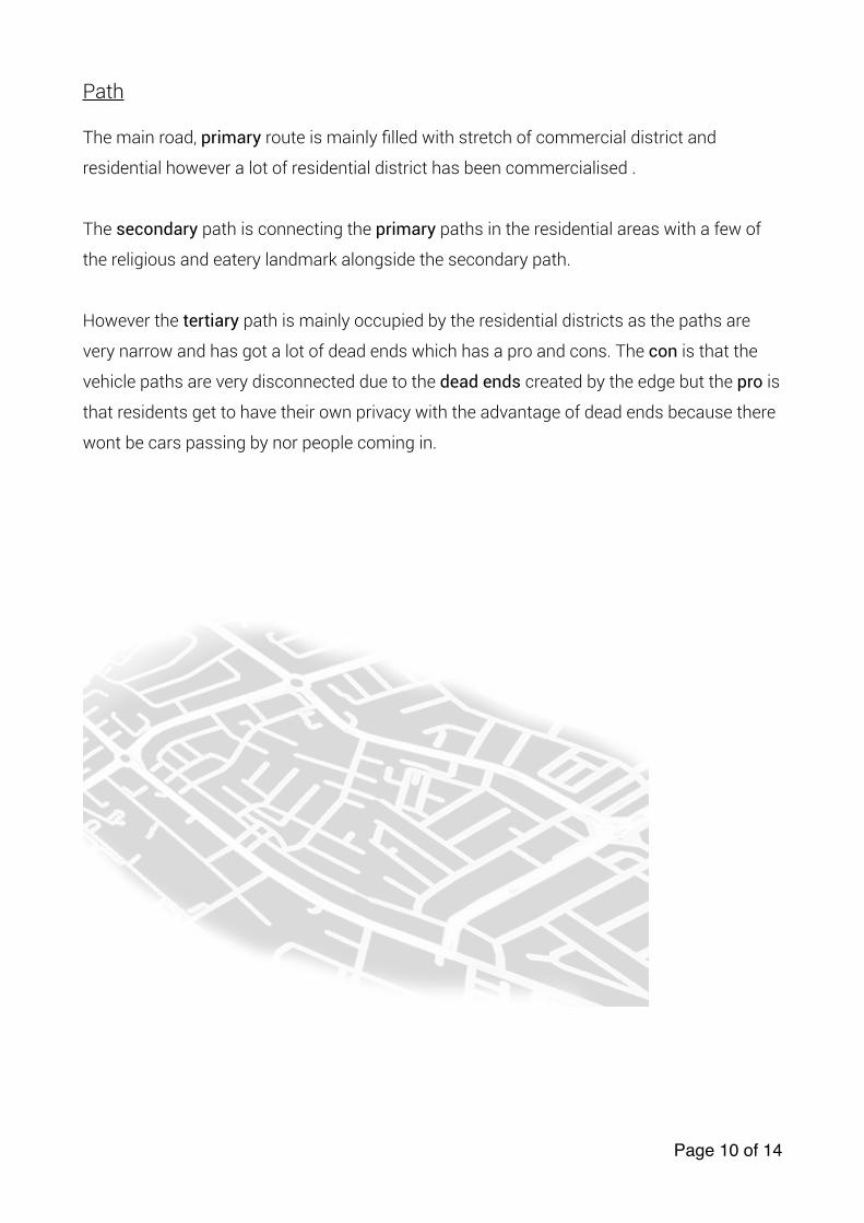
Path
The main road, primary route is mainly filled with stretch of commercial district and
residential however a lot of residential district has been commercialised .
The secondary path is connecting the primary paths in the residential areas with a few of
the religious and eatery landmark alongside the secondary path.
However the tertiary path is mainly occupied by the residential districts as the paths are
very narrow and has got a lot of dead ends which has a pro and cons. The con is that the
vehicle paths are very disconnected due to the dead ends created by the edge but the pro is
that residents get to have their own privacy with the advantage of dead ends because there
wont be cars passing by nor people coming in.
Page � of �10 14
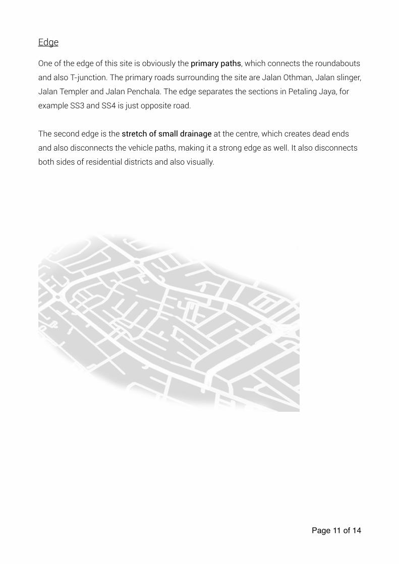
Edge
One of the edge of this site is obviously the primary paths, which connects the roundabouts
and also T-junction. The primary roads surrounding the site are Jalan Othman, Jalan slinger,
Jalan Templer and Jalan Penchala. The edge separates the sections in Petaling Jaya, for
example SS3 and SS4 is just opposite road.
The second edge is the stretch of small drainage at the centre, which creates dead ends
and also disconnects the vehicle paths, making it a strong edge as well. It also disconnects
both sides of residential districts and also visually.
Page � of �11 14
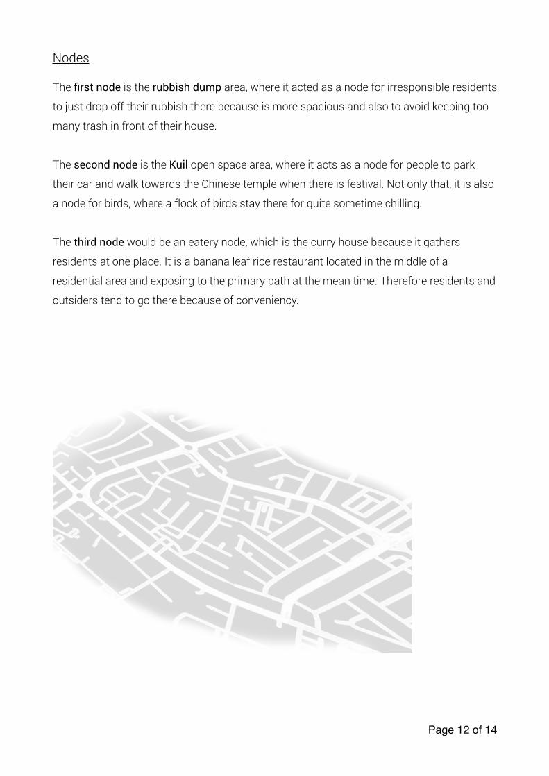
Nodes
The first node is the rubbish dump area, where it acted as a node for irresponsible residents
to just drop off their rubbish there because is more spacious and also to avoid keeping too
many trash in front of their house.
The second node is the Kuil open space area, where it acts as a node for people to park
their car and walk towards the Chinese temple when there is festival. Not only that, it is also
a node for birds, where a flock of birds stay there for quite sometime chilling.
The third node would be an eatery node, which is the curry house because it gathers
residents at one place. It is a banana leaf rice restaurant located in the middle of a
residential area and exposing to the primary path at the mean time. Therefore residents and
outsiders tend to go there because of conveniency.
Page � of �12 14
Conclusion
In conclusion, the site is actually a site with full of potential due to its location and also the
simple layout, which is easily memorised despite the dead ends problem. However there is
no perfect site, each site has pro and cons but problems can be solved via architectural
strategies. That is why the urban planning at the first place is the important. This site has
got a majority of residential district compared to the others, therefore making it an
interesting site.
However, the path in the residential area is too messy, only places with a landmark in the
middle of residential area has got more direction. I personally feel that this site could have a
more simple layout, for example the grid pattern layout of SS1, which is easily memorised
and accessible. The layout of this site is too scattered, as in the districts but the idea of the
residential area being surrounded by commercial is good that it bring crowd and also
conveniency for residents.
Afterall, if I were to design this site, I would use grid pattern principle and also bring in more
commercial districts and bigger scale buildings. The grid pattern will definitely solve the
path problems on site.
Page � of �13 14
Reference
1) Google maps - https://www.google.com.my/maps/place/Assunta
+Hospital/@3.0933462,101.643384,17z/data=!3m1!4b1!4m5!3m4!
1s0x31cc498e8f955555:0x76e61e62e50d6163!8m2!3d3.0933408!
4d101.645578?hl=en
2) Research on PJ old town - http://archresearch.org/_data_store_1/
jk_board/
4/2011-5/5.contextualmodernization_newtownplanninginpetalingjayaofm
alaysia_12.pdf
3) Picture Sources - Google maps and self taken only
4) Jason’s memory, observation and analysis
Page � of �14 14


