

Practical Applications for Remote Sensing 10/24/2017

What is Feature Extraction?
• Transforming data into information

Advantages of Feature Extraction
• Analysis of multiple data sources
• Reproducible results and repeatability
• Versatility and adaptability
• Analysis of data pixel by pixel, point by point
• Analysis of objects measures such as shape, size, texture, shadow, context, association etc.
• Scientific measure of accuracy
• Reduce labor cost and time
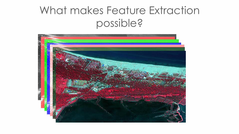
What makes Feature Extraction
possible?

Object Based Image Analysis (OBIA)
• Segmentation: The process of grouping together pixels based on certain criteria.
• These objects are then classified based on
– Radiometry/reflectance
– Geometry/shape
– Neighborhood/context
– Topology/network structure

Image Segmentation
• The problem: The explicit determination of the amount and distribution of the desired ground phenomena.
– Edge detection
– Region growing

Classification

What makes feature extraction possible?
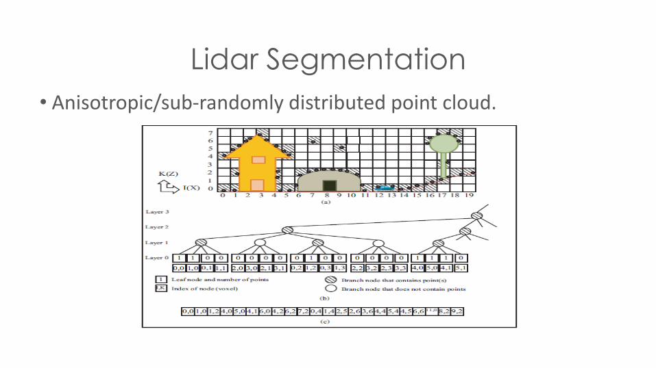
Lidar Segmentation
• Anisotropic/sub-randomly distributed point cloud.
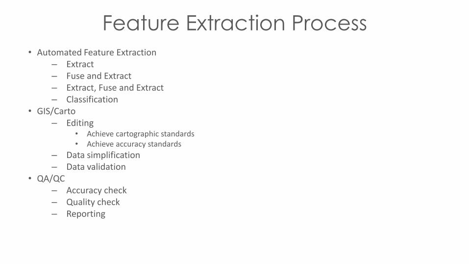
• Automated Feature Extraction– Extract– Fuse and Extract– Extract, Fuse and Extract– Classification
• GIS/Carto– Editing
• Achieve cartographic standards• Achieve accuracy standards
– Data simplification– Data validation
• QA/QC– Accuracy check– Quality check– Reporting
Feature Extraction Process
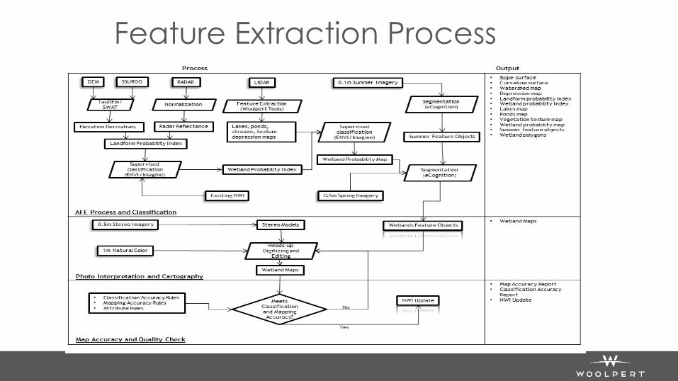
Feature Extraction Process

LidarTopology Determination
Plane detection by segmentation

LidarTopology Determination
Plane detection by segmentation

LidarTopology Determination
Plane detection by segmentation

LidarPolygon Generation
Plane detection by segmentation
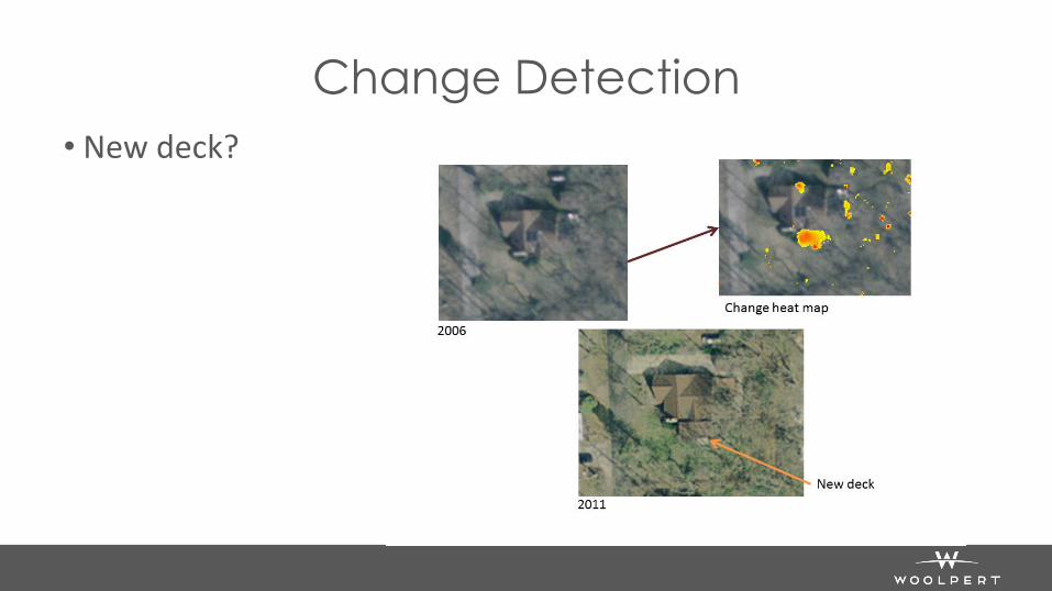
Change Detection
• New deck?

Change Detection
• 2006 - 2011

Building Outlines
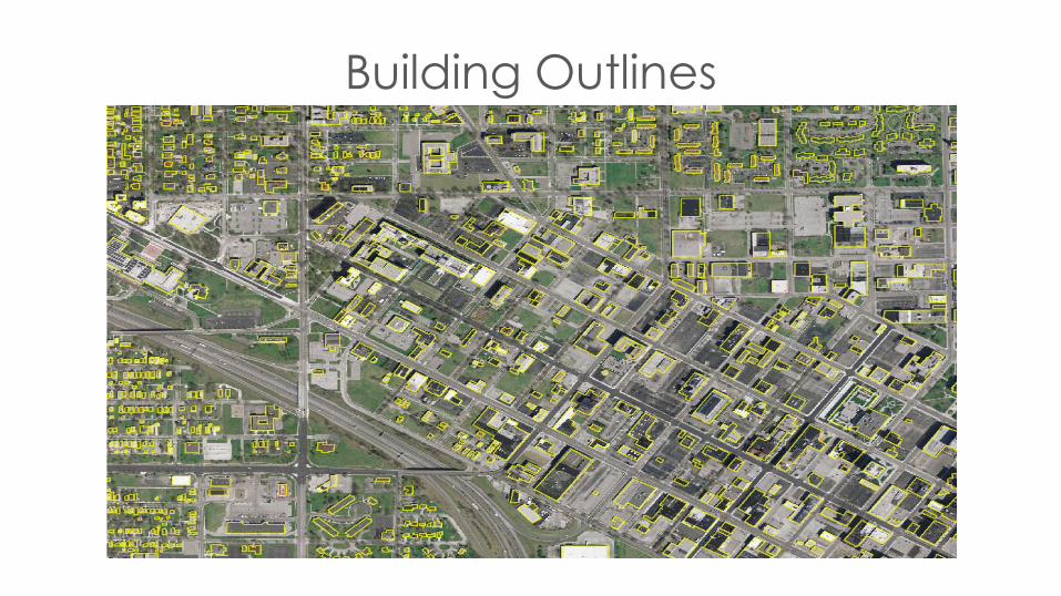
Building Outlines

Land Use/Land Cover Mapping

Land Use/Land Cover Mapping

Impervious Surface Mapping• Incorporate historical data• Parcel mapping• Road centerlines• Land-cover• Impervious surface• Zoning maps
Road CenterlinesParcel Mapping
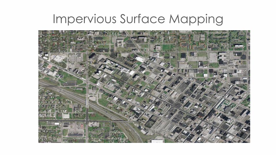
Impervious Surface Mapping
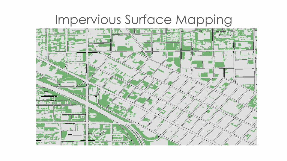
Impervious Surface Mapping

Impervious Surface Mapping
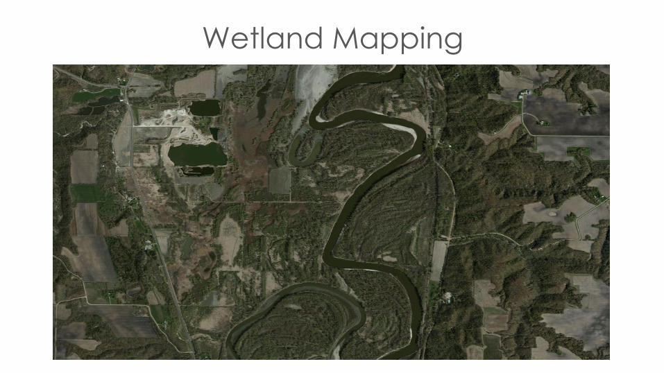
Wetland Mapping

Wetland Mapping

Wetland Mapping

Terrain Modeling

Solar Potential

Solar Potential
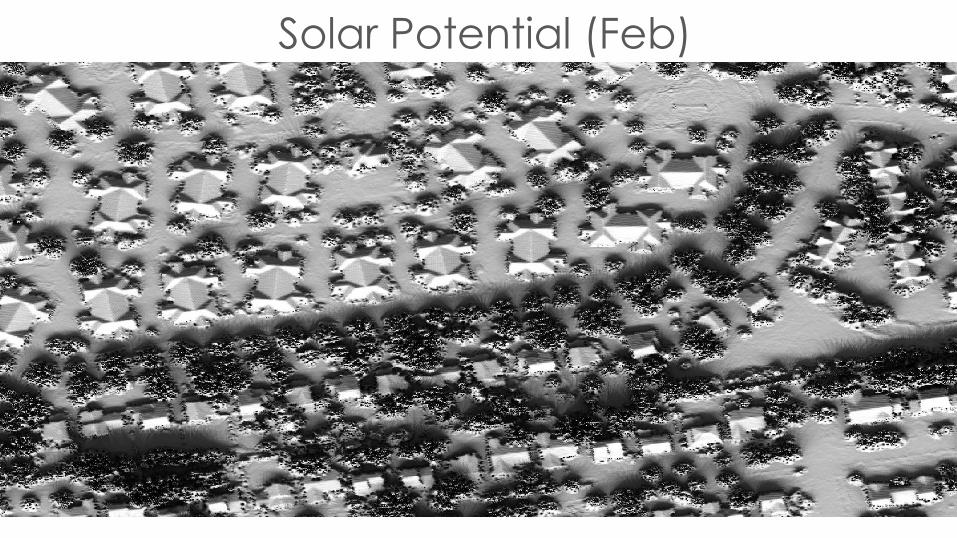
Solar Potential (Feb)

Solar Potential (Apr)
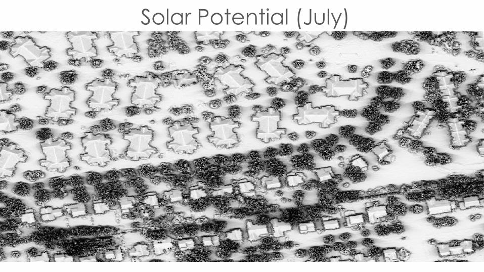
Solar Potential (July)

Solar Potential

Why?
• Reproducible
• Reduce field work
• Reduces manual edits
• Simplifies the comparison process
• Leverages existing data!

Questions / Comments
Kent L ParkGeospatial Project Manager
317.281.2092


![[REMOTE SENSING] 3-PM Remote Sensing](https://cdn.vdocuments.us/doc/165x107/61f2bbb282fa78206228d9e2/remote-sensing-3-pm-remote-sensing.jpg)
