
Sustainable and improved water governance in the Brahmaputra basin:
Issues and concerns
Partha J DasWater, Climate and Hazard Programme
AARANYAK
Guwahati-781 028, Assam
Email: [email protected]
www.aaranyak.org
Country level dialogue-IndiaTransnational policy dialogue for improved water governance in Brahmaputra river10 September, 2013IIT-Guwahati, Guwahati
Partha J DasWater, Climate & Hazard ProgrammeAaranyakGuwahati-781028

Brahmaputra-Meghna Basin(China, Bhutan, India, Bangladesh)

Physiography
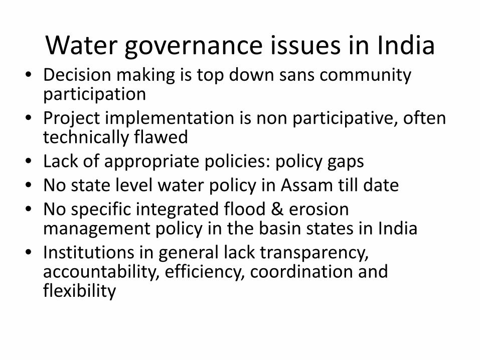
Water governance issues in India• Decision making is top down sans community
participation• Project implementation is non participative, often
technically flawed• Lack of appropriate policies: policy gaps• No state level water policy in Assam till date• No specific integrated flood & erosion
management policy in the basin states in India• Institutions in general lack transparency,
accountability, efficiency, coordination and flexibility
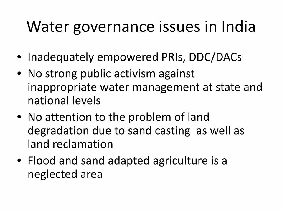
Water governance issues in India
• Inadequately empowered PRIs, DDC/DACs• No strong public activism against
inappropriate water management at state and national levels
• No attention to the problem of land degradation due to sand casting as well as land reclamation
• Flood and sand adapted agriculture is a neglected area

Policy Gaps
• Lack of an integrated flood and erosion management policy
• Land acquisition policy for embankments(state and central) not pro-people
• No locally acceptable R&R policy
• No bilateral arrangement for exchange of information about river status and hydrological data for monitoring and forecasting and warning of flash floods
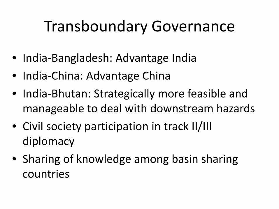
Transboundary Governance
• India-Bangladesh: Advantage India
• India-China: Advantage China
• India-Bhutan: Strategically more feasible and manageable to deal with downstream hazards
• Civil society participation in track II/III diplomacy
• Sharing of knowledge among basin sharing countries

Governance :Inter-state issues• No common platform for regional panning of
the basin• Clash of interest and priorities among states• NEWRA didn’t materialise• Difference in opinion on hydropower
development(e.g. Arunachal Pradesh and Assam)
• Upstream-downstream linkages in hydrogeomorphology not recognised in policy and practices
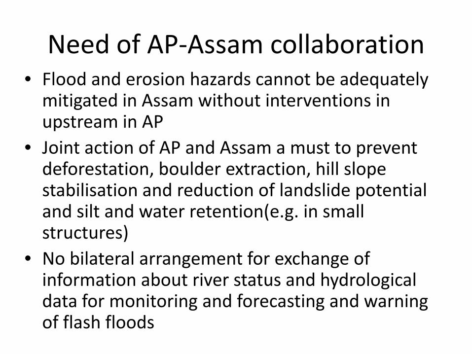
Need of AP-Assam collaboration • Flood and erosion hazards cannot be adequately
mitigated in Assam without interventions in upstream in AP
• Joint action of AP and Assam a must to prevent deforestation, boulder extraction, hill slope stabilisation and reduction of landslide potential and silt and water retention(e.g. in small structures)
• No bilateral arrangement for exchange of information about river status and hydrological data for monitoring and forecasting and warning of flash floods
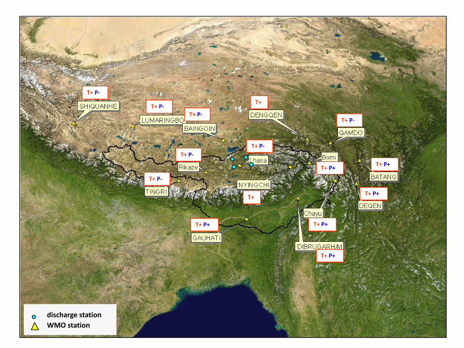
discharge stationWMO station
T+
T+
T+ P-
T+ P-T+ P-
T+ P-
T+ P-
T+ P-
T+ P-
T+ P+
T+ P+
T+ P+
T+ P+
T+ P+
T+ P+
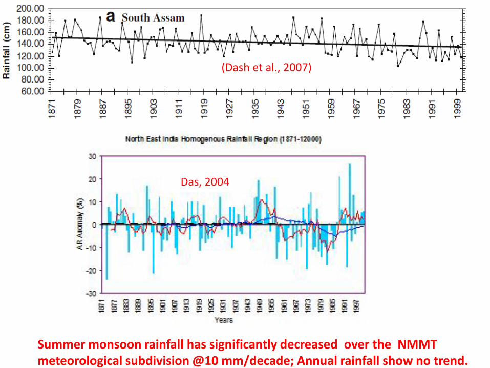
Summer monsoon rainfall has significantly decreased over the NMMT meteorological subdivision @10 mm/decade; Annual rainfall show no trend.
(Dash et al., 2007)
(Das, 2004)Das, 2004

Increasing trend in the contribution of very wet days to the total precipitation amount indicates the rise in extreme rainfall events
Dash et al(2007)
Eastern Himalaya Region
South Asia Region
Extreme(heavy) rainfall events have increased in magnitude and frequency in eastern Himalayan region
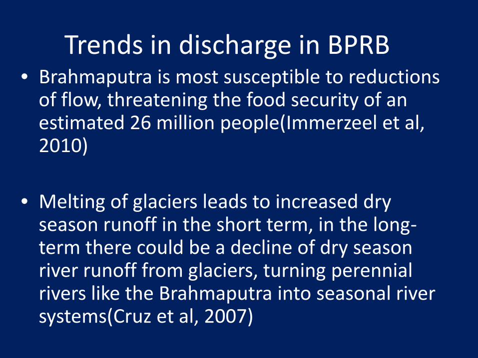
Trends in discharge in BPRB• Brahmaputra is most susceptible to reductions
of flow, threatening the food security of an estimated 26 million people(Immerzeel et al, 2010)
• Melting of glaciers leads to increased dry season runoff in the short term, in the long-term there could be a decline of dry season river runoff from glaciers, turning perennial rivers like the Brahmaputra into seasonal river systems(Cruz et al, 2007)

Trends in discharge in BPRB• There will be an initial increase in increase in mean
rainfall over the upstream of Brahmaputra basin by about 25 %, till 2040s
• Flow in the Brahmaputra basin will increase due to accelerated glacial melt till about the fourth decade of this century
• But the overall summer and late spring discharges are eventually expected to be reduced consistently and considerably, at least by 19.6% on an average during the years 2046 to 2065(Immerzeel et al, 2010)
• A very strong increase in peak flows is projected during 1961-2100(Gain et al, 2011)

CC and water availability of BPB• CC may alter both intensity and reliability of the
monsoon, and thus affect both high and low flows leading to increased flooding but possibly also to increased variability of available water, both in space and time (Postel et al., 1996).
• It may not be possible to utilise the high flows during floods and wet seasons to augment flow in the river in the dry season unless large storage systems are in place (Oki and Kanae, 2006).

1971-2000 2011-2040 2051-2080 2011-2040 2051-2080
COM 15501 14807 -22 -25
A1B 16815 14212 -15 -28
A2 17218 15081 -13 -24
B1 16909 15336 -15 -23
19823
Change [%]Annual discharge [m³/s]
Mean Discharge in Upper Brahmaputra Basin
Source: Brahmatwinn Project
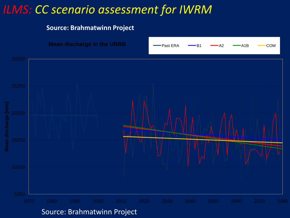
Mean discharge in the UBRB
5250
10250
15250
20250
25250
30250
1970 1980 1990 2000 2010 2020 2030 2040 2050 2060 2070 2080
Mea
n di
scha
rge
[mm
]
Past ERA B1 A2 A1B COM
ILMS: CC scenario assessment for IWRMSource: Brahmatwinn Project
Source: Brahmatwinn Project
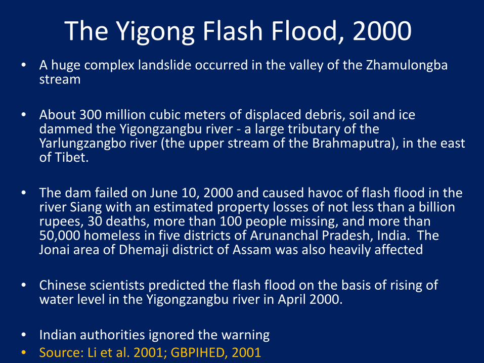
The Yigong Flash Flood, 2000• A huge complex landslide occurred in the valley of the Zhamulongba
stream
• About 300 million cubic meters of displaced debris, soil and ice dammed the Yigongzangbu river - a large tributary of the Yarlungzangbo river (the upper stream of the Brahmaputra), in the east of Tibet.
• The dam failed on June 10, 2000 and caused havoc of flash flood in the river Siang with an estimated property losses of not less than a billion rupees, 30 deaths, more than 100 people missing, and more than 50,000 homeless in five districts of Arunanchal Pradesh, India. The Jonai area of Dhemaji district of Assam was also heavily affected
• Chinese scientists predicted the flash flood on the basis of rising of water level in the Yigongzangbu river in April 2000.
• Indian authorities ignored the warning• Source: Li et al. 2001; GBPIHED, 2001

Climate change and sedimentation
• The increase in the sediment yield in the Himalayan region is up to 25%, which can be detrimental for the existing water resources projects and has the potential to cause considerable damage to the environment.
• Sediment yield will also increase in the North-Eastern region up to 25%.
Source: 4X4 assessment, MoEF, GoI, 2010
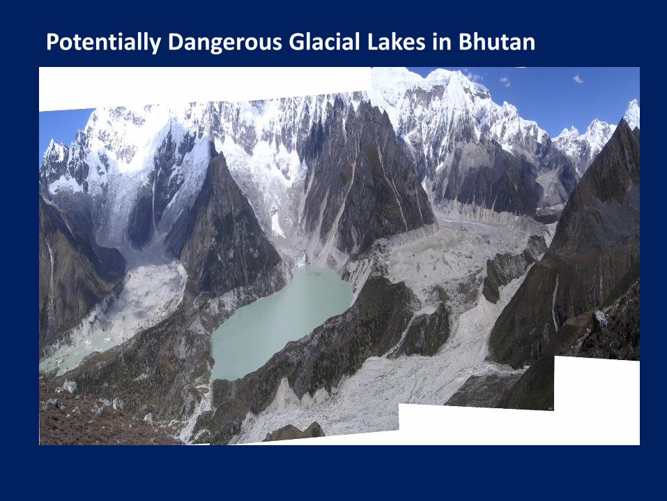
Potentially Dangerous Glacial Lakes in Bhutan

Sandscape of Samarajan, Dhemaji, Assam

The menace of sand casting in Dhemaji district
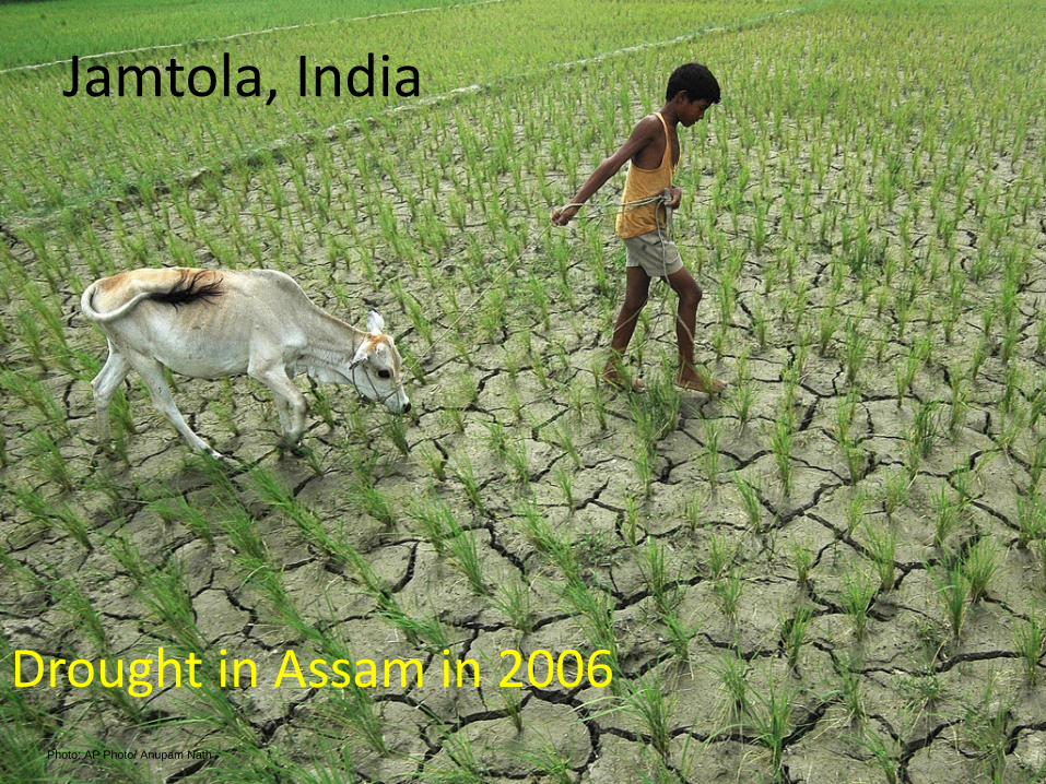
Photo: AP Photo/ Anupam Nath
Jamtola, India
Drought in Assam in 2006
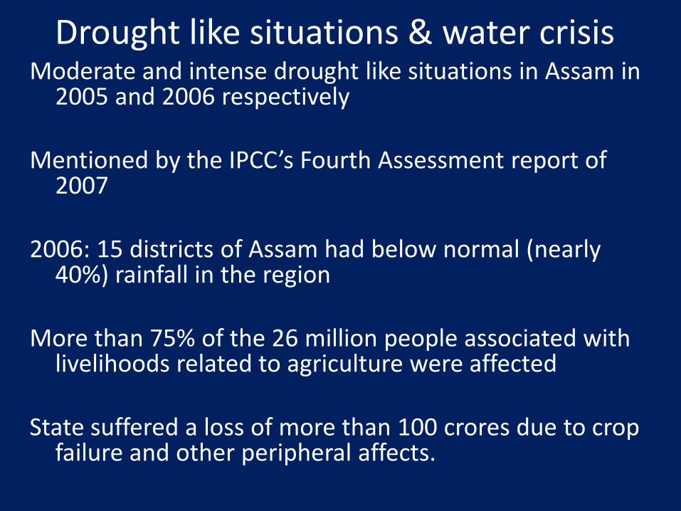
Drought like situations & water crisisModerate and intense drought like situations in Assam in
2005 and 2006 respectively
Mentioned by the IPCC’s Fourth Assessment report of 2007
2006: 15 districts of Assam had below normal (nearly 40%) rainfall in the region
More than 75% of the 26 million people associated with livelihoods related to agriculture were affected
State suffered a loss of more than 100 crores due to crop failure and other peripheral affects.
Drought like situations & water crisis
• Other states of the region also received rainfall 30 – 40 % below their normal rainfall except Mizoram.
• Dry spell from October 2009 to March 2010 in Nepal, NEI, Orissa
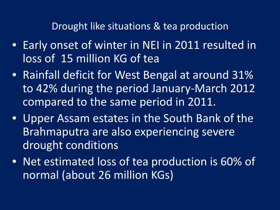
• Early onset of winter in NEI in 2011 resulted in loss of 15 million KG of tea
• Rainfall deficit for West Bengal at around 31% to 42% during the period January-March 2012 compared to the same period in 2011.
• Upper Assam estates in the South Bank of the Brahmaputra are also experiencing severe drought conditions
• Net estimated loss of tea production is 60% of normal (about 26 million KGs)
Drought like situations & tea production

Scarcity of drinking water in lean season: Lakhimpur & Dhemaji
Kekuri village, Dhemaji
Tekjuri Barman, Dhemaji
Kekuri village, Dhemaji
Mingmang-Lakhimpur

Hydropower Projects, Large river dams and Climate change
• Storage reservoirs of large hydro dams emit significant amount of green house gases(Methane, CO2)
• Hydropower being a green energy source is a myth
• Climate change impacts are not factored in designing the dams(e.g. DPR, EIA)
• CC effects on hydrological regime of rivers may make many of the dams inefficient
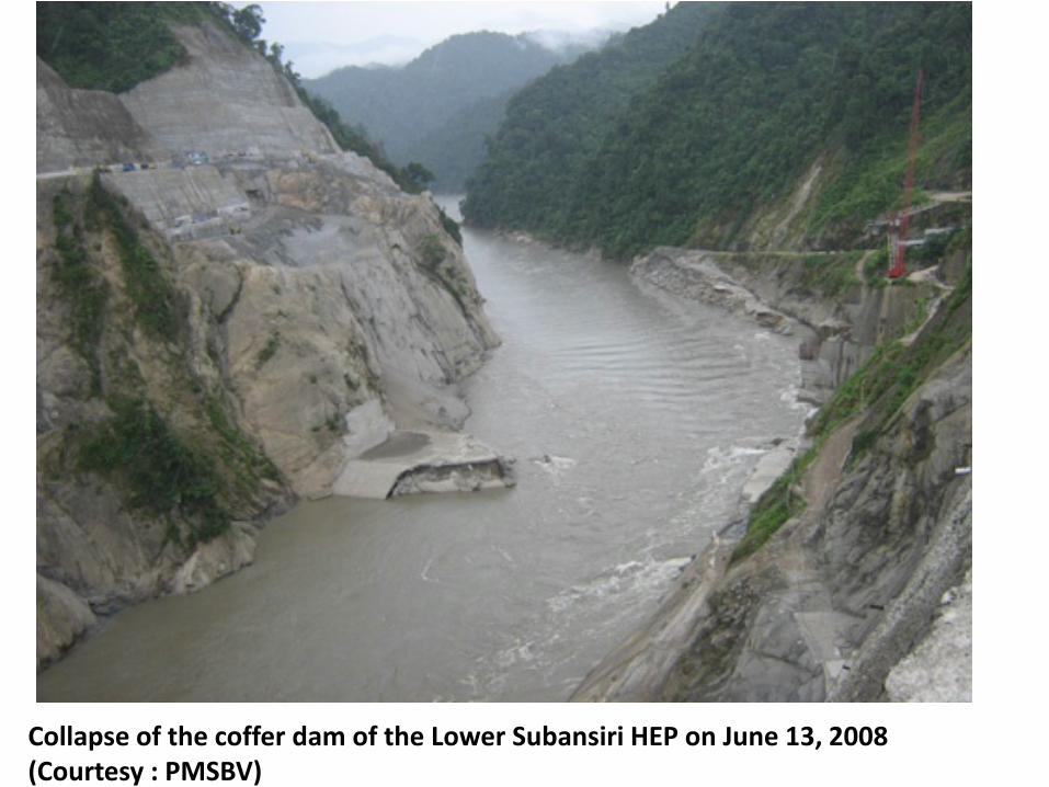
Collapse of the coffer dam of the Lower Subansiri HEP on June 13, 2008 (Courtesy : PMSBV)
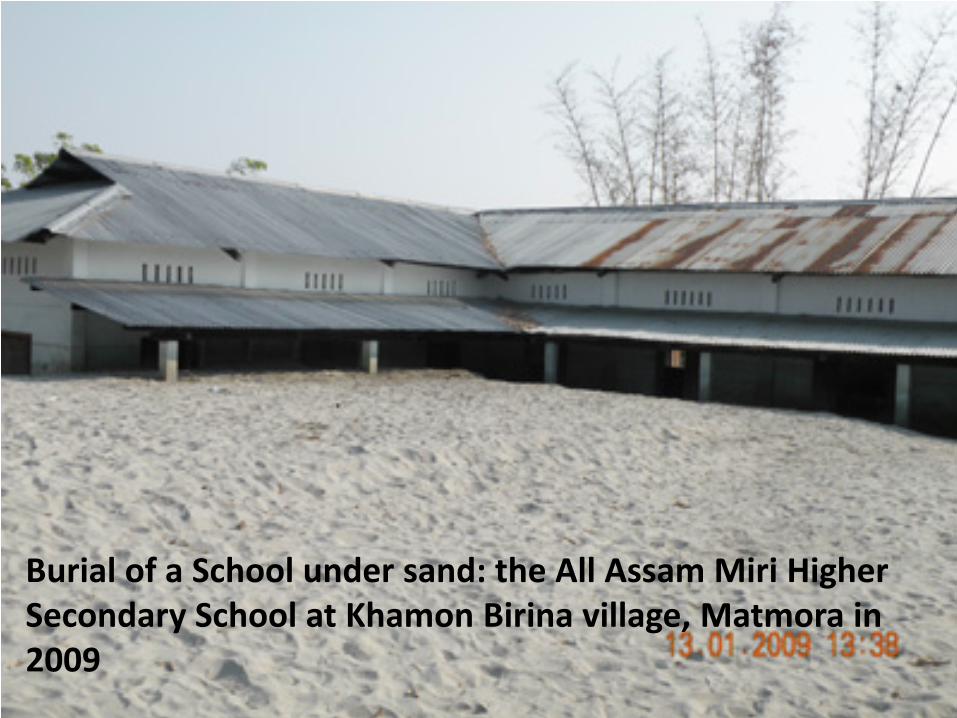
Burial of a School under sand: the All Assam Miri Higher Secondary School at Khamon Birina village, Matmora in 2009

FEWS System in the village Kesakathani in Dhemaji on 02.09.13
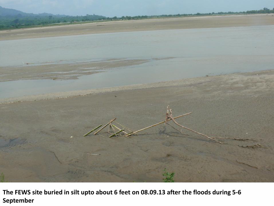
The FEWS site buried in silt upto about 6 feet on 08.09.13 after the floods during 5-6 September
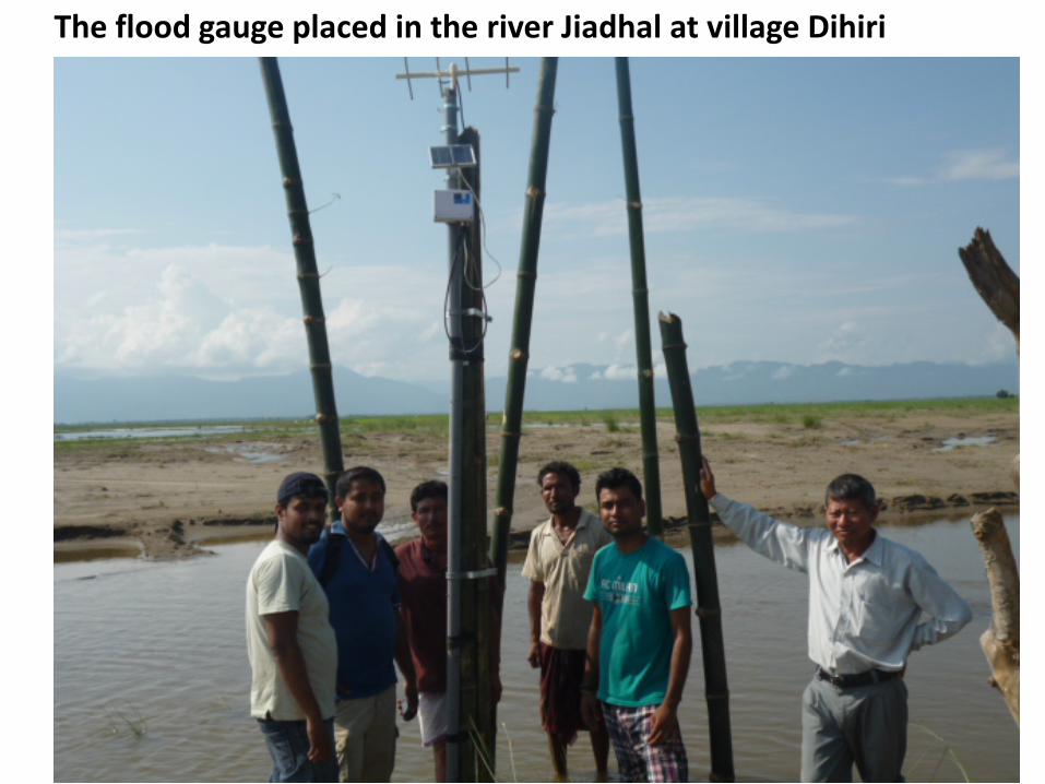
The flood gauge placed in the river Jiadhal at village Dihiri
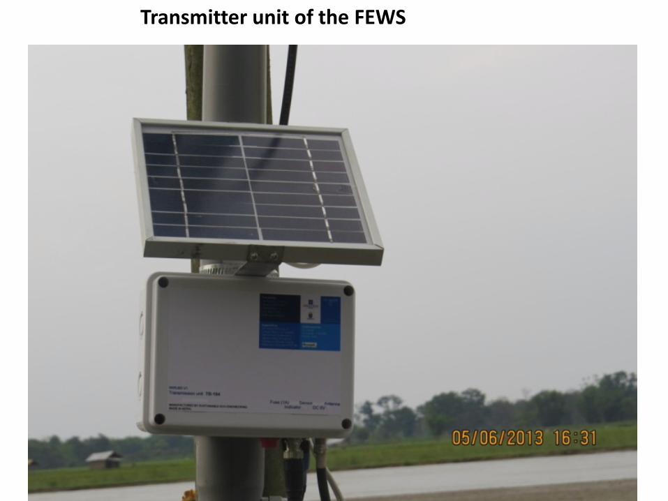
Transmitter unit of the FEWS
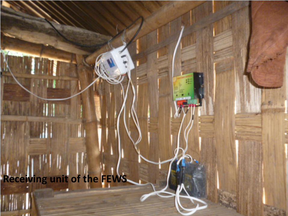
Receiving unit of the FEWS
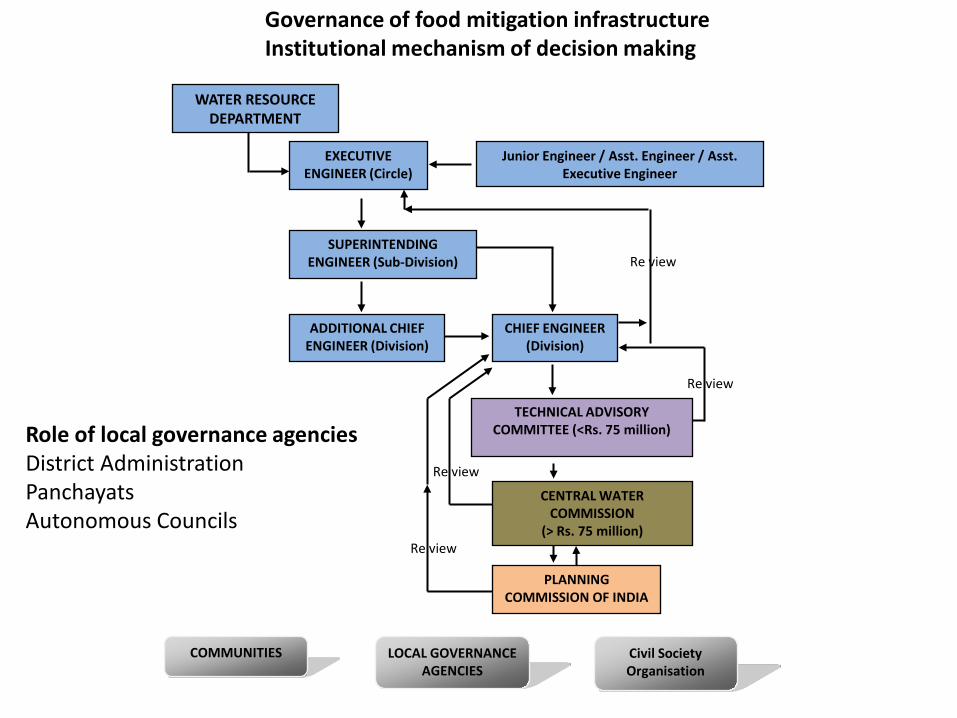
COMMUNITIES LOCAL GOVERNANCE AGENCIES
Civil Society Organisation
EXECUTIVE ENGINEER (Circle)
SUPERINTENDING ENGINEER (Sub-Division)
ADDITIONAL CHIEF ENGINEER (Division)
CHIEF ENGINEER (Division)
TECHNICAL ADVISORY COMMITTEE (<Rs. 75 million)
CENTRAL WATER COMMISSION
(> Rs. 75 million)
PLANNING COMMISSION OF INDIA
WATER RESOURCE DEPARTMENT
Junior Engineer / Asst. Engineer / Asst. Executive Engineer
Re view
Re view
Re view
Re view
Governance of food mitigation infrastructure Institutional mechanism of decision making
Role of local governance agenciesDistrict AdministrationPanchayatsAutonomous Councils

106.13
171.03
121.29
0
20
40
60
80
100
120
140
160
180
1973 1990 2010
Are
a in
Squ
are
Kilo
met
er
Year
Changes in area of sand deposition and sandy soil (1973-2010)Jiadhal River catchment, Dhemaji

110.34
87.9
58.67
0
20
40
60
80
100
120
1973 1990 2010
Are
a in
Squ
are
Kilo
met
er
Year
Changes in area of Rabi Crops(1973-2010)Jiadhal River Catchment, Dhemaji
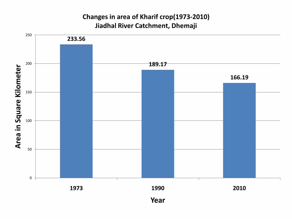
233.56
189.17
166.19
0
50
100
150
200
250
1973 1990 2010
Are
a in
Squ
are
Kilo
met
er
Year
Changes in area of Kharif crop(1973-2010)Jiadhal River Catchment, Dhemaji
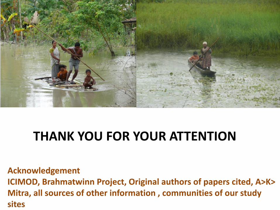
THANK YOU FOR YOUR ATTENTION
AcknowledgementICIMOD, Brahmatwinn Project, Original authors of papers cited, A>K> Mitra, all sources of other information , communities of our study sites


