
Office of Coast Survey
Improving NOAA’s Capacity to Address Improving NOAA’s Capacity to Address Coastal Inundation EventsCoastal Inundation Events
The Storm Surge Roadmap and the Way ForwardThe Storm Surge Roadmap and the Way Forward
Jesse C. FeyenStorm Surge Roadmap Portfolio Manager

Office of Coast Survey
Thanks to Numerous Co-Authors…
• NOS/Coast Survey Development Lab– Yuji Funakoshi, Machuan
Peng, Jindong Wang, Frank Aikman, Teresa Fleisher
• NWS/National Hurricane Center– Jamie Rhome
• NWS/Meteorological Development Lab– Arthur Taylor, Amy Haase,
Anne Myckow• NWS HQ
– Jennifer Sprague
• NWS/NCEP/Environmental Modeling Center– Hendrik Tolman, Andre van
der Westhuysen, Arun Chawla, Iliya Rivin
• SocResearch Miami– Betty Morrow
• NCAR/Societal Impacts Program– Jeff Lazo
Office of Coast Survey
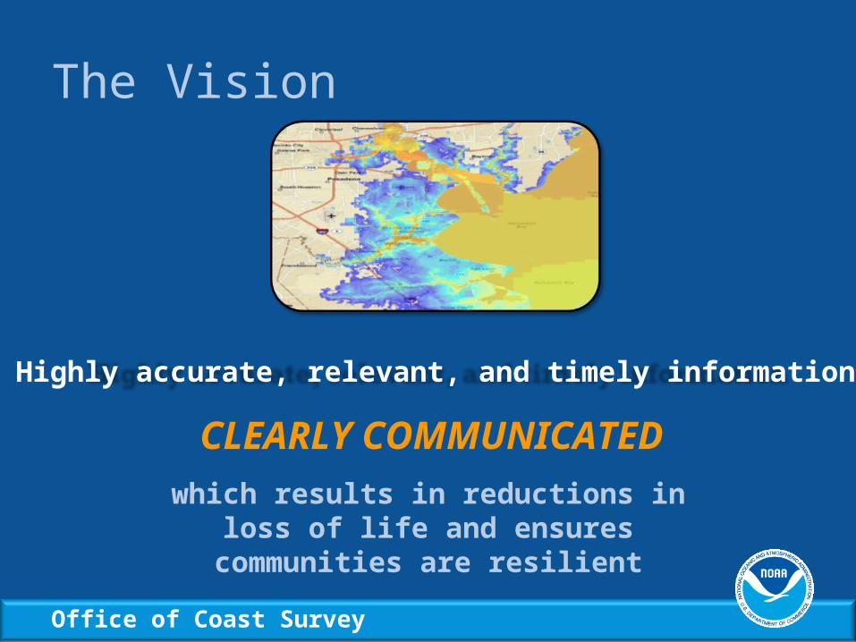
The Vision
Highly accurate, relevant, and timely information
CLEARLY COMMUNICATEDwhich results in reductions in loss of life and
ensures communities are resilient
Office of Coast Survey
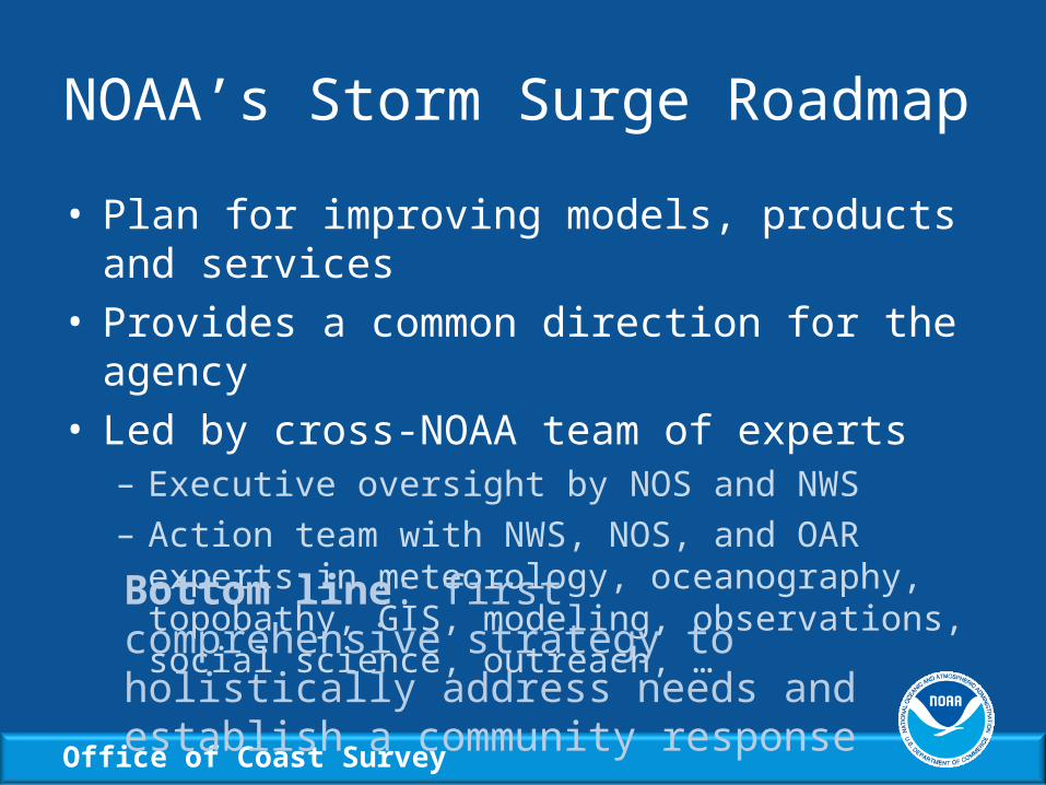
NOAA’s Storm Surge Roadmap
• Plan for improving models, products and services• Provides a common direction for the agency• Led by cross-NOAA team of experts
– Executive oversight by NOS and NWS– Action team with NWS, NOS, and OAR experts in
meteorology, oceanography, topobathy, GIS, modeling, observations, social science, outreach, …
Bottom line: first comprehensive strategy to holistically address needs and establish a community response

Office of Coast Survey
The Bottom Line for NOAACustomers Ask:• Who will get flooded?
How much?• When will it arrive and
leave?• What will the impacts be?• How often will it occur?• How should I act?
Roadmap Goals:1. Accurately determine storm
water levels– Total Water Level (TWL) models with
surge + tides + waves + rivers– Uncertainty (ensembles, probabilistic )
2. Intuitively describe inundation as flooding above ground level– In statements and maps
3. Communicate actionable information– Based on social science

Office of Coast Survey
Surge Model Development Efforts
• Moving toward total water level modeling– Adding tides to operational surge model SLOSH– Implementing extratropical surge+tide model ESTOFS– Coupling surge (ADCIRC) and wave (WAVEWATCH
III®) models in the Nearshore Wave Prediction System
• Accelerating transition of research to operations– IOOS testbed for evaluating costs and benefits of
transitioning community models to operations– Investigating ensemble approaches to support multiple
surge models in the future

Office of Coast Survey
Adding Tides to SLOSH• Tide constituent data from ADCIRC models• Experimental use this hurricane season
Surge + Tides = SLOSH+Tides Surge + Tides = SLOSH+Tides

Office of Coast Survey
Extratropical Surge and Tide Prediction
• Extratropical Surge+Tide Operational Forecast System (ESTOFS) operational in spring
• Uses community-based ADCIRC model with GFS winds
• Coupled to WAVEWATCH III® for Nearshore Wave Prediction System (NWPS)
• Output in NetCDF and 2.5 km NDFD GRIB2• http://nomad1.ncep.noaa.gov/pub/raid2/estofs/
Office of Coast Survey
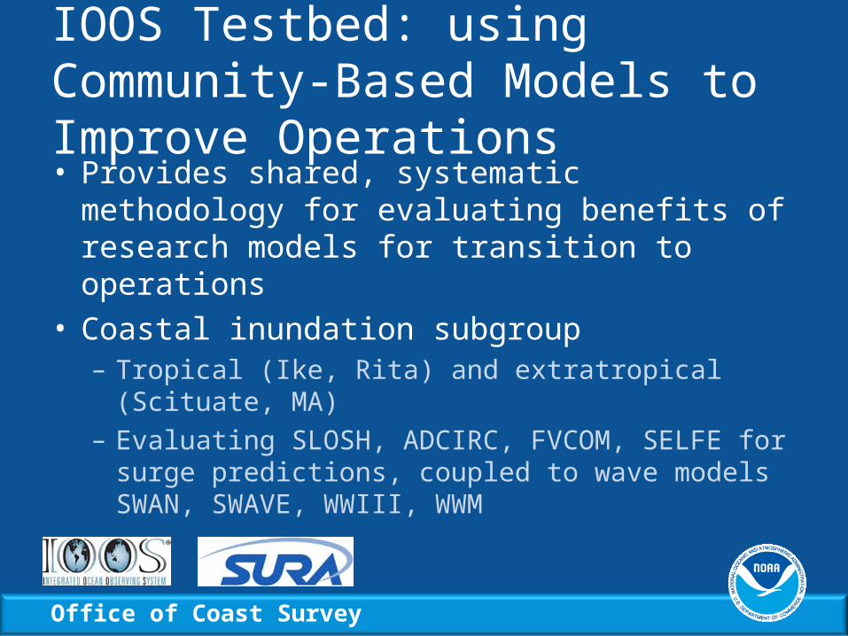
IOOS Testbed: using Community-Based Models to Improve Operations• Provides shared, systematic methodology for
evaluating benefits of research models for transition to operations
• Coastal inundation subgroup– Tropical (Ike, Rita) and extratropical (Scituate, MA)– Evaluating SLOSH, ADCIRC, FVCOM, SELFE for
surge predictions, coupled to wave models SWAN, SWAVE, WWIII, WWM

Office of Coast Survey
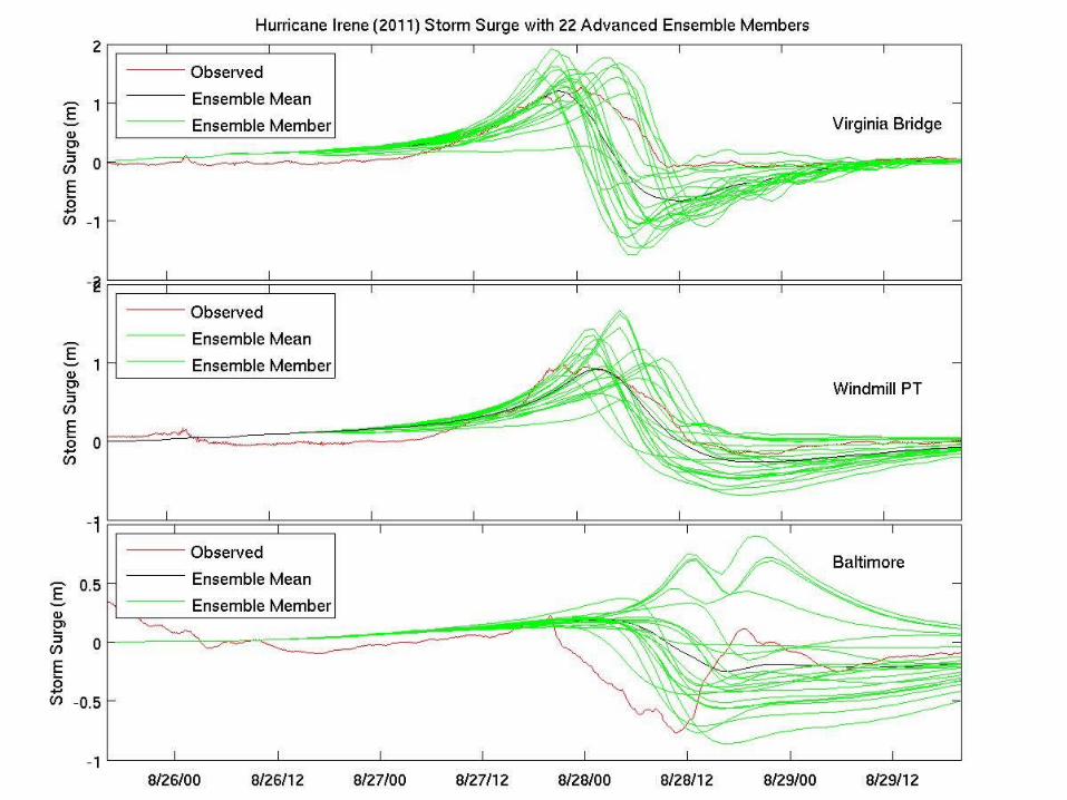
Ensemble Storm Surge Modeling: Combining Multiple Predictions• Ensemble approach requires:
– Multiple simulations (including both multiple forcing of one model and multiple surge models)
– Statistical assessment of the ensemble and its members
• Developing ensemble of forecast tracks– Tracks generated by forecasts and dynamical models
(e.g., NHC, GFDL, HWRF, GFS, UKMET, ECMWF…)– P-Surge adopted to use multiple modeled tracks, and
later other surge models can be added to ensemble
Office of Coast Survey

Office of Coast Survey
Office of Coast Survey
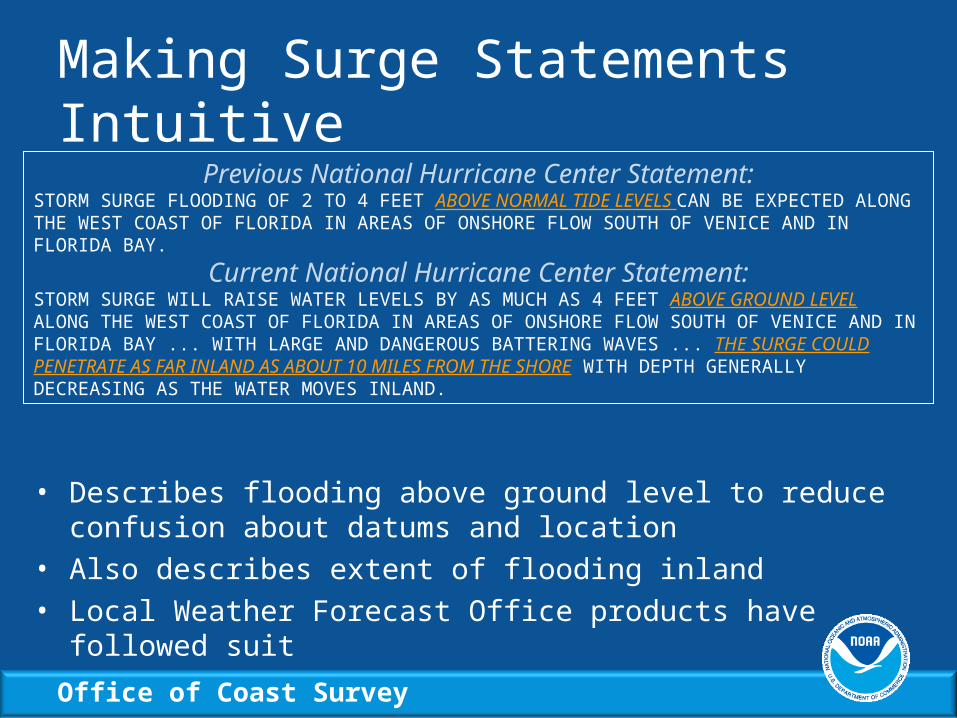
Making Surge Statements Intuitive
• Describes flooding above ground level to reduce confusion about datums and location
• Also describes extent of flooding inland
• Local Weather Forecast Office products have followed suit
Previous National Hurricane Center Statement:STORM SURGE FLOODING OF 2 TO 4 FEET ABOVE NORMAL TIDE LEVELS CAN BE EXPECTED ALONG THE WEST COAST OF FLORIDA IN AREAS OF ONSHORE FLOW SOUTH OF VENICE AND IN FLORIDA BAY.
Current National Hurricane Center Statement:STORM SURGE WILL RAISE WATER LEVELS BY AS MUCH AS 4 FEET ABOVE GROUND LEVEL ALONG THE WEST COAST OF FLORIDA IN AREAS OF ONSHORE FLOW SOUTH OF VENICE AND IN FLORIDA BAY ... WITH LARGE AND DANGEROUS BATTERING WAVES ... THE SURGE COULD PENETRATE AS FAR INLAND AS ABOUT 10 MILES FROM THE SHORE WITH DEPTH GENERALLY DECREASING AS THE WATER MOVES INLAND.
Office of Coast Survey
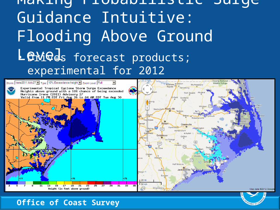
Making Probabilistic Surge Guidance Intuitive: Flooding Above Ground Level• Drives forecast products; experimental for 2012
– http://www.nws.noaa.gov/mdl/phish/

Office of Coast Survey
Communicating Actionable Surge Information• Employing social science techniques to assess
user’s needs and design new products• Results show a significant portion of the surge
vulnerable population does not understand:– what storm surge is, their vulnerability, what the
forecast information means, and the potential impacts – people desire more info but unsure of how
• Now evaluating new product prototypes– High resolution inundation graphics in development
and testing with public, EMs, media

Office of Coast Survey
Making Surge Information Accessible
• Storm surge listed on NOAAWatch, NOAA’s all hazards monitor
• Centralized NOAA website on storm surge expertise to be released this year
Office of Coast Survey


