MODIS Workshop
An Introduction toNASA’s Earth Observing System
(EOS), Terra, and the MODIS Instrument
Michele [email protected]
406-243-6263http://eostc.umt.edu/forestry

MODIS Workshop
Primary Research
MODIS Science Compute Facility
EOS Training Center
The University of MontanaSchool of Forestry
MODIS Land Science Team Member

MODIS Workshop
Training and support in theacquisition, translation, andinterpretation of EOS data.
Supporting applicationsof EOS data for naturalresource management.
GoalsGoals
MODIS Workshop
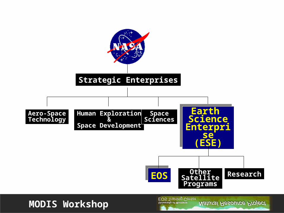
EOSEOS
Strategic Enterprises
Aero-SpaceTechnology
Human Exploration&
Space Development
SpaceSciences
Earth Science
Enterprise(ESE)
Earth Science
Enterprise(ESE)
OtherSatellite
ProgramsResearch

MODIS Workshop
Primary GOAL:Primary GOAL: Long-term monitoring of the Earth’s biosphere
NASA’s EOS Program

MODIS Workshop
Components for a Comprehensive Mission:
• A Space ComponentA Space Component
• A Science ComponentA Science Component
• A Data ComponentA Data Component
NASA’s EOS Program
MODIS Workshop
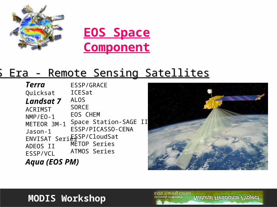
TerraQuicksat
Landsat 7ACRIMSTNMP/EO-1METEOR 3M-1Jason-1ENVISAT SeriesADEOS IIESSP/VCL
Aqua (EOS PM)
ESSP/GRACEICESatALOSSORCEEOS CHEMSpace Station-SAGE IIIESSP/PICASSO-CENAESSP/CloudSatMETOP SeriesATMOS Series
EOS Era - Remote Sensing SatellitesEOS Era - Remote Sensing Satellites
EOS Space Component

MODIS Workshop
A global data-base of remote sensing measurementsA global data-base of remote sensing measurements
OCEANOCEAN
Sea Surface Temperature
ATMOSPHEREATMOSPHERE
Cloud Type
CRYOSPHERECRYOSPHERE
Ice Extent
LANDLAND
The Alps
SOLAR RADIATIONSOLAR RADIATION
Emitted Long Wave Radiation
EOS Science Component

MODIS Workshop
DAAC = Distributed Active Archive Centers
EOS Data Component
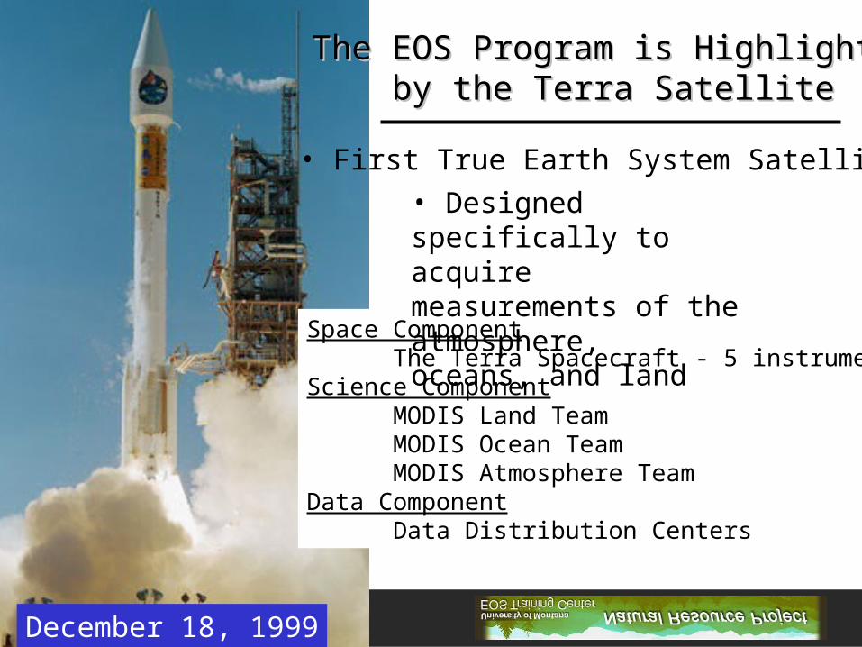
MODIS WorkshopDecember 18, 1999
The EOS Program is HighlightedThe EOS Program is Highlightedby the Terra Satelliteby the Terra Satellite
• First True Earth System Satellite
Space ComponentThe Terra Spacecraft - 5 instruments
Science ComponentMODIS Land TeamMODIS Ocean TeamMODIS Atmosphere Team
Data ComponentData Distribution Centers
• Designed specifically to acquiremeasurements of the atmosphere, oceans, and land

MODIS Workshop
Terra Carries Terra Carries 55 Separate Instruments Separate Instruments
The Terra SatelliteThe Terra Satellite

MODIS Workshop
- Atmosphere, land, and ocean viewing in a single instrument
- Daily global coverage - 2330 km swath
- Designed to monitor vegetation
- 36 channels - 2 @ 250m pixels, 5 @ 500m, 29 @ 1km
- Custom tailored spectral bands from 0.4 to 14.0 m
- Enhanced atmospheric correction
- On-board calibration
- Improved geo-referencing
The MODIS InstrumentModerate Resolution Imaging Spectroradiometer

MODIS Workshop
SatelliteSensor
Landsat-7ETM+
NOAA-14AVHRR
TerraMODIS
Spectral Range (m) .45 - 12.5 .58 - 12.5 .40 - 14.4
Number of Bands 7 5 36
Ground Resolution30 m
60 m - thermal15 m - panchromatic
1.1 km250m - bands 1-2500m - band 3-7
1000m - bands 8-36
Swath Width 185 km 2399 km 2330 km
Repeat Coverage 16 days 1 day 1-2 days
Altitude of Satellite 705 km 833 km 705 km
OrbitSun-synchronous
Polar orbitingDescending Node
10:00 am
Sun-synchronousPolar orbiting
Ascending Node 1:40 pm
Sun-synchronousPolar orbiting
Descending Node 10:30 am
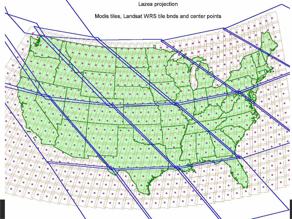
MODIS Workshop

MODIS Workshop
MODIS Application Products
One of the greatest advantages to the end user are the MODISApplication Products that are available
• World Wide• Nominal Cost

MODIS Workshop
MODIS Land Products
Ecosystem VariablesVegetation IndicesLeaf Area Index (LAI) and Fraction Photosynthetically Active Radiation (FPAR)Vegetation Production, Net Primary Productivity (NPP)Evapotranspiration and Surface Resistance
Land Cover CharacteristicsFire and Thermal AnomaliesLand CoverVegetation Cover ConversionAt-Launch Land Cover (derived from AVHRR)
Radiation Budget VariablesSurface Reflectance/Atmospheric Correction
Land Surface Temperature (LST) and Emissivity
Snow and Ice Cover
Bi-directional Reflection (BRDF) and Albedo


