×
Log in
Upload File
Most Popular
Study
Business
Design
Technology
Travel
Explore all categories
Download -
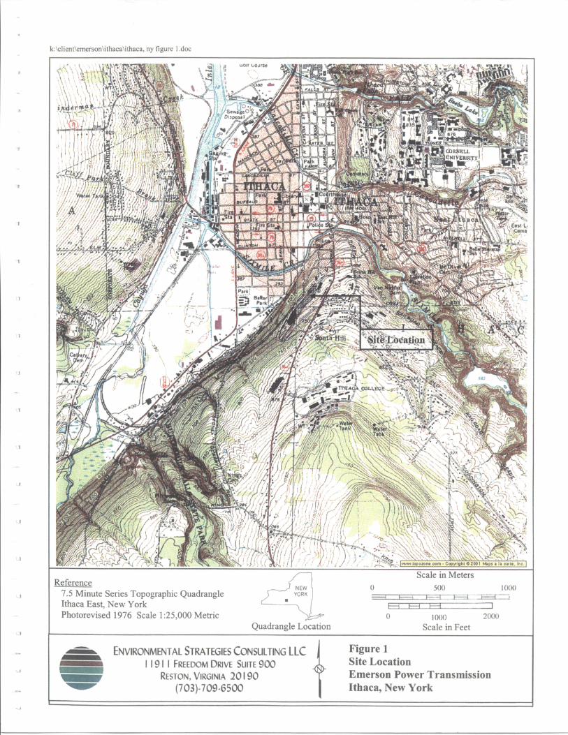
Ithaca Topography Map
Download
Transcript
Page 1
Top Related
ATLAS Corneal Topography System - Eye Care Alliance · corneal assessments . Intuitive Analysis and Reporting. Topography Map. Display as curvature, elevation, corneal . wavefront,
65. Aogashima - data.jma.go.jp€¦ · (65. Aogashima) 2 Red Relief Image Map Figure 65-1 Topography of Aogashima. 1:50,000 scale topographic map (Hachijojima) and digital map 50
SHUTTLE RADAR TOPOGRAPHY MISSION - NASA · The primary objective of the Shuttle Radar Topography Mission is to acquire a high-resolution topographic map of the Earth's land mass (between
16120 North Fork Franchini - images.landandfarm.com€¦ · Satellite Image . Forest Service Map . Topography Map . Section Map ... 3: Cummings MeàdbWs— Pine QUARTZ e frailereeç
US Geography and Map Skills Unit I. Vocabulary Relative Location Absolute Location Map Projection Hemisphere Scale Latitude Longitude Topography Physical
Topography! Understanding topographic maps.. What is a topographic map? Topographic maps show the topography of a land area. – When Earth Scientists
The Topography of Eden - viXra.org open e-Print archivevixra.org/pdf/1307.0088v1.pdfThe Topography of Eden: a map of conscious creation Daniel K. Pratt, 15 March 2010 Abstract: Human
Pre-Target Axon Sorting Establishes the Neural Map Topography