
1
Introduction of new electronic systems for aviation
Thor Breien, Dr. Ing
Park Air Systems AS
Presented by
Linda Lavik

2
Subjects to be discussed
• Navigation Systems in use for air traffic• Why need for new systems• Factors against transition from ground
based to satellite based systems• The Authorities, ATC / airport operators,
system suppliers, and airlines roles in the implementation process
• Experiences from SCAT-I
3
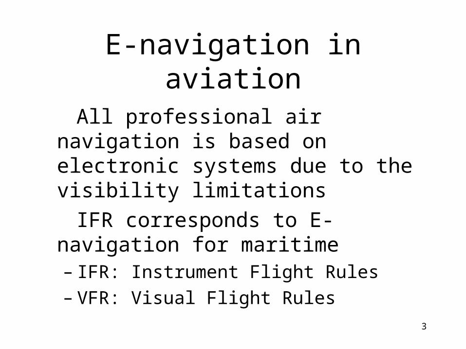
E-navigation in aviation
All professional air navigation is based on electronic systems due to the visibility limitations
IFR corresponds to E-navigation for maritime– IFR: Instrument Flight Rules– VFR: Visual Flight Rules

4
Navigation Systems in useHistory of air navigation
• Aviation started in 1903
• From 1919 bonfires and artificial lights, in addition to landmarks and maps, were used to help pilots find their way

5
Navigation Systems in use Early Landing Aid and Landing field light

6
Navigation Systems in use History of air radio navigation
• 1920’s: Started use of radio navigation aids (NAVAIDS)
• In 1947 ICAO was founded as a specialized aviation UN agency and NAVAIDS international standardized. Several systems were then taken in use:
– CONSOL -DME (distance)
– LORAN -ILS (landing)
– VOR (bearing) -NDB (bearing/position)

7
Navigation Systems in use Typical today's Navigation and
Landing aids

8
Why need for new NAVAIDS?• Technology evolution
– The availability of GPS and extended use of computers in flight management systems
• Congestions in airspace– Need to increase capacity by moving from today's route network to Free
Flight navigation (Single European Sky)
• Cost reductions– Need for more cost-effective use of aircraft by shorter stopovers and less
fuel consumption– Lower Navigation fees; reduction of redundant NAVAIDS
• Increased safety– Introduction of NAVAIDS for more areas and airports will increase safety
and potential for fewer accidents
9
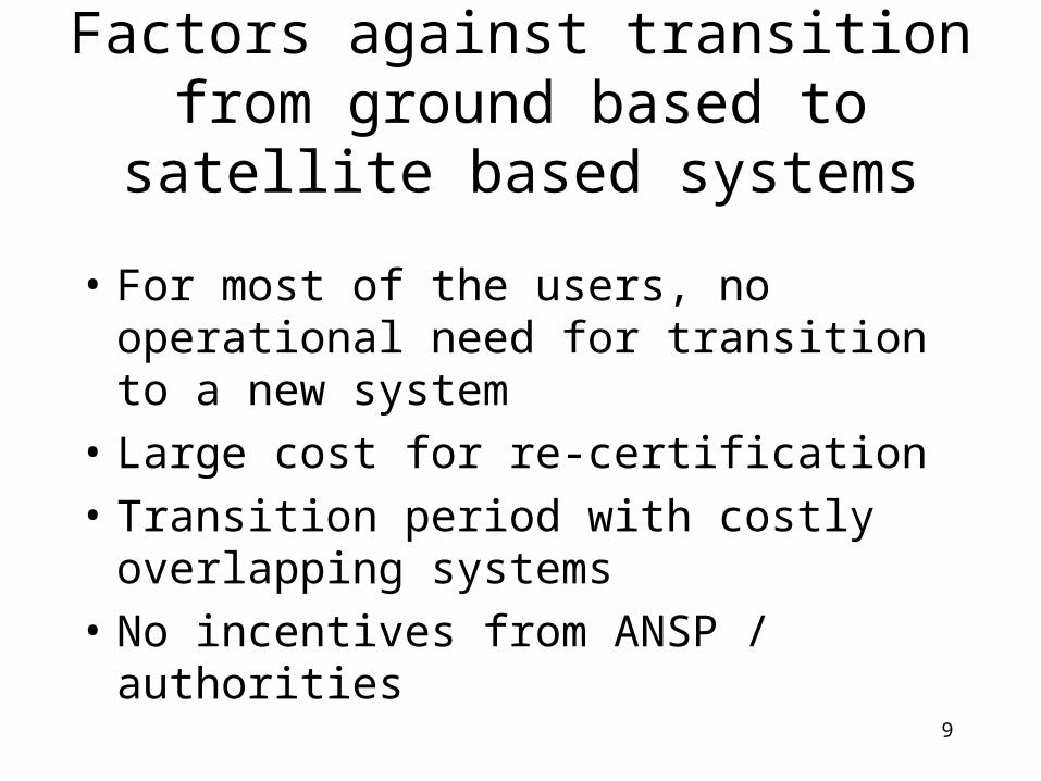
Factors against transition from ground based to satellite based systems
• For most of the users, no operational need for transition to a new system
• Large cost for re-certification
• Transition period with costly overlapping systems
• No incentives from ANSP / authorities

10
Why new NAVAIDS? Potential cost savings and
environmental benefits with GPS-based systems
Example Curved Approach withContinuous Descent
© 2002 The MITRE Corporation. All RightsReserved.

11
Why not just use satellite systems...
..and switch off the expensive ground infrastructure??
There are several obstacles:
• All aircraft must have installed new avionics
• International consensus on the transition required
• Political and legal aspects to be clarified
• Satellite systems must have proved their performance

12
Political and legal aspects to be clarified
• Who is responsible for any accidents?
• Who controls the signal availability?– Need for more systems
than GPS
• Reduced accessibility, who takes the delay / cancellation bill?

13
International coordination for introduction of new systems
• National and international Radio Navigation Plans are policy documents for the future use of existing and new navigation aids
• All plans agree on the main items:– Navigation and landing will be based on a mixture of
ground and satellite systems– Evolutionary introduction of satellite systems – Some ground based systems will be gradually
withdrawn– Maintain complementary ground systems until satellite
systems have received full acceptance

14
Who participate in the the NAVAIDS transition process?
• Authorities
• ATC / airport operators (Air Navigation Service Providers)
• System suppliers
• Airlines

15
The Authorities role
• ICAO (parallel to IMO) – establish the international agreed standards and set the
protection dates
• EUROCONTROL– develops, coordinates and plans for implementation of pan-
European air traffic management strategies
• Civil Aviation Authority– Establish national regulations– Issue certificates to put new systems into operations– Inspections of service providers, industry and airlines
according to JAA/EU regulations

16
The Air Navigation Service Providers’ role
• Clarify service needs based on input from airlines
• Define system requirements
• Collect/produce documentation for approval
• Acquire and put into operations
• Maintain the systems

17
The Airlines’ role
• Identify the needs for more cost-effective / safer navigation
• Define the avionics concept
• Collect/Produce documentation for certification
• Install the avionics in new aircraft, retrofit for existing aircraft

18
The system suppliers’ role
• Specify the design methodology, the system equipment functionality and performance
• Produce product documentation and safety assessments according to the CAA regulations
• Design and manufacture the system equipment

19
Certification of a first generation satellite-based landing system
• SCAT-I developed in accordance with USA specifications due to no international standard
• Certification process included approval of safety-critical software with very stringent QA-requirements
• Certification completed

20
SCAT-I Concept
-D ifferential corrections-Satellite health-FAS Data
GPS Data
GPS DataGPS Data
Monitor Data

21
Challenges for a system frontier
• System Requirements changing during the project due to better knowledge of GPS-weaknesses
• First time an approach is based on flying on information from a datalink and not a ”radiation beam”

22
Challenges
• Approval authorities not used to software-based NAVAIDS– Very much focus on integrity aspects
• No other companies in Norway to consult in such stringent SW-process
• Depending on avionics supplier’s equipment; completion of the common certification got to a halt due to partner’s financial problems

23
Status and outcome of the Park Air Systems’ development
• SCAT-I ground station certification completed in 2004, avionics in 2007
• Established and successfully implemented a development process for safety-critical software and products
• Foundation for further development within satellite navigation systems and other safety-critical products

24
The future for air navigation systems
• Based on more than one satellite system (e.g. GPS and Galileo)
• Some ground based NAVAIDS will remain for backup / supplement
• Ground systems will still handle the most safety-critical landings


