
GPS and RFID Advanced Technology Program
Matt McLaughlin
NOVA District Utility Construction Engineer
Virginia Department of Transportation
2
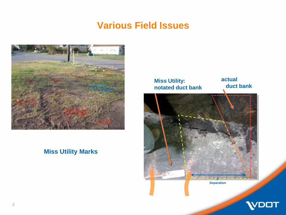
Various Field Issues
Miss Utility Marks
actual
duct bankMiss Utility:
notated duct bank
5’
Separation

3
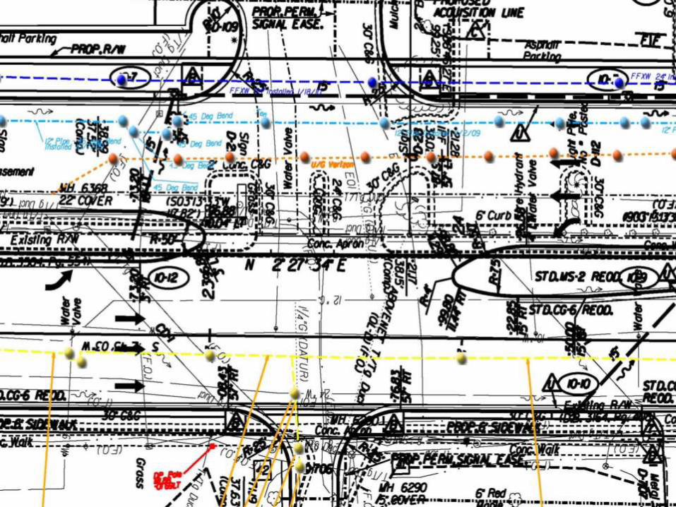
Rte. 29/Gallows Rd.

4

5
X-Section 22+75.00

6
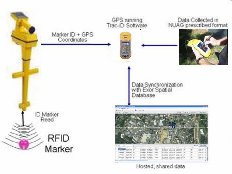
GPS/RFID Pilot Program
• RFID will provide pertinent information to Utility Owners, Locators, Excavators, and Design Engineers.
• Assigns each programmable RFID tag with GPS coordinates for mapping and locating purposes.
• Compiles relocated or newly installed utility information for reference.
• RFID tags have proven to aid in the accuracy of utility locating in both vertical and horizontal aspects.
• Provides pertinent information to the Excavator for test pitting purposes that is normally unknown
Does not supersede any Miss Utility Laws

7
Protocol for RFID Marker Installation
Install RFID tags on relocated facilities:
• Every 25’ for metallic and non-metallic pipes.
• Every horizontal, vertical directional change, critical existing utility crossings, service connections, and abandoned facilities.
Install RFID on existing facilities during test pit operations.
Programmable RFID tags provide vital information about the facility (Owner, Type, Elevation, etc.).
During utility construction, the as-build information is provided to the Utility Owners on a monthly basis for progress reporting.
At the end of relocation efforts, a complete facility as-build can be provided to the Utility Owner in the requested format for record updates.

8
RFID Marker Installation Process
Step 1 Step 2 Step 3
Transfer template
from the PC to the
RFID locator
Program Ball
which transfers
information from the
locator to the RFID
Marker
Install RFID Marker
above utility
9
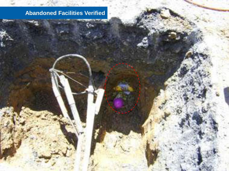
Abandoned Facilities Verified

10
Overview of Benefits
Enhances damage prevention and public safety throughout
the Commonwealth of Virginia.
Conveys the knowledge obtained from the VDOT design and
field operations to the Utility Owners.
Enables utility companies to work together.
RFID tags become the backbone of the GPS system and
provides specific information for future use by the
Contractors, Locators and Designers.
Creates a linear GPS segment that can be used to establish
the zone of protection for the specific utility when
construction equipment is outfitted with GPS enabled
digging trigger mechanisms
11
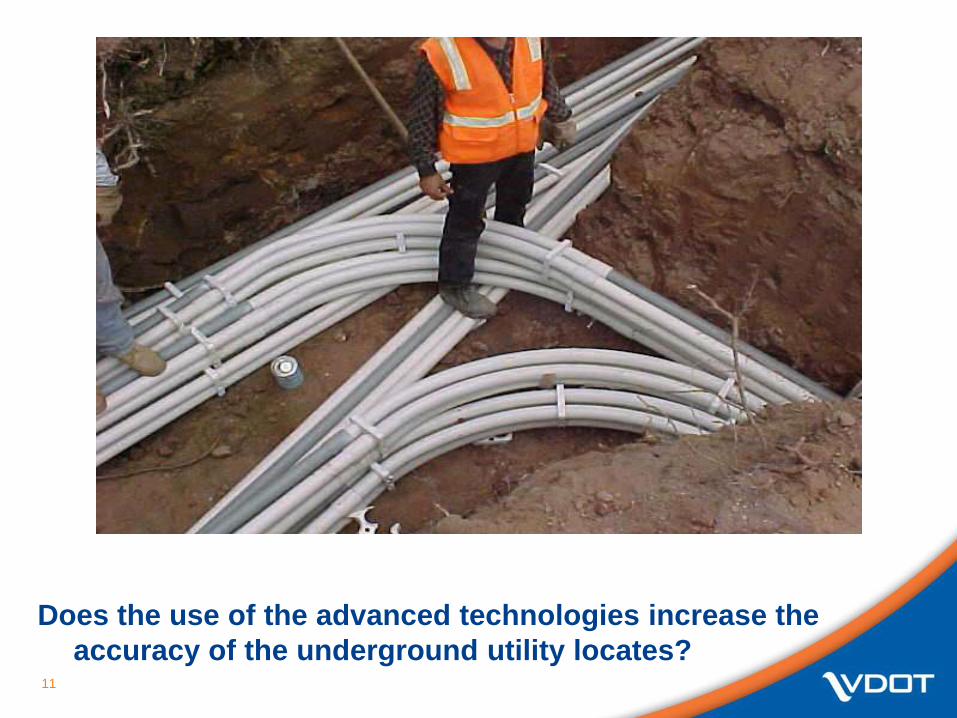
Does the use of the advanced technologies increase the
accuracy of the underground utility locates?

12

13

14

15

16

17
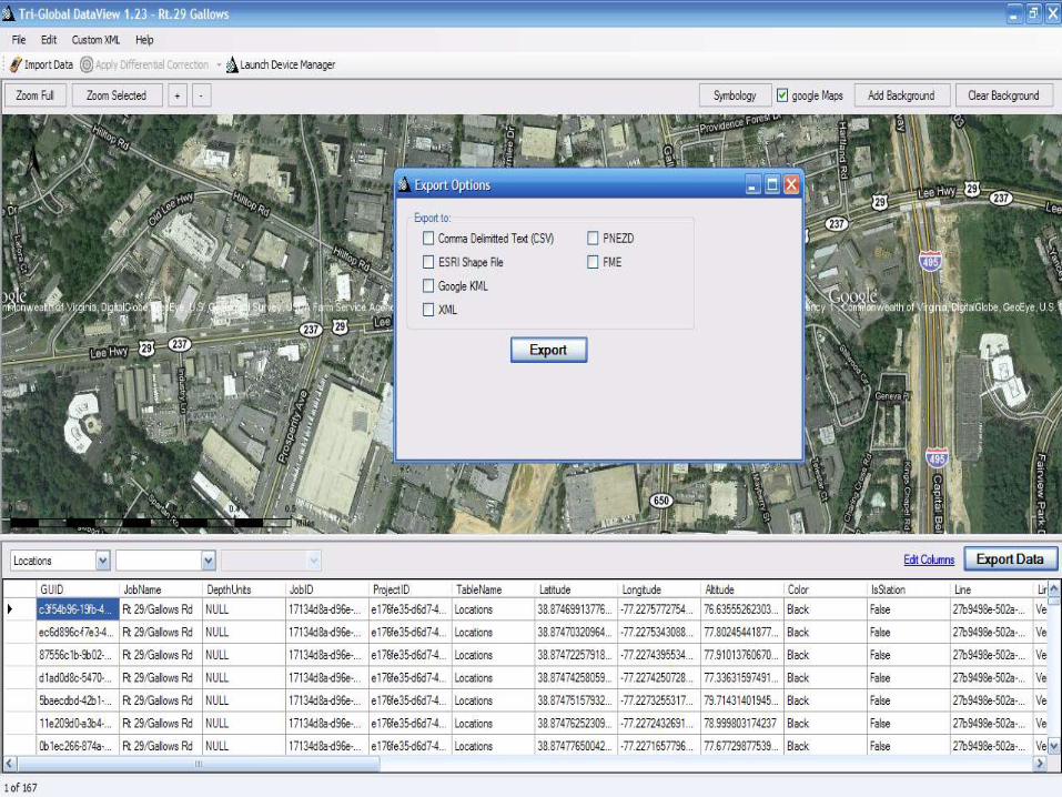
Mapping Solutions utilizing GPS and RFID technologies
Shea Ridings
On-Time Utility Solutions
18
19

20

21

22
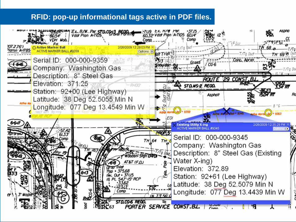
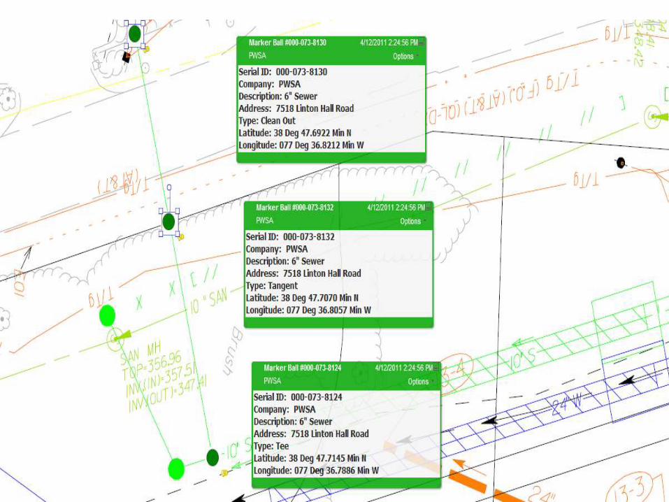
RFID depicted on VDOT Construction Plans
23
24
RFID: pop-up informational tags active in PDF files.
25

26
27
New Initiatives
Install programmable RFID tags during the preliminary
engineering stage of the project when the existing utilities
are designated as part of the beginning phase of the best
value plan concept.
VUPS, GTI, and VDOT are involved in an initiative to provide
the RFID information to the locating community.
Consideration is being made to implement this system into
the Land Use Permit acquisition requirements.
28
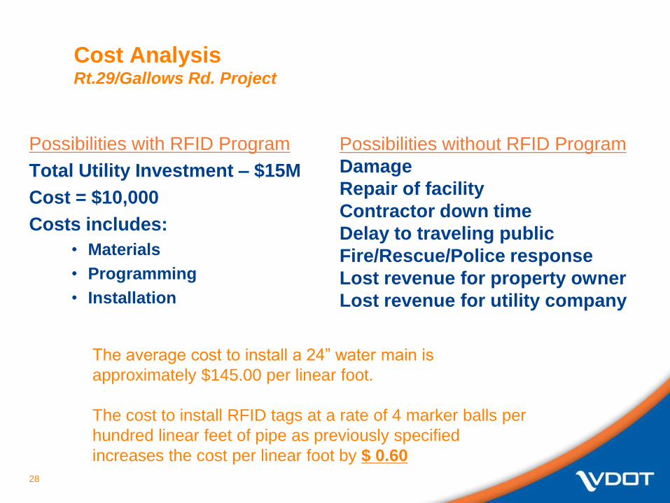
Cost Analysis Rt.29/Gallows Rd. Project
Possibilities with RFID Program
Total Utility Investment – $15M
Cost = $10,000
Costs includes:
• Materials
• Programming
• Installation
Possibilities without RFID Program
Damage
Repair of facility
Contractor down time
Delay to traveling public
Fire/Rescue/Police response
Lost revenue for property owner
Lost revenue for utility company
The average cost to install a 24” water main is
approximately $145.00 per linear foot.
The cost to install RFID tags at a rate of 4 marker balls per
hundred linear feet of pipe as previously specified
increases the cost per linear foot by $ 0.60


Confidentiality – The information contained in this presentation is proprietary and confidential. Use of this information is limited to members of
OTD and their employees, and may only be used for the internal purposes of the members and may not be disclosed to third parties.
Damage Prevention Research at GTI
> Alicia Farag, GTI
> Virginia DPC
> April 26th 2011

OTD & GTI CONFIDENTIAL 3131
Project Overview
>Intelligent Utility System
>GPS Based Excavation Encroachment Notification
>Acoustic Plastic Pipe Locator
>VDOT Marker Ball Program
OTD & GTI CONFIDENTIAL 3232
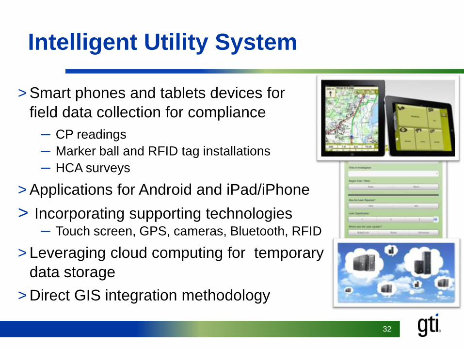
Intelligent Utility System
> Smart phones and tablets devices for
field data collection for compliance
─ CP readings
─ Marker ball and RFID tag installations
─ HCA surveys
> Applications for Android and iPad/iPhone
> Incorporating supporting technologies─ Touch screen, GPS, cameras, Bluetooth, RFID
> Leveraging cloud computing for temporary
data storage
> Direct GIS integration methodology

OTD & GTI CONFIDENTIAL 3333
GPS Based Excavation Encroachment Notification
> Phase 3A – GPS tracks excavation
activity and creates a notification if
digging is occurring outside of a valid
one call ticket
> Phase 3B – GPS tracks bucket
location and creates a notification if
digging is occurring near a utility line
> New pilot project in New York and
maybe Texas

OTD & GTI CONFIDENTIAL 3434
Acoustic Plastic Pipe Locator
> Locates small diameter plastic pipe up to five feet deep
>Tested in various soil conditions
>Commercial agreement with Sensit Technologies
OTD & GTI CONFIDENTIAL 3535
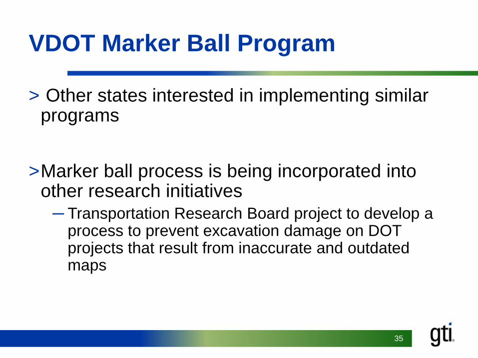
VDOT Marker Ball Program
> Other states interested in implementing similar programs
>Marker ball process is being incorporated into other research initiatives
─ Transportation Research Board project to develop a process to prevent excavation damage on DOT projects that result from inaccurate and outdated maps


