GF
GF
GF
GF
GF
GF
GF
GF
GF
GFGF
GF
GFGF
GFGFGFGF
GF
GF
GF
GF
GF
GFGF
GF
GF
GF
GF
GF
GF
GF
GF
GF
GF
GFGF
GF
GFGF
GFGF
GFGFGF
GFGFGFGF
GFGFGF
GF
GFGFGF
GFGFGF
GF
GF
GF
3°30'0"E
3°30'0"E
3°0'0"E
3°0'0"E
2°30'0"E
2°30'0"E
2°0'0"E
2°0'0"E
1°30'0"E
1°30'0"E
1°0'0"E
1°0'0"E
52°30'0"N
52°30'0"N
52°0'0"N
52°0'0"N
Re f:
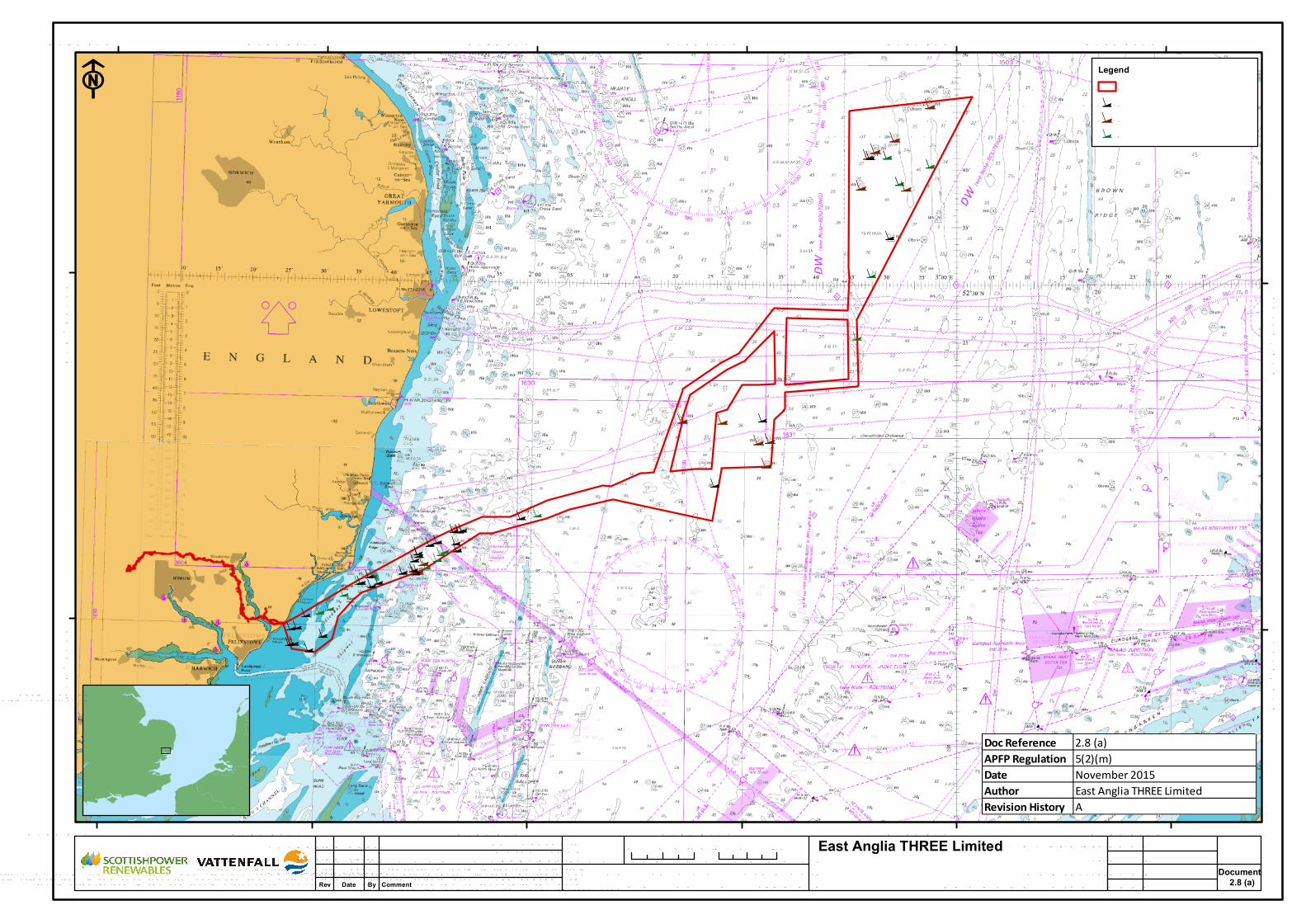
East Anglia THREE LimitedStatutory/Non-Statutory Historic or Sche d ule dM onume nt Site s of the Historic Environme nt - O ffshore(She e t 1 of 1)
W re c k d ata p rovid e d b y W e sse x Archae ology, 2015. De rive d from EM U surve y. © Crown Cop yright 2015.All rights re se rve d . © British Crown and Se aZone Solutions Limite d . All rights re se rve d . Prod ucts Lic e nc e
No. 082010.001. This p rod uct has b e e n d e rive d in p art from mate rial ob taine d from the U K Hyd rograp hic O ffic e with the p e rmission of the Controlle r of He r M aje sty’s Statione ry O ffic e and the U K Hyd rograp hic O ffic e
(www.ukho.gov.uk). NO T TO BE U SED FO R NAV IGATIO NRev Date By Comment20/10/15 JE1 First issue
0 5 10km
03/11/20153
DateRe vDrg No EA3-DCO -2.8.1
APFP Re f: 5(2)(m)
O riginal A3 Plot Scale1:500,000
F
Document2.8 (a)
LegendO rd e r limits
GF W re c k - A1 (Gard line & EM U )GF W re c k - A1 (U KHO )GF Re c ord e d wre c k - A3 (U KHO )
Doc Reference 2.8 (a)APFP Regulation 5(2)(m)Date November 2015Author East Anglia THREE LimitedRevision History A
0 2.5 5nm
Datum: W GS84Proje ction: U TM 31N
29/10/15 JE2 Se c ond issue03/11/15 JE3 Third issue


