Download - Crescent report - North Bay Resources Inc
2013 Assessment Report on the Crescent Project Page 1
ASSESSMENT REPORT
Prospecting Survey
On the
CRESCENT PROJECT
Nelson Mining Division
Latitude: 49° 27’ 35’’ N; Longitude: 117° 35’ 34’’ W
NTS 082F05; BCGS 082F042, 082F043
For
NORTH BAY RESOURCES INC. PO Box 162
Skippack Pennsylvania 19474 USA
By
Dan V. Oancea PGeo
April 19, 2013
2013 Assessment Report on the Crescent Project Page 2
TABLE OF CONTENTS
1. Summary...............................................................................................................Page 3 2. Conclusions...........................................................................................................Page 3 3. Recommendations.................................................................................................Page 4 4. Introduction...........................................................................................................Page 4 4.1 Location, Access and Physiography...................................................................Page 4 4.2 Mineral Claims...................................................................................................Page 4 4.3 Climate, Local Resources, Infrastructure...........................................................Page 5 4.4 History and Development...................................................................................Page 5 5. Geology and Mineralization...................................................................................Page 6 6. Prospecting Survey................................................................................................ Page 6 7. Discussion and Conclusions...................................................................................Page 8 8. Recommended Work.............................................................................................Page 10 9. Cost Statement.......................................................................................................Page 11 10. References.............................................................................................................Page 12 11. Statement of Qualifications...................................................................................Page 13
LIST OF FIGURES Figure 1 – Index Map..........................................................................................After page 3 Figure 2 – Mineral Claims Map..........................................................................After page 5 Figure 3 – Rock Sampling Map..........................................................................After page 7
LIST OF TABLES Table 1 – Mineral Titles...............................................................................................Page 5 Table 2 – Sample Locations & Descriptions...............................................................Page 14
PICTURES
Plate 1 – Samarskite mineralization in potassium feldspar..........................................Page 7 Plate 2 – Mineralized gneiss.........................................................................................Page 8
APPENDICES
Appendix 1 – ALS Chemex Analytical Certificates & Chemical Procedures
2013 Assessment Report on the Crescent Project Page 3
1. Summary
The Crescent mineral project is located near the community of Krestova, 24 km west of Nelson in southeastern British Columbia, Canada. The property is 3 km west of the community of Crescent Valley and is road accessible. The mineral project is 100% owned by North Bay Resources Inc.
The 377.92 hectares (933.86 acres) mineral claims cover niobium-tantalum-rare earth (REE) occurrences in pegmatite syenite rocks of Eocene age that intrude Castelgar gneissic rocks. The niobium-tantalum-REE mineralization is associated with niobian rutile and samarskite minerals.
Historic exploration of the Crescent showing returned assays up to 25.7% niobium and 9.8% tantalum.
A one day prospecting survey was undertaken in April 2013. It resulted in the identification of niobium-tantalum-REE mineralization hosted in pegmatite and syenite rocks at a new location. Limited sampling returned assays up to 64.8 ppm Nb2O5.
2. Conclusions
The 2013 Crescent prospecting survey succeeded in validating the rock types and mineralization described in previous assessment reports.
The reconnaissance and prospecting survey identified new mineralized outcrops therefore expanding the known mineralized area. The area that had been sampled consists of concentrations of quartz pods and large potassium feldspar crystals that host the niobium-tantalum-REE mineralization - the zone is about 30 m wide and open in both directions. The results of the 2013 survey as well as information from older assessment reports showed that the same type of mineralization was identified in gneissic country rocks north of the Crescent showing. This proves that mineralization occurs over a larger area than previously thought.
The type of mineralization occurring at Crescent (i.e. high zirconium, yttrium, niobium and REE but less tantalum) is also characteristic for alkaline to peralkaline granites and syenites. Many of these types of occurrences are flat-lying and some of them don’t even outcrop.
A geomorphologic analysis of the mineral claims area indicate that the hill that hosts the Crescent showing represents a weathering resistant intrusion which is prospective to host more niobium-tantalum-REE mineralization.
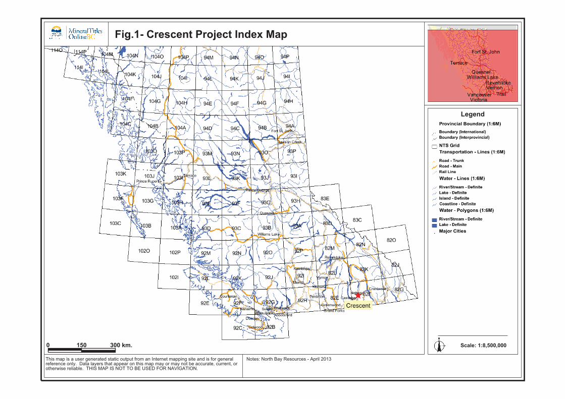
Fig.1- Crescent Project Index Map
0 150 300 km.
Legend
This map is a user generated static output from an Internet mapping site and is for generalreference only. Data layers that appear on this map may or may not be accurate, current, orotherwise reliable. THIS MAP IS NOT TO BE USED FOR NAVIGATION.
Notes: North Bay Resources - April 2013
Scale: 1:8,500,000Map center: 53°35' N, 125°9' W
2013 Assessment Report on the Crescent Project Page 4
3. Recommendations
Prospecting, mapping and a radiometric survey should be employed to identify anomalous zones and further define their extent. Trenching and shallow drilling would be used in anomalous areas to obtain further geological information and grades.
4. Introduction
4.1 Location, Access and Physiography
The Crescent mineral property is located in south eastern British Columbia in the Nelson Mining Division, some 24 km west of Nelson. The property is 3 km west of the small unincorporated community of Crescent Valley, which is located on the provincial Highway 6. A paved road crosses the eastern side of the property.
The project is located west of the Slocan River and south of the Valhalla Provincial Park.
Nelson is the seat of the regional district of Central Kootenay. The city of Castelgar located 24 km south west of Crescent is the West Kootenay’s commercial service center and the closest airport. Both cities are appropriate bases for exploration programmes.
Elevations range from 600 m near the Slocan River to 1,100 m in the western part of the property. Second growth fir and pine trees cover the claims with the exception of the hill (850 masl) that hosts the Crescent prospect which is largely barren.
Abundant water supply exists on the claims including the Langill, Sher and Dermid creeks.
4.2 Mineral Claims
The Crescent mineral project consists of 5 mineral tenures that cover 377.92 ha (933.86 acres). The claims are 100% owned by North Bay Resources Inc. and are centered at 49° 27’ 35 N and 117° 35 34 W. The mineral property is part of the NTS 082F05 and BCGS 082F042, BCGS 082F043 maps.
2013 Assessment Report on the Crescent Project Page 5
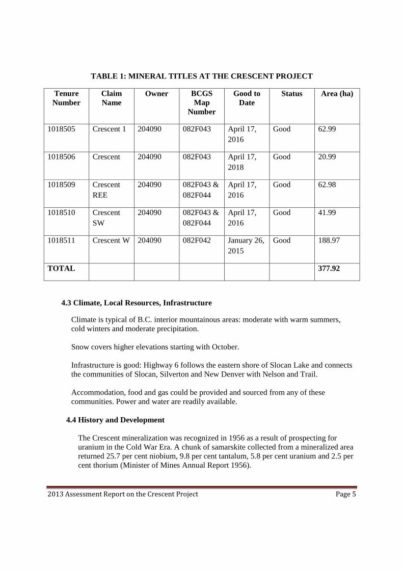
TABLE 1: MINERAL TITLES AT THE CRESCENT PROJECT
Tenure Number
Claim Name
Owner BCGS Map
Number
Good to Date
Status Area (ha)
1018505 Crescent 1 204090 082F043 April 17, 2016
Good 62.99
1018506 Crescent 204090 082F043 April 17, 2018
Good 20.99
1018509 Crescent REE
204090 082F043 & 082F044
April 17, 2016
Good 62.98
1018510 Crescent SW
204090 082F043 & 082F044
April 17, 2016
Good 41.99
1018511 Crescent W 204090 082F042 January 26, 2015
Good 188.97
TOTAL 377.92
4.3 Climate, Local Resources, Infrastructure
Climate is typical of B.C. interior mountainous areas: moderate with warm summers, cold winters and moderate precipitation. Snow covers higher elevations starting with October. Infrastructure is good: Highway 6 follows the eastern shore of Slocan Lake and connects the communities of Slocan, Silverton and New Denver with Nelson and Trail. Accommodation, food and gas could be provided and sourced from any of these communities. Power and water are readily available.
4.4 History and Development The Crescent mineralization was recognized in 1956 as a result of prospecting for uranium in the Cold War Era. A chunk of samarskite collected from a mineralized area returned 25.7 per cent niobium, 9.8 per cent tantalum, 5.8 per cent uranium and 2.5 per cent thorium (Minister of Mines Annual Report 1956).

Fig. 2 - Crescent Project Claims Map
0 450 900 m.
Legend
This map is a user generated static output from an Internet mapping site and is for generalreference only. Data layers that appear on this map may or may not be accurate, current, orotherwise reliable. THIS MAP IS NOT TO BE USED FOR NAVIGATION.
Notes: Contour of claims marked by blue line. North Bay Resources - April 2013
Scale: 1:12,500Map center: 49° 27' 36" N, 117° 36' 8" W

2013 Assessment Report on the Crescent Project Page 6
In 1967, another Crescent sample assayed 2.2 per cent niobium, 0.32 per cent yttrium and 0.14 per cent uranium (Metcalfe, 1967) Active Minerals Exploration Ltd. investigated the Crescent area in 1985. Rock and soil samples were collected and assays returned values up to 1.25 per cent Nb2O5 and 0.14 per cent Ta2O5. (AR14652)
5. Geology and Mineralization Gneiss and augen gneiss of the Castlegar gneiss complex, of unknown age, are intruded by a Middle Eocene Coryell syenite stock. Greisen and pegmatite zones occur in a cupola of the syenite. (Minfile 082FSW272) Two of the larger quartzose pegmatite-greisen zones, 300 metres apart, measure 20 by 30 metres and 8 by 30 metres. They consist predominantly of coarse-grained feldspar with minor quartz and muscovite and contain niobium-tantalum oxide minerals. The black radioactive minerals are likely samarskite and ilmenorutile or niobium rutile. They occur as disseminations in reddish feldspar and patches up to 5 centimetres across. It was proposed that mineralization hosted by pegmatititic/greisens zones is a result of a magmatic differentiation process of the parent syenitic magma. (Minfile 082FSW272) Rocks underlying the northern part of the claims consist of quartz monzonites which contain pegmatites as well as pegmatitic lenses, sills and veins which are generally conformable with foliation. They also carry the same type of niobium-tantalum-REE mineralization. (AR26855)
6. Prospecting Survey A one day reconnaissance survey was undertaken in April 2013 on the Crescent mineral claims held by North Bay Resources Inc. The scope of the survey was limited to validating the rock types and mineralization described in previous assessment reports and to assess the prospectivity of the claims. A quartz monzonite rock grading to gneissic rock consisting of potassium feldspar, biotite, hornblende and quartz was recognized in the northern part of the property. The syenite intrusion that hosts the Crescent mineralization was encountered at 750m in elevation. It represents a distinct topographic feature marked by bluffs that are part of a larger circular knob. The rock is made of coarse grained feldspar with minor quartz. It sometimes contains blocks of country rock gneiss as xenoliths. Pods of quartz are also visible in the syenite rock. The syenite rock is sometimes
2013 Assessment Report on the Crescent Project Page 7
hydrothermally altered and displays a greenish tinge. At times the rock is silicified when in contact with dark grey microcrystalline quartz. Grey nepheline minerals have been tentatively identified in the syenite as well.
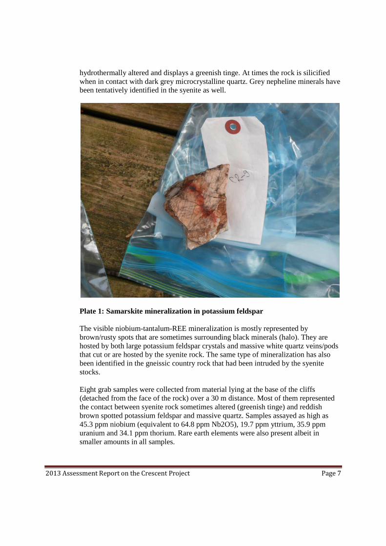
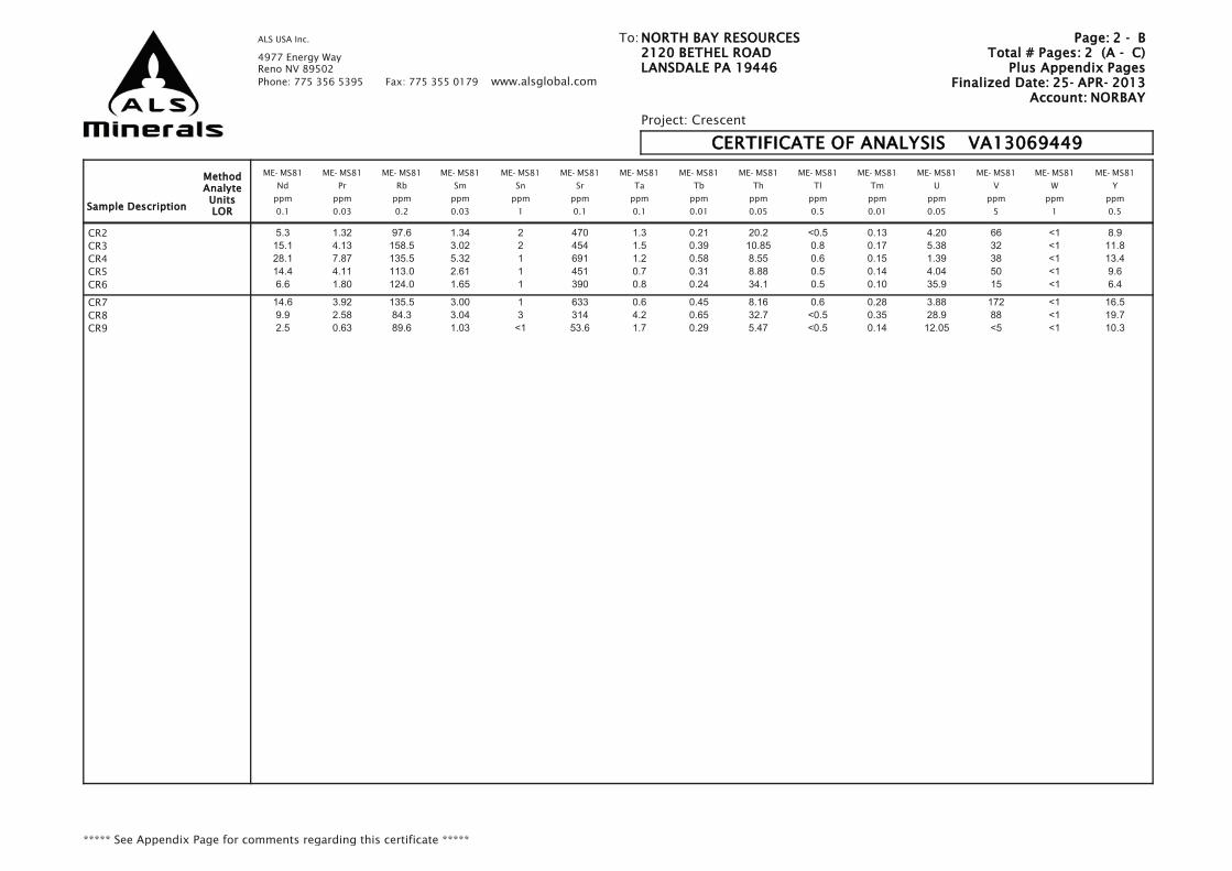
Plate 1: Samarskite mineralization in potassium feldspar The visible niobium-tantalum-REE mineralization is mostly represented by brown/rusty spots that are sometimes surrounding black minerals (halo). They are hosted by both large potassium feldspar crystals and massive white quartz veins/pods that cut or are hosted by the syenite rock. The same type of mineralization has also been identified in the gneissic country rock that had been intruded by the syenite stocks. Eight grab samples were collected from material lying at the base of the cliffs (detached from the face of the rock) over a 30 m distance. Most of them represented the contact between syenite rock sometimes altered (greenish tinge) and reddish brown spotted potassium feldspar and massive quartz. Samples assayed as high as 45.3 ppm niobium (equivalent to 64.8 ppm Nb2O5), 19.7 ppm yttrium, 35.9 ppm uranium and 34.1 ppm thorium. Rare earth elements were also present albeit in smaller amounts in all samples.

Fig. 3 - Crescent Project Sampling Map
0 160 320 m.
Legend
This map is a user generated static output from an Internet mapping site and is for generalreference only. Data layers that appear on this map may or may not be accurate, current, orotherwise reliable. THIS MAP IS NOT TO BE USED FOR NAVIGATION.
Notes: Red asterisk: Sampling location; Blue asterisk: Waypoint. North Bay Resources, April2013
Scale: 1:3,000Map center: 49° 27' 47.8" N, 117° 35' 44.9" W
2013 Assessment Report on the Crescent Project Page 8
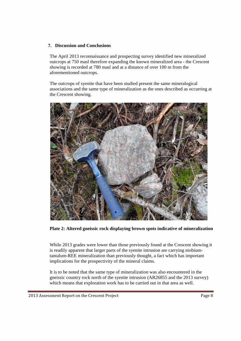
7. Discussion and Conclusions The April 2013 reconnaissance and prospecting survey identified new mineralized outcrops at 750 masl therefore expanding the known mineralized area - the Crescent showing is recorded at 780 masl and at a distance of over 100 m from the aforementioned outcrops. The outcrops of syenite that have been studied present the same mineralogical associations and the same type of mineralization as the ones described as occurring at the Crescent showing.
Plate 2: Altered gneissic rock displaying brown spots indicative of mineralization While 2013 grades were lower than those previously found at the Crescent showing it is readily apparent that larger parts of the syenite intrusion are carrying niobium-tantalum-REE mineralization than previously thought, a fact which has important implications for the prospectivity of the mineral claims. It is to be noted that the same type of mineralization was also encountered in the gneissic country rock north of the syenite intrusion (AR26855 and the 2013 survey) which means that exploration work has to be carried out in that area as well.

2013 Assessment Report on the Crescent Project Page 9
A geomorphologic analysis of the topography of the claims area indicates that the Crescent hill stands out as a circular feature/knob that was not eroded away by the abrasive action of glaciers or by weathering processes. Even though the hill was not mapped in 2013 it can be presumed that it most likely represents the syenite intrusion - the top of which is rich in accumulations of quartz pods (and possible associated mineralization) which makes it weathering resistant. This possible extensive niobium-tantalum-REE-uranium-thorium mineralization of unknown grades, which is presumed existent over large areas in the syenite body, may have contributed to the lack of vegetation on the top of the hill. To be remembered that barren mountain sides usually occur at higher elevations - the Crescent hill is only 849 masl. Vegetation could also lack on rocks that do not permit the formation of proto-soils because of the lack of decomposing minerals, which is not the case at Crescent as feldspars are an abundant rock forming mineral and easy to weather. Therefore the hypothesis that chemical elements from the country rock impede the development of vegetation on the Crescent hill has also to be taken into consideration. An analysis (linears, creeks and vegetation) of Google Earth pictures indicates that the 1018511 mineral tenure could host syenites as well, which means that they might also be considered prospective for hosting niobium-tantalum-REE mineralization. If the pegmatitic classification of the niobium-tantalum-REE mineralization is valid then there is the distinct possibility that some of the mineralized pegmatites occur as flat-lying bodies i.e. they do not outcrop and could be identified only by drilling. Due to the general association of this type of mineralization with radioactive minerals containing uranium and thorium the radiometric method of prospecting is considered to be effective in the identification and delineation of higher grade mineralized zones. A separate note has to be made as to the classification of mineralization. According to the British Geological Survey (BGS) the type of mineralization which contains high zirconium, yttrium, niobium and REE but less tantalum is usually associated with alkaline to peralkaline granites and syenites and not with pegmatites. Niobium mineralization associated with granites and pegmatites of the LCT type (lithium, caesium, tantalum) contains tantalum grades higher than niobium grades. Therefore according to this classification the Crescent mineralization could be associated with alkaline syenites rather than pegmatites which opens the possibility that mineralization is more extensive than previously considered as it is not restricted to the ‘pegmatitic’ zones anymore. An example of an alkaline syenitic complex that hosts a similar type of mineralization could be found in south-west Greenland namely the Illimaussaq and Matzfeldt
2013 Assessment Report on the Crescent Project Page 10
complexes – their richer layers average 0.1 per cent niobium. Hydrothermal veins also occur in both syenites and country rocks and they host niobium-tantalum-REE pyrochlore mineralization and significant uranium-niobium mineralization (BGS).
8. Recommended Work The Crescent mineral claims should be surveyed in detail, prospected, mapped and sampled. A radiometric survey is considered useful, to be employed to help in finding and delineating high mineralized zones. Due to high rock hardness rock saws should be employed in executing channel sampling. As the geological knowledge increases a better understanding of the style of mineralization (pegmatite vs. alkaline syenites) would help in guiding the exploration process. Drilling should be carried to a certain depth that would permit the intersection of other inferred mineralized flat-lying structures.
2013 Assessment Report on the Crescent Project Page 11
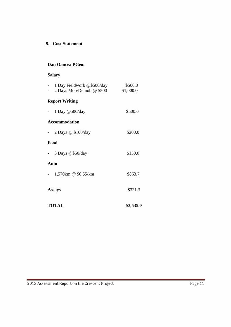
9. Cost Statement
Dan Oancea PGeo: Salary - 1 Day Fieldwork @$500/day $500.0 - 2 Days Mob/Demob @ $500 $1,000.0 Report Writing - 1 Day @500/day $500.0 Accommodation - 2 Days @ $100/day $200.0 Food - 3 Days @$50/day $150.0 Auto - 1,570km @ $0.55/km $863.7 Assays $321.3 TOTAL $3,535.0
2013 Assessment Report on the Crescent Project Page 12
10. References
1. Assessment Reports 14652, 26855
2. British Geological Survey (BGS): Niobium-Tantalum, April 2011
3. B.C. Minister of Mines Annual Report 1956, p.77
4. Metcalfe S. (1967): Assays of the M.C. claims in the Uranium Commodity File
5. Minfile 082FSW272
2013 Assessment Report on the Crescent Project Page 13
11. Statement of Qualifications
I, Dan V. Oancea, of 12-330 Angela Drive, Port Moody, do hereby certify that:
1. I am a registered Professional Geoscientist in the Province of British Columbia, Canada and a Fellow of the Geological Association of Canada.
2. I have a B.Sc. degree in Geological Engineering and Geophysics from Babes-Bolyai University of Cluj-Napoca, Romania, which I graduated in 1987.
3. I have practiced my profession for over 13 years.
4. As a result of my experience and qualification I am a Qualified Person as defined in National Instrument 43-101.
5. I have authored this report which is based upon review and compilation of data relating to Crescent mineral property and upon personal knowledge of the property gained from on-site survey work carried out in April 15, 2013.
6. I do not own interest in the Crescent mineral property.
Vancouver, Respectfully submitted
April 19, 2013 Dan V. Oancea PGeo
2013 Assessment Report on the Crescent Project Page 14
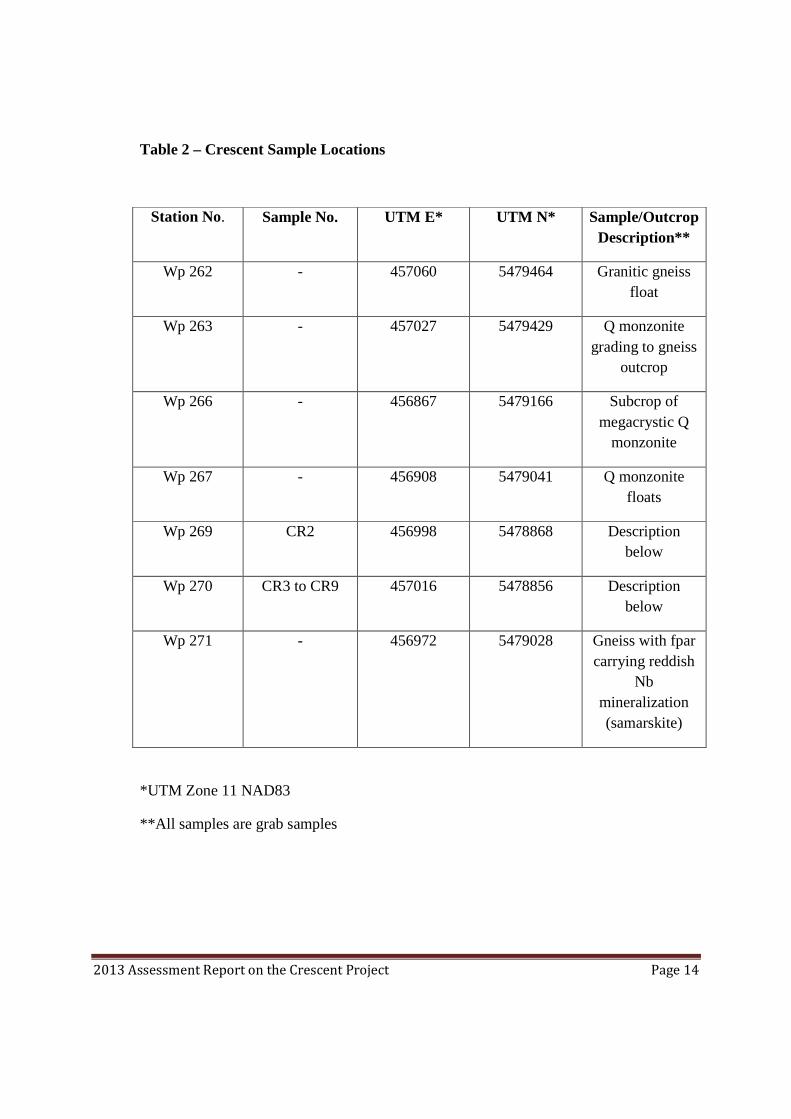
Table 2 – Crescent Sample Locations
Station No. Sample No. UTM E* UTM N* Sample/Outcrop Description**
Wp 262 - 457060 5479464 Granitic gneiss float
Wp 263 - 457027 5479429 Q monzonite grading to gneiss
outcrop
Wp 266 - 456867 5479166 Subcrop of megacrystic Q
monzonite
Wp 267 - 456908 5479041 Q monzonite floats
Wp 269 CR2 456998 5478868 Description below
Wp 270 CR3 to CR9 457016 5478856 Description below
Wp 271 - 456972 5479028 Gneiss with fpar carrying reddish
Nb mineralization (samarskite)
*UTM Zone 11 NAD83
**All samples are grab samples
2013 Assessment Report on the Crescent Project Page 15
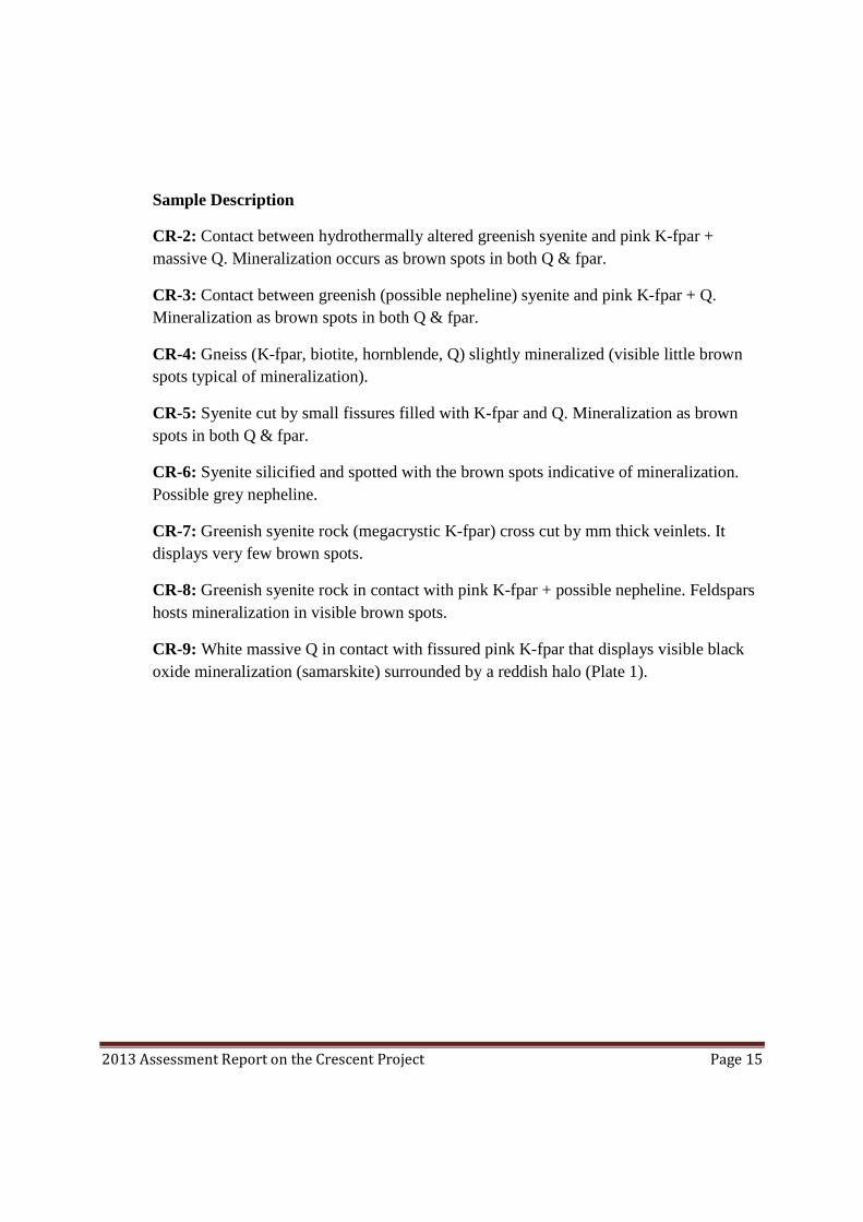
Sample Description
CR-2: Contact between hydrothermally altered greenish syenite and pink K-fpar + massive Q. Mineralization occurs as brown spots in both Q & fpar.
CR-3: Contact between greenish (possible nepheline) syenite and pink K-fpar + Q. Mineralization as brown spots in both Q & fpar.
CR-4: Gneiss (K-fpar, biotite, hornblende, Q) slightly mineralized (visible little brown spots typical of mineralization).
CR-5: Syenite cut by small fissures filled with K-fpar and Q. Mineralization as brown spots in both Q & fpar.
CR-6: Syenite silicified and spotted with the brown spots indicative of mineralization. Possible grey nepheline.
CR-7: Greenish syenite rock (megacrystic K-fpar) cross cut by mm thick veinlets. It displays very few brown spots.
CR-8: Greenish syenite rock in contact with pink K-fpar + possible nepheline. Feldspars hosts mineralization in visible brown spots.
CR-9: White massive Q in contact with fissured pink K-fpar that displays visible black oxide mineralization (samarskite) surrounded by a reddish halo (Plate 1).

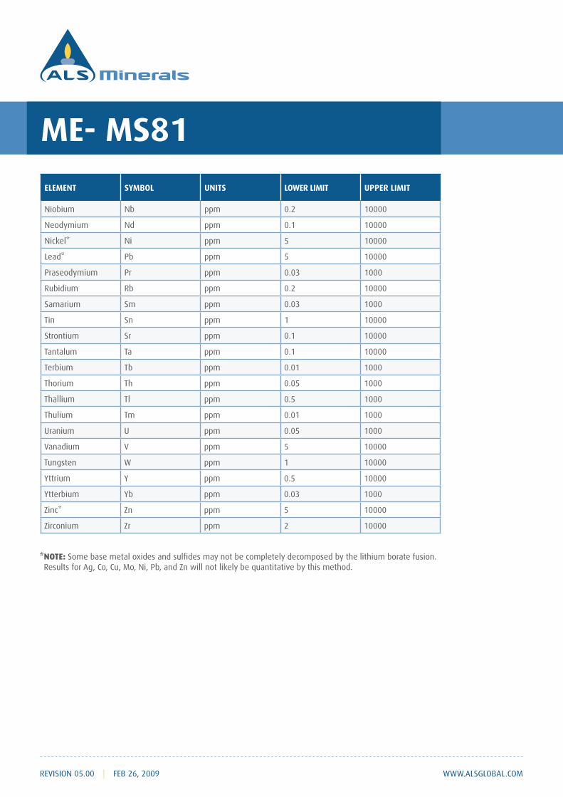
GEOCHEMICAL PROCEDURE
ME- MS81
ULTRA- TRACE LEVEL METHODS
REVISION 05.00 | FEB 26, 2009 WWW.ALSGLOBAL.COM
SAMPLE DECOMPOSITION
Lithium Metaborate Fusion (FUS-LI01)
ANALYTICAL METHOD
Inductively Coupled Plasma - Mass Spectroscopy (ICP - MS)
ELEMENT SYMBOL UNITS LOWER LIMIT UPPER LIMIT
Ag ppm 1 1000
Barium Ba ppm 0.5 10000
Cerium Ce ppm 0.5 10000
Co ppm 0.5 10000
Chromium Cr ppm 10 10000
Cesium Cs ppm 0.01 10000
Cu ppm 5 10000
ppm 0.05 1000
Erbium Er ppm 1000
Europium Eu ppm 1000
Gallium Ga ppm 0.1 1000
Gd ppm 0.05 1000
ppm 0.2 10000
ppm 0.01 1000
La ppm 0.5 10000
Lutetium Lu ppm 0.01 1000
Mo ppm 2 10000
ME- MS81
WWW.ALSGLOBAL.COM
ELEMENT SYMBOL UNITS LOWER LIMIT UPPER LIMIT
Niobium Nb ppm 0.2 10000
Nd ppm 0.1 10000
Ni ppm 5 10000
Pb ppm 5 10000
Pr ppm 1000
Rubidium Rb ppm 0.2 10000
Samarium Sm ppm 1000
ppm 1 10000
Sr ppm 0.1 10000
Ta ppm 0.1 10000
Terbium Tb ppm 0.01 1000
Thorium Th ppm 0.05 1000
Thallium Tl ppm 0.5 1000
Thulium Tm ppm 0.01 1000
U ppm 0.05 1000
V ppm 5 10000
W ppm 1 10000
Yttrium Y ppm 0.5 10000
Ytterbium Yb ppm 1000
ppm 5 10000
Zr ppm 2 10000
* NOTE:
REVISION 05.00 | FEB 26, 2009
ME- MS81
WWW.ALSGLOBAL.COMREVISION 05.00 | FEB 26, 2009
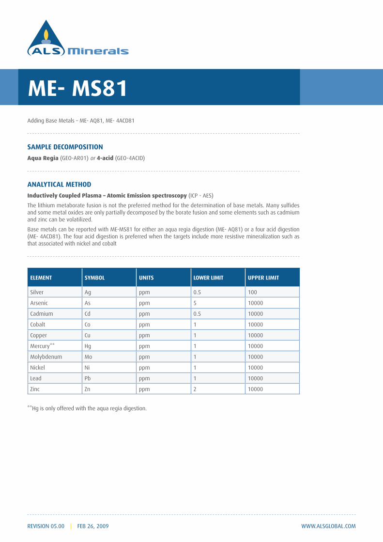
SAMPLE DECOMPOSITION
Aqua Regia (GEO-AR01) or 4-acid
ANALYTICAL METHOD
Inductively Coupled Plasma – Atomic Emission spectroscopy (ICP - AES)
ELEMENT SYMBOL UNITS LOWER LIMIT UPPER LIMIT
Ag ppm 0.5 100
As ppm 5 10000
Cadmium Cd ppm 0.5 10000
Cobalt Co ppm 1 10000
Copper Cu ppm 1 10000
ppm 1 10000
Mo ppm 1 10000
Ni ppm 1 10000
Lead Pb ppm 1 10000
ppm 2 10000
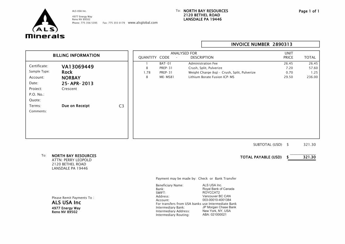
BILLING INFORMATIONTOTAL
UNITPRICE
ANALYSED FORCODE - DESCRIPTIONQUANTITY
INVOICE NUMBER 2890313
ALS USA Inc.
4977 Energy WayReno NV 89502
Phone: 775 356 5395 Fax: 775 355 0179 www.alsglobal.com
NORTH BAY RESOURCES2120 BETHEL ROADLANSDALE PA 19446
To: Page 1 of 1
Comments:
C3
Certificate:
Account:
Date:
Project:
P.O. No.:
Quote:
Due on Receipt
VA13069449
NORBAY
Crescent
25- APR- 2013
Terms:
Sample Type: Rock
NORTH BAY RESOURCESATTN: PERRY LEOPOLD2120 BETHEL ROADLANSDALE PA 19446
To:
Please Remit Payments To :
ALS USA Inc4977 Energy WayReno NV 89502
Payment may be made by: Check or Bank Transfer
Beneficiary Name:Bank:SWIFT:Address:Account:For transfers from USA banks use Intermediate BankIntermediary Bank:Intermediary Address:Intermediary Routing:
ALS USA Inc.Royal Bank of CanadaROYCCAT2Vancouver BC CAN003-00010-4001384
JP Morgan Chase BankNew York, NY, USAABA: 021000021
SUBTOTAL (USD) $
_TOTAL PAYABLE (USD) $
321.30
_____________
321.30
1 BAT- 01 26.45 26.45Administration Fee
8 PREP- 31 7.20 57.60Crush, Split, Pulverize
1.78 PREP- 31 0.70 1.25Weight Charge (kg) - Crush, Split, Pulverize
8 ME- MS81 29.50 236.00Lithium Borate Fusion ICP- MS

ALS CODE DESCRIPTION
SAMPLE PREPARATION
WEI- 21 Received Sample Weight
CRU- QC Crushing QC Test
PUL- QC Pulverizing QC Test
LOG- 22 Sample login - Rcd w/o BarCode
CRU- 31 Fine crushing - 70% < 2mm
SPL- 21 Split sample - riffle splitter
PUL- 31 Pulverize split to 85% < 75 um
ALS CODE DESCRIPTION INSTRUMENT
ANALYTICAL PROCEDURES
ME- MS81 ICP- MSLithium Borate Fusion ICP- MS
CERTIFICATE VA13069449
This report is for 8 Rock samples submitted to our lab in Vancouver, BC, Canada on 17- APR- 2013.
Project: Crescent
P.O. No.:
The following have access to data associated with this certificate:PERRY LEOPOLD DAN OANCEA
NORTH BAY RESOURCESATTN: DAN OANCEA2120 BETHEL ROADLANSDALE PA 19446
To:
Page: 1Finalized Date: 25- APR- 2013
This copy reported on 26- APR- 2013
Account: NORBAY
NORTH BAY RESOURCES2120 BETHEL ROADLANSDALE PA 19446
To:ALS USA Inc.
4977 Energy WayReno NV 89502
Phone: 775 356 5395 Fax: 775 355 0179 www.alsglobal.com
This is the Final Report and supersedes any preliminary report with this certificate number. Results apply to samples as submitted. All pages of this report have been checked and approved for release.
Signature:Colin Ramshaw, Vancouver Laboratory Manager***** See Appendix Page for comments regarding this certificate *****

Page: 2 - ATotal # Pages: 2 (A - C)
Plus Appendix PagesFinalized Date: 25- APR- 2013
Account: NORBAY
ALS USA Inc.
4977 Energy WayReno NV 89502
Phone: 775 356 5395 Fax: 775 355 0179 www.alsglobal.com
NORTH BAY RESOURCES2120 BETHEL ROADLANSDALE PA 19446
To:
Project: Crescent
CERTIFICATE OF ANALYSIS VA13069449
Sample Description
MethodAnalyteUnitsLOR
WEI- 21 ME- MS81 ME- MS81 ME- MS81 ME- MS81 ME- MS81 ME- MS81 ME- MS81 ME- MS81 ME- MS81 ME- MS81 ME- MS81 ME- MS81 ME- MS81 ME- MS81
Recvd Wt. Ba Ce Cr Cs Dy Er Eu Ga Gd Hf Ho La Lu Nb
kg ppm ppm ppm ppm ppm ppm ppm ppm ppm ppm ppm ppm ppm ppm
0.02 0.5 0.5 10 0.01 0.05 0.03 0.03 0.1 0.05 0.2 0.01 0.5 0.01 0.2
CR2 0.48 493 11.3 30 2.02 1.26 0.77 0.33 15.9 1.33 2.6 0.27 5.6 0.15 9.7
CR3 0.56 758 39.0 20 2.55 2.21 1.14 0.74 20.0 2.63 3.3 0.42 19.6 0.15 17.1
CR4 0.28 1665 71.2 10 1.43 2.85 1.18 1.47 23.0 4.36 3.2 0.50 35.7 0.10 18.2
CR5 0.28 904 38.2 20 1.67 1.75 0.92 0.78 20.7 2.22 3.8 0.34 20.7 0.13 6.9
CR6 0.22 387 15.7 30 1.72 1.32 0.67 0.41 22.2 1.57 3.1 0.25 7.4 0.09 9.0
CR7 0.10 675 35.5 20 3.16 2.67 1.77 0.89 27.6 2.94 3.1 0.59 18.1 0.29 8.3
CR8 0.34 176.0 27.7 20 1.46 4.04 2.33 0.44 29.7 3.49 3.1 0.82 9.5 0.34 45.3
CR9 0.40 64.8 5.9 40 1.24 1.79 1.03 0.09 10.9 1.33 1.0 0.38 2.7 0.14 16.7
***** See Appendix Page for comments regarding this certificate *****
Page: 2 - BTotal # Pages: 2 (A - C)
Plus Appendix PagesFinalized Date: 25- APR- 2013
Account: NORBAY
ALS USA Inc.
4977 Energy WayReno NV 89502
Phone: 775 356 5395 Fax: 775 355 0179 www.alsglobal.com
NORTH BAY RESOURCES2120 BETHEL ROADLANSDALE PA 19446
To:
Project: Crescent
CERTIFICATE OF ANALYSIS VA13069449
Sample Description
MethodAnalyteUnitsLOR
ME- MS81 ME- MS81 ME- MS81 ME- MS81 ME- MS81 ME- MS81 ME- MS81 ME- MS81 ME- MS81 ME- MS81 ME- MS81 ME- MS81 ME- MS81 ME- MS81 ME- MS81
Nd Pr Rb Sm Sn Sr Ta Tb Th Tl Tm U V W Y
ppm ppm ppm ppm ppm ppm ppm ppm ppm ppm ppm ppm ppm ppm ppm
0.1 0.03 0.2 0.03 1 0.1 0.1 0.01 0.05 0.5 0.01 0.05 5 1 0.5
CR2 5.3 1.32 97.6 1.34 2 470 1.3 0.21 20.2 <0.5 0.13 4.20 66 <1 8.9
CR3 15.1 4.13 158.5 3.02 2 454 1.5 0.39 10.85 0.8 0.17 5.38 32 <1 11.8
CR4 28.1 7.87 135.5 5.32 1 691 1.2 0.58 8.55 0.6 0.15 1.39 38 <1 13.4
CR5 14.4 4.11 113.0 2.61 1 451 0.7 0.31 8.88 0.5 0.14 4.04 50 <1 9.6
CR6 6.6 1.80 124.0 1.65 1 390 0.8 0.24 34.1 0.5 0.10 35.9 15 <1 6.4
CR7 14.6 3.92 135.5 3.00 1 633 0.6 0.45 8.16 0.6 0.28 3.88 172 <1 16.5
CR8 9.9 2.58 84.3 3.04 3 314 4.2 0.65 32.7 <0.5 0.35 28.9 88 <1 19.7
CR9 2.5 0.63 89.6 1.03 <1 53.6 1.7 0.29 5.47 <0.5 0.14 12.05 <5 <1 10.3
***** See Appendix Page for comments regarding this certificate *****
Page: 2 - CTotal # Pages: 2 (A - C)
Plus Appendix PagesFinalized Date: 25- APR- 2013
Account: NORBAY
ALS USA Inc.
4977 Energy WayReno NV 89502
Phone: 775 356 5395 Fax: 775 355 0179 www.alsglobal.com
NORTH BAY RESOURCES2120 BETHEL ROADLANSDALE PA 19446
To:
Project: Crescent
CERTIFICATE OF ANALYSIS VA13069449
Sample Description
MethodAnalyteUnitsLOR
ME- MS81 ME- MS81
Yb Zr
ppm ppm
0.03 2
CR2 0.95 67
CR3 1.04 122
CR4 0.83 130
CR5 0.93 165
CR6 0.66 80
CR7 1.85 121
CR8 2.33 89
CR9 0.94 21
***** See Appendix Page for comments regarding this certificate *****

Page: Appendix 1Total # Appendix Pages: 1
Finalized Date: 25- APR- 2013Account: NORBAY
ALS USA Inc.
4977 Energy WayReno NV 89502
Phone: 775 356 5395 Fax: 775 355 0179 www.alsglobal.com
NORTH BAY RESOURCES2120 BETHEL ROADLANSDALE PA 19446
To:
Project: Crescent
CERTIFICATE OF ANALYSIS VA13069449
CERTIFICATE COMMENTS
LABORATORY ADDRESSES
Processed at ALS Vancouver located at 2103 Dollarton Hwy, North Vancouver, BC, Canada.
CRU- 31Applies to Method: CRU- QC LOG- 22 ME- MS81
PUL- 31 PUL- QC SPL- 21 WEI- 21


