
CalNex Forecast
Prepared Friday
21 May 2010

Anticipated Platform ActivitiesWP-3DFri: take off at 8:30 pdt, Maersk vessel fuel switch off San Nic Isl, intercept intercontinental transport, MODIS overflight 1055 pdt for cloud retrieval verification; in afternoon, LA Basin constant altitude legs to become familiar with terrain before night flights begin Sat: No Flight (50-hr maintenance)Sun: first planned evening flight late afternoon - evening to start then over course of 10 - 14 days gradually transitioning to later evening to sunrise. Mon: night flight if do not fly on Sunday
NOAA Twin Otter: Possible weekend flight
CIRPAS Twin Otter:
NASA King Air:
R/V Atlantis: LA Bight
Local Features
Friday: P3 ship fuel switch measurements, AM; afternoon activities to become familiar with terrain for night flightssatellite pic showing dry areas offshore and cirrus late in approaching study area, low clouds near coast and inland clearing in PM so conditions good for today's flight objectives900 acre McKinley Fire burning just east of Corona (SE LA Basin); 70% contained
Sunday: P3 night flight?W winds 30-35kts offshore and 10-15kts over basin; gusty winds in mts & desert; T ~20 deg below norm; strong winds & turbulence with frontal passage late in day; good AQ
Monday: P3 night flight?less windy and slightly warmer on Monday with marine layer slow to reform; moderate background O3 production; good AQ though slight deterioration from Sunday

Synoptic Overview for California
NO FORECAST TODAY
Unusual unsettled weather continues for May with another strong Gulf of Alaska low forecast for next week

Thursday 17 PDT Analysis

Friday 05 PDT
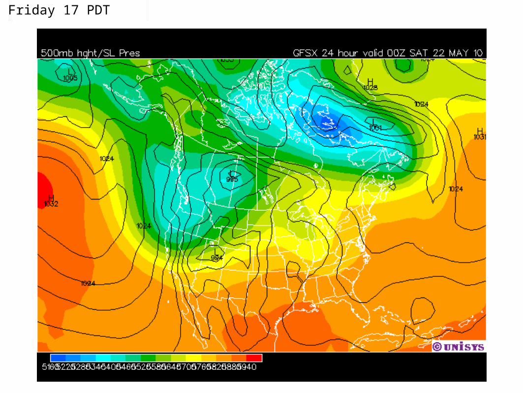
Friday 17 PDT

Saturday 05 PDT

Saturday 17 PDT

Sunday 05 PDT

Sunday 17 PDT

Monday 05 PDT

Monday 17 PDT

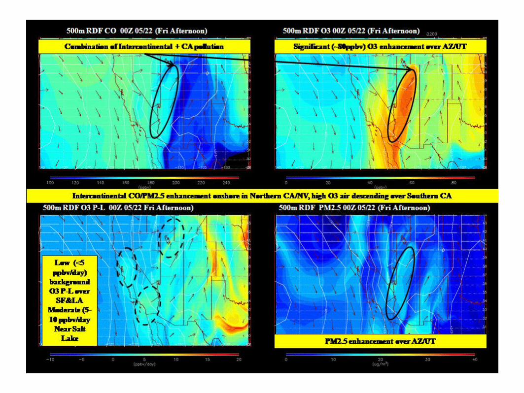
Large Scale Transport
RAQMS FX updated Friday, May 21st.


SF Bay Area
Friday• NW 20kt in early morning, weakens to 5kt in the morning and afternoon, resumes
20 in the evening• MBL mostly 3,000 ft, areas of 8,000ft
Saturday• Mostly NW 20kt all day, except 15kt during mid to late AM• MBL 3,000 to 5,000 ft gradually lowers to 1,500 to 2,000ft
Sunday• NW 25kt all day, lightens briefly in late AM• MBL 1,500 ft to 2,000 ft
Monday• NW 20kt ligtens during late morning hours and stay around 10kt for the rest of the
day
Tuesday & Wednesday• NW wind lightens further, GFS predicts S wind by late morning; W wind for
Wednesday

Sacramento ValleyFriday• WNW 5 to 10 kt, occasionally 15 kt in the afternoon; 5kt at night• Onshore flow through Coastal Range• No AM downslope flow• AM PBL 1,000 to 2,000ft , PM PBL 4,000 to 6,000 ft per GFS, in excess of 8,000 ft
per COAMPS• Max aftn temp: 20C• Cirrostratus moves in and out of area in early morning; altocumulus moves in around
noon and move out in the evening; 20% chance of precipitation• Air Quality: Good; max 8-hr mean O3 in 0.04ppm range
Saturday• CANSAC: due to deflected NW flow, SW 5 kt in early AM shifting to SE in late AM,
back to SW in early PM, surface divergences in mid PM, shifts NE afterward• COAMPS: NW 5kt in throughout the morning; briefly W 10kt for southern SV in the
afternoon• Onshore through Coastal Range• AM PBL 1,000 ft; PM PBL 7,000 ft• Max aftn temp: 18C• Cumulus moves in early afternoon; 0% chance of precipitation• Air Quality: Good; max 8-hr mean O3 in 0.04ppm range

Sacramento Valley (cont'd)
Sunday• NW 5kt wind in the AM; N 10kt late AM and early PM; NW 5kt in the evening; light E downslope flow
at late night (per COAMPS due to weak onshore gradient), or light SW onshore flow for southern SV• AM PBL at 1,500 ft, PM PBL in excess of 8,000ft• Max aftn temp: 21C• Cumulus lingers early AM and moves out by late AM; 0% chance of precipitation• Good air quality: max 8-hr mean O3 in 0.04 ppm range
Monday• Light SE downslope flow early AM for northern SV, S onshore flow for southern SV; SW onshore
flow for the rest of day, stronger in the afternoon• Max aftn temp: 21C• Some cirrostratus moves through in the day, increasing cloudiness in the evening - altostratus
moves in• Good air quality: max 8-hr mean O3 in 0.05 ppm range
Tuesday• S 10kt onshore wind through the delta• Max aftn temp: 20C• Altostratus thickens throughout AM; becomes stratus in the late AM and lingers though the day; 60%
chance of precipitation• Good air quality
Wednesday• SW wind• Cumulus lingers through the day• Good air quality

San Joaquin Valley
NO FORECAST TODAY

Central Coast
Forecast prepared 5/20/2010 - 430 pm PST
Synopsis 5/21 – 5/26: Unsettled weather continues – models indicate persistent trough over west coast US through Wed, 5/26 -Strong NW flow along the coast, NW flow aloft coast, Friday 5/21 through Monday 5/24 afternoons. -Blowing dust in afternoons – Oceano Dunes/Nipomo Mesa Friday through Monday. -NE flow eastern San Luis Obispo County ridgetops/Temblor Range -Sundowner winds possible Gaviota- SBA Fri - Sunday
Friday: Trough deepening over CA, NW flow aloft. Blowing dust in afternoon/Moderate AQ – Oceano Dunes/Nipomo Mesa - NE flow eastern San Luis Obispo County ridgetops/Temblor Range Saturday: Trough deepening over CA, NW flow aloft. Blowing dust in afternoon/Moderate AQ – Oceano Dunes/Nipomo Mesa Sunday: Cutoff low over CA, Slight chance of precipitation. Blowing dust in afternoon/Moderate AQ – Oceano Dunes/Nipomo Mesa Monday: Trough NV, NW flow aloft. Blowing dust in afternoon– Oceano Dunes/Nipomo Mesa Tuesday: Trough CA, NW flow aloft. Wednesday: Trough CA. Air quality: Good air quality with exception - Blowing dust midday/ afternoons-Oceano Dunes/Nipomo Mesa - Moderate AQ – Friday through Monday Significant features for study: Blowing dust Oceano Dunes/Nipomo Mesa peaking midday/afternoons - Friday 5/21 – Monday 5/24, max PM10 Fri-Sat midday/afternoons

Southern Coastal Waters

COAMPS Wind Plots(and interpolated observed winds
comparison)
Retrieved Fri May 20Base = 12Z Thu May 20
http://www.sccoos.org/data/coamps/coamps.html for high (6 km) resolution products scroll down to grid 3 loop buttons are at far right


0500 PDT Friday 12z

1100 PDT - Friday 18z

1700 PDT - Friday

2300 PDT - Friday

0500 PDT - Saturday

1100 PDT - Saturday

1700 PDT - Saturday

2300 PDT - Saturday

0500 PDT - Sunday

1100 PDT - Sunday

1700 PDT - Sunday
COAMPS 850 mb cloud plots
Retrieved Fri May 21Base = 12Z Thu May 20
http://www.sccoos.org/data/coamps/coamps.html for high (6 km) resolution products scroll down to grid 3 loop buttons are at far right

Friday 0700 PDT Visible

Friday 0700 PDT Visible

Fri 05PDT

Fri 11PDT

Fri 17PDT

Fri 23PDT

Sat 05PDT

Sat 11PDT

Sat 17PDT

Sat 23PDT

Sun 05PDT

Sun 11PDT

Sun 17PDT

South Coast• Friday: Upper low in Pacific Northwest; inversion base & marine
layer deepening (~2000 ft) in response to the the trough moving over CA;AM Satellite image shows low clouds/fog across coastal plain to San Bernardino & Riverside Co. valleys, eddy offshore centered near Catalina with a large dry area offshore in the northern bight and further offshore; previous COAMPS runs predicted this fairly well;cooler temps Friday compared to Thursday (to upper 70s inland Basin); stronger onshore flow in afternoon; winds increase Friday afternoon, gusty W to NW in the mountains and deserts; windy & dry in southern deserts for NWS fire weather watch;
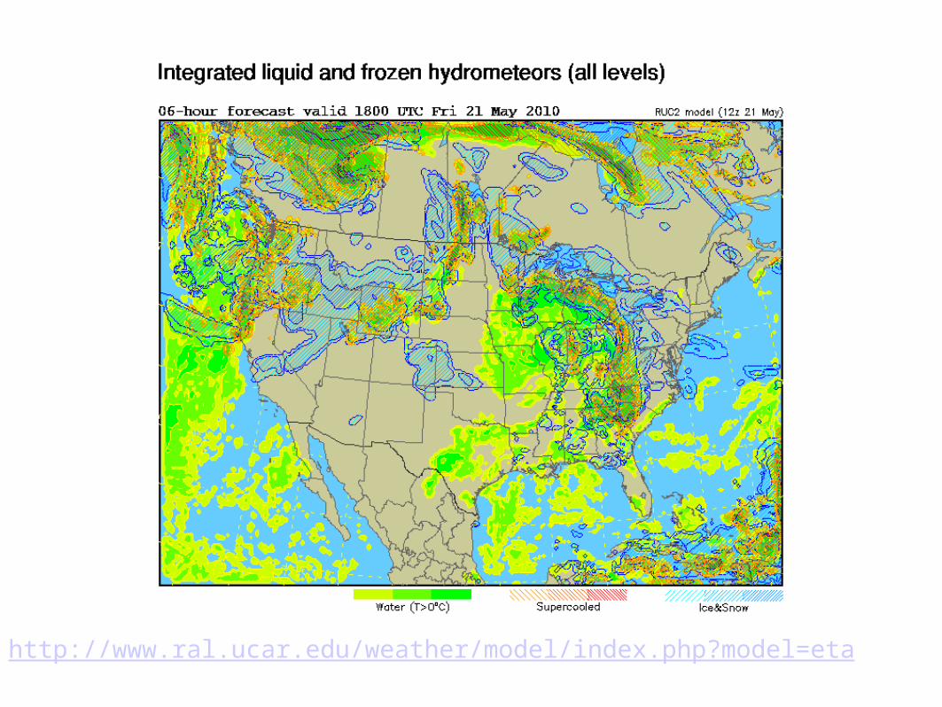
WRF/NAM 18Z Friday cloud model shows AM stratus band near the coast S of Palos Verdes and the narrow band of cirrus is well to the N near the Bay Area. See: http://www.ral.ucar.edu/weather/model/index.php?model=eta choosing "Clouds: all levels" option
McKinley Fire (just east of Corona):5/21 UPDATE 0730 AM: 900 ACRES, 70 percent contained, full containment expected tonight at 7:00 PM.
http://cdfdata.fire.ca.gov/incidents/incidents_details_info?incident_id=411

http://profilerops.sonomatechdata.com/scaqmd/map.jsp?site=IRV

http://www.ral.ucar.edu/weather/model/index.php?model=eta
http://www.ral.ucar.edu/weather/model/index.php?model=eta

South Coast (cont'd)
• Saturday: inversion lifts & weakens with trough, but AM clouds may be minimal & confined to near the coast with dry NW gradient (?); COAMPS keeps coastal eddy - similar to Friday; cooler several degrees; strong onshore gradients for gusty W & NW winds, esp. mountains & deserts (WADs through early Sunday) - peaking in evening; mostly Moderate ozone for the next few days, but some USG possible with sun inland - mainly Central San Bernardino Mountains & into deserts
• Sunday: deeper marine layer - coastal eddy could deepen marine layer to 5000 ft; persistent low clouds; AM gusty winds mountains & deserts;possible AM drizzle & slight chance of light showers on northern slopes of LA/San Bernardino Mtns; temps cool considerably (~20 degrees below normal in many areas); front passage late Sunday with strong W winds could destroy inversion; tough conditions for Sunday's flight; good to moderate ozone through the week
• Monday: trough weakens for a little warming; inversion may be slow to reform• Tuesday: little change from Monday• Wednesday-Saturday: another upper trough approaching west coast; deeper
marine layer; onshore push with gusty winds, especially mtns & dsrts

Northern California
Observed, Model-Interpolated Winds for SF Bay http://sfports.wr.usgs.gov/cgi-bin/wind/windbin.cgi
and COAMPS Wind Plots
http://www.sccoos.org/data/coamps/coamps.html

![[PPT]Slide 1 · Web viewMaersk Rhine. Handytankers Ks. Maersk Rhone. Maersk Rapier. Ocean Quest. Maersk Rouen. Maersk Rugen. Asashio Maru. Bow Fortune. Bow Century. Dl](https://cdn.vdocuments.us/doc/165x107/5aa343597f8b9ada698e029f/pptslide-1-viewmaersk-rhine-handytankers-ks-maersk-rhone-maersk-rapier-ocean.jpg)


