Access to Cloud Raster Data Using GDAL, MRF and LERC
Peng Gao, Peter Becker, Thomas Maurer, Abhijit Doshi, Lucian Plesea Esri, 380 New York Street, Redlands, CA 92373
IN52A-04, 2015 AGU Fall Meeting

Team Credentials
• Peng Gao - Esri, Development Lead, Imagery
• Peter Becker - Esri , Product Manger - Imagery
• Thomas Maurer - Esri Computer Scientist, image processing
• Abhijit Doshi - Esri, Product Engineer
• Lucian Plesea - Esri Computer Scientist, geospatial data services
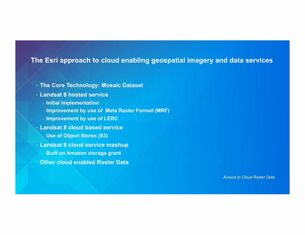
The Esri approach to cloud enabling geospatial imagery and data services
Access to Cloud Raster Data
• The Core Technology: Mosaic Dataset • Landsat 8 hosted service
- Initial implementation - Improvement by use of Meta Raster Format (MRF) - Improvement by use of LERC
• Landsat 8 cloud based service - Use of Object Stores (S3)
• Landsat 8 cloud service mashup - Built on Amazon storage grant
• Other cloud enabled Raster Data

High Level GIS Service: Mosaic Dataset and Image Services
Access to Cloud Raster Data
• A mosaic dataset is a data model for management of large collections of imagery /rasters • A mosaic dataset stores in a database:
- References to image/rasters - Metadata about rasters - Processing to be applied
• Data selection, fusion of input rasters and any other processing is done on demand • An image services is a dynamic web service which exposes the capabilities and content of a
mosaic dataset • Scalable to extremely large dataset collections • Performance is dependent on the source data features and access
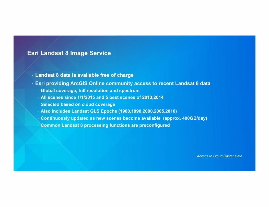
Esri Landsat 8 Image Service
Access to Cloud Raster Data
• Landsat 8 data is available free of charge • Esri providing ArcGIS Online community access to recent Landsat 8 data
- Global coverage, full resolution and spectrum - All scenes since 1/1/2015 and 5 best scenes of 2013,2014 - Selected based on cloud coverage - Also includes Landsat GLS Epochs (1980,1990,2000,2005,2010) - Continuously updated as new scenes become available (approx. 400GB/day) - Common Landsat 8 processing functions are preconfigured
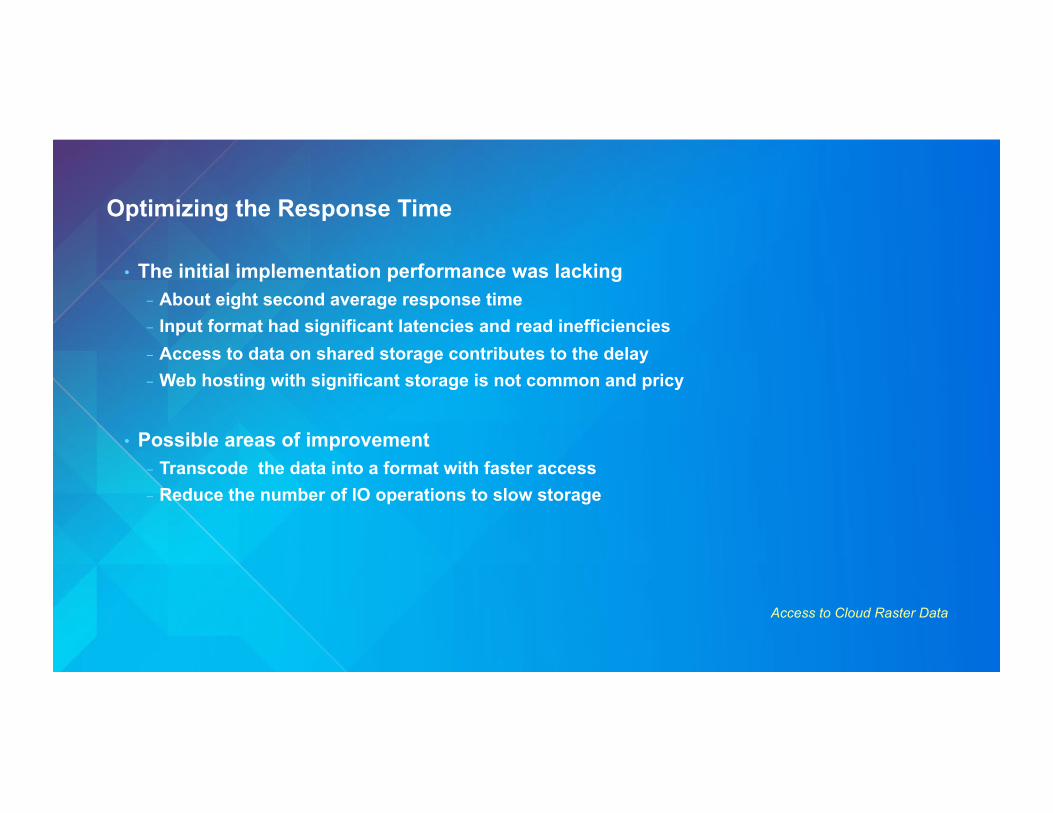
Optimizing the Response Time
Access to Cloud Raster Data
• The initial implementation performance was lacking - About eight second average response time - Input format had significant latencies and read inefficiencies - Access to data on shared storage contributes to the delay - Web hosting with significant storage is not common and pricy
• Possible areas of improvement - Transcode the data into a format with faster access - Reduce the number of IO operations to slow storage
Limited Error Raster Compression (LERC)
Access to Cloud Raster Data
• Esri algorithm for data compression • Years of use in ArcGIS Server as a web transmission format • Does not rely on sequence matching (like LZW, DEFLATE) nor on a space transform
(Wavelet, DCT) • Very fast decode and encode, about one order of magnitude faster than PNG • Loss-less or lossy, based on user provided maximum error
- Uses quantization internally
• Explicit data mask, making it efficient for sparse and projected swath raster data • Patented but being released for geospatial application

Meta Raster Format (MRF)
Access to Cloud Raster Data
•! Raster format originated at JPL, for large raster datasets and web server tile -!Open source GDAL driver -!Abstracts tiling and pyramid organization -!Various tile (subraster) compression formats -!Separate and simple metadata, index and raster data
components (files)
•! The ability to located the different components on different classes of storage makes it a valuable technology for cloud GIS
Index Metadata
Pyramid
Datafile

Amazon Storage Options
Ephemeral (80GB)
$0 (inc. with EC2)
NFS
EBS (Elastic Block Storage) 1TB/Disk ($100/TB/Month)
S3
Object Store $30/TB/Month
99.999999999% Durability 99.99% Reliability/year
≈10-50MB/s
HTTP
Landsat 8 Service, Second Hosted Implementation
Access to Cloud Raster Data
• Customized ArcGIS Server that includes MRF+LERC • Splitting MRF between ephemeral and EBS doubles the access speed vs. TIFF • Using LERC compression doubles the access speed again vs. DEFLATE • Average request latency reduced from eight to two seconds
- Performance is very close to directly connected storage - Acceptable for interactive applications
• Added pre-processing - Trans-coding of data from downloaded TIF to MRF - Had to be implemented on SSD to achieve reasonable performance
• This implementation became public

Landsat on AWS
Access to Cloud Raster Data
• Landsat 8 data is available for anyone via Amazon S3 - http://aws.amazon.com/public-data-sets/landsat/ - All 2015 scenes, selections of cloud free 2013-2014 - Stored as geoTIF with Deflate compression and 3X pyramids
• Esri Cloud based Landsat 8 server - Based on the Amazon Landsat collection - S3 latency is large, comparable with a slow shared network file system - Data is converted to local MRF on demand, then cached locally and reused

Esri Landsat 8 Service: Mash-up
Access to Cloud Raster Data
• http://www.esri.com/landsatonaws • Fully cloud based, on AWS and S3 • Enabling technology is MRF with LERC
compression, from S3 object store • Response times are in the 3-4 seconds
initially, dropping to 1-2 seconds for repeated access
• Easy to scale out since no local data is required initially

Other Esri cloud raster services: NAIP
Access to Cloud Raster Data
• USDA National Agriculture Imagery Program - A primary goal of the NAIP program is to make digital ortho-photography available to
governmental agencies and the public within a year of acquisition - Each state mosaic is redone every three years
• Esri is collaborating with USDA to help achieve the timely release goal - Service available on ArcGIS OnLine - Updated at the same time as new NAIP data is released - DOQs are converted to MRF and LERC - A Mosaic Dataset allows access to the whole NAIP collection
• http://blogs.esri.com/esri/arcgis/2014/07/02/naip-imagery-now-available-as-arcgis-online-image-layers/
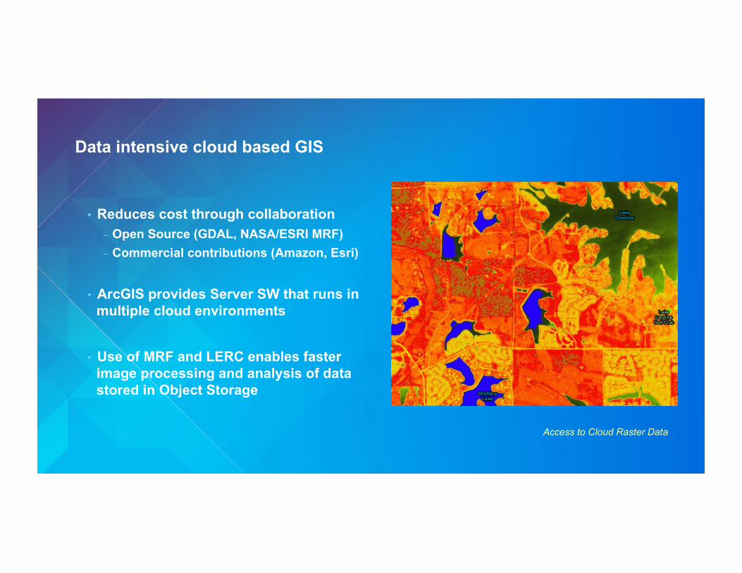
Data intensive cloud based GIS
Access to Cloud Raster Data
• Reduces cost through collaboration - Open Source (GDAL, NASA/ESRI MRF) - Commercial contributions (Amazon, Esri)
• ArcGIS provides Server SW that runs in multiple cloud environments
• Use of MRF and LERC enables faster image processing and analysis of data stored in Object Storage