does the data resolution/origin matter? satellite ... · does the data resolution/origin matter?...
TRANSCRIPT
DOES THE DATA RESOLUTION/ORIGIN MATTER? SATELLITE, AIRBORNE AND
UAV IMAGERY TO TACKLE PLANT INVASIONS
Jana Müllerováa, *, Josef Brůnaa,b, Petr Dvořákc, Tomáš Bartalošd, Michaela Vítkováa
a Institute of Botany, The Czech Academy of Sciences, Průhonice, Czech Republic – (jana.mullerova, michaela.vitkova)@ibot.cas.cz
b Faculty of Science, Charles University in Prague, Czech Republic – [email protected] c Brno University of Technology, Institute of Aerospace Engineering, Brno, Czech Republic - [email protected]
d GISAT Ltd., Prague, Czech Republic - [email protected]
* Corresponding author
ThS15
KEY WORDS: Detection; Invasive species; Mapping; MSS imagery; Object- and pixel-based classification; Spectral, spatial and
temporal resolution
ABSTRACT:
Invasive plant species represent a serious threat to biodiversity and landscape as well as human health and socio-economy. To
successfully fight plant invasions, new methods enabling fast and efficient monitoring, such as remote sensing, are needed. In an
ongoing project, optical remote sensing (RS) data of different origin (satellite, aerial and UAV), spectral (panchromatic,
multispectral and color), spatial (very high to medium) and temporal resolution, and various technical approaches (object-, pixel-
based and combined) are tested to choose the best strategies for monitoring of four invasive plant species (giant hogweed, black
locust, tree of heaven and exotic knotweeds). In our study, we address trade-offs between spectral, spatial and temporal resolutions
required for balance between the precision of detection and economic feasibility. For the best results, it is necessary to choose best
combination of spatial and spectral resolution and phenological stage of the plant in focus. For species forming distinct
inflorescences such as giant hogweed iterative semi-automated object-oriented approach was successfully applied even for low
spectral resolution data (if pixel size was sufficient) whereas for lower spatial resolution satellite imagery or less distinct species with
complicated architecture such as knotweed, combination of pixel and object based approaches was used. High accuracies achieved
for very high resolution data indicate the possible application of described methodology for monitoring invasions and their long-term
dynamics elsewhere, making management measures comparably precise, fast and efficient. This knowledge serves as a basis for
prediction, monitoring and prioritization of management targets.
1. INTRODUCTION
Invasive species have large effect on landscape, nature and
human society (both economy and human health; Ehrenfeld,
2010), and despite the worldwide efforts, their menace grows
(Hulme et al., 2009). Invasions represent fast and dynamic
processes and their eradication and control is difficult. Early
and regular detection of the invading species and rapid
management response on both local and landscape level is
therefore crucial (Vilà and Ibáñez, 2011). There is an urgent
need for new techniques enabling timely, fast and precise
monitoring (European Commission, 2008). Remote sensing
(RS) can potentially provide detailed vegetation mapping over
large areas, reducing costs of extensive field campaigns.
Multispectral optical data have been successfully used to study
invasive plant species (for review see Huang and Asner, 2009),
however, mostly for shrubs and trees (but see e.g. Müllerová et
al., 2013; Jones et al., 2011). Detection of herb species is only
possible if the data provide enough spectral and/or spatial
details, the species are distinct from their neighborhood, form
dense and uniform stands, and/or are large enough to be
detected (Maheu-Giroux and de Blois, 2004; Müllerová et al.,
2005). The potential for invasive species monitoring using RS
is still not fully exploited and for the majority of invasive
species there are no detection algorithms described.
In an on-going project, we aim to meet the need for cost-
effective techniques for timely, fast and precise management
including prevention and monitoring measures of alien plant
species. We are searching for the solution that would be
operational and applicable for landscape managers regarding
both costs and labor. Testing various RS data gives us
opportunity to evaluate potential of data differing in spectral,
spatial and temporal resolution, and to choose best mapping
strategies for species of interest. Using UAV provides flexibility
necessary for assessment of role of phenology crucial for
detection of species distinct only in certain phenological stages,
e.g. during flowering. Such evaluation could not be done using
any other source of RS data. To make the use of UAV for
invasion detection as operational as possible, we seek for low-
cost solution, developing purposely designed UAV for the data
acquisition. Methodology developed for automatic/semi-
automatic detection of four selected invasive species will help
to minimize the negative impact of invasions and save
management costs by providing means for fast and timely
monitoring of plant invasions.
2. METHODS
2.1 Study species
Species of interest are: giant hogweed (Heracleum
mantegazzianum), black locust (Robinia pseudoaccacia), tree
of heaven (Ailanthus altissima), and exotic knotweeds (Fallopia
japonica, F. sachalinensis and F. × bohemica). All mentioned
species are considered invasive in a number of European
The International Archives of the Photogrammetry, Remote Sensing and Spatial Information Sciences, Volume XLI-B7, 2016 XXIII ISPRS Congress, 12–19 July 2016, Prague, Czech Republic
This contribution has been peer-reviewed. doi:10.5194/isprsarchives-XLI-B7-903-2016
903
countries and North America (except for the American native
black locust), and are listed among the hundred most aggressive
invaders in Europe (DAISIE database, http://www.europe-
aliens.org/).
Tree of heaven is a fast growing deciduous tree 20 m tall, native
to East Asia and introduced worldwide. It is a species of warmer
regions with potential to spread due to global warming. It can
be found in urban environments, industrial zones, along
railways, but also in termophilous shrub and grassland
vegetation. It causes loss of biodiversity, its root system
damages pavements, walls and buildings and it poses danger for
humans, because its sap is causing contact dermatitis.
Exotic knotweeds are herbaceous perennials with robust erect
stems up to 4 m tall, native to East Asia, and their hybrid
F. × bohemica. They form dense monospecific stands on
nutrient rich mesic to wet sites in settlements, abandoned
gardens and floodplains. They cause a loss of biodiversity,
alteration of hydrological regime, damage of roads and flood-
prevention structures and increase erosion potential of rivers.
Giant hogweed is a herbaceous perennial plant up to 4 m tall
with large round inflorescences up to 2 m in diameter, native to
the Western Greater Caucasus. It often forms large
monospecific stands in semi-natural grasslands, forest edges and
anthropogenic habitats along roads. As a mountain plant, it
rarely occurs in dry and warm lowlands. It causes a loss of
biodiversity and is dangerous to humans, because its sap is
causing dermatitis.
Black locust is a deciduous tree up to 30 m tall native to south-
east of the USA. It was planted for timber, erosion control, soil
eutrophication and honey making. As nitrogen fixing tree it
changes availability of soil nutrients and causes vegetation
changes towards ruderal and nitrophilous species resulting in
loss of biodiversity. It is toxic to cattle and horses.
Whereas the RS detection of the tree of heaven was not
previously investigated, for other three species the timing of the
data acquisition showed to be important (exotic knotweeds:
Dorigo et al., 2012; Jones et al., 2011; g. hogweed: Müllerová
et al., 2005, 2013; b. locust: Somodi et al., 2012).
2.2 Remote sensing data
Optical RS data of different origin (satellite, aerial and UAV),
spectral (panchromatic, multispectral and color), spatial (very
high to medium) and temporal resolution were tested in our
project.
2.2.1 Satellite and aerial data
Optical RS data of different resolution were chosen to assess the
importance of spectral/spatial resolution for the species
recognition. Following data were used in the study (Figure 1):
panchromatic historical aerial photography (0.5 m)
color aerial orthophotos (0.5 m)
World View-2 (0.5/1.84 m PAN/MSS)
World View-3 (0.3/1.24 m PAN/MSS)
Pleiades (0.5/2.8 m PAN/MSS resolution)
RapidEye (6.5 m)
Sentinel-2 (10 m)
2.2.2 Unmanned aircraft
Acquisition of UAV data has been performed by several aerial
platforms (Table 1). Development of dedicated unmanned
platform optimized for invasive species monitoring is an
ongoing task of the project (Dvořák et al., 2015).
Table 1. Small VUT unmanned platforms for invasive species
monitoring used in the project
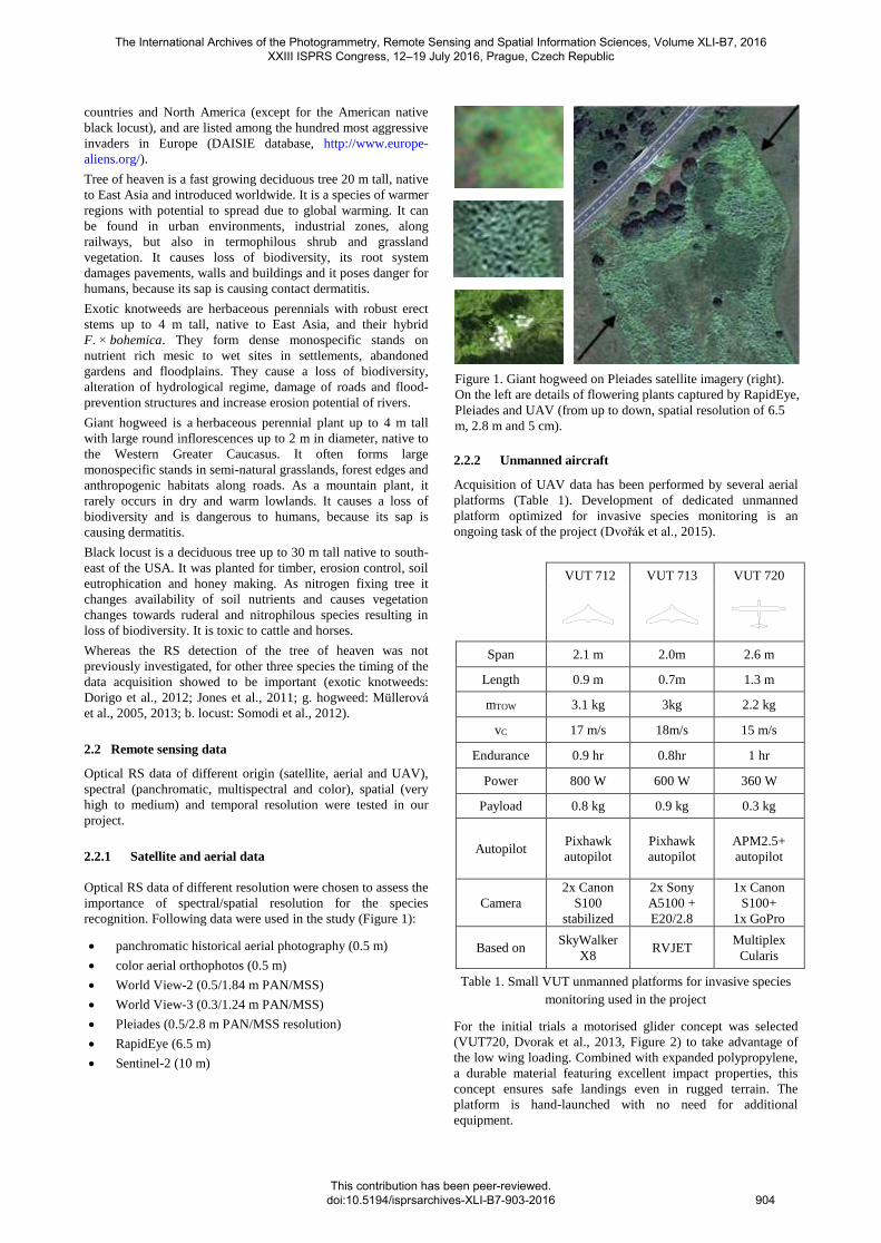
For the initial trials a motorised glider concept was selected
(VUT720, Dvorak et al., 2013, Figure 2) to take advantage of
the low wing loading. Combined with expanded polypropylene,
a durable material featuring excellent impact properties, this
concept ensures safe landings even in rugged terrain. The
platform is hand-launched with no need for additional
equipment.
VUT 712 VUT 713 VUT 720
Span 2.1 m 2.0m 2.6 m
Length 0.9 m 0.7m 1.3 m
mTOW 3.1 kg 3kg 2.2 kg
vC 17 m/s 18m/s 15 m/s
Endurance 0.9 hr 0.8hr 1 hr
Power 800 W 600 W 360 W
Payload 0.8 kg 0.9 kg 0.3 kg
Autopilot Pixhawk
autopilot
Pixhawk
autopilot
APM2.5+
autopilot
Camera
2x Canon
S100
stabilized
2x Sony
A5100 +
E20/2.8
1x Canon
S100+
1x GoPro
Based on SkyWalker
X8 RVJET
Multiplex
Cularis
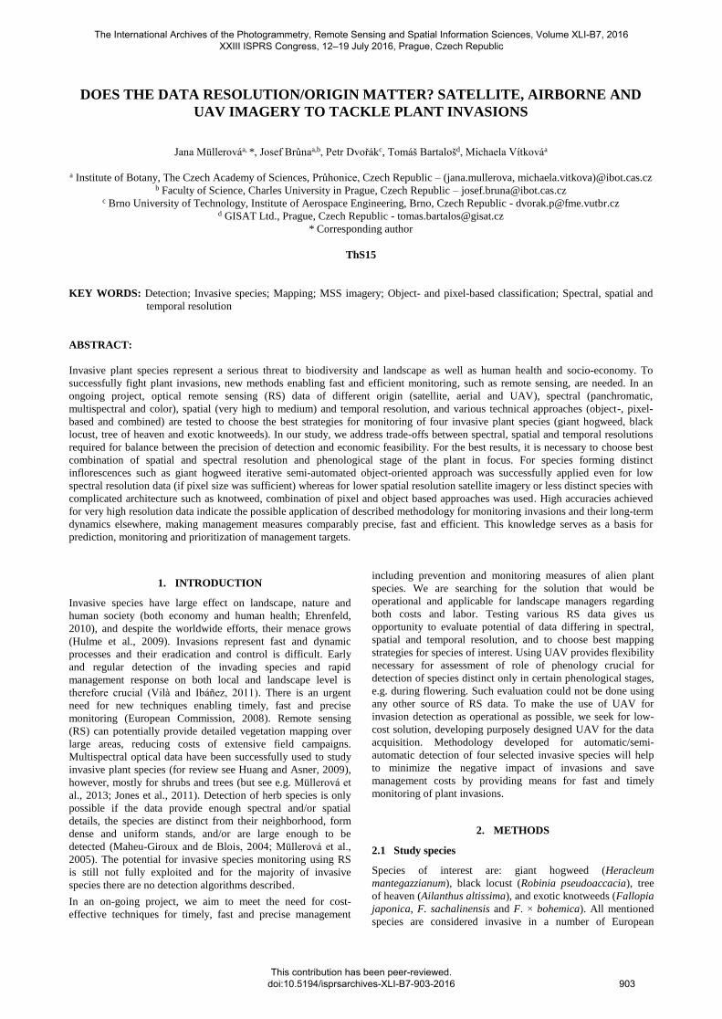
Figure 1. Giant hogweed on Pleiades satellite imagery (right).
On the left are details of flowering plants captured by RapidEye,
Pleiades and UAV (from up to down, spatial resolution of 6.5
m, 2.8 m and 5 cm).
The International Archives of the Photogrammetry, Remote Sensing and Spatial Information Sciences, Volume XLI-B7, 2016 XXIII ISPRS Congress, 12–19 July 2016, Prague, Czech Republic
This contribution has been peer-reviewed. doi:10.5194/isprsarchives-XLI-B7-903-2016
904
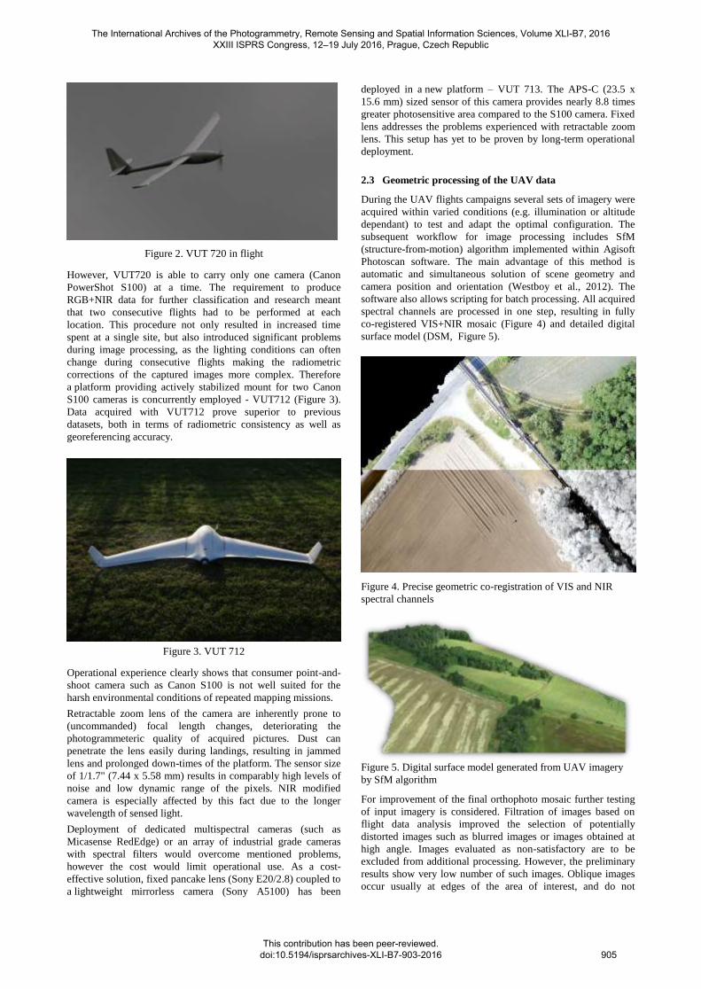
Figure 2. VUT 720 in flight
However, VUT720 is able to carry only one camera (Canon
PowerShot S100) at a time. The requirement to produce
RGB+NIR data for further classification and research meant
that two consecutive flights had to be performed at each
location. This procedure not only resulted in increased time
spent at a single site, but also introduced significant problems
during image processing, as the lighting conditions can often
change during consecutive flights making the radiometric
corrections of the captured images more complex. Therefore
a platform providing actively stabilized mount for two Canon
S100 cameras is concurrently employed - VUT712 (Figure 3).
Data acquired with VUT712 prove superior to previous
datasets, both in terms of radiometric consistency as well as
georeferencing accuracy.
Figure 3. VUT 712
Operational experience clearly shows that consumer point-and-
shoot camera such as Canon S100 is not well suited for the
harsh environmental conditions of repeated mapping missions.
Retractable zoom lens of the camera are inherently prone to
(uncommanded) focal length changes, deteriorating the
photogrammeteric quality of acquired pictures. Dust can
penetrate the lens easily during landings, resulting in jammed
lens and prolonged down-times of the platform. The sensor size
of 1/1.7" (7.44 x 5.58 mm) results in comparably high levels of
noise and low dynamic range of the pixels. NIR modified
camera is especially affected by this fact due to the longer
wavelength of sensed light.
Deployment of dedicated multispectral cameras (such as
Micasense RedEdge) or an array of industrial grade cameras
with spectral filters would overcome mentioned problems,
however the cost would limit operational use. As a cost-
effective solution, fixed pancake lens (Sony E20/2.8) coupled to
a lightweight mirrorless camera (Sony A5100) has been
deployed in a new platform – VUT 713. The APS-C (23.5 x
15.6 mm) sized sensor of this camera provides nearly 8.8 times
greater photosensitive area compared to the S100 camera. Fixed
lens addresses the problems experienced with retractable zoom
lens. This setup has yet to be proven by long-term operational
deployment.
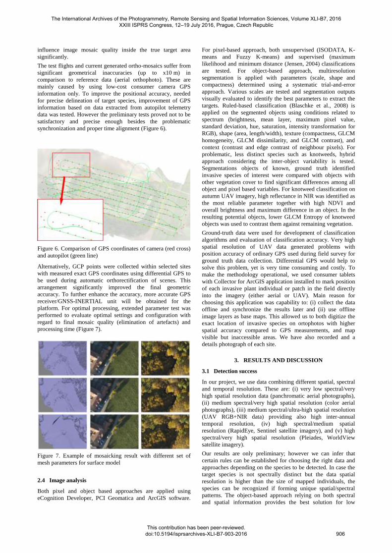
2.3 Geometric processing of the UAV data
During the UAV flights campaigns several sets of imagery were
acquired within varied conditions (e.g. illumination or altitude
dependant) to test and adapt the optimal configuration. The
subsequent workflow for image processing includes SfM
(structure-from-motion) algorithm implemented within Agisoft
Photoscan software. The main advantage of this method is
automatic and simultaneous solution of scene geometry and
camera position and orientation (Westboy et al., 2012). The
software also allows scripting for batch processing. All acquired
spectral channels are processed in one step, resulting in fully
co-registered VIS+NIR mosaic (Figure 4) and detailed digital
surface model (DSM, Figure 5).
Figure 4. Precise geometric co-registration of VIS and NIR
spectral channels
Figure 5. Digital surface model generated from UAV imagery
by SfM algorithm
For improvement of the final orthophoto mosaic further testing
of input imagery is considered. Filtration of images based on
flight data analysis improved the selection of potentially
distorted images such as blurred images or images obtained at
high angle. Images evaluated as non-satisfactory are to be
excluded from additional processing. However, the preliminary
results show very low number of such images. Oblique images
occur usually at edges of the area of interest, and do not
The International Archives of the Photogrammetry, Remote Sensing and Spatial Information Sciences, Volume XLI-B7, 2016 XXIII ISPRS Congress, 12–19 July 2016, Prague, Czech Republic
This contribution has been peer-reviewed. doi:10.5194/isprsarchives-XLI-B7-903-2016
905
influence image mosaic quality inside the true target area
significantly.
The test flights and current generated ortho-mosaics suffer from
significant geometrical inaccuracies (up to x10 m) in
comparison to reference data (aerial orthophoto). These are
mainly caused by using low-cost consumer camera GPS
information only. To improve the positional accuracy, needed
for precise delineation of target species, improvement of GPS
information based on data extracted from autopilot telemetry
data was tested. However the preliminary tests proved not to be
satisfactory and precise enough besides the problematic
synchronization and proper time alignment (Figure 6).
Figure 6. Comparison of GPS coordinates of camera (red cross)
and autopilot (green line)
Alternatively, GCP points were collected within selected sites
with measured exact GPS coordinates using differential GPS to
be used during automatic orthorectification of scenes. This
arrangement significantly improved the final geometric
accuracy. To further enhance the accuracy, more accurate GPS
receiver/GNSS-INERTIAL unit will be obtained for the
platform. For optimal processing, extended parameter test was
performed to evaluate optimal settings and configuration with
regard to final mosaic quality (elimination of artefacts) and
processing time (Figure 7).
Figure 7. Example of mosaicking result with different set of
mesh parameters for surface model
2.4 Image analysis
Both pixel and object based approaches are applied using
eCognition Developer, PCI Geomatica and ArcGIS software.
For pixel-based approach, both unsupervised (ISODATA, K-
means and Fuzzy K-means) and supervised (maximum
likelihood and minimum distance (Jensen, 2004) classifications
are tested. For object-based approach, multiresolution
segmentation is applied with parameters (scale, shape and
compactness) determined using a systematic trial-and-error
approach. Various scales are tested and segmentation outputs
visually evaluated to identify the best parameters to extract the
targets. Ruled-based classification (Blaschke et al., 2008) is
applied on the segmented objects using conditions related to
spectrum (brightness, mean layer, maximum pixel value,
standard deviation, hue, saturation, intensity transformation for
RGB), shape (area, length/width), texture (compactness, GLCM
homogeneity, GLCM dissimilarity, and GLCM contrast), and
context (contrast and edge contrast of neighbour pixels). For
problematic, less distinct species such as knotweeds, hybrid
approach considering the inter-object variability is tested.
Segmentations objects of known, ground truth identified
invasive species of interest were compared with objects with
other vegetation cover to find significant differences among all
object and pixel based variables. For knotweed classification on
autumn UAV imagery, high reflectance in NIR was identified as
the most reliable parameter together with high NDVI and
overall brightness and maximum difference in an object. In the
resulting potential objects, lower GLCM Entropy of knotweed
objects was used to contrast them against remaining vegetation.
Ground-truth data were used for development of classification
algorithms and evaluation of classification accuracy. Very high
spatial resolution of UAV data generated problems with
position accuracy of ordinary GPS used during field survey for
ground truth data collection. Differential GPS would help to
solve this problem, yet is very time consuming and costly. To
make the methodology operational, we used consumer tablets
with Collector for ArcGIS application installed to mark position
of each invasive plant individual or patch in the field directly
into the imagery (either aerial or UAV). Main reason for
choosing this application was capability to: (i) collect the data
offline and synchronize the results later and (ii) use offline
image layers as base maps. This allowed us to both digitize the
exact location of invasive species on ortophotos with higher
spatial accuracy compared to GPS measurements, and map
visible but inaccessible areas. We have also recorded and a
details photograph of each site.
3. RESULTS AND DISCUSSION
3.1 Detection success
In our project, we use data combining different spatial, spectral
and temporal resolution. These are: (i) very low spectral/very
high spatial resolution data (panchromatic aerial photographs),
(ii) medium spectral/very high spatial resolution (color aerial
photographs), (iii) medium spectral/ultra-high spatial resolution
(UAV RGB+NIR data) providing also high inter-annual
temporal resolution, (iv) high spectral/medium spatial
resolution (RapidEye, Sentinel satellite imagery), and (v) high
spectral/very high spatial resolution (Pleiades, WorldView
satellite imagery).
Our results are only preliminary; however we can infer that
certain rules can be established for choosing the right data and
approaches depending on the species to be detected. In case the
target species is not spectrally distinct but the data spatial
resolution is higher than the size of mapped individuals, the
species can be recognized if forming unique spatial/spectral
patterns. The object-based approach relying on both spectral
and spatial information provides the best solution for low
The International Archives of the Photogrammetry, Remote Sensing and Spatial Information Sciences, Volume XLI-B7, 2016 XXIII ISPRS Congress, 12–19 July 2016, Prague, Czech Republic
This contribution has been peer-reviewed. doi:10.5194/isprsarchives-XLI-B7-903-2016
906
spectral resolution imagery such as historical panchromatic
photography (see Laliberte et al., 2004, or Müllerová et al.,
2013), less spectrally distinct species, and species with typical
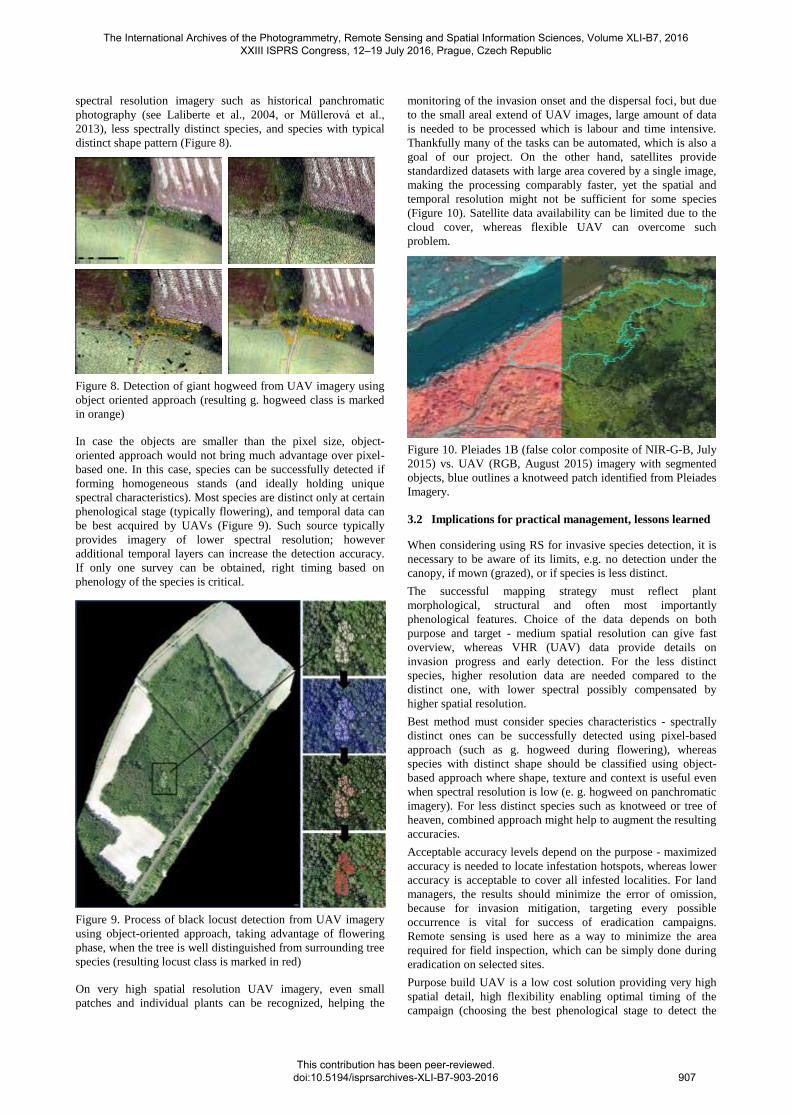
distinct shape pattern (Figure 8).
Figure 8. Detection of giant hogweed from UAV imagery using
object oriented approach (resulting g. hogweed class is marked
in orange)
In case the objects are smaller than the pixel size, object-
oriented approach would not bring much advantage over pixel-
based one. In this case, species can be successfully detected if
forming homogeneous stands (and ideally holding unique
spectral characteristics). Most species are distinct only at certain
phenological stage (typically flowering), and temporal data can
be best acquired by UAVs (Figure 9). Such source typically
provides imagery of lower spectral resolution; however
additional temporal layers can increase the detection accuracy.
If only one survey can be obtained, right timing based on
phenology of the species is critical.
Figure 9. Process of black locust detection from UAV imagery
using object-oriented approach, taking advantage of flowering
phase, when the tree is well distinguished from surrounding tree
species (resulting locust class is marked in red)
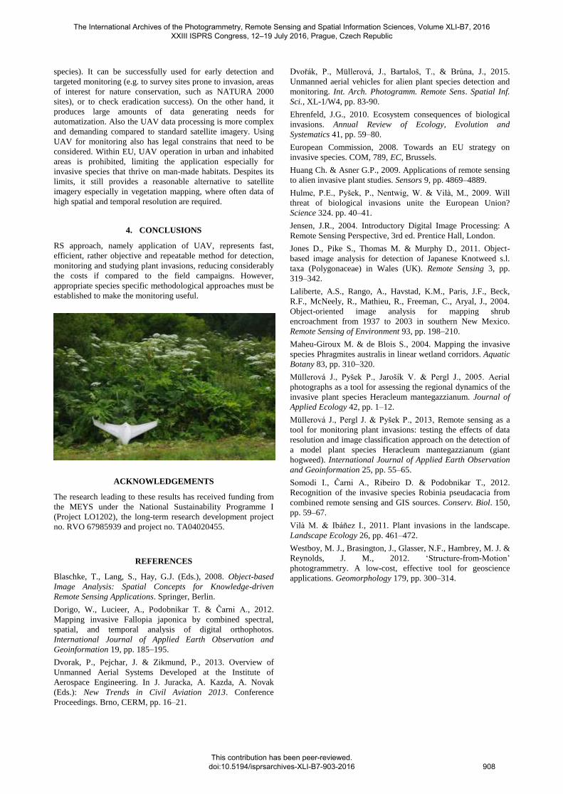
On very high spatial resolution UAV imagery, even small
patches and individual plants can be recognized, helping the
monitoring of the invasion onset and the dispersal foci, but due
to the small areal extend of UAV images, large amount of data
is needed to be processed which is labour and time intensive.
Thankfully many of the tasks can be automated, which is also a
goal of our project. On the other hand, satellites provide
standardized datasets with large area covered by a single image,
making the processing comparably faster, yet the spatial and
temporal resolution might not be sufficient for some species
(Figure 10). Satellite data availability can be limited due to the
cloud cover, whereas flexible UAV can overcome such
problem.
Figure 10. Pleiades 1B (false color composite of NIR-G-B, July
2015) vs. UAV (RGB, August 2015) imagery with segmented
objects, blue outlines a knotweed patch identified from Pleiades
Imagery.
3.2 Implications for practical management, lessons learned
When considering using RS for invasive species detection, it is
necessary to be aware of its limits, e.g. no detection under the
canopy, if mown (grazed), or if species is less distinct.
The successful mapping strategy must reflect plant
morphological, structural and often most importantly
phenological features. Choice of the data depends on both
purpose and target - medium spatial resolution can give fast
overview, whereas VHR (UAV) data provide details on
invasion progress and early detection. For the less distinct
species, higher resolution data are needed compared to the
distinct one, with lower spectral possibly compensated by
higher spatial resolution.
Best method must consider species characteristics - spectrally
distinct ones can be successfully detected using pixel-based
approach (such as g. hogweed during flowering), whereas
species with distinct shape should be classified using object-
based approach where shape, texture and context is useful even
when spectral resolution is low (e. g. hogweed on panchromatic
imagery). For less distinct species such as knotweed or tree of
heaven, combined approach might help to augment the resulting
accuracies.
Acceptable accuracy levels depend on the purpose - maximized
accuracy is needed to locate infestation hotspots, whereas lower
accuracy is acceptable to cover all infested localities. For land
managers, the results should minimize the error of omission,
because for invasion mitigation, targeting every possible
occurrence is vital for success of eradication campaigns.
Remote sensing is used here as a way to minimize the area
required for field inspection, which can be simply done during
eradication on selected sites.
Purpose build UAV is a low cost solution providing very high
spatial detail, high flexibility enabling optimal timing of the
campaign (choosing the best phenological stage to detect the
The International Archives of the Photogrammetry, Remote Sensing and Spatial Information Sciences, Volume XLI-B7, 2016 XXIII ISPRS Congress, 12–19 July 2016, Prague, Czech Republic
This contribution has been peer-reviewed. doi:10.5194/isprsarchives-XLI-B7-903-2016
907
species). It can be successfully used for early detection and
targeted monitoring (e.g. to survey sites prone to invasion, areas
of interest for nature conservation, such as NATURA 2000
sites), or to check eradication success). On the other hand, it
produces large amounts of data generating needs for
automatization. Also the UAV data processing is more complex
and demanding compared to standard satellite imagery. Using
UAV for monitoring also has legal constrains that need to be
considered. Within EU, UAV operation in urban and inhabited
areas is prohibited, limiting the application especially for
invasive species that thrive on man-made habitats. Despites its
limits, it still provides a reasonable alternative to satellite
imagery especially in vegetation mapping, where often data of
high spatial and temporal resolution are required.
4. CONCLUSIONS
RS approach, namely application of UAV, represents fast,
efficient, rather objective and repeatable method for detection,
monitoring and studying plant invasions, reducing considerably
the costs if compared to the field campaigns. However,
appropriate species specific methodological approaches must be
established to make the monitoring useful.
ACKNOWLEDGEMENTS
The research leading to these results has received funding from
the MEYS under the National Sustainability Programme I
(Project LO1202), the long-term research development project
no. RVO 67985939 and project no. TA04020455.
REFERENCES
Blaschke, T., Lang, S., Hay, G.J. (Eds.), 2008. Object-based
Image Analysis: Spatial Concepts for Knowledge-driven
Remote Sensing Applications. Springer, Berlin.
Dorigo, W., Lucieer, A., Podobnikar T. & Čarni A., 2012.
Mapping invasive Fallopia japonica by combined spectral,
spatial, and temporal analysis of digital orthophotos.
International Journal of Applied Earth Observation and
Geoinformation 19, pp. 185–195.
Dvorak, P., Pejchar, J. & Zikmund, P., 2013. Overview of
Unmanned Aerial Systems Developed at the Institute of
Aerospace Engineering. In J. Juracka, A. Kazda, A. Novak
(Eds.): New Trends in Civil Aviation 2013. Conference
Proceedings. Brno, CERM, pp. 16–21.
Dvořák, P., Müllerová, J., Bartaloš, T., & Brůna, J., 2015.
Unmanned aerial vehicles for alien plant species detection and
monitoring. Int. Arch. Photogramm. Remote Sens. Spatial Inf.
Sci., XL-1/W4, pp. 83-90.
Ehrenfeld, J.G., 2010. Ecosystem consequences of biological
invasions. Annual Review of Ecology, Evolution and
Systematics 41, pp. 59–80.
European Commission, 2008. Towards an EU strategy on
invasive species. COM, 789, EC, Brussels.
Huang Ch. & Asner G.P., 2009. Applications of remote sensing
to alien invasive plant studies. Sensors 9, pp. 4869–4889.
Hulme, P.E., Pyšek, P., Nentwig, W. & Vilà, M., 2009. Will
threat of biological invasions unite the European Union?
Science 324. pp. 40–41.
Jensen, J.R., 2004. Introductory Digital Image Processing: A
Remote Sensing Perspective, 3rd ed. Prentice Hall, London.
Jones D., Pike S., Thomas M. & Murphy D., 2011. Object-
based image analysis for detection of Japanese Knotweed s.l.
taxa (Polygonaceae) in Wales (UK). Remote Sensing 3, pp.
319–342.
Laliberte, A.S., Rango, A., Havstad, K.M., Paris, J.F., Beck,
R.F., McNeely, R., Mathieu, R., Freeman, C., Aryal, J., 2004.
Object-oriented image analysis for mapping shrub
encroachment from 1937 to 2003 in southern New Mexico.
Remote Sensing of Environment 93, pp. 198–210.
Maheu-Giroux M. & de Blois S., 2004. Mapping the invasive
species Phragmites australis in linear wetland corridors. Aquatic
Botany 83, pp. 310–320.
Müllerová J., Pyšek P., Jarošík V. & Pergl J., 2005. Aerial
photographs as a tool for assessing the regional dynamics of the
invasive plant species Heracleum mantegazzianum. Journal of
Applied Ecology 42, pp. 1–12.
Müllerová J., Pergl J. & Pyšek P., 2013, Remote sensing as a
tool for monitoring plant invasions: testing the effects of data
resolution and image classification approach on the detection of
a model plant species Heracleum mantegazzianum (giant
hogweed). International Journal of Applied Earth Observation
and Geoinformation 25, pp. 55–65.
Somodi I., Čarni A., Ribeiro D. & Podobnikar T., 2012.
Recognition of the invasive species Robinia pseudacacia from
combined remote sensing and GIS sources. Conserv. Biol. 150,
pp. 59–67.
Vilà M. & Ibáñez I., 2011. Plant invasions in the landscape.
Landscape Ecology 26, pp. 461–472.
Westboy, M. J., Brasington, J., Glasser, N.F., Hambrey, M. J. &
Reynolds, J. M., 2012. ‘Structure-from-Motion’
photogrammetry. A low-cost, effective tool for geoscience
applications. Geomorphology 179, pp. 300–314.
The International Archives of the Photogrammetry, Remote Sensing and Spatial Information Sciences, Volume XLI-B7, 2016 XXIII ISPRS Congress, 12–19 July 2016, Prague, Czech Republic
This contribution has been peer-reviewed. doi:10.5194/isprsarchives-XLI-B7-903-2016
908