document overview title: fully polarimetric airborne sar and ers sar observations of snow:...
TRANSCRIPT

DOCUMENT OVERVIEWDOCUMENT OVERVIEW
Title:Title: Fully Polarimetric Airborne SAR and ERS SAR Fully Polarimetric Airborne SAR and ERS SAR Observations of Snow: Implications For Selection of Observations of Snow: Implications For Selection of
ENVISAT ASAR ModesENVISAT ASAR Modes
Journal:Journal: International Journal of Remote Sensing, 2003, International Journal of Remote Sensing, 2003, Vol. 24, No. 19, 3839-3854Vol. 24, No. 19, 3839-3854
Authors: Authors: Tore Guneriussen and Harold JohnsenTore Guneriussen and Harold Johnsen
Presented by: Joey BoggessPresented by: Joey Boggess
Date: December 1, 2004Date: December 1, 2004

What is SAR?What is SAR?
Synthetic Aperture Radar (SAR)Synthetic Aperture Radar (SAR) SAR is a method of microwave remote SAR is a method of microwave remote
sensing where the motion of the radar is sensing where the motion of the radar is used to improve the image resolution in used to improve the image resolution in the direction of the moving radar the direction of the moving radar antenna. antenna.
SAR instruments can penetrate through SAR instruments can penetrate through clouds, haze, smoke, and vegetation. clouds, haze, smoke, and vegetation.
Airborne and Earth Resource Satellite Airborne and Earth Resource Satellite (ERS)(ERS)
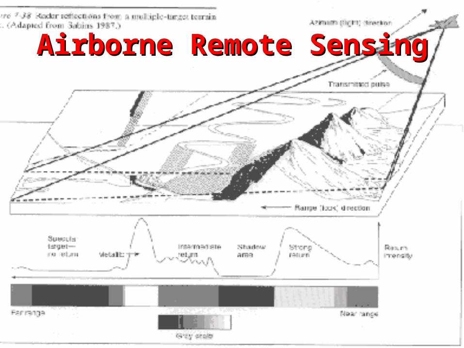
Airborne Remote SensingAirborne Remote Sensing

Satellite Remote SensingSatellite Remote Sensing

What is Envisat?What is Envisat?
Envisat is the most powerful European Envisat is the most powerful European Earth Observation satellite ever built. It Earth Observation satellite ever built. It has begun making the most complete has begun making the most complete sets of observations of the earth’s sets of observations of the earth’s surface that any satellite has ever surface that any satellite has ever carried out. Envisat monitors: carried out. Envisat monitors: The land The land Oceans Oceans Atmosphere Atmosphere Ice caps Ice caps

What Are ASAR Modes?What Are ASAR Modes?
Advanced Synthetic Aperture Radar Advanced Synthetic Aperture Radar (ASAR) are instruments on Envisat (ASAR) are instruments on Envisat that enhances snow mapping that enhances snow mapping capabilities. capabilities.
Modes are the different ways the Modes are the different ways the remote sensor scans the earth.remote sensor scans the earth.

ASAR ModesASAR Modes
Image ModeImage Mode Alternating Alternating Polarization ModePolarization Mode

ASAR Modes ASAR Modes (Continued)(Continued)
Global Monitoring Global Monitoring ModeMode
Wave ModeWave Mode

ASAR Modes ASAR Modes (Continued)(Continued)
Wide Swath ModeWide Swath Mode

Purpose of StudyPurpose of Study
The purpose of this study was to The purpose of this study was to contribute to the growing contribute to the growing understanding of the interaction understanding of the interaction between snow cover and between snow cover and microwaves. microwaves.
Answer the question:Answer the question: Which band is more useful to the Which band is more useful to the
this type of experiment the C- or this type of experiment the C- or the L-band?the L-band?

IntroductionIntroduction
The researchers used seven different The researchers used seven different ASAR image modes, which had ASAR image modes, which had incidence angles that ranged from incidence angles that ranged from 15 - 45°, approximately the same 15 - 45°, approximately the same variation as the Radarsat Standard variation as the Radarsat Standard beam mode data frequently used. beam mode data frequently used.


Introduction Introduction (Continued)(Continued)
With the modes in place the With the modes in place the researchers used their data and the researchers used their data and the theory of backscattering from snow theory of backscattering from snow cover to determine the optimum cover to determine the optimum polarization and incidence angle polarization and incidence angle combinations to successfully monitor combinations to successfully monitor the snow coverage of their point of the snow coverage of their point of interest. interest.

Study AreaStudy Area
Norwegian part of the snow and Norwegian part of the snow and ice experiment within the ice experiment within the European Multi-sensor Airborne European Multi-sensor Airborne Campaign (EMAC’95) acquired Campaign (EMAC’95) acquired in the Kongsfjellet areain the Kongsfjellet area

DataData
Data stemmed from the combination of Data stemmed from the combination of three remote sensing and three remote sensing and in situin situ campaigns campaigns that were conducted in 1995. that were conducted in 1995.
Fully polarimetric C- and L-band SAR data Fully polarimetric C- and L-band SAR data was gathered from the ElectroMagnetic was gathered from the ElectroMagnetic Institute SAR (EMISAR), which is an Institute SAR (EMISAR), which is an airborne instrument operated by the Danish airborne instrument operated by the Danish Center for Remote Sensing (DCR). The Center for Remote Sensing (DCR). The data gather from the DCR was attained in data gather from the DCR was attained in the months of March, May and July of 1995. the months of March, May and July of 1995.

European Multi-Sensor Airborne European Multi-Sensor Airborne Campaign (EMAC’95)Campaign (EMAC’95)
One of the EMAC One of the EMAC objectives was to objectives was to encourage new encourage new experiments to help experiments to help develop and test develop and test algorithms for snow algorithms for snow parameters extraction parameters extraction based on existing and based on existing and future spaceborne SAR future spaceborne SAR systems (snow cover extent systems (snow cover extent and snow water equivalent and snow water equivalent data) using combined data) using combined airborne, spaceborne and airborne, spaceborne and ground data. ground data.

C- and L-band HH, VV, and HV C- and L-band HH, VV, and HV polarizationpolarization
C-bandC-band L-bandL-band

Backscattering TheoryBackscattering Theory
The theory states that backscattering from The theory states that backscattering from a snow covered terrain depends on 1) a snow covered terrain depends on 1) sensor parameters which includes sensor parameters which includes frequency, polarization and viewing frequency, polarization and viewing geometry, and 2) snowpack and ground geometry, and 2) snowpack and ground parameters which includes snow density, parameters which includes snow density, liquid water content, ice particle size and liquid water content, ice particle size and shape, surface roughness parameters, and shape, surface roughness parameters, and stratification.stratification.
σo (θ) = σoss (θ) + ψ (θ)2 [σosv(θ’) + σosg (θ’)L -σo (θ) = σoss (θ) + ψ (θ)2 [σosv(θ’) + σosg (θ’)L -2 (θ’)]2 (θ’)]

The Problem of BackscatteringThe Problem of Backscattering

BackscatteringBackscattering
Backscattering Backscattering profiles, which profiles, which clearly show the clearly show the difference between difference between the snow-covered the snow-covered areas with low areas with low backscatter and backscatter and the snow-free the snow-free ground with higher ground with higher backscatter. backscatter.

ResultsResults
First set of results focused on the First set of results focused on the backscattering angular dependency backscattering angular dependency of snow and bare ground from ERS of snow and bare ground from ERS and EMISAR.and EMISAR.
The second set of results focused on The second set of results focused on the angular dependency of the angular dependency of polarization features from snow and polarization features from snow and bare ground. bare ground.

First Set of ResultsFirst Set of Results
The test results based on backscattering The test results based on backscattering angular dependency of snow and bare ground angular dependency of snow and bare ground from ERS and EMISAR showed that at high from ERS and EMISAR showed that at high incidence angles the EMISAR backscattering incidence angles the EMISAR backscattering corresponded to volume scattering, while at low corresponded to volume scattering, while at low local incidence angles the data corresponded local incidence angles the data corresponded more with surface scattering. more with surface scattering.
By referring to the data the researchers By referring to the data the researchers assumed that the greatest distinction between assumed that the greatest distinction between the snow and bare ground was to be expected the snow and bare ground was to be expected from SAR instruments with large incidence from SAR instruments with large incidence angles. angles.

Second Set of ResultsSecond Set of Results
The researchers used their data to The researchers used their data to enhance the differences between VV and enhance the differences between VV and HH polarizations by increasing the HH polarizations by increasing the incidence angles. The enhanced incidence angles. The enhanced difference between VV and HH shown in difference between VV and HH shown in the results were consistent with the the results were consistent with the theoretical results for the first-order theoretical results for the first-order solution of the radiative transfer equation solution of the radiative transfer equation for a randomly rough surface for which for a randomly rough surface for which multiple scattering can be ignored.multiple scattering can be ignored.

ConclusionConclusion
The conclusion was drawn that the best The conclusion was drawn that the best separation between wet snow and the separation between wet snow and the ground was found using the C-band data. ground was found using the C-band data.
The researchers also concluded that The researchers also concluded that when the snow properties changed the C-when the snow properties changed the C-band proved to be more affected than the band proved to be more affected than the L-band in the month when the snow L-band in the month when the snow cover was wettest, noting that a decrease cover was wettest, noting that a decrease in backscattering was observed for all the in backscattering was observed for all the polarizations.polarizations.

ReferencesReferences http://www.esa.int/export/esaEO/http://www.esa.int/export/esaEO/
ESAXU0MBAMC_index_0.htmlESAXU0MBAMC_index_0.html http://www.westernsnowconference.org/http://www.westernsnowconference.org/ http://www.informatics.org/gorilla/shuttle.htmlhttp://www.informatics.org/gorilla/shuttle.html http://www.estec.esa.nl/vrwww/emac/Image/NokL_sw5.jpghttp://www.estec.esa.nl/vrwww/emac/Image/NokL_sw5.jpg http://www.caf.dlr.de/caf/satellitendaten/missionen/http://www.caf.dlr.de/caf/satellitendaten/missionen/
envisat/va_land/asar/_asar/asar_modes_ge.htmenvisat/va_land/asar/_asar/asar_modes_ge.htm http://www.eurimage.com/products/radarsat.htmlhttp://www.eurimage.com/products/radarsat.html http://folk.uio.no/kjetikj/fjellet/pics/v4rolig1.jpghttp://folk.uio.no/kjetikj/fjellet/pics/v4rolig1.jpg http://esapub.esrin.esa.it/eoq/eoq53/gune53.htmhttp://esapub.esrin.esa.it/eoq/eoq53/gune53.htm www.maion.com/photography/www.maion.com/photography/

The EndThe End