district 8 mrs week: 09/18 mississippi river system · coast guard district 8, waterways, (504) ......
TRANSCRIPT

28 February 201809/18LNM:
Coast Guard District 8-MRSPage 1 of 21
U.S. Departmentof Homeland Security
United StatesCoast Guard
LOCAL NOTICE TO MARINERS
LIGHT LIST VOLUME VNOTICE NUMBER 09-18
February 28, 2018
LIGHT LIST REFERENCE: COMDTPUB P16502.5, Vol V, 2018 Edition.CONTENTS: Rivers are listed in alphabetical order and are included only when there is information to report.
Broadcast Notice to Mariners Covered in this EditionOriginating Unit Beginning BNM's Ending BNM's
Sector Upper Mississippi River 0059 - 18 (UM) 0033 - 18 (UM) Sector Lower Mississippi River 0039 - 18 (LM) 0051- 18 (LM)
Sector Ohio Valley 0168 - 18 (OV) 0194 - 18 (OV) OB DWB 0014 - 18 (OB) 0018- 18 (OB)
COAST GUARD DISTRICT 8, WATERWAYS, (504) 671-2327, 7:00 a.m. until 3:30 p.m. (CST)COMMENTS REGARDING SECTION VI – PROPOSED CHANGES MAY ALSO BE EMAILED TO: [email protected]
NIS WATCHSTANDER PHONE (703) 313-5900 24-HOURS A DAYINTERNET ADDRESS https://www.navcen.uscg.gov/
2013 SPECIAL NOTICE TO MARINERS https://www.navcen.uscg.gov/MISSISSIPPI RIVER SYSTEM LNM VIA INTERNET https://www.navcen.uscg.gov/?pageName=lnmDistrict®ion=8&ext=r
MISSISSIPPI RIVER SYSTEM LIGHT LIST VIA INTERNET https://www.navcen.uscg.gov/?pageName=lightLists
ABBREVIATIONS
District 8 MRS Week: 09/18
A through H
ADRIFT - Buoy AdriftAICW - Atlantic Intracoastal WaterwayAl - AlternatingB - BuoyBKW - Breakwaterbl - BlastBNM - Broadcast Notice to Marinerbu - BlueC - CanadianCHAN - ChannelCGD - Coast Guard DistrictC/O - Cut OffCONT - ContourCRK - CreekCONST - ConstructionDAYMK/Daymk - DaymarkDBN/Dbn - DaybeaconDBD/DAYBD - DayboardDEFAC - DefacedDEST - DestroyedDISCON - DiscontinuedDMGD/DAMGD - Damagedec - eclipseEST - Established Aidev - everyEVAL - EvaluationEXT - ExtinguishedF - Fixedfl - flashFl - Flashing
I through O
I - InterruptedICW - Intracoastal WaterwayIMCH - Improper CharacteristicINL - InletINOP - Not OperatingINT - IntensityISL - IsletIso - IsophasekHz - KilohertzLAT - LatitudeLB - Lighted BuoyLBB - Lighted Bell BuoyLHB - Lighted Horn BuoyLGB - Lighted Gong BuoyLONG - LongitudeLNM - Local Notice to MarinersLT - LightLT CONT - Light ContinuousLTR - LetterLWB - Lighted Whistle BuoyLWP - Left Watching ProperlyMHz - Megahertz MISS/MSNG - MissingMo - Morse Code MRASS - Marine Radio Activated Sound SignalMSLD - MisleadingN/C - Not ChartedNGA - National Geospatial-Intelligence AgencyNO/NUM - NumberNOS - National Ocean Service
P through Z
PRIV - Private AidQ - QuickR - Red RACON - Radar Transponder BeaconRa ref - Radar reflectorRBN - Radio BeaconREBUILT - Aid RebuiltRECOVERED - Aid RecoveredRED - Red BuoyREFL - ReflectiveRRL - Range Rear LightRELIGHTED - Aid RelitRELOC - RelocatedRESET ON STATION - Aid Reset on StationRFL - Range Front LightRIV - RiverRRASS - Remote Radio Activated Sound Signals - secondsSEC - SectionSHL - Shoalingsi - silentSIG - SignalSND - SoundSPM - Single Point Mooring BuoySS - Sound SignalSTA - StationSTRUCT - StructureSt M - Statute MileTEMP - Temporary Aid ChangeTMK - Topmark
Mississippi River System

28 February 201809/18LNM:
Coast Guard District 8-MRSPage 2 of 21
RIAC - River Industry Action CommitteeMMSI - Mobile Maritime Service IdentityAIS - Automatic Identification SystemATON - Aids To NavigationCOTP - Captain of The PortTRDBN - Temporary Replaced by DaybeaconC.F.S. - Cubic Feet per SecondIAW - In Accordance With
SECTION I - SPECIAL NOTICESThis section contains information of special concern to the Mariner.
DEPARTMENT OF HOMELAND SECURITY SUSPICIOUS ACTIVITY
USACE NASHVILLE DISTRICT - SEMI-ANNUAL NAVIGATION MEETING
LOWER MISSISSIPPI RIVER SAFETY ADVISORY/CHANNEL CONDITION - UPDATE
GPS TESTING - FORT POLK, LOUISIANA
GPS TESTING - WHITEMAN AIR FORCE BASE, MISSOURI
The Department of Homeland Security (DHS) encourages the maritime public to report information concerning suspicious activity to the local Federal Bureau of Investigation Joint Terrorism Task Force (JTTF) Office, http://www.fbi.gov/about-us/investigate/terrorism/terrorism_jttfs, or to other appropriate authorities. The U.S. Coast Guard reminds the maritime industry that they may also report information concerning suspicious activity to the www.AmericasWaterwayWatch.org, the National Response Center (NRC) 1-800-424-8802 or 1-877-24WATCH.
The USACE Nashville District will host a Navigation Meeting on March 15, 2018, from 10:00 a.m. until 12:30 p.m. Attached as enclosures to this LNM are the Notice to Navigation Interests 18-09 and the agenda for the meeting.
The COTP Lower Mississippi has issued a high water Safety Advisory from Mile 869.0 to Mile 303.0, due to hazardous conditions associated with strong currents, severe outdrafts, missing/off station aids to navigation and diving buoys. The COTP in concurrence with the Lower Mississippi River Committee recommends the following limits to tows when the Memphis, Tennessee, Gauge reaches 25.0 feet, and that will be transiting between Mile 869.0 and 303.0. Dound-bound: Towing vessels must have at least 240 h.p., with a maximum tow size of 36 barges. Towing vessels with less than 6,000 h.p., may have a maximum tow size of 25 loaded barges. Towing vessels with 6,000 h.p. to 7,200 h.p., may have a maximum tow size of 30 loaded barges. Towing vessels with 7, 201 to 8,400 h.p., may have a maximum tow size of 35 loaded barges. Towing vessels with greater than 8,400 h.p., may have a maximum tow size of 36 loaded barges.Tows passing fleeting areas should pass at the farthest distance possible and at their slowest safe speed to reduce the possibility of breakaways. Fleet operators should regularly check their fleets and immediately report barge breakaways to the U.S. Coast Guard. Mariners are requested to contact U.S. Coast Guard Sector Lower Mississippi River, for additional information or to report areas of concern.
Commencing March 12-23, 2018, GPS testing will be conducted in the vicinity of Fort Polk, Louisiana. Systems that rely on GPS, such as E-911, AIS and DSC, may be affected at an approximate test center of 31-05-35.0N 093-03-50.2W, with a possible impact radius of 45 nautical miles from the center point. More information is available at the U.S. Coast Guard Navigation Center Website, https://www.navcen.uscg.gov . During these periods, GPS users are encouraged to report any GPS outages that they may experience to the Navigation Information Service (NIS) by calling (703) 313-5900 or by using the NAVCEN Website to submit a GPS problem report.
Continuing until March 3, 2018 and March 5, 2018 until March 7, 2018, GPS testing will be conducted in the vicinity of Whiteman Air Force Base, Missouri. Systems that rely on GPS, such as E-911, AIS and DSC, may be affected at an approximate test center of 38-40-54.75N 093-33-16.34.57W, with a possible impact radius of 61 nautical miles from the center point. More information is available at the U.S. Coast Guard Navigation Center Website, https://www.navcen.uscg.gov . During these periods, GPS users are encouraged to report any GPS outages that they may experience to the Navigation Information Service (NIS) by calling (703) 313-5900 or by using the NAVCEN Website to submit a GPS
LNM:
LNM:
LNM:
LNM:
DPW
09-18
09-18
09-18
Additional Abbreviations Specific to this LNM Edition:
G - Green GIWW - Gulf Intracoastal WaterwayHAZ - Hazard to NavigationHBR - HarborHOR - Horizontal ClearanceHT - Height
NW - Notice WriterOBSCU - ObscuredOBST - ObstructionOBSTR - ObstructionOc - OccultingODAS - Anchored Oceanographic Data Buoy
TRLB - Temporarily Replaced by Lighted BuoyTRLT - Temporarily Replaced by LightTRUB - Temporarily Replaced by Unlighted BuoyUSACE - Army Corps of EngineersW - WhiteY - Yellow

28 February 201809/18LNM:
Coast Guard District 8-MRSPage 3 of 21
GPS TESTING - OFFUTT AIR FORCE BASE, NEBRASKA
ILLINOIS WATERWAY - CHANNEL CONDITION/SAFETY ADVISORY
OHIO RIVER AND TRIBUTARIES - WINTER NAVIGATION
USACE HUNTINGTON DISTRICT LOCKS - MAIL DELIVERY AND CREW CHANGE POLICIES
USACE HUNTINGTON DISTRICT - NOTIFICATION OF SINKING OR SUNKEN VESSELS, VESSEL GROUNDINGS AND BARGE BREAKAWAYS
USACE HUNTINGTON DISTRICT - REVIEW OF REGULATIONS AND GENERAL SAFETY PRACTICES
USACE HUNTINGTON DISTRICT - RESTRICTED AREAS AT NAVIGATION STRUCTURES
ARKANSAS RIVER - USACE CHANNEL STATUS REPORT
RED RIVER - CHANNEL CONDITION/SAFETY ADVISORY
problem report.
Continuing until March 3, 2018 and March 5, 2018 until March 7, 2018, GPS testing will be conducted in the vicinity of Offutt Air Force Base, Nebraska. Systems that rely on GPS, such as E-911, AIS and DSC, may be affected at an approximate test center of 41-06-57.55N 095-53-52.66W, with a possible impact radius of 52 nautical miles from the center point. More information is available at the U.S. Coast Guard Navigation Center Website, https://www.navcen.uscg.gov . During these periods, GPS users are encouraged to report any GPS outages that they may experience to the Navigation Information Service (NIS) by calling (703) 313-5900 or by using the NAVCEN Website to submit a GPS problem report.
The following zones are in the extreme high water action phase in accordance with the Western Rivers Waterways Action Plan:Illinois Waterway: Zone 7, 6 and 5 (Mile 180.9 – Mile 102.0). Recreational traffic is highly discouraged, due to debris and swift currents. Laying up on saturated levees is prohibited.The following zones are in the high water watch phase in accordance with the Western Rivers Waterways Action Plan:Zone 4 and 3 (Mile 101.9 – Mile 50.0).Mariners should exercise caution and minimize their wake and avoid laying up on saturated levees. Mariners should be experienced in high waterconditions and avoid down-streaming. Mariners should remain vigilant to an increase in debris and maneuver appropriately, be aware of the buildup of debris in fleeting areas and take appropriate action to prevent any breakaways from occurring. Mariners are to use caution in all meeting and overtaking situations. Navigation buoys may have been dragged off station, so remain cautious while transiting the area.
Attached as an enclosure to this LNM is a USACE Huntington District Notice to Navigation Interests 18-02, regarding winter navigation on the Ohio River and tributaries.
Attached as an enclosure to this LNM is a USACE Huntington District Notice to Navigation Interests 18-05, regarding mail delivery and crew change policies at navigation locks, for towboats.
Attached as an enclosure to this LNM is a USACE Huntington District Notice to Navigation Interests 18-04, regarding notification of sinking or sunken vessels, vessel groundings and barge breakaways.
Attached as an enclosure to this LNM is a USACE Huntington District Notice to Navigation Interests 18-03, regarding the review of regulations and general safety practices.
Attached as an enclosure to this LNM is a USACE Huntington District Notice to Navigation Interests 18-06, regarding restricted areas at navigation structures.
Attached as an enclosure to this LNM, is a USACE Tulsa District Arkansas River Channel Status Report 18-02.
The COTP Lower Mississippi River has issued a Safety Advisory between approximate Miles 227.0 and 0.0, due to hazardous conditions associated with strong currents, sever outdrafts, missing/off station aids to navigation and diving buoys. The COTP Lower Mississippi River, in association with the Red River Valley Association, recommends the following limits for tows when transiting :
LNM:
LNM:
LNM:
LNM:
LNM:
LNM:
LNM:
LNM:
LNM:
09-18
09-18
09-18
03-18
03-18
03-18
03-18
03-18
06-18

28 February 201809/18LNM:
Coast Guard District 8-MRSPage 4 of 21
UPPER MISSISSIPPI RIVER - ST. CROIX RIVER - MISSOURI RIVER - DRAWBRIDGE OPERATION
UPPER MISSISSIPPI RIVER - L/D RESTRICTIONS/WINTER CLOSURES
ILLINOIS WATERWAY - CHANNEL CONDITIONS/ONE-WAY TRAFFIC - UPDATE
ILLINOIS WATERWAY - CHANNEL CONDITIONS
LOWER MISSISSIPPI RIVER - SAFETY ADVISORY/CHANNEL CONDITION
Up-bound and down-bound towing vessels, must have at least 600 h.p., per loaded barge with a maximum tow size of 6 barges. Recommended daylight transit only through L/D 2. Fleet operators should regularly check their fleets and immediately report barge break-awaysto the U.S. Coast Guard. Mariners are requested to contact U.S. Coast Guard Sector Lower Mississippi River via VHF-FM Channel 16 or at (866) 777-2784, for additional information or to report areas of concern.
Attached as an enclosure to this LNM, is Special Public Notice D8 DWB-879, regarding drawbridge operation on the Upper Mississippi River, St. Croix River and the Missouri River.
Attached as an enclosure to this LNM, is USACE Navigation Notice 17-8200-1, regarding L/D restrictions and L/D winter lock closures.
Icing conditions no longer exist. The one-way traffic restriction has been cancelled.
As a result of high water conditions, the following recommendations are based on current gauge readings IAW the Waterway Action Plan. Recreational vessels are strongly discouraged from transiting between approximate Miles 327.0 and 187.0. All vessels are discouraged from laying up on levees. Mariners are advised that swift currents are present and to transit the area with caution.
Mariners are advised to remain cognizant between approximate Miles 869.0 and 303.0, of their wake and transit the area at their slowest safe speed to minimize their wake in the vicinity of levees, water bourn casinos and homes in low-lying areas. Mariners are requested to give as wideof a berth as possible when transiting in the vicinity of these low lying areas.
LNM:
LNM:
LNM:
LNM:
LNM:
LNM:
09-18
48-17
47-17
09-18
09-18
09-18
DISCREPANCIES (FEDERAL AIDS)
SECTION II - DISCREPANCIESThis section lists all reported and corrected discrepancies related to Aids to Navigation in this edition. A discrepancy is a change in the status of
an aid to navigation that differs from what is published or charted.
LNM EndLLNR Aid Name Status Chart No. BNM Ref. LNM StBrier Creek Light
Non Lateral Mark 330.4Non Lateral Mark 313.9
Arbuckle Island Light
Mulberry River DaybeaconMoores Creek Light
O'Kane Island Light
Dardanelle Reach LightNon Lateral Mark 197.9
Tri County Light
Crystal Hill LightEstes Place Light
Non Lateral Mark 92.0
Ste. Marie Bend Lower DaybeaconRichland Bend Lower Daybeacon
Cooper Point Light
Kimbrough Light
STRUCT DEST
STRUCT DESTSTRUCT DEST
STRUCT DEST
STRUCT DESTLT IMCH/STRUCT DMGD
LT IMCH/STRUCT DMGD
DAYMK DMGDSTRUCT DEST
STRUCT DEST
LT IMCHDAYMK IMCH/STRUCT DMGD
STRUCT DEST
STRUCT DESTDAYMK DMGD
LT EXT
LT EXT
31/15
05/1605/16
05/16
11/1744/16
44/16
31/1513/17
41/16
12/1744/16
44/16
45/1647/16
46/17
46/17
1070
12131267
1430
14551510
1520
16951708
1930
20052160
2199
23702440
2465
2475
0205LM0087LM
0089LM
0091LM0041UM
0394LM
0393LM0204LM
0052LM
0370LM0047LM
0396LM
0398LM0407LM
0438LM
0335LM0336LM

28 February 201809/18LNM:
Coast Guard District 8-MRSPage 5 of 21
Mud Lake Bend Light
Cummins Bend DaybeaconLake Bend Light
Sample Island Light
Sample Island Lower LightSouth Bend Landing Light
Ross Ferry Light
Cook Point LightMary Mcgraw Light
Paradise Bay Light
Owens Lake DaybeaconOld Hickory Light
Watkins Daybeacon
Harpeth Shoals Upper LightShammels Mound Landing Light
Saline Creek Light
Crooked Creek LightHurricane Isle Upper Daybeacon
Blooms Landing Light
Preston Peninsula LightQuaker Oats Light
Milton Bell Light
Stewart Bar Light
Murphy Smith Upper DaybeaconMurphy Smith Light
Bader Light
Nebraska Point LightJosie Harry Bar Light
Harbert Point Light
Delta Lower LightKangaroo Point Light
Miller Point Light
Old Town Bend Foot LightRobson Light
Sunflower Cut-Off Foot Light
Ludlow Bar LightWood Cottage Light
Knowlton Light
Mason Landing DaybeaconCypress Bend Light
Choctaw Bend Light
Ashbrook Neck LightMiller Bend Light
La Grange Towhead Light
Vaucluse Bend LightAnconia Point Light
American Bar Light
Corregidor LightOpossum Point Lower Light
Skipwith Bar Light
Fitler Point DaybeaconBelle Island Corner Daybeacon
Cabin Teele Light
Kings Point LightCentennial Island Light
Coggins Light
LT EXT
STRUCT DESTLT EXT
STRUCT DEST
STRUCT DESTLT EXT
STRUCT DEST
LT EXTLT EXT
STRUCT DEST
DAYMK DMGDLT IMCH
STRUCT DEST
LT EXTSTRUCT DEST
STRUCT DEST/TRUB
STRUCT DEST/TRUBSTRUCT DEST
STRUCT DEST
REDUCED INTSTRUCT DEST
LT EXT
DAYMK DMGD
STRUCT DESTSTRUCT DEST
STRUCT DEST
LT EXTSTRUCT DEST
LT EXT
STRUCT DESTSTRUCT DEST
STRUCT DEST
STRUCT DESTSTRUCT DEST
STRUCT DEST
DAYMK DMGDSTRUCT DEST
STRUCT DEST
STRUCT DESTSTRUCT DEST
LT EXT
LT EXTSTRUCT DEST
STRUCT DEST
STRUCT DESTSTRUCT DEST
STRUCT DEST
STRUCT DESTSTRUCT DEST
STRUCT DEST
STRUCT DESTSTRUCT DEST/TRDBN
STRUCT DMGD
LT EXTLT EXT
STRUCT DEST
46/17
06/1646/17
06/16
06/1646/17
39/15
46/1714/17
36/15
06/1621/17
19/17
19/1702/16
26/16
36/1630/17
12/14
46/1606/16
22/16
19/16
14/1740/15
14/17
22/1624/17
36/15
06/1606/16
14/16
36/1506/16
06/16
04/1806/16
06/16
14/1607/18
03/18
06/1806/18
06/18
06/1808/16
06/18
05/1606/16
05/16
28/1722/15
12/14
35/1635/16
29/16
2490
24982520
2540
25502560
2570
25752640
2650
26653735
3965
40154250
4285
43907980
8085
91859535
9690
9820
98459850
9935
1000010445
10540
1062510640
10650
1066010685
10700
1071010715
10720
1073010885
10900
1094510955
10965
1105011070
11077
1112511140
11145
1121011250
11270
1130011305
11407
0337LM
0103LM0338LM
0106LM
0107LM0332LM
0287LM
0334LM0061LM
0258LM
0110LM0278OV
0245OV
0244OV0010OV
0221OV
0383OV0301UM
0032UM
0420LM0043OV
0172OV
0229LM0065LM
0303LM
0066LM0254LM
0125LM
0256LM0118LM
0117LM
0171LM0253LM
0116LM
0115LM0018LM
0114LM
0113LM0172LM
0032LM
0013LM0031LM
0030LM
0029LM0028LM
0130LM
0027LM0080LM
0120LM
0079LM
0170LM0134LM
0079LM
0337LM0338LM
0296LM

28 February 201809/18LNM:
Coast Guard District 8-MRSPage 6 of 21
Reid Bedford Point Light
Cannon Point LightGiles Bend Cut-Off Light
Natchez Beam Light
Warnicott Bar LightDeadman Slough Daybeacon
Perry Ruby Light
Nine-Mile Island LightCapt Mike Ehrler Light
Credit Island Towhead Light
Hershey Chute Upper LightPort Louisa Lower Light
Edwards Island Upper Light
Keithsburg Island LightBurlington Island Daybeacon
Des Moines River Lower Daybeacon
Bledsoe LightHoward Light
Mudd Hurdle Light
Ste. Genevieve Island LightCholson Daybeacon
Mclain Ferry Light
Black Horse Light
Narrow Run LightCrown City Light
Rural Home Light
Buena Vista LightScotts Landing Daybeacon
Markland Upper Light
Boone Hollow LightConcordia Light
Hancock Bend Lower Light
Mussel Shoal LightCorn Island Light
Pup Creek Light
Beeler Island LightBon Harbor Light
Tobacco Patch Light
Deer Creek LightHamletsburg Towhead Light
Cotton Lower Daybeacon
Ben Routh Upper DaybeaconBarbin Daybeacon
Hadden Fort Middle A Daybeacon
Hadden Fort Middle B DaybeaconLarto Middle Daybeacon
Larto Bayou Daybeacon
Catfish Bayou DaybeaconAlligator Bayou Daybeacon
Three Rivers Junction Light
Half Moon Foot LightFouchee Light
Yetters Daybeacon
Melton Bluff LightChambers Daybeacon
Diamond Island Lower Daybeacon
LT EXT
STRUCT DESTSTRUCT DEST
LT EXT
STRUCT DESTDAYMK DMGD
STRUCT DEST
STRUCT DESTSTRUCT DEST
STRUCT DEST
STRUCT DESTSTRUCT DEST
STRUCT DEST/TRUB
STRUCT DESTSTRUCT DEST
STRUCT DEST
STRUCT DESTDAYMK IMCH/TRDBN
LT EXT
LT IMCHMISSING
LT EXT
LT EXT
LT EXTSTRUCT DEST
STRUCT DEST
STRUCT DESTDAYMK DMGD
STRUCT DEST
LT EXTLT EXT
LT EXT
DAYMK DMGDSTRUCT DEST
LT EXT
LT EXTLT EXT
STRUCT DEST
STRUCT DESTSTRUCT DEST
STRUCT DEST
STRUCT DESTTRUB/STRUCT DEST
MISSING
STRUCT DESTSTRUCT DEST
STRUCT DEST
STRUCT DESTSTRUCT DEST
STRUCT DEST
STRUCT DEST/TRLBLT EXT
STRUCT DEST
STRUCT DEST/TRUBSTRUCT DEST
STRUCT DEST
28/16
41/1728/17
25/16
27/1704/18
12/17
36/1723/17
17/17
23/1716/17
26/16
22/1732/17
25/17
14/1710/17
48/16
48/1650/11
49/16
47/17
07/1842/15
42/15
35/1531/17
05/17
07/1807/18
51/16
14/1728/15
14/17
14/1715/16
04/18
29/1312/17
11/15
17/1417/14
41/11
17/1412/17
12/17
14/1733/17
33/17
01/1845/17
21/17
16/1711/13
11/13
11415
1144011540
11550
1161513500
13510
1423014320
14830
1498015120
15170
1521015340
15535
1557015640
16895
1691017930
21945
23315
2373024850
24875
2547526065
26383
2711027115
27190
2723527275
27327
2733227440
27700
2803528135
29327
2951829542
29547
2954929597
29600
2965529725
29775
3060030635
30655
3180532140
32170
0292LM
0294LM0171LM
0269LM
0208LM0012UM
0061UM
0410LM0217UM
0136UM
0212UM0128UM
0403UM
0196UM0334UM
0249UM
0084UM0040UM
0592UM
0593UM0623UM
0529OV
0736OV
0558OV0461OV
0441OV
0065OV0129OV
0542OV0155OV
0355OV
0156OV0156OV
0101OV
0044OV
0142OV
0032LM0113LM
0115LM
0436LM0114LM
0049LM
0050LM0055LM
0216LM
0215LM
0824OV0715OV
0267OV
0179OV0178OV
0177OV

28 February 201809/18LNM:
Coast Guard District 8-MRSPage 7 of 21
DISCREPANCIES (FEDERAL AIDS) CORRECTED
DISCREPANCIES (PRIVATE AIDS)
LNM End
LNM End
LLNR
LLNR
Aid Name
Aid Name
Status
Status
Chart No.
Chart No.
BNM Ref.
BNM Ref.
LNM St
LNM St
Sales Light
Higgins LightStanding Rock Upper Light
Clyde Light
Newburg Light
Oakley Dock Light
Mobley Dock Light
Bunge Grain Elevator Lights (2)Island Harbor Marina Light
Century Tube Lights (2)
Pickett And Davison Lights (2)Bunge Grain Dock Light
Lakewood Marina Lights (4)
Old Hickory Intake LightDupont Dock Lights (2)
Nashville Water Intake Lights (2)
Holnam Dock Lights (2)Kerr-Mcgee Dock Lights (2)
Cohen Terminal Lights (2)
Alcoa Chemical Dock Lights (2)Hunter Marine Transport Dock Lights (2)
Riverview Marina Lights (2)
Clarksville Boat Club Dock Lights (2)Quantum Chemical Dock Lights (2)
Consolidated Grain & Barge Lights (2)
Flint Hills Dock Lights (2)S. T. Services Terminal Lights (2)
Continental Grain Company Light
Cargill Lights (3)Cargo Carriers Dock Lights (2)
Pekin Boat Club Breakwater Light
Shell Dock Lights (2)Adm Growmark Mooring Light
Sours Grain Tramway Light
Tomen Dock LightAdm Growmark Mooring Lights (3)
Cargill Mooring Lights (2)
Cargill Dock Lights (2)Pere Marquette Boat Harbor Light
Black Dog Lights (5)
Huffman Grain LightBunge Corporation Dock Lights (2)
Cargill Dock Light
Peavey Lights (2)Suburban Propane Dock Light
Western Tar Products Dock Light
TRUB/STRUCT DEST
STRUCT DESTSTRUCT DEST
LT EXT
STRUCT DEST
LT EXT
LT EXT
LT IMCHLT EXT
LT EXT
LT EXTLT IMCH
LT IMCH
LT EXTOFF STA/LT EXT
LT EXT
LT EXTLT EXT
LT EXT
MSLD SIG/LT EXTLT EXT
LT EXT
LT EXTLT EXT
LT EXT
LT EXTLT EXT
LT EXT
LT EXTLT EXT
LT EXT
LT EXTLT EXT
LT EXT
LT EXTLT EXT
LT EXT
LT EXTLT EXT
LT EXT
STRUCT DESTLT EXT
LT EXT
LT EXTLT EXT
LT EXT
19/14
27/1541/13
44/15
29/15
44/14
48/13
26/1745/16
45/16
50/1341/11
34/15
34/1526/15
44/11
44/1144/11
44/11
14/1047/08
47/08
34/1231/01
41/14
41/1441/14
41/14
41/1425/08
05/16
16/0216/02
21/03
25/0821/03
21/03
35/0804/15
43/16
08/1608/03
34/01
36/0236/02
36/02
32445
3248032530
32600
32605
1685
1690
23002337
2340
24002450
3725
37403750
3795
38053815
3820
39303960
3995
40556170
6580
66356650
6695
67007225
7235
72507255
7260
72657295
7460
76208095
9440
996510110
10300
1039010395
10415
None
0269OV
0342OV0658OV
0581OV
0362OV
0307-14 LM
0454-13 LM
0481-13 LM0438-11 LM
0439-15 OV
0438-15 OV0305-15 OV
0216-10 OV
0533-12 OV0436-01 UM
0429-14 UM
0123-02 UM0122-02 UM
0279-03 UM
0281-03 UM
0284-03 UM
0013-15 UM
0131-16 LM0090-03 LM
0361-01 LM
0398-02 LM0396-02 LM
0394-02 LM

28 February 201809/18LNM:
Coast Guard District 8-MRSPage 8 of 21
Bunge Corporation Desoto Terminal Lights (2)Bear Industries Barge Dock Lights (4)
Riverside Dock Lights (2)University Dock Lights (3)
Koch Fuel Dock Lights (2)
Newport Terminal Lights (2)Shiely Dock Lights (2)
City of Red Wing Metering Station Special LightConsolidated Grain and Barge Loading Dock Piling Lights (2)Alma City Dock Light/Daymarks (3)
G. Heileman Brewery Dock LightCounty Of Lacrosse Cell Light
Isle Of Capri Casino Marina Daybeacon
Koch Nitrogen Dock LightRiverview Park Dock Light
Jersey County Grain Dock Lights (2)
Piasa Harbor LightCommodore Meyer Light
Con-Agra Mooring Lights (2)
Alton Marina Breakwater Lights (3)Amoco Dock Light
Amoco Dock Lights (4)
Redco Dock Lights (2)Sioux City/New Orleans Terminal Light
Western Dock Lights (9)
Adm-Growmark Dock Lights (4)Union Electric Coal Dock Lights (2)
St. Louis Terminal Light
Continental Cement Lights (2)Cargill Lights (3)
Peavey Company Dock Lights (3)
Cahokia Marine Terminal Lights (2)Slay Bulk Terminal Lights (2)
Peavey Lights (3)
Eagle Marine Industries LightPhillips Pipeline Lights (2)
Growmark Dock Lights (2)
Eagle Marine Dock Lights (2)Savannah Foods Dock Lights (2)
J.H. Collier Barge Mooring Lights (2)
Clark Oil Refining Dock Lights (4)Alcoa Foil Lights (2)
Hci Chemtech Dock Lights (2)
Semmaterials Terminal Lights (2)American Commercial Dock Lights (2)
Bussen Terminal Light
Bunge Dock Lights (3)Bartlett Dock Light
St. Joseph L & P Dock Light
Bartlett Grain Dock LightLeavenworth Water Intake Lights (2)
Smoot Grain Dock Lights (2)
Board Of Public Utilities Light
Public Utilities Intake Lights (3)
LT EXT
LT EXT
LT EXTLT EXT
LT EXT
LT EXTLT IMCH
MISSING
MISSING
MISSING
MISSINGMISSING
MISSING
LT EXTLT EXT
LT EXT
LT EXTLT EXT
LT EXT
LT EXTSTRUCT DEST
LT EXT
LT EXTSTRUCT DEST
LT IMCH
LT EXTLT EXT
LT EXT
LT EXTLT EXT
LT EXT
LT EXTLT EXT
LT EXT
LT IMCHLT EXT
LT EXT
LT EXTLT EXT
LT EXT
LT EXTLT EXT
LT EXT
LT EXTLT EXT
LT EXT
MISSING/LT EXTMISSING
LT IMCH
LT EXTLT EXT
LT EXT
LT EXT
LT EXT
14/12
30/17
40/0140/01
35/16
35/1635/16
42/16
42/16
42/16
42/1642/16
03/16
41/1449/15
19/16
22/1521/16
21/16
22/1535/09
35/09
35/0935/09
34/08
44/0134/08
32/08
34/0834/08
34/08
34/0834/08
34/08
34/0834/08
34/08
34/0834/08
34/08
34/0834/08
34/08
34/0834/08
34/08
18/0840/07
17/08
44/1439/07
39/07
39/07
38/08
10875
11943
1199012080
12215
1232012385
12712
12768
12930
1340513423
14756
1534515415
16100
1620516215
16220
1623016265
16280
1629516310
16380
1639016430
16440
1644516490
16505
1653016540
16545
1655016560
16565
1657516585
16600
1660516609
16615
1661716630
16655
1870019175
19185
1930019415
19460
19505
19535
0091-12 LM
0600-17 NO
0695-01 UM0696-01 UM
0531-15 UM
0131-15 UM
0131-15 UM
0776-01 UM0305-08 UM
0305-08 UM3305-08 UM
0305-08 UM
0305-08 UM0305-08 UM
3305-08 UM
0305-08 UM0305-08 UM
0305-08 UM
0305-08 UM0305-08 UM
0305-08 UM
0305-08 UM0305-08 UM
0305-08 UM
0305-08 UM0305-08 UM
0305-08 UM
0539-07 UM
0104-07 UM
0385-07 UM
0386-07 UM

28 February 201809/18LNM:
Coast Guard District 8-MRSPage 9 of 21
DISCREPANCIES (PRIVATE AIDS) CORRECTED
SECTION III - TEMPORARY CHANGES and TEMPORARY CHANGES CORRECTEDThis section contains temporary changes and corrections to Aids to Navigation for this edition. When charted aids are temporarily relocated for dredging, testing, evaluation, or marking an obstruction, a temporary correction shall be listed in Section IV giving the
new position.
TEMPORARY CHANGES
TEMPORARY CHANGES CORRECTED
LNM End
LNM End
LLNR
LLNR
Aid Name
Aid Name
Status
Status
Chart No.
Chart No.
BNM Ref.
BNM Ref.
LNM St
LNM St
LNM EndLLNR Aid Name Status Chart No. BNM Ref. LNM St
Midwest Terminal Lights (3)
Continental Grain Dock Lights (4)Kansas City Power And Light Company Lights (2)Cargill Barge Loading Facility Light
Orsanco Light
Boone County Sand And Gravel Lights (2)Ergon Dock Lights (2)
LT EXT
LT EXTLT EXT
LT EXT
MISSING
LT EXT
LT IMCH
34/16
24/0824/08
40/09
40/09
40/00
17/13
19595
1966019695
25820
25847
26290
32900
Blue Creek Point Lower Lighted Buoy
Drolls Point Upper Lighted Buoy
Peoria Heights Lighted Buoy
Belle Island Corner Daybeacon
Marshall Point Cut-Off Daybeacon
Joseph Henry Daybeacon
Dutchman Island Lighted Buoy
Sunken M/V John Paul Lighted Buoy
Waggoner PT Lighted Buoy
George Zerr Daybeacon
Scotts Landing Daybeacon
Spring Creek Light
Graham Varble Light
TRUB
TRUB
TRUB
TRDBN
TRDBN
TRDBN
TRUB
TRUB
TRUB
DISCONTINUED
DISCONTINUED
RELOCATED
RELOCATED
51/17
51/17
51/17
49/16
49/16
49/16
47/17
47/17
47/17
49/17
07/18
07/18
07/18
7015
7030
7040
11250
11275
11280
15395
15435
15475
22910
26065
26565
27855
None
None
0181-08 UM0181-08 UM
0552-09 OV
0553-09 OV
0769-00 OV
0766OV
0108OV
PLATFORM DISCREPANCIES
PLATFORM DISCREPANCIES CORRECTED
Name
Name
Status
Status
Position
Position
BNM Ref.
BNM Ref.
LNM St
LNM St
LNM End
LNM End
None
None
PLATFORM TEMPORARY CHANGES
Name Status Position BNM Ref. LNM St LNM End
None

28 February 201809/18LNM:
Coast Guard District 8-MRSPage 10 of 21
SECTION V - ADVANCE NOTICESThis section contains advance notice of approved projects, changes to aids to navigation, or upcoming temporary changes such as dredging, etc.
Mariners are advised to use caution while transiting these areas.
SUMMARY OF ADVANCED APPROVED PROJECTS
Approved Project(s) Project Date Ref. LNM
UPPER MISSISSIPPI RIVER
UPPER MISSISSIPPI RIVER
ILLINOIS RIVER
MISSOURI RIVER
Due to shoaling and the project depth not being maintained above Lock and Dam 1 at mile 847.6, the Coast Guard is unable to maintain thechannels aids to navigation. The Coast Guard intends to remove all federal maintained aids to navigation previously used to mark the channel.The following changes will be made after 13 December, 2017.Discontinue SQUAW ISLAND LIGHT (LLNR-16155) at mile 221.8 Left DescendingBank in position 38-56-20.504N/090-29-19.338W.Discontinue BLACKBURN ISLAND LIGHT (LLNR-15925) at mile 284.4 Right Descending Bank in position 39-28-10.132N/091-03-48.157W.Discontinue ORTON ISLAND Light (LLNR-15745) at mile 323.6 Right Descending Bank in position 39-53-22.835N/091-26-54.196W.Discontinue HOWARD LIGHT (LLNR-15640) at mile 338.4 Right Descending Bank in position 40-04-30.836N/091-29-57.359W.Discontinue FOX ISLAND Light (LLNR-15565) at mile 357.5 Right Descending Bank in position 40-20-22.439N/091-28-02.393W.Discontinue BLEDSOE LIGHT (LLNR-15570) at mile 356.0 Left DescendingBank in position 40-18-59.243N/091-28-07.831W.Discontinue PORT LOUISA LOWER LIGHT (LLNR-15120) at mile 440.3 Right Descending Bank in position 41-13-29.595N/091-05-55.591W.
Due to shoaling and the project depth not being maintained above Lock and Dam 1 at mile 847.6, the Coast Guard is unable to maintain thechannels aids to navigation. The Coast Guard intends to remove all federal maintained aids to navigation previously used to mark the channel.
Due to bank erosion caused by river scouring in the vicinity of mile 9.3 Right Descending Bank, the Coast Guard is unable to rebuild Blooms Landing Light (LLNR-8085).The following change will be made after March 6, 2018.Discontinue Blooms Landing Light (LLNR-8085) at mile 9.3 Right Descending Bankin approximate position 38-59-39.466N/090-34-22.098W.
The following changes will be made after March 27, 2018.Discontinue Cholson Daybeacon (LLNR-17930) at mile 686.1 Right Descending Bank in approximate position 41-58-41.759N/096-10-01.793W.
LNM:
LNM:
LNM:
LNM:
42/17
42/17
02/18
05/18
SECTION VI - PROPOSED CHANGESPeriodically, the Coast Guard evaluates its system of aids to navigation to determine whether the conditions for which the aids to navigation were
established have changed. When changes occur, the feasibility of improving, relocating, replacing, or discontinuing aids are considered. This section contains notice(s) of non-approved, proposed projects open for comment. SPECIAL NOTE: Mariners are requested to respond in writing to the District
office unless otherwise noted (see banner page for address).
PROPOSED WATERWAY PROJECTS OPEN FOR PUBLIC COMMENT
Proposed Project(s) Closing Docket No. Ref. LNM
ILLINOIS RIVERComments to be received by March 6, 2018. This aid to navigation is destroyed and the Coast Guard is unable to rebuild.
PLATFORM TEMPORARY CHANGES CORRECTED
Name Status Position BNM Ref. LNM St LNM End
None
None
None
Advance Notice(s)
Proposed Change Notice(s)

28 February 201809/18LNM:
Coast Guard District 8-MRSPage 11 of 21
ARKANSAS RIVER
OHIO RIVER
Discontinue Pilot Peak Bend Daybeacon (LLNR-7875) at mile 47.8 Left Descending Bank in approximate position 39-31-10.067N/090-34-44.353W.
Comments to be received by March 6, 2018. These aids to navigation are destroyed and the Coast Guard is unable to rebuild them.Discontinue Non Lateral Mark 313.9 (LLNR-1267) at mile 313.9 Right Descending Bank in approximate position 35-20-42.590N/094-29-42.710W.Discontinue Non Lateral Mark 330.4 (LLNR-1213) at mile 330.4 Right Descending Bank at approximate position 35-19-45.790N/094-41-39.660W.
Comments to be received by March 27, 2018. This aid to navigation is destroyed and the Coast Guard is unable to rebuild.Discontinue Crown City Light (LLNR-24850) at mile 290.0 Right Descending Bankin position 38-35-53.325N/082-15-54.383W.
LNM:
LNM:
LNM:
02/18
02/18
05/18
SECTION VII - GENERALThis section contains information of general concern to the Mariners. Mariners are advised to use caution while transiting these areas.
Continuing until approximately March 1, 2018, repairs will be conducted to the RS Kerr L/D 15 in the vicinity of Mile 336.2. Delays will primarily be weekdays from 7:00 a.m. until 9:00 a.m. and 2:30 p.m. until 3:30 p.m. Mariners are asked to check with L/D 15, for the latest information. Mariners may contact Mr. Robert Steiner, Navigation Operation Manager at (918) 775-4474, ext. 5833 or Mr. Vic Heister, Navigation Field Engineer at (918) 669-7244, for additional information.
Continuing until March 24, 2018, the Dardanelle L/D (No. 10) in the vicinity of Mile 205.5, will have intermittent closures, lasting up to 8-hours. Subsequent delays are anticipated to be four hours or less in duration. During this timeframe, the tow haulage system's availability will be Intermittent and double cut tows may have to be locked the conventional way, without the use of tow haulage. Lock operators may be contacted via VHF-FM Channel 16 or by phone at (479) 890-4987 in advance of arrival to be advised of current conditions. Questions or requests for additional information should be directed to USACE Little Rock, at (501) 324-5739 or via e-mail at [email protected] .
The USACE Little Rock, advises that the flow on the Arkansas River, at Murray L/D, vicinity of Mile 125.4, has exceeded 70,000 cubic feet per second. The Regulated Navigation Area, at Little Rock, Arkansas, from Mile 125.4 to Mile 118.2, is now in effect. Mariners transiting this area must follow the Special Operating Procedures outlined in Title 33 Code of Federal Regulations, Part 165.817 and Part 117.123.
Baring Cross Railroad Bridge; Due to repair work being conducted, the bridge will be in the closed to navigation position on the following dates: from 7:00 a.m. until 1:00 p.m., February 16 to 23, 2018, March 1 to 9, 2018, March 16 to 23, 2018, April 1 to 9, 2018, and April 16 to 18, 2018. For additional information mariners may contact the onsite supervisor by VHF-FM Channel 13 or by phone at (816) 244-5736 or (660) 281-5765.
On March 3, 2018, from 7:00 a.m. until 1:00 p.m., and again on March 24, 2018, from 7:00 a.m. until 5:30 p.m., the University of Alabama will hold a rowing competition between approximate Miles 341.5 and 339.0, Tuscaloosa, Alabama. This event is published in 33 Code of Federal Regulations part 100.801 (Table 7, Sector Mobile #4) as a Special Local Regulation. Vessels desiring to transit the regulated area may do so only with prior approval of the Patrol Commander and when so directed by that officer and will be operated at a no wake speed in such a manner which will not endanger participants in the event or any other craft. The Patrol Commander may be contacted via VHF-FM Channel 16, call sign PATCOM. For further information, mariners may contact U.S. Coast Guard Sector Mobile, Alabama, at (251) 441-5976.
Attached as an enclosure to this LNM is USACE Nashville District Notice to Navigation Interests LRN 18-01, regarding the Oak Ridge Rowing Association 2018 schedule for rowing events between approximate Miles 52.0 and 49.0.
LNM:
LNM:
LNM:
LNM:
LNM:
LNM:
02-18
02-18
09-18
08-18
08-18
02-18
ARKANSAS RIVERMILE 336.2 - L/D DELAYS
MILE 205.5 - L/D TEMPORARY CLOSURES
MILE 125.4 - MILE 118.2 - CHANNEL CONDITION/REGULATED NAVIGATION AREA
MILE 119.6 - BRIDGE REPAIR
BLACK WARRIOR RIVER - TOMBIGBEE WATERWAYMILE 341.5 - MILE 339.0 - MARINE EVENT/SPECIAL LOCAL REGULATION
CLINCH RIVERMILE 52.0 - MILE 49.0 - MARINE EVENT

28 February 201809/18LNM:
Coast Guard District 8-MRSPage 12 of 21
The COTP Ohio Valley advises that due to the Cheatham L/D, in the vicinity of Mile 148.7, discharge exceeding 75,000 c.f.s., the following tow restrictions are in effect. Tows will be limited to no greater in length and width than would be 9 jumbo barges made up in a 3 by 3 configuration and will not exceed approximately 105 feet by 795 feet overall, including the boat. Only straight single lockage will be allowed. No barges will be on the hip and the tow must enter and exit the lock made up and may not be separated for multiple lockage. Mariners are urged to exercise caution when transiting the area.
Multiple buoys have been reported not properly marking the channel between approximate Miles 147.2 and 68.0. Mariners are urged to exercise caution in the area.
Multiple buoys have been reported off station between approximate Miles 66.1 and 64.0. Mariners are urged to exercise caution in the area.
On March 3, 2018, during daylight hours, the LBT Adventure Challenge, a canoe and kayak race will be held between approximate Miles 63.0 and 59.0. Mariners are urged to transit the area at their slowest safe speed to minimize their wake and proceed with caution.
High water conditions reportedly exist in the vicinity of Mile 9.1. The L/D 1 has ceased locking operations with an upper gauge reading above 24.1 feet. Mariners should contact the lock operator to determine if it is safe to navigate over the weir. Mariners are urged to exercise caution in the area.
High water conditions reportedly exist in the vicinity of Mile 9.1. The L/D 1 has ceased locking operations with an upper gauge reading above 25.9 feet. Mariners should contact the lock operator to determine if it is safe to navigate over the weir. Mariners are urged to exercise caution in the area.
A can buoy has been reported not properly marking the channel, mid-channel, in the vicinity of Mile 289.6. Marienrs are urged to exercise caution in the area.
Utica Highway Bridge; Horizontal clearance may be reduced to 325 feet, due to cofferdam construction on the right descending bank. Work barges may be in the river, during daylight hours, Monday through Saturday. For additional information mariners may contact the M/V TAYLOR LYNN via VHF-FM Channels 13 or 16, or the site supervisor at (779) 205-8080.
Shoaling has been reported between approximate Miles 87.6 and 87.1, extending approximately 75 feet into the channel from the LDB. Mariners are urged to exercise caution in the area.
Meredosia Bridge Replacement; Due to a suspended platform below low steel, vertical clearance in the navigation span is reduced 6.5 feet. The platform measures 16 feet across and will be at various locations in the navigation span, until further notice. Mariners are urged to transit the bridge with caution.
Continuing until approximately March 30, 2018, Amherst Madison Incorporated will install an outfall diffuser for Black Hawk Mining L.L.C., in the vicinity of Mile 73.4, LDB. The contractors floating plant will consist of the M/V EARL FRANKLIN, a barge mounted crane and a material barge. TheM/V EARL FRANKLIN will monitor VHF-FM Channel 13 or 16. Work will be conducted from 7:00 a.m. until 5:00 p.m., Monday through Friday. During non-working hours, the contractors floating plant will be moored at the work site and lighted accordingly. Mariners are urged to transit the area at their slowest safe speed to minimize their wake and proceed with caution.
LNM:
LNM:
LNM:
LNM:
LNM:
LNM:
LNM:
LNM:
LNM:
LNM:
09-18
05-18
05-18
08-18
08-18
08-18
08-18
02-18
05-18
05-18
CUMBERLAND RIVERMILE 148.7 - HIGH WATER CONDITION/COTP ADVISORY - UPDATE
MILE 147.2 - MILE 68.0 - AIDS TO NAVIGATION
MILE 66.1 - MILE 64.0 - AIDS TO NAVIGATION
MILE 63.0 - MILE 59.0 - MARINE EVENT
GREEN RIVERMILE 63.0 - CHANNEL CONDITION/L/D CLOSURE
MILE 9.1 - CHANNEL CONDITION/L/D CLOSURE
ILLINOIS WATERWAYMILE 289.6 - AID TO NAVIGATION
MILE 229.6 - BRIDGE CONSTRUCTION
MILE 87.6 - MILE 87.1 - CHANNEL CONDITION
MILE 71.3 - BRIDGE REPLACEMENT
KANAWHA RIVERMILE 73.4 - DIFFUSER INSTALLATION

28 February 201809/18LNM:
Coast Guard District 8-MRSPage 13 of 21
Continuing until approximately April 19, 2018, Amherst Madison will remove mooring cells and make dock modifications in the vicinity of Mile 49.5, RDB. The contractors floating plant will consist of the M/V TOM COOK, a crane barge and 2 material barges. Work will be conducted from 7:00 a.m. until 5:00 p.m., Monday through Friday. During non-working hours, the contractors floating plant will be moored at the worksite and lighted accordingly. The M/V TOM COOK will monitor VHF-FM Channel 13 or 16. Mariners are urged to transit the area at their slowest safe speed to minimize their wake and proceed with caution.
Bendway weir construction operations in the vicinity of Mile 811.0, Barfield, Arkansas, have been suspended, due to high water and will resume when the Cairo Gauge is at 30 feet and falling.
Multiple buoys have been reported missing in the vicinity of Mile 594.0, Victoria Bend. Mariners are urged to exercise caution in the area.
A sunken barge has been reported in the vicinity of Mile 553.0, Bruce Oakley Grain Facility. Salvage operations are cancelled, due to high water. Mariners are urged to exercise caution in the area.
Shoaling has been reported mid-channel between approximate Miles 486.0 and 485.0. The shoaling has been marked with 6 buoys. Mariners are urged to exercise caution in the area.
Natchez-Vidalia Dual Bridge; A containment system may reduce vertical clearance by up to 2 feet 4 inches and will remain in place until April 2019. For additional information, mariners may contact the site supervisor at (727) 744-8866.
Continuing until March 12, 2018, Riverside Construction Co., Inc., will construct a dike in the vicinity of Blackhawk, La. Work will be conducted 24-hous a day, 7-days a week. The contractors floating plant will consist of the M/V LATANA, M/V ERGONOT and 4 deck barges. Deck barges will transit from near Jackson Point in the vicinity of Mile 332.0, LDB, to approximate Mile 331.0, RDB. Spoils will be transported upland for disposal in the vicinity of Mile 331.0, RDB. The M/D LATANA and the M/V ERGONOT will monitor VHF-FM Channel 3, 16 or 72 and requests transiting vessels contact the floating plant at Mile 330.0 and Mile 329.0, to arrange for safe passage through the area.
Attached as an enclosure to this LNM, is USACE New Orleans District Navigation Bulletin 18-27, regarding navigation in the vicinity of inflow channels between approximate Miles 316.5 and 311.0.
Attached as an enclosure to this LNM, is USACE New Orleans Navigation Bulletin 18-22, regarding restrictions at the Old River L/D in the vicinity of Mile 304.0.
Shoaling has been reported between approximate Miles 853.4 and 847.6, pool one. Aids to navigation in the area may not be marking a 9-foot channel. Mariners are urged to exercise caution in the area.
Belt Line (Pigs Eye) Railroad Bridge; Mariners shall only use the right descending navigation span at slowest safe speed, as the left descending navigation span is closed to vessel traffic, due to lack of fendering. Mariners should contact the onsite work boats M/V JAMES BRENNAN or the M/V BARBARA B via VHF-FM Channel 13 or 16, prior to transiting the bridge. All southbound tows are recommended to use an assist vessel, but southbound tows with more than 9 loads are required to use an assist vessel. For further information, mariners may contact the bridge tender.
LNM:
LNM:
LNM:
LNM:
LNM:
LNM:
LNM:
LNM:
LNM:
LNM:
LNM:
02-18
06-18
09-18
08-18
09-18
05-18
25-17
09-18
09-18
08-18
32-17
KANAWHA RIVERMILE 73.4 - DIFFUSER INSTALLATION
MILE 49.5 - MOORING CELL REMOVAL/DOCK MODIFICATION
LOWER MISSISSIPPI RIVERMILE 814.0 - MILE 808.0 - WEIR CONSTRUCTION/TEMPORARY RIVER CLOSURES - UPDATE
MILE 594.0 - AIDS TO NAVIGATION
MILE 553.0 - SUNK BARGE - UPDATE
MILE 486.0 - MILE 485.0 - CHANNEL CONDITION
MILE 363.3 - BRIDGE MAINTENANCE
MILE 333.0 - MILE 329.0 - DIKE CONSTRUCTION
MILE 316.5 - MILE 311.0 - CHANNEL CONDITION/OLD RIVER CONTROL STRUCTURE
MILE 304.0 - L/D RESTICTIONS
UPPER MISSISSIPPI RIVERMILE 853.4 - MILE 847.6 - CHANNEL CONDITION/AIDS TO NAVIGATION
MILE 835.7 - BRIDGE REPAIR

28 February 201809/18LNM:
Coast Guard District 8-MRSPage 14 of 21
Shoaling has been reported in the vicinity of Mile 820.8, along the nun buoy line. Mariners are urged to exercise caution in the area.
Shoaling has been reported between approximate Miles 785.4 and 782.5. The channel width has been reduced to approximately 270 feet. Mariners are urged to exercise caution in the area.
Winona Highway Bridge; Repairs are ongoing, a work platform is suspended up to 4 feet below low steel in the navigation span following the contour of the bridge. For additional information, mariners may contact the M/V ANDREA M., via VHF-FM Channels 13 or 16 or by phone at (651) 328-4994.
Shoaling has been reported mid-channel in the vicinity of Mile 615.2, north of L/D 10. Mariners are urged to exercise caution in the area.
Shoaling has been reported between approximate Miles 594.7 and 592.2. Mariners are urged to exercise caution in the area.
Railroad Bridge #39.2; A small wooden trestle railroad bridge is being replaced over an unnamed creek in the vicinity of Mile 575.5. A work barge is protruding 150 feet out into the river from the RDB. For additional information mariners may contact the work barge via VHF-FM Channels 13 or 16, or by phone at (608) 770-3206.
Savanna (US 52) Highway Replacement Bridge; New bridge construction complete, old bridge demolition preparatory work ongoing with no impact to navigation. Navigation channel remains reduced to 350 feet, due to new bridge’s channel pier. A helper boat will be available upon request to assist vessels transiting the site by contacting M/V WILLIAM E. LAWSON via VHF-FM Channel 11 or 16, or by telephone at (563) 249-9282.
Continuing until 7:00 p.m., March 6, 2018, L/D 14 in the vicinity of Mile 493.3, will be closed for maintenance. During this closure, mariners are requested NOT to tie up on the guidewalls. Mariners may contact the lock via VHF-FM Channel 14 or at (309) 794-4357, for additional information.
I-74 Replacement Bridge; The main navigation span may at times be reduced to 500 feet, due to pier construction. All access in and around Sylvan Slough remains open but mariners are requested to transit the construction site with caution. Mariners may contact the M/V CLEVA LEE via VHF-FM Channel 16 or at (920) 450-1357, for more information.
Continuing until noon, March 6, 2018, the L/D 16, in the vicinity of Mile 457.2, will be closed for construction. During this closure, tow boat operators are requested NOT to tie up on the guidewalls. Mariners may contact L/D 16 at (309) 537-3191 or via VHF-FM Channel 14, for assistance.
Continuing until noon, March 6, 2018, L/D 18 in the vicinity of Mile 410.5, will be closed for maintenance. During this closure, mariners are requested NOT to tie up on the guidewalls. Mariners may contact L/D 10 via VHF-FM Channel 14 or at (309) 873-2246, for assistance.
The following aids to navigation have been removed and replaced with an unlighted buoy, for the season:Dutchman Island Lighted Buoy (LLNR 15395), vicinity of Mile 384.8, Sunken M/V John Paul Lighted Buoy (LLNR 15435) andWaggoner PT Lighted Buoy (LLNR 15475).
LNM:
LNM:
LNM:
LNM:
LNM:
LNM:
LNM:
LNM:
LNM:
LNM:
LNM:
LNM:
52-17
06-18
06-18
37-17
46-17
47-17
28-17
46-17
47-17
33-17
47-17
47-17
MILE 835.7 - BRIDGE REPAIR
MILE 820.8 - CHANNEL CONDITION
MILE 785.4 - MILE 782.5 - CHANNEL CONDITION
MILE 725.9 - BRIDGE MAINTENANCE
MILE 615.2 - CHANNEL CONDITION
MILE 594.7 - MILE 592.2 - CHANNEL CONDITION
MILE 575.5 - BRIDGE REPLACEMENT
MILE 537.81 - BRIDGE CONSTRUCTION
MILE 493.3 - L/D CLOSURE
MILE 485.81 - BRIDGE REPLACEMENT
MILE 457.2 - L/D CLOSURE
MILE 410.5 - L/D CLOSURE
MILE 384.8 - MILE 367.2 - AIDS TO NAVIGATION

28 February 201809/18LNM:
Coast Guard District 8-MRSPage 15 of 21
Due to ice conditions at L/D 21 in the vicinity of Mile 324.9, double tripping or the use of an industry helper boat will be required for doubles, as both locks are unable to use tow haulage units to pull cuts. The width restriction has been lifted, as ice and weather conditions continue to change. Mariners may contact L/D 21 at (217) 222-0918, for the latest information.
Shoaling has been reported between approximate Miles 324.1 and 323.6, extending from the LDB approximately 200 yards. Mariners are urged toexercise caution in the area.
Due to ice conditions at L/D 22 in the vicinity of Mile 301.2, double tripping or the use of an industry helper boat will be required for doubles, as both locks are unable to use tow haulage units to pull cuts. The width restriction has been lifted, as ice and weather conditions continue to change. Mariners may contact L/D 22 at (573) 221-0294, for the latest information.
Louisiana Highway Bridge; Horizontal clearance in the navigation channel may be reduced to 325 feet, until March 31, 2018, due to ongoing construction. Work boats may be traversing the navigation channel at various times while work is being conducted. For additional information, mariners may contact the M/V BILL STAHL or M/V BILOXI II via VHF-FM Channel 13 or 16, or call (573) 238-5724.
Shoaling has been reported in the vicinity of Mile 274.4, along the RDB, north of L/D 24. Mariners are urged to exercise caution in the area.
Shoaling has been reported in the vicinity of Mile 254.4, LDB. Mariners are urged to exercise caution in the area.
Shoaling has been reported in the vicinity of Mile 220.5, LDB. Mariners are urged to exercise caution in the area.
Continuing until 6:00 p.m., March 8, 2018, Mel Price L/D 26 (main chamber), in the vicinity of Mile 200.8, is closed to navigation. The 600-foot auxiliary chamber is available to pass traffic. The auxiliary L/D does not have tow haulage equipment. Tows requiring double lockage must providetheir own helper boat, NO government assist vessel will be provided to pull cuts. Mariners should be alert for and abide by any special instructions from the lockmaster.
Poplar Street Bridge; A Safespan Platform system is being installed following the contours of the bridge in the main navigation span. The platform will extend approximately 3 feet below low steel of the bridge. Work barges will be spudded down on the backsides of both left and right descending main navigation piers. Barges will remain in place overnight and properly lit.
A partially submerged barge has been reported in the vicinity of Mile 158.5, RDB. Salvage operations are ongoing. Mariners are requested to transit at slowest safe speed to minimize wake and transit the area with caution.
Bill Emerson Memorial Bridge; Note: Decorative lights have been installed and are energized from dusk to midnight. The decorative lights can be extinguished for 45 minutes by dialing (573) 472-9056, then, press 1#, 1#. If mariners are unable to extinguish the decorative lights, they are advised to report this to the U.S. Coast Guard Sector Ohio River Valley at (502) 779-4322.
The COTP Ohio Valley has established a Safety Zone from Mile 46.0 to Mile 38.0, to facilitate subsurface rock removal operations. Vessels are NOTpermitted to transit this area from 7:00 a.m. until 7:00 p.m., unless permission has been granted by the U.S. Coast Guard. When stopping to await passage through the Thebes area, mariners are to contact U.S. Coast Guard MSU Paducah at (270) 557-6882 or via e-mail at msupaducah-
LNM:
LNM:
LNM:
LNM:
LNM:
LNM:
LNM:
LNM:
LNM:
LNM:
LNM:
LNM:
47-17
03-18
36-17
03-18
05-18
28-17
46-17
36-17
02-18
03-18
03-18
08-18
MILE 384.8 - MILE 367.2 - AIDS TO NAVIGATION
MILE 324.9 - L/D RESTRICTION
MILE 324.1 - MILE 323.6 - CHANNEL CONDITION
MILE 301.2 - L/D RESTRICTION
MILE 283.2 - BRIDGE CONSTRUCTION
MILE 274.4 - CHANNEL CONDITION
MILE 254.4 - CHANNEL CONDITION
MILE 220.5 - CHANNEL CONDITION
MILE 200.8 - L/D CLOSURE
MILE 179.2 - BRIDGE CONSTRUCTION
MILE 158.5 - SUNK BARGE/SALVAGE OPERATION
MILE 51.5 - BRIDGE DECORATIVE LIGHTING
MILE 46.0 - MILE 38.0 - ROCK REMOVAL/SAFETY ZONE

28 February 201809/18LNM:
Coast Guard District 8-MRSPage 16 of 21
[email protected] , to be placed in vessel queue. The River Industry Action Committee will contact vessels in the queue to facilitate passage throughthe Thebes Area when the river opens to traffic. Mariners are urged to transit the area with caution.
Washington Bridge Replacement; Horizontal clearance in the navigation span is reduced to 350 feet due to ongoing construction work. Mariners may contact M/V PIASA via VHF-FM Channel 13 or 16, for more information.
The gate opening at Point Marion L/D in the vicinity of Mile 90.8, is greater than 20 feet. The COTP Pittsburgh has issued the following Safety Advisory due to high water/high flow conditions. Exercise caution when transiting through Coburn Bend between approximate Miles 95.0 and 93.0.
The USACE has closed the Grays Landing L/D in the vicinity of Mile 82.0, due to high water/flow conditions. The upper gauge reading is greater than 15 feet. Fleeting facilities are advised to review and act in accordance with their Waterfront Fleet Operations Guide and any company contingency plans. Fleeting facilities are to assign a person to be in continuous surveillance, to observe the barges in the fleeting facility. Double-up lines on the head of the fleet and provide an adequate number of spring and breast lines between the dock and the barges in the fleet. Review the need to secure towboat assistance. Mariners are advised to transit the area with caution.
The COTP Pittsburgh has issued the following Safety Advisory due to high water/flow conditions that reportedly exist at L/D 4 in the vicinity of Mile41.5. The gate opening is greater than 8 feet. Mariners are urged to exercise caution while double locking through L/D 4. Exercise caution while transiting through the area between Greenfield Bend in the vicinity of Mile 50.0 and Maxwell L/D in the vicinity of Mile 61.2.
Multiple buoys have been reported missing between approximate Miles 26.0 and 21.0. Mariners are urged to exercise caution in the area.
The gate opening at Braddock Dam, vicinity of Mile 11.3, is greater than 15 feet. The COTP has issued the following Safety Advisory; Exercise caution while transiting under the McKeesport - Duquesne Highway Bridge in the vicinity of Mile 14.0 and the Union Railroad Bridge in the vicinity ofMile 14.2, due to the narrow channel and the short distance between these two bridges, due to reported high water and high flow conditions.
South 10th Street Bridge; Vertical clearance in the navigation channel may be reduced by 3 feet, until February 28, 2018, due to ongoing construction. During this time a small safety boat may be in the water and will monitor VHF-FM Channel 13, daily.
Liberty Bridge; Vertical clearance in the navigation span is reduced by 4 feet due to installed containment system. The system follows the contourof the bridge providing 70 feet of vertical clearance above normal pool at the center and 40 of vertical clearance above normal pool at the pier faces. At various times and locations the channel’s horizontal clearance may be temporarily reduced by up to 100 feet due to the presence of a floating workplant. Mariners may contact M/V DONNA LEE via VHF-FM Channel 13 or 16, or the site supervisor at (412) 400-3679, for more information.
The gate opening at Emsworth L/D, vicinity of Mile 6.2, is greater than 85 feet. When transiting down river, with the intention of using the front channel, past Brunot Island, vicinity of Mile 1.5, keep towards the RDB while entering the front channel to avoid a severe set towards the island. When transiting up river, with the intention of using the back channel, past Brunot Island, vicinity of Mile 3.0, exercise caution when entering the back channel to prevent being set against the LDB. Mariners are urged to exercise caution and ensure vertical clearance is sufficient, while transiting under the bridges located between Mile 3.0 and Mile 0.0, on the Allegheny River and between Mile 9.0 and 0.0, on the Monongahela River. Mariners are urged to exercise caution in the area of Emsworth and Dashields L/D’s, between approximate Miles 15.0 and 13.3, due to strong currents in the area. Southbound tows are recommended to have a helper boat present to assist when either pushing a tow consisting of 2barge lengths or greater when at least 1 barge is a tank barge or conducting a double lockage through Emsworth, Dashields or Montgomery L/D’s.
LNM:
LNM:
LNM:
LNM:
LNM:
LNM:
LNM:
LNM:
LNM:
08-18
20-17
09-18
09-18
07-18
08-18
07-18
05-18
39-17
MILE 46.0 - MILE 38.0 - ROCK REMOVAL/SAFETY ZONE
MISSOURI RIVERMILE 67.61 - BRIDGE REPLACEMENT
MONONGAHELA RIVERMILE 95.0 – MILE 90.8CHANNEL CONDITION/COTP ADVISORY
MILE 82.0 - CHANNEL CONDITION/COTP ADVISORY
MILE 41.5 - CHANNEL CONDITION/COTP ADVISORY
MILE 26.0 - MILE 21.0 - AIDS TO NAVIGATION
MILE 14.2 - MILE 11.3 - CHANNEL CONDITION/SAFETY ADVISORY
MILE 1.5 - BRIDGE MAINTENANCE
MILE 1.1 - BRIDGE MAINTENANCE
OHIO RIVERMILE 1.5 - MILE 15.0 - CHANNEL CONDITION/COTP ADVISORY

28 February 201809/18LNM:
Coast Guard District 8-MRSPage 17 of 21
The gate opening at Montgomery L/D, vicinity of Mile 31.7, is greater than 65 feet. Exercise caution when transiting under the Newell Highway Bridge in the vicinity of Mile 44.5 and the P.L. & E. Bridge in the vicinity of Mile 25.8, due to strong set and water currents in the area. Tow vessels are recommended to have a helper when transiting through the Montgomery L/D, if they are pushing 2 barge lengths or greater. Up-bound tow vessels are advised that when performing a set over or knock out, through the Montgomery Locks, to secure the head of their tows to the lock wall using the closest pin possible before the set over or knock out is initiated and ensure that tows are fully secured prior to leaving the vicinity of the locks. Down-bound tow vessels performing a double lockage are strongly advised to have a helper boat assist the tows in keeping alongside the guide wall, while entering the lock.
The gate opening at New Cumberland Dam, vicinity of Mile 54.4, is reportedly greater than 50 feet. Due to reported high water and flow conditions, the COTP Ohio Valley has issued the following Safety Advisory; Mariners are urged to exercise caution while transiting past Browns Island, between approximate Miles 60.5 and 64.0, due to the narrow channel, abundance of fleeting areas, river bends and reported fast currents in the area. Exercise extreme caution when transiting past Cables Eddy, between approximate Miles 64.5 and 65.5, due to the narrow channel and a sharp bend in the area.
A can entrance buoy in the vicinity of Mile 129.0, Hannibal L/D, has been reported off station. Mariners are urged to exercise caution in the area.
The gate opening at Willow Island L/D in the vicinity of Mile 161.7, exceeds 100 feet. Tows of 800 feet or greater are recommended to transit during daylight hours only. Mariners are advised to exercise caution due to the hazardous conditions associated with strong currents, increased drift, increased drafting toward bridge piers, and severe outdrafts. Mariners are advised to consider horsepower capability and tow size for safe navigation. Fleet operators should regularly check their fleets and immediately report barge break-aways to the U.S. Coast Guard.
Continuing until April 1, 2018, the COTP Ohio Valley has established a Safety Zone between Miles 236.0 and 239.0, extending the entire width of the river, due to continued severe outdrafts impacting navigation safety at night. North-bound traffic can transit this area 24-hours a day. South-bound traffic is permitted to transit this Safety Zone between 7:00 a.m. and 6:00 p.m., each day. No south-bound traffic is permitted in this Safety Zone between 6:00 p.m. and 7:00 a.m. Mariners may contact U.S. Coast Guard Sector Ohio Valley at (800) 253-7465, for additional information.
The Racine L/D in the vicinity of Mile 237.5, is open to north-bound traffic 24-hours each day. South-bound traffic is permitted to lock through from 7:00 a.m. until 6:00 p.m. Mariners are advised to exercise caution, enter lock chambers at their slowest safe speed and prepare for potentialoutdrafts. Mariners are reminded to ensure the towboat has adequate h.p. for tow size and current river conditions. If not planning on locking south-bound, mariners are requested to leave the mooring cells immediately up-river of the locking chambers on the LDB open for the next vessel in the lock queue to allow them a better position on the approach to the lock. When transiting flooded area, mariners are requested to transit at their slowest safe speed to minimize their wake to avoid further water intrusion in flooded communities. The city of Pomeroy, Ohio, in the vicinity of Mile 249.0 to 252.0, is experiencing flood wall damage and continuing flooding. Mariners are urged to exercise caution to avoid wheel wash.
Ironton-Russell Bridge; The old navigation piers have been partially removed and are below the waterline. Lighted buoys are marking the position of the piers.
The Cincinnati Gauge is at 45 feet or greater, a Regulated Navigation Area is in effect in the Cincinnati Harbor between Miles 466.0 and 473.0. Entry into this zone by down-bound vessels, towing cargoes regulated by title 46 C.F.R. Subchapter D and O, with a tow length exceeding 600 feet, excluding towboat, is prohibited from ½ hour before sunset to ½ hour after sunrise. In accordance with the provisions outlined in title 33 C.F.R. 165.821, this Regulated Navigation Area will remain in effect until the Cincinnati Gauge drops below 45 feet. Mariners are urged to exercise caution when transiting this area.
Continuing until further notice, the Markland L/D in the vicinity of Mile 531.5, is closed due to high water.
LNM:
LNM:
LNM:
LNM:
LNM:
LNM:
LNM:
LNM:
LNM:
LNM:
08-18
09-18
08-18
05-18
08-18
09-18
09-18
42-17
08-18
09-18
OHIO RIVERMILE 1.5 - MILE 15.0 - CHANNEL CONDITION/COTP ADVISORY
MILE 31.7 - MILE 44.5 - CHANNEL CONDITION - SAFETY ADVISORY
MILE 54.4 - MILE 65.5 - CHANNEL CONDITION/COTP ADVISORY
MILE 129.0 - AID TO NAVIGATION
MILE 183.0 - MILE 185.0 -CHANNEL CONDITION/SAFETY ADVISORY
MILE 236.0 - MILE 239.0 - CHANNEL CONDITION/SAFETY ZONE
MILE 237.5 - L/D OPERATION/CHANNEL CONDITION
MILE 326.6 - BRIDGE REMOVAL
MILE 466.0 - MILE 473.0 - HIGH WATER - REGULATED NAVIGATION AREA
MILE 531.5 - L/D CLOSURE

28 February 201809/18LNM:
Coast Guard District 8-MRSPage 18 of 21
The Vessel Traffic System Louisville, Kentucky has been activated. This system extends from Mile 593.0 to Mile 606.8 and will remain in effect while the McAlpine L/D, Upper Gauge reads 13.0 feet and above. Operating procedures and instructions to mariners are described in Title 33 Codeof Federal Regulations Part 161. The COTP Ohio Valley has determined that conditions exist to limit down-bound vessels required to participate in the Louisville VTS System, to daylight transit only, until the McAlpine Upper gauge drops below 18 feet. The U.S. Coast Guard Sector Ohio Valley monitors VHF-FM Channel 16 and the Louisville Traffic monitors VHF-FM Channel 14 or at (800) 253-7465.
Due to high water, the McAlpine L/D in the vicinity of Mile 606.8, has ceased locking operations.
Matthew E. Walsh Bridge; Vertical clearance will be reduced 5 feet below low steel due to a containment system, following the contour of the bridge, until October 2018. Vertical clearance in the main navigation span will be reduced to 86 feet; the alternate navigation span will be reduced to 83.3 feet. For additional information, mariners may contact the site supervisor by phone at (330) 503-1615 or (330) 503-6482.
The COTP Ohio Valley has issued a Safety Advisory due to high water and excessive drift in the vicinity of Mile 720.7. The Cannelton L/D has ceased locking, due to high water.
The COTP Ohio Valley has issued a Safety Advisory due to high water conditions in the vicinity of Mile 776.1, Newburgh L/D: The Newburgh L/D has ceased locking operations. The navigation lane has been transferred to the LDB over the fixed weir. The navigation lane is marked with electronic buoys. They will be transmitted via AIS and available on electronic overlays by contacting an ICE or CORMIG representative. The navigation lane will remain on the LDB over the fixed weir until the lower gauge is below 46.5 feet and/or the locks are placed back into service. Mariners may contact the lockmaster and an assist vessel for transiting instructions and hours of operation.
Due to high water/flow conditions, the John T. Myers L/D in the vicinity of Mile 846.0 has ceased locking. The navigation lane has been transferred to the LDB over the fixed weir. The navigation lane is marked with electronic buoys on the electronic overlays. The navigation lane will remain on the LDB until the lower gauge is at or below 46.5 feet and the locks placed back into service.
The COTP Ohio Valley has issued a Safety Advisory for Mile 935.0 to Mile 981, due to high water/flow conditions. It is highly recommend that south-bound transits through the take place during daylight hours only. High current and drift are present and this proactive measure will reduce the risk of bridge allisions as well as decrease potential property damage due to flooding that is occurring adjacent to the river. Mariners are urgedto transit the area with caution.
The USACE advises that anchored buoys used at L/D 52, Mile 939.0, bear traps near the Kentucky Shore present a navigation hazard. All vessels are required to use the navigation pass at this location, despite gauge readings that previously allowed navigation over the bear traps. Mariners are reminded that all vessels must transit the navigation pass at L/D 52 until further notice.
Due to high flows at the Olmsted L/D in the vicinity of Mile 964.4, the USACE advises that all north-bound tows wishing to transit the locks, must have a minimum of 250 h.p. per barge. Mariners must contact the Olmsted Lockmaster prior to arriving at the approach points for permission to lock.
Continuing until further notice, the Columbia L/D in the vicinity of Mile 117.0, the L/D will only be locking through commercial vessels, due to unscheduled maintenance. Mariners may contact the L/D via VHF-FM Channel 12 or 16, or by calling (318) 649-2049, for additional information and any updates.
LNM:
LNM:
LNM:
LNM:
LNM:
LNM:
LNM:
LNM:
LNM:
LNM:
08-18
09-18
28-17
09-18
09-18
09-18
09-18
08-18
09-18
05-18
MILE 593.0 - MILE 606.8 - VTS ACTIVATION
MILE 606.8 - L/D CLOSURE
MILE 647.8 - BRIDGE MAINTENANCE
MILE 720.7 - SAFETY ADVISORY/L/D CLOSURE
MILE 776.1 - CHANNEL CONDITION - COTP ADVISORY
MILE 846.0 - CHANNEL CONDITION/L/D CLOSURE
MILE 935.0 - MILE 981.0 - CHANNEL CONDTION/SAFETY ADVISORY
MILE 939.0 - ANCHORED BUOYS/USACE ADVISORY
MILE 964.4 - CHANNEL CONDITION - L/D CLOSURE
OUACHITA-BLACK WATERWAYMILE 117.0 - L/D RESTRICTION
TENNESSEE-TOMBIGBEE WATERWAYMILE 125.8 - MILE 125.7 - CONSTRUCTION ACTIVITY

28 February 201809/18LNM:
Coast Guard District 8-MRSPage 19 of 21
Continuing until approximately March 21, 2018, a Neon Aquatic Observatory will be constructed between approximate Miles 125.8 and 125.7, Lenoir Landing. The construction will involve drilling of observation wells and the establishment of shore based land equipment. The activity will involve the placement of 2 buoys in the area. Mariners may contact Mr. Lance Robinson at (702) 921-2697 or Mr. David Mitchell at (865) 272-0058, for additional information. Mariners are urged to exercise caution in the area.
Attached as an enclosure to this LNM is USACE Nashville District Notice to Navigation Interest LRN 18-10, concerning intermittent closures at the Chickamauga L/D, in the vicinity of Mile 471.0.
Due to emergency high water conditions, the Chickamauga Lock, Mile 471.0, has ceased locking.
Olgiati Bridge; Due to construction, there will be work barges on both sides of the channel reducing the horizontal clearance by 40 feet. Work is scheduled to be completed by April 30, 2018. Mariners are urged to transit the bridge with caution.
Heavy rainfall has caused releases from Chickamauga Dam in the vicinity of Mile 471.0, to exceed 100,000 c.f.s. IAW the waterway management plan, navigation through the gorge area, between Mile 454.5 and Mile 446.0 has ceased. Fleet operators should regularly check their fleets and immediately report barge breakaways to the U.S. Coast Guard. This advisory will remain in effect until the flows at Chickamauga Dam falls below 100,000 c.f.s.
On March 2 & 3, 2018, cargo operations will be conducted at the Redstone Arsenal. The COTP Ohio Valley has closed the river to facilitate this event. No vessels will be allowed to transit between Mile 325.0 and 322.0, without the permission of the COTP Sector Ohio Valley or a designated representative, prior to, during and 30 minutes after any vessel movement and cargo transfer operations. A Broadcast Notice to Mariners will be issued at least 1 hour before each enforcement period. The U.S. Coast Guard Sector Ohio Valley will monitor VHF-FM Channel 16, during this event. For further information, mariners may contact Sector Ohio Valley at (800) 253-7465
Continuing until May 19, 2018, mooring cell construction operations will be conducted at the up-stream mooring cell in the vicinity of Mile 209.0, above Pickwick L/D. Work will be conducted Monday through Friday, during daylight hours. The contractors floating plane will consist of the M/V LOW BID TOO, a crane barge, a deck barge and a hopper barge. The M/V LOW BID TOO will monitor VHF-FM Channel 13. During non-working hours, the contractors floating plant will be moored at the worksite. The down-stream mooring cell is not available for moorage during this construction.
LNM:
LNM:
LNM:
LNM:
LNM:
LNM:
LNM:
05-18
09-18
08-18
06-18
08-18
08-18
02-18
SECTION VIII - LIGHT LIST CORRECTIONSAn Asterisk *, indicates the column in which a correction has been made to new information
(7)Remarks
(1)No.
(2)Name and Location
(3)Mile
(5)Characteristic
(4)Bank
(6)Structure / Dayboard Up Down
TENNESSEE-TOMBIGBEE WATERWAYMILE 125.8 - MILE 125.7 - CONSTRUCTION ACTIVITY
TENNESSEE RIVERMILE 471.0 - L/D INTERMITTENT CLOSURES - UPDATE
MILE 471.0 - CHANNEL CONDITION/L/D CLOSURE
MILE 463.7 - BRIDGE CONSTRUCTION
MILE 455.0 - MILE 446.0 - SAFETY ZONE/HIGH WATER
MILE 325.0 - MILE 322.0 - CARGO OPERATIONS/SAFETY ZONE/RIVER CLOSURE
MILE 209.0 - MOORING CELL CONSTRUCTION
805
1542
1585
1590
Blue Mound Daybeacon
Non Lateral Mark 244.1
CANE CREEK LIGHT
RAGON MOUNTAIN LIGHT
Remove from list.
*
Remove from list.
*
Remove from list.
*
Remove from list.
*
09/18
09/18
09/18
09/18

28 February 201809/18LNM:
Coast Guard District 8-MRSPage 20 of 21
ENCLOSURESUSACE Nashville District Notice to Navigation Interests LRN 18-01
USACE Notice to Navigation Interests 18-09
USACE Huntington District Notice to Navigation Interests 18-02
USACE Huntington District Notice to Navigation Interests 18-05
USACE Huntington District Notice to Navigation Interests 18-14
USACE Huntington District Notice to Navigation Interests 18-03
USACE Huntington District Notice to Navigation Interests 18-06
USACE Tulsa District Channel Status Report 18-02
Special Public Notice D8 DWB-879
USACE Navigation Notice 17-8200-1
Oak Ridge Rowing Association 2018 schedule.
Navigation Meeting Announcement and Agenda.
Winter navigation on the Ohio River and tributaries.
Mail delivery and crew change policies at navigation locks, for towboats.
Notification of sinking or sunken vessels, vessel groundings and barge breakaways.
Review of regulations and general safety practices.
Restricted areas at navigation structures.
Arkansas River Channel Status Report.
Winter drawbridge operation.
L/D restrictions and L/D winter lock closures.
02-18
09-18
03-18
03-18
03-18
03-18
03-18
06-18
48-17
LNM:
LNM:
LNM:
LNM:
LNM:
LNM:
LNM:
LNM:
LNM:
(7)Remarks
(1)No.
(2)Name and Location
(3)Mile
(5)Characteristic
(4)Bank
(6)Structure / Dayboard Up Down
SECTION VIII - LIGHT LIST CORRECTIONS (Continued)
*
1730
3870
GALLA ROCK LIGHT
Louisville and NashvilleRailroad Drawbridge
190.4
Remove from list.
*
CLEARANCES: Horizontal,left span 113.0 feet, rightspan 113.0 feet; vertical,closed, 47.0 feet above normal pool. CALL SIGN: KQ 7179, channels 13 and 16.
09/18
09/18

28 February 201809/18LNM:
Coast Guard District 8-MRSPage 21 of 21
USACE New Orleans District Navigation Bulletin 18-10
USACE New Orleans Navigation Bulletin 18-22
Nashville District Notice to Navigation Interest LRN 18-10
Navigation in the vicinity of inflow channels.
Restrictions at the Old River L/D in the vicinity of Mile 304.0.
Intermittent lock closures.
47-17
09-18
08-18
09-18
LNM:
LNM:
LNM:
LNM:
Commander, Eighth Coast Guard DistrictHale Boggs Federal Building, Room 1230
500 Poydras Street, New Orleans, LA 70130-3310Telephone (504) 671-2327
(Business Hours 7:00 a.m. - 3:30 p.m. Monday - Friday)(Nights, Weekends, Holidays) (504) 589-6225
RADM Thomas

POC: NAVIGATION NOTICE NO.: 8462 Owen Traughber (615) 736-5608 [email protected]
LOCAL NOTICE NO.: LRN 18-09
DATE: 21 FEB 2018
ATTN: CELRN-DE 110 9TH AVENUE SOUTH NASHVILLE TN 37203-3863
SEMI-ANNUAL NAVIGATION MEETING
The Nashville District will be hosting the Spring Navigation Meeting on Thursday, 15 March 2018, 10:00am-12:30pm. Topics to be covered include the Nashville District's 2018 Lock Major Maintenance Schedule, status on new Kentucky Lock construction, Tennessee Valley Authority Activities for 2018, and the US Coast Guard Activities and Marine Events 2018. Other topics will be discussed as time allows. LOCATION: Lake Barkley Resource Managers Office. 200 Barkley Dam Overlook, Grand Rivers, Kentucky. A tentative agenda is attached. If anyone has questions or would like to be included on the agenda please contact Owen Traughber at (615) 736-5608, or email [email protected] FOR THE DISTRICT ENGINEER: ////original signed//// John D Tribble, Jr. Chief, Navigation Section Technical Support Branch O.T.
NOTICE TO NAVIGATION INTERESTS EFFECTIVE: 15 MAR 2018

AGENDA
Spring Semi-Annual Navigation Meeting Lake Barkley Resource Managers Office
15 March 2018
HOST: U.S. Army Corps of Engineers, Nashville District MODERATOR: Owen Traughber 10:00 a.m. Welcome/Opening Remarks
10:15 a.m. US Army Corps of Engineers Program Review / Activities 2018
10:45 a.m. Kentucky and Chickamauga Locks Update. KY Lock D/S Cofferdam Marine Safety Plan Update.
11:15 a.m. U.S. Coast Guard MSD Activities / Marine Events 2018
11:45 a.m. TVA Activities 2018
12:15 p.m. General Discussions / Wrap Up Proposed Acoustic Sound Barrier at Barkley Lock

NOTICE TO NAVIGATION INTERESTS
HUNTINGTON DISTRICT DATE: 01/10/2018 NOTICE NUMBER: 8339
ATTN: CELRH-DE502 8TH STREETHUNTINGTON WV 25701-2070HTTP://WWW.LRH.USACE.ARMY.MIL/
POC: Kent C. BrowningChief, Waterways(304)399-5239
LOCAL NUMBER: 18-02WATERWAY: BIG SANDY RIVER
KANAWHA RIVERMUSKINGUM RIVER
OHIO RIVER
EFFECTIVE: 12/21/2017 11:28 thru 03/20/2018 23:59 EDT________________________________________________________________________________________________________________________
WINTER NAVIGATION ON THE OHIO RIVER AND TRIBUTARIES
In the interest of navigation safety on the waterways, users are reminded that navigation during winter months is a hazardous undertaking. Operators are requested to exercise extreme caution during this season and carefully evaluate the makeup and motive power for each tow.
ICE CONDITIONS
It is common for ice to build up beneath barges navigating the river, causing subsequent grounding in shoal areas. Should this occur, notify the nearest navigation structure as to your location and exercise caution when trying to remove barges so as not to disturb the navigation channel. When locking down bound there is the potential that build-up of ice under a barge could come in contact with the bottom of the lock chamber and puncture the bottom of the barge causing it to sink. Additionally, any build-up of ice between barges in a tow or on the sides of the barges will increase the overall width and possibly hamper the entrance or the exit of the locks. Any noticeable build-up, either in or under the tow, should be checked to assure that the lockage can be accomplished without incident. Whenever conditions warrant, vessel owners should consider adjusting their tow size to compensate for ice formation.
When ice builds up on the lock walls to the extent that full usage of the lock chamber is prohibited, width restrictions will be imposed on lockages. In addition, ice at times will prevent the full opening of the lock miter gates. Should this occur, locking will cease until the ice can be removed or the width of the tow is reduced. Navigators should contact the Lockmaster at each facility to verify locking conditions. This practice will continue as long as ice conditions warrant. Each company should access the Ohio River Region’s computerized navigation daily reports to keep abreast of the latest conditions. This information can be obtained via the internet from the Great Lakes and Ohio River Division’s Water Management website at: http://www.lrd-wc.usace.army.mil/OhioRiver/text/lourpti.rpt
Another occurrence during heavy icing conditions is the freezing of the floating mooring bitts in the recesses in the lock walls. In the event the floating bitts become inoperable, it will be necessary for the vessel to utilize the fixed line hook and manually move the mooring lines as the water in the chamber is raised or lowered. Additional lines should be readily available for the deck crew.

In an effort to assist navigators and help alleviate the ice problems at navigation structures, the auxiliary lock chamber may be used for the passage of ice and may not be available for use by traffic at the following locks:
Location River Mile
Meldahl Locks 436.2 R
Greenup Locks 341.0 L
Robert C. Byrd Locks 279.2 L
Racine Locks 237.5 L
Belleville Locks 203.9 R
Willow Island Locks 161.7 R
All three locks on the Kanawha River - Winfield (mile 31.1R), Marmet (mile 67.7R) and London (mile 82.8R) have the capability for passage of ice. This is accomplished by using the Roller Flap Dam Gate, unlike the Ohio River where the emergency gates or bulkheads are used in the auxiliary chamber.
During heavy ice conditions, historic information in the Huntington District indicates that ice jams can most frequently be expected to form on the Ohio River at the following locations:
- Meldahl Dam to Augusta, Kentucky (mile 436.2 to approximate mile 429.0)
- Manchester Islands Area (mile 395.2 to mile 393.5)
- Brush Creek Island Area (mile 388.0 to mile 387.0)
- Scioto River to New Boston, Ohio Area (mile 356.6 to mile 352.0)
- Racine Dam to Head of Letart Island (mile 237.5 to mile 235.0)
- Ravenswood, West Virginia, Area (mile 223.0 to mile 220.0)
- Long Bottom, Ohio, and Area (mile 210.0 to mile 208.0)
Navigators are advised that ice conditions may become severe enough to warrant the closure of navigation on certain reaches of the river. Should conditions so develop, it is imperative that navigators take refuge in safe harbors. Safe refuge from ice may be found for vessels operating on the Ohio and Kanawha Rivers at the Government owned ice piers at the following locations in the Huntington District:

Ohio River Mile City Piers Bank
251.7 Middleport, Ohio 3 Right
269.5 Gallipolis, Ohio 3 Right
408.5 Maysville, Kentucky 3 Left
Kanawha River Mile
1.3 Henderson, West Virginia 1* Left
*Two additional piers at this location are owned by Amherst Industries, Incorporated.
The locations of the ice piers are shown on the Huntington District Ohio and Kanawha River Navigation Charts. Several privately-owned piers are also located along the Ohio and Kanawha Rivers. In addition to the ice piers, safe harborage is afforded in the mouth of the Muskingum, Little Kanawha, Guyandotte, and Big Sandy Rivers. Some of these areas are designated as congested areas on the Navigation Charts and can only be used for harborage during icing conditions. Navigators using these streams for safe harborage are cautioned about low clearances of the bridges near the mouth of these streams. Tows using the ice piers and the mouths of the tributary streams should be moored in such a manner as to not obstruct the passage of other vessels.
HIGH FLOW CONDITIONS
Seasonal high water, normally encountered during the late winter and early spring months, increases the problem of maintaining a safe course. Vessel operators are reminded that specific regulations govern the operation of vessels on navigable waters at flood stage. When passing habitations or other structures partially or wholly submerged that are subject to damage from wave actions, vessels shall proceed slowly and keep as far away from such structures as circumstances allow. The Navigation Charts have the elevation of ordinary high water indicated on each sheet, except for the R. C. Byrd Pool. When water levels in the river is equal to or is greater than that elevation, navigators should operate near the published sailing line to prevent damage attributable to waves created by the vessel.
In the immediate vicinity of navigation structures, the potential exists for adverse out draft currents to develop across the upper lock approaches whenever there are high flows in the river. These currents, coupled with high winds, exert tremendous forces upon large flotillas, especially when empty barges are in the tow. All operators should carefully evaluate the makeup of each tow and its motive power. Power should be sufficient to counter the adverse conditions that can be expected during a voyage.
The Ohio River current, coupled with excessive headway when exiting a slack water area of any lock, especially R. C. Byrd upper approach, may be a contributing factor for the head barge of tows to “dive” as they exit the canal and enter the main channel. Navigators should carefully evaluate their tow configuration and give special attention to the draft and freeboard of their head barges. Extreme caution

and good navigational judgment should be used at all times, particularly when there is more than forty feet of gate openings on the dam.
MOORING TOWS
Another facet of this season that is of major concern is the problem of breakaways. Barges left unattended, whether simply tied to natural objects or moored at terminals and fleeting areas, are subject to being dislodged by strong currents aided by wind, wave-wash from passing tows, ice flows and/or drift. Operators are urged to use extreme care in tying off tows or individual barges, to prevent such occurrences. Three or more lines are recommended, with both the upstream and downstream ends of the tow being made fast.
As required by the Department of the Army Permits for all permitted fleeting areas, barges must be securely attached such that rotation or a breakaway does not occur. All headline attachments to the bank shall be to permanent, authorized mooring devices. At least one safety line, equal or greater in strength than the headline shall be used in addition to all headlines. Breasting lines shall be used to prevent rotation of the barges. Stern lines shall be used at all unwatched facilities. Breakaways resulting from noncompliance will result in a suspension or termination of the facility’s permit.
If, under emergency conditions, it becomes necessary to tie off tows along the banks, extreme care should be exercised in selecting trees or other natural objects for mooring. Banks are usually softened by saturation during high water and during spring thaws and rains, and using trees near the water for tie off could be risky under such conditions. Should the emergency necessitate temporary mooring within ten miles of any navigation dam, especially upstream of one, the Lockmaster will be promptly advised.
If conditions warrant, the Huntington District Emergency Operations Center will be opened and maintained on a round-the-clock basis serving as an information/control center. Daily or as-required aerial flights over the river, supplemented by on-ground patrols, will be utilized to supplement the data obtained from our established field offices, to maintain current river condition data base for operational uses. Navigators wishing to make reports to the Huntington District should call (304) 399-5239 or relay the information through one of the Huntington District navigation projects.
//signed//
Dale A. SmithActing Chief, Technical Support Branch

NAVIGATION POLICY NOTICE
HUNTINGTON DISTRICT DATE: 01/10/2018 NOTICE NUMBER: 8342
ATTN: CELRH-DE502 8TH STREETHUNTINGTON WV 25701-2070HTTP://WWW.LRH.USACE.ARMY.MIL/
POC: Kent BrowningChief, Waterways(304)399-5239
LOCAL NUMBER: 18-05WATERWAY: KANAWHA RIVER
OHIO RIVER
EFFECTIVE: Until Superseded________________________________________________________________________________________________________________________
CREW CHANGE AND MAIL DELIVERY POLICIES AT NAVIGATION LOCKS
HUNTINGTON DISTRICT
The following policies are in effect for all navigation locks within the Huntington District. Crew changes will be allowed only when security levels warrant. The following procedures will be used for crew changes:
The towing companies must request permission from the Lockmaster or designee for crew changes at least two (2) hours prior to requested change. If given permission, the shift change will take place at high pool (when lock chamber is full). The crew change vehicle will remain outside the government facility gate until the motor vessel has arrived at the lock. All crew members must be in possession of a Transportation Worker Identification Credential (TWIC) card, with all other passengers having valid photo ID. A valid photo ID would be either a state-issued driver’s license or a state- or federally-issued identification card. Crew change vehicle will not be left on the government facility or unattended. Once the crew change vehicle leaves, all personnel will leave with the vehicle and not stay on the government facility.
No mail and/or packages will be accepted for any non-government personnel at any navigation lock. Also, stamped mail from boat crews will not be accepted by lock personnel for postal pickup. Personally delivered mail and/or packages will not be accepted by the lock personnel, nor shall items be stored at the locks for later pickup by towboat personnel. The only mail that will be accepted by the project will be stamped mail addressed to the towing company.
If a motor vessel needs parts or service for breakdown maintenance, they must request permission to deliver them to the project two (2) hours in advance. If the Regional Repair Fleet is working at a project, there will be no crew changes.
//signed//
Dale SmithActing Chief, Technical Support Branch

NAVIGATION POLICY NOTICE
HUNTINGTON DISTRICT DATE: 01/10/2018 NOTICE NUMBER: 8341
ATTN: CELRH-DE502 8TH STREETHUNTINGTON WV 25701-2070HTTP://WWW.LRH.USACE.ARMY.MIL/
POC: Kent BrowningChief, Waterways(304)399-5239
LOCAL NUMBER: 18-04WATERWAY: KANAWHA RIVER
OHIO RIVER
EFFECTIVE: Until Superseded________________________________________________________________________________________________________________________
NOTIFICATION OF SINKING OR SUNKEN VESSELS,
VESSEL GROUNDINGS, AND BARGE BREAKAWAYS
Timely notification of sinking or sunken vessels, groundings, and barges breakaway is a matter of great concern to the United States Army Corps of Engineers because of the potential danger that could result from unreported cases.
Pursuant to Section 7 of the River and Harbor Act of August 8, 1917, regulations have been prescribed to govern the use, administration, and navigation of the Ohio River, the Mississippi River above Cairo, Illinois, and their tributaries. Excerpts from these regulations (33 CFR 207.300) are as follows:
“Any accident resulting in uncontrolled barges shall immediately be reported
to the nearest lock. The report shall include information as to the number
of loose barges, their cargo, and the time and location where they broke loose.
The lockmaster or locks shall be kept informed of the progress being made in
bringing the barges under control so that they can initiate whatever actions may
be warranted.”
“Sunken or sinking barges shall be reported to the nearest lock both downstream
and upstream of the location in order that other traffic passing those points may
be advised of the hazards.”
“Any other activity on the waterways that could conceivably endanger
navigation or a navigation structure shall be reported to the nearest lock.”
The following is a listing of pertinent information for all Huntington District Lock and Dam Projects.

Location River River Mile Telephone Number
Willow Island Ohio 161.7 R 740-374-8710
Belleville Ohio 203.9 R 740-378-6110
Racine Ohio 237.5 L 740-247-3130
Robert C. Byrd Ohio 279.2 L 304-576-2272
Greenup Ohio 341.0 L 606-473-7441
Meldahal Ohio 436.2 R 513-876-2921
Winfield Kanawha 31.1 R 304-586-2501
Marmet Kanawha 67.7 R 304-949-1175
London Kanawha 82.8 R 304-442-8422
Reporting incidents such as these to other Federal Agencies other than the U. S. Army Corps of Engineers does not fulfill your reporting obligation.
If you have any questions, please contact this office at (304) 399-5239.//signed//
Dale SmithActing Chief Technical Support Branch

NAVIGATION POLICY NOTICE
HUNTINGTON DISTRICT DATE: 01/10/2018 NOTICE NUMBER: 8340
ATTN: CELRH-DE502 8TH STREETHUNTINGTON WV 25701-2070HTTP://WWW.LRH.USACE.ARMY.MIL/
POC: Kent BrowningChief, Waterways(304)399-5239
LOCAL NUMBER: 18-03WATERWAY: KANAWHA RIVER
OHIO RIVER
EFFECTIVE: Until Superseded________________________________________________________________________________________________________________________
REVIEW OF REGULATIONS AND
GENERAL SAFETY PRACTICES
Notice is given that the Huntington District Corps of Engineers is requesting that all towing companies and other waterway users review their operating procedures to insure that their personnel are complying with all regulations and general safety practices.
Regulations prescribed by the Secretary of the Army to govern the use, administration, and navigation for the Ohio River, Mississippi River above Cairo, Illinois, and their tributaries are contained in the “Blue Book” (33 CFR 207.300). It is required that a copy of these regulations be kept at all times on board each vessel regularly engaged in navigating the rivers to which these regulations apply.
In the interest of safety to personnel and property, it is essential that the following procedures be reviewed by your operating vessel personnel in order that they may have a comprehensive understanding of the rules for vessels in the locking process, including the act of approaching or departing a lock:
a. All deck hands working outside areas not having bulwarks or handrails shall wear a USCG approved work vest which shall be fastened.
b. Smoking, open flames, chipping or other spark-producing activities are not permitted during the locking cycle on or inside barges, on outside areas of the towboat, or on the lock walls, except in designated areas.
c. Vessels with flammable or hazardous cargo barges, loaded or empty, are required to use spark-proof protective rubbing fenders (“possums”). All vessels shall utilize “possums” to help alleviate damages that are occurring to lock structures. Repairs necessitated by these damages require closure of the lock chambers and are expensive.
d. Vessels shall be moored with bow and stern lines leading in opposite directions to prevent the vessel from “running” the lock whenever possible. Floating mooring bitts cannot be used for “checking”, nor shall the pilot engage movement of propellers once the tow is secured to the floating mooring bitts, except for an

emergency or when directed by the lockmaster.
e. Tow boat operators shall not use the walls of the lock to push off to gain thrust. This technique is also known as “heeling” and is not permitted.
The observance of safe locking procedures leads to a safer and more efficient locking process both for the navigation industry and for the U.S. Army Corps of Engineers.
Thank you for your help and participation.//signed//
Dale A. SmithActing Chief, Technical Support Branch

NAVIGATION POLICY NOTICE
HUNTINGTON DISTRICT DATE: 01/10/2018 NOTICE NUMBER: 8343
ATTN: CELRH-DE502 8TH STREETHUNTINGTON WV 25701-2070HTTP://WWW.LRH.USACE.ARMY.MIL/
POC: Kent BrowningChief, Waterways(304)399-5239
LOCAL NUMBER: 18-06WATERWAY: KANAWHA RIVER
OHIO RIVER
EFFECTIVE: Until Superseded________________________________________________________________________________________________________________________
RESTRICTED AREAS AT NAVIGATION STRUCTURES
IN THE HUNTINGTON DISTRICT
This Notice is applicable to the following Huntington District Corps of Engineers’ Ohio River Locks and Dams: Captain Anthony Meldahl, Greenup, R.C. Byrd, Racine, Belleville, and Willow Island, and the following Kanawha River Locks and Dams: Winfield, Marmet, and London.
A number of accidents have occurred in the past when vessels, particularly small recreation/fishing craft, violated existing regulations and entered the “Restricted Areas” either above or below the navigation dams. These “Restricted Areas” are exceedingly dangerous and have been permanently declared restricted to all vessels excepting those on official business. Vessel operators who enter these “Restricted Areas” risk their lives and property and may interfere with required operation of the locks and dam.
The Huntington District has adopted a practice whereby as soon as river flow conditions permit each spring, “special purpose” buoys are placed in the river to physically mark the boundaries of the “Restricted Areas.”These “special purpose” buoys have a white background with two reflective orange horizontal bands and a reflective orange cross enclosed within a diamond. The words “KEEP OUT” are lettered on each buoy. The buoys are placed above and below the dam to delineate the “Restricted Area” at each project. Signs are also in place adjacent to the buoy lines on the river wall of the lock and on / or near the opposite riverbank.
These signs and buoys are positioned to delineate areas where unpredictable currents flow upstream toward the dam on the surface. These currents create dangerously turbulent water and nearly always contain hidden undertows. Additional signs (Day Markers) are installed on the downstream side of the dam “DANGER, STAY OUT”. An additional hazard exists in the culvert valve discharge areas where water from the locks empties into the river. These areas are in the “Restricted Areas” and are marked by signs mounted on the riverside of the lock wall over the discharge areas reading “DANGER, TURBULENT WATER.” The force of water issuing from these underwater discharges is extremely violent and can capsize vessels, especially small recreation/fishing craft. The releases are intermittent and can cause sudden changes in the character of the water surface. A long warning siren is sounded prior to each such discharge to alert all persons of the release of water. This is a total different sound than the whistle to enter and leave the lock chamber.
Navigators must educate themselves to the boundaries of the “Restricted Areas” and stay clear at all times, even when buoys are off station. “Restricted Areas” are delineated on the current issue of the Navigation Charts.

The Federal regulations which control restricted areas are contained in the current issue of the “Blue Book” and are repeated in part:
33 CFR 207.300 “ (s) Restricted Areas at Lock and Dam. All waters immediately
above and below each dam, as posted by the respective District Engineers, are hereby
designated as restricted areas. No vessel or other floating craft shall enter any such
restricted areas at any time. The limits of the restricted areas at each dam will be
determined by the responsible District Engineer and marked by signs and/or flashing
red lights in conspicuous and appropriate places.”
Lockmasters, their staff, and Corps Park Ranger(s) will enforce these Federal regulations. The U. S. Coast Guard, state agencies and local law enforcement officers may render assistance as appropriate. Violators may be subject to a citation requiring appearance in Federal and / or State Court and upon conviction are subject to fine and / or imprisonment – (or both).
//signed//
Dale SmithActing Chief, Technical Support Branch

Lock & Dam - Flows Nav Mile
Notices to Navigational Interests (NTNI): https://ntninotices.usace.army.mil/
USCG Local Notice to Mariners: https://www.navcen.uscg.gov/?pageName=lnmDistrict®ion=8&ext=g
Navigation Conditions: http://www.swt-wc.usace.army.mil/
Location Normal El. Deviation
Lock 14 W.D. Mayo 411 - 413 None
Lock 15 Robert S. Kerr 458 - 460
Lock 16 Webbers Falls 487 - 490
Groundings
Dredge
MKARNS - OK Channel Status Report No. 18-02 February 5, 2018
Lock 15 Robert S. Kerr
Lock 16 Webbers Falls
Lock 17 Chouteau
Lock 18 Newt-Graham
401.5
421.6
366.6
336.2
319.6
Lock 14 W.D. Mayo
Ark
ansa
s R
iver
Tulsa District
Lock 17 Chouteau
Lock 18 Newt-Graham
511 - 511.5
532 - 532.5
None
None
None
None
Updates
Port of Catoosa
Oakley's Port 33
Mid America Port
Port of Dunkin
Port of Muskogee
Port of Keota
Port of Fort Smith
Ports
0 cfs
0 cfs
8950 cfs
0 cfs
0 cfs
Navigation Notice TD 2017-4(Reference Navigation Notice TD 2016-15 Date 6 Oct 2016) The rebuilding of the Hwy 412 Bridge over the McClellan-Kerr Arkansas River Navigation System NM431.6 by the Oklahoma Department of Transportation is in progress. Barges and cranes will periodically be positioned along the banks and in or near the navigation channel. Mariners are advised to use caution when transiting this area during these activities. Waterway users are asked to check with Newt-Graham Lock and Dam 18 for the latest information concerning these events at 543-2216 ext 1. Questions or requests for additional information concerning this notice should be directed to Mr. Kenneth Todd; Navigation Operations Manager: 918-687-4501 ext 2 or Mr. Vic Heister; Navigation Field Engineer: 918-669-7244.
Hwy 412 Bridge Construction NM 431.6
Deviations:
None
Tainter Gate Maintenance through 28 Feb 2018
Navigation Notice TD 2018-2 Dated 8 January 2018 Mariners can expect delays at RS Kerr L&D No. 15 through 28 February 2018 as the Corps of Engineers Major Maintenance Unit (MMU) makes repairs to the Tainter Gates. Delays will primarily be weekdays from 0700-0900 and 1430-1530 as the MMU transits in/out of the spillway. Waterway users are asked to check with Lock No. 15 for the latest information. Questions or request for additional information concerning this notice should be directed to Mr. Robert Steiner; Navigation Operation Manager: 918-775-4475 ext 5833 or Mr. Vic Heister; Navigation Field Engineer: 918-669-7244.

!P
!P
!P
!P
!P
!P
!P
!P
[ Webbers Falls L&D 16]Current Flows
Nav Chart
[ Newt Graham L&D 18 ]Current Flows
Nav Chart
[ Robers S. Kerr L&D 15 ]Current Flows
Nav Chart
[ W.D. Mayo L&D 14 ]Current Flows
Nav Chart
[ Chouteau L&D 17 ]Current Flows
Nav Chart
Port of Dunkin
Port of CatoosaMid America Port
Oakley's Port 33
Port of Keota
Port of Muskogee
Port of Van Buren
Port of Fort Smith
Sources: Esri, HERE, DeLorme, USGS, Intermap, increment P Corp., NRCAN, Esri Japan, METI, Esri China (Hong Kong), Esri (Thailand), MapmyIndia, © OpenStreetMap contributors, and the GISUser Community
MAP CREATED BY: CESWT-ODT-N JOE SCHMALZ, C.E.TechUPDATED BY: CESWT-ODT-N DAWN BIRTH, C.E. Tech
Legend_̂ Groundings !P Ports ! USACE Site
Marine Fleet
XY Locks ! River Miles
MKARNS Navigation µ
0 10 20 30 40Miles
MKARNS - Tulsa District River Status Report
U.S. Army Corps of Engineers Southwestern Division
Deviations: None
All Locks are open
[Navigation Notice] Highway 412 Bridge NM431.6
[Navigation Notice]Lock 15 Delays for Tainter Gate
Maintenance through 28 February 2018
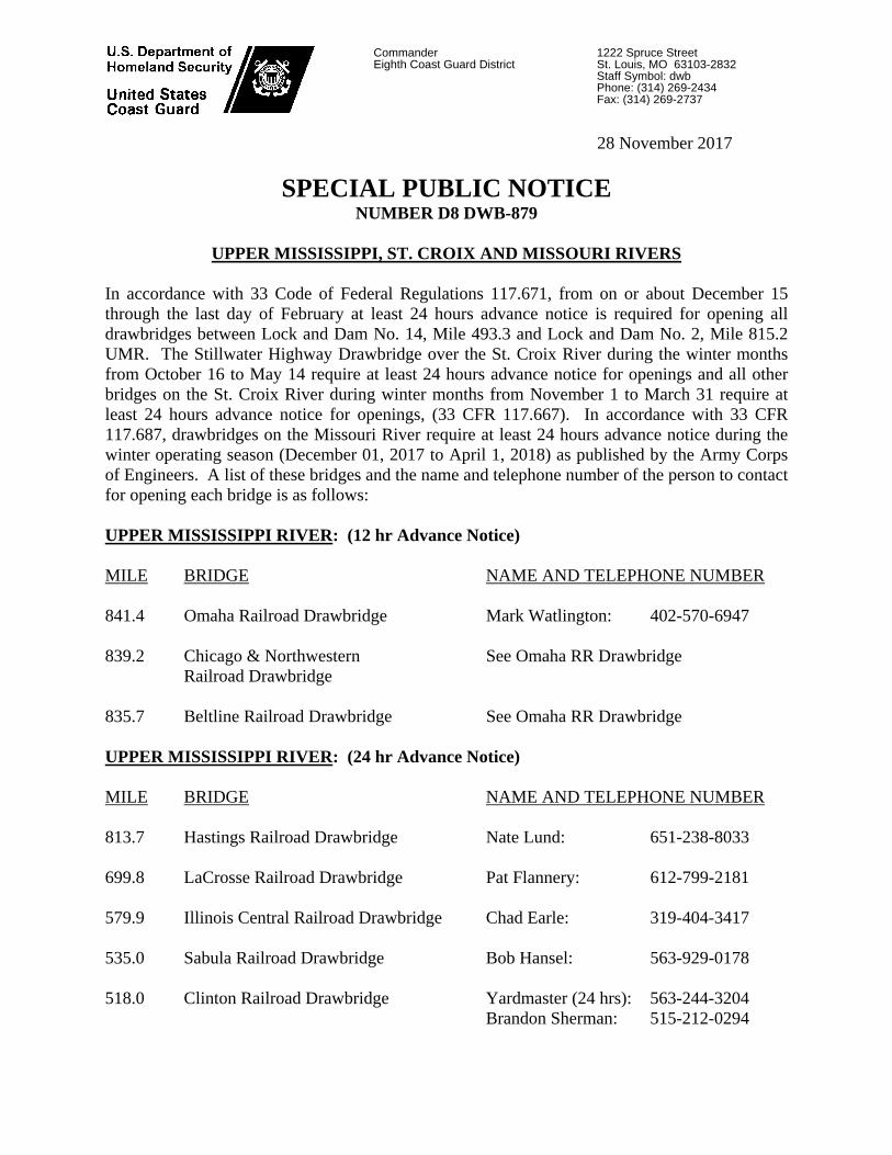
28 November 2017
SPECIAL PUBLIC NOTICE NUMBER D8 DWB-879
UPPER MISSISSIPPI, ST. CROIX AND MISSOURI RIVERS
In accordance with 33 Code of Federal Regulations 117.671, from on or about December 15 through the last day of February at least 24 hours advance notice is required for opening all drawbridges between Lock and Dam No. 14, Mile 493.3 and Lock and Dam No. 2, Mile 815.2 UMR. The Stillwater Highway Drawbridge over the St. Croix River during the winter months from October 16 to May 14 require at least 24 hours advance notice for openings and all other bridges on the St. Croix River during winter months from November 1 to March 31 require at least 24 hours advance notice for openings, (33 CFR 117.667). In accordance with 33 CFR 117.687, drawbridges on the Missouri River require at least 24 hours advance notice during the winter operating season (December 01, 2017 to April 1, 2018) as published by the Army Corps of Engineers. A list of these bridges and the name and telephone number of the person to contact for opening each bridge is as follows: UPPER MISSISSIPPI RIVER: (12 hr Advance Notice) MILE BRIDGE NAME AND TELEPHONE NUMBER 841.4 Omaha Railroad Drawbridge Mark Watlington: 402-570-6947 839.2 Chicago & Northwestern See Omaha RR Drawbridge Railroad Drawbridge 835.7 Beltline Railroad Drawbridge See Omaha RR Drawbridge UPPER MISSISSIPPI RIVER: (24 hr Advance Notice) MILE BRIDGE NAME AND TELEPHONE NUMBER 813.7 Hastings Railroad Drawbridge Nate Lund: 651-238-8033 699.8 LaCrosse Railroad Drawbridge Pat Flannery: 612-799-2181 579.9 Illinois Central Railroad Drawbridge Chad Earle: 319-404-3417 535.0 Sabula Railroad Drawbridge Bob Hansel: 563-929-0178
518.0 Clinton Railroad Drawbridge Yardmaster (24 hrs): 563-244-3204 Brandon Sherman: 515-212-0294
CommanderEighth Coast Guard District
1222 Spruce Street St. Louis, MO 63103-2832 Staff Symbol: dwb Phone: (314) 269-2434 Fax: (314) 269-2737

2
ST. CROIX RIVER: (24 hr Advance Notice) MILE BRIDGE NAME AND TELEPHONE NUMBER 23.4 Stillwater Highway Drawbridge MNDOT Dispatchers: 651-234-7110 17.3 Hudson Railroad Drawbridge Mark Watlington: 402-570-6947 0.3 Prescott Highway Drawbridge Mike Stevens: 563-580-6801 0.2 Burlington Northern Santa Fe Matt Holland: 319-371-1628 Drawbridge Yardmaster (24 hrs): 319-758-5603 MISSOURI RIVER: (24 hr Advance Notice) MILE BRIDGE NAME AND TELEPHONE NUMBER 448.2 Union Pacific Railroad Drawbridge Colin Fitzgerald: 402-616-4723 913-360-0109 422.5 Atchison Railroad Drawbridge See Union Pacific Railroad Drawbridge 366.1 Hannibal Railroad Drawbridge Destrey Gibson: 701-509-4005 365.6 A.S.B. Highway and Railroad Drawbridge See Hannibal Railroad Drawbridge 359.4 Harry S. Truman Railroad Drawbridge Primary: 816-459-9714 //s// ERIC A. WASHBURN Bridge Administrator, Western Rivers By direction of the District Commander

NAVIGATION NOTICE
ROCK ISLAND DISTRICT DATE: 11/21/2017 NOTICE NUMBER: 8200-1ATTN: CEMVR-DECLOCK TOWER BLDG. - RODMAN AVEROCK ISLAND IL 61299HTTP://WWW.MVR.USACE.ARMY.MIL/
POC: Robert V. Castro, P.E.Chief, Lock and Dam Section(309) 794-4580
LOCAL NUMBER: MR 17-8200-1WATERWAY: UPPER MISSISSIPPI
EFFECTIVE: 12/12/2017 00:00 thru 03/06/2018 00:00 CDT
________________________________________________________________________________________________________________________
WINTER LOCKAGE HOURSLock & Dam No. 11 UMR 583.0 THROUGH Lock & Dam No. 22 UMR 301.2
Locks 11, 12, 13, 15, and 17 will be staffed to lock traffic between 0800 and 1600, Monday through Friday during the period from 12 December 2017 through 6 March 2018.
Locks 14 and 16 will be closed to navigation from 12 Dec 2017 thru 6 March 2018. Refer to separate Navigation Notices for each site.
Lock 18 will be closed to navigation from 16 Dec 2017 thru 6 March 2018. Refer to separate Navigation Notice.
Locks 19, and 20 will be staffed to lock traffic between 0800 and 1600, Monday through Friday during the period from 17 December 2017 through 6 March 2018.
Locks and Dam 21 and 22 will be staffed to lock traffic 24/7 throughout the winter.
Tows requiring a lockage outside of these hours must contact the Lockmaster in advance so that lock operators can be called in to operate the lock. Winter conditions will dictate whether or not a lockage can be accomplished.
Operational Aspects
Rake to box ice couplings the entire width of the tow, at break points of the tow, will be required at all locks when ice is present at the lock.
Double tripping and use of industry helper boats during ice conditions will be required if proper couplings are not accomplished prior to arrival at the locks.
Failure to have the tow configured properly may result in loss of lock turn.
Tow configuration to ice couplings shall not be accomplished at the lock or lock approach.
//signed//
Robert V. Castro, P.E.Chief, Lock and Dam SectionMississippi River Project

POC: NAVIGATION NOTICE NO.: 8328 Regatta Director Oak Ridge Rowing Association (508) 488-0868
LOCAL NOTICE NO.: LRN 18-01
DATE: 3 JAN 2018
ATTN: CELRN-DE 110 9TH AVENUE SOUTH NASHVILLE TN 37203-3863
OAK RIDGE ROWING ASSOCIATION 2018 SCHEDULE Clinch River Mile 49-52 (Tennessee River Basin)
The Oak Ridge Rowing Association anticipates the following schedule of events for the 2018 season. This is to notify interested parties of the safety concerns with operations of power water craft in the proximity of the low profile, slow moving craft used in preparation for and during rowing events. All operators of water borne vessels are asked to exercise extreme caution when transiting this area during these events. Dates subject to change. Date Event
February 3rd Set up course
February 19th – April 30th Spring Training
March 16th -18th Cardinal Invitational
March 23rd-24th Atomic City Turn & Burn
April 13th-15th SIRA Regatta
April 27th – 29th Dogwood Junior Regatta
May 11th - 13th Big 12 Championships
May 18th – 19th Dogwood Masters
October (TBD) Secret City Head Race FOR THE DISTRICT ENGINEER:
/////original signed/////
JOHN D. TRIBBLE, JR Chief, Navigation Section JKS Technical Support Branch
NOTICE TO NAVIGATION INTERESTS EFFECTIVE: 1 February – 31 October 2018

POC: NAVIGATION NOTICE NO.: 8431 Tracy Barrett, Intec Group LLC 859-576-9961 Wade Johnson, Intec Group LLC 502-648-5353 Danny Darnell, Choctaw Trans Co. 731-445-6912
LOCAL NOTICE NO.: LRN 18-07
DATE: 7 FEB 2018
ATTN: CELRN-DE 110 9TH AVENUE SOUTH NASHVILLE TN 37203-3863
CONTRUCTION UPDATE KENTUCKY LOCK ADDITION
TENNESSEE RIVER MILE 22.1 Approximately 12 February, 2018, crews will begin constructing a rock dike in order to minimize large eddy formations in the navigation channel just downstream of the Powerhouse Island. Minimizing the eddy will facilitate safer approaches and departures by tows using Kentucky Lock during the ongoing construction of the Downstream Cofferdam and upon completion of the new lock. Crews responsible for the dike construction are expected to be on site for approximately three weeks. See attached site map. All barges involved in this dike’s construction will be moored at the Kentucky Lock and Dam Boat Basin, or left on site within the construction limits and staffed by “Tug Boat” personnel when not being actively used and during non-working hours. No nighttime construction is anticipated. All barges or tows will have white steady burn lights. FOR THE DISTRICT ENGINEER:
John D. Tribble, Jr.
Chief, Navigation Section Technical Services Branch JKS
NOTICE TO NAVIGATION INTERESTS EFFECTIVE: 12 February – 2 March, 2018


SUPERSEDES NOTICE TO NAVIGATION INTERESTS LRN 17-65 (8279)
POC: NAVIGATION NOTICE NO.: 8467 Lockmasters Office Chickamauga Lock and Dam (423) 875-6230
LOCAL NOTICE NO.: LRN 18-10
DATE: 22 FEB 2018
ATTN: CELRN-DE 110 9TH AVENUE SOUTH NASHVILLE TN 37203-3863
INTERMITTENT CLOSURES CHICKAMAUGA LOCK TENNESSEE RIVER MILE 471.0
The Nashville District U.S. Army Corps of Engineers and the Tennessee Valley Authority have schedule a series of intermittent closures at Chickamauga Lock, Tennessee River Mile 471.0, in order to replace the upstream miter gate anchorages. The majority of this work will be accomplished utilizing intermittent, daytime closures with crews working 10 ½ hour shifts, however there are two instances where a complete closure is necessary. The work is scheduled as follows: (All times are Eastern Time Zone) 6 February – 10 March 2018: Daytime intermittent closures daily 0700 to 1730 (lockage will occur starting at 1800 and continue through 0630 the following morning) 10-15 March 2018: Complete closure (no traffic from 0700 on the 10th to 2400 on the 15th.) 16 – 22 March 2018: Beginning at 0700 fully operational with no restrictions 23-28 March 2018: Complete closure (no traffic 0700 on the 23rd to 2400 on the 28th.) 29 March – 19 April, 2018: Daytime intermittent closures daily 0700 to 1730 (lockage will occur starting at 1800 and continue through 0630 the following morning) This work will be actively tracked and updates to this schedule will be distributed as needed. FOR THE DISTRICT ENGINEER: ////original signed//// John D Tribble, Jr. Chief, Navigation Section JKS Technical Support Branch
NOTICE TO NAVIGATION INTERESTS EFFECTIVE: 6 February – 19 April, 2018