distance elearning courses eduserv 01... · distance elearning courses eduserv thank you ... •...
TRANSCRIPT
European Spatial Data Research – www.eurosdr.net1
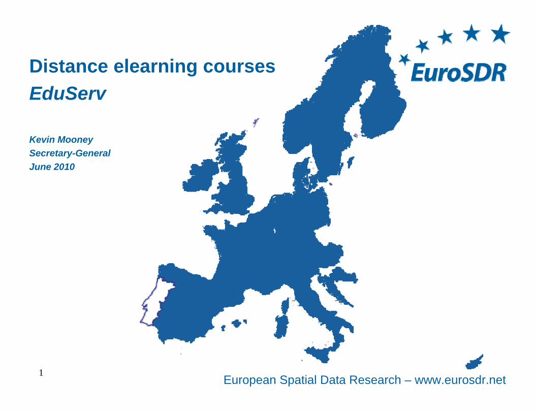
Distance elearning coursesEduServ
Kevin MooneySecretary-GeneralJune 2010
European Spatial Data Research – www.eurosdr.net
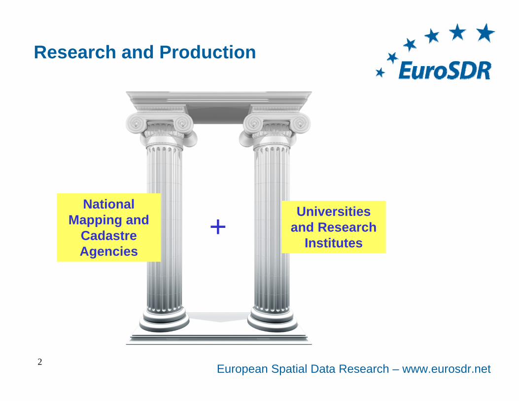
Research and Production
2
National Mapping and
Cadastre Agencies
Universities and Research
Institutes+
European Spatial Data Research – www.eurosdr.net3
ProductionResearchTwo Delegates from Each
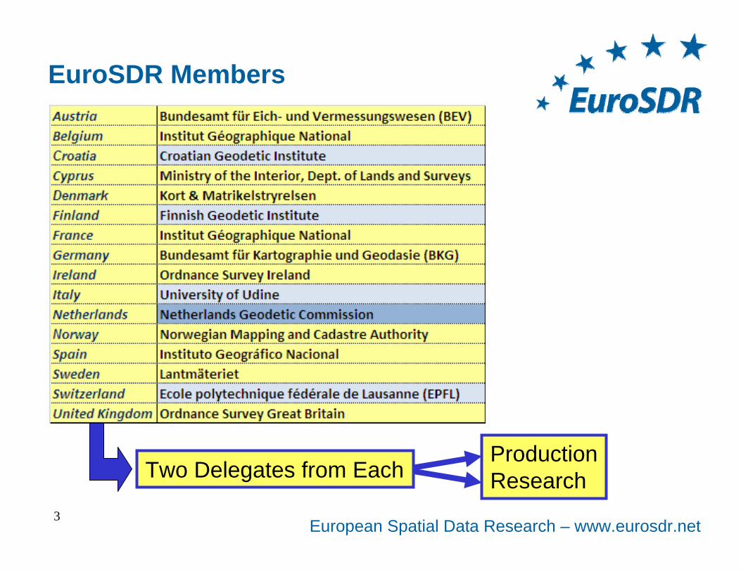
EuroSDR Members
European Spatial Data Research – www.eurosdr.net
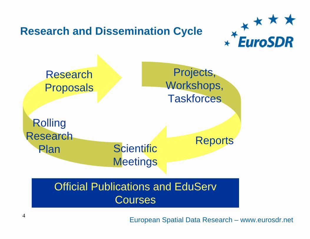
Research and Dissemination Cycle
4
Scientific Meetings
Rolling Research
Plan
Research Proposals
Projects, Workshops, Taskforces
Reports
Mapping Agencies together with Research Institutes
Official Publications and EduServ Courses
European Spatial Data Research – www.eurosdr.net
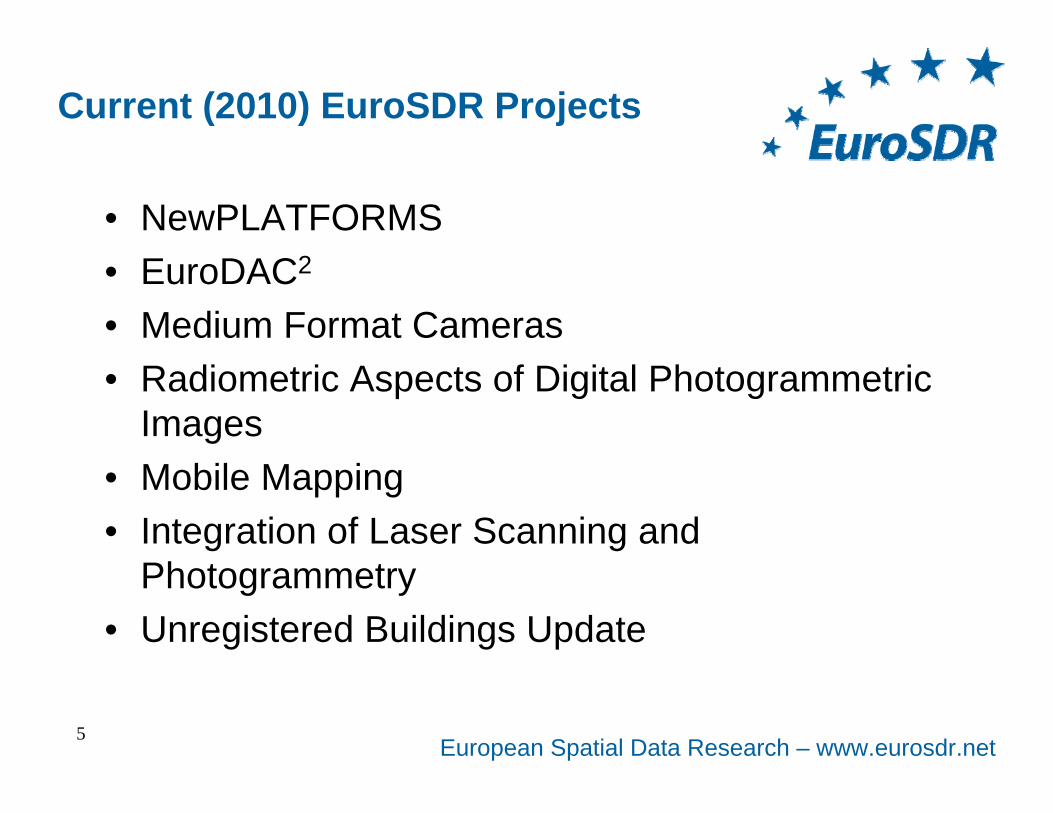
Current (2010) EuroSDR Projects
• NewPLATFORMS• EuroDAC2
• Medium Format Cameras• Radiometric Aspects of Digital Photogrammetric
Images• Mobile Mapping• Integration of Laser Scanning and
Photogrammetry• Unregistered Buildings Update
5
European Spatial Data Research – www.eurosdr.net
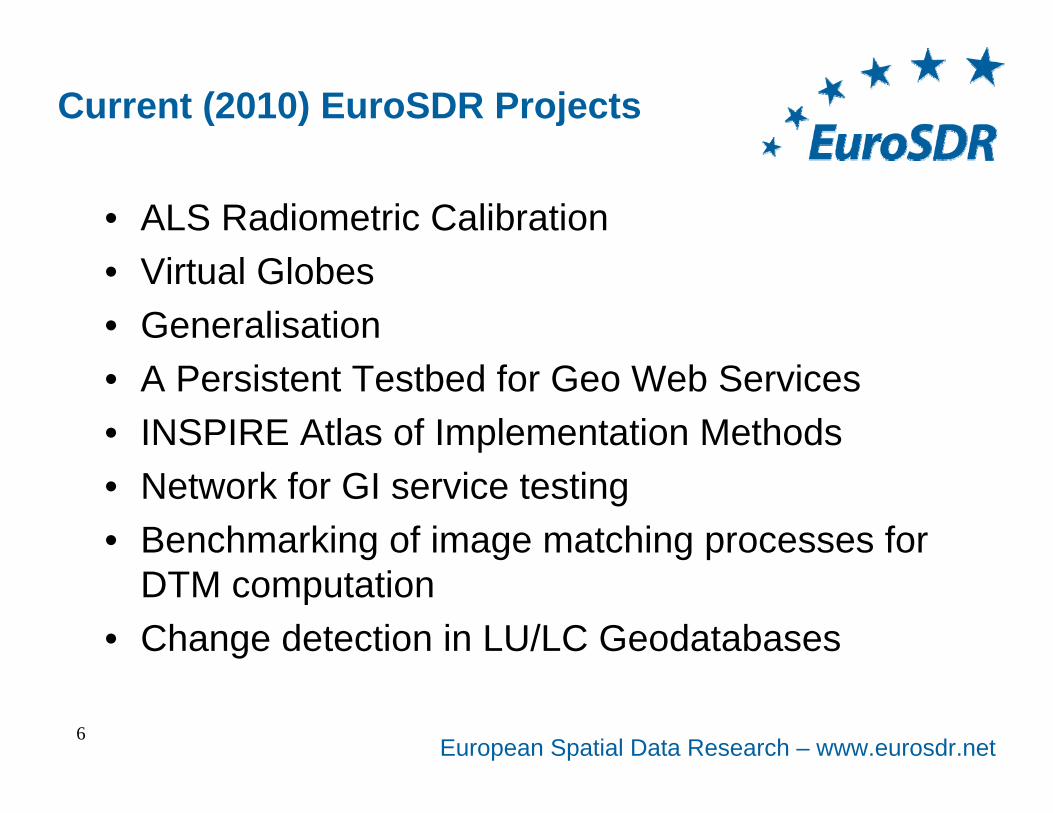
Current (2010) EuroSDR Projects
• ALS Radiometric Calibration• Virtual Globes• Generalisation• A Persistent Testbed for Geo Web Services• INSPIRE Atlas of Implementation Methods• Network for GI service testing• Benchmarking of image matching processes for
DTM computation• Change detection in LU/LC Geodatabases
6
European Spatial Data Research – www.eurosdr.net
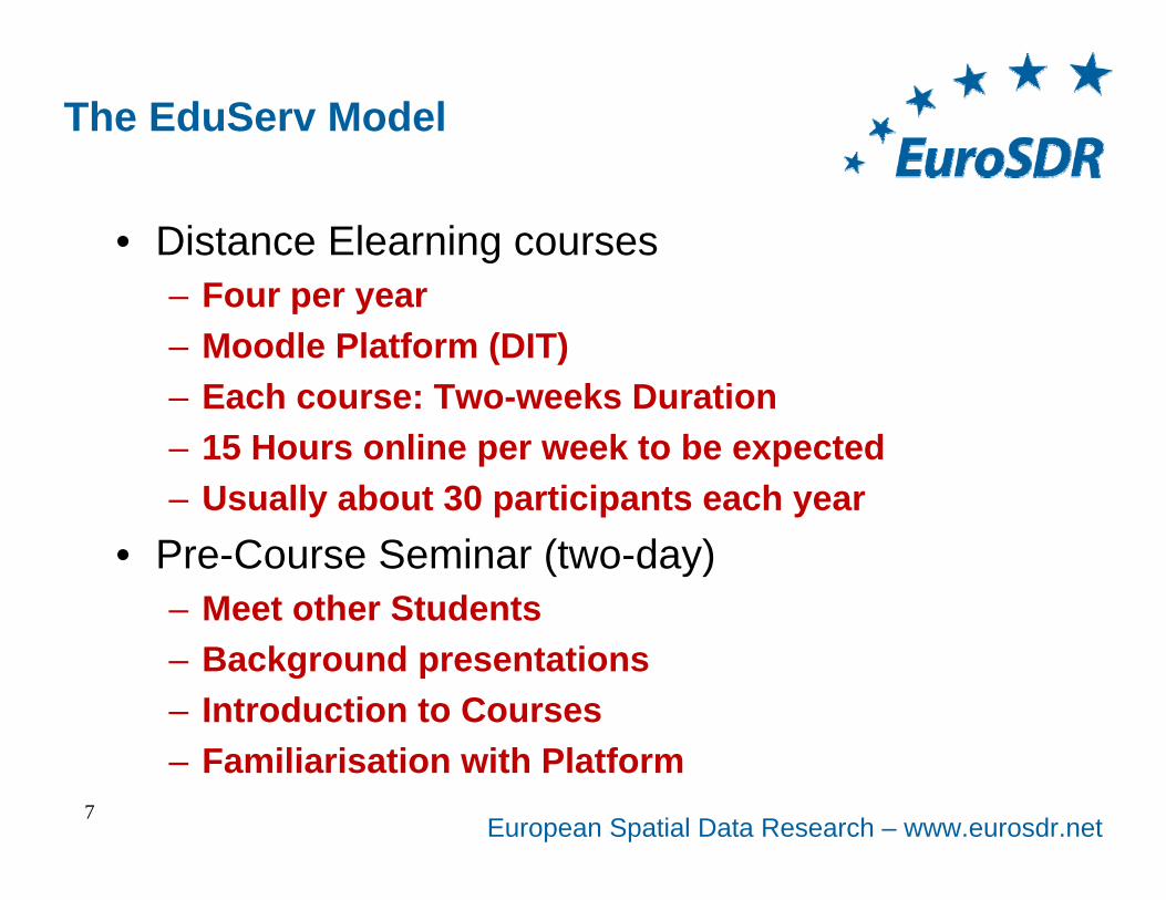
The EduServ Model
• Distance Elearning courses– Four per year– Moodle Platform (DIT)– Each course: Two-weeks Duration– 15 Hours online per week to be expected– Usually about 30 participants each year
• Pre-Course Seminar (two-day)– Meet other Students– Background presentations– Introduction to Courses– Familiarisation with Platform
7
European Spatial Data Research – www.eurosdr.net8
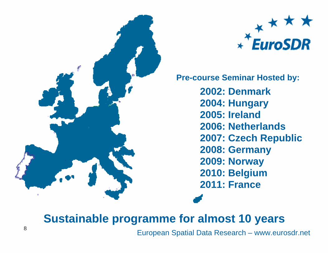
Pre-course Seminar Hosted by:
2002: Denmark2004: Hungary2005: Ireland2006: Netherlands2007: Czech Republic2008: Germany2009: Norway2010: Belgium2011: France
Sustainable programme for almost 10 years
European Spatial Data Research – www.eurosdr.net
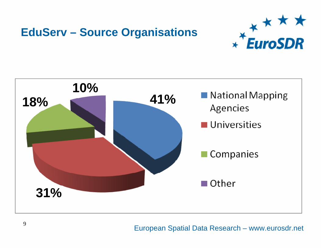
EduServ – Source Organisations
9
41%
31%
18%10%
European Spatial Data Research – www.eurosdr.net
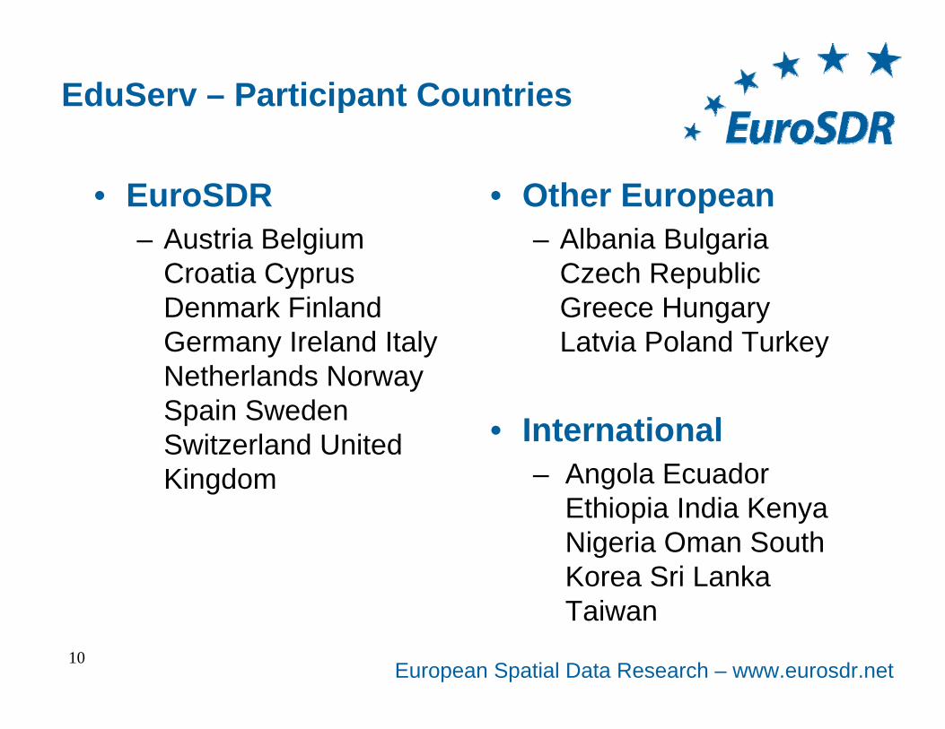
EduServ – Participant Countries
• EuroSDR– Austria Belgium
Croatia Cyprus Denmark Finland Germany Ireland Italy Netherlands Norway Spain Sweden Switzerland United Kingdom
• Other European– Albania Bulgaria
Czech Republic Greece Hungary Latvia Poland Turkey
10
• International– Angola Ecuador
Ethiopia India Kenya Nigeria Oman South Korea Sri Lanka Taiwan
European Spatial Data Research – www.eurosdr.net
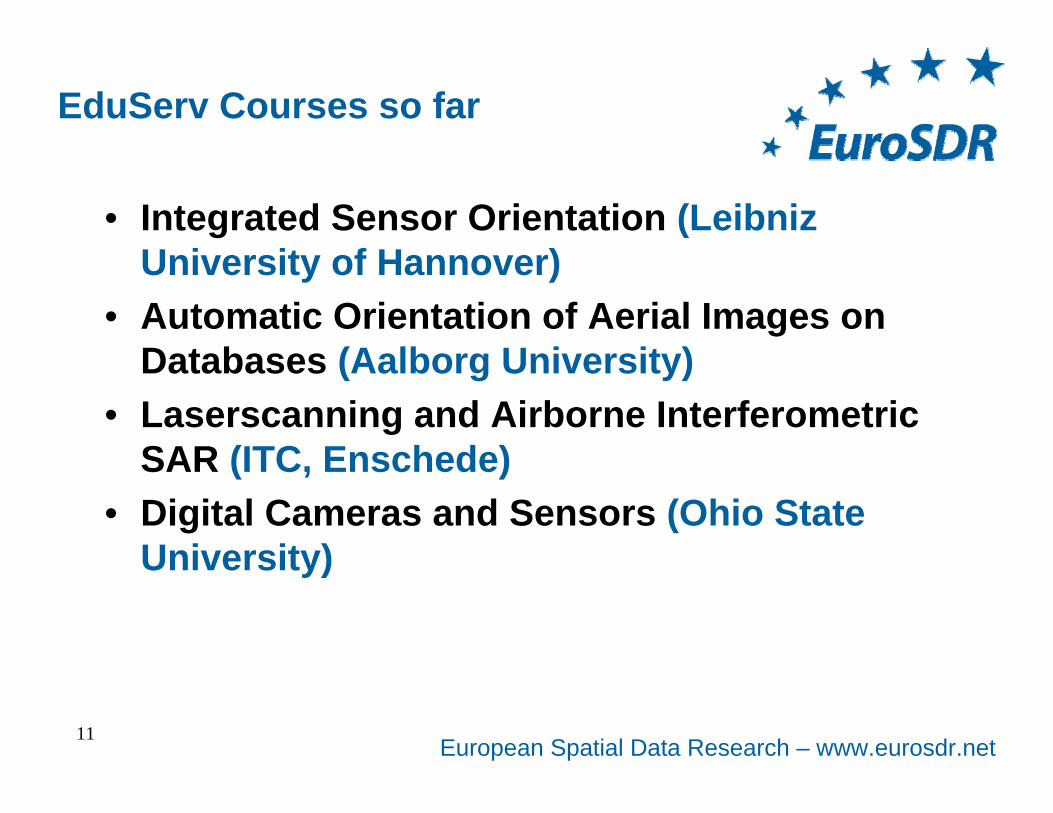
EduServ Courses so far
• Integrated Sensor Orientation (Leibniz University of Hannover)
• Automatic Orientation of Aerial Images on Databases (Aalborg University)
• Laserscanning and Airborne Interferometric SAR (ITC, Enschede)
• Digital Cameras and Sensors (Ohio State University)
11
European Spatial Data Research – www.eurosdr.net
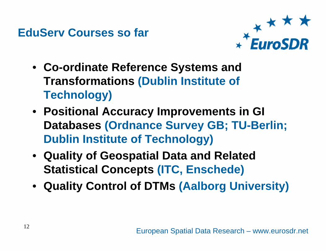
EduServ Courses so far
• Co-ordinate Reference Systems and Transformations (Dublin Institute of Technology)
• Positional Accuracy Improvements in GI Databases (Ordnance Survey GB; TU-Berlin; Dublin Institute of Technology)
• Quality of Geospatial Data and Related Statistical Concepts (ITC, Enschede)
• Quality Control of DTMs (Aalborg University)
12
European Spatial Data Research – www.eurosdr.net
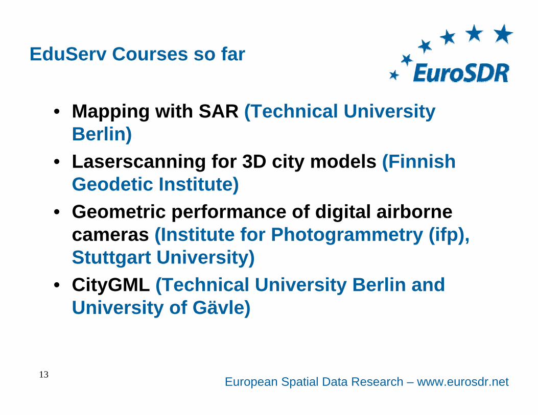
EduServ Courses so far
• Mapping with SAR (Technical University Berlin)
• Laserscanning for 3D city models (Finnish Geodetic Institute)
• Geometric performance of digital airborne cameras (Institute for Photogrammetry (ifp), Stuttgart University)
• CityGML (Technical University Berlin and University of Gävle)
13
European Spatial Data Research – www.eurosdr.net
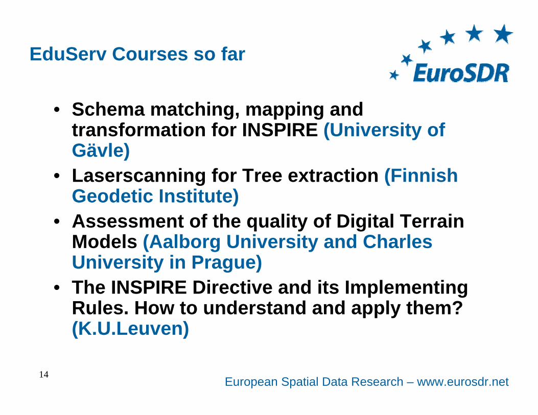
EduServ Courses so far
• Schema matching, mapping and transformation for INSPIRE (University of Gävle)
• Laserscanning for Tree extraction (Finnish Geodetic Institute)
• Assessment of the quality of Digital Terrain Models (Aalborg University and Charles University in Prague)
• The INSPIRE Directive and its Implementing Rules. How to understand and apply them? (K.U.Leuven)
14
European Spatial Data Research – www.eurosdr.net
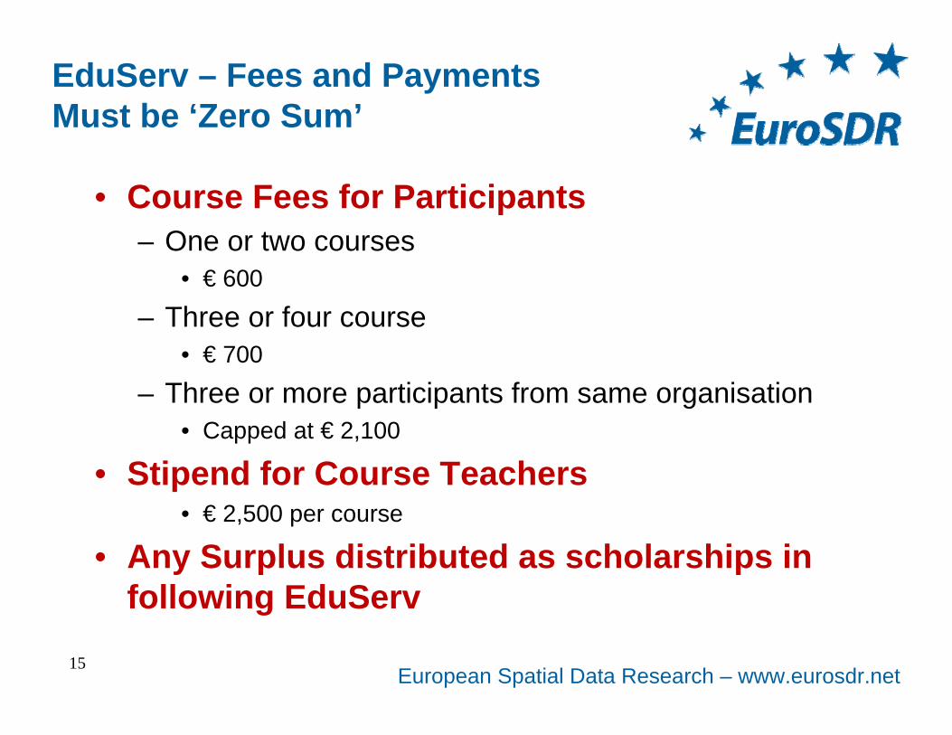
EduServ – Fees and PaymentsMust be ‘Zero Sum’
• Course Fees for Participants– One or two courses
• € 600
– Three or four course• € 700
– Three or more participants from same organisation• Capped at € 2,100
• Stipend for Course Teachers• € 2,500 per course
• Any Surplus distributed as scholarships in following EduServ
15
European Spatial Data Research – www.eurosdr.net
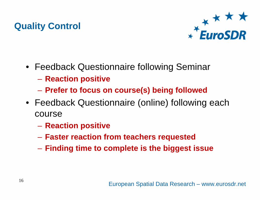
Quality Control
• Feedback Questionnaire following Seminar– Reaction positive– Prefer to focus on course(s) being followed
• Feedback Questionnaire (online) following each course– Reaction positive– Faster reaction from teachers requested– Finding time to complete is the biggest issue
16
European Spatial Data Research – www.eurosdr.net
EuroSDR Education Service
• Inter Commission WG on Education Services concentrates solely on EduServ courses– Capacity building not addressed; Outreach not
addressed– Possible scope for collaboration with related
organisations• Conflict of roles versus Universities not
significant– Many mapping agencies do not have access to local
CPD
17
European Spatial Data Research – www.eurosdr.net
EuroSDR Education Service
• Courses are not validated for external credits such as ECTS– Continuing Professional Development (CPD)
• EduServ is not good at marketing itself and so can be vulnerable– Potential participants don’t know courses exist
• Attendance at pre-course seminar is recommended– Buddy system available
18
European Spatial Data Research – www.eurosdr.net
EuroSDR Education Service
• Course participation is difficult to fit to production pressure cycles– Drop out not significant but is a factor
• Life after EduServ courses is being addressed– Archiving of courses for future (limited?) access
• EduServ courses aim to– transfer results of EuroSDR research activities to
production• EduServ works because
– EuroSDR’s mapping agencies and education institutes both support it.19
European Spatial Data Research – www.eurosdr.net
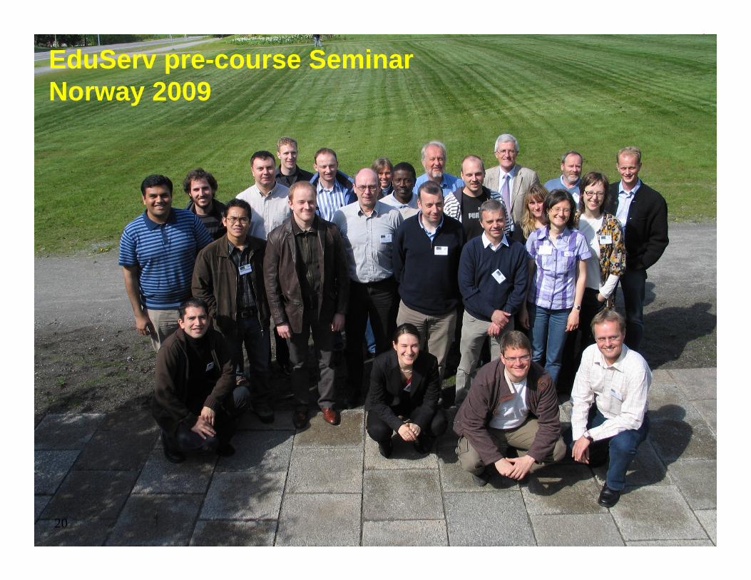
EduServ pre-course SeminarNorway 2009
20
European Spatial Data Research – www.eurosdr.net21
Distance elearning coursesEduServ
Thank youfor your attention
European Spatial Data Research – www.eurosdr.net
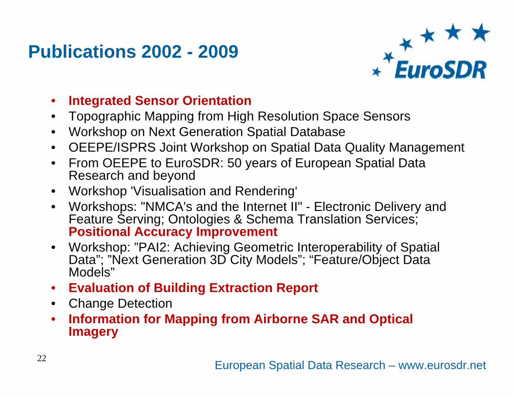
Publications 2002 - 2009
• Integrated Sensor Orientation• Topographic Mapping from High Resolution Space Sensors• Workshop on Next Generation Spatial Database• OEEPE/ISPRS Joint Workshop on Spatial Data Quality Management• From OEEPE to EuroSDR: 50 years of European Spatial Data
Research and beyond• Workshop 'Visualisation and Rendering‘• Workshops: "NMCA's and the Internet II" - Electronic Delivery and
Feature Serving; Ontologies & Schema Translation Services; Positional Accuracy Improvement
• Workshop: ”PAI2: Achieving Geometric Interoperability of Spatial Data”; ”Next Generation 3D City Models”; “Feature/Object Data Models”
• Evaluation of Building Extraction Report• Change Detection• Information for Mapping from Airborne SAR and Optical
Imagery
22
European Spatial Data Research – www.eurosdr.net
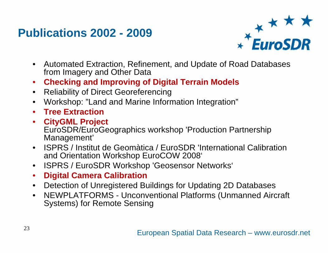
Publications 2002 - 2009
• Automated Extraction, Refinement, and Update of Road Databases from Imagery and Other Data
• Checking and Improving of Digital Terrain Models• Reliability of Direct Georeferencing• Workshop: ”Land and Marine Information Integration”• Tree Extraction• CityGML Project
EuroSDR/EuroGeographics workshop 'Production Partnership Management’
• ISPRS / Institut de Geomàtica / EuroSDR 'International Calibration and Orientation Workshop EuroCOW 2008‘
• ISPRS / EuroSDR Workshop 'Geosensor Networks‘• Digital Camera Calibration• Detection of Unregistered Buildings for Updating 2D Databases• NEWPLATFORMS - Unconventional Platforms (Unmanned Aircraft
Systems) for Remote Sensing
23