disaster risk reduction project noah...
TRANSCRIPT

Disaster Risk Reduction
Project NOAH Solution


Superimposed tracks of typhoons that entered PAR from 1951-2013

Natural disaster?
NATURAL
DISASTERS?


There is no such thing as natural disasters.

DISASTER PREVENTION, MITIGATION, andPREPAREDNESS

DOST – PROJECT NOAHJULY 12, 2012
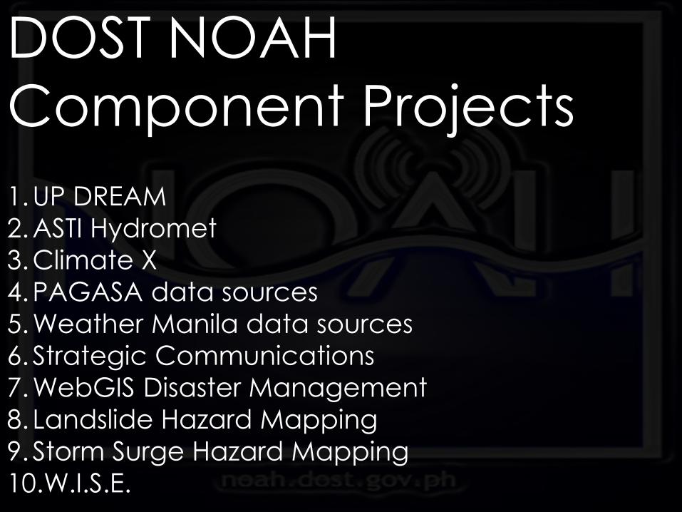
DOST NOAH
Component Projects
1.UP DREAM
2.ASTI Hydromet
3.Climate X
4.PAGASA data sources
5.Weather Manila data sources
6.Strategic Communications
7.WebGIS Disaster Management
8. Landslide Hazard Mapping
9.Storm Surge Hazard Mapping
10.W.I.S.E.

UP DREAM
LIDAR
HIGH RESOLUTION
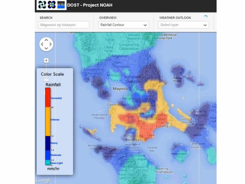
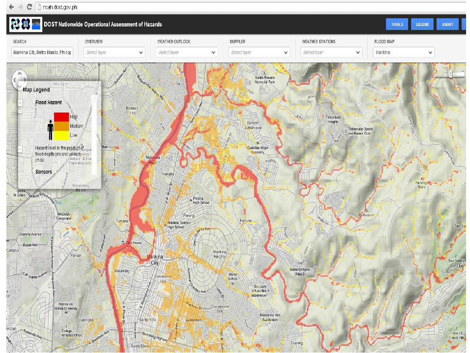
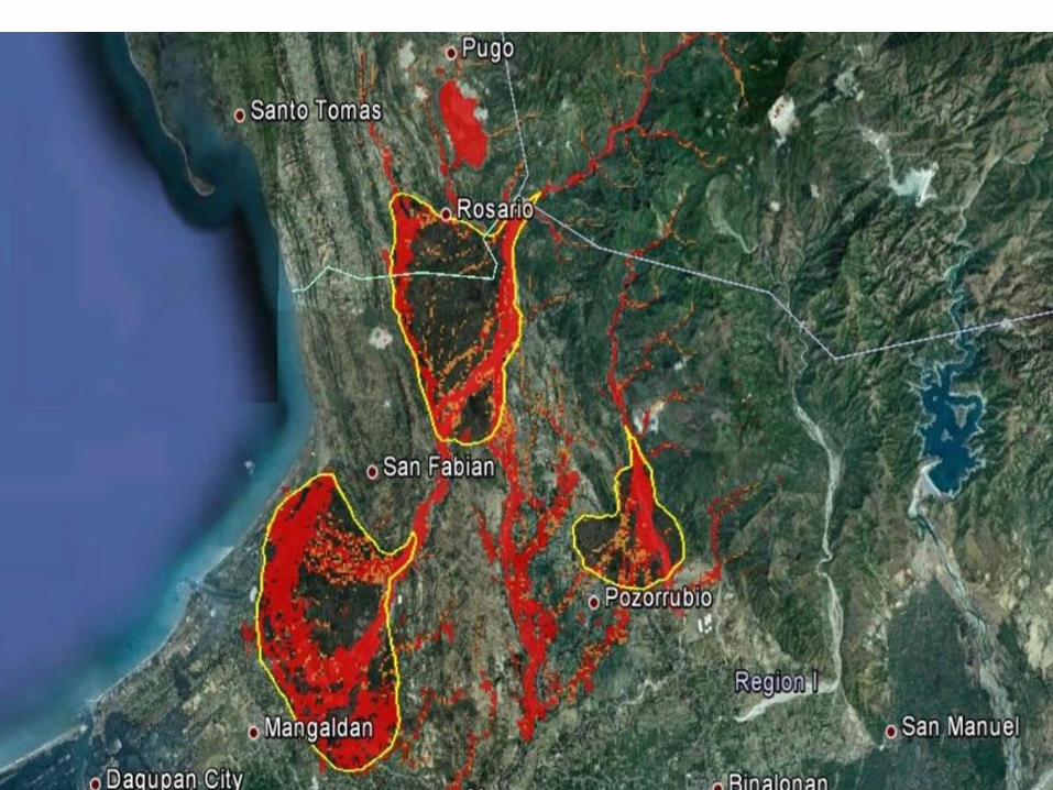
FLOOD HAZARD MAPS

FLOOD
HAZARD
MAPS
HIGH RESOLUTION
FLOOD HAZARD MAPS

LANDSLIDE
HAZARD
MAPPING

24Department of Science and Technology
STORM SURGE
HAZARD
MAPPING

ADVANCED
SCIENCE AND
TECHNOLOGY
INSTITUTE
HYDROMETEOROLGICAL
SENSORS

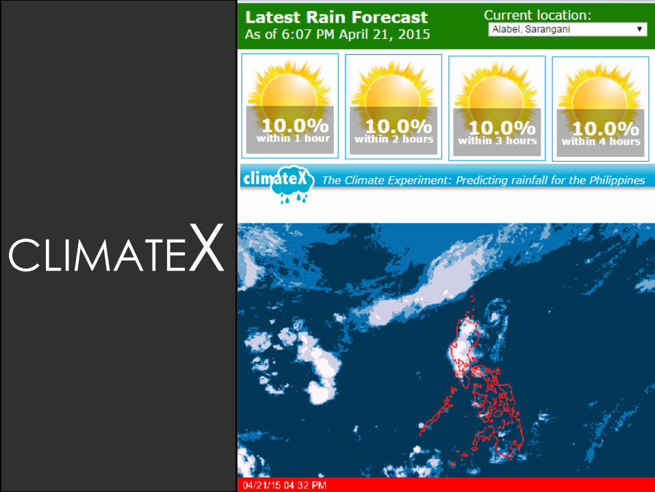
CLIMATEX

www.noah.dost.gov.ph


9
Devices designed and assembled by ASTI-DOST
Automated Weather Station (AWS)
Measures- Wind Speed- Wind direction- Air Temperature- Air humidity- Air pressure- Rain amount, duration & intensity Automated
Rain Gauge (ARG)
Measures amount of rainfall over a period of time
9
Devices designed and assembled by ASTI-DOST
Automated Weather Station (AWS)
Measures- Wind Speed- Wind direction- Air Temperature- Air humidity- Air pressure- Rain amount, duration & intensity Automated
Rain Gauge (ARG)
Measures amount of rainfall over a period of time
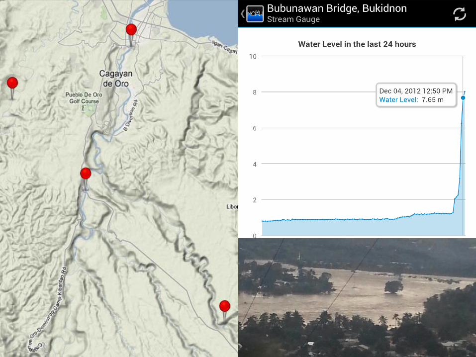
Teknolohiyang Gamit ngProject NOAH
Doppler Radar
Stream Gauge


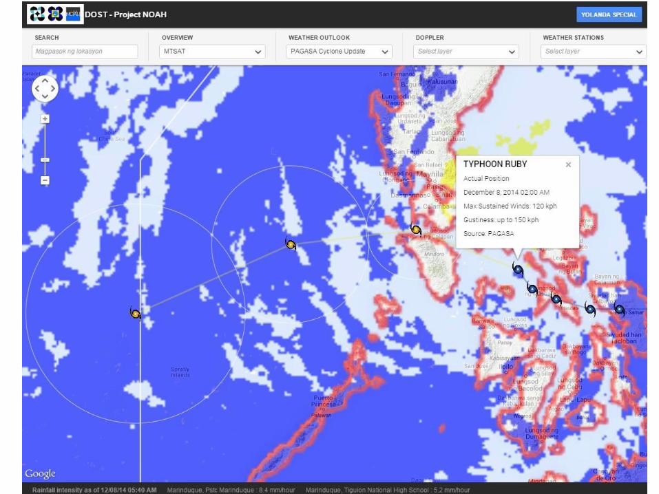
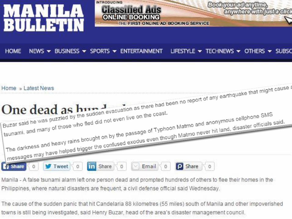
Explain Haiyan exampleSHOW PINOY VIDEO WARNING

Explain Haiyan exampleSHOW PINOY VIDEO WARNING
Be alert to the threat of storm surges… which
can reach 5-6 meters in height in many places
“
”

Show disaster information flow
Image source: NDRRMC Presentation


COMMUNICATE THE
RISK EFFECTIVELY

DISASTER AWARENESS
PROGRAMS
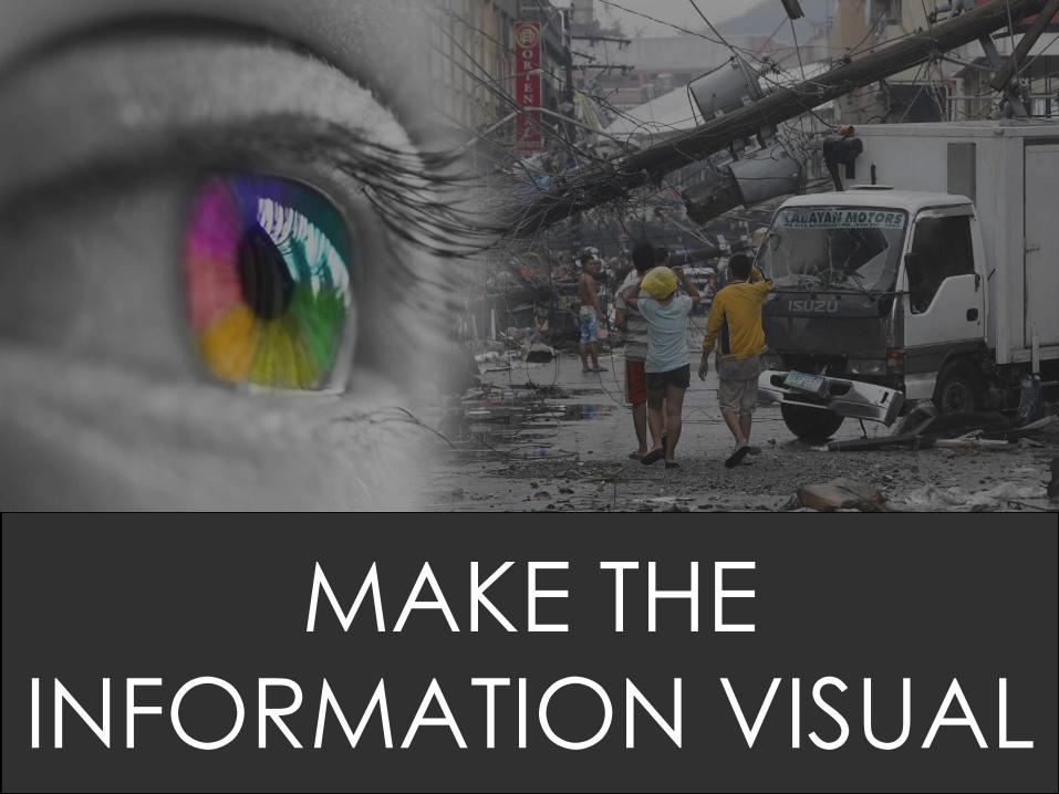
MAKE THE
INFORMATION VISUAL

DEBRIS FLOW

New Bataan, Compostela Valley


1.5 m
7.5-9 m


BRIDGING THE GAP

SOCIAL MEDIA

LOCALIZETHE INFO

LOCALIZETHE INFO
31
28
MAJOR
LANGUAGES
MAJOR
ETHNIC
GROUPS
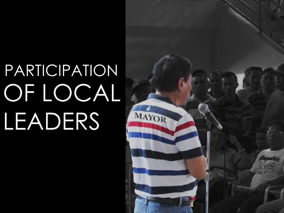
OF LOCAL
LEADERS
PARTICIPATION


COMMUNICATE THE RISK EFFECTIVELY
• DISASTER AWARENESS PROGRAMS
• VISUAL INFORMATION
• BRIDGING THE GAP BETWEEN MEDIA AND SCIENCE
• LOCALIZE THE INFORMATION AND THE IMPORTANCE OF LOCAL LEADERS
• USE AMBASSADORS TO GET YOUR MESSAGE ACROSS

Sources for images:
rjthefiredog.comfacebook.com/dostprojectnoahRodrigo DuterteWikipediaMatanglawinInquirer.netPRCRappler.comAbscbn.comPep.phNdrrmc.gov.phanc.comImgflip.comgmanews.comTwitter.com/nababahaTwitter.com/annecurtis

Oscar Lizardo
@ovlizardo
THANK YOU!
Tamang impormasyon sa tamang panahon!Maraming Salamat!
