disaster preparedness and prevention center … · the public work research institute (pwri), which...
TRANSCRIPT

DISASTER PREPAREDNESS AND PREVENTION CENTER (DPPC)MALAYSIA-JAPAN INTERNATIONAL INSTITUTE OF TECHNOLOGY (MJIIT)
UNIVERSITI TEKNOLOGI MALAYSIA (UTM) KUALA LUMPUR
“Facilitating Disaster Risk Reduction through Education, Research and Field Practice in Asia”
Education / Training

Published by:Disaster Preparedness and Prevention Centre (DPPC),Malaysia - Japan International Institute of Technology (MJIIT),UTM Kuala Lumpur,Jalan Sultan Yahya Petra (Jalan Semarak),54100 Kuala Lumpur,Malaysia.Tel : (6)03 - 22031585Email : [email protected]
ISBN 978-967-15384-8-7
Printed in Malaysia
First Print 2018
Perpustakaan Negara Malaysia
Japan Attachment Program 2017: Master of Disaster Risk Management (MDRM)
Copyright © Disaster Preparedness and Prevention Centre (DPPC),Malaysia - Japan International Institute of Technology (MJIIT) of UTM, Kuala Lumpur.All rights reserved.No parts of this publication may be reproduced, stored in retrieval system, or transmitted in any form or by any means, electronic, mechanical, photocopying, recording, or otherwise, without the written permission of the publisher.

CONTENTSParticipants of Japan Attachments 2017 1Foreword 2Schedule 3Objectives 5Kanto Program 7Kansai Program 23Next Steps 47Concluding Remarks 50

July - August 2017 1
Rashdan Rahmat Mohd. Zubir Mohd. Juzad Ghazali Abd. Rahman Abdul Karim Mustafa Mohd. Fadly Mohd. Fauzi Prof. Dr. Aminaton Marto Dr. Siti Uzairiah Mohd. Tobi Dr. Samira Albati Kamarudin Dr. Sumiaty AmbranDato.’ Zakaria Mohamad Che Siti Noor Koh Poh Lee
Zaimi Samat
Alias Azizan
Mazwina Meor Hamid
Prof. Dr. Masafumi Goto
MDRM studentMDRM studentMDRM studentMDRM studentMDRM studentMDRM lecturerMDRM lecturerMDRM lecturerMDRM task force memberMDRM technical advisorNational Disaster Management Agency (NaDMA)Fire & Rescue Department Malaysia (BOMBA)Civil Defense Force Malaysia (APM)Drainage & Irrigation Department Malaysia (DID)DPPC Director
Dr. Khamarrul Azahari RazakProf. Dr. Kuniaki MiyamotoProf. Dr. Jun AsanumaAssoc. Prof. Dr. Naoko KaidaMs. Yoko YamashitaProf. Dr. Kaoru TakaraProf. Dr. Norio Maki Ms. Sono InoueMs. Miwa Kurabayashi Dr. Shohei Matsuura
PARTICIPANTS
ORGANIZING TEAMMDRM Program CoordinatorTsukuba UniversityTsukuba UniversityTsukuba UniversityTsukuba UniversityKyoto UniversityKyoto UniversityKyoto UniversityJICA Tsukuba CenterJICA Expert, DPPC/MJIIT
Participants of Japan Attachment 2017

2
Khamarrul Azahari Razak, PhDMDRM Program Coordinator
FOREWORD
Foreword
The Japan Attachment, organized by the Disaster Preparedness and Prevention Center (DPPC) of the Malaysia-Japan International Institute of Technology (MJIIT), is a 2-week intensive field visit, implemented as a part of Master of Disaster Risk Management (MDRM) program in which full-time students are given the opportunity to gain hands-on field experience on what they have learned in-class during the course and to see how Disaster Risk Reduction and Management (DRRM) are conducted in Japan.
The Japan Attachment provides an opportunity for the students to acquire field experiences in Japan on issues learned in the MDRM program. Because all MDRM students are experienced disaster
managers, the contents of the Japan Attachment were designed to be practical and hands-on. The program also aimed to provide new knowledge and approaches that are difficult to gain in their everyday work. This year, MDRM students were also joined by DPPC researchers and strategic partners from DRM agencies in Malaysia.
As the MDRM Program Coordinator, I would like to sincerely thank all partners who had kindly helped in supporting the Japan Attachment 2017: the Japan International Cooperation Agency (JICA) for financial and logistical assistance, Tsukuba University for providing technical and on-site logistic support for the East Japan (Kanto) Program, Kyoto University for hosting the joint seminars and supporting the West Japan (Kansai) Program and many other organizations that received the MDRM students and shared their invaluable experiences and knowledge for building resilience to natural disasters.
This knowledge note is our humble attempt to recapture and record what we have learned from the Japan Attachment 2017.

3
SCHEDULE WEEK 1 – KANTO PROGRAM
Schedule
Date23/07/17 Sunday Arrival in Japan
Activity Place
24/07/17 Monday
Program orientation by JICA JICA TsukubaMinistry of Land, Infrastructure, Transport &
Tourism (MLIT), Kanto Regional Office, Nikko Sabo Dam Management Office
Tuesday
Visit & lecture
25/07/17
International Centre for Water Hazard and Risk Management (ICHARM), Public Work
Research Institute (PWRI)Visit & discussion
Center for Computational Sciences, Tsukuba UniversityVisit & lecture
Welcome reception University of Tsukuba
Wednesday26/07/17
RyuQ-Kan: Tokyo Metropolitan Area Outer Underground Discharge ChannelVisit
Japan Aerospace Exploration Agency (JAXA)Visit
Remote Sensing Technology Center of Japan (RESTEC)Lecture
Thursday27/07/17
National Research Institute for EarthScience and Disaster Prevention (NIED)Visit & lecture
Shimodate River Management Office, MLITLectureWatarase Detention Pond and Kokai River
Flood Recovery Project / MoshijimaRetarding Pond
Field visit & lecture
Friday28/07/17
Visit to sites of 2015 flood (Joso City)Field visit
Joso City DRM DivisionLecture
JICA TsukubaReview of Kanto Program29/07/17 Saturday Move to Kyoto30/07/17 Sunday Preparations for reporting

4
SCHEDULE WEEK 2 – KANSAI PROGRAM
Schedule
Date
31/07/17 Monday
Briefing on Kansai Program and Introduction to DPRI
Activity Place
MJIIT - Kyoto University Joint Seminar I
Disaster Prevention Research Institute (DPRI)
Tuesday
Visit & lecture
01/08/17
Graduate School of Advanced Integrated Studies in Human Survivability (GSAIS)
Briefing on GSAIS
Lake Biwa Canal MuseumVisit & lectureVisit Nanzen-ji Water Canal System
Wednesday02/08/17
Kyoto City Fire DepartmentVisit & lecture
Ritsumeikan UniversityLecture on Cultural Heritage Protection Program
Institute of Disaster Mitigation for Urban Cultural Heritage, Ritsumeikan UniversityLecture on R-DMUCH
Thursday03/08/17
Move to OsakaIntegrated Flood Management in Neya
River Basin, Osaka Prefecture RiverManagement Office
Visit & lecture
Yodogawa River Management Office, Kinki Regional Office, MLITLecture
Friday04/08/17
Hyogo Prefecture (DM Division)LectureHyogo Emergency Medical Center (DMAT)Visit & lectureDisaster Reduction and Human Renovation
Institution (DRI)Visit & lecture
Reporting of program outcome
05/08/17 Saturday Depart Japan
Ujigawa Open Laboratory
MJIIT - Kyoto University Joint Seminar II
Yodogawa Dam Management Office, MLITField visit
JICA Kansai

5
Course Objective:For participants to be able to apply the field experiences in Japan on issues learned in the Master of Disaster Risk Management (MDRM) Program for their respective work in Malaysia.
Module Objectives: To understand policies and measures of comprehensive disaster risk management (DRM) in Japan To understand integrated flood management in Japan through lectures and field visits To be able to discuss on future possibilities of joint research by understanding examples of DRM research in Japan To understand DRM practices in Japan and consider application in Malaysia where possible
OBJECTIVES OF JAPAN ATTACHMENT
Objectives


7
NIKKO SABO MANAGEMENT OFFICE
Kanto Regional Development Bureau, Ministry of Land, Infrastructure, Transport and Tourism (MLIT) Date : 24 July 2017Time : 15:00 - 17:00
Background of the visit:Nikko is located at the foot of mountain area in Tochigi Prefecture, Kanto Region. The visited area has been historically prone to sediment-related disasters mainly due to earthquake-triggered landslides, which continue to erode and collapse into Inari River (tributary of Daiya River) catchment area. After series of major disasters recorded since 1662, Sabo work was transferred to the jurisdiction of the central government (Interior Ministry) in 1918 that led to the establishment of Daiichi Engineering Branch Office and Inari River Plant – the current Nikko Sabo Management Office. In July 1919, Inari River No.1 Check Dam was completed in the traditional Nikko masonry style. Unfortunately, because the dam was washed away by debris flow immediately after completion, it caused a major shift in check dam building methods from stone to concrete. After that, more check dams were built along the Inari River to mitigate the debris flow, to trap the sediment at the upstream points and preventing it from eroding and flowing downstream. It also designed to catch boulders and to slow down the velocity of water flow. Nearly after 100 years, this structure proves it function as the effective approach to mitigate the sediment-related disasters.
The Nikko area is surrounded by beautiful mountain rages reaching up to 2,000m and owns several World Heritage Sites and important cultural assets as well as hot springs attracting many tourists to visit the area throughout the year.
Lecture and discussion points:Landslides often produce sediment that is deposited on the riverbed. Due to increased river flow caused by heavy rainfall, the mud may flow into the river and cause flooding in the lower stream. Sabo weirs are often used to prevent the damage caused by sediment run-off and built at the upper part of the mountain streams where landslides occur. Sabo weirs have preventive effects in 4 ways – enable checking of the flow of sediment; sediment control by holding back temporarily large amount of sediment; preventing erosion of riverbed; and preventing erosion of stream banks and hillsides by raising the riverbed and make the ridge more secure with accumulated sediment. The Chief Technical Officer explained the functions of the Sabo Management Office by showing CCTV footage of debris flow occurrences at several points of Inari River. In addition, 17 rainfall stations, 27 CCTV cameras to monitor the real time mudflow and 6 wire sensors were shown as a component of an effective early warning system in providingtimely information.
Kanto Program 1 - 1

4
Once the threat was detected, Nikko Sabo office will send the information to the municipal government which then disseminates the warning and information to the communities through sirens, social media, national TV broadcasting (NHK) and disaster prevention receivers. Throughout the year, the 30 staffs of the Nikko Sabo Office conduct site checks of the infrastructures that are not only recognized for their sediment run-off control, but also as cultural heritage and civil engineering heritage structures. The Sabo structures also preserve the natural environment; helping reforestation of hillside that reduce production of sediment and protect the ecosystem. The visit concluded with visit to the downstream catchment area.
Kanto Program 1 - 1

9
INTERNATIONAL CENTRE FOR WATER HAZARD AND RISK MANAGEMENT (ICHARM)
Background of the visit:International Centre for Water Hazard and Risk Management (ICHARM) was established on March 6, 2006 under the auspices on UNESCO (UNESCO category II center) and belongs to the Public Work Research Institute (PWRI), which is under the jurisdiction of the Ministry of Land, Infrastructure, Transport and Tourism (MLIT) of Japan. While PWRI has been conducting various research, experiments, development and training related to civil engineering, ICHARM concentrates more on water-related issues including, floods, droughts, landslides, debris flows, tsunamis, storm surges, water contamination and snow and ice disasters. ICHARM aims to provide solutions to local issues through its expertise and knowledge, whether in Japan or overseas. For this, it works with various groups such as, international donor agencies, researchers, communities, NGOs, practitioners and policy makers. ICHARM has been undertaking activities with the following 3 themes:
Theme 1 – Innovative Research (Advanced Technology) Development and Dissemination of Integrated Flood Analysis System (IFAS) – create a runoff analysis model that can be obtained free from the internet. Development of Rainfall-Runoff-Inundation (RRI) - numerical flood model that simulates various hydrological processes. Also available free to public since May 2016. Risk Assessment and Risk Reduction - risk assessment and damage simulation that incorporates not only hazards, but also livelihood of the society/communities. Studies have been conducted in Nepal, Philippines, Myanmar and Pakistan.
Theme 2 – Information networkInternational Flood initiatives (IFI) - developed as platform to promote collaboration among international organizations.
Theme 3 – Capacity buildingThis was done through education and training programs that include M.Sc. Program, Ph.D program and other short-term professional training programs.
Kanto Program 1 - 2
Public Works Research Institute (PWRI)Date : 25 July 2017 Time : 9:30 - 11:30

10
Lecture and discussion points:ICHARM’s founding Director, Kuniyoshi Takeuchi, Professor Emeritus of Yamanashi University and MDRM lecturer, presented on the promotion of transdisciplinary approach to strengthen Disaster Risk Reduction (DRR). The steps for this approach include multi-agency collaboration and proposing common solutions based on scientific and technological knowledge. For this, enhancing risk governance is critical as decisions for DRR should not be based mere experience, assumption or popular opinion. Only when DRR decision-making can shift from the conventional “non-scientific knowledge” to “scientific knowledge” can create a “Paradigm Shift.” Particularly in developing countries, collaboration among different agencies by combining funding and knowledge is very practical, due to limited financial and human resources. For example, when all agencies work together, the data barriers are successfully removed – allowing many to have better data to improve their DRR decision making.
Kanto Program 1 - 2

11
University of TsukubaDate : 25 July 2017Time : 14:00 - 16:00
Background of the visit:Center for Computational Sciences (CCS) of the University of Tsukuba aims to utilize advanced computing technologies to conduct high speed simulations and analysis of large-scale data for various scientific fields as well as to establish super high performance network and calculation system that can be used to develop innovative information science. The researchers attached to CCS show the diversity of the studies ranging from fundamental science, material science, life science and environmental science. The super computer at CSS (called COMA) is one of the fastest in the world and jointly managed with Tokyo University and supports researches of computational science in Japanese universities and institutes by operating leading edge computing systems.
Lecture and discussion points:Professor Tanaka Hiroshi, team leader of Global Environment Research Group of CCS, introduced an experiment that used the PUFF Model to simulate volcanic ash dispersal caused by the eruption of Eyjafjallajökull Volcano in Iceland that was widely affected the European airlines industry. The study of using the PUFF Model to model several scenarios for multiple disasters in which air traffic control could provide early warnings to aircrafts flying in areas surrounded with volcano ash proved to be effective and can be considered to be embedded into existing disaster management system. The model integrates volcanic area information, as well as data related to the wind and air to simulate the volcanic ash movement by through advanced computing technologies and using high-speed computer facilities in CCS. As this study is a multidisciplinary study requiring experts in from different fields including, volcano expert, meteorologist, satellite specialist, remote sensing expert and computer specialist such as software engineers etc., the set up of CSS with 8 different research groups would be ideal to implement such research projects.
Professor Tanaka also presented his latest study by his team on the atmospheric dispersion of radioactivity due to damage to the Fukushima Daiichi Nuclear Power Plant during the 2011 East Japan Earthquake and Tsunami. Related studies can also be applied to monitoring and predicting climate change, cold frontal activities, stratospheric ozone changes and general circulation of the atmosphere.
Kanto Program 1 - 3
CENTER FOR COMPUTATIONAL SCIENCES (CCS)

Kanto Program 1 - 3

13
TOKYO METROPOLITAN AREA OUTER UNDERGROUND DISCHARGE CHANNEL (RYUKYU-KAN)
Edogawa River Office, Ministry of Land, Infrastructure, Transport and Tourism (MLIT)Date : 26 July 2017Time : 11:30 - 12:30
Background of the visit:The Metropolitan Area Outer Underground Discharge Channel (or Ryukyu-Kan) is one of the world’s largest underground discharge channels that diverts floodwater from small to mid-size rivers such as the Naka, Kuramatsu and Oootoshifurutone and directs it to the Edo River through a 6.3 kilometers long tunnel that runs 50 meters underground. It is managed by the Edo River Management Bureau of the Ministry of Land, Infrastructure, Transport and Tourism (MLIT). Construction started in March 1993 and completed after 13 year in June 2016. Cost cutting measures were taken by building the underground channel below existing highways. The system utilizes world-class Japanese civil engineering technologies that allows up to 200m² of water per second to be flushed into the Edo River. Since its operation until 2017, the discharge channel system has been operated over 100 times (on a average of 7 times per year) and has been proven to be effective in reducing inundation in critical areas in the Kanto Region. Recently, the underground reservoir has been covered by the media, making it a popular destination for tourists to enter and observe the massive 78m (W) x 117m (L) x 18m (H) space that is equivalent in size to a soccer field.
Lecture and discussion points:From the visit, the group learned that Ryukyu-Kan is the main pillar of “Naka and Ayase River Comprehensive Flood Counter Measure” with aim of making the town along the river basin resistant to flood disasters. Once the underground reservoir and channel are filled with water, it usually takes three days to clean the tunnel after heavy raining has stopped. The operation cost for the system is approximately between JPY 300 million to 400 million per year. Owning the same purpose as the Storm water Management And Road Tunnel (SMART Tunnel) in Kuala Lumpur Malaysia, it would be worth to compare the engineering features, operation and maintenance issues and social impact through the disaster risk reduction measures.
The lecture from the MLIT officer introduced the unique features of Ryukyu-Kan inlcuding “Draining Pump Station” that uses gas turbine engine (equivalent to a Boeing 737 engine) to pump stored floodwater 14 meters up to the Edo River. Other features such as “Pressure-adjusting Water Tank” that reduces the water flow in the upper ground area to secure a smooth flow and the “Drainage Sluiceway” for draining floodwater from underground reservoirs and channels.
Kanto Program 1 - 4

Kanto Program 1 - 4

15
JAPAN AEROSPACE EXPLORATION AGENCY (JAXA)
Tsukuba Space CenterDate : 26 July 2017Time : 15:00 - 16:30
Background of the visit:The Japan Aerospace Exploration Agency (JAXA) or the National Research and Development Agency on Aerospace Research and Development was established in 2003 by merger of three related agencies. Tsukuba Space Center (TKSC) is located in Tsukuba Science City in which its 530,000m² facility is the core center for space development in Japan, undertaking research, technology development and the launch of satellites into orbit, and is involved in many more advanced missions, such as asteroid exploration and possible manned exploration of the moon.
Lecture and discussion points:JAXA utilize its space technology to support disaster management. It is known that the Advanced Land Observing Satellite DAICHI (ALOS) was able to give the overall picture of the damages caused by the 2011 East Japan Earthquake and Tsunami only after 4 days after the tsunami event – otherwise would have been difficult to observe such as a wide area from the ground or by plane. This remote sensing space technology has helped front liners of disaster response with information plan effective actions for the affected areas. Satellite communication also allows large-volume, high-speed communications that can be used to make calls and/or send data in affected areas when conventional telecommunication systems are damaged from disasters. Currently, experiments are being conducted with various DRM stakeholders to use space technology for assessing disaster risks, improving early warning systems and sharing these information for reducing future disaster risks.
Kanto Program 1 - 5

16
REMOTE SENSING TECHNOLOGY CENTER OF JAPAN (RESTEC)
Lecture at University of TsukubaDate : 26 July 2017Time : 17:00 - 18:30
Background of the visit:Remote Sensing Technology Center of Japan (RESTEC) is a research and development center that develops remote-sensing technology, which aims to implement fundamental and comprehensive investigation of global phenomena and earth resources by using data obtained from satellites. It was established in August 1975 and has been located in Tsukuba, Japan. RESTEC is responsible for data processing, analysis and data distribution obtained from earth-observation satellites.
Lecture and discussion points:The lecture started with a brief introduction and recent developments of using remote sensing space technology for disaster risk reduction. The main advantage of satellite remote sensing is that enables us to look over the earth surface widely, periodically and easily. There are two types of sensor, which are optical sensor and RADAR (microwave sensor). Both sensors have their advantage and disadvantage. The main advantage of the optical sensor is its capability to capture clear image; however, the sensor has difficulty under bad weather conditions. On the other hand, RADAR can observe under bad weather conditions or at nighttime, but interpretation of the imaginary can be difficult. Some of the latest application can be seen in monitoring the 2017 historical flooding in Kyushu, Japan, 2015 Landslide Disaster at Chin, Myanmar and 2010 Eruption of Mt, Murapi, Indonesia.
Advanced remote sensing technology allows 3D imagery analysis of floods, improving flood early warning system, damage and loss estimation that helps disaster responders, recovery planners and communities prepare for future disasters.
Kanto Program 1 - 6

17
NATIONAL RESEARCH INSTITUTE FOR EARTH SCIENCE AND DISASTER PREVENTION (NIED)
Date : 27 July 2017Time : 10:00 - 12:00
Background of the visit:The National Research Institute for Earth Science and Disaster Resilience (NIED) is a national research institute under the auspices of Ministry of Education, Culture, Sports, Science and Technology (MEXT) based in Tsukuba City. The institute owns several experimental facilities including, large-scale earthquake simulator, rainfall simulator, cryospheric environment simulator and other experimental and observation facilities located all over Japan. Through research and experiments, NIED aims to protect people's lives and properties from natural disasters and to prepare society to be resilient to natural disasters, through research on disasters caused by earthquakes, volcanoes, floods, landslides, meteorological changes, snow and ice damages.
NIED has been active in conducting international research cooperation with developing countries, such as “Research and Development for Reducing Geo-Hazard Damage in Malaysia caused by Landslide & Flood” in Malaysia that had been implemented as a JICA SATREPS project.
Lecture and discussion points:The group first visited the Storm, Flood and Landslide Research Division that research on storm, flood and landslide prediction technologies using multi-sensing technology. Data from the cloud radar, X-band MP radar, advanced microwave scanning radiometer and other sensors in combination with the development of good numerical models have greatly improved NIED researchers make better predictions on extreme climatic hazard.
Dr. Naoki Sakai, Chief Researcher and MDRM lecturer specialized in geotechnical engineering, introduced world’s largest rainfall simulator that can conduct experiments to simulate landslides, debris flow, soil erosion and urban flooding in different settings.
While the facility can produce rainfall intensities between 15 and 300mm per hour, the group was able to experience the so-called “guerilla” extreme rainfall that are becoming more common in some regions in Malaysia.
Kanto Program 1 - 7

10
The group was also able to reunite with another MDRM lecturer, Dr. Koji Dairaku, Chief Researcher of the Integrated Research on Disaster Risk Reduction Division, who gave a special lecture on his research for evaluating hazard risk for natural disasters and application of information particularly related to climate change. Dr. Dairaku emphasized on how disaster research should aim to develop methodologies and technologies that would improve preparedness, response and recovery capacities of the society.
Kanto Program 1 - 7

19
SHIMODATE RIVER MANAGEMENT OFFICE AND VISITS TO WATARASE DETENTION POND/MOSHIJIMA RETARDING POND
Minister of land, Infrastructure, Transport and Tourism (MLIT)Date : 27 July 2017Time : 14:00 - 16:30
Background of the visit:Shimodate River Management Office of MLIT is responsible for looking over the upper reach of the Kinu River Basin that originates from the mountains of Nikko in Tochigi Prefecture, later joining the Tone River around Tokyo then flowing out to the sea at Tokyo Bay. It is one of the major river systems (class A) in the Kanto area, extending 177km with catchment area of 1,761km² and owning a population of about 550,000.
In September 2015, the basin experienced a record rainfall of 551mm in just 24 hours (Ikari rain-gauge station in Nikko City, Tochigi Prefecture) and due to exceeded discharge capacity the river water overflowed at 7 locations, causing a major levee collapse that flooded wide areas around in Joso City, Ibaraki Prefecture. This event is known as the 2015 Kanto-Tohoku Heavy Rainfall. Around 35,000 people were evacuated from the city and close to 10,000 homes were damaged at different levels.
Lecture and discussion points:Shimodate River Management Office is responsible for managing flood control infrastructures of the river basin. Anticipating a possibility of an unusual event due to the heavy rainfall, emergency recovery efforts only required 9 hours to start after the levee was breached. In approximately 5 days, a temporary levee that extends approximately 200m has been completed. Soon after, an investigation team was formed to reveal the cause of the levee collapse, after 29 years since the occurrence of such event.
The result of the investigation was the start of the Kinu River Emergency Countermeasure Project. 7 cities and towns along the Kinugawa River, including Joso City, took initiatives to implement the project that include both physical and non-physical flood control measures. For physical measures, levee development including bank raising and widening as well as dredging of river channels were planned and implemented (expected to complete in 2020). Visits to Watarase Detention Pond and Moshijima Retarding Pond deepened understanding infrastructural measures in combining dam control, water gates, improving levees for comprehensive flood control. “Easement System” for getting consent from the local residents for establishing such hard measures was a new concept learned through the visit.
Kanto Program 1 - 8

10
As for non-physical measures, participation of local residents were considered for the first time to develop evacuation timeline and conduct drills, joint inspection of high risk areas, awareness raising by disseminating hazard/ inundation maps and organizing regular consultation meetings to discuss on building community resilience.
Kanto Program 1 - 8

21
JOSO CITY DISASTER-PREVENTION CRISIS-MANAGEMENT DIVISION
Office of the Mayor, Joso City, Ibaraki PrefectureDate : 28 July 2017Time : 9:00 - 16:00
Background of the visit:During the 2015 Kanto-Tohoku Heavy Rain Disaster, one-third (or 40km²) of Joso City was inundated due to riverbank collapse on the Kinu River that extended up to 200m in Wakamiyado area. When the mayor was informed by the Shimodate River Management Office regarding possible flooding of the river, the city government quickly established the Disaster Management Operation Center and disseminated evacuation advisories to its residents through emergency broadcast system, loudspeaker cars, official website, emergency alert mail, etc. Evacuation caenters were already ready to receive local residents and at its peak, over 6,000 people evacuated. Close to 9,000 homes received damage as well as public facilities including hospitals. Soon after floodwater receded, disaster waste became a big problem in which the city government was forced to set up sheds for temporary storage.
Ibaraki Prefectural Government also took a significant role in the rescue/emergency operation in which the Disaster Prevention Air Corps in coordination with the city Emergency Fire Response Teams. Coincidently, the Aviation Operations Coordination Liaison Meeting was organized just weeks before the event, making rescue personnel familiar with the local geography and communicate better with the members of Disaster Management Operation Center – allowing them to operate efficiently during the actual emergency.
Lecture and discussion points:Joso City’s Disaster-Prevention Crisis-Management Division raised four key lessons learned from the 2015 flooding disaster: Regular education/training is needed to further strengthen disaster response at local level Rapid response can be enhanced by improving efficiency in gathering information and analysis to make timely response decisions Early communication (advisories and warnings) is important, assuming that some residents will not evacuate Improving information regarding evacuation (e.g. targeting specific groups such as elder groups and/or specific areas, ensuring better delivery of evacuation advisory/order)
Kanto Program 1 - 9

1022
Joso City had already taken its own DRM vinitiatives including: Reinforcing emergency power supply of the city government office Installing weather observation sensors at 10 elementary schools (date can be seen by public online) Flood inundation mark on electric poles for awareness Subsidies to train local DRM experts (all city officials must undergo this training) Development of “Timeline” for disaster response (and “MyTimeline” for individuals) Disaster management drills at elementary and junior-high schools
There are still over 100 people who are disaster “refugees” residing in neighboring towns awaiting reconstruction of their former homes. The city continues to support these people for a smooth transition back to their normal lives.
Kanto Program 1 - 9

23
MJIIT-KYOTO UNIVERSITY JOINT SEMINAR I
Disaster Prevention Research Institute (DPRI), Kyoto UniversityDate : 31 July 2017Time : 9:00 - 12:00
Program:09:00 - 09:30 Briefing of Kansai Program and introduction of DPRI – Prof. Kaoru Takara, DPRI 09:30 - 10:30 Sharing session by MDRM students (MDRM research projects) – Prof. Dr. Aminaton Marto, Deputy Dean, MJIIT (facilitator)10:30 - 11:30 Sharing session by DPRI students on current research activities – Prof. Kaoru Takara (facilitator)11:30 - 12:00 Q&A with DPRI professors and participants
Outline of the seminar:Disaster Prevention Research Institute (DPRI) was established in Kyoto University to conduct comprehensive research on natural hazards and consequent disasters as well as integrated research on prevention and mitigation of disasters. Currently, having five research divisions and six research centers, DPRI excels as a Global Center of Excellence in the area of DRM. DPRI also involves in the major international initiatives such as Global Alliance of Disaster Research Institutes (GADRI), Japan-ASEAN Science and Technology Innovation Partnership for Sustainable Development (JASTIP) and implementing several Science and Technology Research Partnership for Sustainable Development (SATREPS) projects around the world.
In the seminar, the MDRM students presented on the progress of their respective research projects. The titles of the research topics are as follows: Capitalization of Expert Knowledge on Enhancement of Drones Deployment for Disaster Response and Rescue - Ghazali Abd. Rahman Developing an Effective Flood Preparedness Action Plan inKelantan - Mohd. Fadly Mohd. Fauzi Guideline for Flood Disaster Management System For Malaysia Disaster Managers - Mohd. Zubir Mohd. Juzad A Study on the Risk Perception of Assistant Medical Officer in Johor - Rashdan Hj. Rahmat Opportunities in Social Media Technologies in the Enhancement of Disaster Response in Malaysia - Abdul Karim Mustafa
Kansai Program 2 - 1

10
DPRI students also shared their ongoing research on topics including: Analysis of Rainfall Runoff and Flood Inundation by RRI Model Estimation of Time of Concentration by Reflecting Flood Inundation Effects and Hazard Mapping Finite Element Analysis of Landslides and Recommended Countermeasures
After the presentations, MJIIT and DPRI faculty members and other seminar participants raised questions and suggested ways to improve and move forward with their research activities. The seminar became a good platform for young researchers to share the outputs of their activities and to better understand the various DRM issues in their respective countries.
Kansai Program 2 - 1

25
UJIGAWA OPEN LABORATORY
Disaster Prevention Research Institute (DPRI), Kyoto UniversityDate : 31 July 2017Time : 14:00 - 16:00
Kansai Program 2 - 2
Background of the visit:The Ujigawa Open Laboratory (previously, Hydraulics Laboratory) of DPRI was established in 1952 beside the right-hand levee of the Uji River. The main activity of the laboratory is to investigate various issues on natural disasters caused by water and soil. The laboratory consists of 5 research divisions and 5 research centers which includes research areas in River Disaster Prevention System, Coastal Sedimentary Environment and Sedimentation Disasters.
The facility is primarily used for educating faculty members and graduate school students, but also for industry-university-government cooperative research, international academic cooperation, as the name “Open” Laboratory implies.
Lecture and discussion points:Associate Professor Kawaike of DPRI guided the group to observe the experimental facilities including tsunami simulator, rainfall simulator, real-scale staircase model (water flowing staircase) and real-scale door model for flooding experience.
The rainfall simulator is aimed to clarify the mechanisms of hydrological processes induced by rainfall and is designed to allow installation of various kinds of experimental devices. This basin model replicates the Takatoki River Basin in 1/1500 scale. In the ongoing Lake Biwa Project in which the objective is to clarify the water/energy cycle in the basin, this basin model is helping the researchers validate the hydrological model developed in the project.
Real-scale staircase model is the device to stimulate the flow into underground spaces, such as metro stations and underground shopping complex. Some of the group members were able to experience the flow characteristics and evacuation from underground spaces.
Lastly, real-scale door model that simulates hydrostatic pressure (due to flood inundation) was observed. The simulator consists of a reservoir, which is divided into two parts by a wall and a real door. Such scientific experiments can help architects to design risk informed buildings and for users to know how to take appropriate actions when evacuating in flooding events.

Kansai Program 2-2Kansai Program 2 - 2

27
MJIIT-KYOTO UNIVERSITY JOINT SEMINAR II
Graduate School of Advanced Integrated Studies in Human Survivability (GSAIS), Kyoto UniversityDate : 1 August 2017Time : 9:00 - 12:00
Program:09:00 - 09:30 Briefing of GSAIS – Prof. Kaoru Takara, Dean of GSAIS09:30 - 10:30 Sharing session by DPPC/MDRM faculty – Prof. Dr. Aminaton Marto, Deputy Dean, MJIIT (facilitator) Presentations on present and prospective research activities 10:30 - 11:30 Sharing session by DPPC Strategic Partners Presentations to share roles, activities and issues of their respective agencies – Dato’ Zakaria Mohamad, MDRM Board of Study Member (facilitator)11:30 - 12:00 Q&A with seminar participants
Outline of the seminar:Professor Takara, the Dean of the Graduate School of Advanced Integrated Studies in Human Survivability (GSAIS) introduced the degree program that seamlessly combines master and doctoral programs that actively involve collaboration with businesses, government agencies and partner universities. Some features of the GSAIS include: (i) lectures on integrated studies on human survivability and leadership training programs, (ii) a one-year international internship during the program and (iii) project-based research during the 5th year.
In the sharing session, the DPPC/MDRM faculty members presented to the GSAIS professors and students on the following topics: Development of 3D-optical FBG sensor for Geohazard health Monitoring and Post Flood Monitoring of Water Resources Quality – Dr. Sumiaty Ambran Soil and Water Related Research (e.g. NAPL Contamination and the Rainfall Recharge Effects, Soil Water Estimation at Heterogeneous Sites Using GPR, Method to Determine the Clay Shale Shear Strength for Slope Stability) – Dr. Samira Albati Kamaruddin Managing post-conflict housing reconstruction after disaster (2014 Kelantan Flood) – Dr. Siti Uzairiah Mohd. Tobi
Kansai Program 2 - 3

10
The DPPC strategic partners followed by presenting on DRM issues faced in their respective departments: DRM issues and challenges in Malaysia – Role of the National Disaster Management Agency (NaDMA) and its future - Ms. Che Siti Noor Che Mamat, Principle Assistant Officer, NaDMA Mainstreaming good practices in DRM in Malaysia – Roles and Responsibilities of Civil Defense Force (APM) - Major (CD) Alias Azizan, Civil Defense Force Malaysia Actions for Integrated Water Resource Management in Malaysia - Ms. Mazwina Meor Hamid, Department of Irrigation and Drainage (DID)
GSAIS students also shared their research topics on Mechanisms and Hazard Assessment of Rainfall-Induced Landslide Dams and Pre-disaster Recovery Planning in Myanmar.
Kansai Program 2 - 3

1029
LAKE BIWA CANAL MUSEUM & NANZEN-JI WATER CANAL
Date : 1 August 2017Time : 15:00 - 16:00
Background of the visit:The Lake Biwa Canal Museum was originally established in 1989 to commemorate the 100th anniversary of the completion of the first canal. Together with the second canal that was built 20 years later, these canals functioned as a waterway that secured water supply, transportation and electric supply in Kyoto, which was a key factor that developed the city as it is today. The museum owns a library, gallery and a theater that displays the various functions of the canals and their history with Kyoto.
The Nanzen-ji Water Canal (or Aqueduct), only a few minutes away from the museum, is a part of the canal system that is within the premises of the Nanzen Temple, a nationally designed important historic site and a popular tourist destination. The Roman-style structure provides a striking contrast with the traditional Japanese setting and displays the best of civil engineering technology at the time.
Kansai Program 2 - 4

30
Kansai Program 2 - 4

31
KYOTO CITY FIRE DEPARTMENT
Date : 2 August 2017Time : 10:00 - 12:00
Background of the visit:In Japan, the fire departments are under the jurisdiction of the municipal government, under the management of the city mayor and budgeted by the municipal government. In Kyoto City, there are about 1,600 staffs and 60 stations across the city. Kyoto used to often experience fire disasters because of the densely constructed wooden structures, but through the long history of fire prevention efforts, the city now has the lowest percentage of fire disaster events among the government ordinance city in Japan. Kyoto is known for owning many cultural heritage sites and because of this, fire prevention efforts had been especially important to the city.
Lecture and discussion points:Aside from firefighting, the Kyoto City Fire Department has a central role in disaster management. Specifically, the Disaster and Crisis Management Division of the Kyoto City Fire Department functions as the secretariat for coordinating DRM activities of the city. It is also responsible for drafting the local DRM plans that include measures for earthquake, flood/landslide, mega-disaster, blackout and forest fire events. The department also takes part to assist disaster proofing of Kyo-machiya (traditional homes in Kyoto), planning temporary evacuation spots and drafts the evacuation center management manual.
One of the important tasks of the division to disseminate information about the various disaster risks that the city faces to the communities through hazard risk maps. In Kyoto, 3 hazard maps (earthquake, flood, landslide) had been developed and distributed to all households. The map not only provide information on hazard risks, but also practical information about understanding early warning messages, evacuation routes, important emergency contact list, check list of evacuation goods to take, etc.
At the community level, the Firefighting Volunteer Corps (or Shobo-dan), comprised of volunteers who are given status as “specially appointed civil servants,” play a significant in supporting the fire department during disaster response as well as awareness raising activities during peacetime.
Kansai Program 2 - 5

10
In addition, Voluntary disaster prevention organization (or Jishubo in short), based on neighborhood associations, also play an important role for local residents to “protect their neighborhoods by themselves” in coordination with fire departments, Shobo-dan and other stakeholders.
Kansai Program 2 - 5

33
INSTITUTE OF DISASTER MITIGATION FOR URBAN CULTURAL HERITAGE (R-DMUCH)
Ritsumeikan UniversityDate : 2 August 2017Time : 16:00 - 17:30
Background of the visit:Institute of Disaster Mitigation for Urban Cultural Heritage (R-DMUCH) of Ritsumeikan University was established in 2003 with aim to become a hub for education and research in “Disaster Mitigation of Cultural Heritage and Historic Cities.” In detail, the institute’s research, training and community engagement activities centers around issues on preservation of arts, culture and disaster mitigation measures to protect the community of culture and arts. R-DMUCH, with substantial external funds such as the 21st Century COE Program and the Global COE Program adopted by Ministry of Education, Culture, Sports, Science and Technology (MEXT), is also active in implementing international training programs on disaster mitigation for cultural heritage for nine consecutive years up to 2014. R-DMUCH’s “Cultural Heritage and Risk Management, International Training Course on Disaster Risk Management of Cultural Heritage” is a UNESCO chair program that has certified over 100 participants since its start.
Lecture and discussion points:Professor Takeyuki Okubo, Director of R-DMUCH introduced the project, “Research and Development for the Protection of Kiyomizu-dera Area from Fires Triggered by Earthquake in Kyoto.” The uniqueness of DRM measures in Kyoto, a world-renowned cultural heritage city, lies on the fact that there is high percentage of wooden traditional structures (14 world heritage sites, 15 national treasures, 4 important preservation districts), densely populated with high percentage of persons age 65 and older and many tourists who are unfamiliar with the area. As seen in the lessons from 1995 Kobe Earthquake, it is not possible for government departments to handle all response actions during a huge disaster event and therefore, Kyoto residents must develop their self-help capacities and to help with firefighting when possible. For this, the project focused on working with local residents in planning community based disaster response through exercise including Disaster Imagination Game (DIG). It also analyzed ways to strengthen Emergency Water Supply System (EWSS), which built a natural water (rain and river) network system to be used as firefighters and residents to fight fires caused by earthquake disaster. Some simple measures that enable local citizens to be involved in disaster management were introduced, such as “Easy Hydrant System for Citizens’ Use.” Other low-cost, small-scale methods to protect historical buildings were also explained, including the Water Shield System (WSS).
Kansai Program 2 - 6

10
In the near future, the project aims to develop a comprehensive disaster fire risk management plans for key areas in Kyoto.
Kansai Program 2 - 6

35
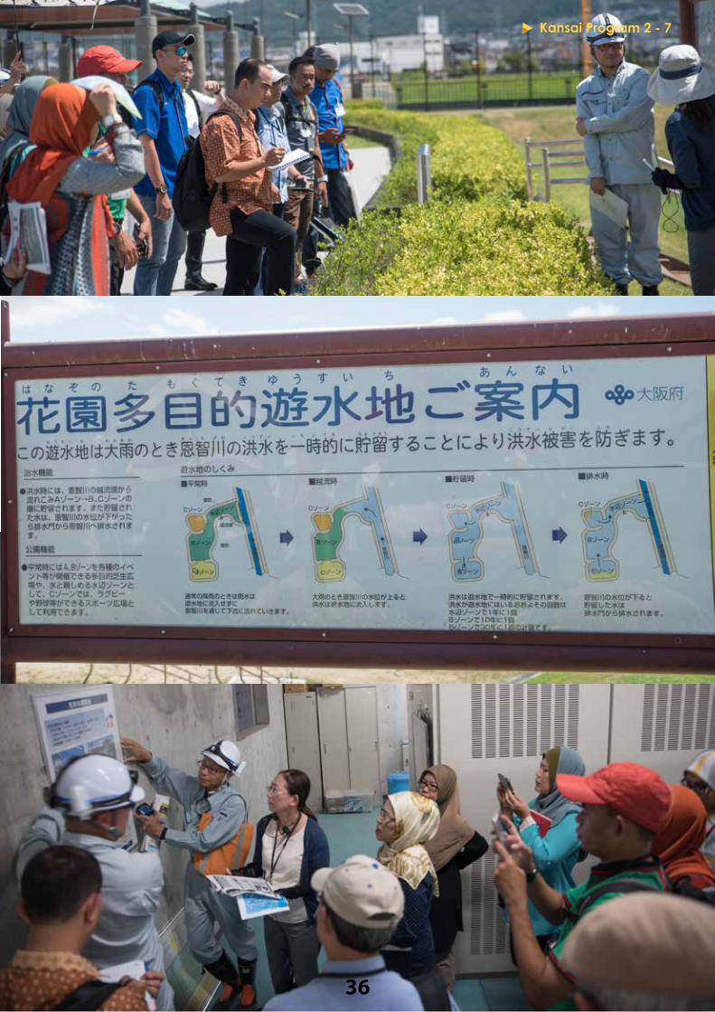
INTEGRATED FLOOD MANAGEMENT IN NEYA RIVER BASIN
Osaka Prefecture River Management OfficeDate : 3 August 2017Time : 10:00 - 11:30
Background of the visit:The Neya River Basin, a tributary of the Yodo River, is a highly populated low-lying area that has historically faced flood disasters. As so, in early 1990s, the Osaka Prefectural Government with the central government and 11 municipal governments adopted the “Neya River Basin River Maintenance Plan” and implemented such mitigation measures as widening of the river, raising of the embankment, dredging the riverbed and building a pumping system that drains excess water into the Neya River. After several amendments, the “Neya River Basin Integrated Flood Management Plan” was adopted in 2014 to realize a holistic flood control with multiple hard and software measures. Lecture and discussion points:Field observation was conducted at Matsubaraminami Retarding Pond, which is an area next to the Hanazono rugby field (famous for the national high school rugby championship tournament), utilized as a temporary pond to store floodwater that will eventually be released to the Onchi River when the water level comes down. There are three storage areas (marked as zone A, B and C) that will be filed one by one depending on the amount of floodwater. Maximum capacity of 1.46 million m³ can be retained during extreme flooding. Underneath the park, there are also underground tunnels and flood-adjusting reservoir that can temporarily store up to 1.8 million m³ of rainwater that cannot be released to the Neya River. As of now, there are 24 of such facilities on the river basin. During peacetime, the area is used by families and school children as public park to be used for recreational activities such as sports and BBQs.
Environmental considerations are also incorporated in the design including land use planning and conservation of green environment. Other non-structural measures such as local early warning system, community awareness raising on flood risks and evacuation drills are also conducted as part of the flood management activities. Such integrated flood prevention measures that are not solely implemented for the sake of disaster management, but also bring benefits to local residents can convince taxpayers to invest more in DRM.
Kansai Program 2 - 7
36
Kansai Program 2 - 7

37
YODO RIVER MANAGEMENT OFFICE
Kinki Regional Development Bureau, MLIT Date : 3 August 2017Time : 14:00 - 15:00
Background of the visit:Yodo River or Yodogawa, originates in Lake Biwa, Japan’s largest freshwater lake, runs about 75km south through 6 prefectures (Osaka, Hyogo, Kyoto, Shiga and Nara) and eventually flows out to the ocean at Osaka Bay. The river basin consists of an area about 8,240km² and has been the foundation of cultural, economical and social development in the Kansai area. As other areas in Japan, cities with high population density were developed in areas lower than the river and therefore, there is a long history of river management and flood control measures in the river basin. It is know that close to 95% of city of Osaka is in the flood-prone zone.
The Yodo River Management Office, Kinki Regional Development Bureau, MLIT is responsible for the following DRM measures.For flood and high tide: Publication of Inundation Simulation Map Planning development of Super Levee Identification and monitoring of critical flood control areas For earthquake: EQ proofing of embankment and levee system Monitoring of EQ monitoring network Rehabilitation of damaged embankment and leveesOther DRM measures: Management of information network Dissemination of disaster information (including imagery information) Operation of disaster response equipment Function as secretariat of Council for Developing Flood Resilient Region (comprised of local leaders, government departments and community representatives)
Lecture and discussion points:The riverbank of Yodo River was observed where the officers of Yodo River Management Office explained that the embankment has a long history of constant upgrading since Sengoku Period (16th century) in Japan. Because of this, the structure was made with different materials by various engineering methodology, making the strength uneven from place to place. As the case, it is important to continuously monitor the embankment to prevent breaching during flooding times.
Kansai Program 2 - 8

10
The river must be managed by a combination of multiple measures other than embankment and levee, such as by dams in the upstream and river flow control structures. On the Yodo River Basin, there are also Super Levees that places a whole community on the levee itself that is commonly 30 times wider than the height of the original levee. While Super Levees are unbreakable and effective in protecting a wider area, it is also costly and time consuming to construct.
Kansai Program 2 - 8
39
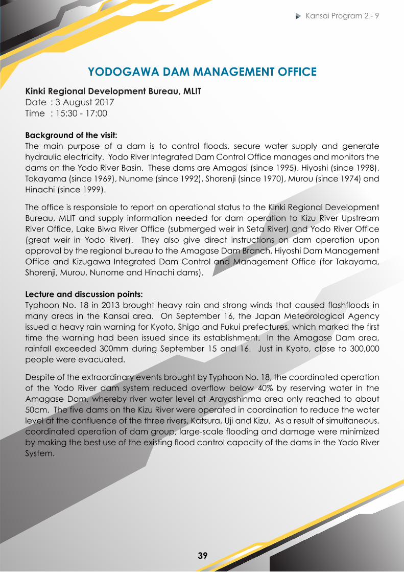
YODOGAWA DAM MANAGEMENT OFFICE
Kinki Regional Development Bureau, MLIT Date : 3 August 2017Time : 15:30 - 17:00
Background of the visit:The main purpose of a dam is to control floods, secure water supply and generate hydraulic electricity. Yodo River Integrated Dam Control Office manages and monitors the dams on the Yodo River Basin. These dams are Amagasi (since 1995), Hiyoshi (since 1998), Takayama (since 1969), Nunome (since 1992), Shorenji (since 1970), Murou (since 1974) and Hinachi (since 1999).
The office is responsible to report on operational status to the Kinki Regional Development Bureau, MLIT and supply information needed for dam operation to Kizu River Upstream River Office, Lake Biwa River Office (submerged weir in Seta River) and Yodo River Office (great weir in Yodo River). They also give direct instructions on dam operation upon approval by the regional bureau to the Amagase Dam Branch, Hiyoshi Dam Management Office and Kizugawa Integrated Dam Control and Management Office (for Takayama, Shorenji, Murou, Nunome and Hinachi dams).
Lecture and discussion points:Typhoon No. 18 in 2013 brought heavy rain and strong winds that caused flashfloods in many areas in the Kansai area. On September 16, the Japan Meteorological Agency issued a heavy rain warning for Kyoto, Shiga and Fukui prefectures, which marked the first time the warning had been issued since its establishment. In the Amagase Dam area, rainfall exceeded 300mm during September 15 and 16. Just in Kyoto, close to 300,000 people were evacuated.
Despite of the extraordinary events brought by Typhoon No. 18, the coordinated operation of the Yodo River dam system reduced overflow below 40% by reserving water in the Amagase Dam, whereby river water level at Arayashinma area only reached to about 50cm. The five dams on the Kizu River were operated in coordination to reduce the water level at the confluence of the three rivers, Katsura, Uji and Kizu. As a result of simultaneous, coordinated operation of dam group, large-scale flooding and damage were minimized by making the best use of the existing flood control capacity of the dams in the Yodo River System.
Kansai Program 2 - 9

Kansai Program 2-8Kansai Program 2 - 9

41
HYOGO DISASTER MANAGEMENT CENTER
Hyogo Prefectural GovernmentDate : 4 August 2017 Time : 9:00 - 10:00
Background of the visit:Until the 1995 Great Hanshin-Awaji Earthquake (GHAE), the Hyogo Prefectural Government had not experienced any major earthquake since the 1946 Nankai Earthquake. Because of this, its disaster management system was mainly designed to prepare for and respond to storm and flooding disasters. Based on the lessons learned from the experiences of GHAE, local governments in Japan have significantly enhanced their disaster management system in terms of strengthening the planning and facilities. Prior to the GHAE, Hyogo Prefecture was not equipped with a crisis management system that addresses different disaster scenarios including occurrence of a major earthquake in highly urbanized area. After 1995, the prefecture established the Disaster Management and Planning Bureau and Disaster Response Bureau, both bureaus dedicated to prepare for disasters, take emergency actions and lead post-disaster recovery efforts. The Hyogo government also established the Hyogo Disaster Management Center in a building with an earthquake-resistant structure.
Lecture and discussion points:The Disaster Planning Section of Hyogo Prefecture lectured on two issues; (i) basic framework of DRM in Japan at national and local levels and (ii) details of DRM plan in Hyogo Prefecture. Japan has faced various natural and man-made disasters including GHAE in 1995, oil contamination from marine accidents, wildfires, flooding and landslides.
Under Japan’s Disaster Countermeasures Basic Act (1961), the 3-tier administrative levels (national, prefectural and municipal) all have different roles in disaster response and risk reduction and at the same time, there is a system to support each other in case of mega disasters. The act addresses all phases of the disaster management cycle; prevention, mitigation and preparedness, emergency responses as well as recovery and reconstruction with roles and responsibilities among the national and local government clearly defined. In accordance with the Act overarching at the national level, the Hyogo Regional Disaster Management Plan had been enacted with aims to protect Japanese soil and lives and assets as well as providing resources to secure public welfare.
Kansai Program 2 - 10

10
Hyogo’s DRM Plan has been crucial in developing and sustaining the “Culture of Disaster Management” that prioritizes in nurturing a disaster-conscious oriented culture, with self-help and mutual-help as fundamental concepts.
Kansai Program 2 - 10
Artboard 40

43
HYOGO EMERGENCY MEDICAL CENTER (HEMC)
Date : 4 August 2017Time : 10:30 - 12:00
Background of the visit:The Hyogo Emergency Medical Center (HEMC) was established in 2003 and became the headquarters for Disaster Medical Assistance Teams (DMAT) in 2005, following the 1995 Great Hanshin-Awaji Earthquake. It was built next to Red Cross Kobe Hospital. Both hospitals have been operated in an integrated manner since their establishment with the doctors in both centers communicating on a daily basis. HEMC provides level-3 critical care for all types of emergencies with air evacuation facility. DMAT consists of well-trained personnel in emergency medical care and is able to actively participate in various disaster relief activities locally or internationally. Currently, there are 786 hospitals with DMAT, with 1,571 teams and 11,481 members (3,496 doctors; 4,734 nurses and 3,251 logisticians) in Japan.
Based upon the experience of communication breakdown during the 1995 event, Emergency Medical Information System (EMIS) was established in 1996 by Hyogo Prefecture. The EMIS provides nationwide medical information sharing by using ICT technology. Its main functions are (i) to notify emergency status of hospitals to HQ (in terms of extent of damages, number of patients beyond capacity, need for transportation, etc.); (ii) to support DMAT operation; and (iii) to provide data from Medical Air-Transport Tracking System (MATTS).
Lecture and discussion points:Dr. Nakayama, Director of HEMC, shared his experience during the 1995 Great Hanshin Awaji Earthquake (GHAE) where he was then, working in the Kyoto University Hospital. One of the major issues during the initial stage was the uneven distribution of patients among the hospitals in the region due to breakdown of communication systems damaged by the earthquake. Some hospitals were overloaded with patients and lacking medical personnel, while others were not utilized. The EMIS was developed based on this experience. DMAT was established to strengthen team coordination among well-trained personnel that will be quickly dispatched the disaster areas to provide emergency medical and trauma care to the disaster victims. The composition of DMAT members is not restricted to emergency personnel and may include other specialists from other disciplines such as orthopedics, surgery, nursing and logistic experts.
The group then observed the Emergency Call Center of HEMC (operational center)where EMIS is used and the HEMC ambulance
Kansai Program 2 - 11
Artboard 40

Kansai Program 2-11Kansai Program 2 - 11

45
Background of the visit:At 5.46 am, 17 January 1995, Kobe was hit with an earthquake of magnitude 7.3 on Richter scale, with epicenter in the northern part of Awaji Island in Hyogo Prefecture. The event took lives of more than 6,000 people and was the largest disaster in post-war Japan. The Disaster Reduction & Human Renovation Institution (DRI) was established in 2002 with the support of the Japanese government and located in the building known as the Great Hanshin-Awaji Earthquake Memorial. The mission of the DRI is to help shape safe, secure and disaster-resilient communities by fomenting resident collaboration, improving the disaster preparedness of communities, supporting the development of disaster management policies, creatively promoting post-disaster reconstruction, and molding a culture of disaster awareness from the experiences and lessons of the Great Hanshin-Awaji Earthquake and other natural disasters that occurred since then in Japan and abroad. The exhibit is visited by over 400,000 visitors, both adults and children in Japan and abroad. It is one of the popular destinations for school trips in which students are able to learn from the displays, films and stories from local volunteers who share their experiences of surviving from GHAE.
Lecture and discussion points:DRI primarily has six main functions: (i) research on disaster risk reduction (DRR) practices, (ii) operation of museum exhibits, which aims to motivate visitors to take interest in, deliberate upon and understand the importance of DRR, preciousness of human life and the value of mutual dependence of people, (iii) collection and preservation of source documents and materials - DRI works with local citizens to continuously collect information on earthquake and disaster management to develop information database, (iv) assistance during disaster response - DRI can dispatch experts with practical and systematic knowledge in disaster response to provide appropriate information and advice to disaster managers, (v) exchange and networking - DRI functions as a crossroad of government practitioners, researchers, citizens and business enterprises in earthquake and DRR, (vi) training for disaster management practitioners.
DISASTER REDUCTION & HUMAN RENOVATION INSTITUTION (DRI)
Date : 4 August 2017Time : 14:00 - 16:00
Kansai Program 2 - 12

Kansai Program 2-11
46
Kansai Program 2 - 12

47
NEXT STEPS
At the end of the Japan Attachment, the participants (MDRM students, faculty members and DPPC strategic partners) presented ideas on how to follow up on what they have learned and experienced during the program in Japan.
MDRM students were keen in incorporating some the Japanese DRM experiences that they have learned during the program into their Master project (thesis). For example: Incorporate good practices in Japan for suggesting the main components of Local Integrated Flood Preparedness Action Plan in Malaysia (e.g. Asset inventory management system of Kyoto Fire Department). For strengthening decision making process after flood event in Malaysia, refer to experiences and methodologies of Joso City Government and identifying what physical information is critical for effective disaster response.
Next Steps
Functional Specification of Flood Disaster Management System for Malaysia Disaster Managers
Information for making a decision on issuing evacuation advisory / order
Lecture: Kanto / Tohoku heavy rain disaster in 2015 (pg. 16)Date: 28 / 07/ 2017
Mayor / Joso City Government
Evacuation advisory / order
Well supported decision
Ad
vise
& c
on
vin
ce
Data / information needed to support decision making processWell analyzed data presentation
Non science Science based
Lecture: Takeuchi SenseiDate: 25 / 07 / 2017
Study Area
Decision making concept
Objective No. 2: To analyse information needed in disaster
management system during flood disaster in Malaysia
Decision making process
Japan Attachment Linked with Master ProjectCoordination Meeting / FGD
Kyoto Fire Department - FGD (academic, researcher, agency) Shimodate River Office - Easement System (land acquisition)
}
Early Warning System
Siren warning - Kogaigawa and Kinugawa (Shimodate River Office) NIED - X Band, Cumulunimbus Cloud System Kyoto Fire Dept. - radio, TV, SMS
Disaster Education & Training
Joso City Office - community at Kogaigawa and Kinugawa Kyoto Fire Dept. - community at Kyoto City
Communication
Kyoto Fire Dept. - ambulance support system JAXA - satellite, Himawari
Disaster Command & Control Centre
Kyoto Fire Department - NHK connection, mobile command centre
Evacuation Center
Kyoto Fire Department - survival kit AED - Automatic External Defibrillator
Volunteer Coordination
Kyoto Fire Department - fire volunteers Joso City - flood fighting corps.
Risk Assessment & Mapping
Kyoto Fire Department - risk mapping for public knowledge
Assets & Logistics
Kyoto Fire Department - assets inventory management
FLOOD PREPAREDNESS ACTION PLAN

48
MDRM faculty members suggested several research ideas that may be implemented jointly with Japanese universities and research institutes, such as: Developing flood early warning system tools by integrating improved localized forecasting and risk mapping in flood-prone regions in Malaysia using examples from Kyoto City Fire Department with Kyoto University. Guideline for Cost Benefit Analysis (CBA) for reducing disaster risks in cultural heritage sites with the Institute of Disaster Mitigation for Urban Cultural Heritage (R-DMUCH), Ritsumeikan University.
Lesson learned from JICA training: Shimodate River Management Office, MLIT - Hakojima Retarding Basin (The Easement system - from English law) Global Centre of Excellence for Water Hazard & Risk Management (ICHARM) Scientific data to make decision, series of short term towards long term goals and multidisciplinary engagement using same resources (PWD, Land District Office, Local Government, JUPEM - GIS mapping >> needs to work together) Joso City Government (community training & awareness program and the MyTimeline SOP / Apps to ensure evacuation & info distribution) Cost Benefit Analysis (CBA) for heritage building (Ritsumeikan University) Integrated data management are crucially needed.
Next Steps
INTEGRATION OF EARLY FLOOD WARNING SYSTEM AND FORECASTING IN FLOOD RISK MANAGEMENTThe study aimed to propose the integration for early flood warning system and forecasting to reduce local flood risk
reduction in future urbanization business development and populationIssue
A reliable early flood warning system and forecasting in reducing flood risk management is needed concurrently with additional gauge data. Forecast points must be intended for precise reaching of a river where flood impact is likely high, such as near towns, cities or agricultural areas. Inconsistent formats exist and resulting in the data availability and integrity can be unreliable. The AMRFF system is still under development and requires further adjustments where the assimilation of WRF generated QPF are most important. The satellite data provided by GSMaP is highly overestimated result of hydrograph compared to ground based rainfall. The difference between the observed rainfall data and GSMaP - NRT data can be improved by advanced correction method.
Research Question (RQ) Research Objective (RO)RQ1 : What is the existing status to the early
flood warning system and forecasting in reducing flood risk management?
To identify the status of existing flood early warning system and forecasting in flood
risk reduction at Kuala Kangsar
RQ2 : What is the accuracy and lead time for the alternative strategy on the non
structural approach of the integration of early flood warning system and forecasting
in reducing flood risk management?
To assess accuracy and lead time for the alternative strategy on the non structural
approach of the integration of early flood warning system and forecasting in reducing flood risk management
RQ3 : How can a reliable operational integration of early flood warning system
and forecasting be established in developing towns, considering uncertainty as an effective tool for decision making?
To recommend integration of the early flood warning system and forecasting for future development in Kuala Kangsar and
population growth based on AMRFF developed for Pahang, Kelantan and
Johor river basins
Funding supposed to cover salary for a RO, connection and travelling budget for ICHARM’s expert (Prof. Takeuchi), main meetings between UTM and
strategic partners from government agencies; and consumables

49
Strategic partners raised ideas on what activities their respective departments could jointly implement with DPPC for enhancing their DRM efforts in Malaysia. Some suggestions were: In-house technical capacity building for risk assessment and data analysis, dam management system and building database historical disaster damage and loss – National Disaster Management Agency (NaDMA) Training and research collaborations with DPPC and Japanese partners on improved partnership with public and application of new DRM methodologies for building resilience to flood disasters – Department of Irrigation and Drainage (DID)
Proposal:
Next Steps
A guidance on methodologies and standards for risk assessment, disaster risk modelling and use of data into implementation
Application of Puff Modelling to haze (transboundary / peat fire smoke) in Malaysia
Capacity building - technology transfer, cross fertilization programme
To improve dam management system - Integrated Dam Management System in Malaysia
Database of knowledge on historical disasters and disaster mitigation
Proposal by Department of Irrigation & Drainage:
Disaster management as one of a priority subject for DID in considering the application for further studies (MSc. & PhD)
Cooperation in managing disaster management especially with the public (outreach programme etc.)
Capacity building - training, further study, attachment on DRM programme


50
CONCLUDING REMARKS
Dato’ Zakaria MohamadScientific expert panel to National
Disaster Management Agency (NaDMA)MDRM Board of Study member
and DPPC Fellow
Concluding Remarks
The significance of educational and research programs in the field of Disaster Risk Reduction and Management (DRRM) is that the outcomes of the programs may directly or indirectly provide long-term impact in saving people’s lives and prosperity duing disaster situations. While the MDRM program is designed to be practical for meeting the requirements of DRM professionals, it also attempts to provide added value with academic/scientific approach that enhance analytical and problem solving skills that disaster practitioners need to have today.
There are two unique features to the MDRM program. One is the integration of education/training with research and field practice that allows the program to combine the practical and scientific aspects of DRRM as mentioned above. The other is the link with the Japanese partners in which 13 prominent universities and research institutes (DRM Subcommittee of the Japan University Consortium: JUC) support and provide us with rich DRRM knowledge and experiences of Japan.
Even with a life long career in the geoscience field with the Department of Mineral and Geoscience Malaysia (JMG), I was able to learn new things about Japan disaster management together with the students. Aside from disaster management, it was also rewarding to know more about Japanese people and their work ethics. I was also able to admire the beautiful sceneries and friendly people, especially in Kyoto.
I wish to continue supporting the efforts of MDRM program and DPPC as Board of Study member, as I believe that the program plays an important role in strengthening DRRM in Malaysia as well as the rest of Asia Region.

51
About Universiti Technologi Malaysia (UTM)
Universiti Teknologi Malaysia (UTM) is a leading public innovation-driven entrepreneurial research university in engineering, science and technology. The main campus is located in Iskandar Puteri, Johor Bahru and in Kuala Lumpur, the capital city of Malaysia.
About Malaysia-Japan International Institute of Technology (MJIIT)
MJIIT was born in 2011 under Malaysia’s Look East Policy and upon agreement between the governments of Japan and Malaysia. With support from 30 top Japanese universities, the institute aims to provide Japanese style engineering education for students who can contribute to industries across ASEAN region.
About Disaster Preparedness and Prevention Center (DPPC)
DPPC is the newest program at MJIIT with aims to become the regional hub for DRRM education and research. In partnership with Japanese and ASEAN universities, government agencies and experts, DPPC supports countries and communities build disaster resilience through science, technology and innovation.
Design by: Muhammad Syafiq Yazid, MJIIT UTM Edzreen Syahira Jamil, MJIIT UTM
