directions to camera point: from the beginning of the trail just past the pond travel roughly 30...
Post on 21-Dec-2015
214 views
TRANSCRIPT
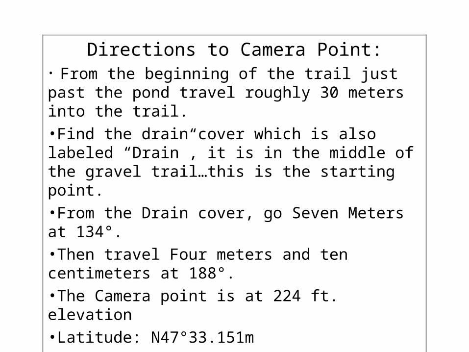
Directions to Camera Point:• From the beginning of the trail just past the pond travel roughly 30 meters into the trail.•Find the drain cover which is also labeled “Drain”, it is in the middle of the gravel trail…this is the starting point.•From the Drain cover, go Seven Meters at 134°.•Then travel Four meters and ten centimeters at 188°.•The Camera point is at 224 ft. elevation•Latitude: N47°33.151m•Longitude: W122°09.903

Photo of Camera Point
Photo Point Map
1A
Key
Starting Point
Photo Point
Camera Point1
*Map shows 2nd green manhole cover as starting point
North
Camera Point
Starting Point
Path
Curved Trees
Stream
Drain Cover
pond 7m, 134°
4.1m, 188°
2A
2B
2C 2
162°
295°
245°
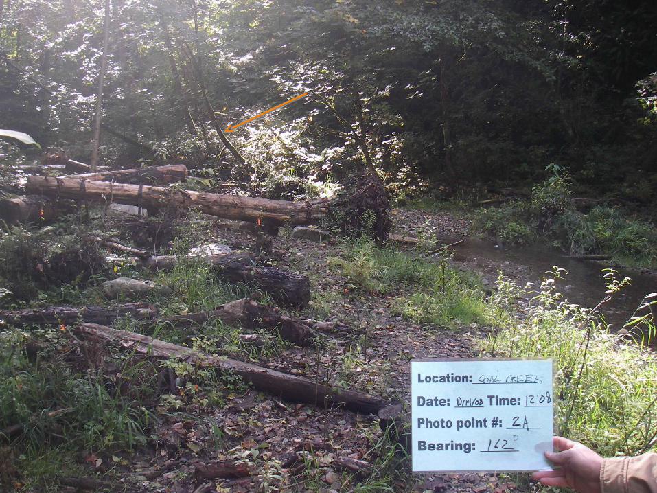
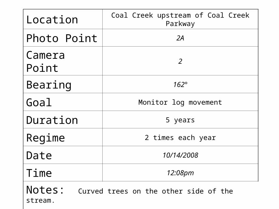
Location Coal Creek upstream of Coal Creek Parkway
Photo Point 2A
Camera Point 2
Bearing 162°
Goal Monitor log movement
Duration 5 years
Regime 2 times each year
Date 10/14/2008
Time 12:08pm
Notes: Curved trees on the other side of the stream.
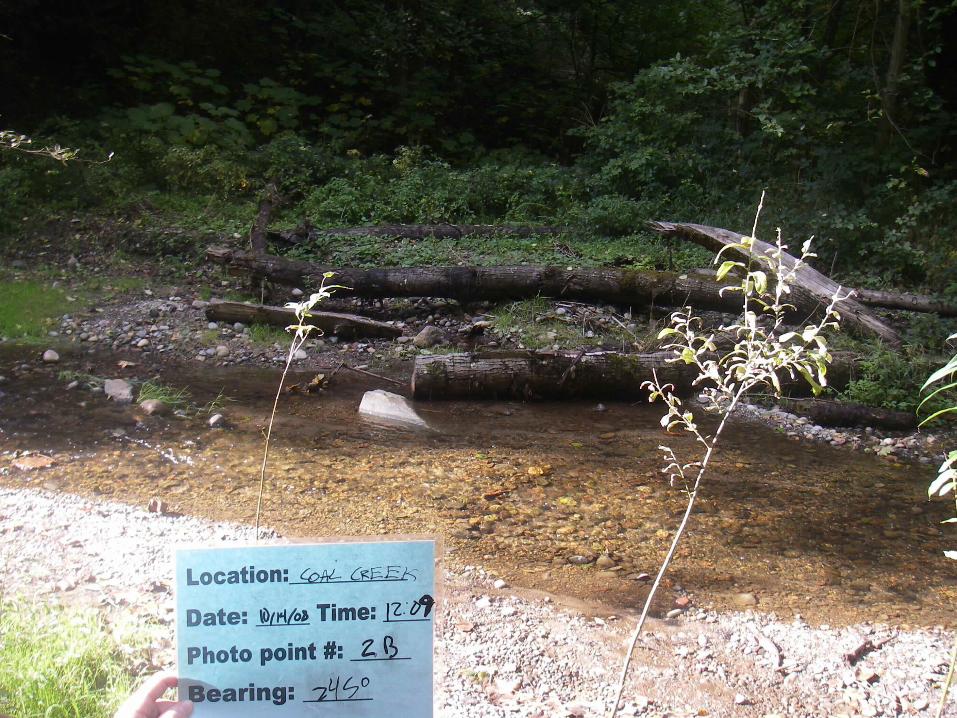
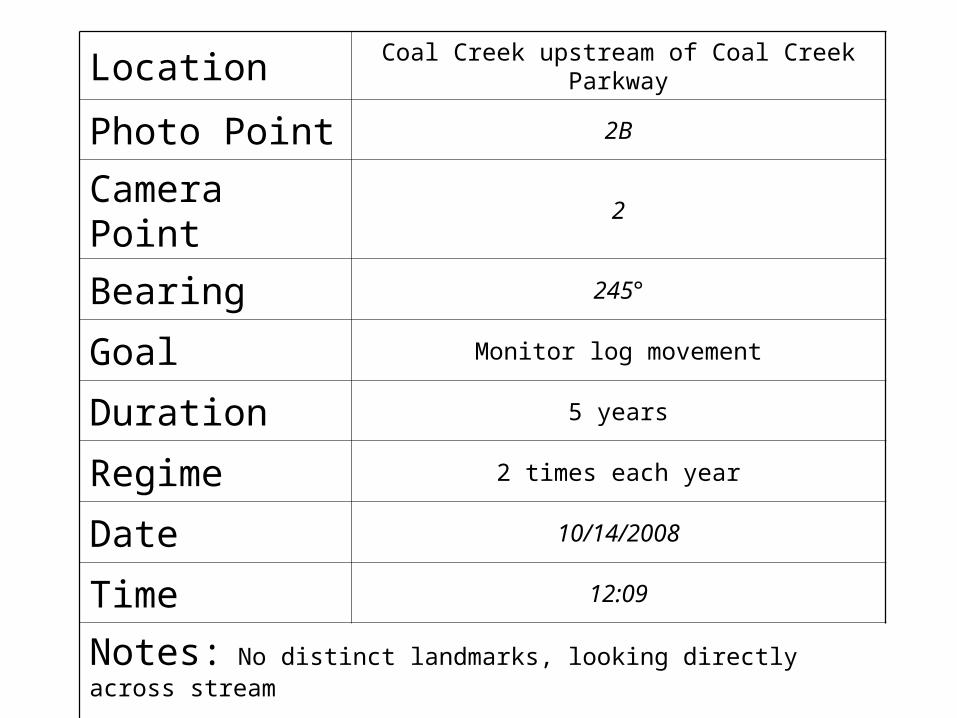
Location Coal Creek upstream of Coal Creek Parkway
Photo Point 2B
Camera Point 2
Bearing 245°
Goal Monitor log movement
Duration 5 years
Regime 2 times each year
Date 10/14/2008
Time 12:09
Notes: No distinct landmarks, looking directly across stream

Overflow pipe
Trail

Location Coal Creek upstream of Coal Creek Parkway
Photo Point 2
Camera Point 2C
Bearing 290°
Goal Monitor log movement
Duration 5 years
Regime 2 times each year
Date 10/14/2008
Time 12:05
Notes: Overflow pipe in bottom right corner of photo, view of trail above the pipe.

Captain Planet