differential leveling - university of arizona · pdf fileusing a laser level, perform a...
TRANSCRIPT
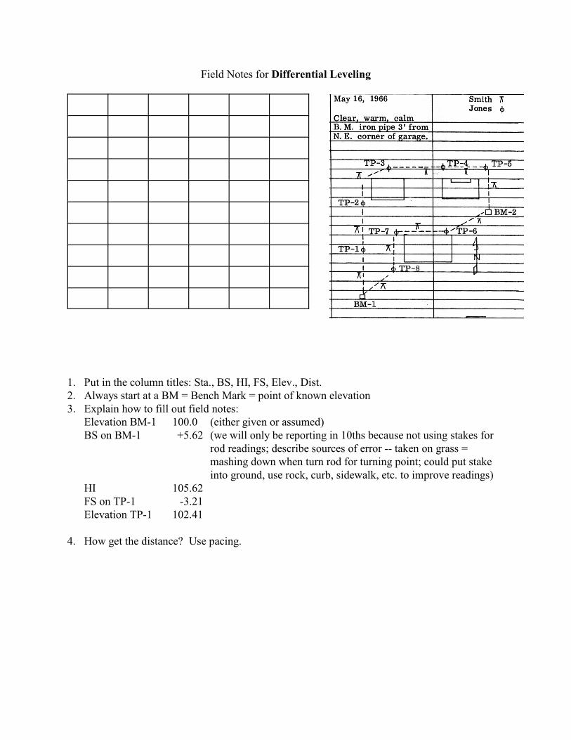
Field Notes for Differential Leveling
1. Put in the column titles: Sta., BS, HI, FS, Elev., Dist.2. Always start at a BM = Bench Mark = point of known elevation3. Explain how to fill out field notes:
Elevation BM-1 100.0 (either given or assumed)BS on BM-1 +5.62 (we will only be reporting in 10ths because not using stakes for
rod readings; describe sources of error -- taken on grass =mashing down when turn rod for turning point; could put stakeinto ground, use rock, curb, sidewalk, etc. to improve readings)
HI 105.62FS on TP-1 -3.21Elevation TP-1 102.41
4. How get the distance? Use pacing.
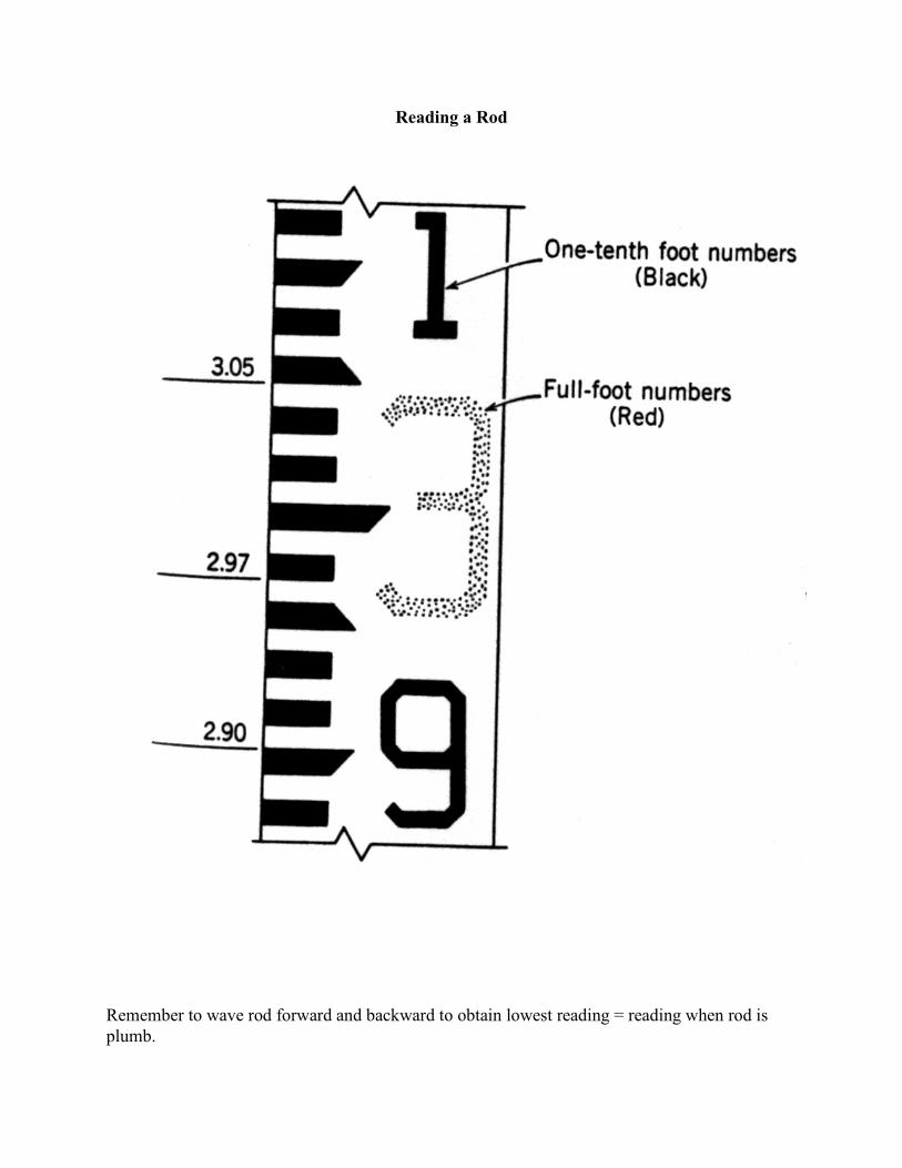
Reading a Rod
Remember to wave rod forward and backward to obtain lowest reading = reading when rod isplumb.
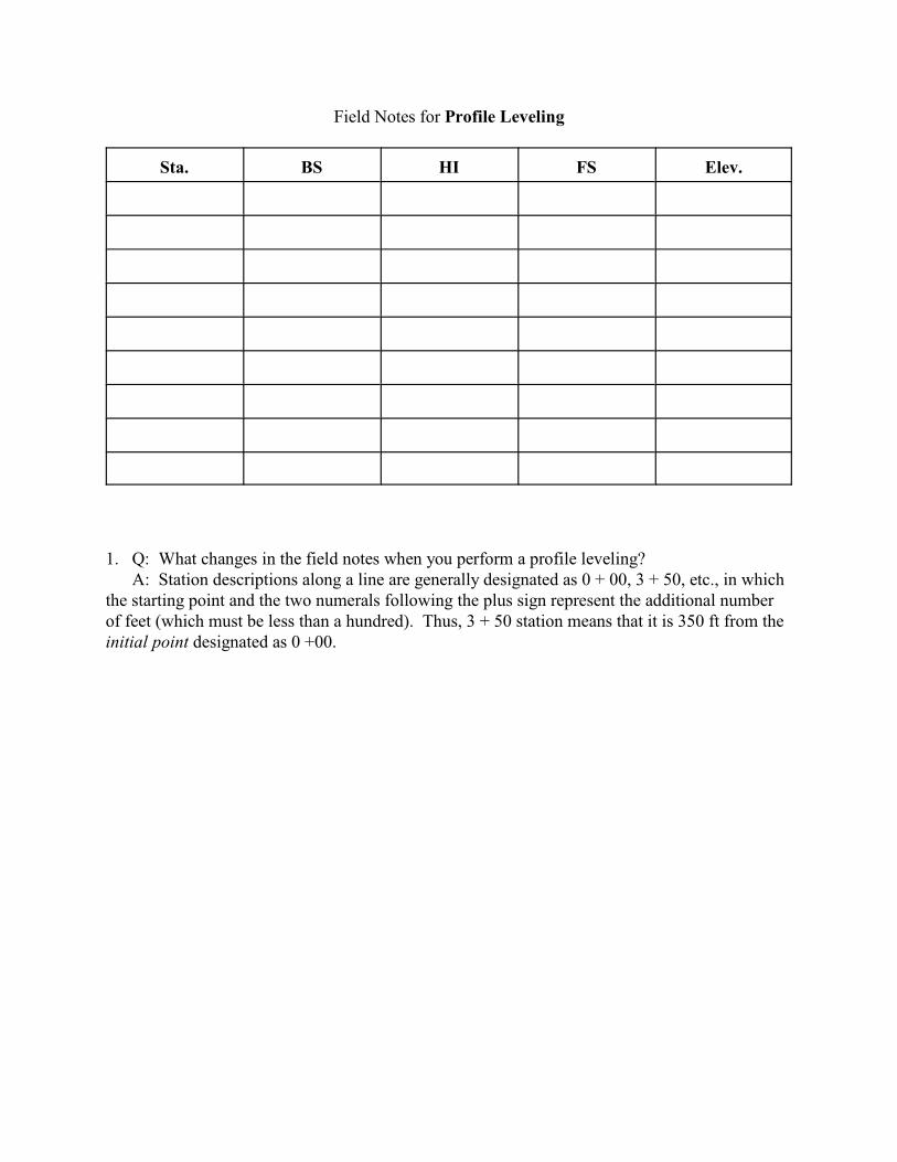
Field Notes for Profile Leveling
Sta. BS HI FS Elev.
1. Q: What changes in the field notes when you perform a profile leveling?A: Station descriptions along a line are generally designated as 0 + 00, 3 + 50, etc., in which
the starting point and the two numerals following the plus sign represent the additional numberof feet (which must be less than a hundred). Thus, 3 + 50 station means that it is 350 ft from theinitial point designated as 0 +00.
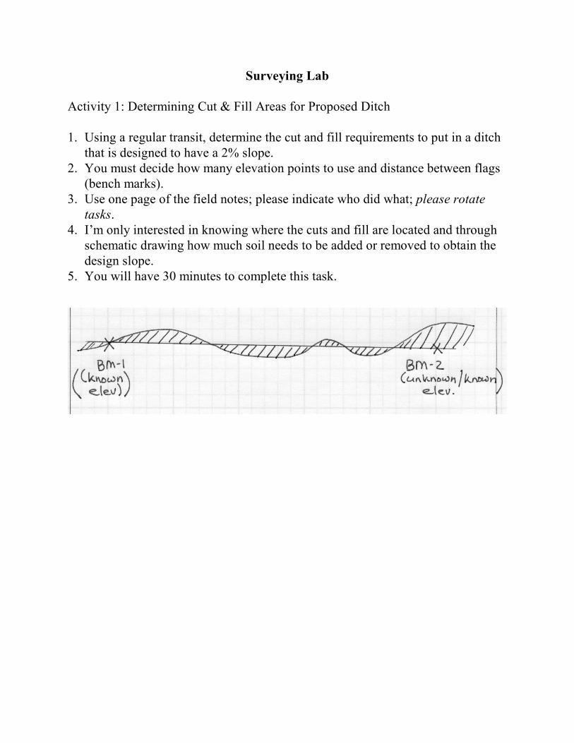
Surveying Lab
Activity 1: Determining Cut & Fill Areas for Proposed Ditch
1. Using a regular transit, determine the cut and fill requirements to put in a ditchthat is designed to have a 2% slope.
2. You must decide how many elevation points to use and distance between flags(bench marks).
3. Use one page of the field notes; please indicate who did what; please rotatetasks.
4. I’m only interested in knowing where the cuts and fill are located and throughschematic drawing how much soil needs to be added or removed to obtain thedesign slope.
5. You will have 30 minutes to complete this task.
Surveying Lab
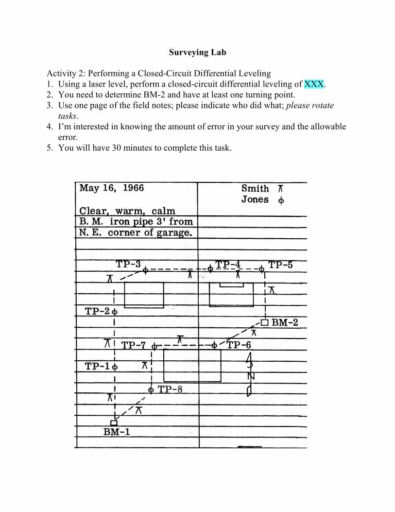
Activity 2: Performing a Closed-Circuit Differential Leveling1. Using a laser level, perform a closed-circuit differential leveling of XXX.2. You need to determine BM-2 and have at least one turning point.3. Use one page of the field notes; please indicate who did what; please rotate
tasks.4. I’m interested in knowing the amount of error in your survey and the allowable
error.5. You will have 30 minutes to complete this task.
Surveying Lab
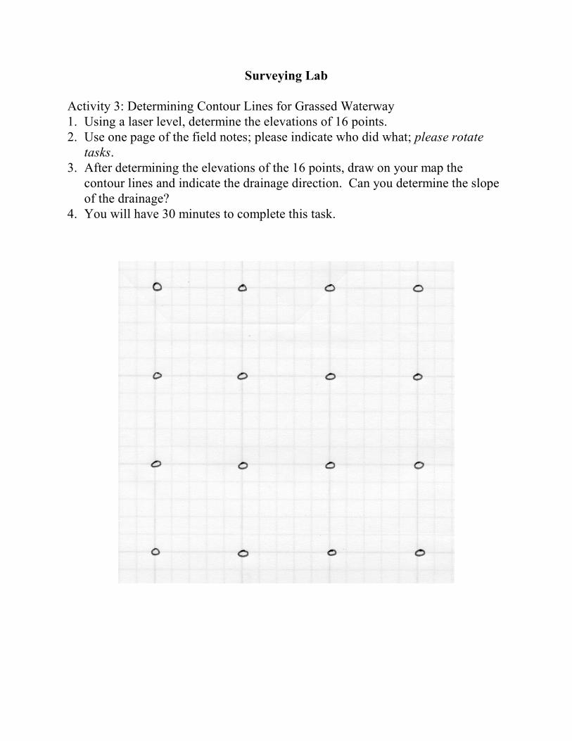
Activity 3: Determining Contour Lines for Grassed Waterway1. Using a laser level, determine the elevations of 16 points.2. Use one page of the field notes; please indicate who did what; please rotate
tasks.3. After determining the elevations of the 16 points, draw on your map the
contour lines and indicate the drainage direction. Can you determine the slopeof the drainage?
4. You will have 30 minutes to complete this task.