diamond drilling report on the art l-4 mineral claims …
TRANSCRIPT
DIAMOND DRILLING REPORT
ON THE
ART l-4 MINERAL CLAIMS
ART CREEK AREA
CARmOO-CLINTON MINING DIVISIONS
NTS 93Ai2E 92P\15E LATITUDE: 52 00 N
LONGITUDE: 120 37 W
BY
D. W. RIDLEY P.O. BOX 77
EAGLE CREEK, BC VOK 1LO

TABLE OF CONTENTS
SUMMARY 1 LOCATION AND ACCESS 1 CLAIM STATUS l-2 REGIONAL GEOLOGY 2 PROPERTY GEOLOGY 2 PAST WORK 2-3 200 1 WORK PROGRAM 3-4 CONCLUSIONS 4-5 RECOMMECNDATIONS 5 FINANCIAL STATEMENT 6 REFERENCES 7 STATEMENT OF QUALIFICATIONS 8
APPENDICES
SAMPLE ANALYSIS CERTlFlCATE DRILL LOGS DDH-O1-01,01-02
STATEMENT OF WORK NOTICE TO GROUP
LIST OF FKXJRES
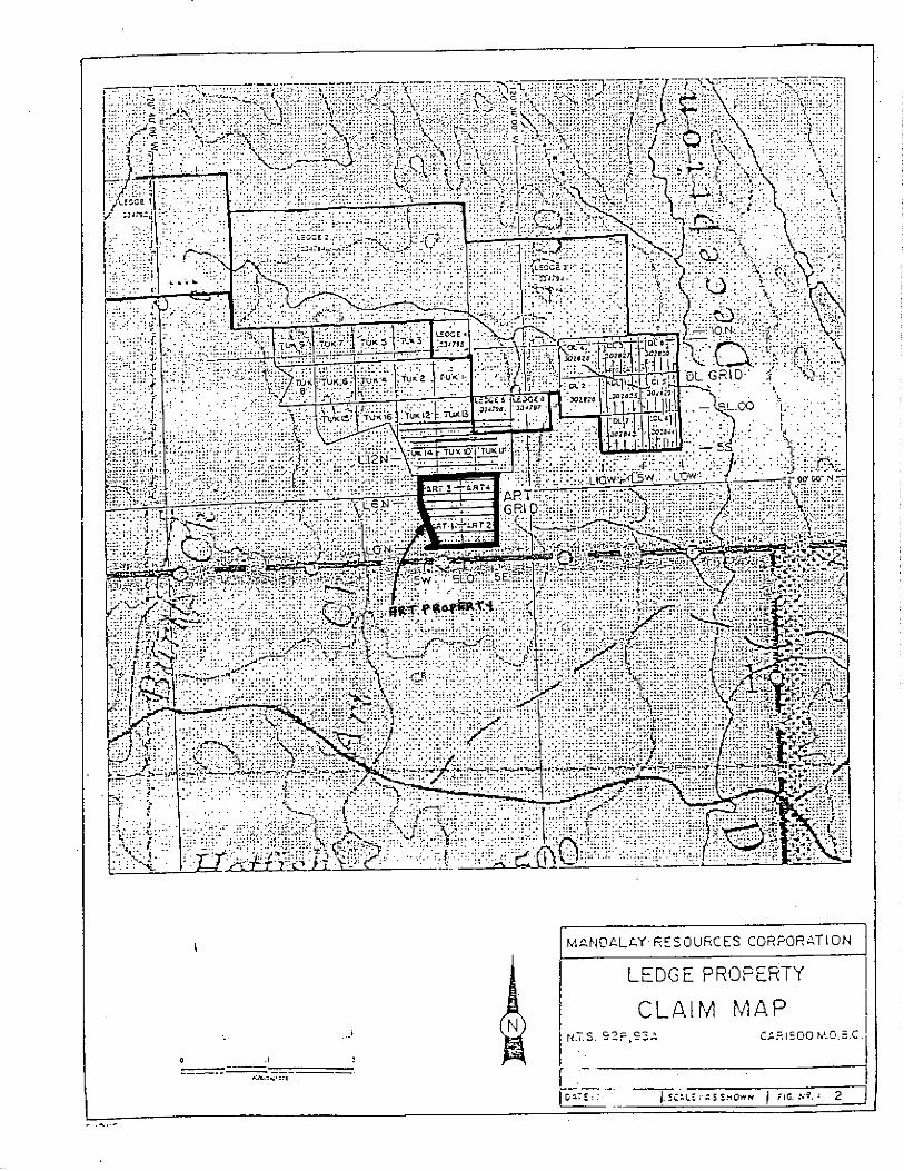
CLAIM LOCATION 1-2 GENERAL GEOLOGY 2-3 LOCATION OF 2001 DRILL HOLES 5-6

Summary
The Art property is situated in the Quesnel Trough, a subdivision of the Intermontane belt, which is composed of Triassic to Jurassic volcanic and sedimentary rocks and intruded by various plutons ranging in age from Triassic to Cretaceous. A rhyodacitic flow dome complex is partially exposed in the central portion of the property. These felsic rocks host stockwork-style quartz-carbonate veinlets which contain anomalous gold, arsenic, zinc, and copper values, as well as a zone of intensely argillic-altered rhyo- &cite with semi-massive pyrite-arsenomte mineralization
The showings were discovered by Ridley in the fall of 1997 who staked the present property optioned it to Mar&lay Resources in June 1998. Man&lay gridded the entire four units and carried out geological mapping geophysical surveys, and a limited soil sampling program during 1998. No other work was done until Mar&lay snuck in during early May 200 1 and drilled two holes on the property. This was entirely witbout the claim owner’s knowledge a&or consent. They dropped their option and refused to turn over the drill data which is the reason for the lateness of this report. The data has since been obtained and is included in this report. The core is securely stored on Ridley’s property at Eagle Creek.
Sampling results returned an average of 167 ppb gold and 3500 pprn arsenic over 12.0 meters of core length in DDH 01-2 and 143 ppb gold across 1.3 meters in DDH-OI-OI. These results are highly encouraging when one considers the fact that the holes were poorly targeted and completely missed the high sulphide zone exposed on surface.
The Art property remains an excellent gold prospect. Additional work should include soil sampling the property and correlating these results to the geophysical surveys. An aggressive machine trenching and diamond drill program would follow.
Location and Access
The Art property is located in Cariboo Mining Division approximately 75 kilometers northeast of JO0 Mile House and some 30 kilometers from Eagle Creek Post OtTice. The property is readily accessible via paved and gravel logging roads from 100 Mile House on highway 97.
Claim Status
The Art property consists of four 2-post mineral claims which are held by DW Ridley. This property is surrounded on three sides by competitor claims. The Tuk claims are to the north and the Kingpin group lies to the west and south The Art property (Record Numbers 359881,359882,359883, and 359884) was held under option by Man&lay

Resources from June I998 until May 200 1. The Art property is currently in good standing until Oct. 20,2005, pending acceptance of this report
The Art property (Minfjle #093A 200) lies in the Quesnel Trough., a subdivision of the Intermontane Belt, which is composed of Triassic to Jurassic volcanic and sedimentary rocks and intruded by various plutons, ranging in age from Triassic to Cretaceous(?). The oldest rocks in the vicinity occur east of Deception creek and are comprised of quartz-mica schist, rnicaceous quartzite. and feldsparguartz gniess of the Lower Cambrian Snowshoe Formation.
The Permian-Mississippian rocks of the Redfern Complex, consisting of amphibolite, gabbro. norite, serpentinite, woxenite, and peridotite, outcrops east of the property as well. These rocks have been correlated to the Crooked Amphibolite Unit of Bloodgood (1990) and is interpreted to represent the imbricated boundary between Quesnellia and Bark&He terranes.
A thick package of Triassic to Jurassic vdlcanic and sediments form the bulk of rocks near the property as well as underlying a large area to the west. These rocks are intruded by stocks of Cretaceous intrusions of granodiorite, diorite, and quartz monzonite as well as by Triassic to Jurassic Takomkane batholith.
The Art property was mapped in 1998 by geologist E. Ronyccz (Ass. Rpt. #25801) which is utilized as a base for the compilation map shown in this report (FIG. ). The property is underlain predomintely by pyroclastic porphritic augite andesite flows to the west that are intcrbedded with argillite, shale, and minor limestone that is cut by andesitic to basaltic dykes and a granodiorite-quarizdiorite stock. A rhyodacitic flow dome complex occurs in the central portion of the property. These felsic rocks are inferred to be in fault contact with partly serpentinized andesite flows to the east, and a quartzdiorite plug with intrusive breccias to the west. Near the common claim post for the Art 14 claims felsic rocks are argilIic ahered and cut by carbonate veinkts that carry minor pyrite, sphalerite, and anenopyrite. The property is further disrupted by late northwest-southeast faulting.
Past Work
The Art property was Iwatcd in 1997 after finding an exposure of a sulphide-rich fault zone in the ditch of the newly constucted Art creek logging road. Limited prospecting and sampling was done at this time under the auspices of a Prospector’s Assistance Grant awarded to C. Ridley (9198 P-66). A mini-grid, measuring 200 x 300 meters was soil sampled and anomalous arsenic, gold, and copper values were detected. Limited rock
2

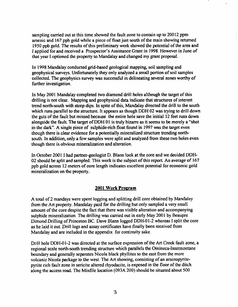
sampling carried out at this time showed the fault zone to contain up to 200 12 ppm arsenic and 167 ppb gold while a piece of float just south of the main showing returned 1950 ppb gold The results of this preliminary work showed the potential of the area and I applied for and received a Prospector’s Assistance Grant in 1998. However in June of that year I optioned the property to MandaIay and changed my grant proposal.
In 1998 Man&lay conducted grid-based geological mapping, soil sampling and geophysical surveys. Unfortunately tiey only analyzed a small portion of soil samples collected The geophysics survey was successful in delineating several zones worthy of fiuther investigation.
In May 200 1 Mandalay completed two diamond drill holes a!though the target of this drilling is not clear. Mapping and geophysical data indicate that structures of interest trend north-south with steep dips.. In spite of this, Mar&lay directed the drill to the south which runs parallel to the structure. It appears as though DDH 02 was hying to drill down the guts of the fault but missed because the entire hole save the initial 12 feet runs down alongside the fault. The target of DDH 01 is mly bizarre as it seems to be merely a “shot in the dark”. A singIe piece of sulphide-rich float found in 1997 was the target even though there is clear evidence for a pDtential!y mineralized structure trending north- south In addition, only a few samples were split and analyzed from these two holes even though there is obvious mineralization and alteration.
In October 200 I I had partner-geologist D. Blann look at the core and we decided DDH- 02 should be split and sampled. This work is the subject of this report An average of 167 ppb gold across 12 meters of core length indicates excellent potential for economic gold mineralization on the property.
2001 Work Proeram
A total of 2 mandays were spent logging and splitting drill core obtained by Mandalay from the Art property. Ma&lay paid for the drilling but only sampled a very small amount of the core despite the fact that there was visible alteration and accompanying sulphide mineralization. The drilling was carried out in early May 2001 by !3eaupre Dimond DrilIing of Princeton BC. Dave BIann logged DDH-O 1-2 whereas I split the core as he laid it out. Drill logs and assay certificates have finally been received from Ma&lay and are included in the appendix for continuity sake.
Drill hole DDH-OI-2 was directed at the surface expression of the Art Creek fault zone, a regional scale north-south trending structure which parallels the Omincca-Intermontane boundary and generally separates Nicola black phyllites to the east from the more volcanic Nicola package to the west. The Art showing, consisting of an arsenopyTite- pyrite rich fault zone in &cite altered rhyodacite, is exposed in the floor of the ditch along the access road. The Minfile location (093A 200) should k situated about 500
3
meters south of its position as shown on government maps. The showing is actually situated close to the common claim post for the Art l-4 mineral claims.
A total of 11 core samples from DDH-Ol-2 were submitted to Acme Analytical for analysis in mid-December 200 1. This hole was drilled at 180160 for a total depth of 80.15 meters and situated at grid co-ordinate 4+72N;O+64W which is on the main access road It should be pointed out that the drilling was along strike and missed the heavy sulphide portion of the fauIt exposed in the road. In fact the hole was poorly targeted given the information at hand. Geophysics and surf&e mapping clearly indicate the Art fault as well as another stronger parallel structure to tbe east. The drill was setup on the road right over the showing, however, it missed the high sulphide portion and went down along the east side of the fault
A continuous sample taken over 24.5 meters of core length was split and analyzed. This was from the edge of the fault and consisted of rhy&cite cut by calcite stringers and veinlets with local disemmina ted arsenopyrite-pyrite and b-ace chalcopyritc. An average of 167 ppb gold and 3500 ppm arsenic was obtained from four samples between 8.0 and 20.0 meters down-hole.
DDH-O 1-O 1 had four samples split and analyzed by Mandalay personnel. One of these (hJ586613) taken between 32.5 and 33.8 meters downhole contained 143 ppb gold. The hole targeted gold bearing float found in 1997, however it ignored the geophysical data which suggested a mineralized north-south structure just to the east of the road This hole was situated at 4+5ON;o+7OW and its attitude was 160\60 for a total depth of 80.15 meters.
Based on a compilation of past data and the results of this drill program it can bc concluded that the Art property has excellent potential to host Eskay Creek type VMS andor stn~cturally hosted gold mineralization. This is due;
I) a favourble geological environment (ie shallow marine volcanc+sedimerttary sequence which is cut by co-eval quartz diorite inbusives and a later felsic flow dome of rhyo- dacitc to &cite).
2) existence of long-lived, deepseated faults to provide conduits for hydrothermal fluids (several, regional-scale structures are assumed to parallel the tectonic terrane boundary to the east).
3) Iocal presence of intense argillic alteration with semi-massive pyrite-arsenopyrite within a larger zone of sericitic alteration which carries minor pyrite-arsenopyrite sphalerite-chalcopyrite in stockwork style carbonate-quartz veinlets.
4) significantly anomalous gold enrichment encountered in the drill holes (ie DDH-OI- 01 contained 143 ppb gold across 1.3 meters whereas DDH-Ol-02 returned 167 ppb gold over 12.0 meters of core length).
5) existence of several prominent VLF-EM conductors which are -incident with magnetometer highs and some contain anomalous As-Au-Ag-Cu-Zn-Ba soil geochemical values as outlined from the limited soil survey in 1998.
Recommendations
Flier work is highly recommended for the Art property. The fust phase would consist of soil sampling the rest of the 1998 grid as well as extending surveys to the east and south. All data could then be compiied and definitive machine trenching and diamond drill targets laid out.


FIXAIICIAL STATEMENT ON THE
ART l-4 2-POST MINERAL CLAIMS CARIBOO MINING DIVISION
NTS 93AU; 92PW DECEMBER 2001
Diamond Drilling; Beau Pre Diamond Drilling, Princton, BC; May 2001 2 holes 160 meters total @ S6Obneter (estimate) $9600.00
Core Handling; D.E. Blarm, P.Geo; core logging (Oct.. 15,200 1) $ 300.00 D.W. Ridley; core splitting and sampling (Oct. 15 2001) $ 200.00
Sample Analysis; 11 core samples @ 23.54 (December 2001) $ 258.94
Shipping; $ 20.00
Report Preparation % 600.00
Total EXIWWB for 2001 feld season $10978.94

REFERENCES
Adamec, J. 1999: Report on the Art property (Ass. Rpt. #25801).
Basil, C. 1998: Geophysical Report on theArt property (in Ass. Rpt. #25801).
Bloodgood M-A 1990: Geology of Eureka Peak and Spanish Lake Areas, BC; BCMEMPR Paper 1990-3.
Campbell, RB. and Tipper, H. W. 197 1: Geology of Bonaparte Lake Area, 92P; GSC Memoir 363.
Campbell, RB. 1978: Geology of Quesnel Lake Area, 93A; GSC Open File 574.
Ridley, D. W. and Dunn, D. 1993: Prospecting Report on Deception Ledge property (Ass. Rpt. #23201).
Ronyecq E. 200 1: Report on the Ledge property (Ass. Rpt. #26607).
n
J
1)
21
3)
4)
4
9 I anrudy awn 8n interest in the property
-M---

ACMB ANALYTICAL LABORATORIES LTD. 852 B. HASTINGS ST. VANCOUVRR BC V6A lR6 PHONi(60%)253-3158 (IS0 9002 Accredited Co.)
GEOCHEMICAL ANALYSIS CERTIFICATE
-- --- .__-._. - SAMPLE#
-.-__ .-.- _. - .- .- ~.---~
SI B 76196 6 76197 B 76198 E 76199
B 76200 B 76201 B 76202 RE B 76202 RRE B 76202
B 76203 B 76204 B 76205 B 76206 STANDARD DS3/FA-1OR
Y-
I
Lodestone Explorations Co. Inc. File # A104407 P.O. Box T7, Eagle Creek BC VOK 1LO Submitted by: D. Ridley
Mb- Cue-Pb Zn Ag Ni Co Hn Fe As - __-~-
U Au Th Sr Cd Sb Bi V Ca P La Cr Hg Ba Ti B Al Na K W Au** Pt** Pd*'
pnmppnppnppmppnppm PP ~ppnFmwPPFvppnmppnppn % xppnppm xppm xppm x x ~PpnPpbppbppb - ---.-
(1 1 (3 2 <.3 4 <l 14 -03 (2 <8 (2 (2 3 c.2 <3 (3 1 .09<.001 1 9 .Ol 2s.01 <3 .Ol .36 c.01 ~2 3 <2 ~2 3 20 6 30 e.3 38 12 349 2.50 132 ~8 (2 4 58 .8 7 ~3 76 1.29 .130 23 70 1.29 154 .05 <3 1.32 .08 .49 (2 23 5 2 2 110 3 58 .5 137 42 868 5.93 894 (8 <2 ~2 353 1.3 7 <3 216 6.99 .127 3 345 4.11 332 -16 ~3 3.20 .06 1.66 ~2 48 8 10 3 144 6 55 .5 100 46 1015 6.84 4550 <8 <2 ~2 353 1.0 6 <3 240 8.49 -117 2 282 3.62 218 .19 <3 3.43 .17 1.80 ~2 181 11 14 2270 6 64 .7 100 45 1074 6.74 4192 <8 ~2 <2 335 1.4 10 ~3 236 9.25 .113 2 264 3.78 307 .20 3 3.29 .12 1.87 3 270 7 13
3 96 7 28 -3 84 34 1095 5.96 3226 ~8 <2 <2 444 1.2 11 3 212 9.68 .103 2 231 4.02 346 .13 ~3 3.41 .18 1.68 2 114 4 14 1 96 8 33 .5 137 35 974 6.02 2030 <8 (2 <2 375 .9 16 4 217 7.73 .130 3 274 4.34 296 .13 3 3.96 .22 1.63 <2 103 4 13 2 111 3 55 .3 118 36 1054 6.42 858 <8 <2 ~2 259 1.2 15 ~3 227 6.98 .139 4 260 4.72 336 .15 3 3.67 .13 1.63 3 49 5 10 2 109 <3 56 .4 118 37 1038 6.38 832 <8 <2 2 255 1.0 11 5 226 6.97 .139 4 259 4.72 307 .14 3 3.63 .12 1.64 <2 47 6 9 2 111 <3 61 .3 120 37 1059 6.42 861 <8 (2 <2 260 1.2 14 5 225 7.05 .I39 4 257 4.74 332 .15 ~3 3.64 .12 1.62 ~2 46 ~2 8
2 107 <:3 66 .3 146 37 1032 6.34 55 ~8 ~2 2 238 1.1 10 <3 234 6.38 .143 4 293 4.68 1177 .17 ~3 3.35 .05 1.61 e2 4 6 11 2 104 7 64 e.3 272 43 1059 6.17 36 <8 <2 <2 257 1.1 5 ~3 220 6.35 -126 4 434 6.35 709 .14 ~3 3.16 .04 1.15 <2 2 e2 12 2 108 6 64 .3 259 42 1173 6.45 244 <8 <2 ~2 332 1.0 8 ~3 215 6.85 -121 4 431 6.30 404 .lO ~3 3.17 .03 1.00 ~2 26 3 7 2 82 9 59 .3 186 38 1034 5.19 278 ~8 ~2 (2 424 .9 8 4 162 9.13 .085 3 425 4.43 543 .09 <3 2.67 .04 .93 (2 30 4 10 9 122 33 153 .3 33 11 824 3.11 30 8 ~2 4 25 5.6 5 5 74 .49 .088 17 178 .55 151 .08 ~3 1.62 .04 .16 4 485 469 479
GROUP 10 - 0.50 GM SAMPLE LEACHED WITH 3 ML 2-2-2 HCL-HNO3-HZ0 AT 95 DEG. C FOR ONE HOUR, DILUTED TO 10 ML, ANALYSED BY ICP-ES. UPPER LIMITS - AC, AU, HC, W = 100 PPH; MO, CO, CD, SB, BI, TH, IJ 8 B = 2,000 PPM; CU, PB, ZN, NI, MN, AS, V, LA, CR = 10,000 PPM. ASSAY RECOMMENDED FOR ROCK AND CORE SAMPLES IF CU PB ZN AS > 1%. AC > 30 PPM B AU > 1000 PPB - SAMPLE TYPE: CORE R150 60C AU** PT** PD** GROUP 38 BY FIRE ASSAY & ANALYSIS BY ICP-ES. (30 gm) Samples beginning 'RE' are Reruns and 'RRE' are Reject Reruns.
DATE RECEIVED: DEC 19 1991 DATE REPORT MAILED: OL D. TOYE, C.LEONG, J. WANG; CERTIFIED B.C. ASSAYERS
I
All rc! nrc considered the confidcntiol property of the client. Acme assune! liabilities for actual cost of the analysis only. II‘/FA --
m

Diamond Drill Log I Company: Lodestone Explorations Co Inc.
Project: Art Core logged by: DBlann, P.Eng.
Date: 7WOl
Art01 -2
Northing
Easting
Elevation
Azimuth Dip
Collar 1 I I 8 I
EOH 60.16 1 I

STAND~RII G-2 I
M 586613 M 506614 M 586615 M 586616 M 586617
M 586618 M 506619 M 586620
1 zE2~;
RlZ M 506622 1Zlllr: M 506622
Ii ZEEi M 586625
M 586626
1 zm M 586623 M 586630
M 586631
ri E%EE M 506G34 RE M 586634
RRE M 586634 M 586635
Ii ZEE M 586638
M 506639
; qg;': M r=86642 STANDARD C3/AU-R
2 <l
21 2
3 <1
1: cl
<l 1
cl 1 1
tz
i
i 2 1. 2
ii
: . 4
2 4
2:
c.3 c.3 <.3 c.3 1.4
1.6 1 . 7 1.G
.7
.4
4 <:3
2 .5
1:: 8
<:3
1:; .5 . 3
5.5
GROUP 1D - 0.50 GM SAMPLE LEACHED UlTll 3 ML 2-2-2 IICL-llN03-1120 AT 95 DEG. C FOR OtIE IIOIJR, DILUTED TO 10 ML ANALYSED BY ICp-ES. UPPER LIHITS - AC, AU, IIG, u = 100 PPtd; MO, CO, CD, SB, 61, TN, U & 8 = 2,000 PPM; CU, I’D ZN, NJ, MN, AS,‘V, LA, CR ASSAY RECOMMENDED FOR ROCK AND CORE SAMPLES IF CU PO ZN AS > 1X, AC > 30 PPM 8 AU > 1000 ;po
= 10,000 PPH.
- SAMPLE IYPE: CORE R150 60C Smpl cs Iq~innin~E ’
AU** GROUP 30 - 30.00 CM SAMPLE ANALYSIS IIY FA/ICP. ilt’c RC~~IIIS OIXI ‘RRE’ flrc RC~CC~ Rc~\~IIs. -~---___--
DATE RECEIVED: MAY 14 2001 DATE REPORT MAILED: fl&f,@, . TOYE, C.LEONC, J. WANG; CERTIFIED O.C. ASSAYERS
All results are considered the confidcntiol property of the clier~t. I ’
- Acme ossutws the liabilities for actual cost I )f the analysis only. Data -- FA &J\/‘; 1
Mandalay Resources Corp. FILE 11 A101305 &CM NULVIICN
-_ - --.
SAMPLE/t _- ____ ------~--.^- ----._------. ..-.-.. .-...-- _- ._--.-. _--__--_--- ____ _
Fl %E M 50664; M 586646 M 5136.647
RE M 586647 IZRE M 506647
STANDARD G-2
ADI NINIIICN ~- MO Cu Pb
--~
4 39 10 54 c.3 94 2 3
1;; 12
252 c 3
2: '65
1: <:3 233: 1;:
35 12 5:: i: 40:
3 1 5 44 <.3 7 -
Samt3l.e ty=:: CORE R150 6OC. Sampl.es beqinninq 'RE' are Reruns and 'RRE' are Reiect Rerrlns.
All results are consiclcretl the conf itlcnt ial property of the client. Ame assumes the liabilities for actual cost of the analysis only. Data FA ‘/& \

Art - DL PROPERTY PROJECT DDH-011Ol- FIELD DESCRIPTIONS
INTERVAL(M) DESCRIPTIONS
O- 3.05 3.05 32.31
32.31- 53.00
53.00- 66.14
66.14- 73.76
73.76- 80.15
Casing Light grey, medium grained dioritic rock,l9.75 to20.25 m quartz -carbonate veining Fractured grey, medium grained volcanics with quartz-car bonate veining and fine disseminated sulphides
Dark grey, medium grained dioritic composition rock, locally thin quartz veinlets, trace of sulphides Fine grained brecciated voolcanics in places with foliated green greasy rock, trace of pyrite Fine grained, dark grey volcanics,EOH Recovery 95%.
SAMPLE LOCATION
Sample Number From(m) TO-0 Length(m)
M586613 32.53 33.83 1.30
M586614 66.14 67.97 1.83
M586615 72.24 73.76 1.52
M586616 8.53 9.53 1 .oo
M586617 21.66 22.86 1.20

DDH-Ol-02- FIELD DESCRIPTIONS
INTERVAL(m) DESCRIPTIONS
o.oo- 3.05 Casing 3.05 5.00 Very brittle. Limonitic rock, slightly magnetic 5.00- 80.16 Light brown, fine grained volcanics with quartz veinlets
from 1 to 3 mm thick, fine disseminated sulphides, slightly magnetic.From 30.25 to 30.65 sheared. EOH Recovery 98%.
SAMPLE LOCATION
Sample Number
M586618 M586619 M586620 M586621 M586622
From(m) J-o(m) Length (m)
3.05 4.80 1.75 54.75 55.85 1.10 60.95 61.95 1 .oo 66.14 67.14 1 .oo 77.70 78.70 1 .oo
DDH-Ol-03-FIELD DESCRIPTIONS
INTERVAL (m) DESCRIPTIONS
o.oo- 3.05
3.05 Casing, overburden 50.60 Dark grey, greenish fine porhyritic andesite, locally with
quartz-calcite veinlets. EOH Recovery 99%.
Sample Location
Sample Number From(m) To(m) Length(m)
M586623 12.82 13.82 1.00 M586624 49.60 50.60 1.00