diagnostic of the tourism sector in solomon islands
TRANSCRIPT

Boosting Tourism: Environmental and Social Diagnostic of the Tourism Sector in Solomon Islands’ Western Province
Main Report – April 2021
IN PARTNERSHIP WITH

PAGE II

About IFCIFC—a member of the World Bank Group—is the largest global development institution focused on the private sector in emerging markets. We work in more than 100 countries, using our capital, expertise, and influence to create markets and opportunities in developing countries. In fiscal year 2020, we invested $22 billion in private companies and financial institutions in developing countries, leveraging the power of the private sector to end extreme poverty and boost shared prosperity. For more information, visit www.ifc.org.
IFC’s work in Solomon Islands is guided by the Pacific Partnership. Australia, New Zealand, and IFC are working together through the partnership to stimulate private sector investment and reduce poverty in the Pacific.
PAGE III

© International Finance Corporation.
First printing, April 2021. All rights reserved.
2121 Pennsylvania Avenue, N.W. Washington, D.C. 20433
The material in this work is copyrighted. Copying and/or transmitting portions or all of this work without permission may be a violation of
applicable law. IFC encourages dissemination of its work and will normally grant permission to reproduce portions of the work promptly,
and when the reproduction is for educational and non-commercial purposes, without a fee, subject to such attributions and notices as
we may reasonably require.
While reasonable efforts have been made to ensure that the information contained in this work is accurate, complete, and current,
IFC does not warrant or guarantee the accuracy, completeness, or currency of the information contained herein. IFC does not assume
responsibility or liability for any errors (including typographical and technical errors), omissions, or discrepancies in the information set
forth in this work, and does not assume responsibility or liability with respect to the use of or failure to use or reliance on any information,
methods, processes, conclusions, or judgments contained herein. IFC expressly disclaims any responsibility or liability for any damages,
whether special, indirect, consequential, or compensatory, arising from or relating to the use of information in or reliance upon this work.
The boundaries, colors, denominations, and other information shown on any map in this work do not imply any judgment on the part of
IFC concerning the legal status of any territory or the endorsement or acceptance of such boundaries. The findings, interpretations, and
conclusions expressed in this volume do not necessarily reflect the views of the Executive Directors of IFC or the governments they represent.
The contents of this work are intended for general informational purposes only and are not intended to constitute legal, securities, or
investment advice, an opinion regarding the appropriateness of any investment, or a solicitation of any type. IFC or its affiliates may
have an investment in, provide other advice or services to, or otherwise have a financial interest in, certain of the companies and parties
(including named herein).
All other queries on rights and licenses, including subsidiary rights, should be addressed to IFC Communications, 2121 Pennsylvania
Avenue, N.W., Washington, D.C. 20433.
International Finance Corporation is an international organization established by Articles of Agreement among its member countries,
and a member of the World Bank Group. All names, logos and trademarks IFC are the property of IFC and you may not use any of such
materials for any purpose without the express written consent of IFC. Additionally, “International Finance Corporation” and “IFC” are
registered trademarks of IFC and are protected under international law. All other product names, trademarks and registered trademarks
are property of their respective owners.
Cover photo:
Boats at Gizo, Western Province, Solomon Islands.
Credit: Tourism Solomons (Chris McLennan)
Citation:
International Finance Corporation. 2020. Boosting Tourism: Environmental and Social Diagnostic Study for the Tourism Sector in Solomon
Islands’ Western Province. International Finance Corporation, Washington, D.C., USA.
PAGE IV

PAGE X
EXECUTIVE SUMMARY
Photo Credit: Robert Taupongi

Executive Summary
1 A landscape-level assessment is a geographically based assessment of a defined landscape area. It includes a) identifying components of the landscape, b) characterization and mapping to differentiate areas that are distinct from one another based on relevant criteria and evaluation of the landscape, and c) ranking or prioritizing areas that require high protection or management. It provides a high-level indication of wider landscape matters that can be used to make informed site selection for development. Further detailed investigation of a chosen site can then be undertaken.
2 Tourism development in the context of the ESDS refers to expansion of existing tourism assets and creation of new infrastructure, such as hotel facilities suitable for investment. Reference should be made to the Western Province Tourism Investment Needs Assessment: Identifying Essential Investments for First-Stage Development of the Tourism Sector in Solomon Islands report (WPTINA) completed by IFC’s Solomon Islands Tourism Program in October 2018.
3 See WPTINA. To overcome a lack of investable land, a three-stage process of site identification was conducted. Land parcels were firstly filtered against the tourism corridor identified in the report, excluding those outside the corridor. Remaining land parcels were then filtered by status, excluding non-registered land parcels. Registered land parcels (and sites within them) inside the corridor were then visited to assess tourism attractiveness and suitability.
OVERVIEWThe Solomon Islands Government (SIG) is seeking to encourage tourism development in Western Province, Solomon Islands (Map 1). As part of a program of activities, IFC commissioned an Environmental and Social Diagnostic Study (ESDS) to inform key stakeholders of potential landscape-level( 1) environmental and social (E&S) risks and opportunities for tourism development. This report sets out a new assessment methodology and process, including a set of recommendations to reduce risks and enhance the business environment to facilitate tourism development.( 2)
SCOPE AND PURPOSE OF THE ESDS
This study identifies E&S risks and opportunities for tourism development within the defined tourism corridor and selected sites in Western Province. Focus areas were the key gateway hubs of Gizo, Munda, and Seghe.
Within these areas, IFC previously identified registered land parcels and sites within those parcels that were attractive for tourism development. Through this study, these sites were then considered based on a risk register to determine low, moderate, and high levels of E&S risks, and how these would be compounded in case of tourism development.( 3)
Using the study as a reference, the SIG and the Western Provincial Government can review the identified risks and related recommendations for enhancing current policy frameworks as well as strengthening legal requirements and enforcement. They can also identify ways to improve the business environment for existing and potential investors.
Potential tourism developers/investors can be more informed on business requirements and challenges within their sites of interest, particularly regarding access to customary land and natural resources. The study provides recommendations for sustainable business planning, so developers/investors can use its findings to estimate development time and cost in relation to potential risks.
Non-governmental organizations (NGOs), civil society organizations (CSOs), and local communities can make use of the findings to improve data collection and conduct more detailed studies to fill knowledge gaps. The findings can also facilitate their discussions with governmental agencies and developers/investors to enhance the likelihood of developing sustainable tourism in Western Province.
PAGE 1
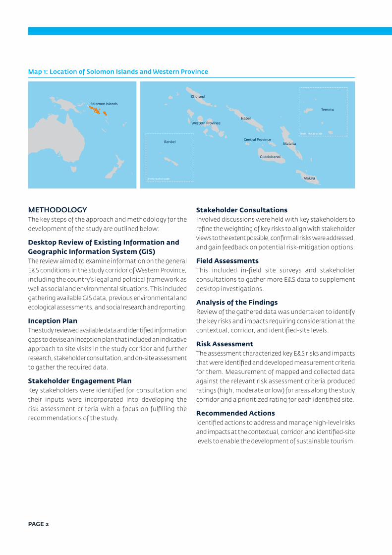
Map 1: Location of Solomon Islands and Western Province
Inset: Not to scale
Inset: Not to scale
Western Province
Solomon Islands
Choiseul
Isabel
Central Province
Guadalcanal
Malaita
Makira
Temotu
Renbel
METHODOLOGYThe key steps of the approach and methodology for the development of the study are outlined below:
Desktop Review of Existing Information and Geographic Information System (GIS) The review aimed to examine information on the general E&S conditions in the study corridor of Western Province, including the country’s legal and political framework as well as social and environmental situations. This included gathering available GIS data, previous environmental and ecological assessments, and social research and reporting.
Inception PlanThe study reviewed available data and identified information gaps to devise an inception plan that included an indicative approach to site visits in the study corridor and further research, stakeholder consultation, and on-site assessment to gather the required data.
Stakeholder Engagement Plan Key stakeholders were identified for consultation and their inputs were incorporated into developing the risk assessment criteria with a focus on fulfilling the recommendations of the study.
Stakeholder ConsultationsInvolved discussions were held with key stakeholders to refine the weighting of key risks to align with stakeholder views to the extent possible, confirm all risks were addressed, and gain feedback on potential risk-mitigation options.
Field AssessmentsThis included in-field site surveys and stakeholder consultations to gather more E&S data to supplement desktop investigations.
Analysis of the FindingsReview of the gathered data was undertaken to identify the key risks and impacts requiring consideration at the contextual, corridor, and identified-site levels.
Risk Assessment The assessment characterized key E&S risks and impacts that were identified and developed measurement criteria for them. Measurement of mapped and collected data against the relevant risk assessment criteria produced ratings (high, moderate or low) for areas along the study corridor and a prioritized rating for each identified site.
Recommended Actions Identified actions to address and manage high-level risks and impacts at the contextual, corridor, and identified-site levels to enable the development of sustainable tourism.
PAGE 2

RISK-ASSESSMENT METHODOLOGY The risk-assessment process was guided by the IFC Performance Standards (IFC PS), as depicted in Figure 1 below.
Figure 1: Risk-Assessment Methodology Framework
• Risks that can vary across the corridor and are largely based on secondary data• Risks can potentially be reduced with appropriate management and mitigation
• Broad overarching risks that are beyond the control of the developer and are general risks of doing business in Solomon Islands
• Risks related to identified sites based on primary and secondary data• Risks can potentially be reduced with appropriate management and mitigation
and through planning of appropriate tourism operations
CONTEXTUAL RISKS
CORRIDOR RISKS
IDENTIFIED SITE RISKS
PAGE 3

Using baseline data, the E&S risks were characterized into three levels of assessment as detailed in Table 1. For the purposes of this study, only the risks considered relevant to tourism development in Western Province have been included.
Table 1: Characterization of Risks
Risks Description
Contextual risks
• Contextual risks—from a private sector’s E&S perspective—are defined as external risks at a country, sector, or subnational level that project developers do not control but can negatively impact a project’s or private sector client’s ability to meet IFC’s E&S requirements and other international good practices.
• Existing country-level risks in Solomon Islands, including in Western Province, considered applicable for the tourism sector are captured. They include security and conflict; political risks and governance; access to infrastructure; labor and workforce; food security and health epidemics; natural disasters; biodiversity, ecosystem services, and climate change; access to land and natural resources; social cohesion; gender; and reprisals.
• The contextual risks were assessed based on IFC’s contextual risk framework, professional judgment, field assessments, and stakeholder consultation.
• High and moderate risks likely to turn into high without mitigation are included.
Corridor risks • E&S risks that would occur in the study corridor (areas defined by IFC as within 20 kilometers of airports or less than 1 hour by boat of Western Province airports of Gizo, Munda, and Seghe as well as areas along the water transport route that are further than 20 kilometers from airports but have existing or high aesthetic potential for tourism development) and might vary depending on the availability and precision of data. These risks were assessed based on secondary data, particularly through GIS mapping, which seeks to support investors and government in identifying potential tourism sites with lower E&S risks.
• The corridor risks were assessed using a low, moderate, and high rating.
Identified-site risks
• Site risks were determined through on-site investigations and stakeholder consultations, supplemented with secondary data.
• Site risks were assessed through a multi-criteria analysis based on qualitative and semi-quantitative data. A linear scale from 1-10 was used to categorize the risk ratings (1-3 – low risk; 4-6 – moderate risk; 7-10 – high risk).
Details of the assessment methodology are covered in section 2.
PAGE 4

BASELINE DATATourism in Western Province The tourism industry is still in its infancy and centers on nature-based activities as well as cultural and/or historical tours, with a growing number of cruise and sailing tourists. Limited infrastructure, high operational costs, and tourism marketing have stunted the further development of tourism in the province.
To attract investors, the SIG began offering a Tourism Investment Incentives Package in 2017, providing tax reliefs, duty exemptions, and energy incentives. Map 2 depicts existing tourism providers in Western Province and indicates current land uses and known proposed infrastructure upgrades.
Map 2: Land Use, Existing Tourism, and Proposed Infrastructure
KolombangaraIsland
Vonunu
Ringgi
Ghizo Island
Noro
New Georgia
Rendova
Tetepare
VangunuIsland
Peava
Ranongga
Munda
Gizo
Seghe
¯
Identified site boundaries
Logged areas
Reefs
LandcoverCassava
Coconut crops
Coconut forest
Coconut plantation
Cultivated land
Forest
Grassland
Nut tree
Oil palm
Open land
Other
Plantation
Rice
Settlement
Taro
Water
0 7.5 km
PAGE 5

Out of the nine provinces in Solomon Islands, Western Province is by far the most popular for tourists. It has an area of 5,475 km², comprising 16 large islands and hundreds of smaller ones (see Map 3). Small but regular numbers of international tourists have been visiting the province since the 1990s. There are several reasons why Western Province is the tourism hub of the country: the geography of the province—with its many islands, lagoons, and extinct volcanoes—makes
it spectacularly beautiful; the reefs in the province have some of the highest marine biodiversity in Asia-Pacific and are recognized as a world-class dive destination; and the province has historically been a center of trade and commerce, which makes the local communities more open to tourism development than more remote regions of the country.
Map 3: Map of Western Province
Nusa SimboIsland
Inset: Not to scale
Tetepare
Rendova
VangunuIsland
Kolombangara Island
Vella LavellaIsland
RanonggaIsland
ShortlandIslands
MonoIsland
Kohinggo Island
New Georgia
GhizoIsland
Ringgi
Chuchulu
Halisi
Ndora
Seghe
Peava
Noro
Munda
Gizo
PAGE 6

Since 2017, there have been positive developments benefitting the tourism sector in Western Province. Projects include extensions to telecommunication networks, energy and water supply, and upgrades of roads, ports, and airports.( 4) The province has one international and four regional airports as well as one international port.
A real milestone for tourism was reached in March 2019 when the upgraded Munda International Airport, funded by the New Zealand Ministry of Foreign Affairs and Trade, opened a weekly direct flight from Brisbane, Australia to Munda. The SIG is trying to reduce the country’s reliance on logging and sees tourism as a viable growth sector.( 5) The focus on Western Province as a priority destination is due to its pristine environment and internationally recognized diving and World War II (WWII) sites.
Tourism operations in Western Province concentrate around the three main airport hubs of Gizo, Munda, and Seghe. Most are accommodation providers that also offer activities and excursions. Apart from two hotels in Gizo and Munda, most operations are located on scenic islands and can be described as small resorts or lodges. The core of the Western Province tourism sector is 15 operators who regularly receive international tourists as a result of being featured in the programs of wholesalers/specialized travel agents, or online travel agents in Australia and New Zealand. They are mostly foreign owned and operated. Apart from the established tourism operators, a growing number of local operators is trying to enter the market. There are also local guesthouses catering for local businesses and domestic travelers.
Political Context and Legal FrameworkSolomon Islands is a unitary state with a national and provincial-level government. While the country and its provinces have both national and provincial legislation, customary rights and law take precedence over common law. Although customary rights protect the interests of tribes and local communities and families, the status quo presents challenges to the government and tourism investors because the bridge between Solomon Islands’ legal systems and customary law is weak.
4 Activities responding to IFC’s WPTINA investment recommendations and other works undertaken by the SIG, donors, and the private sector since 2017 are tracked through the Western Province Tourism Investment Plan.
5 Solomon Islands National Development Strategy 2016-2035.
The SIG has gazetted and implemented various policies, legislation, and strategies relevant to tourism development, including the Environment Act 1998, the Wildlife Protection and Management Act 2016, the Solomon Islands Visitors Bureau Act 1996, the Gaming and Lotteries Bill 2004, the Solomon Islands National Tourism Development Strategy 2015–2019, and most recently the Western Province Tourism and Culture Policy 2019-2021. Relevant governing bodies and agencies at both national and provincial levels facilitate the implementation of the legal frameworks and policies, although their capacity to monitor and enforce E&S safeguards is limited.
One of the most pressing development challenges for Solomon Islands is access to land. Despite legal mechanisms to facilitate land registration, such as the Land and Titles Act 1968 and the Customary Land Records Act 1994, it remains a lengthy and arduous process because of conflicting land claims and the tendency to settle such claims through traditional mediation. As such, land registration records may not be up to date.
Due to these issues, IFC only considered registered land—not customary land—when selecting land parcels and sites. While registered land is a relatively small share of overall land, there is enough land with tourism potential to meet near-term investment needs. A lot of registered land is old plantations on small islands and along the coast with access to regional hubs that provide supporting infrastructure, such as airports, ports, suppliers, and services, to facilitate tourism development.
Status of the Environment and/or BiodiversityEcologically, Solomon Islands is part of a recognized eastern Melanesian biodiversity hotspot and is recognized as significant due to a high level of endemism, particularly for mammals and birds. It is also part of the coral triangle with significant, intact tropical coral reefs. Yet, at the study-corridor and investment-site levels, the distribution and occurrence of species considered to be of conservational significance is poorly documented. The Western Province terrestrial environment within the study corridor is dominated by anthropogenic disturbances,
PAGE 7

nearly all associated with the development of copra plantations on coastal fringes and extensive mechanized logging on coastal lowlands and ridges, including some higher altitude areas. This has given rise to a mosaic of successional vegetation communities, which in their own right have become a discernible habitat type. Based on The International Union for Conservation of Nature’s Red List of Threatened Species (IUCN Red List) (IUCN 2020), the conservation-significant species that are known to occur at sites within the study corridor include three mammals, one reptile, one amphibian, 11 birds, 15 plant species, one fish, and one insect. Overall, these numbers reflect a small proportion of the overall known biodiversity of the region. Ninety-four fauna species are known to be introduced (invasive) to the environment.
Within the corridor, four key terrestrial communities are particularly sensitive based on-site studies and available information. They are:
• Forests that are above a 400 m altitude and include cloud forests and their unique species assemblages (flora and fauna), notably on Kolombangara Island
• Small island communities on coralline substrates – which are widely distributed throughout the corridor – where there is limited to no disturbance evident
• Any primary coastal lowland forest, but nearly all these areas have been logged and representative areas are restricted to limited localities such as on Tetepare Island
• Freshwater wetlands and the interface with intertidal communities, such as mangroves, but they remain rare, poorly understood, and relatively undisturbed on New Georgia and Vangunu islands
Socio-Economic The total population of Western Province is estimated to be 99,000 (48 percent women), with 87 percent classified as living in rural areas.( 6) This population consists of almost 14,000 households with an average household size of 5.3 people. The median age was 39.5 years in 2019, with an adult literacy rate of about 76 percent. The main socio-economic activities include fisheries, forestry (logging
6 Solomon Islands National Statistics Office, “Projected Population by Province 2010-2025.”
7 Kastom is a Solomon Islands pijin term that can refer to shared traditions but also to contemporary ideas and institutions perceived to be grounded in indigenous concepts and principles. Thus, kastom is not, as is often supposed, synonymous with the English word “custom,” which is typically conceived as Melanesian ways from before the arrival of Europeans in the islands. In addition to its usage in everyday language, anthropologists have analyzed and debated kastom’s meanings. Particularly in its political uses, kastom is often closely tied to indigenous means of dispute resolution, or “kastom loa,” set in opposition to state or government law (Solomon Islands Historical Encyclopedia 2020).
8 People of an extended family and/or people from the same language group.
9 The 2009 Census categorized atheists/non-religious under “all other faiths,” totaling 5 percent of the population.
and plantations), tourism, and agriculture.
Cultural ContextIn Solomon Islands, kastom( 7) and the wantok( 8) system – based on traditional culture – apply to doing business and, in some cases, public governance. The wantok system is perceived as a way of helping family, relatives, and neighbors during times of need. However, there have been cases where conflicts occur between the wantok system and formal governance systems inherited from colonial times. In addition, Western Province comprises several different tribes and villages, which all have their own leadership styles, customary governance, and languages.
Examples exist of disagreements and conflicts between tribes and villages when only one part of the community has benefitted from a business activity. Other factors affecting tourism development include religion, kastom practices, and cultural celebrations due to their meaning and importance to the cultural identity of the tribes and/or local communities.
About 95 percent( 9) of the population follow a Christian faith, with 39 percent involved in the United Churches, which have the largest following within Solomon Islands.
Existing and Proposed Infrastructure and Access to Services Western Province is accessible via its maritime ports that are scattered throughout the province and the public airports of Gizo, Seghe, and Noro. There are several informal or unused airstrips in the province, most of which were constructed during WWII.
The province’s geographical characteristics have presented challenges to the construction and maintenance of transportation infrastructure in the islands and remote communities. The main form of transport is the “banana boat” or “ray boat,” which is a 7-meter-long, 2.5-meter-wide open boat with an outboard motor. As a nation of islands, with many remote communities, the delivery of public goods/services and access to basic needs infrastructure are further exacerbated by logistical and financial challenges.
Similarly, other infrastructure and services, such as energy

systems, water supplies and systems, waste management, and telecommunications, are also limited.( 10) Most proposed service infrastructure upgrades for power, water, and waste are focused around the towns of Gizo, Munda, and Seghe, with smaller projects providing other services such as jetty upgrades and mobile banking services in remoter areas of the province.
Map 2 summarizes the current land use, identifies the main settlement areas, existing tourism operators, and proposed infrastructure upgrades in Western Province.( 11)
ANALYSIS OF FINDINGS AND RISK ASSESSMENTBased on the data collected from various sources and site visits, risks and opportunities for tourism development have been identified. The main observations are:
CONTEXTUAL LEVELSocial cohesion: Investors and developers should consider local tradition, culture, and religion in Western Province when planning tourism developments. Otherwise, discontent and conflict could erupt and cause unnecessary delays on proposed developments, increase investment cost, and pose security risks to government and business. Based on the stakeholder consultations undertaken, local communities realize that tourism development can influence their way of living because of increased interactions with visitors and greater exposure to different cultures. But the communities can also share their customs and cultural practices with visitors and developers to foster greater respect for their identities and more culturally sustainable developments.
Security and conflict: Over the last decade, there have been no notable wide-scale conflicts and/or security situations that could impact tourism development in Western Province. The conflicts in Guadalcanal and Malaita provinces during the late 1990s to 2000s and informal settlements in Honiara were considered in the analysis. However, the relevance of this risk is considered limited for tourism development in Western Province. Local conflict is covered separately under reprisal risk.
Labor and workforce: Solomon Islands has a young population that will provide enough staff to support a tourism workforce, but the average skill level is limited because of low education levels. Accessing labor from
10 IFC, WPTINA, October 2018.
11 Proposed infrastructure has been mapped in sites that are able to be defined.
the local communities will likely require reasonable effort and investment in training. Tourism operations may help address gender inequality, which constrains many women to a limited set of defined roles and reduced access to benefits from development. Investment in training and/or capacity building in tourism operations and management would be necessary to maximize labor inputs from local communities. In the case of child labor, the SIG allows children as young as 12 to undertake some types of work under the Labour Act 1996, which does not align with the International Labour Organization’s minimum working age of 15 (13 for light work).
Food security: While the country has a wide range of natural resources to support food production, there remains strong pressure on reef fish stocks due to overfishing. The country’s resilience and capacity to deal with food shortages may be limited.
Health epidemic/pandemic: Solomon Islands’ health system has limited capacity to cope with epidemics or pandemics. This is exacerbated in Western Province, where clinics in remote areas have only basic facilities. Tourism will potentially increase community vulnerability to epidemics/pandemics through the local and international movement of people. While the tourism sector would provide some buffering capacity and additional resources, the medical capacity to deal with emergencies and epidemics/pandemics, especially in the province’s rural areas, is likely to pose a moderate to high risk.
Political risk and governance: Based on the desktop research, government agencies responsible for the efficient and equitable public-service delivery face challenges in enforcing relevant policies and/or legislation to ensure that E&S safeguards are in place. Complicating the problem is a weak link between customary practices, or wantok, and common law, resulting in lengthy and bureaucratic procedures for the setting up of businesses and potential integrity issues. Despite efforts to improve the business-enabling environment, the existing policy framework, limited capacity of government agencies, and insufficient data inhibit the smooth delivery of public services; government agencies are also facing difficulties in monitoring businesses’ adherence to their E&S policies. Nonetheless, it should be noted that the SIG and the Western Provincial Government have strong political will to tackle
PAGE 9

the issues and open the market for tourism development.
Natural hazards: Solomon Islands is situated in the “Ring of Fire,” a seismically active location, and are also prone to tropical cyclones. A tsunami swept Western Province most recently in 2007. The community’s ability to react to natural hazards will depend on strong disaster risk management planning, awareness, and warning-system practices, which remain limited at present.
Biodiversity, ecosystem services, and climate change: Based on the contextual analysis, deforestation, sedimentation risks to marine habitats, threats to the sustainable use of natural resources, government capacity in natural-resource and protected-area management, and climate change vulnerability and resilience present high risks. Policy gaps as well as implementation and enforcement of regulations and laws need to be addressed to strengthen the protection and conservation of local biodiversity and ecosystems. It is worth noting that Solomon Islands is highly vulnerable to the impacts of climate change and rising sea levels.
Access to land and natural resources: Tourism investors and developers have found it difficult to identify sites for development because of insufficient data on registered land titles and limited access to records. Much of the country’s land, particularly customary land, is not surveyed or registered. Local tribes, communities, and families face challenges in recording customary land due to overlapping claims to land and/or resources.
Reprisals: In Western Province, reprisals are a high risk for tourism development as discontent and/or jealousy among local communities have led to conflict in the past.
CORRIDOR LEVELEnvironmental FindingsAs most tourism activities in Solomon Islands are nature-based, the threat to local biodiversity and ecosystems could be critical. Thus, tourism development planning in the province should consider wildlife and the potential for increased interactions. At the corridor level, environmental risks were analyzed and categorized into three levels for both the marine and terrestrial environments, as shown in Map 17. Low-risk areas are highly modified and have limited ecological value; moderate-risk areas have some ecological value and potential sources of vegetation; and high-risk areas are important ecological habitats requiring
management and/or protection. This map has used several inputs including information on conservation areas, habitat condition and landforms, the marine ecosystem, and the coral reef system.
Marine Environment Low-risk areas: Open ocean areas that are not at risk from tourism development within the study corridor. Some reef systems are primarily associated with high fishing pressures, coral extraction, and other intensive resource use. These areas are afforded limited to no constraints to development at a corridor level.
Moderate-risk areas: Coral atoll reef systems of the smaller island conglomerations, particularly the Vona Vona Lagoon between Parara and Arundel (Kohinggo Island), Roviana Lagoons, and the outer barrier reef systems east and west of Vangunu Island. They support sparse but widespread settlement where artisanal fishing pressures are limited. Detailed site-level investigations are necessary to establish whether potential investments will meet good international industry practices.
High-risk areas: Six distinct areas in the corridor centering on reefs of outstanding known (and published) biodiversity values and extensive areas of mapped mangroves/intertidal areas that sustain critical ecosystem processes. Some of these locations include Marine Protected Areas, notably the area of Saeraghi Reef at the northern end of Ghizo Island.
Terrestrial Environment Low-risk areas: Areas with low biodiversity and limited ecological value. These include areas comprising monoculture, such as coconut plantations and plantation forestry blocks on Kolombangara, cultivated areas and others that have been significantly modified by human activity, including urban and village areas and environs such as most of Ghizo Islands, Ringgi Station, Munda, Noro, and Seghe.
Moderate-risk areas: Areas that support harvesting activities and are a source for vegetation and/or livelihood for local communities. They provide key resources to local communities and ecosystem services.
High-risk areas: Areas that are commercially logged and heavily impacted by human activity often reaching their carrying capacity. Smaller sections of the terrestrial corridor support harvesting activities and are a source for vegetation and/or livelihood for local communities.
PAGE 10

Key biodiversity areas and natural habitats within the terrestrial corridor sustain critical ecosystem processes and breeding areas for internationally listed threatened species, which may be disrupted or impacted by tourism development. These areas are already at risk because of logging activities affecting local biodiversity. Enforcement of environmental policies to protect and conserve the ecosystems in the areas is weak.
Social FindingsSocial risks at the corridor level consider land tenure, presence of unexploded ordnances (UXO), and proximity to key infrastructure such as airports and medical facilities for access to goods and services. Other social indicators were discussed in the contextual and site-level analysis, but it would be difficult to measure them across the corridor because of a lack of data that allowed generalization. Map 18 shows social risks at the corridor level.
Low-risk areas: Registered land less than 15 km from airport and less than 10 km from a medical facility. Most areas would have a low likelihood of UXO presence. Low-risk areas are located on Ghizo Island, coastal margins of the Vona Vona Lagoon, and the environs of Munda, Noro, and Seghe.
Moderate-risk areas: Surveyed but not registered land 15 km to 30 km away from airport and 10 km to 15 km from medical facilities; these areas also include potential exposure to UXO. They cover the Rendova coast, small sections of Ranongga (excluding UXO) and Vonunu, Kolombangara Island, and the northern end of Gizo; other areas include a portion of Vangunu Island and an area north of Seghe on New Georgia Island.
High-risk areas: Customary land 30 km to 50 km away from airports and 15 km from medical facilities with potential exposure to UXO. All remaining areas of the map not named above are rated high as the land is either customary or surveyed and a larger distance from the airports and medical facilities.
Overall Environmental and Social-Risk RatingsMap 19 depicts the overall environmental and social-risk areas of the corridor. Where an area of the study corridor is classified as high in the environmental assessment and low in the social assessment (or vice versa), it is considered to be an area of moderate risk overall, as reported below:
Low-risk areas: Considered to be more appropriate for tourism development because of their proximity to urban areas and infrastructure, such as Gizo, Noro, Munda, and Seghe. Land in these areas tend to be registered or surveyed for development. Most low-risk areas are in coastal locations and are not in proximity to areas of moderate-to-high-importance marine areas.
Moderate-risk areas: Rural or less developed areas with a mix of coastal and inland areas, with greater distance from urban areas and infrastructure. Landownership and/or identification can be more challenging in these areas as it includes unregistered land. They are likely to require further investigation to determine E&S risks, depending on the size and nature of the tourism development.
High-risk areas: Remote customary land with high-value ecological areas where human impacts are limited. These areas are likely to be significantly distanced from infrastructure and urban areas requiring travel on foot or by boat and are generally in land. They require the most planning and consideration before proceeding with any form of tourism development.
IDENTIFIED-SITE LEVELThe risk categories and descriptors for environment, social, and natural hazards are summarized in Table 10, 11, and 12. The overall environmental, social, and natural-hazard ratings at the 70 identified sites combining all risks are summarized in Map 23.
Environmental risks: Field and walkover surveys were undertaken by observing the sites. While the general condition and integrity of habitats and ecosystem processes were recorded, detailed surveys of flora/fauna of conservation significance were not possible (see Table 10).
Social risks: These risks have been evaluated using specific-site observations, aerial photo review, and discussion with communities, stakeholders, landowners, and users. The risk categories and descriptors are summarized in Table 11.
Natural hazards: Some areas of the identified sites are more prone to natural hazards, including coastal vulnerabilities and sea-level rise. Limited secondary, site-specific data was available for Western Province, so natural hazards have largely been assessed based on site observations and professional judgment. In this study, it was surmised that sites with a low-risk rating could be more easily developed, but sites with moderate-to-high-risk rating could still be
PAGE 11

considered for development if mitigation measures could be devised based on impact-assessment processes specific to individual sites (see Table 12).
CONCLUSIONS AND RECOMMENDATIONS This report was developed as a high-level landscape study and site-screening tool to inform relevant government agencies in Solomon Islands and Western Province, potential and current tourism investors and developers, and other relevant stakeholders such as NGOs, CSOs, and local communities E&S situation and associated risks and opportunities for tourism development in the province.
The SIG, the Western Provincial Government, and other government agencies can use the report to ensure that E&S risks are addressed at the earliest stages of tourism-development planning. The analysis of risks and specific recommendations in Table 14 can inform policy priorities and strategic development plans.
Developers and investors can use the study to plan tourism projects, activities, or establishments, particularly regarding site selection. The report also lists out business requirements and challenges, especially concerning access to customary land and natural resources as well as the contextual risks in Solomon Islands and Western Province.
Local communities may use this study to learn about the opportunities and risks of tourism development that may affect them and collaborate with the SIG and the private sector.
For NGOs and CSOs, the information may augment or improve their programs in Western Province.
The E&S and natural-hazard risks identified through this study show the riskiest areas for tourism development at the landscape and site levels. Developing the low-to-moderate-risk areas, subject to environmental impact assessments (EIAs) and appropriate government approvals/permits, will ensure minimal incremental impact on biodiversity, ecosystem services, land tenure, and local communities.
For high-risk sites, robust E&S impact assessments, monitoring, and a comprehensive management plan should be required to manage the impacts during different phases of project development. Managing E&S risks is complex and takes time and resources; early and genuine engagement with local communities and other stakeholders can mitigate such risks. Participatory approaches that enable community-based initiatives is a proven way for developers/investors and local government authorities to devise a sustainable solution.
In addition to the risk-assessment recommendations above, the study recommends:
Enhancement of the regulatory framework: Taking into account the E&S risks presented in Table 14, policies relevant to tourism development, including the Environment Act 1998 and the Land and Titles Act 1968, should be updated. Relevant government agencies, such as the Ministry of Environment, Climate Change, Disaster Management and Meteorology (MECDM), should reinforce the monitoring and implementation of environmental and social safeguards to conserve local biodiversity, protect communities, and strengthen the business-enabling environment. The government needs to strengthen the statutory obligations of these agencies.
Capacity building: E&S technical training of key government agencies is recommended to improve their capacity for delivering better public services and monitoring and enforcing policies. At the same time, the SIG and/or the Western Provincial Government can work with NGOs, CSOs, and academic and research institutes to provide training on tourism hospitality and health and safety to local communities so that they can share the benefits of tourism development.
PAGE 12

Assessments to address information/data gaps: • Improve the accessibility and quality of spatial data:
- High-resolution topographical survey (mapping one-meter contours) will assist with development planning, hazard mapping for floods and tsunamis, and disaster planning.
- Bathymetric surveys will improve navigation, maritime planning, and infrastructure development.
- Update mapping and document key biodiversity areas and habitats in both the marine and terrestrial environments, including detailed species ordinances.
- Update land and site-boundary surveys to assist with land transaction and leasing.
- Record and register cultural and tabu( 12) sites and areas, included detailed mapping with support of local communities.
• Strengthen marine-resource monitoring, such as the abundance and size of fish stocks, biosecurity, and the occurrence of bio-invasive species.
• Assess and identify the top training priorities within the SIG, in terms of services, to better support tourism development.
• Table 14 and 15 summarize the contextual, corridor, and identified-site E&S risks associated with tourism development as well as proposed actions to assist stakeholders in: (i) facilitating tourism development, (ii) mitigating risks to the natural and social environments, and (iii) attracting national and international partners.
• Only risks relevant to tourism development are included. The following have been excluded:
• Security and conflict are considered to have limited relevance to tourism development in Western Province. Petty conflict may occur among community members – this is covered under reprisal within the risk matrix.
• Biodiversity, ecosystem services, and climate change are discussed in the corridor section of the risk matrix.
12 Tabu, as it has been adopted into the English language, has come to mean “set apart as sacred or accursed or forbidden by social convention;” tabu can also mean something is forbidden, usually with spiritual sanctions, and as such emphasizes the religious significance of the term (Burt 1988)
PAGE 13
Photo Credit: Becky Last

PAGE 141

Contact
International Finance Corporation 1st Floor, Heritage Park Commercial Building Mendana Avenue Honiara, Solomon Islands + (677) 21444
International Finance Corporation Level 18, CML Building 14 Martin Place Sydney, NSW 2000 Tel: (+61) 2 9235 6519
Stay Connected
www.ifc.org/eastasia
www.twitter.com/IFC_EAP
www.facebook.com/IFCeap
IN PARTNERSHIP WITH