dhs information technology evaluation program (itep) project pennsylvania project: enterprise...
Post on 19-Dec-2015
221 views
TRANSCRIPT

DHS Information Technology Evaluation Program (ITEP)
Project
Pennsylvania Project: Enterprise Geospatial Technology
Data Architecture (EGTDA)
Jim Knudson ([email protected])Stacey White ([email protected])

EGTDA Project Background• Grant amount: $603,220• PA project started with a concept and a blank
slate – no existing project to augment, built everything from a bare bones architecture
• Contractors started 6/1/05 (later than most participants), project completed on 3/31/06 (10 months)
• NOT a pilot project for Pennsylvania…– Amazing production capabilities built in 10 months!– We accomplished the impossible…

Project Participants• Governor’s Office• Pennsylvania Emergency Mgmt Agency• DHS Geospatial Mgmt Office/OCIO• ITEP Program Office• GeoDecisions• ESRI• GTO• PA State Police• Office for Information Technology• Regional Counter-Terrorism Task Forces

DHS ITEP Grant Project• PA project defined as Enterprise GT Data
Architecture (EGTDA)– Evaluation of DHS Geospatial Enterprise Architecture
(GEA), start of PA GEA– Enterprise Geospatial Data Repository (designed,
built, populated)– Interoperable GT Data Sharing utilizing Open
Geospatial Consortium (OGC) Mapping Services (14 function-based services, e.g. transportation, utilities)
– Geospatial Mission Applications – situational awareness
– Reusable GT Web Service Components – routing, geocoding

Initial ITEP Architecture Concept
Oracle/Enterprise SAN
OGC-compliant Web Services layer:WMS, WFS, LBS, etc.
GeospatialServer
BasemapFeatures
GeospatialServer
GeocodingServer
GeospatialServer
ImageryServer
GeospatialServer
WeatherServer
GeospatialServer
MetadataServer
GeospatialServer
Secure HSCI Server
Firewall
Non-Secure Data Secure Data
Application Users
GISDesktop
User
HealthNEDDSServer
DEPPAIRSServer
PSPIIMS
Server
PEMAPEIRSServer
OtherAgency
Application
FirstResponder
Internet
GeospatialDatabase

ArcGISServerSOC
`
Oracle SANArcSDE
Repository/Oracle Cluster
Por
t 530
0
Port 5353 & 5052
Port 1521
State ArcGISDesktop and
Co-Location Users
ArcGIS CitrixMetaframe
Por
t 152
1
ArcSDE DirectConnections
Geospatial Enterprise Server Architecture
Port 80
ArcIMS Image andFeature Services
Port 5151 & 5152
Data LoadingOnly
IBMx346s
IBMx445DPs
IBMx346s
IBMx445DPs
Port 1521
MAN Access
Internal Services
ArcGISServerSOM
Port 135/D
CO
M
Port 135/DC
OM
Port 135/DCOM
Port 135/DCOM
Citrix SecureGateway
(OAREMOTE)
Internet MAN
Port 8
0
Por
t 80 P
ort 80
Port 80 Port 80
Port
80
Port 8
0
Hardware Load BalancedHTTP Servers/ArcIMS Connectors
and ArcGIS Server ADF
Hardware Load BalancedHTTP Servers/ArcIMS
Connectors
Por
t 530
0
Por
t 530
0
Por
t 445
Por
t 445
Por
t 445
IBMx445DPs
Port 5353 & 5052
Por
t 530
0
Por
t 530
0
Por
t 530
0
Por
t 445
Por
t 445
Por
t 445
Port 5353 & 5052
Port 5353 & 5052
Port 5353 & 5052
Port 1521
Port 1521 Por
t 152
1
Port 1
521
ArcIMS Application &Spatial Server
ArcIMS Application &Spatial Server
ArcIMS Application &Spatial Server
ArcIMS Application &Spatial Server
ArcIMS Application &Spatial Server
Port 1521
ArcIMS Application &Spatial Server
ArcSDEActive/Passive Cluster
Port 1521
Por
t 445
Port
445
Por
t 445
Por
t 445
Port
445
Por
t 445
Port 5353 & 5052
Updated: January 20, 2006

Geospatial Enterprise Server Architecture (GESA)
• Fault tolerant, high availability, 24x7 operational capabilities built for mission critical public safety applications that supports– Consolidated Enterprise Geospatial Database– Shared Services GT Application hosting environment –
for BGT and other agencies– OGC Mapping Services for information sharing– XML Web Services Reusable Components– Geospatial Portal Deployments
• ITEP project added additional storage and GIS software, with permission from DHS, we flipped our budget from equipment focused to services focused

Geospatial Portal Development• Competitive procurement produced best technical,
lowest cost vendor solution • Leverages the IRRIS Geospatial Framework for
Pennsylvania– $15M Investment in IRRIS by the Military Surface
Deployment and Distribution Command Traffic Engineering Agency (SDDCTEA), implemented by GeoDecisions
– Pennsylvania recognizes Mr. Paul Allred and Mr. Marc Barthello from SDDCTEA for their vision in sharing geospatial framework source code resources from the IRRIS project to further military, homeland security, and public safety initiatives for states and other organizations to utilize and add new components to the framework
– Not Shareware or Open Source, but Shared Source

PA Data Sharing Before ITEP…
AgencyX
AgencyY
AgencyZ
Agency?
SneakerNet?

AdjacentStates
PA Data Sharing After ITEP…
AgencyX
AgencyY
AgencyZ
AllAgencies
RCTTF
FED
EnterpriseGeospatialDatabase
AgencyW
LocalGovt
Data Producers
Data Consumers

EGTDA Concept of OperationsFuture
Data FusionCenter
PEIRSIncident
Database
PEIRSReportableIncidents
All Incidents(Future)
ThematicIncident
Maps
HSWGIncident
Symbology
QuickPlumeModel
AddressGeocoding
Routing
MapView
Metadata
SpatialSearches
ITEP GT Web Services
GeospatialEnterpriseDatabase
DHSAdvisories
AgencyInformation
County9-1-1
Incidents
OtherInformation
PEIRSGeospatialDatabase
DataReplication
TEP2005ProjectEnterpriseGeosp tia TechnologiesDataArchitecture
PEIR
DHS ITEP 2004PA Enterprise Geospatial Technologies Data
ArchitecturePEIRS Geospatial Enhancements
Conceptual Design

EGTDA Concept of Operations• Augment PEMA’s PA Emergency Incident
Response System (PEIRS) with robust geospatial capabilities
• Develop interoperable OGC mapping services that can be accessed over the web and used by agencies, counties, first responders
• Develop interoperable and reusable XML web service geospatial application components

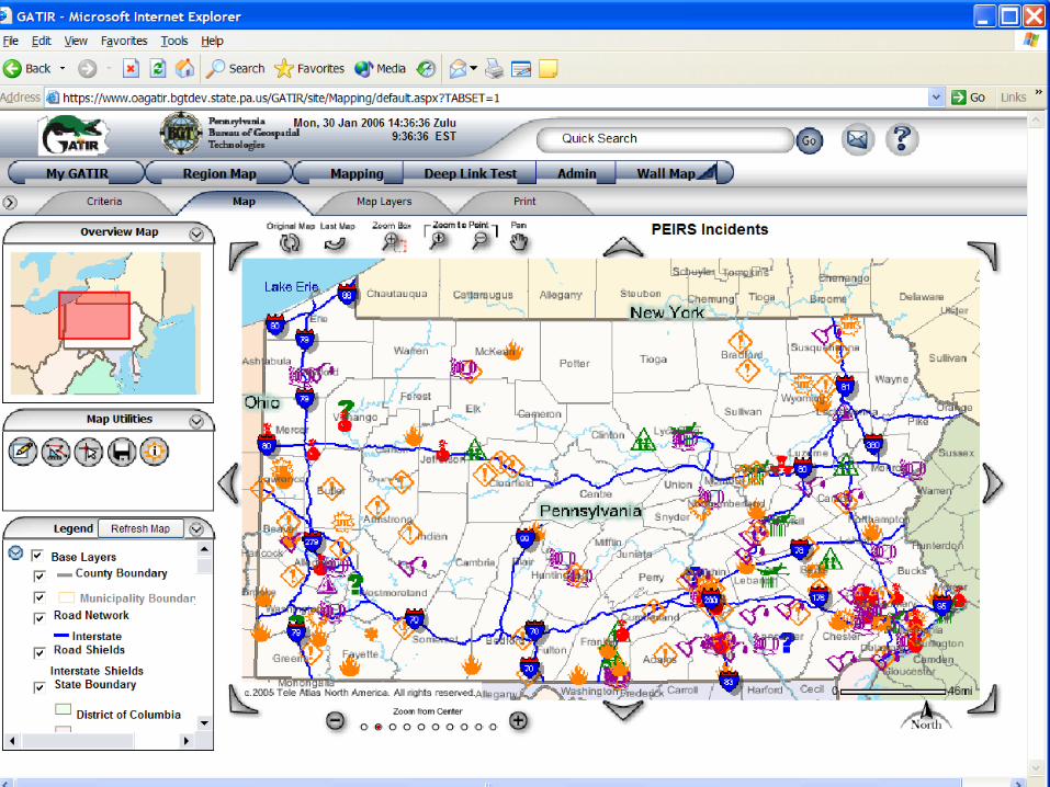
GATIR Functionality• PEMA PEIRS Added Functionality
– Replaced incident location red and green ‘dots’ with meaningful incident symbology based on PEIRS category
– Role based user security mechanism for incidents – PEMA PEIRS controls who sees what incidents based on the user login
– Thematic Incident Detail Maps – type of incident determines symbology and displayed layers, 1-5 mile distance rings, key assets/critical infrastructure nearby highlighted

GATIR Functionality• PEMA PEIRS Added Functionality
– Federal Disaster Declaration Map Automation– EOC/Situational Awareness Wall Map– Mapping, analysis, geocoding, routing– PEMA maintains control for access and details, GATIR
assists in mapping and analysis– Difficult part was that PEIRS was being rewritten in .NET as
the same time as our GATIR project was being developed

Lessons Learned• HSWG Symbology was a good starting point,
but for electronic mapping and use in the EOC, we had to significantly modify the symbology to be useful and meaningful
• It was critical to have the development team onsite to work side by side on a project of such short duration. Implementation decisions were made daily.
• Needed to document decisions in writing instead of verbally so that intent was captured correctly

Lessons Learned• Every implementation is different, and nobody
has really figured out the best solution for load balanced, fault tolerant geospatial applications. We re-architected our design in the middle of the project to fix stability and performance problems
• Map colors were very important to convey information and be visible in the EOC on the projection screens – red colors are the most critical, orange and purple are important, green and blue are informational

EGTDA and GATIR


Wall map slide


Quick maps slide


GTO Integration Vision
WebSAAL Authorized Users
MappingWS
RoutingWS
AddressGeocoding
WS
AddressVerification
WS
SpatialSearch
WS
PlumeModeling
WS
MappingServices
EnterpriseGeospatialDatabase
Justice Network(JNET)
Public Safety Portal
Weather Apps
SHSP2004
PennSafe Database
SARATitle II
HAZMAT
Hazardous MaterialInventory
First Responders
SEE-Team
KC/SSI
UPMC
Pittsburgh -Region #13
XML
DeeplinkURLs
?
UPMCGeospatial
Portal?
Bureau of Geospatial TechnologiesPresent and Strategic Vision 2006-2008
Weather ProvidersMeteorlogix
AWS WeatherBug
Philadelphia
Pittsburgh -Region #13 19 April 2006OA/OIT
Jason SalvaggioMary Johnston PMPPublic Safety CoP
Jim KnudsonBGT
Version #9Work in Progress
DRAFT
Legend:
Planned Initiative - - - - - - -Completed Initiative _____
Severe Weather AlertingPlume Modeling
Real-TimeWeather
Data
XML
?
NIPP
CriticalInfrastructure
(CI)
CriticalInfrastructure
GATIRTransportation
Portal
2004, 2005,2006 FHWAEarmarks
IRRIS (Framework)
DeeplinkURLs
UserUpdate
WS
IncidentUpdate
WS
HospitalStatus
GATIRHealthPortal
2005SHSP
IRRIS (Framework)Deeplink
URLs
Real-TimeWeather
Data
GATIRGeospatial
Analysis of Threatsand Incident Reports
ITEP,SHSP2005
IRRIS (Framework)
TransportationData
HealthData
IncidentData
Mapping Services, Web Service Applications
Geospatial ServicesEnvironment
Visualization, Mapping,Reporting, Routing
RCTTFExternal
Applications
PEIRSPA Emergency
Incident ReportingSystem
Hazardous MaterialInventory

The End Result of PA ITEP/EGTDA• ITEP gave us a unique opportunity to build and
enhance Situational Awareness in PA for many agencies
• DHS and other cluster partners brought intellectual property and expertise to work with states on their projects
• GIS/GT better recognized for the value it provides for visualization and intelligence
• Positioned to become the core of the PA Data Fusion/Intelligence Center Technology Blueprint

The End Result of PA ITEP/EGTDA• Data sharing now occurs daily, so that when an
emergency occurs, it will be easier to share critical information
• Many lessons learned, numerous standards and best practices defined
• Start of Geospatial Enterprise Architecture for Pennsylvania
• IRRIS framework can be used to quickly set up geospatial portals for federal, state, and regional operations, all participants benefit from additional capabilities that are added

Without PA ITEP Opportunity…
AgencyX
AgencyY
AgencyZ
Agency?
SneakerNet?

THANKS!• ITEP Project Office
– Tom Bold– Greg Barnard– Matt Biancucci
• DHS GMO– Ryan Cast– Dan Betz– Tom McCarty– Dan Cotter– Dave Ridley
• Maryland ITEP Project– Matt Felton
• GeoDecisions– Sarah Burkett– Kelly Fisher
• ESRI– Ian Kramer– Mark Lecher
• GTO– Stacey White– Mary Fulton– Bill Brodie

PA GTO Website
http://www.gis.state.pa.us