dgcilliers
TRANSCRIPT

SANSA contribution to DemoGRAPE
Pierre Cilliers, PrEng, PhDResearch Physicist: SANSA Space Science
Hermanus, South Africa
Outline1. Introduction to SANSA2. SANSA-INGV collaboration3. GNSS infrastructure of SANSA4. Proposed GNSS location in Antarctica5. Time constraints6. Other issues
Introduction to SANSA

2nd International Polar Year (1932-33)
Hermanus
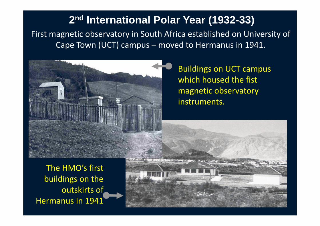
First magnetic observatory in South Africa established on University of Cape Town (UCT) campus – moved to Hermanus in 1941.
2nd International Polar Year (1932-33)
The HMO’s first buildings on the
outskirts of Hermanus in 1941
Buildings on UCT campus which housed the fist magnetic observatory instruments.

HMO to SANSA Space Science
Year Event
1932 Prof Ogg at UCT established a magnetic observatory (in response to International Commission for the Polar Year)
1937 Magnetic Observatory placed under Trigonometrical Survey Office, Department of Lands
1941 Magnetic Observatory relocated to Hermanus (to escape the disturbing effects of the electric railway system)
1969 Magnetic Observatory incorporated into the CSIR
1987 Some of HMO’s services commercialised as a result of CSIR commercialisation
2001 HMO declared a National Facility and transferred to the NRF
2002 HMO mandate expanded to include student training
2011 HMO migrates to the South African National Space Agency (SANSA)

SANSA SPACE SCIENCEHermanus
The Space Science Directorate of SANSA is part of theworldwide network of magnetic observatories and isresponsible for research infrastructure and data used tomonitor the near Earth space environment. The scope ofactivities include fundamental and applied space physicsresearch, post-graduate student training, scienceadvancement, Space Weather and the provision ofgeomagnetic field related services on a commercial basis.

SANSA Earth Observation Directorate
Earth ObservationProgramme
SANSA Space Operations Directorate
Space OperationsProgramme
SANSA Space Science Directorate
Space Science Programme
SANSA Space Engineering Directorate
Space Engineering Programme
Human Capital Development Programme
Science Advancement Programme
SANSA Strategic Programmes

Space Science StructureManaging Director
ICT
Comms & MarketingEducation
Science Advancement
Shared Support ServicesAdvisory Forum
Site Services
Admin ‐ Fin & Bus
Geomag Iono & Atmo Waves
TechnologyResearch
Space WeatherRSU
Admin –HR

SANSA has been the Regional Warning Center (RWC) for Africasince June 2007.
http://www.ises-spaceweather.org/ISES/rwc/rwc.htmlhttp://spaceweather.sansa.org.za/

Regional Space Weather Centre for Africa at SANSA Space Science in Hermanus
• Provides important service to the nation by providing information, early warnings and forecasts on space weather conditions
• Products and services used mainly by defence, aeronautics, navigation and communication sectors
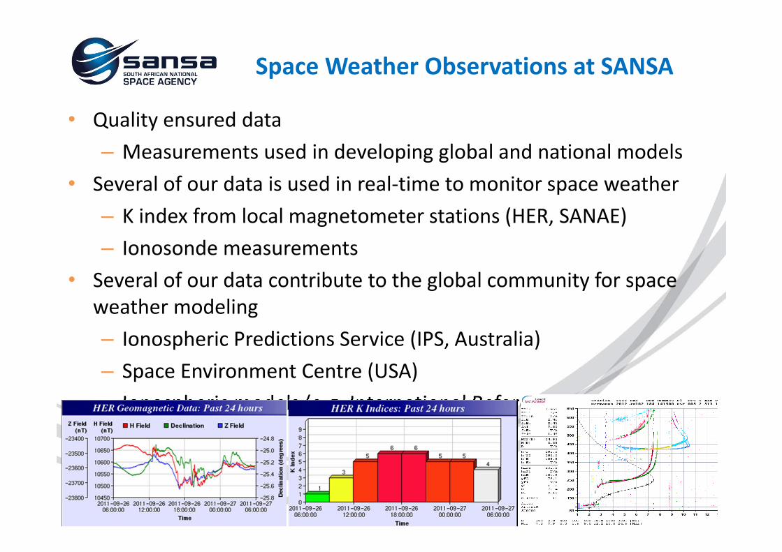
• Quality ensured data– Measurements used in developing global and national models
• Several of our data is used in real‐time to monitor space weather– K index from local magnetometer stations (HER, SANAE)– Ionosonde measurements
• Several of our data contribute to the global community for space weather modeling– Ionospheric Predictions Service (IPS, Australia)– Space Environment Centre (USA)– Ionospheric models (e.g. International Reference Ionosphere (IRI))
Space Weather Observations at SANSA

SANSA‐INGV collaboration• Started through IPY 2007-2008
UAMPY project • Collaboration with SCAR ICESTAR
IPY project• Focus on deployment of new
instruments (magnetometers, GISTMs)

14
ICSU INTERNATIONAL POLAR YEAR 2007/2008 PROJECT:
Polar Space Weather studies during IPY/IHYBetter understanding of the Space Weather and Geomagnetic Storm mechanisms will allow more effective prediction of storm intensity and better mitigation actions to be taken.

LaCour Magnetometer in Norwegian Research Station under the Antarctic ice
First SA Expedition: 3nd International Polar Year & IGY (1957-58)
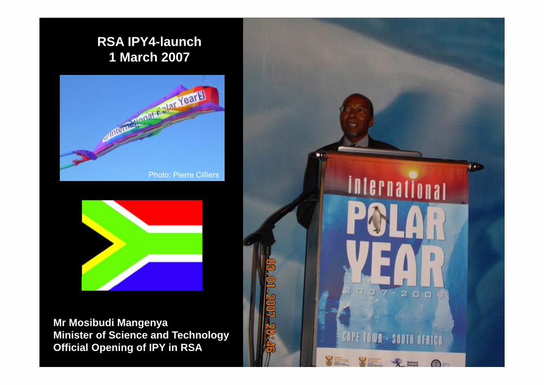
Mr Mosibudi MangenyaMinister of Science and TechnologyOfficial Opening of IPY in RSA
RSA IPY4-launch 1 March 2007
Photo: Pierre Cilliers

UAMPY IPY Polar Space Weather Studies Team
INGV
24E
RHODESHMO
ISSAUKZN
HartRAO
UP
NWU
UCT

IPY4 (Participants in ICESTAR project 63)

GNSS infrastructure of SANSA Space Science

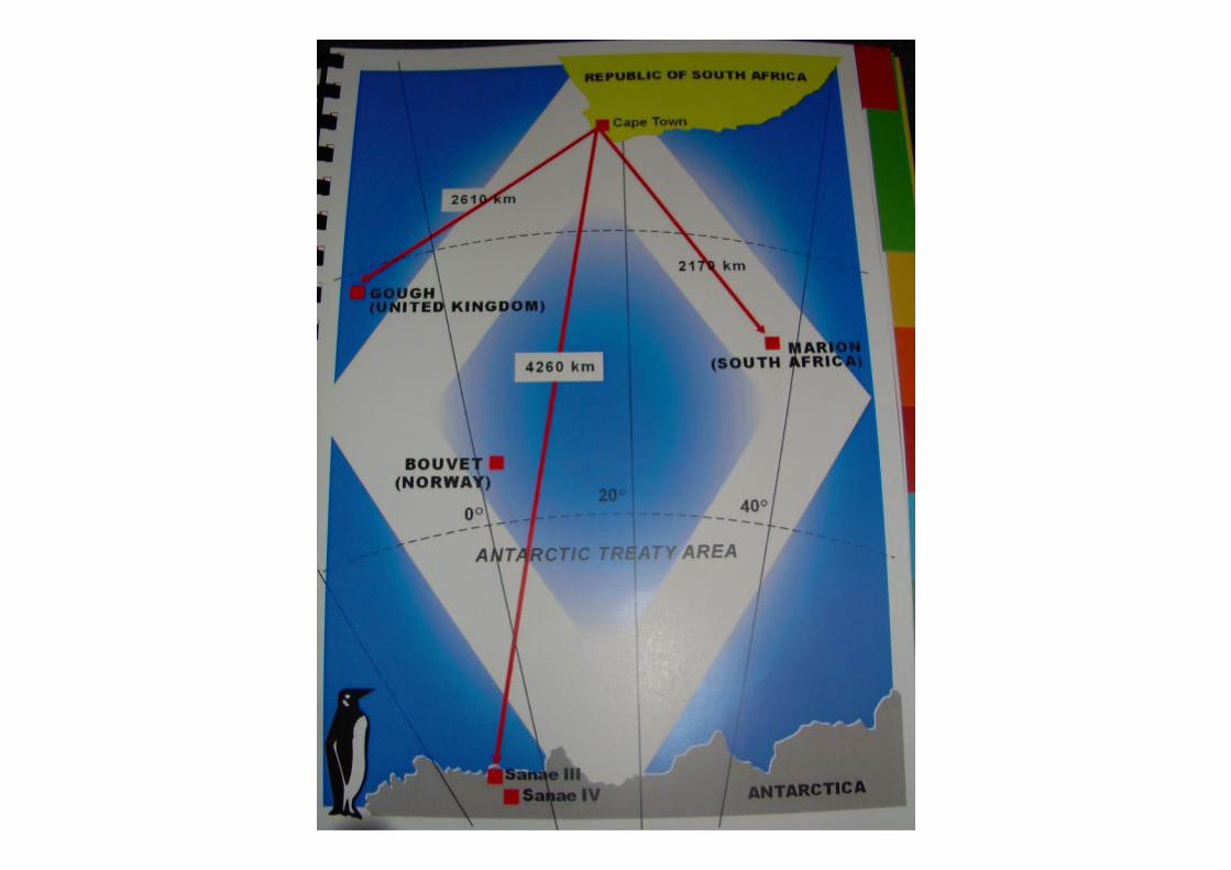
Gough Island40.0°S, 10.0°W
Marion Island46.87º S, 37.86ºE
SANAE IV72.0°S, 2.5°W
Hermanus34.42°S, 19.22°E

SANAE-IV
23
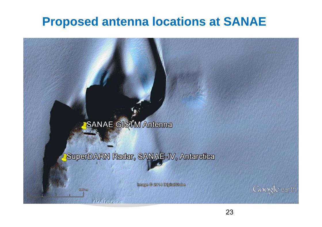
Proposed antenna locations at SANAE
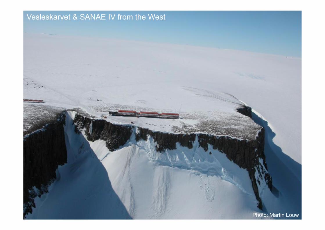
Photo: Martin Louw
Vesleskarvet & SANAE IV from the West

Photo: Carol Jacobs
SANAE IV

Photo: I-TASC
SANAE Helicopter landing pad

SANAE from the S-East

A-Lab
29
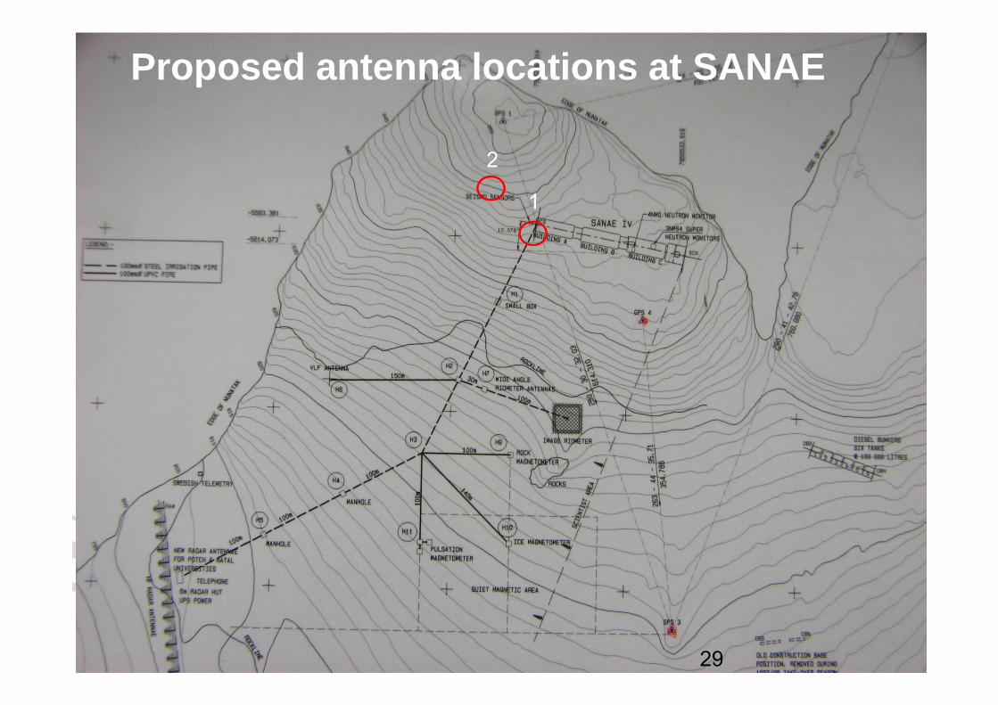
Proposed antenna locations at SANAE
1
2

30
GISTM Antenna71° 40’ 25.67’’ S02° 50’ 30.42 ’’ W
200 m

31
Proposed antenna location (1)on the Southern end of the roof of the SANAE base
http://www.sanap.org.za/

32
Proposed antenna location (1)on the Southern end of the roof of the SANAE base

33
Proposed antenna location (2)on the same pillar as the other GPS antenna
IGS GPS
GISTM
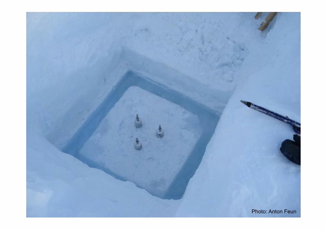
Photo: Anton Feun
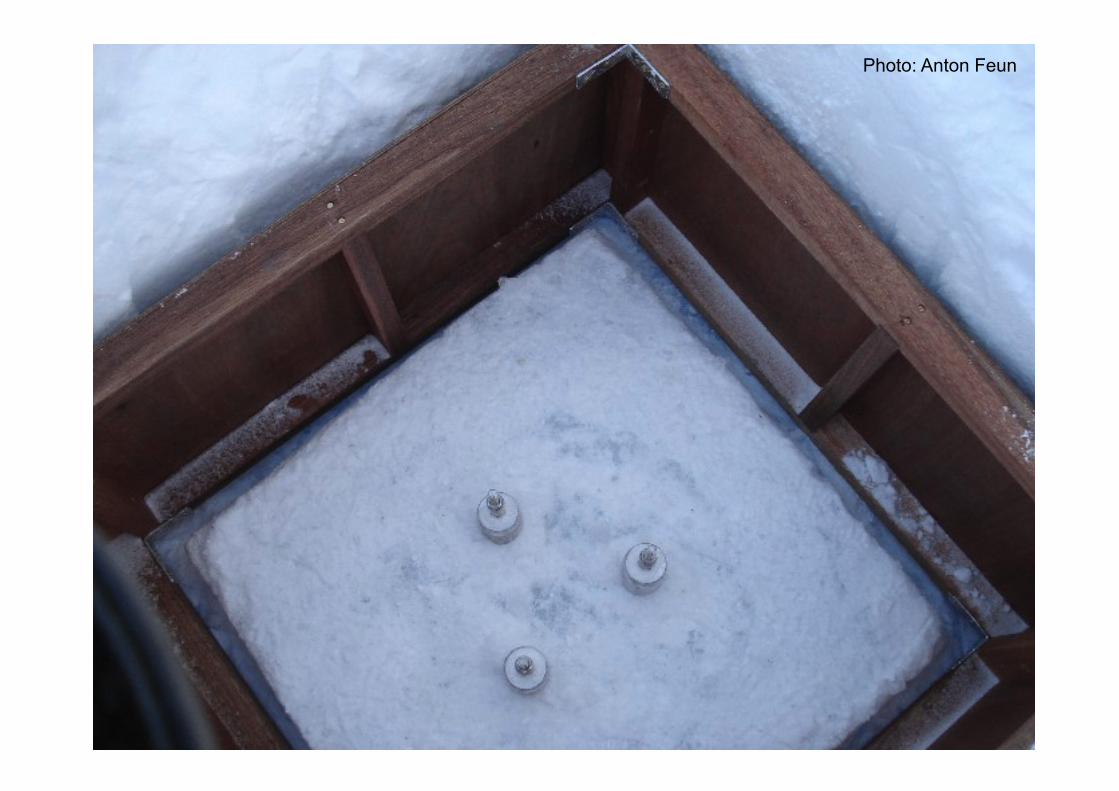
Photo: Anton Feun

Photo: Anton Feun

Photo: Anton Feun
On the pillar in the DI Observation hatch

Instruments installed at SANAE in 2006-2008 for IPY Polar Space Weather Studies
• Overhauser magnetometer for total geomagnetic field measurements.
• GPS ionospheric scintillation monitor for ionospheric studies
• FGE fluxgate magnetometer for continuous recording of vector geomagnetic field (2008).

Physical Science Instrumentation at SANAE-IV
• HF (SuperDARN) radar
• Riometers (beamforming)
• Magnetometers
• Neutron Monitor
• VLF-receiver
• GPS receiver for geodesy
• Seismometer
• Weather station
• Ozone monitorSuperDARN
HF Radar antenna
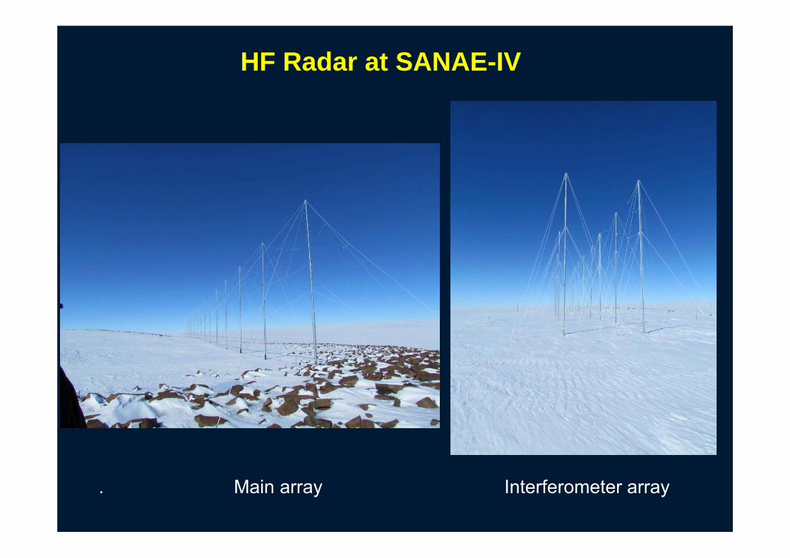
HF Radar at SANAE-IV
4 element HF Radar interferometer antenna. Main array Interferometer array

Digital upgrade of the SuperDARN HF Transceivers
First data from the new digital radar 2014-02-18
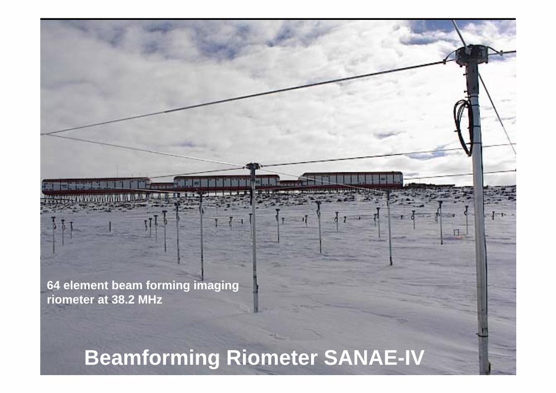
Beamforming Riometer SANAE-IV
64 element beam forming imaging riometer at 38.2 MHz

43
VLF Receiver at SANAE• Owner by University of Kwa-
Zulu Natal (UKZN) Space Physics Group
• Antenna: Orthogonal loops• Receiver: Omnipal VLF• Automatic Whistler Detector• Data logged continuously• Data uploaded daily to UKZN

44
GISTM Equipment at SANAE-IV
receiver
GPSantenna
PC logger
Internet
LAN
Antenna: Novatel N355
GISTM: Novatel
GSV4004B
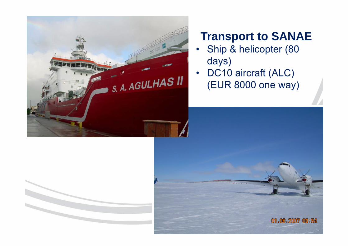
Transport to SANAE• Ship & helicopter (80
days)• DC10 aircraft (ALC)
(EUR 8000 one way)
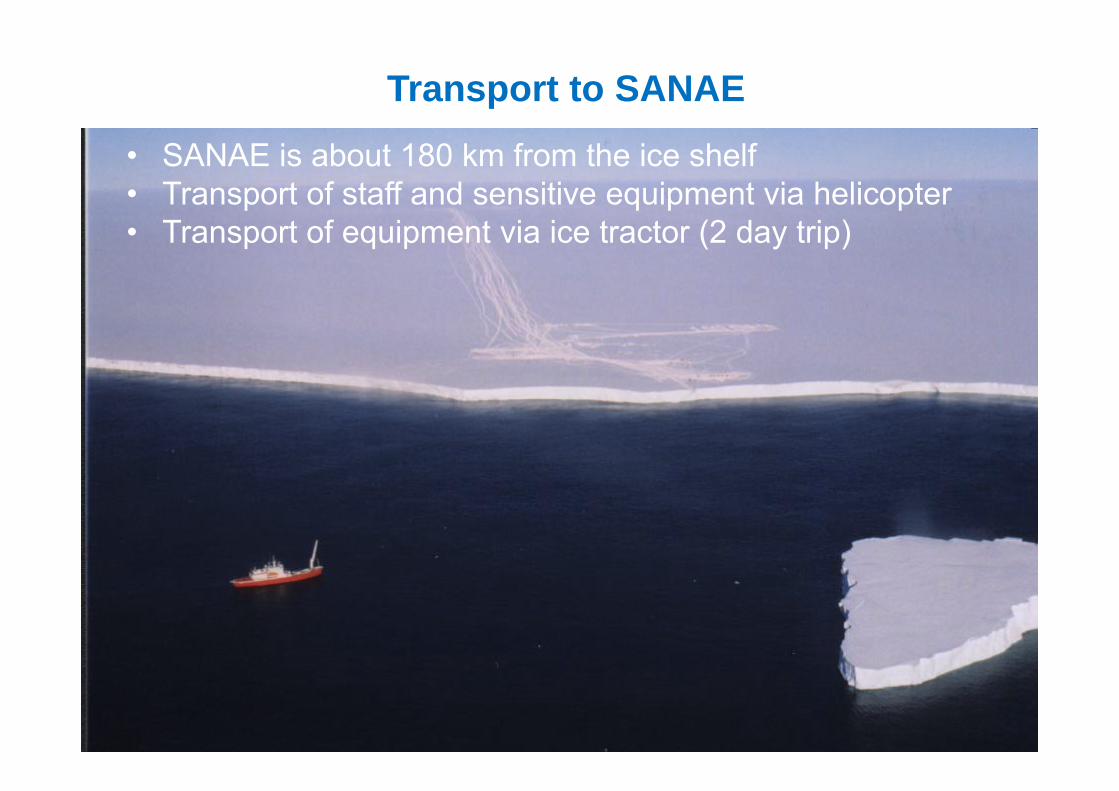
Transport to SANAE
• SANAE is about 180 km from the ice shelf• Transport of staff and sensitive equipment via helicopter• Transport of equipment via ice tractor (2 day trip)

Human resources • SANSA is part of the South African
National Antarctic Programme (SANAP)
• Conducts several on-going space science and space weather related research projects in Antarctica, Marion Island and Gough Island.
• SANSA sends 2 overwintering engineers per year to SANAE and 1 to Marion Island
• 5 months technical training in Hermanus + 1 month survival training in Cape Town
• Engineers spend 14 months in Antarctica and Marion Island

GISTM & GNSS data
49
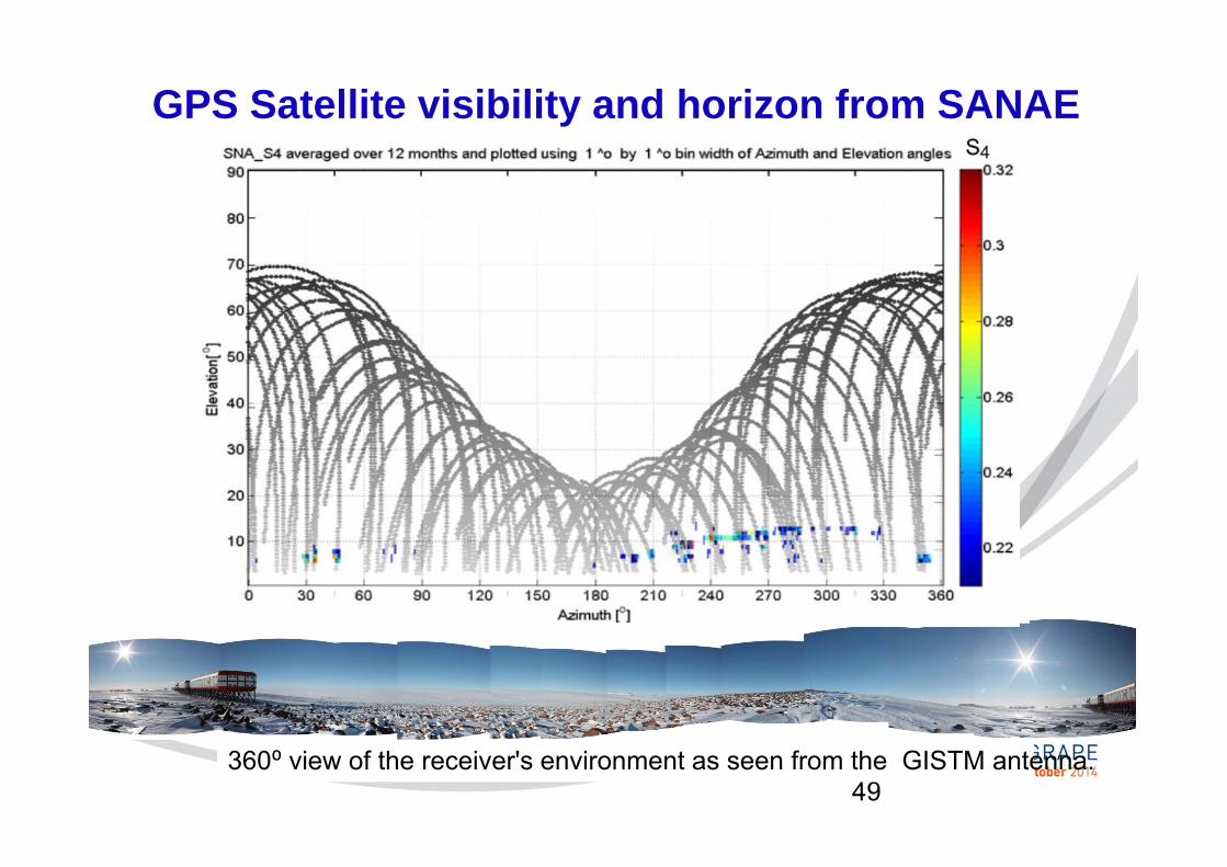
GPS Satellite visibility and horizon from SANAE
360⁰ view of the receiver's environment as seen from the GISTM antenna.

50
Coverage of the SANAE Scintillation receiver

51
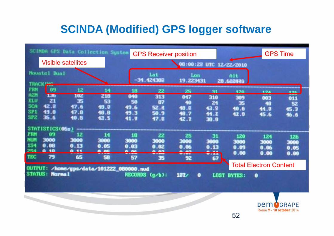
SCINDA (Modified) GPS logger software
52
GPS Receiver position
SCINDA (Modified) GPS logger software
GPS TimeVisible satellites
Total Electron Content

Ionospheric Scintillation Statistics of SANSA GISTMs from GBSC, 2011
Gough Marion
Black is the distribution obtained from all data with elev>20°, Red is from data with both S4<0.1 and σΦ<0.1, i.e. due to non-scintillating signals.
SANAE
Spogli et al, SCAR OPEN SCIENCE CONFERENCE (13-25 July 2012, Portland, USA)

Communication from SANAE
• Via INTELSAT
• Bandwith for real-time upload to SANSA: 300 kB/s
• Daily upload capacity: 500 MB max
• Total annual upload: 200 GB

Thank you for your interest!