developing hydrodynamic and sediment transport modelling ... · herr soeryantono and dwinanti rika...
TRANSCRIPT
Abstract—Lakes in Universitas Indonesia (UI) have several
problems to overcome. Water quality of UI’s lakes degrades in
the last decade. One of the problems is high turbidity. The
longer turbidity in lakes, the more dangerous the lakes
environment life would be. So, this research focuses on
sediments problem or physical assessment. The main research
aims to develop hydrodynamic and sediment transport
modelling of Agathis and Mahoni Lakes in Universitas
Indonesia. The authors want to increase the quality of water in
UI’s lakes and make both Agathis and Mahoni Lakes as the
representative preliminary model. Research design or
methodology is needed to concept the research to achieve goals.
Unfortunately, research methodology has not been developed
yet for this case. This paper goals to construct methodology as a
preliminary study of the main research. The authors use
extensive literature review to model novel methodology.
Hydrodynamic and sediment transport modelling could be
modelled by Resources Modelling Associates (RMA).
Hydrodynamic phenomena in fluid and sediment transport
modelling have the suitable governing equation concept with
RMA’s governing equation. As a thinking result, the main
research would be conducted by RMA program modelling, field
sampling, and laboratory testing. Field sampling and
laboratory could figure the amount of sediment concentration
in lakes as data input. The final simulation of this following
research is making sensitivity and scenario analysis to prove
several hypotheses.
Index Terms—Hydrodynamic modelling, RMA program,
sediment transport.
I. INTRODUCTION
Lakes are life, so their existences are important to notice.
Lakes include raw water resources category [1]. The quality
of raw water is a critical indicator for environment [2], [3].
However, people today have less water for themselves,
livestock, and plants. Raw water is two percent of earth’s
groundwater [4]. In addition, it is the most decreasing and
changing ecosystem [5]. Lakes ecosystem consists of
physical, chemical, and biological characteristics in the water
body. The interaction among them could be studied,
understood, and used for effective lakes management [1].
Recent days, the effort to do lakes conservation is difficult
Manuscript received November 20, 2017; revised December 20, 2017.
This work was supported by Indonesia Endowment Fund for Education or
Lembaga Pengelola Dana Pendidikan (LPDP) under LPDP Research Grant.
This organization is under The Ministry of Finance of Indonesia.
Rian Mantasa Salve Prastica is with Civil Engineering Department of
Engineering Faculty, Universitas Indonesia, Depok, West Java, 16424,
Indonesia (e-mail: [email protected], [email protected]).
Herr Soeryantono and Dwinanti Rika Marthanty are with Water
Resources Management Group, Civil Engineering Department, Faculty of
Engineering, Universitas Indonesia, Depok, West Java, 16424, Indonesia
(e-mail: [email protected]).
to do for several reasons. The threat of biodiversity
decreasing in raw water ecosystem could be affected from
various factors: uncontrollable exploitation, water pollution,
stream modification, damage habitat, and exotic species
invasion [6]-[9]. Environment changes globally. Nitrogen
deposition, temperature increasing, and rainfall pattern
changes are supportive factors for environment threat [10],
[11].
In the past years, people controlled water through
on-stream approach. They regulated rivers. Today,
off-stream approach usage is highly increasing. This
approach involves retention pond and infiltration wells.
Jakarta has been implemented the on-stream approach to
regulate its water. The Jakarta’s government constructs lakes
system. So does Depok’s government. There are hundreds of
lakes in both Jakarta and Depok regions. These lakes could
have optimum hydrological function if they are preserved.
But, the society paradigm becomes a barrier. The lakes
become garbage and waste water dumping site. Furthermore,
they give negative effects, for examples, creating living
habitat for mosquitos, becoming water-borne diseases trigger,
and producing bad odor. To increase the land value, the
society prefer to hoard the lakes with soil. The example is
Pedongkelan Lake that is located in Jakarta-Depok boundary.
Its water body area is decreasing because of land filling in the
lake.
Developing Hydrodynamic and Sediment Transport
Modelling on Lakes: A Preliminary Study
Rian Mantasa Salve Prastica, Herr Soeryantono, and Dwinanti Rika Marthanty
International Journal of Environmental Science and Development, Vol. 9, No. 3, March 2018
49doi: 10.18178/ijesd.2018.9.3.1072
Universitas Indonesia (UI), which is located in Depok,
West Java, has started to increase the effort of making better
water quality. UI has six lakes, namely Kenanga, Agathis,
Mahoni, Puspa, Ulin, and Salam lakes. UI as educational
institution should become role model to manage healthy lake
to the students and society. However, UI’s lakes quality is
deteriorating in the last five years.
UI plans several systems: debris removal, sediments
removal, and nutrients removal. These efforts are highly
suggested to be conducted, so the lakes could perform well in
hydrological function. These could affect to restore water
quality and biotic life.
This proposed problem needs a model simulation to do
water resources management effectively and efficiently.
Several simulators have been examined, for example,
phosphorous and nitrogen distribution simulator. However,
sediment distribution simulator is not developed and
technologically advanced yet. The simulator could be
modelled for hydrodynamic and sediment transport.
Hydrodynamic and sediment transport models could be
used as water quality model for lakes ecosystem response to
various change or condition.
According to these general problems, a solution is needed
to make lakes or ponds become physically, chemically, and
biologically sanitary. This research aims to find a

International Journal of Environmental Science and Development, Vol. 9, No. 3, March 2018
50
methodology to conduct hydrodynamic and sediment
transport modelling on lakes.
II. LITERATURE REVIEW
A. Pollutant Sources
According to research in Kariba Lake [12], the main
pollutant source in lakes comes from urban and industrial
activities, mining, agro-chemistry substances, and
aquaculture. The other research in Colac Lake mentions that
the pollutant comes from water inflow, outflow, and
sediment input [13]. Inflow and outflow come from various
sources. Water bodies receive water flow from wastewater
from local waste treatment. Water in the lake is reported to be
overflowing due to the long rainfall intensity with high
rainfall. This result in the inclusion of various solid or liquid
wastes carried into the water body when water returns to
normal conditions. Incoming sediments then settle into Lake
Colac through natural processes such as carried by the flood
that occurred. Based on this phenomenon, this research aims
to focus on sediment pollutant.
B. Sediment Treatment Strategy
Water discharges in roadways, roofs, and parking lots get
high attention because of its impact, such as high flooding
frequency, bad water quality in the water body, and
downstream ecosystem risk [14]-[16]. The treatment to
control water quality is important to increase water quality
for environment and life.
One example of strategies is a retention pond. It is the most
used strategy for Best Management Practices (BMP) to
control water discharges. The other most used plans are
sediment trap and wetland.
C. Wetlands
The using of constructed wetlands (CW) as pollutant
control is reaching four decades today. It controls pollutant
loading from wastewater system, industrial wastewater,
agricultural wastewater, and stormwater [17].
D. Lakes and Impoundments
Chapra [18] states that the initial stage to do lake or
impoundment simulation is determining the geometry or
morphometry. This stage could be done by mapping lake’s
bathymetry. Bathymetry represents a topographic map of
depth contour lines.
The equation that represents a water balance for a
well-mixed lake is
ssoutin EAPAGQQdt
dVS (1)
where S = storage (m3d-1), V = volume (m3), t = time (d), Qin
= inflow (m3d-1), Qout = outflow (m3d-1), G = groundwater
flow (m3d-1), P = precipitation (md-1), E = evaporation (md-1),
and As = surface area (m2). The equation could be used for
two general fashions: steady state and time vaiable.
III. WATER QUALITY MODELLING
Water quality modelling research gets high interest for
researchers in the last decade. Water quality becomes both
national and international issue which immediately needs to
be overcome. At the same time, several organizations and
institutions create both hardware and software to support the
research.
A. Water Quality Modelling in Lakes
Chapra [18] observes that three categories could make
different kinds of lakes. The classifications are according to
derivation, formation, and size. Different types of loading are
classified also. There are impulse loading, step loading,
linear loading, exponential loading, and sinusoidal loading.
B. Sediment Transport
When sediments enter the water body, they are moved and
transformed with various mechanisms. The part of solid
would disappear because of decomposition. The residual
organic particle with nonorganic solid become movement
object.
C. Total Suspended Solid (TSS) Model
Braskerud [19] shows that steady state condition in CW,
where the flow velocity is relatively low, settling is the
dominant process to decrease the amount of TSS. Chavan and
Dennet [20] give the equation of settling velocity as the
following form.
xv
SxgxdV
g
sssettling18
12 (2)
The sediment settling velocity is represented as Vsettling, g
represents gravitational acceleration, dss represents sediment
particle diameter, Sg as particle specific gravity, and v
represents water kinematic viscosity.
D. Stokes Law
According to Potter [21], continuity equation could be
written by applying mass conservation in control volume,
where flux inflow in the element surface is equal to mass
changes in the element. The following equations are the
derivation of mass conservation principles for this research
model.
elementoutin mt
mm
(3)
The equation above results in the following equation.
0
z
w
y
v
x
u
zw
yv
xu
t
(4)
Then, the previous equation simplifies these equations,
where they are involved in general form from continuity
equation at Cartesian coordinate.
0
z
w
y
v
x
u
dt
D
(5)
If operator gradient, del, is presented, it results:
k
zj
yi
x (6)
Furthermore, the continuity equation could form:
0. Vdt
D
(7)
According to Newton 2nd Law, F = ma, so fluid particle at
x, y, and z-direction become:
Dt
Dug
zyxx
zxyxxx
(8)
Dt
Dvg
zxyy
zyxyyy
(9)
Dt
Dwg
yxzy
yzxzzz
(10)
IV. MATHEMATICS MODEL
Mathematics model represents project area in one, two, or
three-dimensional form. The one-dimensional model
contains cross section is single linear scale. It is modelled
according to the hydraulic condition in the computed cross
sections. Two-dimensional model represents length and
width of lakes. It is assumed that water is well mixed and its
velocity is averaged vertically. Two-dimensional model
figures hydraulic condition in a spatial grid in lakes.
Furthermore, the three-dimensional model represents length,
width, and depth. It is used to give complex hydraulic
characteristics like the stratified flow and vertical turbulence.
In this research, two-dimensional model and
three-dimensional model could be used according to its
purposes. Two-dimensional model predicts flow velocity and
depth in lakes. This model assumes the velocity is averaged
vertically and not involved stratification as consideration in
the model.
Several hydrodynamic models compute three-dimensional
flow – length, width, and depth. It is used when width and
depth of water are assumed as variables, especially for water
body with varied of salinity, temperature, and sediment
loading.
A numerical solution is used to analysis hydrodynamic
which has iterative computation procedure to solve
mathematical expression with no unique solution.
There are three principles of numerical modelling: finite
differences, finite elements, and finite volumes. Finite
difference model uses time interval and limited space with a
regular grid. Finite element processes steps through the
simultaneous equation for a discrete element like element
rows in the two-dimensional grid. The finite volume
combines finite element capability to represent complex
bathymetry with mass and volume conservation which is
done by finite difference.
RMA2 is well known to be used in numerical modelling
for the two-dimensional model. The cooperation between the
US Geological Survey and Federal Highway Administration
develops two-dimensional hydrodynamic public domain
model. It is called Finite Element Surface Water Modeling
System. This model studies about hydrodynamic in
two-dimensional phase in river, lakes, reservoirs, or estuaries.
It could predict physical process (sediment transport),
chemical process (dissolved oxygen, nutrients), or biological
process (bacteria transport) by using advection, dispersion,
diffusion, and decay. Finally, the finite element is chosen to
be numerical model governing equation for this research.
There are four recommended program Simulator program
that used in this proposed research [22]. They are RMA-10,
RMA-11, UNTRIM, and EFDC. These programs have 3-D
dynamic and unsteady concept. Besides that, they simulate
water quality modelling. However, the chosen program is
RMA program because of its availability in Civil
Engineering Department of Universitas Indonesia. RMA-10
has hydraulic governing equation and RMA-11 has
advection-dispersion governing equations.
V. HYDRODYNAMIC PROCESS
Hydrodynamic process is complex surface water system.
Water flows at varied scales and types are highly affected not
only the circulation of temperature, nutrients, and dissolved
oxygen, but also the aggregation or circulation of sediments,
contaminants, and algae.
A. Water Density
According to Ji [22], water density is a fundamental
boundary in hydrodynamic and water quality studies.
Hydrodynamic computation would be more comprehensive
if the water density data is accurate. The density ( ) is
determined by three variables: temperature (T), salinity (S),
and concentration of total suspended sediment (C). These
parameters’ relation could be observed as:
),,( CSTf (11)
The definite form of function f could be examined
empirically. The differential form of the equation above
could be written as:
dCC
dSS
dTT
dSTCTCS ,,,
(12)
Furthermore, it results:
CST (13)
B. Conservation Laws
Governing equation of the conservations laws involve the
conservation of mass, the conservation of energy, and the
conservation of momentum. These conservation laws are the
basis of hydrodynamics. They are used for hydrodynamic
and water quality modelling.
The law of conservation of mass states that mass can
neither be produced nor destroyed. This law could be
International Journal of Environmental Science and Development, Vol. 9, No. 3, March 2018
51

expressed in a mass balance equation. It is called the
continuity equation. It is mass accumulation = mass in – mass
out + source – sink.
The equation above could be restated as
dtmmmdm routin ).( (14)
An equation of mass flux could be stated by dividing with
the time increment, dt . It would become the following mass
balance equation:
routin mmmvmt
m
dt
dm
).(
(15)
The conservation of momentum could be derived from
Newton’s second law:
amF
. (16)
C. Mass Balance
The basic principle of mass balance equation could be
observed from this discussion. Completely mixed system or
well known as continuously stirred tank reactor (CSTR) is
model who proposed by Chapra [18] to model natural water
body. This characteristic is used as water quality modelling
basic.
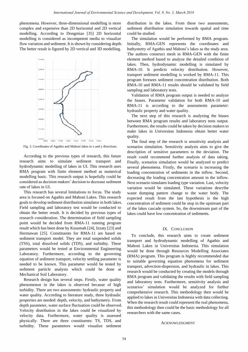
Fig. 1. CSTR scheme according to chapra [18].
Fig. 1 depicts the scheme of CSTR. There are four symbols
presented in the figure. Symbol of A, B, C, and D represent
loading, outflow, settling, and reaction respectively. The
simple equation below is the form of the scheme which
shows mass balance in the infinite period of time.
settlingreactionoutflowloadingonAccumulati (17)
In this mass balance process, sink and source concept is
highly fundamental. This concept figures a process in a
system which affects the decreasing or increasing of
substance’s concentration in the system. Sink and source
system consists of two mechanisms: physically and
chemically. The physical mechanism could be settling
process and chemical mechanism represents reactivity
process. Ji [22] states that the mass balance equation is
represented by the following equation.
QRSx
CD
xx
CU
t
C
)( (18)
According to the above equation, the first term, the second
term, the third term, the fourth term, and the fifth term of
equation represent advection process, dispersion process,
settling, chemical and biological reaction in substances, and
external loading respectively.
In the sediment transport modelling, the equation of mass
balance changes into the following equation [22]. Then, it is
called the governing equation of sediment transport.
szv
zyHyxHx
szyxt
QSH
ASHASHA
SwHvSHuSHS
)()(
)()()()(
(19)
where H = the water depth, u and v = the horizontal velocity
components in the Cartesian horizontal coordinates x and y, w
= the vertical velocity in the vertical sigma coordinate z, ws=
the sediment settling velocity, S = the diffusion coefficients,
and Qs = external sources and sinks. The sediments
movement in lakes represents advection and dispersion
processes.
D. Advection and Dispersion
Advection describes flow horizontal movement that moves
materials but not significantly dissolved [22]. The flux’s
density depends on concentration (C) and flows velocity
(___
v ). This phenomenon could be formed as the following
equation.
______
vCxJa (20)
Dispersion distributes contaminant horizontally. It
involves the mixture of contaminant, which caused by
turbulence and molecullar diffusion [23]. Dispersion in a
longitudinal system generally is stronger than lateral system.
Fick Law states that the movement of mass because of
diffusion is the balance to the gradient from mass
concentration and it depends disperse coefficient (D). The
following equation figures this problem.
x
CDJ
(21)
Furthermore, diffusion moves material from high
concentration to low concentration. To make easier to
understand about diffusion, you may imagine that a dye drops
in the water-filled bottle. By matter of time, the colour would
spread out in the whole water.
According to those phenomena, this research aims to use
the governing equation of advection and dispersion to model
sediment transport and water quality numerically. The
governing equations in hydrodynamic processes are the
principles which applied in Resources Modelling Associates
(RMA) program.
VI. RESOURCES MODELLING ASSOCIATES
The analysis of advection and dispersion in lakes could be
done by using program that contains the numerical solution
for both advection and dispersion governing equations.
International Journal of Environmental Science and Development, Vol. 9, No. 3, March 2018
52

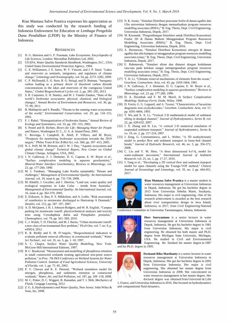
Fig. 2. Study area: Lakes in Universitas Indonesia.
Resources Modelling Associates (RMA) is engineering
firm who applies software and numerical model to help to
manage water resources and environmental changes. Four
programs are provided to develop RMA: RMA-Gen,
RMA-10, RMA-11, and RMA-PLT.
A. RMA-GEN
RMA-GEN or RMA Mesh Generator is a program that
used to transform geometry to finite element model. This
program needs several inputs: basic mal and bathymetry.
B. RMA-10
RMA-10 is three-dimensional model to simulate flow in
estuary and velocity in flow depth. Navier-Stokes nonlinear
equation is needed to describe the flow.
C. RMA-11
This program models water quality with finite element
method to simulate estuary, lake, river, or coastal area in the
three-dimensional model. RMA-11 models constituent in the
water body: dissolved oxygen, temperature, nitrogen cycle,
phosphorus cycle, and sediment. This program allows
sediment transport governing equation.
D. RMA-PLT
RMA-PLT is used to display velocity vector, contour, and
time variation from previous programs: RMA-10 and
RMA-11.
RMA programs facilitate users to model hydrodynamic
movement, both groundwater and water surface. Izzaty [23]
states that these programs could rely on to model water
quality. These programs provide data processing: map
creation, flow simulation, constituent property, and their
display.
VII. STUDY AREA
Water quality problem in lakes is well known worldwide.
It affects the environment to be worse. Macro invertebrate’s
life is in danger. Furthermore, it could affect human through
varied diseases.
Universitas Indonesia (UI) is located in Depok, West Java,
Indonesia. UI has six lakes. They are Kenanga, Agathis,
Mahoni, Puspa, Ulin, and Salam Lakes.
This research aims to develop hydrodynamic and sediment
transport modelling in UI. Lakes in UI have physical,
chemical, and biological problems [23]-[25]. UI desires to
make the lakes’ water quality becomes better. Several types
of research have been done by previous researchers. Fig. 2
depicts the entire system of lakes in Universitas Indonesia.
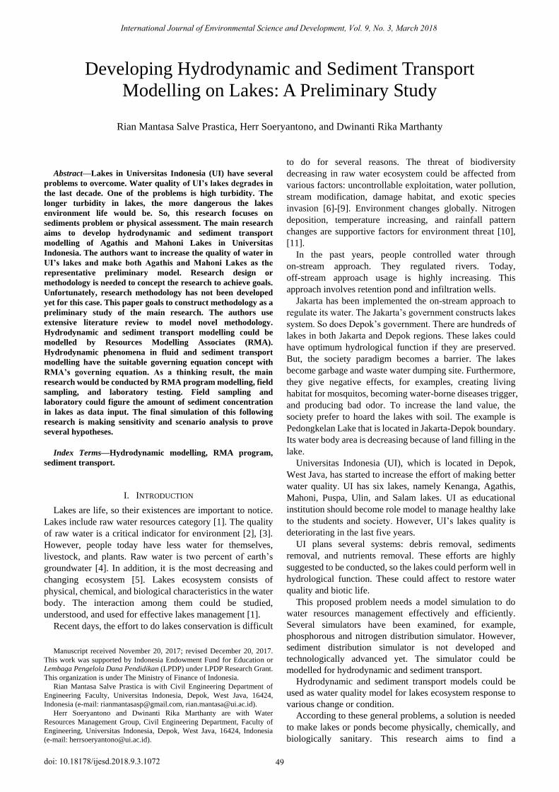
However, this research goals to analyze only both Agathis
and Mahoni Lakes. According to the figure, Agathis and
Mahoni Lakes are symbolized with A and B respectively.
Area A and B in Fig. 2 next would be drawn according to
their lakes’ coordinates x and y from AutoCAD map into Ms.
Excel-based. Fig. 3 depicts the distribution of coordinates
from Agathis and Mahoni Lakes. Symbol A represents
Agathis Lake and B characterizes Mahoni Lake. Next, the x-y
model should add bathymetry as z coordinates to make 3D
modelling in RMA program. This very beginning start is for
RMA-GEN data input. The following program, RMA-10 and
RMA-11 need more comprehensive data to run the programs.
It would be discussed through literature review to develop the
methodology.
VIII. DISCUSSION
In this section, the research plan is discussed. Rahmawati
[26] has been conducted a research about river meander. This
research connects with velocity vector which happened.
Velocity vector in river meander is important to be reviewed
with two or three-dimensional modelling, so numerical
method is used to reach the goal. RMA is a software which
could assist the research. It uses finite element method basic.
Besides problems in the river, RMA could be used as the
model simulator in lakes. Kusumah [24] developed RMA
model as the simulator to predict phosphorous concentration
distribution in Mahoni Lake. A year later, Izzaty [23] created
pollutant transport modelling simulator by using two
prototype lakes in UI: Agathis and Ulin Lakes. In the same
year, Hermawan [25] conducted a research to simulate
nitrogen concentration distribution in both Agathis and Ulin
Lakes by using hydrodynamic modelling.
These previous types of research have several weaknesses.
Initially, hydrodynamic modelling in lakes is limited to
primary data. The researchers only use secondary data for
data processing. So, some errors are found. Next, they model
chemistry process only. Actually, chemical process
modelling has been conducted. Li [27], Davis and Kent [28],
and Dzombak [29] develop Fe and Mn tracing in lakes.
However, Fortin et al [30] state that the result is difficult to
find the physical characteristics of sediment in lakes.
Furthermore, this research field is developed by several
next types of research. Wu and Li [31], Zahng and Liu [32],
Zeng et al [33], and Liu and Shen [34] succeed in developing
numerical model and hydrodynamic engineering for
sediment transport. Liu and Shen [34] develop a simulation
of three-dimensional turbulent modelling. It models sediment
flow and transport and considers three-dimensional
International Journal of Environmental Science and Development, Vol. 9, No. 3, March 2018
53
phenomena. However, three-dimensional modelling is more
complex and expensive than 2D horizontal and 2D vertical
modelling. According to Dongmiao [35] 2D horizontal
modelling is considered as incompetent media to visualize
flow variation and sediment. It is shown by considering depth.
The better result is figured by 2D vertical and 3D modelling.
Fig. 3. Coordinates of Agathis and Mahoni lakes in x and y directions.
According to the previous types of research, this future
research aims to simulate sediment transport and
hydrodynamic modelling of lakes in UI. This research uses
RMA program with finite element method as numerical
modelling basic. This research output is hopefully could be
considered as decision makers’ decision to decrease sediment
rate of lakes in UI.
This research has several limitations to focus. The study
area is focused on Agathis and Mahoni Lakes. This research
goals to develop sediment distribution simulator in both lakes.
Field sampling and laboratory test would be conducted to
obtain the better result. It is decided by previous types of
research consideration. The determination of field sampling
point would be decided from RMA-11 running program
result which has been done by Kusumah [24], Izzaty [23] and
Hermawan [25]. Constituents for RMA-11 are based on
sediment transport model. They are total suspended solids
(TSS), total dissolved solids (TDS), and turbidity. These
parameters would be tested at Environmental Engineering
Laboratory. Furthermore, according to the governing
equation of sediment transport, velocity settling parameter is
needed to be known. This parameter would be tested by
sediment particle analysis which could be done at
Mechanical Soil Laboratory.
Research design has several steps. Firstly, water quality
phenomenon in the lakes is observed because of high
turbidity. There are two assessments: hydraulic property and
water quality. According to literature study, three hydraulic
properties are needed: depth, velocity, and bathymetry. From
depth parameter, water surface fluctuation could be observed.
Velocity distribution in the lakes could be visualized by
velocity data. Furthermore, water quality is assessed
physically. There are three constituents: TS, TDS, and
turbidity. These parameters would visualize sediment
distribution in the lakes. From these two assessments,
sediment distribution simulation towards spatial and time
could be studied.
The simulation would be performed by RMA program.
Initially, RMA-GEN represents the coordinates and
bathymetry of Agathis and Mahoni’s lakes as the study area.
The authors construct mesh in RMA-GEN with the finite
element method based to analyze the detailed condition of
lakes. Then, hydrodynamic modelling is simulated by
RMA-10. It predicts velocity distribution. However,
transport sediment modelling is worked by RMA-11. This
program foresees sediment concentration distribution. Both
RMA-10 and RMA-11 results should be validated by field
sampling and laboratory tests.
Validation of RMA program output is needed to analyze
the biases. Parameter validation for both RMA-10 and
RMA-11 is according to the assessments parameter:
hydraulic property and water quality.
The next step of this research is analyzing the biases
between RMA program results and laboratory tests output.
Furthermore, the results could be taken by decision makers to
make lakes in Universitas Indonesia obtain better water
quality.
The final step of the research is sensitivity analysis and
scenarios simulation. Sensitivity analysis aims to give the
description of sensitive parameters to the deviation. The
result could recommend further analysis of data taking.
Finally, scenarios simulation would be analyzed to predict
several phenomena. Firstly, the scenario is increasing the
loading concentration of sediments in the inflow. Second,
decreasing the loading concentration amount in the inflow.
Next scenario simulates loading type variation. Last, velocity
variation would be simulated. These variations describe
waste dumping pattern change to the water body. The
expected result from the last hypothesis is the high
concentration of sediment could be stop in the upstream part
of the lakes cascade system. So, the downstream part of the
lakes could have low concentration of sediments.
IX. CONCLUSION
To conclude, this research aims to create sediment
transport and hydrodynamic modelling of Agathis and
Mahoni Lakes in Universitas Indonesia. This simulation
would be done through Resources Modelling Associates
(RMA) program. This program is highly recommended due
to suitable governing equation phenomena for sediment
transport, advection-dispersion, and hydraulic in lakes. This
research would be conducted by creating the models through
RMA program and validating the results with field sampling
and laboratory tests. Furthermore, sensitivity analysis and
scenarios’ simulation would be analyzed for further
comprehensive research. This methodology then would be
applied to lakes in Universitas Indonesia with data collecting.
When the research result could represent the real phenomena,
this methodology then could be the basic methodology for all
researchers with the same cases.
ACKNOWLEDGMENT
International Journal of Environmental Science and Development, Vol. 9, No. 3, March 2018
54
Rian Mantasa Salve Prastica expresses his appreciation as
this study was conducted by the research funding of
Indonesia Endowment for Education or Lembaga Pengelola
Dana Pendidikan (LPDP) by the Ministry of Finance of
Indonesia.
REFERENCES
[1] N. G. Hairston and G. F. Fussman, Lake Ecosystems. Encyclopedia of
Life Sciences, London: Macmillan Publishers Ltd, 2002.
[2] US EPA, Water Quality Standards Handbook, Washington, D.C., USA:
United States Environmental Protection Agency, 1994.
[3] C. E. Williamson, J. E. Saros, W. F. Vincent, and J. P. Smol, “Lakes
and reservoirs as sentinels, integrators, and regulators of climate
change,” Limnology and Oceanography, vol. 54, pp. 2273–2282, 2009.
[4] C. P. McDonald, E. G. Stets, R. G. Striegl, and D. Butman, “Inorganic
carbon loading as a primary driver of dissolved carbon dioxide
concentrations in the lakes and reservoirs of the contiguous United
States,” Global Biogeochemical Cycles vol. 2, pp. 285–295, 2013.
[5] S. R. Carpenter, E. H. Stanley, and M. J. Vander Zanden, “State of the
world’s freshwater ecosystems: physical, chemical, and biological
changes,” Annual Review of Environment and Resources, vol. 36, pp.
75–99, 2011.
[6] B. Malmqvist and S. Rundle, “Threats to the running water ecosystems
of the world,” Environmental Conservation, vol. 29, pp. 134–153,
2002.
[7] F. J. Rahel, “Homogenization of freshwater faunas,” Annual Review of
Ecology and Systematics, vol. 33, pp. 291–315, 2002.
[8] S. Postel and B. Richter, Rivers for Life: Managing Water for People
and Nature, Washington D. C., U. S. A: Island Press, 2003.
[9] C. Revenga, I. Campbell, R. Abell, P. Villiers, and M. Bryer,
“Prospects for monitoring freshwater ecosystems towards the 2010
targets,” Philos Trans R Soc B Biol Sci, vol. 360, pp. 397–413, 2005.
[10] N. L. Poff, M. M. Brinson, and J. W. J. Day, “Aquatic ecosystems and
global climate change” Technical Report, Pew Center on Global
Climate Change, Arlington, USA, 2002.
[12] M. J. Tumbare, “Managing Lake Kariba sustainably: Threats and
challenges,” Management of Environmental Quality: An International
Journal, vol. 19, issue 6, pp. 731-739, 2008.
[13] M. Khalifé, J. Gwyther, and J. Aberton, “Land use, water quality and
ecological responses in Lake Colac – trends from Australia,”
Management of Environmental Quality: An International Journal, vol.
16, issue 4, pp. 362-379, 2005.
[14] E. Eriksson, A. Bau, P. S. Mikkelsen, and A. Ledin, “Risk assessment
of xenobiotics in stormwater discharged to Harrestrup Å Denmark,”
Desalin, vol. 215, pp. 187–197, 2007.
[15] A. D. McQueen, J. H. J. Johnson Rodgers, and W. R. English, “Campus
parking lot stormwater runoff: physicochemical analyses and toxicity
tests using Ceriodaphnia dubia and Pimephales promelas,”
Chemosphere, vol. 79, pp. 561–569, 2010.
[16] C. J. Walsh, T. D. Fletcher, and M. J. Burns, “Urban stormwater runoff:
a new class of environmental flow problem,” PLoS One, vol. 7, no. 9, p.
e45814, 2012.
[17] K. R. Reddy and E. M. D’Angelo, “Biogeochemical indicators to
evaluate pollutant removal efficiency in constructed wetlands,” Water
Sci Technol., vol. vol. 35, no. 5, pp. 1–10, 1997.
[18] S. C. Chapra, Surface Water Quality Modelling, New York:
McGraw-Hill International Editions, 1997.
[19] B. C. Braskerud, “Measurement and modelling of phosphorus retention
in small constructed wetlands treating agricultural non-point source
pollution,” in Proc. 7th IWA Conference on Wetland Systems for Water
Pollution Control. Institute of Food Agricultural Sciences, University
of Florida, vol. 1, pp. 75–85, 2002.
[20] P. V. Chavan and K. E. Dennett, “Wetland simulation model for
nitrogen, phosphorus, and sediments retention in constructed
wetlands,” Water, Air, and Soil Pollution, vol. 187, pp. 109–118, 2008.
[21] M. C. Potter, D. C. Wiggert, B. Ramadan, and T. I. Shih, Mechanics of
Fluids, Cengage Learning, 2012.
[22] Z. G. Ji, Hydrodynamics and Water Quality, New Jersey: John Wiley &
Sons, Inc, 2008.
[23] N. K. Izzaty, “Simulasi Distribusi pencemar fosfor di danau agathis dan
Ulin universitas Indonesia dengan memanfaatkan program resources
modelling associates (RMA),” B. Eng. Thesis, Dept. Civil Engineering,
Universitas Indonesia, Depok, 2017.
[24] M. Kusumah, “Pengembangan Simulator untuk Distribusi Konsentrasi
Fosfor 2D di Danau Mahoni Menggunakan Program Resources
Modelling Associates (RMA),” B. Eng. Thesis, Dept. Civil
Engineering, Universitas Indonesia, Depok, 2016.
[25] A. Hermawan, “Simulasi Distribusi Konsentrasi nitrogen di danau
agathis dan ulin kampus ui menggunakan program resources modelling
associates (rma),” B. Eng. Thesis, Dept. Civil Engineering, Universitas
Indonesia, Depok, 2017.
[26] E. Rahmawati, “Simulasi aliran dua dimensi dengan kedalaman
rata-rata pada kelokan sungai mempergunakan program resources
modelling associates (rma),” B. Eng. Thesis, Dept. Civil Engineering,
Universitas Indonesia, Depok, 2011.
[27] Y. H. Li, “Ultimate removal mechanisms of elements from the ocean,”
Geochem. Cosmochem. Acta, vol. 45, pp. 1659-1664, 1981.
[28] J. N. Galloway, F. J. Dentener, D. G. Capone, E. W. Boyer et al.,
“Surface complexation modeling in aqueous geochemistry” Reviews in
Mineralogy, vol. 23, pp. 177-260, 1990.
[29] D. A. Dzombak and F. M. M. Morel, In Surface Complexation
Modeling: Hydrous Ferric Oxide, Wiley, 1990.
[30] D. Fortin, G. G. Leppard, and A. Tessier, “Characteristics of lacustrine
diagenetic iron oxyhydroxides,” Geochem. Cosmochem. Acta, vol. 57,
pp. 4391-4404, 1993.
[31] T. Wu and X. X. Li, “Vertical 2-D mathematical model of sediment
silting in dredged channel,” Journal of Hydrodynamics, Series B, vol.
22, pp. 628-632, 2007.
[32] J. X. Zhang and H. Liu, “A vertical 2-D numerical simulation of
suspended sediment transport,” Journal of Hydrodynamics, Series B,
vo. 19, no. 2, pp. 217-224, 2007.
[33] J. Zeng, G. Constantinescu, and L. Weber, “A 3D nonhydrostatic
model to predict flow and sediment transport in loose-bed channel
bends,” Journal of Hydraulic Research, vol. 46, no. 3, pp. 356-372,
2008.
[34] C. Liu and Y. M. Shen, “A three dimensional k-Ɛ-Ap model for
water-sediment movement,” International Journal of Sediment
Research, vol. 25, no. 1, pp. 17-27, 2010.
[35] J. Tang et al., “Developing a 2D vertical flow and sediment transport
model for open channels using the Youngs-VOF method,” Chinese
Journal of Oceanology and Limnology, vol. 35, no. 2 pp. 444-451,
2017.
Rian Mantasa Salve Prastica is a master student in
water resources management at Universitas Indonesia
in Depok, Indonesia. He got his bachelor degree in
2015 from Universitas Sebelas Maret, Surakarta,
Indonesia. His major is civil engineering. One of his
research achievement is awarded as the best research
about river transportation design in Java Island,
Indonesia, in 2017, from Civil Engineering National
Conference Committee in Universitas Tarumanagara, Jakarta, Indonesia.
Herr Soeryantono is a senior lecturer in water
resources management at Universitas Indonesia in
Depok, Indonesia. He got his bachelor degree in 1981
from Universitas Indonesia. His major is civil
engineering. He obtained his both master and Ph.D.
degree from Michigan State University, Michigan,
USA. He studied in Civil and Environmental
Engineering. He finished his master degree in 1987
and his Ph.D. degree in 1995.
Dwinanti Rika Marthanty is a senior lecturer in water
resources management at Universitas Indonesia in
Depok, Indonesia. She got her bachelor degree in 2002
from Universitas Indonesia. Her major is civil
engineering. She obtained her master degree from
Universitas Indonesia in 2008. She concentrated on
water resources management in her master degree. Her
doctoral degree was obtained from Université de Lille
1, France, and Universitas Indonesia in 2016. She focused on hydrodynamics
and computational fluid dynamics.
International Journal of Environmental Science and Development, Vol. 9, No. 3, March 2018
55
, .
[11] J. N. Galloway, F. J. Dentener, D. G. Capone, E. W. Boyer et al.,
“Surface complexation modeling in aqueous geochemistry,”
Mineral-Water Interface Geochemistry, Reviews in Mineralogy, vol.
23, pp. 177-260, 1990.