develop a village information system (vis) application using … · develop a village information...
TRANSCRIPT

Develop a Village Information System (VIS) Application Using Visual Basic (VB)
Programming
Dr. Pradip Ashok Saymote
Assistant Professor
P.G. Diploma in Geoinformatics, Department of Geography Shivaji University, Kolhapur, INDIA.
Abstract
Organizations like Space Application Centre (SAC),
Ahmedabad (ISRO) and other several institutes have
working a large number of projects related to the
Resource Development. GIS awareness and
requirements have increased manifold, especially in the
Government sector. GIS based Village information
system (VIS) will help to improve the governance by
decentralizing planning at micro level. In various
studies of geoinformatics provides information
specifically for analysis and VB programming with
particular domain has been integrated in this study on a single platform for effective decision making.
Programming languages can be used to write the
programs that work as a mode of human
communication between system and man. VISUAL
BASIC is an ideal Programming Language of
Microsoft used on Windows platform for small and
medium scale application development.
The data like land records, cropping details,
soil information, household details, demographic
aspects, various types of maps, graphs etc. are stored
systematically and one can make use of it as per the
given access 24 × 7. This application is dealing with
both in English and Marathi language. In this paper an
attempt is made to construct village level information
system using visual basic programming language.
Keywords: Village Information System (VIS), Visual
Basic (VB), Programming Language, GIS.
1. Introduction Organizations like Space Application Centre (SAC),
Ahmedabad (ISRO) and other several institutes have
working a large number of projects related to the
Resource Development. GIS awareness and
requirements have increased manifold, especially in the
Government sector. GIS based Village information
system (VIS) will help to improve the governance by
decentralizing planning at micro level [1]. In various
studies of geoinformatics provides information
specifically for analysis and VB programming with
particular domain has been integrated in this study on a
single platform for effective decision making. A
programming language is a machine-readable artificial
language designed to express computations that can be
performed by a machine, particularly a computer.
Programming languages can be used to create programs
that work as a mode of human communication between
system and man. VISUAL BASIC (VB) is a high level
programming language which was evolved from the
earlier DOS version called BASIC. BASIC means
Beginners All-purpose Symbolic Instruction Code.
VISUAL BASIC is an ideal Programming Language of
Microsoft for developing small and medium scale applications for Windows platform. The programming
languages have made many things simpler and
systematic. Visual basic is very good language for the
beginner developer [2].
The aim behind the development of this application is
very wide and genuine. Village Information System is
an application which contains data about important
aspects of a village. This application is developed for
considering the need of data storage, management and
display. In a village there are many transactions
occurring regularly, as this information is very much
important it has to be preserved properly. This system
contains variety of data like land records, cropping
details, soil information, household information,
demographic details, various types of maps, graphs etc.
The data is more important aspect of any kind of
planning and decision making process. Many planning
get fail due to non-availability or inadequate data. This system will store various types of data related to
village. This application is available in English and
there is a possibility that it may be used by a person
who doesn‟t know English. Therefore one attempt has
been made to present some sample data in regional
language i.e. in Marathi.
For the holistic development of village there is needed
to adopt an integrated approach to the development /
strategy [3]. The first step in implementing such a plan
Dr.Pradip Ashok Saymote et al, Int.J.Computer Technology & Applications,Vol 5 (3),916-922
IJCTA | May-June 2014 Available [email protected]
916
ISSN:2229-6093
is the generation of data/information of all the sectors (Land Use, Socio-Economic, Demography,
Infrastructure, etc.) on a common platform so that it is
accessible to all the user agencies for analysis and
scenario generation [4].
2. Aim and Objective The main aim of this paper is to construct inclusive
village level information system applying visual basic.
Following are the specific objectives:
To prepare different display forms using VB programs and connect it to database.
Assemble different forms and prepare
comprehensive system for use.
To create Marathi user friendly interface using
Unicode.
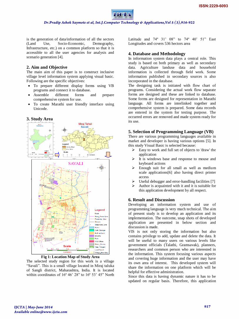
3. Study Area
Fig 1: Location Map of Study Area
The selected study region for this work is a village
“Savali”. This is a small village located in Miraj taluka
of Sangli district, Maharashtra, India. It is located
within coordinates of 16º 46‟ 28” to 16º 53‟ 45” North
Latitude and 74º 31‟ 08” to 74º 40‟ 51” East Longitudes and covers 536 hectors area
4. Database and Methodology In information system data plays a central role. This
study is based on both primary as well as secondary
data. Agriculture landuse data and household
information is collected through field work. Some
information published in secondary sources is also
incorporated in the database.
The designing task is initiated with flow chart of programs. Considering the actual work flow separate
forms are designed and these are linked to database.
Some forms are designed for representation in Marathi
language. All forms are interlinked together and
comprehensive system is prepared. Some data records
are entered in the system for testing purpose. The
occurred errors are removed and made system ready for
its use.
5. Selection of Programming Language (VB) There are various programming languages available in
market and developer is having various options [5]. In
this study Visual Basic is selected because:
Easy to work and full set of objects to 'draw' the
application
It is windows base and response to mouse and
keyboard actions
Enough suit for all small as well as medium
scale applications[6] also having direct printer
access
Useful debugger and error-handling facilities [7] Author is acquainted with it and it is suitable for
this application development by all respect.
6. Result and Discussion Developing an information system and use of
programming language is very much technical. The aim
of present study is to develop an application and its
implementation. The outcome, snap shots of developed
application are presented in below section and
discussion is made.
VIS is not only storing the information but also
contains privilege to add, update and delete the data. It
will be useful to many users on various levels like government officials (Talathi, Gramsavak), planners,
researchers and common person who are interested in
the information. This system focusing various aspects
and covering huge information and the user may have
its own area of interest. This developed system will
share the information on one platform which will be
helpful for effective administration.
Since this data is having dynamic nature it has to be
updated on regular basis. Therefore, this application
Dr.Pradip Ashok Saymote et al, Int.J.Computer Technology & Applications,Vol 5 (3),916-922
IJCTA | May-June 2014 Available [email protected]
917
ISSN:2229-6093

contains a tool by which the user can upload the present data. Once the data is available anyone can use it for
their own use and various types of analysis are possible
on it. To show the data in Marathi language „Unicode‟
application is used. This software contains many
aspects but due to the limitation of write-up space few
snapshots are given below, which will be useful to
understand the developed application.
6.1 Main Window The main window (fig.2) is a front page screen of VIS application contains title, login window, etc. If user
wants to access the information he has to choose the
option either English or Marathi. The login window is
developed for the authentication of developer and super
user. If proper login and password entered it will give
access for the data modification. If user clicks the
„Maps‟ button it will open the digital mapping
information about the village
Fig 2: Main Screen of VIS Application
Once user entered in the system main menu screen will
appear. This screen is having main menu (Fig.3) like
Land Records, Home Information.7/12 Records, Non-
Agriculture, etc. The main categories are again having
sub components like Land Records Menu contains
General Information of Land, Owner Information,
Other Rights, Crop detail, etc. User can choose the
option as per their need. The click on particular option
will lead to open specific form for the user [8].
Fig 3: Main Menu View
6.2 Marathi Information There might be users who require information in
Marathi. Hence, in this application there are some
windows which contain information in Marathi
language. The land record information of land parcels,
household records, cropping data, etc. are made
available in Marathi. Fig.4 shows the parcel-wise data
about agriculture crops in the village and fig.5 is about
general information of land parcel.
Fig 4: Crop Details in Marathi
Fig 5: General Information of Land Parcel
Dr.Pradip Ashok Saymote et al, Int.J.Computer Technology & Applications,Vol 5 (3),916-922
IJCTA | May-June 2014 Available [email protected]
918
ISSN:2229-6093

Figure 6 shows main menu which represent particulars of Land Record like General Information of Land
Parcel, Ownership Details, Other Rights of land and
crop information. The design of main window is made
by considering the data volume. If there are more than
two records then it is shown by the grid view and single
data-set is represented in text box format. General
information window shows all details of particular land
parcels along with its map. The snap-shot of above
mentioned aspects of land are given below (Figure 6, 7,
and 8).
Fig 6: Land Parcel Information
Fig 7: Owner Information of a Land Parcel
6.3 Entire Information of Land Parcel (7/12) Figure 8 shows entire information about particular land
parcel in one screen. As this screen shows all
information at once it helps to get clear idea about that
individual survey plot. The information of all
associated four tables is shown at once along with the
map, in other words it is complete 7-12 record of
particular survey number. While one particular land
parcel is concerned then for mapping purpose in 7/12
with map the selected survey plot appear in the middle
and all adjacent survey plots and their limits are also
shown properly.
Fig 8: Entire Information of a Land Parcel
6.3 Non-Agriculture Land Parcels The figure 9 shows information of a particular land
parcel which are under non-agriculture landuse. All sub
plots form of particular main survey number is shown
in one screen, this will help to understand how many
sub survey numbers, their owners, etc. If user is
interested in only specific non-agricultural (N. A.) plot,
then he can choose the next option which contains
further information about the sub-survey number plots
in detail.
Fig 9: Non-Agriculture Land Parcel
6.4 Household Details The user can get the information about particular house
in the village by selecting perticular window. It
contains the information like general information of
selectd house, demographic information and other
related information. The general table constain name of
house owner, house number, house type, location of
house, etc. (Fig.10)
Dr.Pradip Ashok Saymote et al, Int.J.Computer Technology & Applications,Vol 5 (3),916-922
IJCTA | May-June 2014 Available [email protected]
919
ISSN:2229-6093
The demographic information of particular house is shown in the family table i.e. number of person in the
house, sex, age, education, working place, income, etc.
information is available. (Fig. 10)
Fig 10: Family Details of a Household
The last screen of household menu is of other
information it consists many things like who is the respondent, his age, sex, education, etc. the amenities
available in the home, the satisfactory level about the
facilities and services in the village, needed service,
infrastructure, vehicle information, etc. This data is
very much useful for the analytical task [9].
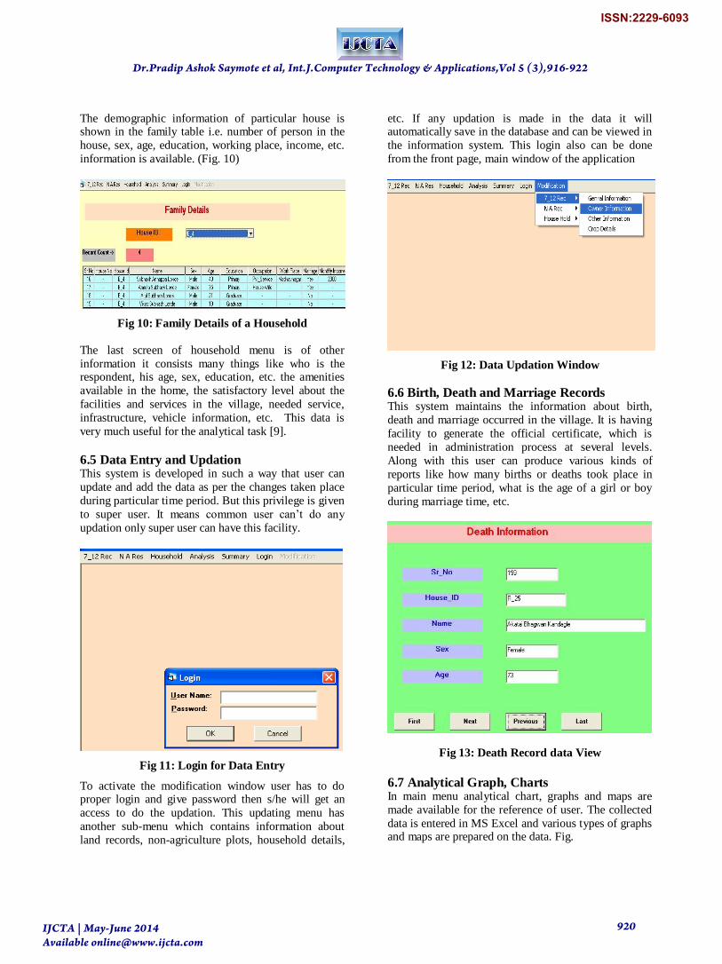
6.5 Data Entry and Updation This system is developed in such a way that user can
update and add the data as per the changes taken place
during particular time period. But this privilege is given
to super user. It means common user can‟t do any
updation only super user can have this facility.
Fig 11: Login for Data Entry
To activate the modification window user has to do proper login and give password then s/he will get an
access to do the updation. This updating menu has
another sub-menu which contains information about
land records, non-agriculture plots, household details,
etc. If any updation is made in the data it will automatically save in the database and can be viewed in
the information system. This login also can be done
from the front page, main window of the application
Fig 12: Data Updation Window
6.6 Birth, Death and Marriage Records This system maintains the information about birth,
death and marriage occurred in the village. It is having
facility to generate the official certificate, which is
needed in administration process at several levels.
Along with this user can produce various kinds of
reports like how many births or deaths took place in
particular time period, what is the age of a girl or boy
during marriage time, etc.
Fig 13: Death Record data View
6.7 Analytical Graph, Charts In main menu analytical chart, graphs and maps are
made available for the reference of user. The collected
data is entered in MS Excel and various types of graphs and maps are prepared on the data. Fig.
Dr.Pradip Ashok Saymote et al, Int.J.Computer Technology & Applications,Vol 5 (3),916-922
IJCTA | May-June 2014 Available [email protected]
920
ISSN:2229-6093

Fig 14: Most Needs Service for Villagers
There are two main categories one is Maps and other is
Graphs. The graph is again sub-divided into two
categories i.e. Land related graphs and Household
related graphs. Fig.15 is the soil distribution map of
village.
Fig 15: Soil Map
6.8 Conclusion Every one concerns about a village is interested in first
hand and authentic information, same time who is
visiting first time also wants to get first hand
information about the Location of village, Approach to the village. The information about the topographic
aspect of the village, population dynamics, cropping
data, facilities available therein, etc. are very much
important. In the development of VIS along with
programming language the web based / mobile
platform is also very much useful. The collection and
sharing of data can be done better through mobile. Visual basic programming language is very good
capabilities for the initial developers. It fulfils all the
demands of small scale applications. In case of VIS it is
best experience and busted the author for further
development. In next phase the VB .NET is applied and
tested successfully.
.
Dr.Pradip Ashok Saymote et al, Int.J.Computer Technology & Applications,Vol 5 (3),916-922
IJCTA | May-June 2014 Available [email protected]
921
ISSN:2229-6093

10. References [1] Pathan, S.K. (2005). Role of geoinformatics in natural resources development: Retrospect and
prospects. Indian Society of Geomatic Newsletter,
Vol.10 & Vol.11, 2005. [2] Saymote, P. A. (2013). Geo-Analysis of Landuse /
Landcover change of Miraj Tahsil in Sangli District : Using Geoinformatics (Doctoral dissertation, Shivaji
University, Kolhapur, MH.).
[3] Singh, H., Kewal, K. and Litoria, P.K. (2009).
Creation of a Village Information System of Moga district in Punjab using Geoinformatics. In proceeding of
the National Conference on Recent Developments in
Computing and its Applications, NCRDCA‟09, August
12-13, 2009. Taken from http://www.researchgate.net/profile/Harpinder_Singh/pu
blication/
[4] Sharma, P.K., Bhatt, C.M., Verma, V. K., Litoria
P.K. and Sood, Anil (2004) Socio-Economic and demographic profile of Muktsar district, Punjab. Project
Report- Information Technology for Sustainable
Agriculture in Punjab, PUNSEN/06/2004.
[5] Anderson T. (1998). Visual Basic in Easy Steps, Comdex Computer Publishing, New Delhi.
[6] Johnson, S. (2006). Visual Basic, Vision Publication,
Delhi, (pp. 37-89).
[7] Peter, N. (2003). Guide to Visual Basic-6, Tech Media Publication, New Delhi.
[8] Noel, J. (1999). The Complete Reference, Visual
Basic-6, Tata McGraw-Hill Publication, New Delhi.
[9] Saymote, P. A. (2009). Development of Village Information System with the help of Geoinformatics. (M.
Phil dissertation, Tilak Maharashtra University, Pune,
MH).
Dr.Pradip Ashok Saymote et al, Int.J.Computer Technology & Applications,Vol 5 (3),916-922
IJCTA | May-June 2014 Available [email protected]
922
ISSN:2229-6093