determination of nepa adequacy (dna)dna-2014-010 carp bypass trail d. nepa adequacy criteria 1. is...
TRANSCRIPT

1790A DNA-2014-010 Carp Bypass Trail
UNITED STATES DEPARTMENT OF THE INTERIOR BUREAU OF LAND MANAGEMENT
EUGENE DISTRICT OFFICE
DETERMINATION OF NEPA ADEQUACY (DNA)
OFFICE: Eugene District office
TRACKING NUMBER: DOI-BLM-OR-E050-2014-010-DNA
PROJECT NAME: Carpenter Bypass Trail Construction
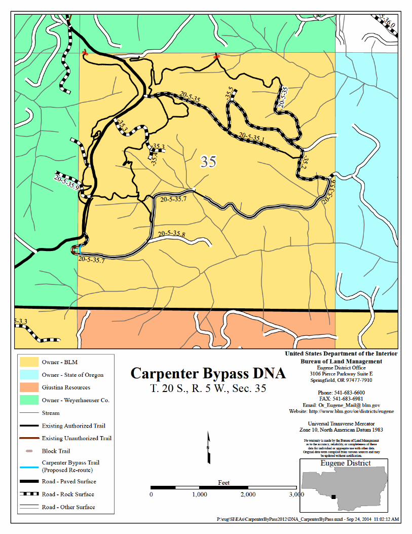
LOCATION/LEGAL DESCRIPTION: Trail locations within the Carpenter Bypass System are located in Township 20 South; Range 6 West, Sections 23, 27 and 35.
A. Description of Proposed Action and any applicable mitigation measures: The proposed action is the re-route of unauthorized existing trail off of adjacent private land back on to BLM land in Sections 23 and 27. Unauthorized trail use on adjacent landowner property and potential mitigations measures were identified in the Environmental Assessment (EA) for the trail system. This action would re-route less than one mile of the existing trail system.
Specific activities that will take place as part of this project include vegetation clearing, grubbing and excavation of full bench trail tread. Trail re-routes will be completed by hand crews as well as small mechanized equipment. The purpose of the project is to effectively manage recreation use in the planning area by re-routing trail off of adjacent private landowners.
The trail system was approved as part of the Carpenter Bypass Mountain Bike Trail EA (July, 2013). The project conforms to the goals and objectives for future recreation management as outlined in the EA.
B. Land Use Plan (LUP) Conformance
The proposed action is in conformance with the applicable LUP because it is specifically provided for in the following LUP decisions:
Pages 80-81, Eugene District Record of Decision and Resource Management Plan (RMP), as amended, June 1995:
“Provide amenities (recreation, facilities, protected special areas, and high quality fisheries) that enhance communities as places to live and work (p. 80).”
“Provide a wide range of developed and dispersed recreation opportunities that contribute to meeting projected recreation demand within the planning area (p. 80).”
“Continue to provide non-motorized recreation opportunities and create additional opportunities where consistent with other management objectives (p. 81).”
C. Identify applicable National Environmental Policy Act (NEPA) documents and other related documents that cover the proposed action.
• Carpenter Bypass Mountain Bike Trail EA (2013) • Letter of Concurrence from the United States Fish and Wildlife Service for informal consultation, November
29, 2012.
- 1

1790A DNA-2014-010 Carp Bypass Trail
D. NEPA Adequacy Criteria
1. Is the new proposed action a feature of, or essentially similar to, an alternative analyzed in the existing NEPA document(s)? Is the project within the same analysis area, or if the project location is different, are the geographic and resource conditions sufficiently similar to those analyzed in the existing NEPA document(s)? If there are differences, can you explain why they are not substantial? Yes. The project is substantially similar in type, location, intensity, and scope to the CB Environmental Assessment (2013). The trail system and Sustainability Assessment Map was used for site-specific analysis contained in the CB Environmental Assessment. The CB EA analyzed the proposed action using design features included in Appendix A, Page A-1, as follows:
PROJECT DESIGN FEATURES A sustainable trail is designed to provide enjoyable and challenging experiences for visitors by managing their expectations and their use effectively. Under Alternative 2, all existing and re-routed mountain bike trails would be designed, constructed, and maintained according to the specifications described below.
These specifications are based on International Mountain Bike Association (IMBA) trail standards, the amount of use, and the physical characteristics of the land. Sustainable trail principles incorporated in any improvement or new construction on the trail system include sustainable trail alignment, sustainable grade, grade reversals, out slope, minimizing user-caused soil displacement and regular maintenance. Useable trail width for mountain bikes is approximately two to three feet.
The following Project Design Features (PDFs) are included in the design of the mountain bike trail system and would be implemented in the proposed action unless otherwise specified.
Trail Construction/Realignment Trail work would be anticipated to begin in the late summer or fall of 2013 and continue for the next several years. Trail re-routes and improvement would only be conducted during dry periods to minimize run-off of loose soils.
Construction would be performed using hand tools including but not limited to pulaskis, Mcleods, digging bars, shovels, hack saws, pruners, etc. Smaller, hand-held motorized equipment, such as chainsaws, may also be used if necessary in compliance with any wildlife and/or fire restrictions. To help prevent the spread of noxious or invasive weeds, all tools would be cleaned before entering projector area for construction and maintenance activities.
Trail improvements would occur within the current trail network in accordance with IMBA standards and as approved by the BLM.
Trail out slope of 10% or greater would be implemented to facilitate proper drainage.
Trail grade or steepness would not exceed half the grade or steepness of the hillside.
Trail design would minimize vegetation removal through route designation. No trees over 11 inches in diameter would be removed or felled as part of the trail construction process. Any trees felled would be left on-site as coarse woody debris.
Trail closures would be done by placing woody slash along trail route and barricades (e.g., rocks/logs) at trail heads. Closures would be clearly posted at trail heads and listed on informational signs at the parking area and through a variety of channels including brochures, web-based outreach and partnerships.
- 2

1790A DNA-2014-010 Carp Bypass Trail
Stream crossings would be well armored with rock to allow crossing without silting the water or obstructing water flow.
Approaches to stream crossings (side hills within each drainage) would be designed to reduce grade and potential for erosion (by roughly maintaining contour where possible), routing approaches at more durable locations where possible and building crib walls where necessary to stabilize the downhill side of the trail and prevent trail sloughing. In areas where re-routing to avoid a stream crossing is feasible and within 25 feet of existing trail route footprints, trials would be re-routed.
Sow native grass seed on bare ground areas where weed infestations are deemed highly likely or where erosion potential is present, after parking lot construction and trail maintenance operations have been completed.
If any cultural resources are discovered during project activities, all operations in the immediate area shall be suspended immediately. District archaeological staff would be contacted immediately to assess and evaluate protection measures needed.
2. Is the range of alternatives analyzed in the existing NEPA document(s) appropriate with respect to the new proposed action, given current environmental concerns, interests, and resource values? Yes. The project, as designed, is consistent with the direction provided in the EA and the range of alternatives analyzed during the NEPA process. The range of alternatives included in the EA remains appropriate.
3. Is the existing analysis valid in light of any new information or circumstances (such as, rangeland health standard assessment, recent endangered species listings, updated lists of BLM-sensitive species)? Can you reasonably conclude that new information and new circumstances would not substantially change the analysis of the new proposed action? There is no additional information relevant to the proposed trail construction area (see map) that would change the analysis of the proposed action. With respect to fisheries, hydrology, cultural resources, botany and recreation, there is no additional relevant information to the project in regards to the analysis. Surveys for special status botanical species were completed and none were found.
4. Are the direct, indirect, and cumulative effects that would result from implementation of the new proposed action similar (both quantitatively and qualitatively) to those analyzed in the existing NEPA document? Yes, the direct and indirect impacts of the proposed action are similar to those analyzed in the Carpenter Bypass Mountain Bike Trail EA and would not differ from those identified in this existing NEPA document. Site specific impacts were evaluated based on the trail map included in the EA. Chapter 3 (Environmental Effects) of the EA outlines site specific impacts in relation to trail locations. The anticipated cumulative impacts that would occur under project implementation are unchanged between the existing EA and the current proposal.
5. Are the public involvement and interagency review associated with existing NEPA document(s) adequate for the current proposed action? Yes, the level of public involvement surrounding the completion of the Carpenter Bypass Mountain Bike Trail EA is adequate and is in compliance with NEPA public involvement requirements in light of current conditions, information, issues and controversies. Public Involvement/Consultation/Coordination surrounding the EA is as follows:
In early April of 2012, outreach informing the public of the EA planning effort and upcoming public meeting was sent out through a formal press release to weekly papers, including The Creswell Chronicle, Cottage Grove Sentinel and Eugene Weekly. This outreach was also sent to radio stations KLCC, KUGN, and KPNW. Further outreach with the same information was published on the BLM public website and at informational kiosks located at BLM Siuslaw Resource Area Recreation areas, including Hult Reservoir Equestrian Trailhead and Hult Reservoir Parking Lot. Informational flyers were provided to local businesses and the University of Oregon.
A public scoping meeting was held on April 26, 2012, at the Lorane Grange in the town of Lorane, Oregon. The meeting was advertised via press release, the BLM public website and the reader board at the Lorane Grange. Approximately 55 members of the public attended the meeting, in addition to five BLM staff. Comment forms
- 3

1790A DNA-2014-010 Carp Bypass Trail
were provided at the meeting and 17 forms were filled out and submitted. In addition to public meeting comment forms the BLM received 54 comments via postal or e-mail correspondence.
A draft EA/FONSI was posted for a 30-day public comment period on August 15, 2012. In response to the number of comments that were received, the comment period was extended for another 15 days until October 4, 2012. A total of 271 comments were received ranging from support from the mountain bike community to concerns from equestrian users regarding language in the EA implying exclusion from trail access. Other comments included concerns from the timber community surrounding unauthorized use of timberlands, concerns from trail users about potential user group conflict on the trail network, and concerns from environmental groups regarding effects to fish and wildlife and stream crossings.
The Decision Maker for the project directed the IDT to review the substantive comments received and re-issue an EA for another 30-day public comment period. All substantive comments were addressed through the revision of the EA.
Several comments from equestrians expressed concerns with analysis that implied that horses would be excluded from trail riding on this trail system. In response to comments from local equestrians, several subsequent meetings were held from December 5, 2012, to February 14, 2013, with members of the Backcountry Horsemen of America (BCHA), at their request, to clarify analysis done and to acquire substantive information to consider incorporating into the EA’s revision. The BCHA was requested to provide a proposal with a map showing desired trail use, and proposals for trail segment re-design to meet equestrian trail use standards. On February 14, 2013, the organization provided the BLM with a map identifying areas within the Carpenter Bypass project area that would provide them with an optimal recreation experience, and discussed possible trail segments renovations to align with federal equestrian trail standards at a future time.
E. Persons/Agencies /BLM Staff Consulted Name Title Resource Agency Represented Peter O’Toole Forester Silviculture BLM Luis Palacios Civil Engineering Tech Engineering BLM Leo Poole Fish Biologist Fisheries BLM Karin Baitis Soil Scientist Soils BLM Steve Steiner Hydrologist Hydrologist BLM Doug Goldenberg Botanist Botany BLM Jason McCaslin Wildlife Tech Wildlife BLM Ted Reiss Forester Forestry Seneca Jones Timber
Company Meghan Tuttle Rights of Way specialist Rights of Way Weyerhaeuser Timber
Company Wade Judy Recreation Planner Recreation BLM Sharmila Premdas NEPA Planner NEPA BLM
- 4

1790A DNA-2014-010 Carp Bypass Trail
Conclusion Based on the review documented above, I conclude that this proposal conforms to the applicable land use plan and that the NEPA documentation fully covers the proposed action and constitute BLM’s compliance with the requirements of the NEPA.
Signature of Project Lead:
/S/ Wade Judy Date: 09/29/2014 Wade Judy, Recreation Planner
Signature of NEPA Coordinator:
/S/ Sharmila Premdas Date: 09/29/2014 Sharmila Premdas, NEPA Planner
Signature of the Responsible Official:
/S/ Michael J. Korn Date: 09/29/2014 Michael J. Korn, Field Manager Siuslaw Resource Area
Note: The signed Conclusion on this Worksheet is part of an interim step in the BLM’s internal decision process and does not constitute an appealable decision. However, the lease, permit, or other authorization based on this DNA is subject to protest or appeal under 43 CFR Part 4 and the program specific regulation
- 5

1790A DNA-2014-010 Carp Bypass Trail
UNITED STATES DEPARTMENT OF THE INTERIOR BUREAU OF LAND MANAGEMENT
EUGENE DISTRICT OFFICE
DECISION RECORD DOI-BLM-OR-E050-2014-010-DNA
Carpenter Bypass Trail
DECISION It is my decision to implement this action as described in the Determination of NEPA Adequacy documentation DOI-BLMOR-E050-2014-010-DNA.
DECISION RATIONALE The proposed action has been reviewed by BLM staff. The Proposed Action is in conformance with the 1995 Eugene District Record of Decision and Resource Management Plan (as amended). Based on the Determination of NEPA Adequacy, I have determined that the existing NEPA documentation fully covers the proposed action and constitutes BLM’s compliance with the requirements of the NEPA.
SURVEY AND MANAGE The project is consistent with the 2001 ROD and Standards and Guidelines for Amendments to the Survey and Manage, Protection Buffer, and other Mitigation Measures Standards and Guidelines, as incorporated into the District Resource Management Plan.
This project utilizes the December 2003 species list. This list incorporates species changes and removals made as a result of the 2001, 2002, and 2003 Annual Species Reviews (ASR) with the exception of the red tree vole. For the red tree vole, the Ninth Circuit Court of Appeals in KSWC et al. v. Boody et al., 468 F3d 549 (9th Cir. 2006) vacated the category change and removal of the red tree vole in the mesic zone, and returned the red tree vole to its status as existed in the 2001 ROD Standards and Guidelines, which makes the species Category C throughout its range.
Trail design would minimize vegetation removal through route designation. No trees over 11 inches in diameter would be removed or felled as part of the trail construction process. Any trees felled would be left on-site as coarse woody debris. Therefore the project would not impact red tree vole habitat or affect the persistence of the species. The proposed reroute segments in section 23, 27 and 35 were surveyed for botanical species. Survey and Manage vascular plants, lichens or bryophytes were not found, and no mitigations are necessary.
ADMINISTRATIVE REMEDIES Any person adversely affected by this decision may appeal it to the Interior Board of Land Appeals (IBLA), Office of the Secretary, in accordance with the regulations contained in 43 CFR, Part 4. If an appeal is taken, a notice of appeal must be filed in this office within 30 days of this decision for transmittal to the Board. If a notice of appeal does not include a statement of reasons, such statement must be filed with this office and with the Board within 30 days after the notice of appeal was filed. A copy of a notice of appeal and any statement of reasons, written arguments, or briefs, must also be served upon the Regional Solicitor, Pacific Northwest Region, U.S. Department of the Interior, 805 SW Broadway, Suite 600, Portland, OR 97205.
Signature of the Responsible Official:
/S/ Michael J. Korn 09/30/2014 Michael J. Korn Date: Field Manager, Siuslaw Resource Area Eugene District Office