determination form project description and purpose and · pdf fileproject description and...
TRANSCRIPT

D R A
F T
* Include pages from current TIP/STIP/LRTP
1. PROJECT DESCRIPTION AND PURPOSE AND NEEDa. Project InformationCounty: Polk CountyProject Name: US 98 (PEACE RIVER-FT MEADE) AT BRIDGE NO 0064(JOHN SINGLETARYBRIDGE)Project Limits: West of Edgewood Drive (MP 1.030) to east of the Fort Meade Recreation AreaEntrance (MP 1.581)Project Numbers:
14114 434886-1-22-01 1801-006-P ETDM (if applicable) Financial Management Federal-Aid
Project Location Map Documentation:Noneb. Proposed Improvements:(SEE ATTACHMENT X- 1.b. PROPOSED IMPROVEMENTS, pgs. 3 - 8)
c. Purpose and Need:(SEE ATTACHMENT X - 1.c. PURPOSE AND NEED, pgs. 9 - 10)
d. Project Planning Consistency:
CurrentlyAdopted CFP-LRTP
COMMENTS
The project is included within the Cost Feasible Plan (CFP) of the Polk TPO's Momentum 2040 LongRange Transportation Plan (LRTP) as adopted December 10, 2015 and amended June 9, 2016 and the2040 LRTP TIP adopted June 9, 2016 and amended December 8, 2016.
PHASE CurrentlyApproved TIP
CurrentlyApproved STIP TIP/STIP $ TIP/STIP FY COMMENTS
PE (Final Design) Y Y $$2.05M/$2.05 M
2017/18;2017/18
Federally funded. DesignNTP anticipated February2018.
R/W N N $ Unfunded. Anticipatedfunding in FY 2020.
Construction N N $Unfunded. Anticipatedfunding in FY 2025, withpotential to advancement toFY 2021.
Project Plan Consistency Documentation:None
STATE OF FLORIDA DEPARTMENT OF TRANSPORTATION
TYPE 2 CATEGORICAL EXCLUSIONDETERMINATION FORM
650-050-11ENVIRONMENTAL MANAGEMENT
09/15
D R A
F T2. COOPERATING AGENCY None
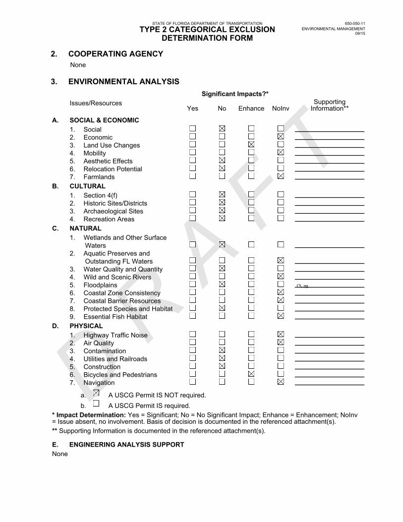
3. ENVIRONMENTAL ANALYSIS Significant Impacts?* Issues/Resources
Yes No Enhance NoInvSupporting
Information**
A. SOCIAL & ECONOMIC 1. Social 2. Economic 3. Land Use Changes .
4. Mobility 5. Aesthetic Effects 6. Relocation Potential 7. FarmlandsB. CULTURAL 1. Section 4(f) 2. Historic Sites/Districts 3. Archaeological Sites 4. Recreation AreasC. NATURAL 1. Wetlands and Other Surface Waters 2. Aquatic Preserves and Outstanding FL Waters 3. Water Quality and Quantity 4. Wild and Scenic Rivers 5. Floodplains C5, pg.
6. Coastal Zone Consistency 7. Coastal Barrier Resources 8. Protected Species and Habitat 9. Essential Fish HabitatD. PHYSICAL 1. Highway Traffic Noise 2. Air Quality 3. Contamination 4. Utilities and Railroads 5. Construction 6. Bicycles and Pedestrians 7. Navigation
a. A USCG Permit IS NOT required. b. A USCG Permit IS required.* Impact Determination: Yes = Significant; No = No Significant Impact; Enhance = Enhancement; NoInv= Issue absent, no involvement. Basis of decision is documented in the referenced attachment(s).** Supporting Information is documented in the referenced attachment(s).
E. ENGINEERING ANALYSIS SUPPORTNone
STATE OF FLORIDA DEPARTMENT OF TRANSPORTATION
TYPE 2 CATEGORICAL EXCLUSIONDETERMINATION FORM
650-050-11ENVIRONMENTAL MANAGEMENT
09/15
D R A
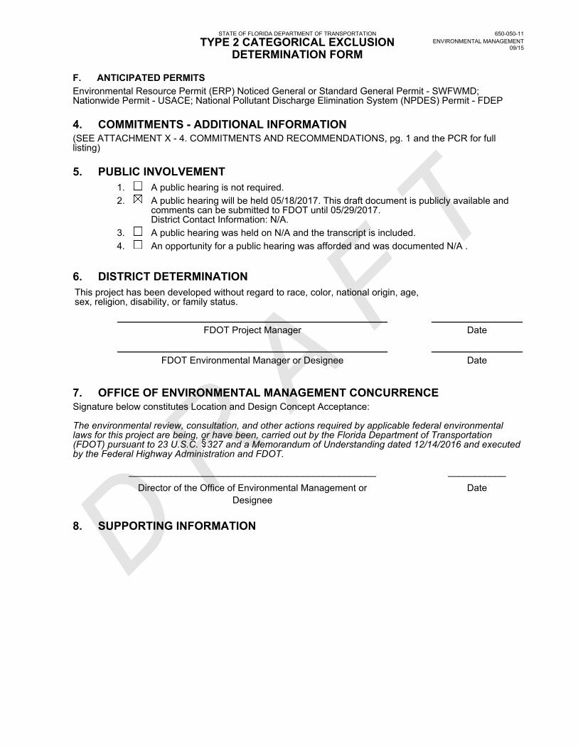
F TF. ANTICIPATED PERMITSEnvironmental Resource Permit (ERP) Noticed General or Standard General Permit - SWFWMD;Nationwide Permit - USACE; National Pollutant Discharge Elimination System (NPDES) Permit - FDEP
4. COMMITMENTS - ADDITIONAL INFORMATION(SEE ATTACHMENT X - 4. COMMITMENTS AND RECOMMENDATIONS, pg. 1 and the PCR for fulllisting)
5. PUBLIC INVOLVEMENT1. A public hearing is not required.2. A public hearing will be held 05/18/2017. This draft document is publicly available and
comments can be submitted to FDOT until 05/29/2017.District Contact Information: N/A.
3. A public hearing was held on N/A and the transcript is included.4. An opportunity for a public hearing was afforded and was documented N/A .
6. DISTRICT DETERMINATIONThis project has been developed without regard to race, color, national origin, age,sex, religion, disability, or family status.
FDOT Project Manager Date
FDOT Environmental Manager or Designee Date
7. OFFICE OF ENVIRONMENTAL MANAGEMENT CONCURRENCESignature below constitutes Location and Design Concept Acceptance:
The environmental review, consultation, and other actions required by applicable federal environmentallaws for this project are being, or have been, carried out by the Florida Department of Transportation(FDOT) pursuant to 23 U.S.C. 327 and a Memorandum of Understanding dated 12/14/2016 and executedby the Federal Highway Administration and FDOT.
_______________________________________________ ___________
Director of the Office of Environmental Management orDesignee
Date
8. SUPPORTING INFORMATION
STATE OF FLORIDA DEPARTMENT OF TRANSPORTATION
TYPE 2 CATEGORICAL EXCLUSIONDETERMINATION FORM
650-050-11ENVIRONMENTAL MANAGEMENT
09/15

April 2017
TYPE 2 CE SUPPORT DOCUMENT
US 98 / JOHN SINGLETARY BRIDGE PROJECT DEVELOPMENT AND ENVIRONMNT (PD&E)
STUDY
FPID: 434886-1-22-01 FAP: 1801-006-P
Type 2 CE Support Document US 98/John Singletary Bridge PD&E Study April 2017 1 FPID: 434886-1-22-01
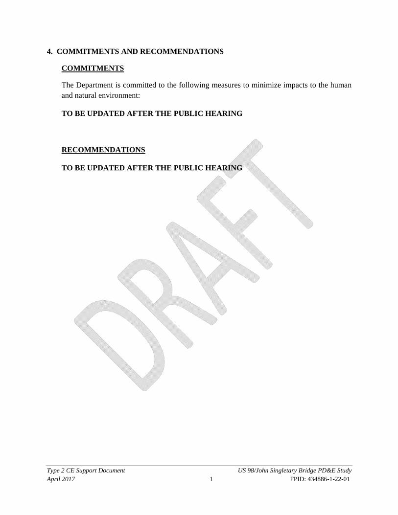
4. COMMITMENTS AND RECOMMENDATIONS
COMMITMENTS
The Department is committed to the following measures to minimize impacts to the human and natural environment:
TO BE UPDATED AFTER THE PUBLIC HEARING
RECOMMENDATIONS
TO BE UPDATED AFTER THE PUBLIC HEARING

Type 2 CE Support Document US 98/John Singletary Bridge PD&E Study April 2017 2 FPID: 434886-1-22-01
The environmental review, consultation, and other actions required by applicable federal environmental laws for this project are being, or have been, carried out by the Florida Department of Transportation (FDOT) pursuant to 23 U.S.C. §327 and a Memorandum of Understanding (MOU) dated December 14, 2016 and executed by the Federal Highway Administration and FDOT. NOTE: Supporting documentation was prepared prior to the MOU execution. Determinations made prior to the MOU by FHWA are noted as such throughout and are adopted by FDOT.

Type 2 CE Support Document US 98/John Singletary Bridge PD&E Study April 2017 3 FPID: 434886-1-22-01
1.b. PROPOSED IMPROVEMENTS This project proposes the replacement of the existing two-lane John Singletary Bridge (Bridge #160064) (see Figure 1) with a new two-lane bridge that meets current FDOT design standards and accommodates pedestrian and bicycle facilities. The new bridge includes eight-foot-wide shoulders/buffered bicycle lanes, a six-foot-wide sidewalk on the north side of the bridge, and a 10-foot-wide shared use path on the south side of the bridge. Traffic railings will separate the sidewalk and shared use path areas from the traffic and bicycle lanes. Proposed roadway improvements include seven-foot-wide buffered bicycle lanes, a six-foot-wide sidewalk on the north side of the road and a 10-foot-wide shared use path on the south side of the road. The new bridge alignment will be shifted to the south of the existing bridge alignment and tie into the existing roadway alignment east of the Fort Meade Recreation Area entrance. Additional improvements include adding a six-foot-wide sidewalk between Washington Avenue and Edgewood Drive to connect the proposed pedestrian improvements with the existing sidewalk that currently ends west of Washington Avenue. This alternative, identified as Build Alternative 2, was selected because of public acceptance, lower cost, and minimal right-of-way impacts. The proposed typical sections are provided on Figure 2 and Figure 3. A full discussion of alternatives evaluated is provided in Section 4.0 of the Preliminary Engineering Report (PER), prepared under separate cover for this project. The development of a new corridor is not considered a viable alternative. By utilizing the existing corridor, adverse effects to the adjacent land uses will be minimized.
Build Alternative 2 will impact one privately owned parcel, one City owned parcel, and one County owned parcel resulting in the right-of-way acquisition of approximately 2.07 acres. No residences or businesses will be displaced as a result of the proposed improvements. Right-of-way will also be needed to accommodate an offsite stormwater management facility; however, this additional right-of-way will not result in any business or residential relocations.

Type 2 CE Support Document US 98/John Singletary Bridge PD&E Study April 2017 4 FPID: 434886-1-22-01
FIGURE 1 - PROJECT LOCATION MAP

Type 2 CE Support Document US 98/John Singletary Bridge PD&E Study April 2017 5 FPID: 434886-1-22-01
FIGURE 2 – ROADWAY TYPICAL SECTION FOR THE RECOMMENDED ALTERNATIVE
FIGURE 3 – BRIDGE TYPICAL SECTION FOR THE RECOMMENDED ALTERNATIVE

Type 2 CE Support Document US 98/John Singletary Bridge PD&E Study April 2017 6 FPID: 434886-1-22-01
1.c. PURPOSE AND NEED
The US 98/John Singletary Bridge is a concrete girder bridge built in 1931 and has two, 10-foot-wide travel lanes and a 5.4-foot-wide sidewalk on the north side. These dimensions are functionally obsolete. The need for the project is to provide a bridge built to current standards. The purpose of this project is to study ways to correct these identified deficiencies and maintain the connection between Downtown Fort Meade to the west and the City of Frostproof to the east, as US 98 serves as the main access road between the two cities. This project is also intended to enhance safety conditions as well as movement/access across the Peace River for motorists, pedestrians, and bicyclists. The need for the project is based on the following criteria:
Primary Criteria
STRUCTURAL AND FUNCTIONAL DEFICIENCIES: Improve Structural and Functional Conditions
The US 98/John Singletary Bridge is a concrete girder bridge built in 1931. The existing bridge typical section includes two 10-foot wide travel lanes and a single 5-foot wide raised sidewalk located on the north side. There are no shoulders. The 550 foot long bridge is classified as functionally obsolete due to the 10 foot lanes, lack of shoulders, and the location of the railing right next to the traffic lane. The bridge has heavy use with significant truck traffic and is located on the National Highway System (NHS). The eastbound passing vehicles are up against the substandard traffic railing on the south side and westbound passing vehicles are at the edge of the sidewalk on the north side. This creates an undesirable condition for pedestrians using the sidewalk and for bicycles using the bridge, since the side mirrors of the trucks extending over the sidewalk. Based on a structural loading test, the bridge was rated at 31 tons instead of the 36 tons required. According to the load test report, this does not meet current design standards.
SAFETY: Improve Safety Conditions
The crash data obtained from the Florida Department of Transportation Safety Office for the period 2010-2014 indicated that, within the project limits, there were a total of 13 crashes. Four (4) of these crashes resulted in injuries and two (2) crashes occurred on the bridge (sideswipe). A bridge modified, or built to, required current standards would allow for greater vehicle clearance through wider travel lanes, potentially reducing vehicle-to-vehicle and vehicle-to-structure conflicts. Further, the addition of bike lanes and sidewalks built to current standards would buffer pedestrians/bicyclists from vehicles thus modifying/ limiting opportunities for conflicts between pedestrians/bicyclists and vehicles.
Secondary Criteria

Type 2 CE Support Document US 98/John Singletary Bridge PD&E Study April 2017 7 FPID: 434886-1-22-01
MODAL INTERRELATIONSHIPS: Enhance Mobility Options and Multi-Modal Access
The US 98/John Singletary Bridge currently connects residents of Downtown Fort Meade on the west side of the Peace River to the City of Frostproof to the east. The proposed improvements will enhance overall pedestrian/bicycle movement and circulation across the Peace River and supports the goals of Polk County to create a connected, regional pedestrian and bicycle network. The anticipated improvements will consider the use of a sidewalk or shared use path on the south side of the bridge, this will provide connectivity with the Peace River Trail at the entrance to the Fort Meade Outdoor Recreational Area.

Type 2 CE Support Document US 98/John Singletary Bridge PD&E Study April 2017 8 FPID: 434886-1-22-01
3. ENVIRONMENTAL ANALYSIS A. SOCIAL & ECONOMIC
A.1. Social
Nondiscrimination Considerations
Executive Order 12898, Federal Actions to Address Environmental Justice in Minority Populations, signed by the President on February 11, 1994, directs federal agencies to take appropriate and necessary steps to identify and address disproportionately high and adverse effects of federal projects on the health or environment of minority and low-income populations to the greatest extent practicable and permitted by law.
The existing demographics of the project area consist of 83.1% White, 6.5% African American, and 10.4% defined as “other”. A further breakdown reveals that 26.7% of this group identify themselves as Hispanic. During the ETDM programming screening review, a degree of effect for social issues was assigned as “Minimal”.
This project has been developed without regard to race, color, national origin, age, sex, religion, disability, or family status. No minority or low-income populations have been identified that would be adversely impacted by the proposed project, as determined above. Therefore, in accordance with the provisions of Executive Order 12898 and FHWA Order 6640.23a, no further Environmental Justice analysis is required. No comment was received during this study regarding conflicts with Title VI of the Civil Rights Act of 1964 or related statutes. Furthermore, the project is not anticipated to negatively affect community resources important to elderly persons, disabled individuals, non-drivers, transit-dependent individuals, or minorities.
Community Cohesion
The proposed action is not expected to result in significant changes to community cohesion. There is no potential for isolating neighborhoods. In fact, this project will increase the transportation options for residents with the addition of bicycle lanes and sidewalks/shared use path throughout the corridor.
Community Services
A variety of community services and facilities are provided within the project area. Community services near the project area but not affected include Rusty Greens Golf Course, Fort Meade Mobile Home Park, Fort Meade Recreation Area, One Accord Outreach International Church, Evergreen Cemetery, and the Fort Meade Middle-Senior High School. Access or traffic patterns around these facilities will not change as a result of this project. There are no transit routes or bus stops within the project limits.

Type 2 CE Support Document US 98/John Singletary Bridge PD&E Study April 2017 9 FPID: 434886-1-22-01
Controversy Potential
A public involvement program was conducted for this project to obtain comments and input from the public, government officials, agency representatives and other interested parties. The major elements of this program to date consist of the advance notification/ETDM coordination process, a Public Kick-off Meeting, Alternatives Public Meeting, and additional local agency coordination.
A.3. Land Use Changes
The project is located within the City of Fort Meade. The existing land use is mostly single and multi-family residential with a few commercial parcels. There is City owned land, including a recreation area, along the southern portion of the project. The proposed improvements are anticipated to support the current and future land use patterns of the area and increase safety and pedestrian/bicyclist mobility needs. This project was reviewed by the appropriate agencies through the Efficient Transportation Decision Making (ETDM) process and was assigned a summary degree of effect of “Enhanced” for land use. Since the project is compatible with the land use vision depicted through the City of Fort Meade 2030 Comprehensive Plan, no changes to existing land use patterns are anticipated. Therefore, the level of effect is enhanced.
A.5. Aesthetic Effects
During the ETDM programming screening review, FDOT stated that the effects to the project area’s visual character/aesthetic quantity are anticipated to be limited as the improvement is intended to provide a convenient, safe, and more comfortable connection for motorists, pedestrians, and bicyclists across the Peace River with the consideration of bike lanes and either sidewalks or a multi-use pathway as part of the project; however, aesthetic qualities associated with the bridge itself and recreational resources within the area may be negatively affected during project construction. A degree of effect of “Moderate” has been assigned to the Aesthetic Effects issue due to 1) adverse impacts to the existing bridge itself and the importance of the bridge to the Fort Meade community and 2) temporary impacts on access to and enjoyment of proximate recreational amenities during project construction.
A.6. Relocation Potential
Build Alternative 2 will impact one privately owned parcel, one City owned parcel, and one County owned parcel resulting in the right-of-way acquisition of approximately 2.07 acres. No residences or businesses will be displaced as a result of the proposed improvements. Right-of-way will also be needed to accommodate an offsite stormwater management facility; however, this additional right-of-way will not result in any business or residential relocations.
Type 2 CE Support Document US 98/John Singletary Bridge PD&E Study April 2017 10 FPID: 434886-1-22-01
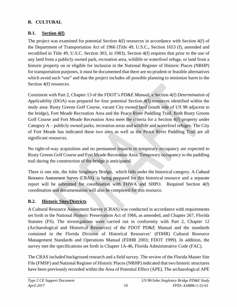
B. CULTURAL B.1. Section 4(f)
The project was examined for potential Section 4(f) resources in accordance with Section 4(f) of the Department of Transportation Act of 1966 (Title 49, U.S.C., Section 1653 (f), amended and recodified in Title 49, U.S.C. Section 303, in 1983). Section 4(f) requires that prior to the use of any land from a publicly owned park, recreation area, wildlife or waterfowl refuge, or land from a historic property on or eligible for inclusion in the National Register of Historic Places (NRHP) for transportation purposes, it must be documented that there are no prudent or feasible alternatives which avoid such “use” and that the project includes all possible planning to minimize harm to the Section 4(f) resources.
Consistent with Part 2, Chapter 13 of the FDOT’s PD&E Manual, a Section 4(f) Determination of Applicability (DOA) was prepared for four potential Section 4(f) resources identified within the study area: Rusty Greens Golf Course, vacant City owned land (south side of US 98 adjacent to the bridge), Fort Meade Recreation Area and the Peace River Paddling Trail. Both Rusty Greens Golf Course and Fort Meade Recreation Area meet the criteria for a Section 4(f) property under Category A – publicly owned parks, recreation areas and wildlife and waterfowl refuges. The City of Fort Meade has indicated these two sites as well as the Peace River Paddling Trail are all significant resources.
No right-of-way acquisition and no permanent impacts or temporary occupancy are expected to Rusty Greens Golf Course and Fort Meade Recreation Area. Temporary occupancy to the paddling trail during the construction of the bridge is anticipated.
There is one site, the John Singletary Bridge, which falls under the historical category. A Cultural Resource Assessment Survey (CRAS) is being prepared for this historical resource and a separate report will be submitted for coordination with FHWA and SHPO. Required Section 4(f) coordination and documentation will also be completed for this resource.
B.2. Historic Sites/Districts
A Cultural Resource Assessment Survey (CRAS) was conducted in accordance with requirements set forth in the National Historic Preservation Act of 1966, as amended, and Chapter 267, Florida Statutes (FS). The investigations were carried out in conformity with Part 2, Chapter 12 (Archaeological and Historical Resources) of the FDOT PD&E Manual and the standards contained in the Florida Division of Historical Resources’ (FDHR) Cultural Resource Management Standards and Operations Manual (FDHR 2003; FDOT 1999). In addition, the survey met the specifications set forth in Chapter 1A-46, Florida Administrative Code (FAC).
The CRAS included background research and a field survey. The review of the Florida Master Site File (FMSF) and National Register of Historic Places (NRHP) indicated that two historic structures have been previously recorded within the Area of Potential Effect (APE). The archaeological APE

Type 2 CE Support Document US 98/John Singletary Bridge PD&E Study April 2017 11 FPID: 434886-1-22-01
was defined as the existing and proposed right-of-way of each of the three potential alignments for the bridge and roadway. One resource, the John Singletary Bridge (FDOT Bridge No. 160064; 8PO5440), was determined eligible for the NRHP by the Florida State Historic Preservation Officer (SHPO) as part of the recent update to The Historic Highway Bridges of Florida (ACI 2012). The second previously recorded resource is the F. M. Yearwood House (8PO239) at 945 East Broadway Street; it has not been evaluated by SHPO. This Neo-Classical Revival style building is not unique for Fort Meade and has received non-historic additions that have compromised its historic integrity. Therefore, it is not considered eligible for the NRHP either individually or as part of a historic district.
The Historical/architectural field survey resulted in the identification of four newly recorded historic resources (50 years of age or older), which include two historic buildings (8PO7964 and 8PO7965), one linear resource (US 98, 8PO7966), and one resource group (Fort Meade City Mobile Home Park, 8PO7967). All of these resources represent commonly occurring types of architecture and/or engineering for the locale, and none is associated with significant historical events or persons. Therefore, none of these is eligible for listing in the NRHP either individually or as a historic district.
In summary, there is one significant cultural resource within the US 98 project APE: the John Singletary Bridge (FDOT Bridge No. 160064; 8PO5440).
B.3. Archaeological Sites
A Cultural Resource Assessment Survey (CRAS) was conducted in accordance with requirements set forth in the National Historic Preservation Act of 1966, as amended, and Chapter 267, Florida Statutes (FS). The investigations were carried out in conformity with Part 2, Chapter 12 (Archaeological and Historical Resources) of the FDOT PD&E Manual and the standards contained in the Florida Division of Historical Resources’ (FDHR) Cultural Resource Management Standards and Operations Manual (FDHR 2003; FDOT 1999). In addition, the survey met the specifications set forth in Chapter 1A-46, Florida Administrative Code (FAC).
The CRAS included background research and a field survey. The review of the Florida Master Site File (FMSF) and the National Register of Historic Places (NRHP) indicated that 10 archaeological sites have been recorded within one mile of the Area of Potential Effect (APE). The archaeological APE was defined as the existing and proposed right-of-way of each of the three potential alignments for the bridge and roadway. The archaeological site location predictive model for the region indicated a variable potential for archaeological sites within the study corridor. As a result of this survey, no archaeological sites were discovered.
B.4. Recreation Areas
There are four publicly owned parks/recreation areas adjacent to the project: Rusty Greens Golf Course, vacant City owned land (south side of US 98 adjacent to the bridge), Fort Meade

Type 2 CE Support Document US 98/John Singletary Bridge PD&E Study April 2017 12 FPID: 434886-1-22-01
Recreation Area and the Peace River Paddling Trail. These sources will not be impacted by this project.
C. NATURAL C.1. Wetlands and Other Surface Waters
In accordance with Executive Order 11990, Protection of Wetlands, dated May 23, 1977, US Department of Transportation Order 56601.A, Preservation of the Nation’s Wetlands, dated August 24, 1978, and FDOT’s PD&E Manual, Part 2, Chapter 18, Wetlands and Surface Waters, a Wetland Evaluation Report (WER) was prepared under separate cover as part of the PD&E Study. The purpose of this evaluation was to assure the protection, preservation, and enhancement of wetlands to the fullest extent practicable.
Field reviews conducted as part of this study determined that wetlands along the project corridor are limited to the forested floodplain and river channel associated with the Peace River. Impacts vary for each of the build alternatives that were considered, however all build alternatives evaluated involve potential impacts to existing forested wetlands or the river channel (ranging between 0.07 and 2.84 acres). Based on the Uniform Mitigation Assessment Method (UMAM) analysis, the Functional Losses (FL) associated with these impacts also vary for each of the build alternatives (ranging between 0.05 and 1.99). Environmental permits, coordination and authorizations will depend on the impacts associated with the chosen alternative, but may involve the following agencies: United States Army Corps of Engineers (USACE), Southwest Florida Water Management District (SWFWMD), and/or Florida Department of Environmental Protection (FDEP).
The proposed project was evaluated for potential wetland impacts in accordance with Executive Order 11990, Protection of Wetlands. Based upon the above considerations, it is determined that there is no practicable alternative to the proposed construction in wetlands and the proposed action includes all practicable measures to minimize impacts to wetlands which may result from such use.
Wetland impacts which will result from the construction of this project will be mitigated pursuant to Section 373.4137, F.S., to satisfy all mitigation requirements of Part IV of Chapter 373, F.S., and 33 U.S.C. §1344.
C.3. Water Quality and Quantity
This project falls under the Peace River above Bowlegs Creek basin, WBID 1623J, which is an Impaired Water Body (IWB), impaired for dissolved oxygen and nutrients. Therefore, nutrient loading criteria is required for this project and must demonstrate a net improvement for total nitrogen (TN) and total phosphorus (TP). The post-development nutrient loading must be less than the pre-development condition. Treatment of stormwater runoff should be optimized in order to prevent turbidity, sedimentation, and surface water contamination. Southwest Florida Water Management District (SWFWMD) noted that the project has the potential to delay the recovery of

Type 2 CE Support Document US 98/John Singletary Bridge PD&E Study April 2017 13 FPID: 434886-1-22-01
an Impaired Water, therefore a higher level of treatment and attenuation may be required for project stormwater runoff. While the project has the potential to improve water quality in areas where stormwater treatment currently does not exist, during the ETDM programming screen review, degrees of effect for water quality and quantity were assigned as “Moderate” by SWFMWD, the Florida Department of Environmental Protection (FDEP), and United States Environmental Protection Agency (USEPA) due to higher standards of water quality treatment and attenuation associated with discharge to an impaired water.
C.5. Floodplains
The limits of this project are covered by recently revised FEMA Panels 12105C0695G and 12105C0885G. The effective date of these revised maps is March 27, 2015. A portion of the project area is located in the FEMA floodplain areas, however no adverse impacts are expected. No floodplain impacts are identified for this project because conveyance will be maintained, therefore a no-rise condition is intended.
C.8. Protected Species and Habitat
The project was evaluated for potential impacts to threatened and endangered plant and animal species in accordance with 50 CFR 402.12, Section 7(c) of the Endangered Species Act of 1973, as amended by Rules 39-25.002, 39-27.002 and 39-27.011 of the Wildlife Code of the State of Florida (Chapter 39, FAC) and Part 2, Chapter 27 of the FDOT PD&E Manual. The evaluation included literature review, database searches, and field assessments of the project area to identify the potential occurrence of protected species and/or presence of federally-designated critical habitat. The purpose of this evaluation was to document current environmental conditions along the corridor and potential impacts to wildlife, habitat, or listed species; evaluate the project area’s current potential to support species listed as endangered, threatened or of special concern; identify current permitting and regulatory agency coordination requirements for the project; and request comments from regulatory agencies with jurisdiction over the study.
An Endangered Species Biological Assessment (ESBA) was prepared under separate cover as part of consultation required under Section 7 of the Endangered Species Act of 1973, as amended, and per the requirements of Part 2, Chapter 27 of the FDOT PD&E Manual. Federally protected species which may be affected but are not likely to be adversely affected by the study include the Florida panther, wood stork, and Eastern indigo snake. State protected wildlife species which may be present but are not likely to be significantly impacted by the study include wetland dependent avian species. Three plant species state listed as commercially exploited and one listed as endangered were observed, and one additional listed as commercially exploited is likely to be present. However, because limited areas of existing habitat for these plant species will be affected by the project, and all are thought to be locally common, long term viability of these species is not anticipated to be affected.

Type 2 CE Support Document US 98/John Singletary Bridge PD&E Study April 2017 14 FPID: 434886-1-22-01
One non-listed protected species, osprey, was observed nesting on the project corridor. Surveys to update locations of active osprey nest sites will be conducted during the permitting phase of the project and permits will be acquired if impacts during construction are unavoidable. Avoidance and nest structure replacement will take place such that the project will not result in any long-term viability impacts to the species.
Depending on the impacts associated with the chosen alternative, coordination and permitting with United States Fish and Wildlife Service (USFWS) may be necessary.
D. PHYSICAL D.3. Contamination
A Contamination Screening Evaluation Report (CSER) was prepared as part of the PD&E Study. Based on a review of Federal, State, and local databases, a total of five sites in the project area are identified as potentially contaminated. From data gathered during further records reviews and site visits, contamination concerns in the immediate vicinity of the proposed alternatives are limited to three sites ranked “low” risk, per the PD&E Manual, Chapter 22 Section 2.2.1. The sites ranked “low” risk in the immediate vicinity if the proposed alternatives are the City of Fort Meade Wastewater Management Facility, the City of Fort Meade Outdoor Recreational Redevelopment Area, and the City of Fort Meade Proposed RV Park. Reviews of all reasonably available information indicate contamination, including documented spills, leaks, soil or groundwater exposure, is not an issue at the time of this investigation. Field reviews did not result in the identification of potential sources of contamination or other signs of possible contamination that may indicate more assessments, interviews, or investigations are needed at this time. An asbestos and metals-based coatings survey of the bridge was performed and did not reveal any asbestos or metal based coatings. While the sites documented is the CSER are not expected to be as problematic as sites ranked “medium” or “high”, these sites may warrant a re-investigation prior to right-of-way acquisition and construction to ensure that contamination incidents have not occurred after the time of this investigation and that these sites continue to be in regulatory compliance. Recommended actions for the sites in the immediate vicinity if the proposed alternatives rated as “low” risk include further records review at the time of right-of-way acquisition or construction and any other action should be based on the results of this review.
D.4. Utilities and Railroads
There are no railroads or railroad crossings along the project corridor. Existing utilities are present within the project footprint and include electric, lighting, telephone and fiber optics, and water and sewer lines. Existing above ground utilities will be impacted as well as utilities adjacent to the bridges. Underground utilities may be impacted and coordination during the design phase will be required with the utility owners to verify the exact location and depth of each utility.

Type 2 CE Support Document US 98/John Singletary Bridge PD&E Study April 2017 15 FPID: 434886-1-22-01
D.5. Construction
Construction activities for the proposed bridge replacement will have air, noise, vibration, water quality, traffic flow, and visual impacts for those residents and travelers within the immediate vicinity of the project.
The air quality impact will be temporary and will primarily be in the form of emissions from diesel-powered construction equipment and dust from embankment and haul road areas. Air pollution associated with the creation of airborne particles will be effectively controlled through the use of watering or the application of other controlled materials in accordance with FDOT's "Standard Specifications for Road and Bridge Construction" as directed by the FDOT Project Engineer.
Noise and vibration impacts will be from the heavy equipment movement and construction activities such as pile driving for construction of the bridge over the Peace River. Noise control measures will include those contained in FDOT's "Standard Specifications for Road and Bridge Construction". Adherence to local construction noise and/or construction vibration ordinances by the contractor will also be required where applicable.
Water quality impacts resulting from erosion and sedimentation will be controlled in accordance with FDOT's "Standard Specifications for Road and Bridge Construction" and through the use of BMPs.
Maintenance of traffic and sequence of construction will be planned and scheduled so as to minimize traffic delays throughout the project. Signs will be used as appropriate to provide notice of road closures and other pertinent information to the traveling public. The local news media will be notified in advance of road closings and other construction-related activities which could excessively inconvenience the community so that motorists, residents, and business persons can plan travel routes in advance.
A sign providing the name, address, and telephone of a Department contact person will be displayed on-site to assist the public in obtaining immediate answers to questions and logging complaints about project activity.
Access to all businesses and residences will be maintained to the extent practical through controlled construction scheduling. Traffic delays will be controlled to the extent possible where many construction operations are in progress at the same time. The contractor will be required to maintain one lane of traffic in each direction at all times and to comply with the BMPs of FDOT (Commitments and Recommendations).
For the residents living along the right-of-way of US 98, some of the materials stored for the project may be displeasing visually; however, this is a temporary condition and should pose no substantial problem in the short term.
Type 2 CE Support Document US 98/John Singletary Bridge PD&E Study April 2017 16 FPID: 434886-1-22-01
Construction of the roadway and bridges requires excavation of unsuitable material (i.e. muck), placement of embankments, and use of materials, such as limerock, asphaltic concrete, and portland cement concrete.
The removal of structures and debris will be in accordance with local and State regulation agencies permitting this operation. The contractor is responsible for his methods of controlling pollution on haul roads, in borrow pits, other materials pits, and areas used for disposal of waste materials from the project. Temporary erosion control features as specified in the FDOT's Standard Specifications, Section 104, will consist of temporary grassing, sodding, mulching, sandbagging, slope drains, sediment basins, sediment checks, artificial coverings and berms.
D.6. Bicycles and Pedestrians
There are no sidewalks or bicycle lanes along the roadway corridor. There is an existing sidewalk, along US 98, that ends west of Washington Avenue. There is a five-foot wide raised sidewalk located on the north side of the bridge only. This project will enhance pedestrian and bicyclist connectivity by adding sidewalks/shared use path and bicycle lanes through the project limits and adding sidewalk connection to the existing sidewalk that ends west of Washington Avenue.
Appendix A – Project Planning Consistency

Appendix B – Concept Plans for the Recommended Alternative

Appendix C – Section 4(f) Determination of Applicability

Appendix D – Cultural Resources Assessment Survey Agency Concurrence Documentation

Appendix E – Wetland Evaluation Report Agency Concurrence Documentation

Appendix F – Endangered Species Biological Assessment Agency Concurrence Documentation