department of the navy office of the chief of … · appendix a opnavinst 11010.36c mco 11010.16 9...
TRANSCRIPT

DEPARTMENT OF THE NAVY OFFICE OF THE CHIEF OF NAVAL OPERATIONS
2000 NAVY PENTAGON WASHINGTON, DC 20350-2000
and HEADQUARTERS UNITED STATES MARINE CORPS
3000 MARINE CORPS PENTAGON WASHINGTON, DC 20350-3000
OPNAVINST 11010.36C MCO 11010.16 N46/LFL 9 Oct 2008
OPNAV INSTRUCTION 11010.36C MARINE CORPS ORDER 11010.16
From:
Subj :
Ref:
Encl:
Chief of Naval Operations Commandant of the Marine Corps
AIR INSTALLATIONS COMPATIBLE USE ZONES (AICUZ) PROGRAM
(a) DoD Instruction 4165.57 of 8 Nov 1977 (b) Noise Control Act of 1972, 42 U.S.C. 4901 {et Seq.) (c) DoD Instruction 4715.13 of 15 Nov 2005 (d) SECNAVINST 11011.47A (e) Federal Management Regulation, 41 CFR 102
(1) Air Installation Compatible Use Zones (AICUZ) Program Procedures and Guidelines for Department of the Navy Air Installations
1. Purpose. To revise Department of the Navy (DON) policy, procedures and guidelines for implementation of reference (a). This instruction provides guidance from the Chief of Naval Operations (CNO) and Commandant of the Marine Corps (CMC) responsible for management of the Air Installations Compatible Use Zones (AICUZ) program.
Cancellation. OPNAVINST 11010.36B.
Backaround
a. Reference (b) requires Federal agencies and State and local governments to develop measures to control the harmful effects of noise on people. The Department of Defense (DoD) initiated the AICUZ program to protect the public's health, safety, and welfare and to prevent encroachment from degrading the operational capability of military air installations in meeting national security.

OPNAVINST 11010.36C MCO 11010.16 9 Oct 2008
b. The AICUZ program recommends land uses that will be compatible with noise levels, accident potential and obstruction clearance criteria associated with military airfield operations. Program implementation procedures for the Navy and Marine Corps are contained in enclosure (1).
4. Discussion. The foundation of the AICUZ program is an active local command effort to work with local, State, regional, other Federal agencies, and community leaders to encourage compatible development of land adjacent to military airfields. The DON is particularly susceptible to such encroachment with many of its installations located in hi-gh growth urban areas. The AICUZ process involves four basic steps:
a. Develop, and periodically update, a study for each air installation to quantify aircraft noise zones and identify accident potential zones; develop a noise reduction strategy for impacted lands, both on and off the installation; prepare a compatible land use plan for the installation and surrounding areas; and develop a strategy to promote compatible development on land within these areas.
b. Develop a prospective long-term (5 to 10 years) AICUZ analysis to illustrate impact on potential future missions and how it will be implemented by the AICUZ program.
c. Implement the AICUZ plan for the installation including coordination with Federal, State, and local officials to maintain public awareness of AICUZ.
d. Identify and program property rights acquisition including encroachment partnering projects in critical areas where action to achieve compatibility within AICUZ program guidelines through local land use controls is not practicable, or has been attempted and proven unsuccessful in providing desired long-term encroachment protection.
5. Applicability. These procedures apply to all Navy and Marine Corps airfields within the confines of the United States, its territories, trusts and possessions. AICUZ studies, or portions thereof, may be developed for U.S. activities in

OPNAVINST 11010.36C MCO 11010.16 9 Oct 2008
foreign countries if such action supports host nation policy for protecting the operational capabilities of those activities, and for on-base facility planning goals.
6. Records Management. All records created by this instruction, regardless of format and media, shall be managed in accordance with Secretary of the Navy Manual 5210.1.
7. ~ction. Addressees shall comply with the procedures outlined herei Jg-JJ7- E. G. USHER I11 Deputy Commandant for , U. S. Navy ~nstallations and Logistics Deputy Chief of Naval Operations
(Fleet Readiness and Logistics)
Distribution: ~lectronic only, via Department of the Navy Issuances Web site http://doni.daps.dla.mil/
PCN: 10211310000

OPNAVINST 11010.36C MCO 11010.16 9 Oct 2008
AIR INSTALLATIONS COMPATIBLE USE ZONES (AICUZ)
PROGRAM PROCEDURES
AND
GUIDELINES
FOR
'DEPARTMENT OF THE NAVY
AIR INSTALLATIONS
Enclosure (1)

CHAPTER
1
2
FIGURE 1
TABLE 1
TABLE 2
APPENDIX A
OPNAVINST 11010.36C MCO 11010.16 9 Oct 2008
TABLE OF CONTENTS
TITLE
THE PROCESS
SIGNIFICANT CHANGES FROM PREVIOUS CNO/CMC GUIDANCE
NOISE EXPOSURE CONTOURS AND ACCIDENT POTENTIAL ZONE DEVELOPMENT
AICUZ STUDY CONTENTS
AICUZ STUDY UPDATES
AICUZ IMPLEMENTATION
REAL PROPERTY GUIDANCE
RESPONSIBILITIES
FIGURES
FIXED WING ACCIDENT POTENTIAL ZONES
TABLES
SUGGESTED LAND USE COMPATIBILITY IN NOISE ZONES
SUGGESTED LAND USE COMPATIBILITY IN ACCIDENT POTENTIAL ZONES
APPENDICES
NAVAL AVIATION INSTALLATIONS WITH AICUZ STUDIES BY REGIONAL COMMAND
PAGE
1-1
Enclosure (1)

OPNAVINST 11010.36C MCO 11010.16
9 Oct 2008
CHAPTER 1
THE PROCESS
1. THE AICUZ PROGRAM OBJECTIVES. The purpose of the AICUZ program is to achieve compatibility between air installations and neighboring communities by:
a. Protecting the health, safety, and welfare of civilians and military personnel by encouraging land use which is compatible with aircraft operations;
b. Protecting Navy and ~arine Corps installation investment by safeguarding the installation's operational capabilities;
c. Reducing noise impacts caused by aircraft operations while meeting operational, training, and flight safety requirements, both on and in the vicinity of air installations; and
d. Informing the public about the AICUZ program and seeking cooperative efforts to minimize noise and aircraft accident potential impact by promoting compatible development in the vicinity of military air installations.
2. THE AICUZ STUDY. Each Navy and Marine Corps air installation designated by the CNO or the CMC has an AICUZ study which includes a detailed analysis of aircraft noise, accident potential, land use compatibility, operational alternatives, and recommended strategies to address existing and potential incompatible development in the vicinity of the air installation. All initial AICUZ studies have been completed and approved and are now updated when circumstances require such action. AICUZ areas depicted in these studies shall not be modified without CNO or CMC approval.
3. OPERATIONAL ALTERNATIVES. Each AICUZ study should normally include an evaluation of operational alternatives to reduce noise and Accident Potential Zone (APZ) impacts, e.g., flight track modifications, altering hours of operation, construction of acoustical enclosures, changes in pattern altitudes, etc. Evaluation of an operational alternative must balance noise and
Enclosure (1)

OPNAVINST 11010.36C MCO 11010.16 9 Oct 2008
APZ changes with impacts on flight safety, operational capability, and cost. The decision to accept or reject a new alternative must be clearly presented. Proposed changes to already approved operational procedures will require documentation by the local command as to the reasons for the change along with notification and approval by the installation's chain of command. Environmental documentation in compliance with the National ~nvironmental Policy Act (NEPA) may also be required.
4. IMPLEMENTATION. Each installation's AICUZ program implementation must be a continuous effort. Local command representatives should continually work toward achieving compatibility between the air installation and its neighboring communities, primarily through local land use controls. Land use controls outside the air installation, which are critical to limiting the number of people exposed to excessive noise and the potential for accidents, are under the exclusive control of State and local governments, and local commands should act only in an informational role. Land acquisition should be considered only in critical situations where State and local governments are unwilling or unable to enact land use controls to achieve land use compatibility within the AICUZ or where long-term land use controls are considered to be tenuous. Interests in land may be acquired via several methods. Land acquisition, for which Congressional authorization is normally required, will usually involve undeveloped land. The air installation should initially ensure chain of command support from the appropriate CNO or CMC resource sponsor, and then submit a land acquisition request via its chain of command for inclusion on the Military Construction (MILCON) Integrated Priority List (IPL) . Alternatively, Encroachment Partnering (EP) with eligible entities, defined as states, counties, cities, and Non- Governmental Organizations (NGOs), enables the DON to leverage available funds to acquire interests in land (usually in the form of a restrictive use easement) to establish compatible buffers around the air installation.
Enclosure (1)

OPNAVINST 11010.36C MCO 11010.16 9 Oct 2008
CHAPTER 2
SIGNIFICANT CHANGES FROM PREVIOUS CNO/CMC GUIDANCE
1. Chapter 3, Table 2 and accompanying notes have been updated to prbvide additional Floor Area Ratio (FAR) maximum density measures in the "TradeM category of the land use compatibility guidelines for APZs. Updated density measures reflect the latest parking generation data.
2. Chapter 3, paragraph 2, Development of Noise Exposure Contours, has been updated to require incorporation of the Day- Night Average Sound Level/Community Noise Equivalent Level (DNL/CNEL) 60 noise contour for the purposes of notification and disclosure to the community of the presence of aircraft operations and to foster long term encroachment protection.
3. Chapter 7, Real Property Guidance, has been updated to reflect the new EP program, authorized by the Fiscal Year 2003 National Defense Authorization Act, as a tool to augment regional and local command efforts to protect and sustain the operational capability of air installations.
4. Chapter 8, Responsibilities, has been updated to reflect the establishment of Commander, Navy Installations Command (CNIC), Marine Corps regionalization, and the roles and responsibilities of mission component commands in support of the AICUZ program.
Enclosure (1)

OPNAVINST 11010.36C MCO 11010.16 9 Oct 2008
CHAPTER 3
NOISE EXPOSURE CONTOURS AND ACCIDENT POTENTIAL ZONE DEVELOPMENT
1. GENERAL. The core of an AICUZ program is a compatible land use plan developed for the air installation. The plan includes height and obstruction criteria for flight safety, as well as recommended land uses for areas exposed to different levels of noise and accident potential. These recommendations indicate the highest and best use of land (both on and off base), which are exposed to high levels of noise and/or aircraft accident potential.
2. DEVELOPMENT OF NOISE EXPOSURE CONTOURS. The initial step in the AICUZ process is preparation of a noise study to define noise exposure contours and compare them to prior noise contours published in the last approved AICUZ document. The noise contours are developed by a computerized simulation of aircraft activity at the installation and reflect site-specific operational data; e.g., flight tracks, type and mix of aircraft, aircraft profiles (airspeed, altitude, power settings), and frequency and times of operations. AICUZ program experience indicates that future year planning is necessary to consider the effects of expected changes in mission, aircraft, operational levels, etc. Therefore, in addition to the current year analysis, AICUZ updates will include an analysis of projected operations. The resultant noise contours will be referred to as the "prospective" noise contours. Projections of aircraft and aircraft operations will be based upon currently available unclassified estimates of future mission requirements. Where such estimates are not available, or where little or no change is expected in the next 5 to 10 years, the current year noise contours may also be used as the prospective noise contours. Noise impacts from aircraft operations will be graphically portrayed, and operational alternatives that could reduce noise impact on the installation and on the nearby community should be evaluated when practicable from the perspectives of aircraft safety and ability to maintain operational and training requirements. The installation shall recommend the most appropriate AICUZ footprint for approval by CNO/CMC.
Enclosure (1)

OPNAVINST 11010.36C MCO 11010.16 9 Oct 2008
a. General
(1) The DNL noise descriptor will be used to describe the noise environment around airfields, except in the State of California where the CNEL descriptor will be used to describe the noise environment. If State or local laws require some other noise descriptor, it may be used in addition to DNL/CNEL. In addition, single event noise analysis can be used to augment the DNL/CNEL analysis, if appropriate as noted by the Federal Interagency Committee on Aircraft Noise.
(2) Since land use compatibility guidelines are based on yearly average noise levels, noise contours should be developed based on Average Annual Day (AAD) operations. However, where the documented nature of AAD air operations at a specific installation does not adequately represent the noise impacts at that installation, the Average Busy Day (ABD) can be used with supporting rationale.
(3) The operations level on an AAD is calculated by dividing the total annual airfield operations by 365 days. An ABD occurs when the airfield operations levels on a day are at least 50 percent of the AAD operations level. The ABD is calculated by determining the number of operations on busy days and dividing the total number of operations on those busy days by the number of busy days.
b. Noise Contours
(1) At a minimum, contours for DNL/CNEL 60, 65, 70, 75, and 80 shall be plotted on maps for Navy and Marine Corps air installations as part of AICUZ studies. Contours below 60 DNL are not required but may be provided if local conditions warrant discussion of lower noise levels or where significant noise complaints have been received in areas outside DNL 60.
(2) The NOISEMAP program will be used for developing noise contours for fixed-wing aircraft, and the ~otorcraft-~oise Model (RNM) program will be used for developing noise contours for rotary-wing and tilt-rotor aircraft operations until the Advanced ~coustic Model (AAM) is approved by DoD. AAM will replace NOISEMAP and RNM. AAM incorporates the features of NOISEMAP and RNM and also provides greater capabilities to model
Enclosure (1 )

OPNAVINST 11010.36C MCO 11010.16 9 Oct 2008
the next generation, high performance aircraft. The Naval Facilities Engineering Command (NAVFACENGCOM) will provide technical assistance to the Navy and Marine Corps once AAM is approved for use in developing noise exposure contours and other supplemental noise metrics.
c. Maintaining Operational Data. Each air installation is responsible for maintaining the operational data required to develop noise exposure contours. This data shall include aircraft operations at the airfield by aircraft type, runway utilization, and operation (approach, departure, Ground Control Approach (GCA), touch-and-go, Field Carrier Landing practice (FCLP), etc.) . If specific questions arise, standardized data packages and guidance for data acquisition and data maintenance at the local activity can be provided by NAVFACENGCOM.
d. Aircraft Noise Data
(1) NAVFACENGCOM is responsible for providing aircraft noise technical and policy guidance within the Department of Navy in the area of aircraft noise. Policy recommendations will be coordinated with the Deputy Commandant of the Marine Corps (Installations and ~ogistics), ~acilities and Services ~ivision, Land Use and Military Construction Branch (LFL) and mission component commands prior to implementation. Acoustic data for DoD aircraft for both flyover and ground runups are available through the DoD NOISEFILE database maintained at the Air Force's Wright-Patterson Research Laboratory at Wright-Patterson Air Force Base. Noise measurements for new aircraft and aircraft/engine upgrades will be acquired during the acquisition process. The DoD Noise Working Group, established through reference (c), will establish DoD-wide procedures and guidelines for collecting acoustic data. The Naval Air Systems Command (NAVAIRSYSCOM) is responsible for programming acoustic data acquisition for new weapons systems.
(2) The AICUZ Program office at NAVFACENGCOM will coordinate with NAVAIRSYSCOM as appropriate to schedule and develop the noise measurement program as required. programming for acoustic data collection for existing legacy aircraft is the responsibility of the Deputy Chief of Naval Operations (Fleet Readiness and ~ogistics), Shore ~eadiness ~ivision (OPNAV (N46)) through the AICUZ Program Office at NAVFACENGCOM. Headquarters,

OPNAVINST 11010.36C MCO 11010.16 9 Oct 2008
Marine Corps (HQMC) is responsible for programming acoustic data collection for Marine Corps existing legacy aircraft after consultation with the AICUZ Program Office at NAVFACENGCOM.
e. Selection of Final Noise Contours to be used in the AICUZ Study. The selection criteria and rationale for the noise contours used must be documented in the request for approval of the AICUZ study. Selection of the recommended AICUZ footprint for approval (i.e., current year or prospective), shall be made by the activity, concurred with by the chain of command, and approved by CNO or CMC.
3. NOISE COMPATIBLE LAND USE GUIDELINES
a. For land use planning purposes, the noise exposure area is divided into three noise zones. Noise Zone 1 (DNL/CNEL 64 and below) is essentially an area of low or no impact. Noise Zone 2 (DNL/CNEL 65 to 74) is an area of moderate impact where some land use controls are needed. Noise Zone 3 (DNL/CNEL 75 and above) is the most severely impacted area and requires the greatest degree of compatible use controls. In addition to the noise zones, areas of concern may be defined where noise levels are not normally considered to be objectionable (less than DNL/CNEL 65), but land use controls are recommended in that particular area.
b. Land use compatibility information and general guidance, by land use category, is presented in Table 1. Further amplification is available from three sources: (1) "Standard Land Use Coding Manual" U. S. Department of Transportation, Federal Highway Administration, March 1977; (2) "Guidelines for Considering Noise in Land Use Planning and Control," Federal Interagency Committee on Urban Noise, June 1980; and (3) Federal Interagency Committee on Noise (FICON) "Federal Agency Review of Selected Noise Issues", August 1992. Where specific local land uses are not adequately described in the standard guidance documents, refinement and interpretation of the basic data is encouraged, within the constraints of accepted land use planning practice and with the approval of CNO/CMC. Recommended acceptable land use for AICUZ noise zones shall also consider sound attenuation measures imposed by zoning, building code requirements, or restrictive use easements. Where local authorities have adopted specific land use recommendations that
Enclosure (1)

OPNAVINST 11010.36C MCO 11010.16
9 Oct 2008
are different than the criteria herein provided, the AICUZ study may incorporate and support the specific local criteria. However, land use planning recommendations proposed for publication in AICUZ documents that vary from Table 1 require CNO/CMC approval prior to public dissemination.
DEVELOPMENT OF FIXED WING AIRCRAFT APZs
a. General. The accident potential concept describes the probable impact area if an accident were to occur, which is to be distinguished from the probability of an accident occurring. Probable impact area information is based upon historical accident data. This data is used to determine: (1) the size of the clear zone and APZs I and 11, and (2) suggested land use guidelines for each zone. Application of this concept includes not only statistical but operational considerations as well.
(1) Clear zones, areas immediately beyond the ends of runways and along primary flight paths, have the greatest potential for occurrence of aircraft accidents and should remain undeveloped. See Figure 1.
(2) The APZs illustrated in Figure 1 are provided for general guidance to protect the public from aircraft accident impact. Strict application will increase the safety of the general public but cannot provide complete protection from aircraft accidents. Local situations may differ significantly from these guidelines and may require individual study. Additionally, there may be cases where the number of flight operations per flight tracks does not meet the threshold criteria to designate APZs and additional analysis may be warranted. Where local authorities desire to implement different criteria than those herein included, to reflect specific local conditions, the AICUZ study may incorporate and support those criteria with approval of the CNO/CMC, as appropriate.
(3) DoD fixed-wing runways are separated into two classes for the purpose of defining accident potential areas. Class A runways are used primarily by light aircraft and do not have the potential for intensive use by heavy or high performance aircraft. Typically, these runways have less than 10 percent of their operations involving heavier aircraft and
Enclosure (1)

OPNAVINST 11010.36C MCO 11010.16 9 Oct 2008
are usually less than 8,000 feet long. Class B runways are all other fixed-wing runways. NAVAIRSYSCOM and NAVFACENGCOM concurrence and CNO/CMC approval is required prior to classifying or reclassifying any runway. Figure 1 illustrates the geometry of the clear zone and APZs I and I1 for both Class A and B runways.
Clear Zones and APZs (See Figure 1)
(1) Clear Zones. The area immediately beyond the usual runway threshold is designated the "Clear Zone." It is the area with the greatest potential for occurrence of aircraft accidents. Clear zones should remain undeveloped. Traditionally, the clear zone has been acquired by the Government in fee, or by restrictive use easements, to keep it clear of obstructions to flight. Due to the characteristics of flight operations at Navy and Marine Corps installations, the trapezoidal or "fan shaped" clear zone shall be used. The clear zone is required for all active runway ends.
(2) Accident Potential Zone I (APZ-I). APZ-I is the area beyond the clear zone which still possesses a measurable potential for accidents relative to the clear zone. APZ-I is provided under flight tracks which experience 5,000 or more annual fixed wing operations (departures or approaches, but not both combined). Figure 1 illustrates the normal dimensions for APZ-1 which may be modified in accordance with paragraph 4c.
(3) Accident Potential Zone I1 (APZ-11) . APZ-I1 is an area beyond APZ-I (or clear zone if APZ-I is not used) which has a measurable potential for aircraft accidents relative to APZ-I or the clear zone. APZ-I1 is used whenever APZ-I is required. If APZ-I is not warranted, APZ-I1 may still be used if an analysis indicates a need for it. In this case, rationale shall be provided for use of APZ-I1 and it shall be configured as shown on Figure 1, next to the clear zone. APZ-I1 may also be modified per paragraph 4c.
c. Modification of APZ. Modification of APZ-I and APZ-I1 for a particular flight path may be considered in the following situations:
Enclosure (1 )

OPNAVINST 11010.36C MCO 11010.16 9 Oct 2008
(1) Fixed-wing aircraft do not operate on the extended runway centerline during normal flight operations. Modifications shall be made to align the zones to follow the projections of the aircraft flight track on the ground. The width of the curved APZ remains 3,000 feet.
(a) Where the flight track departs the runway centerline prior to crossing the clear zone, APZ-I will be 5,000 feet in length and APZ-I1 will be 10,000 feet in length, measured from the point the flight path leaves the runway centerline.
(b) Where the flight track passes through the side of the clear zone, APZ-I will be 5,000 feet in length and the length of APZ-I1 will be the difference between the total length of the clear zone and APZ-I and I1 (15,000 feet) less APZ-I and the distance the flight track traverses the clear zone. The distances are measured beginning at the point the flight path leaves the runway centerline.
(2) FCLP is typically an intense aircraft evolution and is viewed by the DON as an unusual operating condition as noted in reference (a) . FCLP operations are usually conducted at night with several aircraft in the pattern at low altitude. At air stations, Outlying Landing Fields (OLF) and Auxiliary Landing Fields (ALF) where the operational criteria for application of APZ-I is satisfied due to FCLP operations, APZ-I1 should be applied to the entire FCLP track beyond APZ-I resulting in a closed loop for the entire pattern.
(3) Specific conditions may also point toward modification of the standard APZ geometry or application. In these situations, supporting rationale shall be coordinated with the AICUZ Program Office in advance and documented in the AICUZ studyhpdate. Situations in which APZ modifications could-be considered include, but are not limited to, the following:
(a) Where multiple flight tracks exist for a specific operation (e.g., arrival, departure, FCLP, GCA, etc.) which intersect the runway centerline and 5,000 ,operations exist by combining numbers on similar mode flight tracks. APZ should be centered on the dominant flight tracks(s) with the most operations.
Enclosure (1)

OPNAVINST 11010.36C MCO 11010.16 9 Oct 2008
(b) Where other unusual conditions exist and can be documented.
(4) CNO/CMC coordination and approval is required prior to any modification of an installation's APZ.
5. DEVELOPMENT OF ROTARY WING AIRCRAFT APZ
a. Basis for Clear Zone and APZ Application. The clear zone for rotary wing aircraft will be provided for all Visual Flight Rules (VFR) landing pads/runways. The use of APZ-I will be provided for VFR landing pads/runways located at air installations that support daily training and operational missions. Normally, helipads provided to support administrative functions and hospitals, which generate a low volume of helicopter operations, will not require APZ-I or APZ-11. Since extensive land use controls apply to Instrument Flight Rules (IFR) primary surface areas; additional clear zones and APZ are normally not required for IFR helicopter facilities due to extensive IFR primary surface area.
b. Clear Zone and APZs
(1) Clear Zone. The takeoff safety zone for VFR rotary- wing facilities shall be used as the clear zone. The takeoff safety zone is that area under the VFR approach/departure surface until that surface is 50 feet above the established landing area elevation.
(2) APZ-I. An area beyond the clear zone for the remainder of the approach/departure zone, which is defined as the area under the VFR approach/departure surface until that surface is 150 feet above the established landing area elevation.
(3) APZ-11. Normally not applied to helicopter flight paths unless the local accident history indicates the need for additional protection.
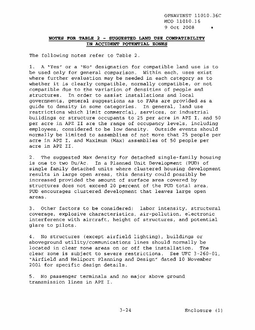
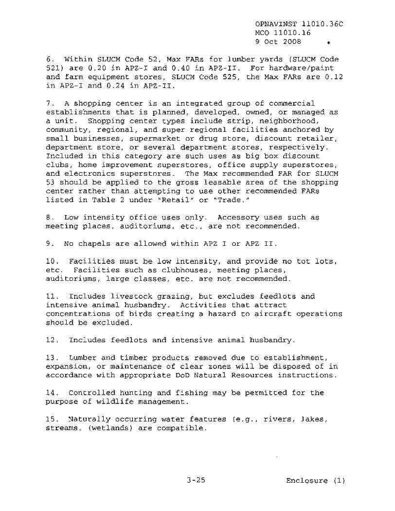
6. APZs COMPATIBLE LAND USE GUIDELINES. Recommended land use compatibility guidelines for clear zones and APZs are shown in Table 2. Local planning and zoning authorities may desire to
Enclosure (1 )

OPNAVINST 11010.36C MCO 11010.16 9 Oct 2008
implement different criteria than those included herein, to reflect specific local conditions. CNO/CMC approval is required prior to an installation's public support of any criteria other than that contained in this instruction. FAR is the ratio between square feet of floor area and square feet of site area based on parking generation requirements, vehicle occupancy rates, and desired maximum density. For APZs I and 11, recommended FARs were calculated to achieve a maximum density of 25 and 50 people per acre, respectively. It is commonly used to identify population density or intensity for non-residential structures or land uses. The maximum FAR recommendations in Table 2 are provided as an aid to local officials and installation personnel considering restrictions on the density/intensity of non-residential development in APZ. However, it is not realist'ic to state that one numerical density is safe while another is not. The objective is to maximize the degree of safety that can reasonably be attained within local land use considerations.
7. OBSTRUCTION AND SAFETY CLEARANCES. This instruction addresses compatible land use with respect to aircraft noise and accident potential. Land uses in the vicinity of air installations are also subject to aircraft safety clearances and height restrictions. These restrictions are included by reference in this Instruction based upon ~ri-Service criteria published in unified Facilities Criteria's UFC-3-260-01. Additionally, the following should be reviewed for compatibility with airfield operations within the installation operating environs :
a. Land uses that may cause smoke, dust, or steam that could obscure aircrew vision;
b. Land uses that generate direct and indirect lighting that could interfere with pilot vision, including, but not limited to, searchlights, lasers, and fireworks;
c. Land uses that may cause electromagnetic interference with aircraft navigation, communication or weapons systems; and
d. Land uses that may attract birds, such as landfills, wastewater treatment facilities, dredge disposal sites, seafood processing plants, etc.
Enclosure (1)

OPNAVINST 11010.36C MCO 11010.16 9 Oct 2008
8. AICUZ COMPATIBLE LAND USE IMPLEMENTATION
a. DoD policy is to work toward promoting compatible land use development in the vicinity of air installations, and to encourage local governments to incorporate the AICUZ study recommendations into local land use planning and control process. his process includes, but is not limited to, zoning and subdivision ordinances and building codes. Land use planning must address long-range strategies involving present and future land use and development. Application of land use control strategies often does not result in immediate changes in land use development in the areas subject to the specific requirements or restrictions. Additionally, since land use planning is a long-range process, communities cannot be expected to continually change their comprehensive plans to reflect frequent changes in Navy/Marine Corps noise contours and APZ. Frequent changes can also undermine support for the program and may be counterproductive to the goal of community support for the AICUZ program. Hence, it is imperative that AICUZ studies consider not only current but also realistic 5- to 10-year projections of airfield operations when making land use planning recommendations.
b. The AICUZ study or update shall include recommended land uses based on recognized guidelines and sound planning principles. The AICUZ boundary is generally defined as that area contained within the accident potential and noise zones. The development of the final boundary of the AICUZ shall also take into account natural and manmade features that can impact land use development underlying the imaginary surfaces of the airfield. The study recommendations shall be based on current operations levels and the best available (5- to 10-year) projection of operations to ensure the future operational capability of the air installation. This information will be provided to local government agencies with the recommendation that it be incorporated into the local planning and regulatory process. Land use compatibility guidelines within noise zones are shown in Table (I), and land use compatibility guidelines within APZs are outlined in Table (2).
c. The recommendations regarding compatible land use within each zone may vary according to local conditions. The primary
Enclosure (1)

OPNAVINST 11010.36C MCO 11010.16 9 Oct 2008
objectives will be to identify areas within the AICUZ that can be affected by air operations; to share information with local government agencies that regulate land use, and to recommend restrictions on incompatible development. Local governments may choose to provide for additional land use controls outside the AICUZ boundary based on local economic and social concerns with the intent of providing long-term encroachment protection. Such actions by local governments should be encouraged since they can have the effect of implementing long-term land use development and smart growth initiatives
Enclosure (1)

CLASS A RUNWAY
# - /
OPNAVINST 11010.36C MCO 11010.16
9 Oct 2008
1000' 1
Notes; (1) APZ I and II may be altered to conform to flight shadow.
(2) The 2284' dimension is based on criteria of using a 7"-58'- 1 1" flare angle for the approach departure surface where the outer width of that surface was established at 15,500'. This dimension would be 23 12' where the outer width of the surface was established at 16,000'.
(See LFC-3-260-0 1 )
./ 0 rC (1
+' /
0 / ..'
0 0 APZ-I1 CLEAR ZONE
228a, 0 0
* , #
/ /
rr.
CLEAR ZONE
CLASS B RUNWAY 4
[See NAVFAC UFC-3-260-01 for additional details. Flare starts at 200' from end of runways and the 3000' clear zone length starts at runway end]
APZ-I , ' d /
Il-
FIGURE 1 - FIXED WING ACCIDENT POTENTIAL ZONES
0
APZ-It
Enclosure (1)

OPNAVINST 11010.36C MCO 11010.16 9 Oct 2008
TABLE 1 - AIR INSTALLATIONS COMPATIBLE USE ZONES SUGGESTED LAND USE COMPATIBILITY IN NOISE ZONES
Enclosure (1)
Suggested Land Use Compatibility
I I related industries I I I

OPNAVINST 11010.36C MCO 11010.16 9 Oct 2008
TABLE 1 - AIR INSTALLATIONS COMPATIBLE USE ZONES SUGGESTED LAND USE COMPATIBILITY IN NOISE ZONES (Continued)
Enclosure (1)
Land Use Suggested Land Use Compatibility
SLUCN NO.
30 3 1
3 2
3 3
34
3 5
3 9
- USE
Yuruf.4~utinq 1acmtiwr.dl Rubber and misc. plastic products; manufacturing Stone, clay and glass products; manufacturing Primary metal products; manufacturing Fabricated metal products; manufacturing Professional scientific, and controlling instruments; photographic and optical goods; watches and clocks Miscellaneous
4 5
46 47 4 8 49
50 5 1 5 2
5 3
54 5 5
5 6
Noise Zone 1 ( DNZ or CNBL)
< 55
Y
Y
Y
Y
Y
Y
and accessories
Highway and street right-of -way Automobile parking Communication Utilities Other transportation, communication and utilities Tra& Wholesale trade Retail trade - building materials, hardware and farm equipment Retail trade - shopping centers Retail trade - food Retail trade - automotive, marine craft, aircraft and accessories Retail trade - apparel
Noise Zone 2 ( DNL or CNEL)
55- 64
Y
Y
Y
Y
Y
Y
Noise Zone 3 ( DNL or CWEL)
65 - 69
Y
Y
Y
Y
Y
Y
Y
Y Y Y Y
Y Y
Y
Y Y
70 -74
yZ
yL
yL
yL
2 5
Y'
85+
N
N
N
N
N
N
75- 79
yJ
- Y
yJ
yJ
3 0
yJ
Y
Y Y Y Y
Y Y
Y
Y Y
80 -84
y4
y4
y4
y4
N
y4
Y
Y Y Y Y
Y Y
Y
Y Y
yL
yZ 2 5' Y'
2 5 5
yL yZ
2 5
2 5 2 5
2 5
Y'
yJ 3 0' yJ 3 o5
Y ' Y'
3 0
3 0 3 0
3 0
y4
Y N y4 N
Y Y
N
N N
N
N
N N N N
N N
N
N N
N
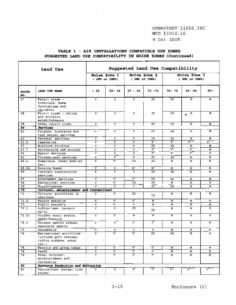
OPNAVINST 11010.36C MCO 11010.16 9 Oct 2008
TABLE 1 - AIR INSTALLATIONS COMPATIBLE USE ZONES SUGGESTED LAND USE COMPATIBILITY IN NOISE ZONES (Continued)
3-15 Enclosure (1)
Land Use Suggested Land Use Compatibility
SLUCM NO. 5 7
5 8
5 9 60
- USE NAME
Retail trade - furniture, home, furnishings and equipment Retail trade - eating and drinking establishments Other retail trade B o ~ i c u
6 1
Noise Zone 1 ( DNL or CNEL)
< 55
Y
Y
Y
55- 64
Y
Y
Y
Noise Zone 2 ( DNL or CNEL)
65 - 69
Y
Y
Y
Noise Zone 3 ( DNL or CNEL)
Y Y Finance, insurance and real estate services
70 -74
25
2 5
25
Y
85+
N
N
N
75- 79
3 0
3 0
3 0
80 -84
N
N
N 25 3 0 N

OPNAVINST 11010.36C MCO 11010.16 9 Oct 2008
TABLE 1 - AIR INSTALLATIONS COMPATIBLE USE ZONES SUGGESTED LAND USE COMPATIBILITY IN NOISE ZONES (Continued)
KEY TO TABLE 1 - SUGGESTED LAND USE COMPATIBILITY IN'NOISE ZONES SLUCM
Land Use
Y (Yes)
Suggested Land Use Compatibility
SLUCM NO. 8 1 . 5 81 .7 8 2
8 3 84 8 5 8 9
Y" (Yes with Restrictions)
LAND USE w
Livestock farming Animal breeding Agriculture related activities Forestry Activities Fishing Activities Mining Activities Other resource production or extraction
N" (No with exceptions)
Noise Zone 1 ( DNL or CNEL)
NLR (Noise Level Reduction)
< 55
Y Y Y
Y Y Y Y
DNL
CNEL
55- 64
Y Y Y
Y Y Y Y
Noise Zone 2 ( DNL or CNELI
Ldn
65 - 69
y8 Y" Y
y8 Y Y Y
Noise Zone 3 ( DNL or CMELI
Standard Land Use Coding Manual, U.S. Department of Transportation
70 -74
y9 Y y9
y9 Y Y Y
75- 79
N N yl"
y10 Y Y Y
Land Use and related structures compatible without restrictions.
Land Use and related structures are not compatible and should be prohibited.
80 -84
N N
Y~~~~~
b~lo'll
Y Y Y
The land use and related structures are generally compatible. However, see note(s) indicated by the superscript.
85+
N N
~ l O , l l
ylO'll
Y Y Y
The land use and related structures are generally incompatible. However, see notes indicated by the superscript.
NLR (outdoor to indoor) to be achieved through incorporation of noise attenuation into the design and construction of the structure.
The numbers refer to NLR levels. Land Use and related structures generally compatible however, measures to achieve NLR of 25 , 30 or 35 must be incorporated into design and construction of structures. However, measures to achieve an overall noise reduction do not necessarily solve noise difficulties outside the structure and additional evaluation is warranted. Also, see notes indicated by superscripts where they appear with one of these numbers.
Day Night Average Sound Level.
Community Noise Equivalent Level (normally within a very small decibel difference of DNL)
Mathematical symbol for DNL.
Enclosure (1)

OPNAVINST 11010.36C MCO 11010.16 9 Oct 2008
NOTES FOR TABLE 1 - SUGGESTED LAND USE COMPATIBILITY IN NOISE ZONES
1. General
a. Although local conditions regarding the need for housing may require residential use in these zones, residential use is discouraged in DNL 65 to 69 and strongly discouraged in DNL 70 to 74. The absence of viable alternative development options should be determined and an evaluation should be conducted locally prior to local approvals indicating that a demonstrated community need for the residential use would not be met if development were prohibited in these zones.
b. Where the community determines that these uses must be allowed measures to achieve and outdoor to indoor NLR of at least 25 Decibels (dB) in DNL 65 to 69 and NLR of 30 dB in DNL 70 to 74 should be incorporated into building codes and be in individual approvals; for transient housing a NLR of at least 35 dB should be incorporated in DNL 75 to 79.
c. Normal permanent construction can be expected to provide a NLR of 20 dB, thus the reduction requirements are often stated as 5, 10 or 15 dB over standard construction and normally assume mechanical ventilation, upgraded sound transmission class ratings in windows and doors and closed windows year round. Additional consideration should be given to modifying NLR levels based on peak noise levels or vibrations.
d. NLR criteria will not eliminate outdoor noise problems. However, building location and site planning, design and use of berms and barriers can help mitigate outdoor noise exposure NLR particularly from ground level sources. Measures that reduce noise at a site should be used wherever practical in preference to measures that only protect interior spaces.
2. Measures to achieve NLR of 2-5 must be incorporated into the design and construction of portions of these buildings where the public is received, office areas, noise sensitive areas or where the normal noise level is low.
3. Measures to achieve NLR of 30 must be incorporated into the design and construction of portions of these buildings where the
Enclosure (1)

OPNAVINST 11010.36C MCO 11010.16 9 Oct 2008
public is received, office areas, noise sensitive areas or where the normal noise level is low.
4. Measures to achieve NLR of 35 must be incorporated into the design and construction of portions of these buildings where the public is received, office areas, noise sensitive areas or where the normal noise level is low.
5. If project or proposed development is noise sensitive, use indicated NLR; if not, land use is compatible without NLR.
6. No buildings.
7. Land use compatible provided special sound reinforcement systems are installed.
8. Residential buildings require a NLR of 25
9. ~esidential buildings require a NLR of 30.
10. Residential buildings not permitted.
11. Land use not recommended, but if community decides use is necessary, hearing protection devices should be worn.
Enclosure (1)

OPNAVINST 11010.36C MCO 11010.16
9 Oct 2008
furniture);
Enclosure (1)

OPNAVINST 11010.36C MCO 11010.16 9 Oct 2008 0
Enclosure (1)
TABLE 2 - AIR INSTALLATIONS COMPATIBLE USE ZONES SUGGESTED LAND USE COMPATIBILITY IN ACCIDENT POTENTIAL ZONES1
SLUCW NO.
3 1
3 2
3 3
3 4
3 5
3 9
LANDUSE W
Rubber and misc. plastic products; manufacturing Stone, clay and glass products; manufacturing Primary metal products ; manufacturing Fabricated metal- products ; manufacturing Professional scientific, & controlling instrument; photographic and optical goods; watches & clocks Miscellaneous manufacturing
& 0.56 in APZ
street railway
CLEAR ZONE R e c a m e n d a t i o n
N
N
N
N
N
N
5 1
5 2
5 3
5 4
Wholesalerade
Retail trade - building materials, hardware and farm equipment Retail trade7 - Shopping centers, Home Improvement Store, Discount Club, Electronics Superstore Retail trade - food
Density R e c o a n r s n d a t i o n
Max FAR 0.56 in APZ I1
Same as above
Same as above
Max FAR of 0.28 in APZ I
-2-1 R e c a m n e n d a t i o n
N
N
N
N
N
Y
APZ-I1 R e c ~ n d a t i o n
N
Y
Y
Y
N
Y
N
N
N
N
Y
Y
Y
Y
Y
Y
N
N
M ~ x T A R of 0.28 in APZ I. & .56 in APZ 11. See Note 6 below
Max FAR of 0.16 in APZ I1
Max FAR of 0.24 in APZ I1

OPNAVINST 11010.36C MCO 11010.16 9 Oct 2008 a
Enclosure (1)
TABLE 2 - AIR INSTALLATIONS COMPATIBLE USE ZONES SUGGESTED LAND USE COMPATIBILITY IN ACCIDENT POTENTIAL ZONES
SLUCM NO.
5 5
5 6
57
LAND USE
Retail trade - automotive, marine craft, aircraft and accessories Retail trade - apparel and accessories Retail trade -
only. Max FAR
APZ-I Recanrmendation
Y
N
N
CLEAR ZONE Recanmendation
N
N
N
71.2 7 2 72.1
72.11
-2-11 Recommendation
Y
Y
Y
Nature exhibits Public assembly
Auditoriums, concert halls
Outdoor music shells, amphitheaters
Density Reconmendation
Max FAR of 0.14 in APZ I & 0.28 in APZ I I Max FAR 0.28 in APZ I1
Same as above
N N N
N
y10 N N
N
yl0 N N
N

OPNAVINST 11010.36C MCO 11010.16 9 Oct 2008 e
Enclosure (1)
TABLE 2 - AIR INSTALLATIONS COMPATIBLE USE ZONES SUGGESTED LAND USE COMPATIBILITY IN ACCIDENT POTENTIAL ZONES1
Density Recommndation
Max FAR of 0.11 APZ I; 0.22 in APZ I1
Same as 74 Same as 74
SLUCM NO.
72.2
7 3
7 4
7 5
7 6 7 9
production or
LAND USE NAME
Outdoor sports arenas, spectator sports Amusements - fairgrounds, miniature golf, driving ranges; amusement parks, etc Recreational activities (including golf courses, riding stables, water recreation) Resorts and group camps Parks Other cultural, entertainment and
CLEAR ZONE Reconmrendation
N
N
N
N
N N
-2-1 Recomnmendation
N
N
y10
N
y10 yy
-2-11 Recamendation
N
Y
y10
N
y10 Y

SLUCM -
OPNAVINST 11010.36C MCO 11010.16 9 Oct 2008 e
KEY TO TABLE 2 - SUGGESTED LAND USE COMPATIBILITY
Y (Yes) -
N (No) -
Yx - (Yes with restrictions)
Nx - (No with exceptions)
FAR - Floor Area Ratio
Du/Ac - Dwelling Units per Acre
Standard Land Use Coding Manual, U.S. Department of Transportation
Land use and related structures are normally compatible without restriction.
Land use and related structures are not normally compatible and should be prohibited.
The land use and related structures are generally compatible. However, see notes indicated by the superscript.
The land use and related structures are generally incompatible. However, see notes indicated by the superscript.
A floor area ratio is the ratio between the square feet floor area of the building and the site area. It is customarily used to measure non-residential intensities
This metric is customarily used to measure residential densities.
Enclosure (1)
OPNAVINST 11010.36C MCO 11010.16 9 Oct 2008 e
NOTES FOR TABLE 2 - SUGGESTED LAND USE COMPATIBILITY
The following notes refer to Table 2.
1. A "Yes" or a "No" designation for compatible land use is to be used only for general comparison. Within each, uses exist where further evaluation may be needed in each category as to whether it is clearly compatible, normally compatible, or not compatible due to the variation of densities of people and structures. In order to assist installations and local governments, general suggestions as to FARs are provided as a guide to density in some categories. In general, land use restrictions which limit commercial, services, or.industria1 buildings or structure occupants to 25 per acre in APZ I, and 50 per acre in APZ I1 are the range of occupancy levels, including employees, considered to be low density. Outside events should normally be limited to assemblies of not more that 25 people per acre in APZ I, and Maximum (Max) assemblies of 50 people per acre in APZ 11.
2. The suggested Max density for detached single-family housing is one to two Du/Ac. In a Planned Unit Development (PUD) of single family detached units where clustered housing development results in large open areas, this density could possibly be increased provided the amount of surface area covered by structures does not exceed 20 percent of the PUD total area. PUD encourages clustered development that leaves large open areas.
3. Other factors to be considered: labor intensity, structural coverage, explosive characteristics, air-pollution, electronic interference with aircraft, height of structures, and potential glare to pilots.
4. No structures (except airfield lighting), buildings or aboveground utility/communications lines should normally be located in clear zone areas on or off the installation. The clear zone is subject to severe restrictions. See UFC 3-260-01, "~irfield and Heliport Planning and Design" dated 10 November 2001 for specific design details.
5. No passenger terminals and no major above ground transmission lines in APZ I.
Enclosure (1)
OPNAVINST 11010.36C MCO 11010.16 9 Oct 2008 e
6. Within SLUCM Code 52, Max FARs for lumber yards (SLUCM Code 521) are 0.20 in APZ-I and 0.40 in APZ-11. For hardware/paint and farm equipment stores, SLUCM Code 525, the Max FARs are 0.12 in APZ-I and 0.24 in APZ-11.
7. A shopping center is an integrated group of commercial establishments that is planned, developed, owned, or managed as a unit. Shopping center types include strip, neighborhood, community, regional, and super regional facilities anchored by small businesses, supermarket or drug store, discount retailer, department store, or several department stores, respectively. Included in this category are such uses as big box discount clubs, home improvement superstores, office supply superstores, and electronics superstores. The Max recommended FAR for SLUCM 53 should be applied to the gross leasable area of the shopping center rather than attempting to use other recommended FARs listed in Table 2 under "Retail" or "Trade."
Low intensity off ice uses only. Accessory uses such meeting places, auditoriums, etc., are not recommended.
9. No chapels are allowed within APZ I or APZ 11.
10. Facilities must be low intensity, and provide no tot lots, etc. ~acilities such as clubhouses, meeting places, auditoriums, large classes, etc. are not recommended.
11. Includes livestock grazing, but excludes feedlots and intensive animal husbandry. Activities that attract concentrations of birds creating a hazard to aircraft operations should be excluded.
12. Includes feedlots and intensive animal husbandry.
13. Lumber and timber products removed due to establishment, expansion, or maintenance of clear zones will be disposed of in accordance with appropriate DoD Natural Resources instructions.
14. Controlled hunting and fishing may be permitted for the purpose of wildlife management.
15. Naturally occurring water features (e.g., rivers, lakes, streams, (wetlands) are compatible.
Enclosure (1)

OPNAVINST 11010.36C MCO 11010.16 9 Oct 2008
CHAPTER 4
AICUZ STUDY CONTENTS
1. GENERAL. AICUZ studies have been developed and approved for each Navy and Marine Corps air installation. Where a new installation is established, or where major missions change to an existing installation is proposed, NEPA documentation is required (see OPNAVINST 5090.1C). Subsequent to the completion of the final NEPA documentation, an AICUZ study should be prepared. The AICUZ study and AICUZ study updates generally should include the following:
a. Existing Conditions. A description and graphic depiction of the flight operations, noise contours and APZs, land use compatibility, and supporting data which describe aircraft types, operations, flight tracks, and a history of aircraft operations since the previous AICUZ study. Locations of previous aircraft accidents should be shown, also noise complaint numbers and locations should be provided. A description of land use controls currently in effect in the area surrounding the installation should also be included.
b. Future-Year Forecast and Prospective AICUZ. Based on the currently available unclassified information, each installation will develop a forecast of air operations activity levels (normally for a time frame 5 to 10 years forward). Forecasts may be based upon historical trends or projected aircraft base loading and should address expected mission changes. The AICUZ update will include footprints and supporting discussions reflecting the operational forecasts. These footprints will provide the necessary guidance as to what actions must be taken to assure future mission integrity at the air installation. Further, future year footprints will provide local governments with the information to plan for changes in air installation activity levels and/or operational procedures.
c. AICUZ Recommendations. An AICUZ map depicting the area of critical concern, a land use compatibility matrix for the installation, and recommended safety clearances/ height restrictions to protect safety of flight shall be included.
Enclosure (1)

OPNAVINST 11010.uC MCO 11010.16 9 Oct 2008
d. Alternatives and Changes from prior AICUZ Study. An analysis of alternatives that could mitigate noise and/or accident potential impact normally is included. Examples of alternatives include community implementation strategies, sound- attenuated facility construction, acquisition of land or interests therein, or practticable potential operational changes. Noise and APZ changes should be described and illustrated since these changes may influence the decision to implement land use control changes. Documentation should include discussion of which factors contributed to the change (aircraft, tempo of operation, operational procedures, etc.) .
e. Impact Analysis. An analysis and graphic depiction of existing and potential land use incompatibilities and their impact on station development and operation shall be included. The AICUZ update shall also discuss strategies to address future development of the impacted areas.
f. On-Station Implementation Plan. On-station development described in regional plans (Navy)/ master-plans (Marine Corps) shall be consistent with the AICUZ Study. The base development strategies and capital improvement projects are MILCON; Military Construction Naval Reserve; Naval Air Facilities (NAF); etc., and public private partnership ventures shall reflect that consistency. However, where consistency is not possible, documentation should be submitted by the installation, via the chain of command and appropriate Naval Facilities Engineering Command (FEC) to the CNO or CMC for consideration of a waiver.
g. Off-Station Implementation. ~ecommendations for off- station implementation proposals shall also be included.
2. APPROVALS. Public distribution of revised or updated AICUZ information requires CNO/CMC approval. AICUZ updates should be forwarded to OPNAV (N46) and HQMC (LFL) , as appropriate, via the region and mission component commands.
Enclosure (1)

OPNAVINST 11010.&6C MCO 11010.16 9 Oct 2008
CHAPTER 5
AICUZ STUDY UPDATES
1. GENERAL. Operational and training requirements, aircraft mix, tempo of aviation activity, maintenance procedures, and community development seldom remain static. The primary purpose of an AICUZ study is to support long-term compatible land use in the vicinity of air installations. Frequent AICUZ updates and changes in land use recommendations can undermine the neighboring community's confidence and willingness to incorporate recommendations into local comprehensive plans or to enact various land use controls. AICUZ reviews should be conducted when new requirements are anticipated at an installation such as basing of a new type of aircraft, significant increases in operational levels, or significant increases in nighttime (2200 to 0700 hours) flying activities. Since major changes in operations, which have a significant impact on the environment, require environmental documentation in accordance with the NEPA, an AICUZ update subsequent to completion of the NEPA documentation is normally sufficient.
2. INTERIM NOISE STUDIES. Noise studies can be conducted on an interim basis for a variety of purposes. These studies can provide useful information that does not always result in the need to update the AICUZ Study. Requests for interim noise studies should be forwarded to CNIC Facilities Real Estate(N444) or HQMC (LFL) via the regional commander documenting the need for the study. CNIC/CMC will provide technical guidance as required.
3. ENVIRONMENTAL IMPACT OF OPERATIONAL CHANGES
a. Several parameters must be periodically monitored locally to insure that the AICUZ study continues to reflect the best information available on noise and accident potential; e.g., the type and mix of aircraft operated or maintained, flight tracks, tempo and timing of night operations, and operational alternatives implemented.
b. When significant operational changes are proposed, an evaluation by the air installation is required, to determine
Enclosure (1 )

OPNAVINST 11010.36C e
MCO 11010.16 9 Oct 2008
whether documentation in compliance with the NEPA is required. If questions arise as to the need for specific documentation in this area, the air installation should consult with their chain of command and the appropriate Naval FEC. Recommendations or questions in this area can be forwarded to the Navy or Marine Corps region for guidance if appropriate. The CNO/CMC will advise the region and air installation as to the need for NEPA documentation in accordance with OPNAVINST 5090.1C or MCO P5090.2 (NOTAL) . If such documentation is required it shall be prepared prior to the implementation of any proposed operational change.
Enclosure (1 )

OPNAVINST 11010.36C MCO 11010.16 9 Oct 2008
CHAPTER 6
AICUZ IMPLEMENTATION
1. GENERAL. Each Navy and Marine Corps air installation listed in Appendix A shall actively pursue implementation of its AICUZ program. Program implementation may include elements such as soliciting the cooperation of local governments, operational modifications, complaint response programs for residents of surrounding communities, and the acquisition of land or interests therein to protect operational capability. Early recognition of the problem will provide increased opportunity to solve it and can reduce future implementation requirements.
2. COMMWNITY IMPLEMENTATION
a. DoD AICUZ policy is predicated on promoting harmony between air installations and neighboring communities through a compatible land use planning and control process conducted by the responsible local authorities. This policy recognizes the local government's responsibility under its police power to protect the public health, safety and welfare. By enacting compatible land use controls, local government protects its citizens from high noise levels of noise or accident potential. When applicable, an installation's AICUZ policy needs to address the uniqueness of federally recognized tribes.
b. Through controls like zoning ordinances, building codes, subdivision regulations, permitting authority, disclosure statements and public acquisition, surrounding areas can be allowed to develop to the highest and best compatible use. Successful implementation of such a program depends on a close working relationship between installation and community leaders. Acquisition should not be discussed as an encroachment solution unless and until all community-oriented strategies prove unsuccessful or inappropriate. The activity should continually inform local governments, citizen groups, and the general public on: (1) the requirements of military aviation; (2) air installation operations; (3) the efforts underway and planned to reduce noise and ensure compatible development, and (4) the local command's position on specific land use issues. Air installation representatives, primarily commanding officers and
Enclosure (1)

OPNAVINST 11010.36C MCO 11010.16 9 Oct 2008
their Community Planning Liaison Officers (CPLO), must take every opportunity to meet with and make presentations to local governments, particularly the planning and zoning agencies. Although the emphasis of the AICUZ implementation effort must be on areas within the AICUZ footprint, the air installation can comment on land use issues outside of the footprint that might impact on it, e.g., large-scale developments bordering the AICUZ area, transportation system developments that could make the AICUZ area more desirable for development, or tall structures such as cell towers that could penetrate approach/departure or other imaginary surfaces. The air installation must be considered as a major land use in the local community. Development that occurs up to the AICUZ area of critical concern boundary could prevent mission changes or mission expansion in the future. Therefore, commanding officers and their staffs are encouraged to monitor proposed development beyond the AICUZ boundary, and, if needed, to present those concerns in appropriate local forums. Although compatible land use development inside the AICUZ footprint is a primary objective of the AICUZ program and projected (5- to 10-year) footprints are required, a prudent course of action is to also seek a "buffer" around the AICUZ footprint in which property owners and lessees are notified of the presence of airfield operations. Air installations should include a DNL/CNEL 60 noise contour on their AICUZ maps thus delineating an area of concern for future development to the local government and local community. While the land use compatibility guidelines provided in Table 2 indicate that land use development is compatible in areas less than DNL/CNEL 65, air. installations should work with local government and community leaders to foster less intense development in this "buffer" area as further long-term encroachment protection. Development up to the AICUZ footprint boundary will make it difficult to expand missions or accept new missions at the installation.
c. In addition, while incorporation of land use recommendations into local comprehensive plans and zoning ordinances is a basic objective of the AICUZ program, required disclosure to prospective buyers and lessees of residential properties within noise and accident potential zones is also recommended. Air installations should make every attempt to work with local governments to encourage enaction of such legislative initiatives.
Enclosure (1)

OPNAVINST 11010.36C MCO 11010.16 9 Oct 2008
3. DOCUMENTATION OF LOCAL EFFORTS. Records of important discussions, negotiations, testimony, etc., with and before local officials, boards, etc., must be maintained by the local command. Such records shall be available for inclusion in MILCON project submissions if required by CNO/CMC. This will ensure that documentation is available to indicate all reasonable and prudent efforts were made to preclude incompatible land use through cooperation with local government officials and that all recourse to such actions has been exhausted.
4. COMMCJNITY PLANNING LIAISON OFFICER (CPLO)
a. Air installations need an interface with community leaders and citizens. The commanding officer should be at the forefront of this effort. A CPLO may be designated as either a full-time or collateral duty to be the central information point and to relieve the commanding officer of some of the day-to-day burden of responding to community complaints or inquiries and administering the installation's encroachment action or control program.
b. Some activities have recognized the need for a primary duty CPLO to respond to inquiries about noise and to work with local and regional government counterparts to foster compatible development. Naval aviators often fill these positions since they are able to describe problems unique to Navy and Marine Corps aviation. CNO/CMC realize that not every air installation can justify and support a full-time CPLO. However, each air installation must be responsive to its own encroachment situation when designating its CPLO. To ensure proper continuity, a community planning liaison team including a civilian planner is strongly encouraged.
Enclosure (1)

OPNAVINST 11010.36C MCO 11010.16 9 Oct 2008
CHAPTER 7
REAL PROPERTY GUIDANCE
1. ACQUISITION POLICY
a. When threats to operational integrity from incompatible development (encroachment) are noted, and when local communities are unwilling or unable to take the initiative in combating the threat via their own authority, consideration can be given to land acquisition. Documentation of community unwillingness or inability will be reaired to support acquisition projects. Where the mission of the air installation is imminently threatened, acquisition of fee title or restrictive easements over the impacted lands in any noise or accident potential zone may be appropriate to maintain operational integrity.
b. Reference (a) states that the first priority for acquisition in fee or restrictive easements is the clear zone. The second priority is other APZs. Noise areas may be considered for acquisition when all avenues of achieving compatible use zoning, or similar protection, have been explored and the operational integrity of the air installation is manifestly threatened. Unless unusual situations exist which would warrant the expense and disruption of "trying to turn back the clock" in developed areas, the primary focus of these acquisition efforts is on undeveloped land.
2. ENCROACHMENT INDICATORS. The importance of the air installation having sensitivity to long-range encroachment indicators cannot be overemphasized. Local community capital improvement plans and long range land use plans, commonly referred to as "Comprehensive Plans," provide clues far in advance of actual encroachment actions. These plans generally address land areas far greater than the AICUZ and must be evaluated to determine their influence on the AICUZ area either directly or indirectly.
3. REAL PROPERTY UTILIZATION SURVEY INTERFACE
a. Reference (e) calls for continual review of Federal real property holdings and the conduct of surveys in order to
Enclosure (1)

OPNAVINST 11010.36C MCO 11010.16
9 Oct 2008
determine the level of their utilization. Properties found to be excess to the requirements of the holding agency are reported for disposal. In the past, the AICUZ area has provided protection to air installations, but increased pressure to excess property can dilute that protection. To avoid the forced disposal of lands required for the protection of the installation from encroachment, air installations will ensure that required lands or easements are fully justified. Where disposal is directed, those rights and interests required for the protection of the future operational integrity of the installation through restrictions to ensure compatible land use will be retained.
b. Particular attention must be paid to property located outside of the AICUZ area, which if excessed, would attract uses that would induce incompatible developments within the AICUZ area; e.g., water, sewer, or highway development adjoining the AICUZ makes the AICUZ area more desirable for development. Additionally, the prior history of AICUZ areas and potential growth should be fully considered. Once property rights are relinquished, they are not easily, if ever, regained. The dynamic nature of Navy and Marine Corps operational needs must be evaluated in encroachment protection decisions.
4. GUIDELINES FOR ACQUISITION/RETENTION OF REAL ESTATE INTERESTS WITHIN AN AICUZ. This instruction shall not be used as sole justification for either the acquisition or the retention of owned interests beyond that required to protect the Government. Reference (d) provides DON policy for the acquisition, management, and disposal by DON of real property and real property interests.
5. REAL ESTATE INTERESTS TO BE CONSIDERED FOR CLEAR ZONES, APZs AND NOISE ZONES. When it is necessary for the Navy to acquire interests in land, a careful assessment must be made of the type of interest to be acquired. The following list of possible interests that should be considered, either in the form of a perpetual restrictive use easement containing the rights or a basis for fee acquisition of the property, is offered for guidance.
a. The right to make low and frequent flights over said land and to generate noises associated with:
Enclosure (1)

OPNAVINST 11010.36C MCO 11010.16 9 Oct 2008
(1) Aircraft in flight, whether or not while directly over said land;
(2) Aircraft and aircraft engines operating on the ground at said installation, and;
(3) Aircraft engine test/stand/cell operations at said installation.
b. The right to regulate or prohibit the release into the air of any substance, which would impair the visibility or otherwise interfere with the operations of aircraft, such as, but not limited to, steam, dust and smoke.
c. The right to regulate or prohibit light emissions, either direct or indirect (reflective), which might interfere with pilot vision.
d. The right to prohibit electromagnetic and radio frequency emissions that would interfere with aircraft, aircraft communications systems, or aircraft navigational equipment.
e. The right to prohibit any use of the land which would unnecessarily attract birds or waterfowl, such as, but not limited to, operation of sanitary landfills, water impoundment areas, maintenance of feeding stations or the growing of certain types of vegetation or activities attractive to flocks of birds or waterfowl.
f. The right to prohibit and remove any buildings or other non-frangible structures that do not comply with the AICUZ plan.
g. The right to top, cut to ground level, and to remove trees, shrubs, brush or other forms of obstruction which the installation commander determines might interfere with the operation of aircraft, including emergency landings.
h. The right of ingress and egress upon, over and across said land for the purpose of exercising the rights set forth herein.
Enclosure (1)

OPNAVINST 11010.36C MCO 11010.16 9 Oct 2008
i. The right to post signs on said land indicating the nature and extent of the Government's control over said land.
j. The right to allow only specific land uses.
k. The right to prohibit entry of persons onto the land except in connection with authorized activities.
1. The right to disapprove and/or prohibit land uses not in accordance with the established land use restrictions.
m. The right to control the height of structures to ensure that they do not become a hazard to flight.
n. The right to install airfield lighting and navigational aids.
o. The right to require sound attenuation in new construction or modifications to buildings in conformance with the AICUZ recommendations.
6. ENCROACHMENT PARTNERING (EP). EP is one of several tools available to the Navy and ~arine Corps to prevent or mitigate encroachment problems. EP is a cooperative, multi-party, real estate based program authorized by Congress under 10 USC 2684a (as amended) to help mitigate the impacts of potential off-base development that would be incompatible with military operations or to preserve habitat on the off-base property. The program is based on the military service "partnering" with an eligible entity (states, counties, cities, and private NGOs) to acquire real estate interests in the vicinity of the military installation to prevent incompatible development or loss of habitat. The program involves sharing acquisition costs with the partners from willing sellers. Use of condemnation authority is not permitted under the EP program. An acquisition planning team composed of installation/region and FEC representatives develop proposed projects and seek out potential partners for project execution. Annual funding is provided by the DoD through the Readiness and Environmental Protection Initiative and by Navy and Marine Corps appropriations for planning and encroachment management as programmed by CNO and CMC .
Enclosure (1)

OPNAVINST 11010.36C MCO 11010.16
9 Oct 2008
7. REAL PROPERTY MANAGEMENT. Regional commanders and commanding officers of Navy and Marine Corps air installations shall be responsible for the oversight of real property assets as related to the readiness and effectiveness of DON air installations. This responsibility is particularly relevant to documentation and enforcement of Navy and Marine Corps interests in land outside the installation boundary as encroachment protection, whether that land is acquired in fee or by easement.
Enclosure (1)

OPNAVINST 11010.36C MCO 11010.16 9 Oct 2008
CHAPTER 8
RESPONSIBILITIES
1. The Deputy Chief of Naval Operations (Fleet Readiness and Logistics) (CNO (N4) ) shall:
a. Exercise program responsibility for the Navy AICUZ program through OPNAV (N46), who programs resources for shore installation management.
b. Execute AICUZ program management responsibilities through CNIC with support from NAVFACENGCOM;
c. Monitor and coordinate application of the policies and principles of the AICUZ program;
d. Emphasize the importance of timely implementation of the AICUZ recommendations;
e. Pursue a training program for installation, chain of command and other cognizant DoD and non-DoD individuals regarding the policies, purposes and strategies of the AICUZ program;
f. Coordinate with the Naval Aviation Enterprise on AICUZ aspects when approving installation facilities planning proposals;
g. Provide resources and support for the DoD Noise Program as outlined in reference (c); and
h. Exercise approval authority over AICUZ documents and AICUZ footprint changes through OPNAV (N46) .
2. Mission Component Commands shall:
a. Provide command direction, priorities and recommendations on AICUZ plans submitted by air installation commanders and Regions under their operational cognizance;
Enclosure (1)

OPNAVINST 11010.36C MCO 11010.16
9 Oct 2008
b. Review and approve proposed operational changes to insure mission requirements are supported;
c. Emphasize to installation commanders the importance of continual review of operational procedures to identify operational changes to reduce noise within the constraints of safety, mission effectiveness and economy; and
d. Ensure that AICUZ-related environmental documentation requirements are met. Specifically, such actions as the introduction of new aircraft types or changes in flight corridors which may change the AICUZ footprint should be assessed as to their potential impact and a determination made as to the appropriate level of environmental documentation.
3. CNIC shall:
a. Coordinate AICUZ program requirements with Navy regions and mission component commands;
b. Develop an IPL for AICUZ and noise study updates in conjunction with NAVFACENGCOM; and
c. Fund, subject to availability, AICUZ/noise study updates.
4. The Commander, NAVFACENGCOM, as directed by CNIC, shall provide policy and technical oversight for the AICUZ program and :
a. Integrate the AICUZ planning process into the Shore Infrastructure Program overview plans for Navy and activity master plans for the Marine Corps recognizing on and off-station impacts and utilizing detailed guidance and criteria in the areas of land use compatibility with respect to both noise and accident potential exposure;
b. Provide technical direction and planning support for the reduction of noise emanating from aircraft flight, maintenance and test operations;
Enclosure (1)

OPNAVINST 11010.36C MCO 11010.16 9 Oct 2008
c. Establish and maintain an east coast and a west coast center of excellence to coordinate AICUZ issues with regional commands and installations within their area of responsibility; and
d. Develop and implement an AICUZ training program for senior Navy and Marine Corps personnel to provide the latest technical and planning guidelines for execution and implementation of the AICUZ program.
5. The Naval Education and Training Command shall provide support for AICUZ training programs tasked by CNO (N4).
6. HQMC (LFL) shall exercise approval authority and responsibility for the AICUZ program within the Marine Corps as follows:
a. Exercise management responsibility for the Marine Corps AICUZ program;
b. Provide technical assistance and guidance to Marine Corps air installations regarding AICUZ policy decisions and implementation;
c. Promote an AICUZ education program in cooperation with NAVFACENGCOM; and
d. Provide resources and support for the DoD Noise Program as outlined in reference (c) .
7. Air Installation Commanders shall:
a. Familiarize themselves with the AICUZ program and implement the concept set forth herein;
b. Actively work with State and local planning officials to implement AICUZ objectives;
c. Notify the chain of command and CNIC (N444) or HQMC (LFL) whenever local conditions merit update or review of the
I AICUZ plan;
Enclosure (1

OPNAVINST 11010.36C MCO 11010.16 9 Oct 2008
d. Promote attendance at CNO/CMC-sponsored AICUZ seminars by commanding officers, executive officers, air operations and other aviation-related staff personnel to increase awareness of current trends and techniques for AICUZ program development and implementation;
#
e. If appropriate, designate a CPLO to assist in the execution of the AICUZ plan by the installation and act as spokesman for the command in AICUZ matters;
f. Maintain a documentary file on the implementation of the AICUZ plan at the air installation including collection of operational data needed to update the AICUZ plan; and
g. Justify the retention of land or interests in land required for mission performance.
Enclosure (1)

OPNAVINST 11010.36C MCO 11010.16
9 Oct 2008
APPENDIX A
NAVAL AVIATION INSTALLATIONS WITH AICUZ STUDIES BY REGIONAL COMMAND
NAVY :
COMNAVREG MID-LANT NAS OCEANA DET NORFOLK, VIRGINIA NAS OCEANA, VIRGINIA
NALF FENTRESS NAS BRUNSWICK, MAINE NAEC LAKEHURST, NEW JERSEY NASJRB WILLOW GROVE, PENNSYLVANIA
COMNAVREG SOUTHEAST NAS JACKSONVILLE, FLORIDA
OLF WHITEHOUSE NS MAYPORT, FLORIDA NAF KEY WEST, FLORIDA NAS MERIDIAN, MISSISSIPPI
OLF JOE WILLIAMS NAS KINGSVILLE, TEXAS
ALF ORANGE GROVE NAS CORPUS CHRISTI, TEXAS
ALF WALDRON ALF CABANISS
NAS WHITING FIELD, FLORIDA NOLF BREWTON NOLF HOLLEY NOLF EVERGREEN NOLF SANTA ROSA NOLF SPENCER NOLF CHOCTAW NOLF SAUFLEY NOLF WOLF NOLF SITE 8 NOLF BARIN NOLF PACE NOLF HAROLD NOLF SILVERHILL NOLF SUMMERDALE
Appendix A to Enclosure (1)

OPNAVINST 11010.36C MCO 11010.16 9 Oct 2008
NAS PENSACOLA, FLORIDA NASJRB FORT WORTH, TEXAS NASJRB NEW ORLEANS, LOUISIANNA NASJRB ATLANTA, GEORGIA*
COMNAVREG EUROPE NAS SIGONELLA, SICILY** NSA NAPLES, ITALY** NSA SOUDA BAY, GREECE** NS ROTA, SPAIN**
COMNAVREG HAWAII PMRF BARKING SANDS, HAWAII
COMNAVREG SOUTHWEST NAS NORTH ISLAND, CALIFORNIA
OLF IMPERIAL BEACH ALF SAN CLEMENTE ISLAND
NB VENTURA COUNTY, CALIFORNIA NAS LEMOORE, CALIFORNIA NAS FALLON, NEVADA NAF EL CENTRO, CALIFORNIA NAWC (WD) CHINA LAKE, CALIFORNIA
OLF SAN NICOLAS ISLAND
COMNAVREG NORTHWEST NAS WHIDBEY ISLAND, WASHINGTON
OLF COUPEVILLE
NAVAL DISTRICT WASHINGTON NAWC (AD) PATUXENT RIVER, MARYLAND
OLF WEBSTER FIELD NAF WASHINGTON, DC*
COMNAVREG JAPAN NAF ATSUGI, HONSHU, JAPAN** NAF MISAWA, HONSHU, JAPAN* * NAF KADENA, OKINAWA, JAPAN** NSF DIEGO GARCIA * *
Appendix A to Enclosure (1)

OPNAVINST 11010.36C MCO 11010.16 9 Oct 2008
MARINE CORPS:
MARINE CORPS INSTALLATIONS EAST
MCAS NEW RIVER, JACKSONVILLE, NORTH CAROLINA MCOLF OAK GROVE MCOLF CAMP DAVIS
MCAS BEAUFORT, SOUTH CAROLINA MCAS CHERRY POINT, NORTH CAROLINA
MCALF BOGUE FIELD MCOLF ATLANTIC
MCAF QUANTICO, VIRGINIA
MARINE CORPS INSTALLATIONS WEST
MCAS MIRAMAR, CALIFORNIA MCAS CAMP PENDLETON, CALIFORNIA MCAS YUMA, ARIZONA MCAGCC TWENTYNINE PALMS, CALIFORNIA
MARINE CORPS INSTALLATIONS MIDPAC
MCBH HAWAII, HAWAII
MARINE CORPS INSTALLATIONS WESTPAC MCAS FUTENMA, OKINAWA, JAPAN** MCAS IWAKUNI, HONSHU, JAPAN**
*NAVY AICUZ STUDY NOT REQUIRED **NOISE STUDY ONLY
~ppendix A to Enclosure (1)