department of environmental protection 17 state … · processing on january 30, 2015, and...
TRANSCRIPT

STATE OF MAINE
DEPARTMENT OF ENVIRONMENTAL PROTECTION 17 STATE HOUSE STATION AUGUSTA, MAINE 04333-0017
DEPARTMENT ORDER
DRAFT IN THE MATTER OF
WEAVER WIND, LLC ) SITE LOCATION OF DEVELOPMENT ACT
Eastbrook/Osborn/T22 MD ) NATURAL RESOURCES PROTECTION ACT
T16 MD/Aurora ) FRESHWATER WETLAND ALTERATION
Hancock County ) ADJACENT ACTIVITY
WIND ENERGY FACILITY ) SIGNIFICANT WILDLIFE HABITAT
L-26464-TH-K-N (approval) ) WATER QUALITY CERTIFICATION
L-26464-24-L-N (approval) )
L-26464-2F-M-N (approval) )
L-26464-IW-N-N (approval) ) FINDINGS OF FACT AND ORDER
Pursuant to the provisions of the Maine Wind Energy Act, 35-A M.R.S. §§ 3401–3404, the
Expedited Permitting of Grid-Scale Wind Energy Development Law, 35-A M.R.S. §§ 3451–
34591, Site Location of Development Act (“Site Law”), 38 M.R.S. §§ 481–490, the Natural
Resources Protection Act, 38 M.R.S. §§ 480-A–480-JJ, Section 401 of the Federal Water
Pollution Control Act (33 U. S. C. § 1341), and Chapters 310, 315, 335, 373, 375, and 500 of its
rules, the Department of Environmental Protection (“Department”) has considered the
application of WEAVER WIND, LLC with the supportive data, agency review comments, public
comments and other related materials on file and FINDS THE FOLLOWING FACTS:
1. PROJECT DESCRIPTION:
A. History of Project. On December 29, 2014, Weaver Wind, LLC submitted an
application for a wind energy development to the Department. The application
was not accepted for processing. On January 29, 2015, Weaver Wind, LLC re-
submitted its application to the Department. The application was accepted for
processing on January 30, 2015, and withdrawn by the applicant on August 28,
2015.
B. Summary. The applicant proposes to construct a 22-turbine, 72.6 megawatt
(MW), wind energy development which is an “expedited wind energy
development” as defined in the WEA, 35-A M.R.S. § 3451(4). In addition to the
generating facilities, the project will include new roads, upgrades to existing
roads, and the construction of a new substation. The project will also include an
operations and maintenance (O&M) building located in the Town of Aurora, an
organized town. The overall proposed project will include 40.5 acres of new
impervious and developed area.
1 The Maine Wind Energy Act and the Expedited Permitting of Grid-Scaled Wind Energy Development Law are
collectively known as the Wind Energy Act (WEA).

L-26464-TH-K-N/L-26464-24-L-N/L-26464-2F-M-N/L-26464-IW-N-N 2 of 48
1. Turbines. The applicant proposes to construct 22 wind turbines, Vestas V126-
3.45 MW, derated to 3.3 MW, with Serrated Trailing Edge (STE) turbine
blades. The turbines will have a maximum height of 591 feet. Eight turbines
will be located in the Town of Eastbrook and 14 will be located in Osborn.
The turbines will be placed on Hardwood Hill, Birch Hill, Een Ridge, Little
Bull Hill, and additional unnamed hills.
2. Turbine Pads. Each turbine pad will be approximately 13,170 square feet in
size.
3. Access Roads and Crane Paths. The applicant proposes to upgrade four miles
of existing gravel logging roads to access the turbine locations. The applicant
also proposes to construct approximately six miles of new roads, with an
average width of 24 feet. All crane paths will be approximately 39.5 feet
wide.
4. Electrical Transmission Lines. The applicant proposes to construct
approximately 24.5 miles of underground and aboveground 34.5 kilovolt (kV)
collector line. The project includes the construction of a new substation
adjacent to the Bull Hill Wind substation, with a 120,000-square foot fenced
footprint.
5. O&M Building. The applicant proposes to construct an O&M building in
Aurora. The development of the O&M building will result in approximately
0.6 acre of impervious area.
6. Meteorological Towers. The applicant proposes to construct up to eight
temporary meteorological (met) towers and up to five permanent met towers
throughout the project site. Each met tower will have a maximum height of
400 feet.
The applicant is also requesting approval under the Natural Resources Protection
Act (NRPA) to clear approximately 110,041 square feet of wetlands for the
construction of overhead lines, and for turbine transport. Additionally, the
applicant is proposing activities adjacent to streams and wetlands of special
significance, and soil disturbance within an Inland Waterfowl and Wading Bird
Habitat (IWWH), a Significant Wildlife Habitat.
The details of the turbines, access roads, and associated facilities are provided on
the set of plans entitled “Weaver Wind Project” prepared by James W. Sewall
Company and dated October 2018.
B. Current Use of Site. The area of and surrounding the proposed project is
currently managed for commercial timber. The site contains numerous logging
roads, some of which will be upgraded as part of this project.

L-26464-TH-K-N/L-26464-24-L-N/L-26464-2F-M-N/L-26464-IW-N-N 3 of 48
C. Public Interest. The Department held its first public meeting on January 16, 2019
in Aurora to solicit comments from the public concerning the project. A second
public meeting was held in Aurora on April 18, 2019. At the second meeting, six
people spoke in support of the project and one person spoke in opposition. Those
in favor of the project discussed the advantages of the tangible and community
benefits packages to the surrounding communities, in addition to other subjects.
The person speaking in opposition expressed several concerns, including the
cumulative impacts of this project when coupled with other nearby existing wind
developments. During the processing of the application, the Department received
other comments both in support of and against the project, as well as questions
from the public. The Department considered all comments received on the
proposed project.
2. TITLE, RIGHT OR INTEREST:
Pursuant to Chapter 2§11(D) and the Department’s Policies and Procedures under the
Site Law, Chapter 372 §9, an applicant must demonstrate to the Department’s satisfaction
sufficient title, right, or interest in all the property that is proposed for development or
use.
To demonstrate title, right or interest for the proposed development, the applicant
submitted signed copies of leases and easements for the properties on which the proposed
project will be located.
The Department finds that the applicant has demonstrated sufficient title, right or interest
for the area which will be occupied by the project.
3. FINANCIAL CAPACITY:
Pursuant to the Financial Capacity Standard of the Site Law, Chapter 373 §2, applications
for approval of proposed developments must include evidence that demonstrates that the
applicant has the financial capacity to construct, operate, and maintain all aspects of the
development.
The applicant estimates the total cost of the project to be $145 million. Weaver Wind,
LLC is a legal entity authorized to do business in the State of Maine and is wholly owned
by Longroad Development Holdings, LLC, which is a wholly owned subsidiary of
Longroad Energy Partners, LLC. The applicant submitted a plan detailing financing for
the project. The financing proposed includes a combination of construction debt, tax
equity, and long-term debt commitments. The applicant also submitted a letter from
KeyBank, dated August 29, 2018, indicating that Longroad Energy Partners, LLC will
likely be able to obtain financing for the project.
The Department finds that the applicant has demonstrated adequate financial capacity to
comply with Department standards, provided the applicant submits, prior to the
commencement of any construction other than tree clearing, evidence that it has been

L-26464-TH-K-N/L-26464-24-L-N/L-26464-2F-M-N/L-26464-IW-N-N 4 of 48
granted a line of credit or a loan by a financial institution authorized to do business in this
State, or evidence of any other form of financial assurance determined by the Department
to be adequate under the Chapter 373, for review and approval by the Department.
4. TECHNICAL ABILITY:
Pursuant to Chapter 373 §3, an applicant must demonstrate the technical ability to design,
construct, operate, and maintain the proposed development in a manner consistent with
the permit and state environmental standards.
The applicant provided resume information for key persons involved with the project and
a list of projects it has successfully constructed. The applicant retained the services of the
following companies to prepare the application:
• Stantec Consulting – permitting, soils, natural resource assessment
• Reed and Reed, Inc., and James W. Sewall Company – civil engineering and
stormwater analysis
• CHA, Inc. – electrical engineering
• Plisga & Day – land surveys
• Aerial Survey and Photo, Inc. – aerial photography interpretation
• Epsilon Associates, Inc. – shadow flicker assessment
• Terrence J. DeWan & Associates – visual impact analysis
• Market Decisions, LLC – user surveys
• Bodwell EnviroAcoustics, LLC – sound assessment
• TRC Solutions – prehistoric archaeological resources
• Independent Archaeological Consulting, LLC – historic archaeological resources
• Kleinfelder – historical architectural resources
• Verrill Dana – legal counsel
• Normandeau Associates, Inc. - soil surveys
• Western Ecosystems - biology
Based on the experience and expertise of the applicant and its retained consultants, the
Department finds that the applicant has demonstrated adequate technical ability to
undertake the project in compliance with Department standards and provisions of the Site
Law.
5. NOISE:
To address the Site Law standards pertaining to the control of noise, ,38 M.R.S§ 484(3),
and the Department’s pertinent rule in Chapter 375 §10, the applicant submitted a sound
level assessment entitled “Sound Level Assessment, Weaver Wind Project,” completed
by Bodwell EnviroAcoustics LLC and dated October 2018. The sound level assessment
was conducted to predict expected sound levels from the proposed project, and to
compare the model results to the applicable requirements of Chapter 375 §10.

L-26464-TH-K-N/L-26464-24-L-N/L-26464-2F-M-N/L-26464-IW-N-N 5 of 48
The Weaver Wind project must comply with Department regulations applicable to sound
levels from construction activities between 7:00 p.m. and 7:00 a.m. (nighttime hours),
routine operation, and routine maintenance. Chapter 375 §10 applies sound level limits
(LeqA-Hr) at facility property boundaries and at “protected locations.” Chapter 375
§10(G)(16) defines a protected location as “[a]ny location accessible by foot, on a parcel
of land containing a residence or planned residence or approved subdivision near the
development site at the time a Site Law application is submitted…”. In addition to
residential parcels, protected locations include, but are not limited to, schools, state parks,
and designated wilderness areas. For the proposed project, the nearest protected location
is 4,590 feet from the closest turbine.
As outlined in Chapter 375 §10(I)(2), the sound levels resulting from routine operation of
a wind energy development are limited to 75 decibels (dBA) at any time of day at any
development property boundary. At any protected location, the limit is 55 dBA between
7:00 a.m. and 7:00 p.m., and 42 dBA between 7:00 p.m. and 7:00 a.m.
Additionally, turbines located within the Town of Eastbrook are subject to the Eastbrook
Wind Energy Facility Ordinance. The Eastbrook ordinance states sounds levels at any
location within two miles of a turbine may not exceed 35 dBA. It also states sound levels
within 660 feet of any protected location may not exceed 40 dBA between 6:00 p.m. and
7:00 a.m.
To assist with the review of the application, the Department retained an independent
noise consultant, Tech Environmental, Inc., to review the applicant’s prediction model
and associated data as well as other evidence received on the issue of noise.
A. Sound Level Modeling. The applicant’s noise consultant, Bodwell EnviroAcoustics LLC,
developed a sound level prediction model to estimate sound levels from the operation of
the proposed project. The sound model for the project was created using Cadna/A software
developed by DataKustik of Germany. Cadna/A allows the consultant to construct
topographic surface models of area terrain for calculating sound attenuation from multiple
sound sources such as wind turbines. The locations of the proposed turbines, roads,
parcels, land uses and waterbodies were entered into Cadna/A in order to calculate sound
levels at various points within the proposed project area. Sound level predictions were
calculated in accordance with ISO 9613-2, which is an international standard for
calculating outdoor sound propagation.
This computerized model can predict sound levels at specific receiver positions
originating from a variety of sound sources. Applicable national or international
standards can also be included in the analysis as described above. Cadna/A accounts
for such factors as:
• Distance attenuation;
• Geometrical characteristics of sources and receivers;
• Atmospheric attenuation (i.e. the rate of sound absorption by atmospheric gases in
the air between sound sources and receptors);

L-26464-TH-K-N/L-26464-24-L-N/L-26464-2F-M-N/L-26464-IW-N-N 6 of 48
• Ground attenuation (effect of sound absorption by the ground as sound passes
over various terrain and vegetation types between source and receptor);
• Screening effects of surrounding terrain; and
• Meteorological conditions and effects.
Sound associated with the operational phase of the project was modeled excluding
other existing sound sources. Modeling the sound generated from the operation of the
22 turbines was conducted using the manufacturer’s full rated sound level output.
Vestas V126 turbines with STE blades have a full rated sound level output of 104.3
dBA with a manufacturer uncertainty value of 2.0 dBA. In addition, the applicant
added 1.0 dBA to the turbine sound power output to compensate for any uncertainty
in the model. The model was run with all 22 turbines operating at full sound power
output. The highest predicted sound level for a turbine subject to the Department’s
42 dBA standard is 37.0 dBA at Receptor W1. At Receptor W3A, which is subject to
Eastbrook’s 40 dBA limit, the predicted sound level is 27.5 dBA. At Receptor W4,
which is subject to Eastbrook’s 35 dBA limit, the predicted sound level is 30.5 dBA.
Finally, at Receptor H1, representing private dwellings on the southeast shore of
Spectacle Pond which will receive sound from both Weaver and the Hancock Wind
project, the predicted sound level is 38.2 dBA. The applicant also modeled the sound
levels at Receptor H1 including sound from the Weaver Project, the Hancock Wind
project and the Bull Hill Wind project and determined them to be in compliance with
the Department standards.
The applicant concluded that the proposed project will result in sound levels below the
required daytime sound level limit of 55 dBA and the nighttime (7:00 p.m. to 7:00 a.m.)
sound level limit of 42 dBA at all protected locations. The applicant also concluded the
proposed project will result in sound levels below the Town of Eastbrook’s Ordinance
levels of 40 dBA within 660 feet of a protected location, and 35 dBA at any location
greater than two miles from a turbine.
B. Tonal Sound. As defined in Chapter 375 §10(I)(3), a tonal sound exists if:
at a protected location, the 10-minute equivalent average one-third octave band
sound pressure level in the band containing the tonal sound exceeds the arithmetic
average of the sound pressure levels of the two contiguous one-third octave bands
by 5 dB for center frequencies at or between 500 Hz and 10,000 Hz, by 8 dB for
center frequencies at or between 160 and 400 Hz, and by 15 dB for center
frequencies at or between 25 Hz and 125 Hz. 5 dBA shall be added to any average
10-minute sound level (LeqA 10-min) for which a tonal sound occurs that results
from routine operation of the wind energy development.
The applicant’s October 2018 sound level assessment states that the Vestas turbines
carry Sound Level Performance Standard warranties certifying that they will not
produce a tonal sound as it is defined by the Department’s Noise Regulations. In its
review of the applicant’s sound level assessment on behalf of the Department, Tech
Environmental, Inc. confirmed that an analysis of the sound power level spectrum for

L-26464-TH-K-N/L-26464-24-L-N/L-26464-2F-M-N/L-26464-IW-N-N 7 of 48
the turbines revealed that they have no potential for creating a tonal sound as defined
in the Department’s Noise Regulations.
C. Short Duration Repetitive Sound. Chapter 375 §10)(I)(4) defines short duration
repetitive sound (SDRS) as:
“a sequence of repetitive sounds that occur within a 10-minute measurement
interval, each clearly discernible as an event resulting from the development and
causing an increase in the sound level of 5 dBA or greater on the fast meter
response above the sound level observed immediately before and after the event,
each typically ±1 second in duration, and which are inherent to the process or
operation of the development.” Chapter 375 §10(I)(4) requires that if any defined
SDRS results from routine operation of a development, 5 dBA must added to the
average 10-minute sound level (LeqA 10 min) measurement interval in which greater
than 5 SDRS events are present.
The October 2018 sound level assessment submitted by the applicant summarized
measurements of operating wind turbines in Maine and data from published literature
that indicates that sound level fluctuations during the blade passage of wind turbines
typically range from 2 to 5 dBA, with an occasional event reaching 6 dBA or more.
Based on the applicant’s sound level assessment and the assessment of the
Department’s noise consultant, it appears that the proposed project will be unlikely to
generate SDRS that will result in sound levels above the applicable limits.
Compliance testing for SDRS must be incorporated into the post-construction noise
monitoring program (discussed in Section 5.G. below) after project completion to
provide assurance that SDRS is not occurring at a rate that will result in sound levels
above the applicable limits.
D. Peer Review and Analysis. Tech Environmental, Inc. reviewed Section 1, Project
Description, as well as Section 5, Noise, of the project application. Section 5 contains
the report by Bodwell EnviroAcoustics, LLC, and entitled “Sound Level Assessment
Weaver Wind Project.” Tech Environmental, Inc. concluded that the Vestas V126
turbine maximum sound power levels with conservative uncertainty factors were used
in the analysis; the acoustic models and their assumptions are appropriate; the sound
receiver locations are appropriate; the decibel contour maps adequately cover the
potential impact area; and Chapter 375 §10 and Town of Eastbrook Wind Energy
Facility requirements have been properly interpreted and applied by the applicant.
Additionally, Tech Environmental, Inc. states the applicant submitted a cumulative
impact analysis of Weaver Wind, Hancock Wind, and Bull Hill Wind projects,
demonstrating compliance with both Department and Eastbrook noise regulations.
E. Winter Operating Protocol. Turbine blade icing can increase sound levels. Previous
analyses have shown Turbine Power Degradation (TPD) is an effective indicator of
increased sound output. The applicant proposes to monitor nine turbines (turbines
#3-11) for TPD. If TPD reaches 25% on one or more turbines, turbine pausing
and/or noise-reduced operation (NRO) will be activated for all nine of these turbines.

L-26464-TH-K-N/L-26464-24-L-N/L-26464-2F-M-N/L-26464-IW-N-N 8 of 48
A Winter Operating Protocol must be developed and submitted to the Department for
review and approval prior to the commencement of commercial operation of the
development.
F. Emergency Generators. The applicant proposes to install emergency generators at
both the O&M building and the substation, however, specific models and locations
have yet to be determined. Prior to the commencement of commercial operation, the
applicant must submit a noise analysis of the chosen generator,, for each site, to the
Department for review, demonstrating that the noise levels from each will comply
with Department standards.
G. Post-construction Monitoring Program. In its review, Tech Environmental, Inc.
stated that to ensure that the sound level predictions submitted by the applicant are
accurate, and to ensure compliance with the Department’s and the Town of
Eastbrook’s Noise Regulations, including the provisions regarding SDRS and tonal
sound, it recommended that the Department require post-construction sound
monitoring at Receptor W1 and Receptor H1. Tech Environmental, Inc. also
recommended that at least six of the twelve test periods to be used in the compliance
test report represent nighttime (7:00 p.m. to 7:00 a.m.) conditions during which the
sound level limit is 42 dBA. In addition, it recommended that the compliance test
report required include a complete presentation of the data and calculations for the
SDRS analysis.
The Department finds that the applicant must demonstrate compliance with the
Department’s and the Town of Eastbrook’s Noise Regulations once during the first
year of operation and every fifth year thereafter until the facility is decommissioned.
The results of the post-construction monitoring program must be submitted to the
Department within 60 days of completion. To ensure compliance, post-construction
monitoring must meet all applicable standards of Chapter 375 §10(I)(8), which
specifies the methods for measuring sound and the information to be reported to the
Department for review.
H. Sound Complaint Response and Resolution Protocol. The applicant proposes to
implement a formal protocol for responding to sound complaints. Prior to the start of
commercial operation, the applicant must submit to the Department for review and
approval a sound complaint response and resolution protocol. The proposed protocol
must meet all applicable standards of Chapter 375 §10(I)(7)(j). The applicant must
notify the Department of any complaints within three business days of receiving them
and must notify the Department of the outcome of its investigation within three
business days of completing the investigation.
Based on the applicant’s submissions and the review of those submissions by the
Department’s noise consultant, the Department finds that the proposed project meets all
applicable standards of Chapter 375 §10, including tonal sound and SDRS as well as the
Town of Eastbrook’s Noise Regulations. To ensure that the project operates in
compliance with this Order and the Department’s and the Town of Eastbrook’s Noise

L-26464-TH-K-N/L-26464-24-L-N/L-26464-2F-M-N/L-26464-IW-N-N 9 of 48
Regulations, the applicant must submit to the Department for review and approval a
sound complaint response and resolution protocol and implement the post-construction
monitoring program described above. The applicant must investigate all complaints and
must notify the Department of any complaints within three business days of receiving
them, and must notify the Department of the outcome of its investigation within three
business days of completion; and the applicant must submit sound level monitoring
reports in accordance with the post-construction monitoring program described above.
Upon any finding of non-compliance by the Department, the applicant must take short-term
action immediately to adjust operations to reduce sound output to applicable limits under
Chapter 375 §10 or the Eastbrook Noise Regulation. Within 60 days of a determination of non-
compliance by the Department, the applicant must submit, for review and approval, a mitigation
plan that proposes actions to bring the project into compliance. The Department will review any
such mitigation plan and may require additional mitigation or alternative measures. The
Department may take such enforcement action as it finds appropriate to ensure compliance with
the Site Law, applicable provisions of Chapter 375 §10, and this Order.
6. SCENIC CHARACTER:
The Site Law, 38 M.R.S. § 484(3), and the NRPA, 38 M.R.S. § 480-D, both have
standards pertaining to scenic impacts that must be satisfied in order to obtain a permit
for a wind energy development. The Site Law requires an applicant to demonstrate that
the developer has made adequate provision for fitting the development harmoniously into
the existing natural environment and that the proposed project will not adversely affect
existing uses or scenic character. Pursuant to the NRPA, an applicant must demonstrate
that a proposed project will not unreasonably interfere with existing scenic, aesthetic or
recreational uses of a protected natural resource. The WEA further specifies those
standards and states that when expedited wind energy developments are being evaluated:
[T]he [Department] shall determine, in the manner provided in subsection 3, whether
the development significantly compromises views from a scenic resource of state or
national significance such that the development has an unreasonable adverse effect on
the scenic character or existing uses related to scenic character… Except as otherwise
provided in subsection 2, determination that a wind energy development fits
harmoniously into the existing natural environment in terms of potential effects on
scenic character and existing uses related to scenic character is not required for
approval under… Title 38, section 484, subsection 3. 35-A M.R.S. § 3452(1).
The proposed project contains “generating facilities” including wind turbines as defined
by 35-A M.R.S. § 3451(5) and “associated facilities” such as buildings, access roads, and
collection lines as defined by 35-A M.R.S. § 3451 (1). With regard to the associated
facilities, the WEA, 35-A M.R.S. § 3452(2), provides in pertinent part that:
The [Department] shall evaluate the effect of associated facilities of a wind energy
development in terms of potential effects on scenic character and existing uses related

L-26464-TH-K-N/L-26464-24-L-N/L-26464-2F-M-N/L-26464-IW-N-N 10 of 48
to scenic character in accordance with… Title 38, section 484, subsection 3, in the
manner provided for development other than wind energy development if the
[Department] determines that application of the standard in subsection 1 to the
development may result in unreasonable adverse effects due to the scope, scale,
location or other characteristics of the associated facilities. An interested party may
submit information regarding this determination to the [Department] for its
consideration. The [Department] shall make a determination pursuant to this
subsection within 30 days of its acceptance of the application as complete for
processing. The Department determined that the associated facilities should be
evaluated pursuant to the standards in the WEA as opposed to Title 38, section 484
subsection 3.
The WEA, 35-A M.R.S. § 3452(3), further provides that:
A finding by the [Department] that the development’s generating facilities are a
highly visible feature in the landscape is not solely sufficient basis for determination
that an expedited wind energy project has an unreasonable adverse effect on the
scenic character and existing uses related to scenic character of a scenic resource of
state or national significance. In making its determination under subsection 1, the
[Department] shall consider insignificant the effects of portions of the development’s
generating facilities located more than 8 miles, measured horizontally, from a scenic
resource of state or national significance.
Pursuant to the Department’s regulations, Chapter 382, Wind Energy Act Standards, the
Department considers evidence regarding the significance of the Scenic Resources of
State or National Significance (SRSNS); the existing character of the area surrounding
the SRSNS; and the expectations of the typical user of the SRSNS, to inform a rating of
the value of the SRSNS as low, medium, or high.
The Department also evaluates the evidence regarding the purpose and context of the
proposed wind energy development; the extent, nature and duration of public uses of the
SRSNS and the potential effect of the proposed development on that public use and
enjoyment; the scope and scale of the potential impacts of the proposed development; and
any cumulative impacts on the scenic character or existing uses related to scenic
character of the SRSNS, to inform a rating of the significance of the impacts as low,
medium, or high. The value of the SRSNS and the significance of the impacts are factors
in the determination of the reasonableness of the scenic impacts of a proposed project.
To address the scenic impact criteria, the applicant submitted a Visual Impact
Assessment (VIA) entitled “Visual Impact Assessment,” prepared by Terrence J. DeWan
& Associates. The VIA examined the potential scenic impact of the generating facilities
and associated facilities on SRSNS within eight miles of the proposed project using the
evaluation criteria contained in the WEA. The applicant also submitted a user intercept
survey authored by Market Decisions. The applicant identified nine SRSNS within eight
miles of the proposed generating facilities.

L-26464-TH-K-N/L-26464-24-L-N/L-26464-2F-M-N/L-26464-IW-N-N 11 of 48
The applicant’s VIA for the generating facility and associated facilities addressed the
criteria set forth in 35-A M.R.S. § 3452(3):
(A) The significance of the potentially affected scenic resource of state or national
significance;
(B) The existing character of the surrounding area;
(C) The expectations of the typical viewer;
(D) The expedited wind energy development’s purpose and the context of the
proposed activity;
(E) The extent, nature, and duration of potentially affected public uses of the scenic
resource of state or national significance and the potential effect of the generating
facilities’ presence on the public’s continued use and enjoyment of the scenic
resource of state or national significance; and
(F) The scope and scale of the potential effect of views of the generating facilities on
the scenic resource of state or national significance, including but not limited to
issues related to the number and extent of turbines visible from the scenic
resource of state or national significance, the distance from the scenic resource of
state or national significance and the effect of prominent features of the
development on the landscape.
A. Scenic Resources of State or National Significance. SRSNS are defined in
35-A M.R.S. § 3451(9). The following is a description of what constitutes each type
of SRSNS and the applicant’s assessment of potential impacts to each of the SRSNS
within eight miles of the proposed generating facilities:
1) National Natural Landmarks. A federally designated wilderness area or other
comparable outstanding natural and cultural features, such as the Orono Bog or
Meddybemps Heath.
The applicant did not identify any national natural landmarks within eight miles
of the project.
2) Historic Places. Properties listed on the National Register of Historic Places
pursuant to the National Historic Preservation Act of 1966, as amended.
The applicant identified three places listed on the National Register of Historic
Places located within eight miles of the project. The three sites, the Eastbrook
Baptist Church, the Town House in Eastbrook, and the Brick School House in
Aurora, would not have any views of the project, and are rated as Low for
resource value. The applicant concluded that the proposed project should not
have an unreasonable adverse effect on the scenic character or existing uses
related to the scenic character of these historic places.
3) National or state parks.

L-26464-TH-K-N/L-26464-24-L-N/L-26464-2F-M-N/L-26464-IW-N-N 12 of 48
The applicant did not identify national or state parks within eight miles of the
project.
4) Great ponds. A great pond is a SRSNS if it is:
a. one of the 66 great ponds located in the State's organized area identified as
having outstanding or significant scenic quality in the "Maine's Finest Lakes"
study published by the Executive Department, State Planning Office in
October 1989; or,
b. one of the 280 great ponds in the State's unorganized or de-organized areas
designated as outstanding or significant from a scenic perspective in the
"Maine Wildlands Lakes Assessment” (MWLA) published by the Maine Land
Use Regulation Commission in June 1987.
There are no great ponds within eight miles of the generating facilities listed in
the “Maine’s Finest Lakes” study. The applicant identified six great ponds within
eight miles of the project that have been rated outstanding or significant for scenic
quality in the MWLA. The applicant identified the six SRSNS as Alligator Lake,
Narraguagus Lake, Upper Lead Mountain Pond, Middle Lead Mountain Pond,
Lower Lead Mountain Pond, and Myrick Pond. According to the applicant’s
VIA, the project would be visible from four of these six great ponds. The
proposed project would not be visible from Alligator Lake or Myrick Pond.
Narraguagus Lake
Narraguagus Lake is a 426-acre lake located in T16 MD, T10 SD, and T9 SD and
located about 5.1 miles southeast of the project. The applicant described the
shoreline as largely undeveloped, with approximately six camps on the
northwestern and western shore. The lake does not have a public boat launch.
The camps are accessed by a logging road. Narraguagus Lake is rated as
“significant” for scenic quality in the MWLA. The applicant rated the lake as
Medium for resource value.
The applicant’s VIA indicates that the closest turbine visible from Narraguagus
Lake is approximately 6.3 miles away. The viewshed analysis, using a 40-foot
tree height, first concluded that blades from up to five turbines may be visible
from the eastern side of the lake. However, the applicant’s refined 3D modeling
lowered the predicted visibility to blades from only one turbine. The turbine
blades would be visible from approximately 22% of Narraguagus Lake. On this
basis the applicant concluded that the proposed project should not have an
unreasonable adverse effect on the scenic character or existing uses related to the
scenic character of Narraguagus Lake because they rated the significance of the
project impact as Low.
Upper Lead Mountain Pond

L-26464-TH-K-N/L-26464-24-L-N/L-26464-2F-M-N/L-26464-IW-N-N 13 of 48
Upper Lead Mountain Pond is a 1,021-acre pond located in T28 MD and T22
MD, which is located about 3.7 miles north of the project. There is a gravel
surface public boat launch on the southeastern side of the pond and the pond is
developed with multiple camps. Upper Lead Mountain Pond is rated as
“significant” for scenic quality in the MWLA. The applicant rated the lake as
Medium for resource value.
Market Decisions Research conducted user surveys for the applicant in June and
July of 2015 at both Upper Lead Mountain Pond and Lower Lead Mountain Pond.
Twenty-one people were interviewed to determine patterns of use and user
expectations of the Ponds. The interviewees were then shown photosimulations of
the proposed project and asked a series of questions to determine viewer opinions
on project impacts. According to the survey, 100% of visitors thought the project
would have no effect or a positive effect on their likelihood to visit the pond in the
future.
The applicant’s VIA states that the closest turbine visible from Upper Lead
Mountain Pond is approximately 3.7 miles away. Approximately 26% of Upper
Lead Mountain Pond would have views of up to one nacelle and the blades of up
to four additional turbines. The applicant’s VIA also shows that several red
warning lights would be visible at night from the eastern side of the pond. The
applicant concluded that the significance of the project impact is low and the
proposed project should not have an unreasonable adverse effect on the scenic
character or existing uses related to the scenic character of Upper Lead Mountain
Pond.
Middle and Lower Lead Mountain Pond
Middle and Lower Lead Mountain Pond is a combined 575 acres, located in T28
MD. The pond was rated as “significant” for scenic quality in the MWLA. The
pond has approximately 12 camps and a public gravel boat launch is located at the
south end of Lower Lead.
The applicant’s VIA depicts that the nearest turbine is 2.0 miles away.
Approximately 26% of Middle Lead and 35% of Lower Lead will have views of
the blades for up to four turbines (Middle) and four nacelles and three blades
(Lower). The applicant conducted surveys of people using Lower Lead Mountain
Pond. According to the survey, 100% of visitors thought the project would have
no effect or a positive effect on their likelihood to visit the pond in the future.
The applicant’s VIA also demonstrates that several red warning lights would be
visible at night from the northeastern side of the pond. The applicant concluded
that the proposed project would have no unreasonable adverse effect on the scenic
character or existing uses related to the scenic character of Middle and Lower
Lead Mountain Pond.

L-26464-TH-K-N/L-26464-24-L-N/L-26464-2F-M-N/L-26464-IW-N-N 14 of 48
5) Scenic Rivers or Streams. A segment of a scenic river or stream is a SRSNS if it
is identified as having unique or outstanding scenic attributes listed in the 1982
“Maine Rivers Study” by the Department of Agriculture, Conservation and
Forestry. The applicant identified a 24-mile segment of the West Branch Union
River as a SRSNS. While three turbines are located within 8 miles of the River,
the applicant stated project visibility will be minimal to none based on intervening
vegetation. The closest turbine is 990 feet from the West Branch of the Union
River.
6) Scenic Viewpoints. A scenic viewpoint is a SRSNS if it is located on state public
reserved land or on a trail that is used exclusively for pedestrian use, such as the
Appalachian Trail, that the Department of Agriculture, Conservation and Forestry
designates by rule adopted in accordance with 35-A M.R.S. § 3457.
There are no qualifying scenic viewpoints from which turbines would be visible
for this project.
7) Scenic Turnouts. A scenic turnout is a SRSNS if it has been constructed by the
Department of Transportation pursuant to 23 M.R.S. § 954 on a public road
designated as a scenic highway.
A 4-mile portion of the Blackwoods Scenic Byway is located within 8 miles of
the proposed project. However, no scenic turnouts are located along that portion
of the Byway.
8) Coastal Scenic Viewpoints. To qualify as a SRSNS, a scenic viewpoint located in
the coastal area, as defined by 38 M.R.S. § 1802((1), must be ranked as having
state or national significance in terms of scenic quality in:
(a) one of the scenic inventories prepared for and published by the Executive
Department, State Planning Office: “Method for Coastal Scenic Landscape
Assessment with Field Results for Kittery to Scarborough and Cape Elizabeth
to South Thomaston,” Dominie, et al., October 1987; “Scenic Inventory
Mainland Sites of Penobscot Bay,” Dewan and Associates, et al., August
1990; or “Scenic Inventory: Islesboro, Vinalhaven, North Haven and
Associated Offshore Islands,” Dewan and Associates, June 1992; or
(b) a scenic inventory developed by or prepared for the Executive Department,
State Planning Office in accordance with 38 M.R.S. § 3457.
The applicant did not identify any coastal scenic viewpoints within eight miles of
the turbines.
B. Peer Review of the Visual Impact Assessment. The Department hired Scenic Quality
Consultants, an independent scenic consultant, to assist in its review of the evidence
submitted on scenic character. Scenic Quality Consultants visited the site of the

L-26464-TH-K-N/L-26464-24-L-N/L-26464-2F-M-N/L-26464-IW-N-N 15 of 48
proposed project on November 7, 2018. Scenic Quality Consultants reviewed the
VIA for adequacy and provided the Department with comments dated December 24,
2018. In its comments, Scenic Quality Consultants stated the VIA meets or exceeds
the professional standards for conducting and reporting a wind energy project VIA.
C. Cumulative Impact. Pursuant to Chapter 382, the Department takes into
consideration the cumulative scenic impact or effect of the proposed development
under both daytime and nighttime conditions in conjunction with scenic impacts from
other wind energy developments located within eight miles of each SRSNS addressed
by the applicant’s VIA. The Department takes into consideration existing, approved,
or projects pending review within eight miles of any portion of any SRSNS addressed
by the applicant’s VIA. The applicant states the following resources will have views
of more than one wind energy development:
1) Narraguagus Lake. One blade from the proposed project, 6 turbines from the
Hancock project, and up to 19 turbines from Bull Hill would be visible from the
Lake.
2) Upper Lead Mountain Pond. No turbines from the Bull Hill project are visible.
Four turbines from the Hancock project and 5 turbines from the Weaver project
would be visible from the Pond.
3) Middle and Lower Lead Mountain Ponds. No turbines from the Bull Hill project
are visible. Blades from up to nine Hancock turbines, and seven Weaver turbines
would be visible.
D. Night Lighting. To reduce scenic impacts of night lighting on SRSNS, the applicant
proposes to install a radar-assisted lighting (RAL) system upon receiving Federal
Aviation Administration (FAA) approval. With RAL, safety lights remain off until
activated by aircraft operating in the vicinity of the turbines. RAL must be installed
and operational within one year of the commencement of commercial operations. In
the event FAA approval is not received, the applicant must submit a copy of the FAA
denial to the Department within 30 days of receipt, along with a statement on other
available technologies that may reduce the visual impacts of night lighting. The
Department’s finding of no unreasonable impact is based, in part, on satisfactory
mitigation for visual impacts from night lighting.
If RAL is installed, the applicant must notify the Department within 72 hours if the
system is rendered inoperable due to malfunction or damage, and is anticipated to be
inoperable for a period of longer than 15 days.
E. Department Analysis and Findings. In its analysis, the Department considered the
evidence pertaining to scenic impacts submitted by the applicant, information
gathered during two public meetings, the comments of its independent scenic
consultant, and the evidence gathered by Department staff. The Department visited
the project area on multiple occasions, including November 7, 2018. The Department
compared the current views of the project area from the scenic resources to the
projected views depicted in the photosimulations.

L-26464-TH-K-N/L-26464-24-L-N/L-26464-2F-M-N/L-26464-IW-N-N 16 of 48
In making its determination of whether the proposed project will cause an
unreasonable adverse effect on scenic character or existing uses related to scenic
character, the Department evaluated the relevant evidence in the record regarding
each of the statutory criteria in 35-A M.R.S. § 3452(3) for each of the SRSNS. For
the Eastbrook Baptist Church, the Town House in Eastbrook, the Brick School House
in Aurora, Alligator Lake, and Myrick Pond, the Department considered the evidence
in the record that there will be no visibility of the generating facilities from these
SRSNS. On that basis, the Department determined that the proposed project will not
cause an unreasonable adverse effect on scenic character or existing uses related to
scenic character for any of those five SRSNS.
For the West Branch Union River, Narraguagus Lake, Upper Lead Mountain Pond,
Middle Lead Mountain Pond, and Lower Lead Mountain Pond, the Department finds
the scenic impact of the project will be Low because of the distance to the proposed
turbines (2.0 to 7.4 miles to the closest turbine) and the number of turbines visible
from the SRSNS. The Department concluded that the overall scenic impact will be
Low and will not constitute an unreasonable adverse effect on scenic character or
existing uses related to scenic character for any of these SRSNS.
Based on the evidence in the record, the Department finds that the proposed project will
not have an unreasonable adverse effect on scenic character or existing uses related to
scenic character of the SRSNS within eight miles of the generating facilities nor will the
project pose an unreasonable cumulative impact, provided the applicant meets the
conditions described above for night lighting.
7. WILDLIFE AND FISHERIES:
Applicants for grid scale wind energy permits are required to demonstrate that the
proposed project will adequately provide for the protection of wildlife and fisheries and
will not cause unreasonable harm to any significant wildlife habitat; freshwater plant
habitat; threatened or endangered plant habitat; aquatic or adjacent upland habitat; travel
corridor; freshwater, estuarine or marine fisheries; or other aquatic life pursuant to the
Site Law Rules, Chapter 375(15), and the NRPA, 38 M.R.S. § 480-D(3). The applicant
retained Stantec Consulting (Stantec) to conduct wildlife surveys; wetland delineations;
rare, threatened and endangered plant and animal surveys; and vernal pool surveys. The
applicant consulted with the Department and other federal and state natural resource
agencies during the preparation of the applications.
A. Vernal Pools. The applicant identified two Significant Vernal Pools in the project
area. No impacts are proposed to these pools or within the 250-foot Critical
Terrestrial Habitat of the pools.
The Maine Department of Inland Fisheries and Wildlife (MDIFW) reviewed the
proposed project and stated it has no concerns related to Significant Vernal Pools.

L-26464-TH-K-N/L-26464-24-L-N/L-26464-2F-M-N/L-26464-IW-N-N 17 of 48
B. Inland Waterfowl and Wading Bird Habitat. The applicant proposes soil
disturbance within three Inland Waterfowl and Wading Bird Habitats (IWWH).
However, the disturbance is proposed within the footprint of an existing road.
MDIFW recommends that disturbed areas be allowed to revegetate to natural
conditions to the extent possible based on proximity to structures and
recommends the use of the “State Conservation Mix” for initial reseeding.
C. Migrating Birds. The applicant retained Stantec to conduct bird and bat surveys
to identify species that occur in the area of the proposed project; the extent that
they use the project site; and potential impacts from the proposed project. The
applicant conducted the following studies: eagle nest and point count surveys
(spring/summer/fall 2014, winter/spring 2015); nocturnal radar surveys
(spring/fall 2014, fall 2016); acoustic bat surveys (spring to fall 2014); raptor
migration surveys (fall 2013, spring/fall 2014); and, breeding bird surveys
(spring/summer 2014). During point count surveys, biologists recorded 52
species of birds, with a total of 599 individuals.
The applicant consulted extensively with MDIFW and the Department during the
review process to identify concerns and potential avenues of research and/or
mitigation. Additionally, an independent firm, Biodiversity Research Institute,
was retained to assist in the evaluation of such research and mitigation projects.
MDIFW determined a research project was unlikely to yield scientifically
meaningful data, however, mitigation through the preservation of desirable bird
habitat, coupled with land management, would offset any anticipated impacts to
migrating birds.
The applicant proposes two parcels for preservation through the execution of deed
restrictions. Draft deed restrictions were submitted to the Department for review.
The two parcels are:
1. Hancock Parcel. Approximately 3,100 acres of property identified as parcel 1
(1,021 acres) and parcel 2 (2,129 acres), north of the Downeast Sunrise Trail as
shown on a Natural Resources Hancock Property map (Stantec, 1/8/19).
2. Whiting Parcel. Approximately 2,691 acres of property as shown on a Natural
Resources Holmes Bay Property map (Stantec, 1/8/19).
MDIFW states that a land management plan should be designed and executed for
each parcel. MDIFW recommends that the management plans be developed
based on current habitat conditions, including current forest typing at the forest
stand level with species composition, age class distribution, basal area, trees per
acre, volumes, presence and extent of protected natural resources and sensitive
habitats, and ground conditions.

L-26464-TH-K-N/L-26464-24-L-N/L-26464-2F-M-N/L-26464-IW-N-N 18 of 48
Prior to the start of construction, the applicant must submit the purchase and sale
agreement for each parcel to the Department for review. Prior to the start of any
construction other than tree clearing, the applicant must submit evidence of
ownership of the parcels to the Department. The applicant must record all deed
restrictions for the parcels and submit the recorded deed restrictions to the
Department within 60 days of the purchase. The land management plan for each
parcel must be developed and submitted to the Department for review and
approval prior to December 31, 2019.
The applicant may, with prior Department review and approval, transfer the lands
to MDIFW or a land trust after acquiring and recording the deed restrictions. If
the land is transferred, the applicant must submit evidence to the Department that
the entity acquiring the property is willing to execute the land management plan
and has sufficient means and expertise to do so.
All deed restrictions, and the land management plan, must be binding for the life
of the project, including if the project is transferred to a different owner. At the
time the project is successfully decommissioned, the deed restrictions may be
removed from the parcels and the land management may cease.
D. Bats. Eight species of bats reside in Maine, two species are listed as Endangered
and one species is listed as Threatened under the Maine Endangered Species Act
(12 M.R.S., §12801 et. seq.). The five remaining Maine bat species are
considered Species of Special Concern. Pre-construction acoustic studies in 2014
had an overall detection rate of 0.5 bat call sequences per night. Of those, an
estimated 3.6% were Myotis species bats.
Based on the recommendation of MDIFW, the applicant proposes to curtail
turbines nightly between April 15 and September 30 each year from at least ½
hour before sunset to at least ½ hour after sunrise when ambient temperatures are
above 32 degrees Fahrenheit, subject to the following ambient wind speeds.
Turbines will only operate at cut-in wind speeds exceeding 6.0 meters per second
(m/s) from April 15 through July 15, as well as from September 16 through
September 30. Turbines will only operate at cut-in wind speeds exceeding 6.5
m/s from July 16 through September 15. Cut-in speeds will be determined based
on mean wind speeds measured at nacelle hub heights of a turbine over a 10-
minute interval. Ambient air temperature will be measured at both ground level
from a central location within the project parcel and at nacelle hub height.
Turbines will be feathered during curtailment and allowed to turn at no more than
one revolution per minute to minimize risks of bat mortality.
MDIFW does not recommend formal Post-Construction Mortality Monitoring for
either bats or birds. However, MDIFW recommends that the applicant require
facility staff to record all discovered mortalities of bats and birds in an annual log.
If possible, carcasses (especially bats) should be collected, stored in plastic bags,
and frozen with labels noting the date, time, and nearest turbine number. MDIFW

L-26464-TH-K-N/L-26464-24-L-N/L-26464-2F-M-N/L-26464-IW-N-N 19 of 48
has authorized the salvage and temporary possession of such specimens. The
applicant must report any bat carcasses or more than 10 bird carcasses found
during any operator inspection within 24 hours to MDIFW and the Department.
E. Fisheries. A total of 41 streams were delineated within the Project area, of which
19 were characterized by the applicant as perennial; 18 were characterized as
intermittent; and 4 were characterized as ephemeral.
For this project, MDIFW recommends maintaining 100-foot undisturbed
vegetated buffers on all perennial and intermittent streams measured from each
bank or, in the presence of contiguous wetlands, from the upland/wetland
boundary. Maintaining and enhancing buffers along these resources is critical to
the protection of water temperatures, water quality, natural inputs of coarse
woody debris, and various forms of aquatic life necessary to support conditions
required by coldwater fish and other aquatic species. MDIFW recommends that
cleared areas be allowed to promptly revegetate to natural conditions.
The applicant has stated that there will be no instream work associated with the
project, including no new or proposed culvert modifications. However, if it is
determined that instream work will be necessary, MDIFW must be consulted for
further recommendations prior to the commencement of that work. Erosion and
sediment control construction Best Management Practices must be closely
followed to avoid erosion, sedimentation, alteration of stream flow, and other
impacts as eroding soils from construction activities can travel significant
distances as well as transport other pollutants resulting in direct impacts to fish
and fisheries habitat.
F. Invasive Plants. Documented invasive species, particularly Japanese knotweed
(Fallopia japonica), purple loosestrife (Lythrum salicaria), and common reed
(Phragmites australis) should be eradicated as part of the post-construction invasive
management plan. MDIFW is concerned about the spread of non-native, invasive
and noxious weeds into riparian zones and wetlands within the Project area. All
construction vehicles must be cleaned prior to initiating work on the Weaver Wind
construction site to remove all soil, seeds, vegetation, or other debris that could
contain seeds or reproductive portions of plants.
The Department considered the submittals from the applicant, information obtained
through site visits, MDIFW’s review of the proposed project, and comments from
interested persons in its analysis of the proposed project’s potential adverse impacts to
wildlife. The Department participated in numerous meetings involving MDIFW, the
applicant, and the Biodiversity Research Institute to discuss potential impacts to
migrating birds and bats. Based on the information in the record, the Department finds
the applicant has demonstrated that the proposed project will not result in significant
adverse impacts to wildlife.. The Department finds the proposed mitigation plan for bird
habitat is adequate to offset any anticipated potential adverse impacts to migrating birds.

L-26464-TH-K-N/L-26464-24-L-N/L-26464-2F-M-N/L-26464-IW-N-N 20 of 48
The Department also finds the proposed turbine curtailment regime is adequate to
minimize potential adverse impacts to bats.
The Department finds that the applicant has made adequate provision for the protection
of wildlife and fisheries provided the two mitigation parcels are preserved and managed
for the enhancement of bird habitat, and the turbine curtailment is executed as proposed.
8. HISTORIC SITES AND UNUSUAL NATURAL AREAS:
The Maine Historic Preservation Commission reviewed the proposed project and stated
that it will have no effect upon any structure or site of historic, architectural, or
archaeological significance as defined by the National Historic Preservation Act of 1966.
The Maine Natural Areas Program database does not contain any records documenting
the existence of rare or unique botanical features on the project site.
The Department finds that the proposed development will not have an adverse effect on
the preservation of any historic sites or unusual natural areas either on or near the
development site.
9. BUFFER STRIPS:
The applicant proposes to maintain stormwater management buffers and buffers for
natural resource protection. All buffers will be vegetated. The applicant proposes to
implement vegetation removal practices during and after project construction in some
areas to preserve and maintain buffers. These practices include no cutting or limited and
selective clearing. The locations of the proposed buffers are shown on project plans
submitted with the application. Prior to the start of construction, the applicant must
permanently mark the location on the ground of all proposed buffers.
A. Stormwater Buffers. The applicant proposes to maintain stormwater buffers along the
access road and around the turbine pads. The proposed stormwater and phosphorus
treatment measures, including the proposed buffers, are more fully described in
Finding 11.
B. Atlantic Salmon Stream Buffers. There are nine perennial streams located in critical
Atlantic salmon habitat watersheds along collector line corridors or adjacent to access
roads. The majority of the collector lines will be installed underground, with no
impacts to the streams. The crossing of the East Branch of the Union River will
require vegetation clearing during project construction. Any areas requiring
vegetation maintenance will have a 100-foot wide vegetated buffer and only plants
that are capable of growing within 15 feet of the conductor within the next three to
four years will be removed. The applicant proposes to place any permanent structures
a minimum of 60 feet from perennial streams. Initial clearing and vegetation
maintenance will be completed by hand-cutting or by using low-ground-pressure tree
harvesting equipment.

L-26464-TH-K-N/L-26464-24-L-N/L-26464-2F-M-N/L-26464-IW-N-N 21 of 48
C. Vegetation Management Plan. The applicant submitted a Vegetation Management
Plan for the proposed project, prepared by Stantec Consulting Services, Inc., and
dated August 2018, which describes the plan for routine maintenance activities. The
plan summarizes vegetation management methods and procedures that will be utilized
by the applicant for overhead collector line corridors.
The applicant must permanently mark the locations of all buffers on the ground prior
to the start of any construction in any area.
The Department finds that the applicant has made adequate provision for buffer strips
provided that the applicant permanently marks the location of the buffers as described
above.
10. SOILS:
The applicant submitted a Class L soil survey for the turbines, met towers, and access
roads, and a Class B soil survey for the O&M building, laydown areas, and substation. A
Class D soil survey was completed for the electrical collector line areas. These surveys
were prepared by a certified soils scientist and reviewed by staff from the Department’s
Division of Environmental Assessment (DEA).
The applicant proposes to conduct geotechnical investigations of new road segments
and/or turbine pads prior to construction. Data from all geotechnical investigations must
be submitted to the Department for review and approval within 30 days of completion of
the reports.
The Department finds that based on the soil surveys and DEA’s review, the soils on the
project site present no limitations to the proposed project that cannot be overcome
through standard engineering practices provided the applicant submits all geotechnical
investigations to the Department for review and approval within 30 days of completion.
11. STORMWATER MANAGEMENT:
The proposed project includes approximately 40.5 acres of new impervious and
developed area. It lies within the watershed of Spectacle Pond, Graham Lake, and the
Union River. The applicant submitted a stormwater management plan based on the
Basic, General, Phosphorus, and Flooding Standards contained in Department Rules,
Chapter 500. The proposed stormwater management system consists of 173 buffers, an
underdrained soil filter, and a detention pond.
A. Basic Standards:
(1) Erosion and Sedimentation Control: The applicant submitted an Erosion and
Sedimentation Control Plan (Section 14 of the application) that is based on the
performance standards contained in Appendix A of Chapter 500 and the Best

L-26464-TH-K-N/L-26464-24-L-N/L-26464-2F-M-N/L-26464-IW-N-N 22 of 48
Management Practices outlined in the Maine Erosion and Sediment Control BMPs, which
were developed by the Department. This plan and plan sheets containing erosion control
details were reviewed by the Bureau of Land Resources (BLR).
Erosion control details will be included on the final construction plans and the erosion
control narrative will be included in the project specifications to be provided to the
construction contractor. Prior the start of construction, the applicant must conduct a pre-
construction meeting to discuss the construction schedule and the erosion and sediment
control plan with the appropriate parties. This meeting must be attended by the
applicant's representative, Department staff, the design engineer, the contractor, and the
third-party inspector. Given the size and nature of the project site, the applicant must
retain the services of a third-party inspector in accordance with the Special Condition for
Third Party Inspection Program, which is attached to this Order.
(2) Inspection and Maintenance: The applicant submitted a maintenance plan that
addresses both short and long-term maintenance requirements. The maintenance plan is
based on the standards contained in Appendix B of Chapter 500. This plan was reviewed
by BLR. The applicant will be responsible for the maintenance of all common facilities
including the stormwater management system.
(3) Housekeeping: The proposed project will comply with the performance standards
outlined in Appendix C of Chapter 500.
Based on BLR's review of the erosion and sedimentation control plan and the
maintenance plan, the Department finds that the proposed project meets the Basic
Standards contained in Chapter 500 § 4(A).
B. General and Phosphorus Standards:
The applicant's stormwater management plan includes general treatment measures that
will mitigate for the increased frequency and duration of channel erosive flows due to
runoff from smaller storms, provide for effective treatment of pollutants in stormwater,
and mitigate potential temperature impacts. This mitigation is being achieved by using
Best Management Practices (BMPs) that will control runoff from no less than 95% of the
impervious area and no less than 80% of the developed area for the O&M building. The
road parts of the proposed project in the Graham Lake watershed meet the definition of "a
linear portion of a project" in Chapter 500 and the applicant is proposing to control runoff
volume from no less than 75% of the impervious area and no less than 50% of the
developed area.
Since part of the proposed project is located in the watershed of Spectacle Pond,
stormwater runoff from the project site will be treated to meet the Phosphorus Standard
outlined in Chapter 500 § 4(C). The applicant's phosphorus control plan was developed
using methodology developed by the Department and outlined in "Phosphorus Control in
Lake Watersheds: A Technical Guide for Evaluating New Development". For the portion
of the project located in Eastbrook, the Permitted Phosphorus Export is 3.4722 pounds of

L-26464-TH-K-N/L-26464-24-L-N/L-26464-2F-M-N/L-26464-IW-N-N 23 of 48
phosphorus per year. The applicant proposes to remove phosphorus from the project's
stormwater runoff by utilizing buffers, as shown on the set of plans referenced in Finding
1. The Predicted Phosphorus Export for the Eastbrook portion, based on the applicant's
model is 3.4341 pounds per year. For the portion of the project located in Osborn, the
Permitted Phosphorus Export is 14.584 pounds of phosphorus per year. The Predicted
Phosphorus Export for the Osborn portion, based on the applicant's model, is 13.9395
pounds per year. For the portion of the project located in T22 MD, the Permitted
Phosphorus Export is 0.1261 pounds of phosphorus per year. The Predicted Phosphorus
Export for the T22 MD portion, based on the applicant's model, is 0.1181 pounds per
year The proposed stormwater treatment will be able to reduce the export of
phosphorus in the stormwater runoff below the maximum permitted phosphorus export
for the site.
The stormwater buffers will be protected from alteration through the execution of deed
restrictions. The applicant submitted a draft deed restriction. Prior to the start of
construction, the location of buffers must be permanently marked on the ground. The
applicant shall execute and record all required deed restrictions prior to the
commencement of commercial operation. The applicant shall submit a copy of the
recorded deed restrictions to the BLR within 60 days of recording.
The stormwater management system proposed by the applicant was reviewed by, and
revised in response to comments from, BLR. After a final review, BLR commented that
the proposed stormwater management system is designed in accordance with the General
and Phosphorus Standards contained in Chapter 500 §4(B) and Chapter 500 §4(C) and
recommended the design engineer oversee the installation of the stormwater best
management practices. At least once a year, or within 30 days of completion, the
applicant must submit an update or as-built plans.
Based on the stormwater system’s design and BLR’s review, the Department finds that
the applicant has made adequate provision to ensure that the proposed project will meet
the General and Phosphorus Standards contained in Chapter 500 §4(B) and Chapter 500
§4(C) provided the above recommendations are met.
C. Flooding Standard:
The applicant estimated pre- and post-development stormwater runoff flows by using
Hydrocad, a stormwater modeling software that utilizes the methodologies outlined in
Technical Releases #55 and #20, U.S.D.A., Soil Conservation Service. The post-
development peak flow from the site will not exceed the pre-development peak flow from
the site and the peak flow of the receiving waters will not be increased as a result of
stormwater runoff from the development site.
Based BLR’s review, the Department finds that the applicant has made adequate
provision to ensure that the proposed project will meet the Flooding Standard contained
in Chapter 500 §4(E) for peak flow from the project site, and channel limits and runoff
areas.

L-26464-TH-K-N/L-26464-24-L-N/L-26464-2F-M-N/L-26464-IW-N-N 24 of 48
The Department further finds that the proposed project will meet the Chapter 500
standards for easements and covenants.
12. GROUNDWATER:
There are two significant sand and gravel aquifers located in and around the site of the
proposed project. The significant sand and gravel aquifer closest to any turbine will be
1,300 feet away.
The applicant submitted a construction Spill Prevention Control and Countermeasure
(SPCC) plan it intends to use. The SPCC plan includes storage and handling
requirements, and training requirements to prevent spilling of oil, hazardous materials, or
waste. The plan also sets out spill reporting and cleanup requirements should such an
event occur.
DEA reviewed the proposed project and commented that the project will not pose a risk
to the sand and gravel aquifers provided that prior to the commencement of commercial
operation of the facility the applicant submits an operational SPCC plan to the
Department for review and approval.
The Department finds that the proposed project will not pose an unreasonable risk that a
discharge to a significant groundwater aquifer would occur and the proposed project will
not unreasonably deplete groundwater resources. The Department further finds that the
proposed project will not have an unreasonable adverse effect on groundwater quality and
quantity provided that prior to the commencement of commercial operation of the
facility, the applicant submits an operational SPCC plan to the Department for review and
approval. The Department may require changes to any SPCC plan or handling or storage
procedure based on review of the SPCC plans or inspections of the site.
13. WATER SUPPLY:
When completed, the proposed project is anticipated to use approximately 300 gallons of
water per day for the O&M building. The applicant submitted an assessment of
groundwater supplies that are available on the project site. This assessment was prepared
by a well driller and was reviewed by the DEA.
DEA comments that the use of water for dust control during construction is acceptable
provided that the third-party inspector approves the locations for water withdrawal and
the vehicle access to these locations is stabilized prior to and after use. The withdrawal
of water must not adversely impact the quantity or quality of water or associated
biological criteria of any water body used as a source of dust control.
The Department finds that the applicant has made adequate provision for securing and
maintaining a sufficient and healthful water supply, provided the dust control measures
meet the requirements of DEA as outlined above.

L-26464-TH-K-N/L-26464-24-L-N/L-26464-2F-M-N/L-26464-IW-N-N 25 of 48
14. WASTEWATER DISPOSAL:
When completed, the proposed project is anticipated to discharge 300 gallons of
wastewater per day for the O&M building. Wastewater will be disposed of by an
individual subsurface wastewater disposal system. The applicant submitted an HHE-200
form for the proposed disposal system. This information was reviewed by DEA.
Based on DEA’s comments, the Department finds that the proposed wastewater disposal
system will be built on suitable soil types.
15. SOLID WASTE:
When completed, the proposed project will generate 264 cubic yards of general office
solid waste per year for the O&M building. All general solid wastes from the proposed
project will be disposed of at Penobscot Energy Recovery Company, which is currently
in substantial compliance with the Maine Solid Waste Management Rules.
Approximately 55 large tires will be disposed of at BDS Waste Disposal. BDS is in
compliance with Maine Solid Waste Management Rules.
The applicant proposes to sell any marketable timber/pulp from the project site. Stumps
may be left in place, used to make erosion control mix, or deposited in a stump dump.
Any stump dumps must be operated in compliance with Maine Solid Waste Management
Rules.
The proposed project will generate approximately 1080 cubic yards of construction
debris and demolition debris. All construction and demolition debris generated will be
disposed of at Juniper Ridge Landfill, which is currently in substantial compliance with
the Maine Solid Waste Management Rules.
Based on the above information, the Department finds that the applicant has made
adequate provision for solid waste disposal.
16. FLOODING:
The proposed project is not located within the 100-year flood plain of any river or stream.
The Department finds that the proposed project will be unlikely to cause or increase
flooding or cause an unreasonable flood hazard to any structure.
17. BLASTING:
The applicant anticipates that blasting will be required to facilitate the construction of the
access roads, turbine foundations and other portions of the project. DEA reviewed a
blasting plan submitted by the applicant outlining the proposed procedures for removing

L-26464-TH-K-N/L-26464-24-L-N/L-26464-2F-M-N/L-26464-IW-N-N 26 of 48
bedrock. The DEA commented that any blasting at the site must be consistent with all
applicable requirements of 38 M.R.S.§490-Z.
The Department finds that, based on this Blasting Plan, and DEA’s review, on-site
blasting will be done in accordance with Department regulations.
18. AIR EMISSIONS:
The applicant states that there will be no sources of emissions associated with the
operation of the project that would require an air emission license. The applicant will
control dust generated during construction activities with calcium chloride, water or other
approved dust control agents on an as needed basis.
19. ODORS:
The applicant states that no odors will be associated with the construction or operation of
the facility.
20. WATER VAPOR:
The applicant states that the proposed project will not produce any water vapors as a
result of construction or operation activities.
21. SUNLIGHT:
The applicant states that the proposed project will not block access to direct sunlight for
any structures using solar energy through active or passive systems.
22. PUBLIC NOTICE:
The applicant held a public information meeting on September 25, 2018 in Eastbrook,
Maine. Approximately 32 members of the public attended the meeting. Notices were
mailed to project abutters announcing the anticipated submission of the application. A
public notice was also placed in the Bangor Daily News (BDN) on October 26, 2018.
The Department placed notices in the BDN on December 29, 2018 and January 5, 2019
notifying the public of the Department’s public meeting which was held in Aurora on
January 16, 2019. Notices were placed in the Ellsworth American on March 28 and April
4 for the Department’s second public meeting on April 18, 2019.
23. WETLAND IMPACTS:
The applicant proposes to clear 110,041 square feet of forested and scrub shrub wetland
for turbine transport, a temporary laydown area, and collector lines. No fill is proposed
in the wetlands.

L-26464-TH-K-N/L-26464-24-L-N/L-26464-2F-M-N/L-26464-IW-N-N 27 of 48
The Wetland Protection Rules interpret and elaborate on the NRPA criteria for obtaining
a permit. The rules guide the Department in its determination of whether a project’s
impacts would be unreasonable. A proposed project would generally be found to be
unreasonable if it would cause a loss in wetland area, functions and values and there is a
practicable alternative to the project that would be less damaging to the environment.
Each application for a NRPA permit that involves a freshwater wetland alteration must
provide an analysis of alternatives in order to demonstrate that a practicable alternative
does not exist.
A. Avoidance. No activity may be permitted if there is a practicable alternative to
the project that would be less damaging to the environment. The applicant submitted an
alternative analysis for the proposed project completed by Stantec and dated October
2018. The purpose of the proposed wetland alteration is to provide clearance for turbine
transport and collector lines. No fill is proposed in the wetlands. The applicant designed
the project to utilize existing roads, when possible, to avoid fill in wetlands at the project
site. The applicant states that in order to meet the stated project purpose some impacts to
freshwater wetlands are unavoidable.
B. Minimal Alteration. The amount of freshwater wetland to be altered must be kept
to the minimum amount necessary for meeting the overall purpose of the project.
Wetland impacts consist of one-time vegetation cutting to a height of one to two feet
above ground for turbine transport or collector line installation. No soil disturbance is
proposed in these areas and no loss of wetland functions and values is anticipated. The
applicant designed the overall project, as well as details such as turbine pad locations,
size, and shape, to minimize wetland impacts.
C. Compensation. In accordance with Chapter 310 § 5C(6)(a), compensation is not
required to achieve the goal of no net loss of wetland functions and values since the
project will not result in any fill in the resource.
The Department finds that the applicant has avoided and minimized wetland impacts to
the greatest extent practicable, and that the proposed project represents the least
environmentally damaging alternative that meets the overall purpose of the project.
24. SHADOW FLICKER:
In accordance with 38 M.R.S. § 484(10) and Chapter 382 § 4, an applicant must
demonstrate that a proposed wind energy development has been designed to avoid
unreasonable adverse shadow flicker effects. Shadow flicker means alternating changes
in light intensity caused by rotating wind turbine blades casting shadows on the ground or
a stationary object. Shadow flicker occurs as the shadows of the blades move past the
observation point, when the rotor is directly between the observer and the sun, and the
rotor is spinning. An applicant must demonstrate that the project will not generate more
than 30 hours per year of shadow flicker on any occupied building on property not owned
by the applicant, or subject to an easement for shadow flicker.

L-26464-TH-K-N/L-26464-24-L-N/L-26464-2F-M-N/L-26464-IW-N-N 28 of 48
The applicant submitted a shadow flicker analysis with its application. The applicant
used WindPRO, a wind modeling software program, to model expected shadow flicker
effects on adjacent properties from the 22 proposed turbine locations. The applicant
assumed a worst-case scenario, that all receptors have a direct in-line view of the
incoming shadow flicker sunlight, and did not take into account any existing vegetative
buffers.
The Department generally recommends that applicants conduct a shadow flicker model
out to a distance of 1,000 feet or greater from a residential structure, and the applicant’s
model did so. The applicant modeled 63 receptors. There are no properties on which the
applicant has obtained an easement for shadow flicker. The applicant’s WindPRO
analysis concludes that no occupied building on property not owned by the applicant will
receive shadow flicker in excess of 30 hours per year.
The Department finds the shadow flicker modeling conducted by the applicant is
credible. Based upon the proposed project’s location and design, the distance to the
nearest shadow flicker receptor, and results of the shadow flicker analysis, the
Department finds that the proposed project will not unreasonably cause shadow flicker to
occur over adjacent properties.
25. PUBLIC SAFETY:
Pursuant to the Department’s Chapter 382 Rules, applicants for wind energy
developments must demonstrate that the project will be constructed with setbacks and
other considerations that are adequate to protect public safety.
The applicant proposes to use Vestas V126-3.45 wind turbines. The turbines’ conformity
with International Electrotechnical Commission standards has been certified by Det
Norske Veritas. The applicant provided a copy of the certification.
The Department recognizes that locating wind turbines a safe distance away from any
occupied structures, public roads, or other public use areas is extremely important for
public safety. Pursuant to the Department rules, Chapter 382 §5, the Department
established the minimum setback for generating facilities. The Department requires that
all wind turbines be set back from property lines, occupied structures, or public areas, a
minimum of 1.5 times the sum of the hub height plus the rotor diameter, or the normal
setback requirement for the local zoning classification as dictated by local municipal
zoning ordinance or the LUPC, whichever is greater. Based on the Department setback
specifications, the minimum setback distance to the nearest property line should be 1,196
feet. A review of the application shows that all turbines are set back more than 1,200 feet
from the nearest non-participating landowner and approximately 3,225 feet from the
nearest private residence.
The turbines are equipped with smoke detection systems. The applicant proposes to
monitor the turbines remotely 24 hours a day, and states that the turbines will
automatically stop in the event of a fire, smoke detection, or failure of the detection

L-26464-TH-K-N/L-26464-24-L-N/L-26464-2F-M-N/L-26464-IW-N-N 29 of 48
system. The applicant submitted a Fire Safety Plan that details fire prevention protocol
and standard operating procedures for a fire event.
The applicant submitted letters from the Maine Forest Service, the Eastbrook Volunteer
Fire Department, and the Osborn Volunteer Fire Department which state that none of the
agencies anticipate an adverse impact on fire services from the proposed project. The
applicant submitted a draft Emergency Preparedness and Emergency Action Plan. The
applicant proposes to submit a final Emergency Preparedness and Emergency Action
Plan once developed. The plan must be submitted to the Department prior to the
commencement of commercial operations at the facility. The applicant must notify the
Department within 48 hours of any fire event that causes one or more turbines to cease
generating electricity.
Based on the information submitted in the application, the proposed continuous
monitoring of the turbines, the submission of a final Emergency Preparedness and
Emergency Action Plan, and the requirement of a timely notification of any fire event,
the Department finds that the applicant has demonstrated that the development will not
adversely impact public safety.
The Department finds that the applicant provided adequate documentation for the
turbines to demonstrate that they comply with applicable industry safety standards. The
Department further finds that the applicant has demonstrated that the proposed project
will be sited with appropriate safety setbacks from adjacent properties and existing uses,
provided that the applicant submits a final Emergency Preparedness and Emergency
Action Plan prior to the commencement of commercial operations and notifies the
Department in the event of a fire as described above.
26. DECOMMISSIONING PLAN:
Pursuant to P.L. 2007, Ch. 661, §B-13(6) and Department Rule Chapter 382 § 7, the
applicant must demonstrate adequate financial capacity to decommission the proposed
wind energy development if required at any time during construction or operation of the
development, or upon termination of development operations. This must include a
demonstration that this financial capacity will be unaffected by any future changes in the
applicant’s financial condition. The obligation to decommission the development must be
transferred to any future owner of the development in the event of a transfer of title. The
financial capacity demonstrated must be sufficient to fully fund any necessary
decommissioning costs commensurate with the wind energy development’s scale,
location and other relevant considerations, including but not limited to those associated
with site restoration and turbine removal.
The applicant submitted a decommissioning plan which includes a description of the
trigger for implementing the decommissioning, a description of the work required, an
estimate of decommissioning costs, a schedule for contributions to its decommissioning
fund, and a demonstration of financial assurance.

L-26464-TH-K-N/L-26464-24-L-N/L-26464-2F-M-N/L-26464-IW-N-N 30 of 48
A. Trigger for implementation of decommissioning. The proposed wind turbine
generators are designed and certified by independent agencies for a minimum
expected operational life of 20 years, however other factors may trigger the
requirement for decommissioning before 20 years have passed.
After the commencement of commercial operations, decommissioning of the entire
facility will begin if no generation occurs for a period of twelve consecutive months.
Decommissioning of one or more individual turbines must begin if 12 consecutive
months of no generation occurs at that turbine. The exception is if one or more
turbines are rendered inoperable by unanticipated mechanical or structural failures, or
by fire, earthquake, flood, tornado, or other natural disaster; or war, civil strife or
other similar violence, and if it will take more than twelve months to repair or replace
the inoperable turbine(s). In that instance, the applicant may request an additional
twelve months to accomplish the repair or replacement without triggering the
decommissioning requirement. The applicant must request an extension within six
months of the event which renders the turbine(s) inoperable. To obtain an extension,
the applicant must submit to the Department, for review and approval, a plan
establishing a reasonable assurance that the turbine(s) will be brought back into
operation within 24 months of the event. If the extension request is denied, the
decommissioning of the inoperable turbine(s) must be initiated within 18 months of
the event.
B. Description of work. The description of work contained in the application outlines
the applicant’s proposal for the manner in which the turbines and other components
of the proposed project will be dismantled and removed from the site. Subsurface
components will be removed to a minimum of 24 inches below grade, generating
facilities will be removed and possibly salvaged, and disturbed areas will be re-
seeded. At the time of decommissioning, the applicant must submit a plan for
continued beneficial use of any wind energy development components proposed to be
left on-site to the Department for review and approval.
C. Financial Assurance. The applicant proposes two distinct decommissioning funds.
For an initial phase, consisting of only tree clearing, the applicant proposes to provide
financial assurance in the amount of $50,000 in the form of (i) a performance bond,
(ii) a surety bond, or (iii) an irrevocable letter of credit, or other acceptable form of
financial assurance. The applicant estimates that the current cost for
decommissioning the entire project will be $3,317,700. The applicant proposes to
provide financial assurance for the total cost of decommissioning, in one of the
manners listed above, within 90 days of the start of construction or prior to the
commencement of any construction other than tree clearing. Proof of acceptable
financial assurance of both funds must be submitted to the Department for review and
approval. The applicant must reevaluate the decommissioning costs at least once
every two years to account for price fluctuations and submit a report and updated
financial assurance to the Department for review. The cost estimate for
decommissioning the entire development must also be reevaluated, and a report

L-26464-TH-K-N/L-26464-24-L-N/L-26464-2F-M-N/L-26464-IW-N-N 31 of 48
submitted to the Department for review, after any decommissioning of one or more
individual turbines occurs.
D. Notification. The applicant must notify the Department within two business days of
any catastrophic turbine failure. Catastrophic turbine failure shall include the
voluntary or involuntary shut-down of a turbine due to a fire event, structural failure
or accidental event resulting in a turbine collapse, a force majeure event, or any
mechanical breakdown the applicant anticipates will result in a turbine being off-line
for a period greater than six months.
Based on the applicant’s proposal outlined above, the Department finds that the
applicant’s proposal will adequately provide for decommissioning, provided the applicant
submits evidence of financial assurance for decommissioning costs as set forth above;
and, at the time of decommissioning, submits a plan for continued beneficial use of any
wind energy development components proposed to be left on-site.
27. TANGIBLE BENEFITS:
Pursuant to 35-A M.R.S. §3454 and Department Ch. 382 (7), an applicant must
demonstrate that a proposed wind energy development will establish environmental and
economic improvements or benefits to the citizens of Maine attributable to the
construction, operation, and maintenance of the proposed development.
In its application, the applicant described tangible benefits that the project will provide to
the State of Maine and to host communities, including economic benefits and
environmental benefits.
A. Job Creation. The applicant states that its proposal will benefit the host communities
and surrounding areas through construction-related employment opportunities. The
applicant has indicated that they will hire local firms and individuals whenever
possible for concrete supply, civil and electrical work, and tree-clearing related to the
project. Additionally, local businesses such as lodging, restaurants, and fuel supply
may receive increased revenue due to the project. The applicant estimates the project
will create approximately 135 full-time jobs during project construction/development
and four to six permanent jobs for the operation and maintenance of the facility after
construction.
B. Generation of Wind Energy. The applicant estimates that the proposed project will
provide an approximate average output of 228,800 megawatt-hours per year.
C. Property Tax Payments. The applicant estimates that the project will result in annual
tax payments to the Town of Osborn ($82,677), the Town of Eastbrook ($354,654),
and Hancock County Unorganized Territory ($15,076). The applicant must submit a
copy of a finalized Tax Increment Financing (TIF) or Town tax bill to the Department
for review within 60 days of issuance of the issuance of the TIF or Town tax bill.

L-26464-TH-K-N/L-26464-24-L-N/L-26464-2F-M-N/L-26464-IW-N-N 32 of 48
D. Community Benefits Agreement. The applicant proposes community benefit
agreements with the Towns of Osborn ($55,994/year) and Eastbrook ($150,004/year).
The above payments will be made yearly for 20 years. The communities may use the
funds at their discretion for public purposes including lowering tax rates or
investment in municipal assets and/or services. Annual payments made to Osborn
and Eastbrook as part of the Community Benefits Agreements total $9,363 per
turbine per year for 20 years, which exceeds the $4,000 per turbine per year for 20
years required in 35-A M.R.S. § 3454(2). Additionally, the applicant proposes a one-
time payment to the Town of Osborn in the amount of $250,000 to be used for
municipal services or infrastructure to advance public safety and a one-time payment
in the amount of $500,000 to the Town of Osborn to establish an energy conservation
fund.
E. Other tangible benefits. The applicant also proposes to make an annual payment to
the Airline Riders ATV Club ($10,000/year for 20 years) and a one-time payment to
the Lower Lead Mountain Pond Owners Association ($230,000) for a dam
rehabilitation.
F. Tangible benefit reporting. The applicant proposes to submit a report to the
Department regarding the tangible benefits realized from the project. The applicant
proposes that no later than 60 days after the first December 31 following
commencement of commercial operation (denoted as Year 1 of operation), the
applicant will report on the tangible benefits realized from the construction of the
project and provide documentation of the project’s community benefits packages and
any payments made pursuant to such packages at the time of reporting. The applicant
will submit information annually on the tangible benefits realized from the operation
and maintenance of the project including but not limited to reporting on payments
made in connection with the community benefits package requirements set forth in
35-A M.R.S. § 3454.
Based on the predicted employment opportunities, energy generation, property tax
revenue and the community benefits agreements proposed by the applicant, the
Department finds that the applicant has demonstrated that the proposed project will
provide significant tangible benefits to the State, host communities and surrounding area
pursuant to 35-A M.R.S. § 3454, provided that annual payments are made to the Towns
of Eastbrook and Osborn and that the applicant submits annual reports on the tangible
benefits, all as described above.
28. MAINE LAND USE PLANNING COMMISSION CERTIFICATION:
The proposed project was reviewed by the LUPC to determine whether the project is an
allowed use in the subdistricts affected and whether the project meets the LUPC’s land
use standards applicable to the project that are not considered in the Department’s review.
The LUPC standards applicable to this project include land division history; vehicular
circulation, access and parking; lighting; minimal dimensional requirements; vegetation
clearing; signs; activities in flood prone areas; and general criteria for approval.

L-26464-TH-K-N/L-26464-24-L-N/L-26464-2F-M-N/L-26464-IW-N-N 33 of 48
In Commission Determination #SLC-6A, dated April 4, 2019 and signed by Nicholas D.
Livesay, Executive Director, the LUPC certified that the project conforms with the
applicable regulatory and statutory requirements, and plans adopted pursuant to 12
M.R.S. Chapter 206-A, and meets the Commission’s Land Use Standards applicable to
the project that are not considered in the Department’s review, subject to conditions of
approval. The conditions of approval, detailed in the Commission Determination, may be
enforced by either the LUPC or the Department.
29. BEST PRACTICAL MITIGATION:
In 35-A, M.R.S. §3459, the Legislature requires applicants to submit information on best
practical mitigation for all aspects of construction and operation of generating facilities.
The Department must consider the following:
A. The existing state of technology;
B. The effectiveness of available technologies or methods for reducing impacts; and,
C. The economic feasibility of the type of mitigation under consideration.
The applicant designed the project to avoid any permanent fill in freshwater wetlands and
to minimize intrusion into significant wildlife habitats. Buffers are proposed to minimize
impacts to streams and wetlands and detailed erosion and sediment control plans have
been developed to minimize soil erosion in and near resources during and after
construction.
The applicant proposes to curtail the project to minimize impacts to bat populations and
proposes a mitigation package to offset impacts to migrating birds.
Radar-assisted lighting is proposed to minimize the visual impacts from the project on
nearby scenic resources. The applicant located the proposed turbines to minimize visual
impacts to the scenic resources and submitted a detailed analysis of scenic impacts.
Based on the applicant’s project design, natural resource impact mitigation, and scenic
analysis, the Department finds the applicant has mitigated project impacts to the best
practical extent.
BASED on the above findings of fact, and subject to the conditions listed below, the Department
makes the following conclusions pursuant to 38 M.R.S. §§ 480-A et seq. and Section 401 of the
Federal Water Pollution Control Act:
A. The proposed activity will not unreasonably interfere with existing scenic, aesthetic,
recreational, or navigational uses provided that the applicant meets the requirements of
Finding 6.

L-26464-TH-K-N/L-26464-24-L-N/L-26464-2F-M-N/L-26464-IW-N-N 34 of 48
B. The proposed activity will not cause unreasonable erosion of soil or sediment.
C. The proposed activity will not unreasonably inhibit the natural transfer of soil from the
terrestrial to the marine or freshwater environment.
D. The proposed activity will not unreasonably harm any significant wildlife habitat,
freshwater wetland plant habitat, threatened or endangered plant habitat, aquatic habitat,
travel corridor, freshwater, estuarine, or marine fisheries or other aquatic life, provided
the applicant meets the requirements in Finding 9.
E. The proposed activity will not unreasonably interfere with the natural flow of any surface
or subsurface waters.
F. The proposed activity will not violate any state water quality law including those
governing the classifications of the State's waters.
G. The proposed activity will not unreasonably cause or increase the flooding of the
alteration area or adjacent properties.
H. The proposed activity is not on or adjacent to a sand dune.
I. The proposed activity is not on an outstanding river segment as noted in 38 M.R.S.
Section 480-P.
BASED on the above findings of fact, and subject to the conditions listed below, the Department
makes the following conclusions pursuant to 38 M.R.S. Sections 481 et seq.:
A. The applicant has provided adequate evidence of financial capacity and technical ability
to develop the project in a manner consistent with state environmental standards provided
that the applicant meets the requirement of Finding 3.
B. The applicant has made adequate provision for fitting the development harmoniously into
the existing natural environment and the development will not adversely affect existing
uses, scenic character, air quality, water quality or other natural resources in the
municipality or in neighboring municipalities provided that the applicant meets the
requirements of Findings 5, 6, 7, and 9.
C. The proposed development will be built on soil types which are suitable to the nature of
the undertaking and will not cause unreasonable erosion of soil or sediment nor inhibit
the natural transfer of soil provided that the applicant meets the requirement of Finding
10.
D. The proposed development meets the standards for storm water management in Section
420-D and the standard for erosion and sedimentation control in Section 420-C provided
that the applicant meets the requirement of Finding 11.
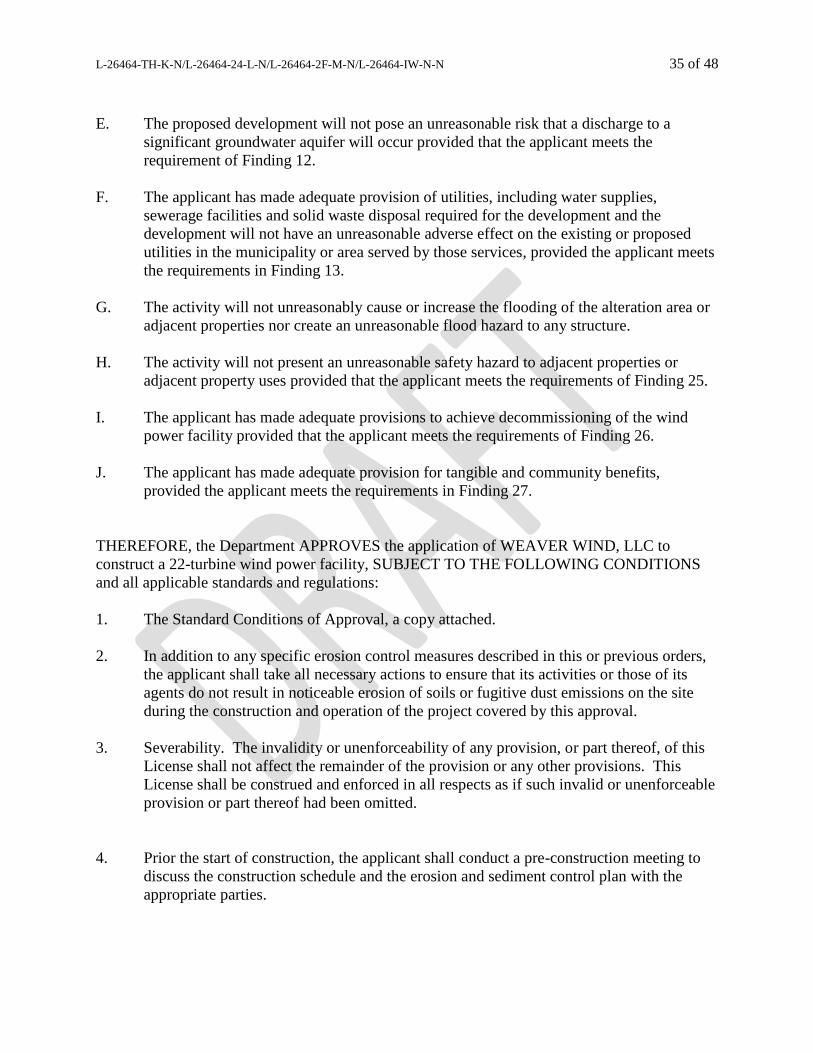
L-26464-TH-K-N/L-26464-24-L-N/L-26464-2F-M-N/L-26464-IW-N-N 35 of 48
E. The proposed development will not pose an unreasonable risk that a discharge to a
significant groundwater aquifer will occur provided that the applicant meets the
requirement of Finding 12.
F. The applicant has made adequate provision of utilities, including water supplies,
sewerage facilities and solid waste disposal required for the development and the
development will not have an unreasonable adverse effect on the existing or proposed
utilities in the municipality or area served by those services, provided the applicant meets
the requirements in Finding 13.
G. The activity will not unreasonably cause or increase the flooding of the alteration area or
adjacent properties nor create an unreasonable flood hazard to any structure.
H. The activity will not present an unreasonable safety hazard to adjacent properties or
adjacent property uses provided that the applicant meets the requirements of Finding 25.
I. The applicant has made adequate provisions to achieve decommissioning of the wind
power facility provided that the applicant meets the requirements of Finding 26.
J. The applicant has made adequate provision for tangible and community benefits,
provided the applicant meets the requirements in Finding 27.
THEREFORE, the Department APPROVES the application of WEAVER WIND, LLC to
construct a 22-turbine wind power facility, SUBJECT TO THE FOLLOWING CONDITIONS
and all applicable standards and regulations:
1. The Standard Conditions of Approval, a copy attached.
2. In addition to any specific erosion control measures described in this or previous orders,
the applicant shall take all necessary actions to ensure that its activities or those of its
agents do not result in noticeable erosion of soils or fugitive dust emissions on the site
during the construction and operation of the project covered by this approval.
3. Severability. The invalidity or unenforceability of any provision, or part thereof, of this
License shall not affect the remainder of the provision or any other provisions. This
License shall be construed and enforced in all respects as if such invalid or unenforceable
provision or part thereof had been omitted.
4. Prior the start of construction, the applicant shall conduct a pre-construction meeting to
discuss the construction schedule and the erosion and sediment control plan with the
appropriate parties.

L-26464-TH-K-N/L-26464-24-L-N/L-26464-2F-M-N/L-26464-IW-N-N 36 of 48
5. The applicant shall retain the services of a third-party inspector in accordance with the
Special Condition for Third-Party Inspection Program, which is attached to this Order.
6. All geotechnical reports for the project shall be submitted to the Department for review
and approval within 30 days of completion of the reports.
7. No later than 60 days after the first December 31 following commencement of
commercial operation (denoted as Year 1 of operation), the applicant shall report on the
tangible benefits realized from the construction of the project and provide documentation
of the project’s community benefits packages and any payments made pursuant to such
packages at the time of reporting. The applicant shall submit annual information on the
tangible benefits realized from the operation and maintenance of the project to the
Department for review.
8. The applicant shall submit a copy of a finalized TIF or Town tax bill for both Eastbrook
and Osborn to the Department for review within 60 days of issuance of the TIF or Town
tax bill.
9. Prior to the commencement of any construction, other than tree clearing, the applicant
shall submit evidence that it has been granted a line of credit or a loan by a financial
institution authorized to do business in this State or evidence of any other form of
financial assurance determined by Department Rules, Chapter 373 §1, to be adequate to
the Department for review and approval.
10. Prior to the commencement of commercial operation of the development, a Winter
Operating Protocol to address blade icing shall be developed and submitted to the
Department for review and approval.
11. Prior to the commencement of commercial operation, the applicant shall submit a noise
analysis of the chosen generators, as they will be installed, for both the O&M building
and the substation, to the Department for review, demonstrating that the noise levels from
each will comply with Department standards.
12. Within one year of the start of commercial operations, sound compliance testing shall be
completed at Receptor H1 and Receptor W1. At least six of the 12 test periods used in
the compliance test report shall represent the nighttime period (7 pm to 7 am) during
which the sound level limit is 42 dBA. The compliance test report shall include a
complete presentation of the data and calculations for the SDRS analysis performed.
13. The applicant shall demonstrate compliance with the Department’s and the Town of
Eastbrook’s Noise Regulations once during the first year of operation and every fifth year
thereafter until the facility is decommissioned. The results of the post-construction
monitoring program shall be submitted to the Department for review within 60 days of

L-26464-TH-K-N/L-26464-24-L-N/L-26464-2F-M-N/L-26464-IW-N-N 37 of 48
completion. Post-construction monitoring must demonstrate that the operating
development meets all applicable standards of Chapter 375 §10(I)(8).
14. Prior to the start of commercial operation, the applicant shall submit to the Department
for review and approval a sound complaint response and resolution protocol. The
proposed protocol shall meet all applicable standards of Chapter 375 §10(I)(7)(j). The
applicant shall notify the Department of any complaints within three business days of
receiving them and shall notify the Department of the outcome of its investigation within
three business days of completing the investigation.
15. Upon any finding by the Department of non-compliance with the Noise Standards, the
applicant shall take short-term action immediately to adjust operations to reduce sound
output to applicable limits under Chapter 375 §10 or the Eastbrook Noise Regulation.
Within 60 days of a determination of non-compliance by the Department, the applicant
shall submit, for review and approval, a mitigation plan that proposes actions to bring the
project into compliance.
16. Within 1 year of the commencement of commercial operations, RAL shall be installed
and operational. In the event FAA approval of RAL is not received, the applicant shall
submit a copy of the FAA denial to the Department within 30 days of receipt, along with
an analysis of other available technologies that may reduce the visual impacts of night
lighting. In the event of an FAA denial of RAL, the Department may require the
installation or use of other reasonably available methods to reduce visual impacts of night
lighting.
17. The applicant shall notify the Department within 72 hours if the RAL system is rendered
inoperable due to malfunction or damage, and is anticipated to be inoperable for a period
of longer than 15 days.
18. Prior to the commencement of commercial operation of the facility, the applicant shall
submit an operational SPCC plan for the project to the Department for review and
approval.
19. The locations for water withdrawal for dust control shall be approved by the Third-Party
inspector, and the vehicle access shall be stabilized prior to and after use.
20. A final Emergency Preparedness and Emergency Action Plan shall be submitted to the
Department for review prior to the commencement of commercial operations at the
facility. The applicant shall notify the Department within 48 hours of any fire event that
causes one or more turbines to cease generating electricity.
21. Prior to the start of construction, the applicant shall provide financial assurance for
decommissioning in the amount of $50,000 in the form of (i) a performance bond, (ii) a
surety bond, or (iii) an irrevocable letter of credit, or other acceptable form of financial
assurance to the Department for review and approval.

L-26464-TH-K-N/L-26464-24-L-N/L-26464-2F-M-N/L-26464-IW-N-N 38 of 48
22. Within 90 days of the start of construction or prior to the commencement of any
construction other than tree clearing, the applicant shall provide full financial assurance
for decommissioning in the amount of $3,317,000 in the form of (i) performance bond,
(ii) surety bond, or (iii) irrevocable letter of credit, or other acceptable form of financial
assurance to the Department for review and approval.
23. The applicant shall reevaluate the decommissioning costs at least once every two years to
account for price fluctuations and submit a report and updated financial assurance, if
necessary, to the Department for review.
24. The cost estimate for decommissioning the entire development shall be reevaluated, and a
report submitted to the Department for review, after any decommissioning of one or more
individual turbines occurs.
25. At the time of decommissioning, the applicant shall submit a plan for continued
beneficial use of any wind energy development components proposed to be left on-site to
the Department for review and approval.
26. The applicant shall notify the Department within two business days of any catastrophic
turbine failure.
27. Turbines shall be curtailed nightly between April 15 and September 30 each year from at
least ½ hour before sunset to at least ½ hour after sunrise when ambient temperatures are
above 32 degrees Fahrenheit, subject to the following ambient wind speeds. Turbines
shall only operate at cut-in wind speeds exceeding 6.0 meters per second (m/s) from
April 15 through July 15, as well as from September 16 through September 30. Turbines
shall only operate at cut-in wind speeds exceeding 6.5 m/s from July 16 through
September 15. Turbines shall be feathered during curtailment and allowed to turn at no
more than one revolution per minute.
28. The applicant shall report any bat carcasses or more than 10 bird carcasses found during
any operator inspection within 24 hours to MDIFW.
29. Prior to the start of construction, the applicant shall submit purchase and sale agreements
for both the Hancock mitigation parcel and the Whiting mitigation parcel to the
Department for review.
30. Prior to the start of any construction other than tree clearing, the applicant shall submit
evidence of ownership of both mitigation parcels to the Department for review. The
applicant shall record all deed restrictions for the parcels and submit the recorded deed
restrictions to the Department within 60 days of the purchase.
31. A land management plan for the Hancock mitigation parcel shall be developed and
submitted to the Department for review and approval prior to December 31, 2019.

L-26464-TH-K-N/L-26464-24-L-N/L-26464-2F-M-N/L-26464-IW-N-N 39 of 48
32. A land management plan for the Whiting mitigation parcel shall be developed and
submitted to the Department for review and approval prior to December 31, 2019.
33. All construction vehicles shall be cleaned prior to initiating work on the Weaver Wind
construction site to remove all soil, seeds, vegetation, or other debris that could contain
seeds or reproductive portions of plants.
34. Prior to construction in any area, the applicant shall clearly mark all resource and
stormwater buffers on the ground. Additionally, prior to the commencement of
commercial operation, the applicant shall record all deed restrictions for stormwater
buffers and submit the recorded deeds to the Department within 60 days of recording.
35. The applicant shall maintain 100-foot undisturbed vegetated buffers on all perennial and
intermittent streams measured from each bank or, in the presence of contiguous wetlands,
from the upland/wetland boundary.
36. The design engineer shall oversee the installation of the stormwater best management
practices. At least once a year, or within 30 days of completion of construction, the
applicant shall submit an update or as-built plans to the Department for review.
THIS APPROVAL DOES NOT CONSTITUTE OR SUBSTITUTE FOR ANY OTHER
REQUIRED STATE, FEDERAL OR LOCAL APPROVALS NOR DOES IT VERIFY
COMPLIANCE WITH ANY APPLICABLE SHORELAND ZONING ORDINANCES.
DONE AND DATED IN AUGUSTA, MAINE, THIS _____ DAY OF _______________, 2019.
DEPARTMENT OF ENVIRONMENTAL PROTECTION
BY:
For: Gerald D. Reid, Commissioner
PLEASE NOTE THE ATTACHED SHEET FOR GUIDANCE ON APPEAL PROCEDURES…
ME/L26464knlnmnnn/ATS#83719, 83720, 83745, 83746

L-26464-TH-K-N/L-26464-24-L-N/L-26464-2F-M-N/L-26464-IW-N-N 40 of 48
Department of Environmental Protection SITE LOCATION OF DEVELOPMENT (SITE)
STANDARD CONDITIONS
A. Approval of Variations from Plans. The granting of this approval is dependent upon and limited
to the proposals and plans contained in the application and supporting documents submitted and
affirmed to by the applicant. Any variation from these plans, proposals, and supporting documents
is subject to review and approval prior to implementation. Further subdivision of proposed lots by
the applicant or future owners is specifically prohibited without prior approval of the Board, and
the applicant shall include deed restrictions to that effect.
B. Compliance with All Applicable Laws. The applicant shall secure and comply with all applicable
federal, state, and local licenses, permits, authorizations, conditions, agreements, and orders prior
to or during construction and operation, as appropriate.
C. Compliance with All Terms and Conditions of Approval. The applicant shall submit all reports
and information requested by the Board or the Department demonstrating that the applicant has
complied or will comply with all preconstruction terms and conditions of this approval. All
preconstruction terms and conditions must be met before construction begins.
D. Advertising. Advertising relating to matters included in this application shall refer to this approval
only if it notes that the approval has been granted WITH CONDITIONS, and indicates where
copies of those conditions may be obtained.
E. Transfer of Development. Unless otherwise provided in this approval, the applicant shall not sell,
lease, assign or otherwise transfer the development or any portion thereof without prior written
approval of the Board where the purpose or consequence of the transfer is to transfer any of the
obligations of the developer as incorporated in this approval. Such approval shall be granted only
if the applicant or transferee demonstrates to the Board that the transferee has the technical capacity
and financial ability to comply with conditions of this approval and the proposals and plans
contained in the application and supporting documents submitted by the applicant.
F. Time frame for approvals. If the construction or operation of the activity is not begun within four
years, this approval shall lapse and the applicant shall reapply to the Board for a new approval. The
applicant may not begin construction or operation of the development until a new approval is
granted. A reapplication for approval may include information submitted in the initial application
by reference. This approval, if construction is begun within the four-year time frame, is valid for
seven years. If construction is not completed within the seven-year time frame, the applicant must
reapply for, and receive, approval prior to continuing construction.
G. Approval Included in Contract Bids. A copy of this approval must be included in or attached to
all contract bid specifications for the development.
H. Approval Shown to Contractors. Work done by a contractor pursuant to this approval shall not
begin before the contractor has been shown by the developer a copy of this approval. (2/81)/Revised December 27, 2011
DEPLW 0429

L-26464-TH-K-N/L-26464-24-L-N/L-26464-2F-M-N/L-26464-IW-N-N 41 of 48
Natural Resources Protection Act (NRPA)
Standard Conditions
THE FOLLOWING STANDARD CONDITIONS SHALL APPLY TO ALL PERMITS GRANTED UNDER THE NATURAL RESOURCES PROTECTION ACT, 38 M.R.S. § 480-A ET SEQ., UNLESS OTHERWISE SPECIFICALLY STATED IN THE PERMIT. A. Approval of Variations From Plans. The granting of this permit is dependent upon and limited to
the proposals and plans contained in the application and supporting documents submitted and affirmed to by the applicant. Any variation from these plans, proposals, and supporting documents is subject to review and approval prior to implementation.
B. Compliance With All Applicable Laws. The applicant shall secure and comply with all applicable federal, state, and local licenses, permits, authorizations, conditions, agreements, and orders prior to or during construction and operation, as appropriate.
C. Erosion Control. The applicant shall take all necessary measures to ensure that his activities or those of his agents do not result in measurable erosion of soils on the site during the construction and operation of the project covered by this Approval.
D. Compliance With Conditions. Should the project be found, at any time, not to be in compliance with any of the Conditions of this Approval, or should the applicant construct or operate this development in any way other the specified in the Application or Supporting Documents, as modified by the Conditions of this Approval, then the terms of this Approval shall be considered to have been violated.
E. Time frame for approvals. If construction or operation of the activity is not begun within four years, this permit shall lapse and the applicant shall reapply to the Board for a new permit. The applicant may not begin construction or operation of the activity until a new permit is granted. Reapplications for permits may include information submitted in the initial application by reference. This approval, if construction is begun within the four-year time frame, is valid for seven years. If construction is not completed within the seven-year time frame, the applicant must reapply for, and receive, approval prior to continuing construction.
F. No Construction Equipment Below High Water. No construction equipment used in the undertaking of an approved activity is allowed below the mean high water line unless otherwise specified by this permit.
G. Permit Included In Contract Bids. A copy of this permit must be included in or attached to all contract bid specifications for the approved activity.
H. Permit Shown To Contractor. Work done by a contractor pursuant to this permit shall not begin before the contractor has been shown by the applicant a copy of this permit.
Revised September 2016

L-26464-TH-K-N/L-26464-24-L-N/L-26464-2F-M-N/L-26464-IW-N-N 42 of 48
STORMWATER STANDARD CONDITIONS
STRICT CONFORMANCE WITH THE STANDARD AND SPECIAL CONDITIONS OF THIS
APPROVAL IS NECESSARY FOR THE PROJECT TO MEET THE STATUTORY CRITERIA
FOR APPROVAL
Standard conditions of approval. Unless otherwise specifically stated in the approval, a department
approval is subject to the following standard conditions pursuant to Chapter 500 Stormwater Management
Law.
(1) Approval of variations from plans. The granting of this approval is dependent upon and
limited to the proposals and plans contained in the application and supporting documents
submitted and affirmed to by the permittee. Any variation from these plans, proposals, and
supporting documents must be reviewed and approved by the department prior to implementation.
Any variation undertaken without approval of the department is in violation of 38 M.R.S. §420-
D(8) and is subject to penalties under 38 M.R.S.. §349.
(2) Compliance with all terms and conditions of approval. The applicant shall submit all
reports and information requested by the department demonstrating that the applicant has
complied or will comply with all terms and conditions of this approval. All preconstruction terms
and conditions must be met before construction begins.
(3) Advertising. Advertising relating to matters included in this application may not refer to
this approval unless it notes that the approval has been granted WITH CONDITIONS, and
indicates where copies of those conditions may be obtained.
(4) Transfer of project. Unless otherwise provided in this approval, the applicant may not sell,
lease, assign, or otherwise transfer the project or any portion thereof without written approval by
the department where the purpose or consequence of the transfer is to transfer any of the
obligations of the developer as incorporated in this approval. Such approval may only be granted
if the applicant or transferee demonstrates to the department that the transferee agrees to comply
with conditions of this approval and the proposals and plans contained in the application and
supporting documents submitted by the applicant. Approval of a transfer of the permit must be
applied for no later than two weeks after any transfer of property subject to the license.
(5) Time frame for approvals. If the construction or operation of the activity is not begun within
four years, this approval shall lapse and the applicant shall reapply to the department for a new
approval. The applicant may not begin construction or operation of the project until a new approval
is granted. A reapplication for approval may include information submitted in the initial
application by reference. This approval, if construction is begun within the four-year time frame,
is valid for seven years. If construction is not completed within the seven-year time frame, the
applicant must reapply for, and receive, approval prior to continuing construction.
(6) Certification. Contracts must specify that "all work is to comply with the conditions of the
Stormwater Permit." Work done by a contractor or subcontractor pursuant to this approval may
not begin before the contractor and any subcontractors have been shown a copy of this approval
with the conditions by the permittee, and the permittee and each contractor and subcontractor has
certified, on a form provided by the department, that the approval and conditions have been
received and read, and that the work will be carried out in accordance with the approval and
conditions. Completed certification forms must be forwarded to the department.

L-26464-TH-K-N/L-26464-24-L-N/L-26464-2F-M-N/L-26464-IW-N-N 43 of 48
(7) Maintenance. The components of the stormwater management system must be adequately
maintained to ensure that the system operates as designed, and as approved by the Department.
If maintenance responsibility is to be transferred from the permittee to another entity, a transfer
request must be filed with the Department which includes the name and contact information for
the person or entity responsible for this maintenance. The form must be signed by the
responsible person or agent of the responsible entity.
(8) Recertification requirement. Within three months of the expiration of each five-year
interval from the date of issuance of the permit, the permittee shall certify the following to the
department.
(a) All areas of the project site have been inspected for areas of erosion, and
appropriate steps have been taken to permanently stabilize these areas.
(b) All aspects of the stormwater control system are operating as approved, have been
inspected for damage, wear, and malfunction, and appropriate steps have been taken to repair or
replace the system, or portions of the system, as necessary.
(c) The stormwater maintenance plan for the site is being implemented as approved
by the Department, and the maintenance log is being maintained.
(d) All proprietary systems have been maintained according to the manufacturer’s
recommendations. Where required by the Department, the permittee shall execute a 5-year
maintenance contract with a qualified professional for the coming 5-year interval. The
maintenance contract must include provisions for routine inspections, cleaning and general
maintenance.
(e) The Department may waive some or all of these recertification requirements on a
case-by-case basis for permittees subject to the Department’s Multi-Sector General Permit
(“MSGP”) and/or Maine Pollutant Discharge Elimination System (“MEPDES”) programs where
it is demonstrated that these programs are providing stormwater control that is at least as
effective as required pursuant to this Chapter.
(9) Transfer of property subject to the license. If any portion of the property subject to the
license containing areas of flow or areas that are flooded are transferred to a new property
owner, restrictive covenants protecting these areas must be included in any deeds or leases, and
recorded at the appropriate county registry of deeds. Also, in all transfers of such areas and areas
containing parts of the stormwater management system, deed restrictions must be included
making the property transfer subject to all applicable terms and conditions of the permit. These
terms and conditions must be incorporated by specific and prominent reference to the permit in
the deed. All transfers must include in the restrictions the requirement that any subsequent
transfer must specifically include the same restrictions unless their removal or modification is
approved by the Department. These restrictions must be written to be enforceable by the
Department, and must reference the permit number.
(10) Severability. The invalidity or unenforceability of any provision, or part thereof, of this permit
shall not affect the remainder of the provision or any other provisions. This permit shall be
construed and enforced in all respects as if such invalid or unenforceable provision or part thereof
had been omitted.
November 16, 2005 (revised August 15, 2015)

L-26464-TH-K-N/L-26464-24-L-N/L-26464-2F-M-N/L-26464-IW-N-N 44 of 48
Special Condition
for
Third Party Inspection Program
DEPLW078-B2001 November 2008

L-26464-TH-K-N/L-26464-24-L-N/L-26464-2F-M-N/L-26464-IW-N-N 45 of 48
THIRD-PARTY INSPECTION PROGRAM
1.0 THE PURPOSE OF THE THIRD-PARTY INSPECTION
As a condition of this permit, the Maine Department of Environmental Protection (MDEP) requires the permit
applicant to retain the services of a third-party inspector to monitor compliance with MDEP permit conditions
during construction. The objectives of this condition are as follows:
1) to ensure that all construction and stabilization activities comply with the permit conditions and the MDEP-
approved drawings and specifications,
2) to ensure that field decisions regarding erosion control implementation, stormwater system installation, and
natural resource protection are based on sound engineering and environmental considerations, and
3) to ensure communication between the contractor and MDEP regarding any changes to the development's
erosion control plan, stormwater management plan, or final stabilization plan.
This document establishes the inspection program and outlines the responsibilities of the permit applicant, the
MDEP, and the inspector.
2.0 SELECTING THE INSPECTOR
At least 30 days prior to starting any construction activity on the site, the applicant will submit the names of at
least two inspector candidates to the MDEP. Each candidate must meet the minimum qualifications listed under
section 3.0. The candidates may not be employees, partners, or contracted consultants involved with the
permitting of the project or otherwise employed by the same company or agency except that the MDEP may
accept subcontractors who worked for the project's primary consultant on some aspect of the project such as, but
not limited to, completing wetland delineations, identifying significant wildlife habitats, or conducting
geotechnical investigations, but who were not directly employed by the applicant, as Third Party inspectors on a
case by case basis. The MDEP will have 15 days from receiving the names to select one of the candidates as the
inspector or to reject both candidates. If the MDEP rejects both candidates, then the MDEP shall state the
particular reasons for the rejections. In this case, the applicant may either dispute the rejection to the Director of
the Bureau of Land Resources or start the selection process over by nominating two, new candidates.
3.0 THE INSPECTOR'S QUALIFICATIONS
Each inspector candidate nominated by the applicant shall have the following minimum qualifications:
1) a degree in an environmental science or civil engineering, or other demonstrated expertise,
2) a practical knowledge of erosion control practices and stormwater hydrology,
3) experience in management or supervision on large construction projects,
4) the ability to understand and articulate permit conditions to contractors concerning erosion control or
stormwater management,
5) the ability to clearly document activities being inspected,
6) appropriate facilities and, if necessary, support staff to carry out the duties and responsibilities set forth in
section 6.0 in a timely manner, and
7) no ownership or financial interest in the development other than that created by being retained as the third-
party inspector.

L-26464-TH-K-N/L-26464-24-L-N/L-26464-2F-M-N/L-26464-IW-N-N 46 of 48
4.0 INITIATING THE INSPECTOR'S SERVICES
The applicant will not formally and finally engage for service any inspector under this permit condition prior to
MDEP approval or waiver by omission under section 2.0. No clearing, grubbing, grading, filling, stockpiling, or
other construction activity will take place on the development site until the applicant retains the MDEP-approved
inspector for service.
5.0 TERMINATING THE INSPECTOR'S SERVICES
The applicant will not terminate the services of the MDEP-approved inspector at any time between commencing
construction and completing final site stabilization without first getting written approval to do so from the
MDEP.
6.0 THE INSPECTOR'S DUTIES AND RESPONSIBILITIES
The inspector's work shall consist of the duties and responsibilities outlined below.
1) Prior to construction, the inspector will become thoroughly familiar with the terms and conditions of the state-
issued site permit, natural resources protection permit, or both.
2) Prior to construction, the inspector will become thoroughly familiar with the proposed construction schedule,
including the timing for installing and removing erosion controls, the timing for constructing and stabilizing
any basins or ponds, and the deadlines for completing stabilization of disturbed soils.
3) Prior to construction, the inspector will become thoroughly familiar with the project plans and specifications,
including those for building detention basins, those for installing the erosion control measures to be used on
the site, and those for temporarily or permanently stabilizing disturbed soils in a timely manner.
4) During construction, the inspector will monitor the contractor's installation and maintenance of the erosion
control measures called for in the state permit(s) and any additional measures the inspector believes are
necessary to prevent sediment discharge to off-site properties or natural resources. This direction will be
based on the approved erosion control plan, field conditions at the time of construction, and the natural
resources potentially impacted by construction activities.
5) During construction, the inspector will monitor the contractor's construction of the stormwater system,
including the construction and stabilization of ditches, culverts, detention basins, water quality treatment
measures, and storm sewers.
6) During construction, the inspector will monitor the contractor's installation of any stream or wetland
crossings.
7) During construction, the inspector will monitor the contractor's final stabilization of the project site.
8) During construction, the inspector will keep logs recording any rain storms at the site, the contractor's
activities on the site, discussions with the contractor(s), and possible violations of the permit conditions.
9) During construction, the inspector will inspect the project site at least once a week and before and after any
significant rain event. The inspector will photograph all protected natural resources both before and after
construction and will photograph all areas under construction. All photographs will be identified with, at a
minimum the date the photo was taken, the location and the name of the individual taking the photograph.
Note: the frequency of these inspections as contained in this condition may be varied to best address
particular project needs.
10) During construction, the inspector will prepare and submit weekly (or other frequency) inspection reports to
the MDEP.

L-26464-TH-K-N/L-26464-24-L-N/L-26464-2F-M-N/L-26464-IW-N-N 47 of 48
11) During construction, the inspector will notify the designated person at the MDEP immediately of any
sediment-laden discharges to a protected natural resource or other significant issues such as the improper
construction of a stormwater control structure or the use of construction plans not approved by the MDEP.
7.0 INSPECTION REPORTS
The inspector will submit weekly written reports (or at another designated frequency), including photographs of
areas that are under construction, on a form provided by the Department to the designated person at the MDEP.
Each report will be due at the MDEP by the Friday (or other designated day) following the inspection week
(Monday through Sunday).
The weekly report will summarize construction activities and events on the site for the previous week as outlined
below.
1) The report will state the name of the development, its permit number(s), and the start and end dates for the
inspection week (Monday through Sunday).
2) The report will state the date(s) and time(s) when the inspector was on the site making inspections.
3) The report will state the date(s) and approximate duration(s) of any rainfall events on the site for the week.
4) The report will identify and describe any erosion problems that resulted in sediment leaving the property or
sediment being discharged into a wetland, brook, stream, river, lake, or public storm sewer system. The
report will describe the contractor's actions to repair any damage to other properties or natural resources,
actions to eliminate the erosion source, and actions to prevent future sediment discharges from the area.
5) The report will list the buildings, roads, parking lots, detention basins, stream crossings or other features open
to construction for the week, including those features or areas actively worked and those left unworked
(dormant).
6) For each area open to construction, the report will list the date of initial soil disturbance for the area.
7) For each area open to construction, the report will note which areas were actively worked that week and
which were left dormant for the week. For those areas actively worked, the report will briefly state the work
performed in the area that week and the progress toward final stabilization of the area -- e.g. "grubbing in
progress", " grubbing complete", "rough grading in progress", "rough grading complete", "finish grading in
progress", "finish grading complete", "permanent seeding completed", "area fully stable and temporary
erosion controls removed", etc.
8) For each area open to construction, the report will list the erosion and sedimentation control measures
installed, maintained, or removed during the week.
9) For each erosion control measure in-place, the report will note the condition of the measure and any
maintenance performed to bring it to standard.
L-26464-TH-K-N/L-26464-24-L-N/L-26464-2F-M-N/L-26464-IW-N-N 48 of 48
Third Party Inspection Form
This report is prepared by a Third Party Inspector to meet the requirements of the Third
Party Inspector Condition attached as a Special Condition to the Department Order that
was issued for the project identified below. The information in this report/form is not
intended to serve as a determination of whether the project is in compliance with the
Department permit or other applicable Department laws and rules. Only Department staff
may make that determination.
TO: PM, Maine DEP (@maine.gov) FROM:
PROJECT NAME/ LOCATION: DEP #:
DATE OF INSPECTION: DATE OF REPORT:
WEATHER: CONDITIONS:
SITE CHARACTERISTICS:
# ACRES OPEN: # ACRES ACTIVE: # ACRES INACTIVE:
LOCATION OF OPEN LAND: LOCATION OF ACTIVE LAND: LOCATION OF INACTIVE LAND:
OPEN SINCE: OPEN SINCE: OPEN SINCE:
PROGRESS OF WORK:
INSPECTION OF: Satisfactory Minor Deviation
(corrective action required)
Unsatisfactory
(include photos)
STORMWATER CONTROL
(VEGETATIVE & STRUCTURAL BMP’S)
EROSION & SEDIMENTATION CONTROL (TEMPORARY & PERMANENT BMP’S)
OTHER: (PERMIT CONDITIONS, ENGINEERING DESIGN, ETC.)
COMMENTS/CORRECTIVE ACTIONS TAKEN (attach additional sheets as necessary):
Photos (must be labeled with date, photographer and location):
Cc:
Original and all copies were sent by email only.