department of advanced computing sar related activities at christian michelsen research kjell røang
TRANSCRIPT

Department of Advanced Computing
SAR related activities
at Christian Michelsen Research
Kjell Røang

Department of Advanced Computing
SARA (Search And Rescue Application)
• Decision support tool for the Joint Rescue Coordination Centres in Norway
• Operative since 2000• Primary function is to aggregate and present all
relevant information about real and potential emergency incidents, including location-based information on electronic maps
• First SW to present results from LeeWay simulations

Department of Advanced Computing
SARA

Department of Advanced Computing
LeeWay simulations in SARA

Department of Advanced Computing
What is web mapping (WMS)
• Standard for transferring map images over Internet• Standardized by Open Gis Consortium (OGC)
– First version 1.0.0, 2000-04-19– Current version 1.3, 2005-08-02 (also ISO/DIS 19128)
• Uses HTTP Get and parameters as ”query string”• Transfers the map as image
– e.g. As PNG, JPEG, GIF, SVG
• Three different requests:– GetCapabilities (What is available)– GetMap (Map image)– GetFeatureInfo (Info about a position on the map)
• Standard handling of coordinate systems (CRS)• Handles also time and elevation

Department of Advanced Computing
MetOc server
• Developed for the Norwegian Defence Research Establishment in collaboration with Met.no
• WMS server supports grid data (GRIB), particle simulation results (oil drift, ship drift), observations (scatterometer, altimeter)
• Plot time series profiles and cross-sections• Exports and imports GRIB data to and from other
servers• Supplies applications with XML data services
(profiles, time series, cross section)

Department of Advanced Computing
MetOc server

Department of Advanced Computing
Oil drift

Department of Advanced Computing
Ship drift

Department of Advanced Computing
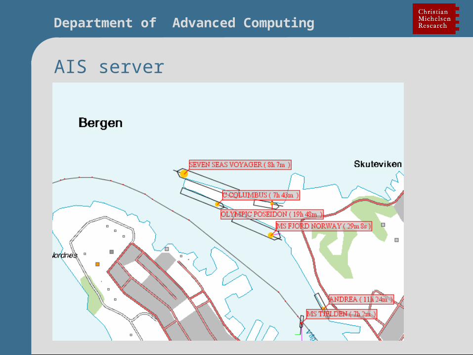
AIS server
• Handles multiple AIS sources• Web browser as client (multiple browser support)• Shows traffic info as a map or a table• User defined filters (Norwegian pilots, tankers
north of 62)• Multiple custom defined background maps • Support WMS foreground maps• Exports data directly to other applications• Integrated database for historic data• “Smart links” to other web applications

Department of Advanced Computing
AIS server
Department of Advanced Computing
AIS server