david parker, t. h. achtor, l. e. gumley university of wisconsin – madison (ssec/cimss) cimss...
TRANSCRIPT
David Parker, T. H. Achtor, L. E. GumleyUniversity of Wisconsin – Madison (SSEC/CIMSS)
CIMSS Student Workshop
Madison, WI23 June 2014
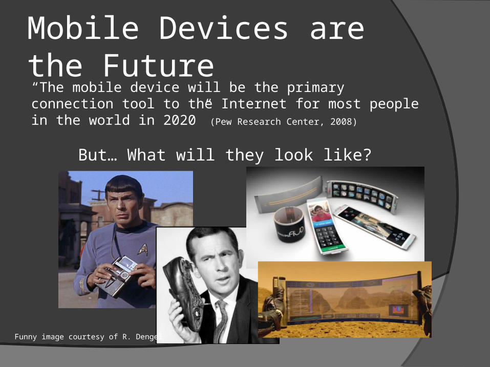
Mobile Devices are the Future“The mobile device will be the primary connection tool to the Internet for most people in the world in 2020” (Pew Research Center, 2008)
But… What will they look like?
Funny image courtesy of R. Dengel
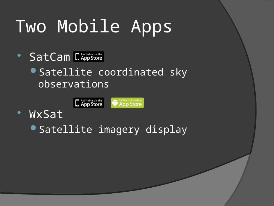
Two Mobile Apps
SatCamSatellite coordinated sky observations
WxSatSatellite imagery display
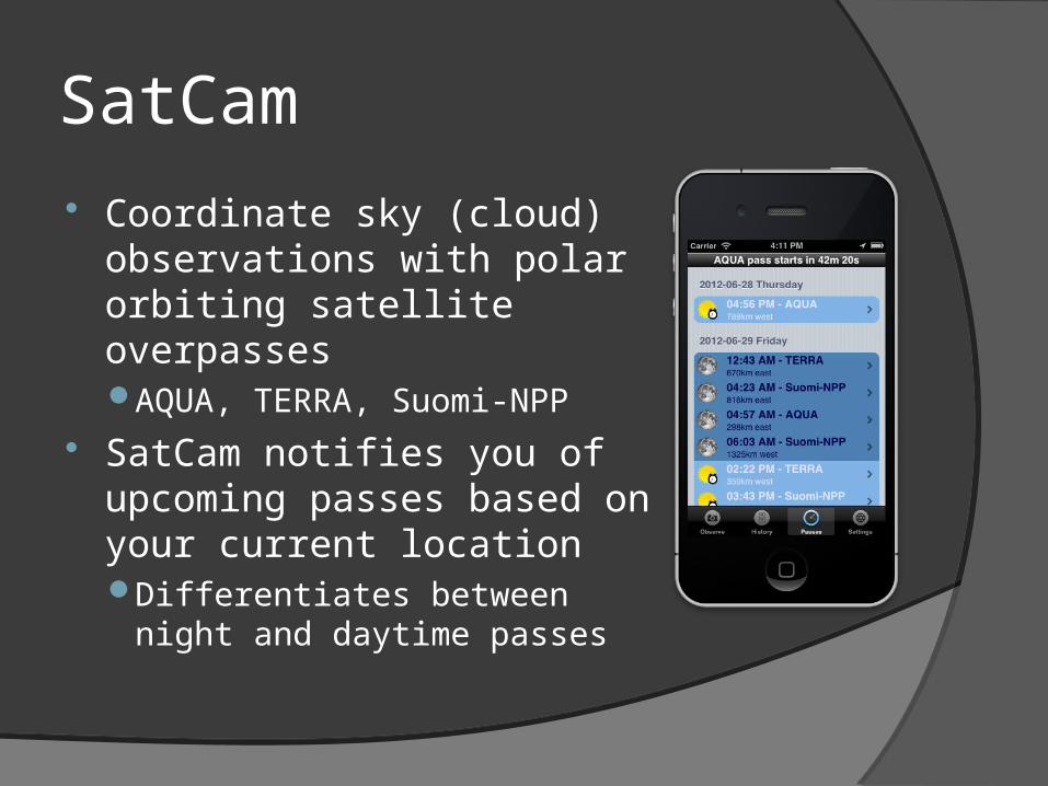
SatCam
Coordinate sky (cloud) observations with polar orbiting satellite overpassesAQUA, TERRA, Suomi-NPP
SatCam notifies you of upcoming passes based on your current locationDifferentiates between night
and daytime passes
SatCam
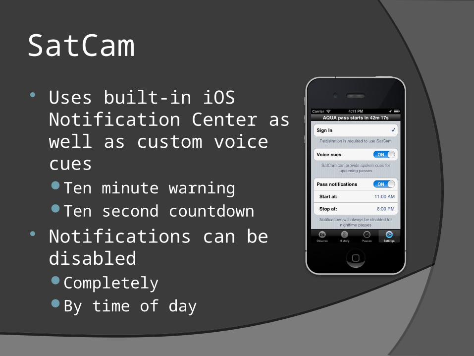
Uses built-in iOS Notification Center as well as custom voice cuesTen minute warningTen second countdown
Notifications can be disabledCompletelyBy time of day
SatCam
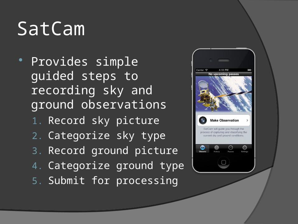
Provides simple guided steps to recording sky and ground observations1. Record sky picture
2. Categorize sky type
3. Record ground picture
4. Categorize ground type
5. Submit for processing
SatCam
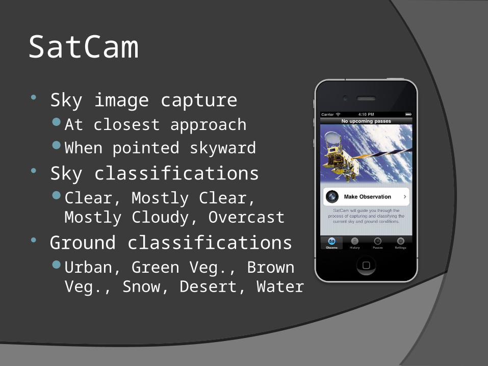
Sky image captureAt closest approachWhen pointed skyward
Sky classificationsClear, Mostly Clear, Mostly
Cloudy, Overcast
Ground classificationsUrban, Green Veg., Brown
Veg., Snow, Desert, Water
SatCam
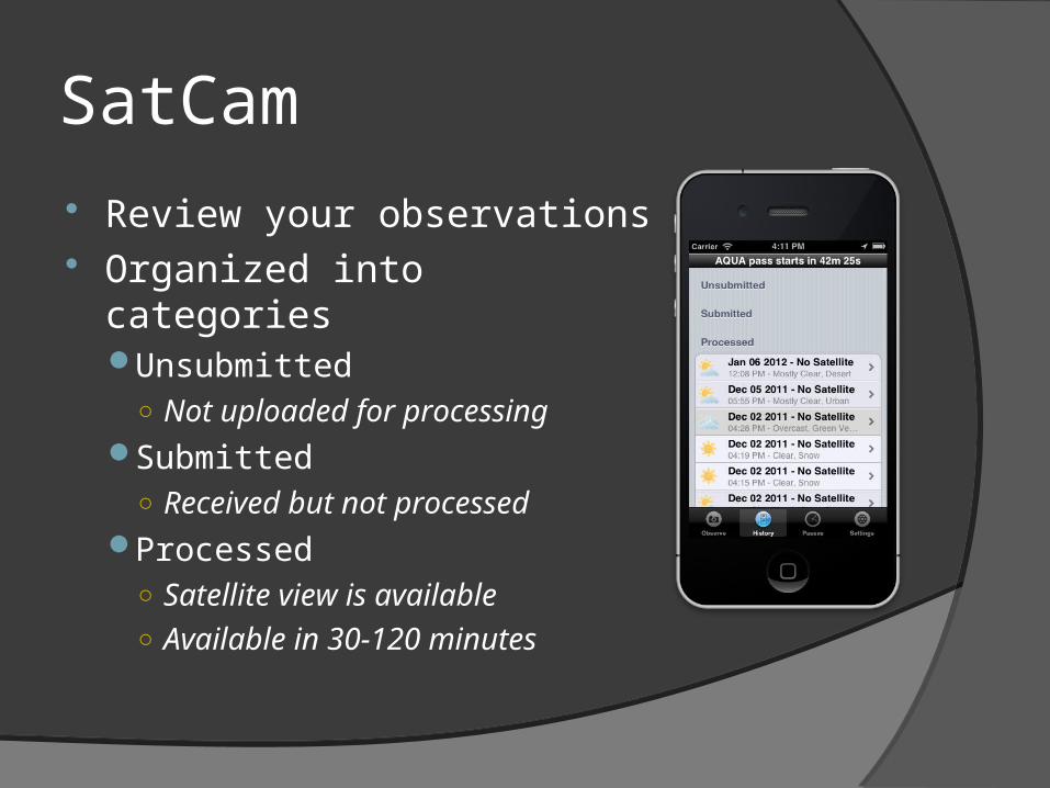
Review your observations Organized into categories
Unsubmitted○ Not uploaded for processing
Submitted○ Received but not processed
Processed○ Satellite view is available○ Available in 30-120 minutes
SatCam
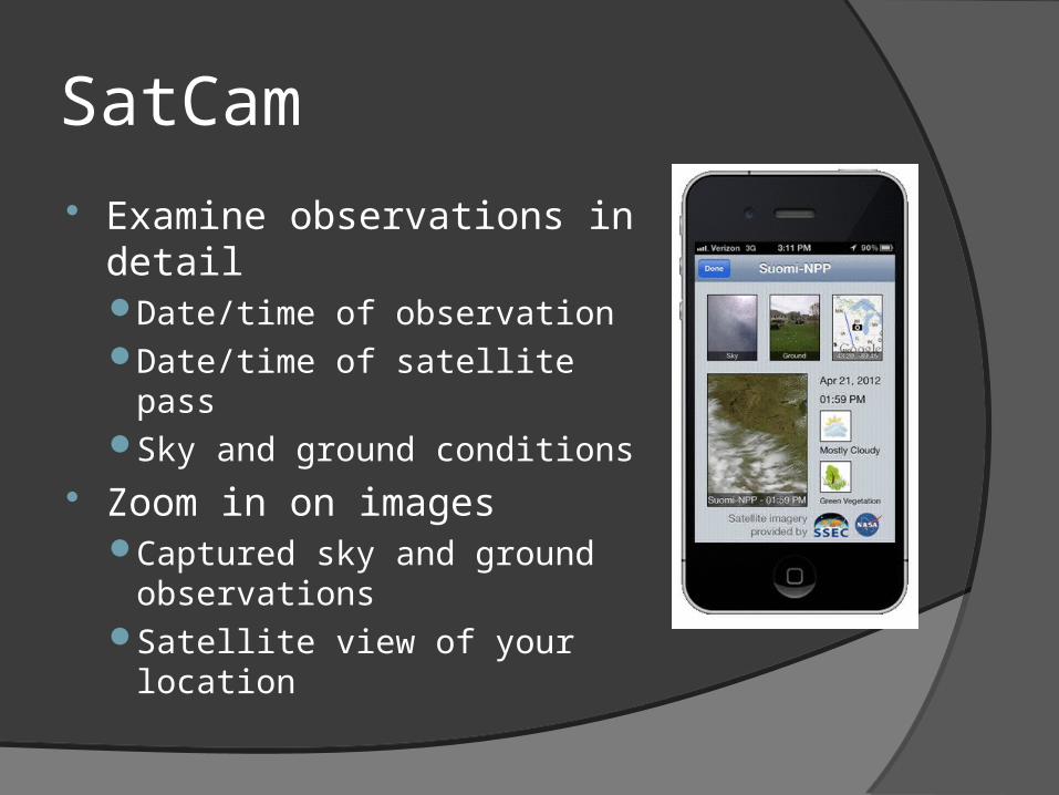
Examine observations in detailDate/time of observationDate/time of satellite passSky and ground conditions
Zoom in on imagesCaptured sky and ground
observationsSatellite view of your location
SatCam
Great for outreachIntuitive connectionSee what tax dollars support
Collecting valuable data for calibration and validationCloud mask productsCloud/ice differentiationLooking to the future…
○ Website, gamification
SatCam
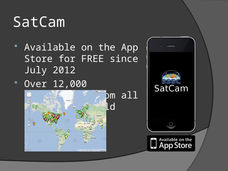
Available on the App Store for FREE since July 2012
Over 12,000 submissions from all around the world
WxSat
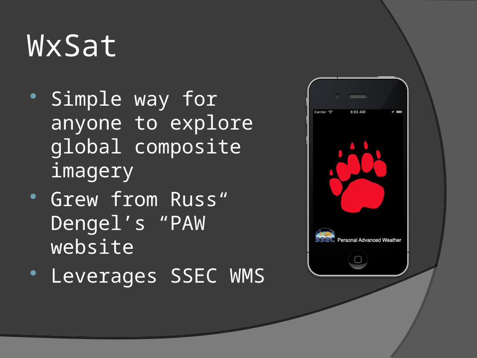
Simple way for anyone to explore global composite imagery
Grew from Russ Dengel’s “PAW” website
Leverages SSEC WMS

WxSat
Clean interface with clear optionsVisibleInfraredWater Vapor
Toggle map overlay Animation and time controls
Select animation time frameSelect specific day/time
WxSat
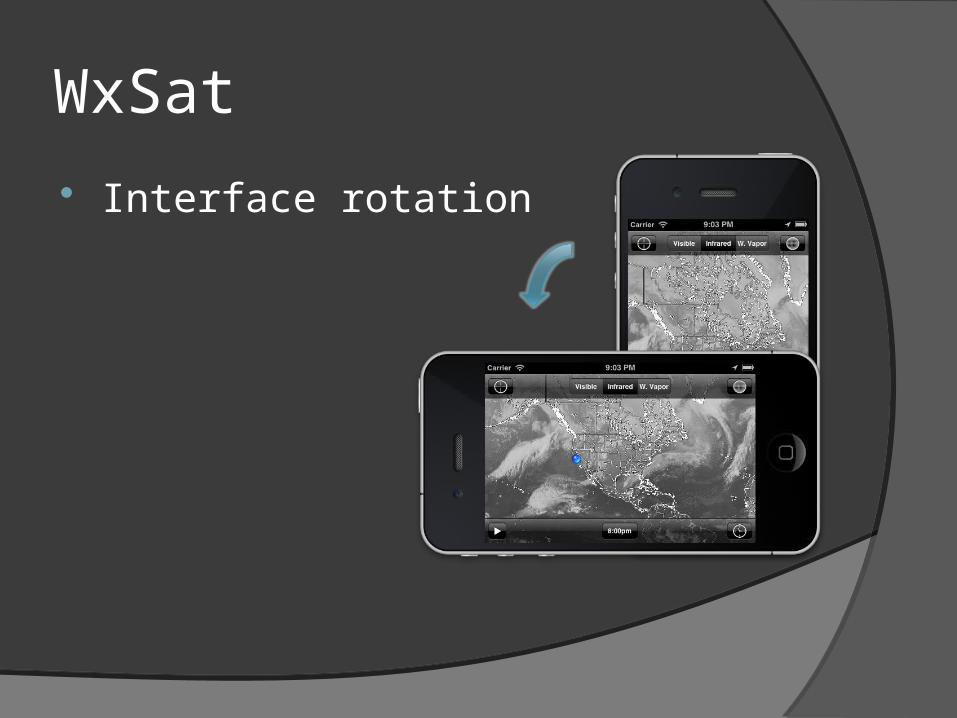
Interface rotation
WxSat
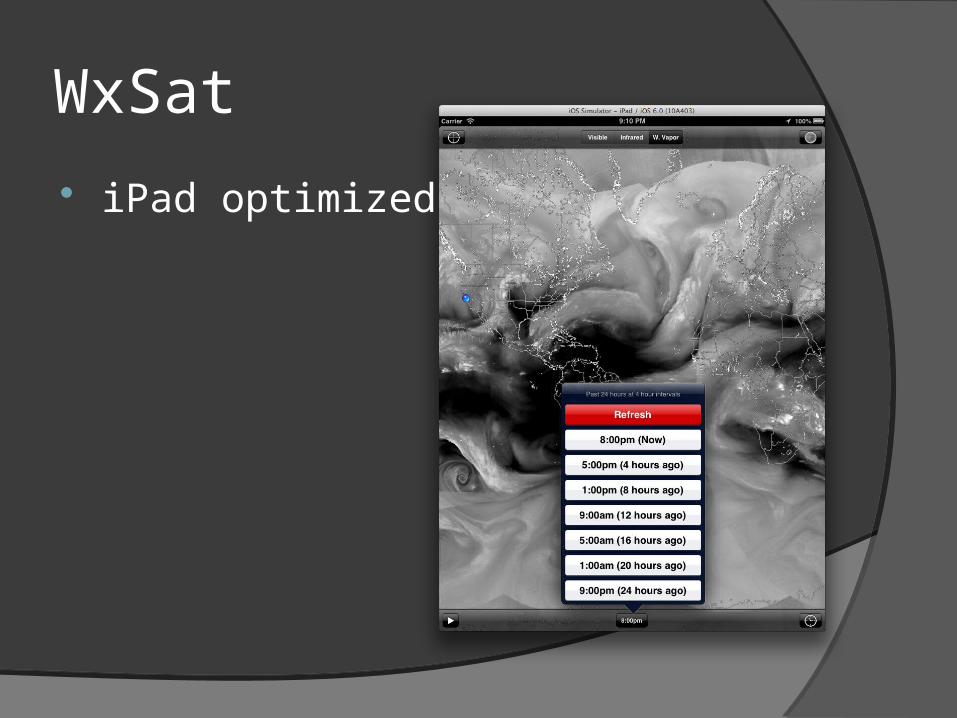
iPad optimized
WxSat
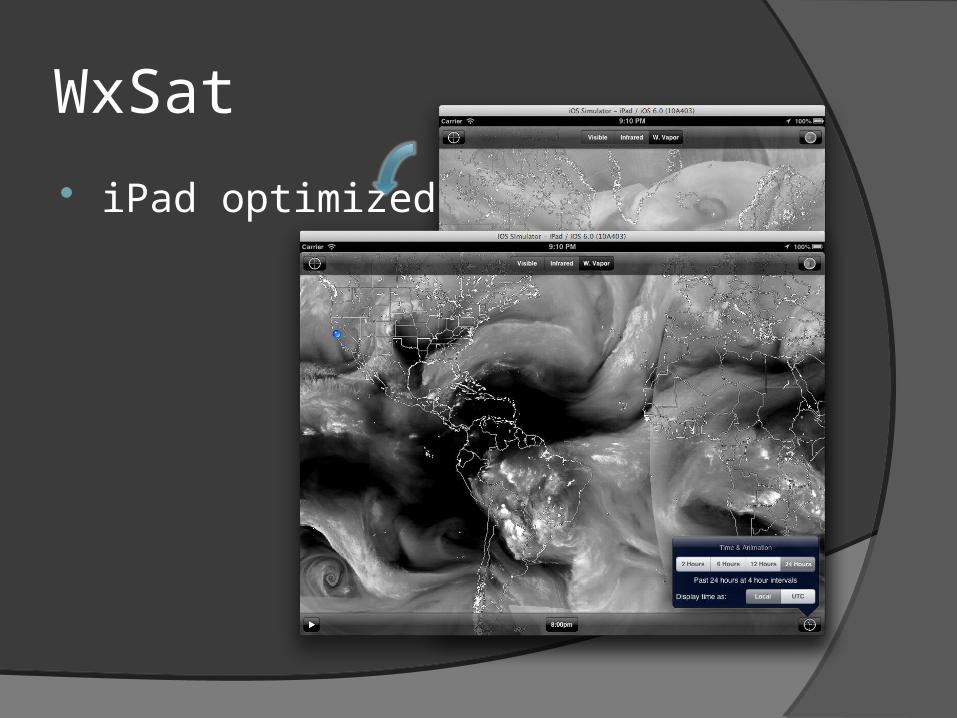
iPad optimized
WxSat
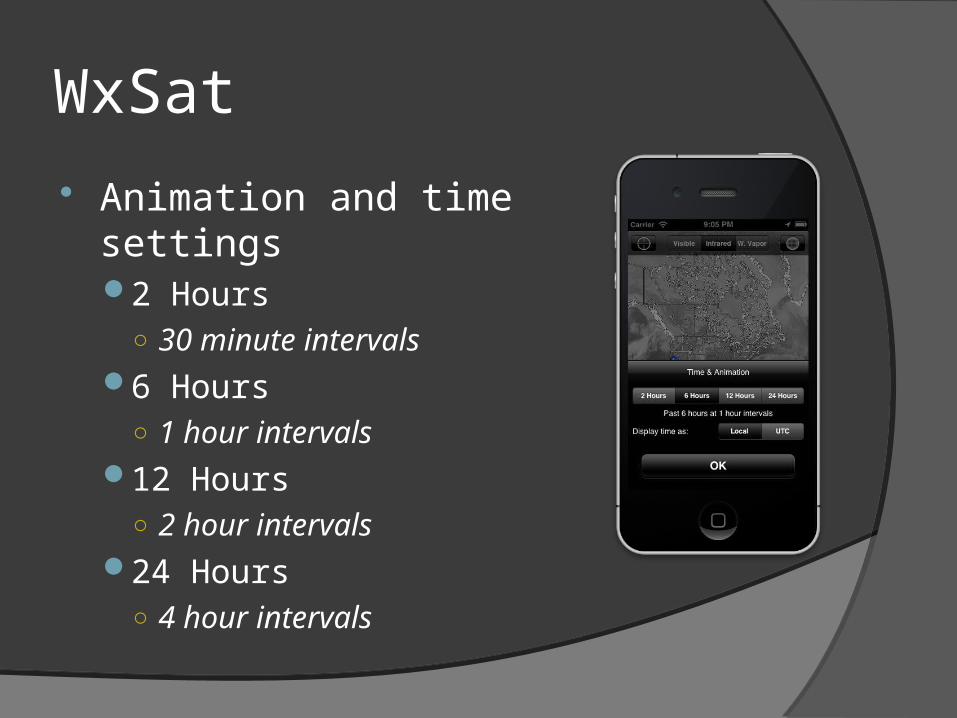
Animation and time settings2 Hours
○ 30 minute intervals6 Hours
○ 1 hour intervals12 Hours
○ 2 hour intervals24 Hours
○ 4 hour intervals
WxSat
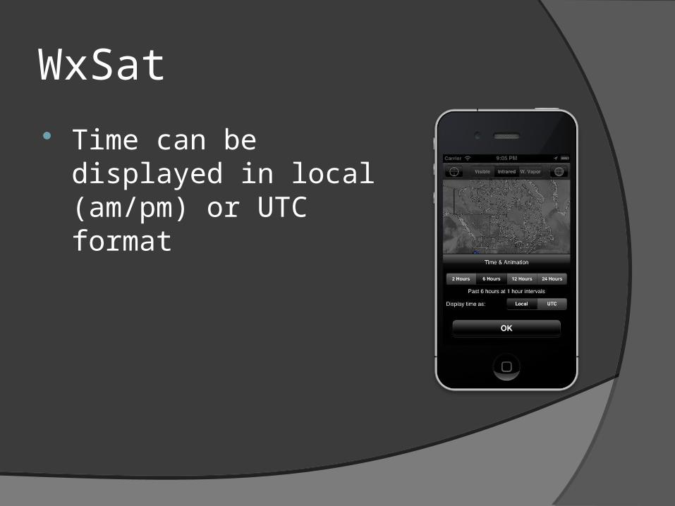
Time can be displayed in local (am/pm) or UTC format
WxSat
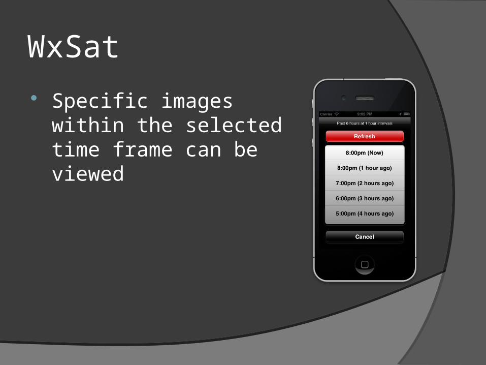
Specific images within the selected time frame can be viewed
WxSat
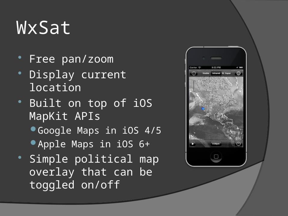
Free pan/zoom Display current location Built on top of iOS MapKit
APIsGoogle Maps in iOS 4/5Apple Maps in iOS 6+
Simple political map overlay that can be toggled on/off
WxSat
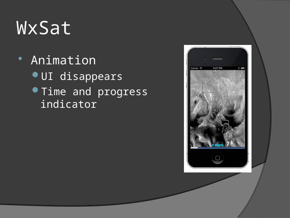
AnimationUI disappearsTime and progress indicator
WxSat
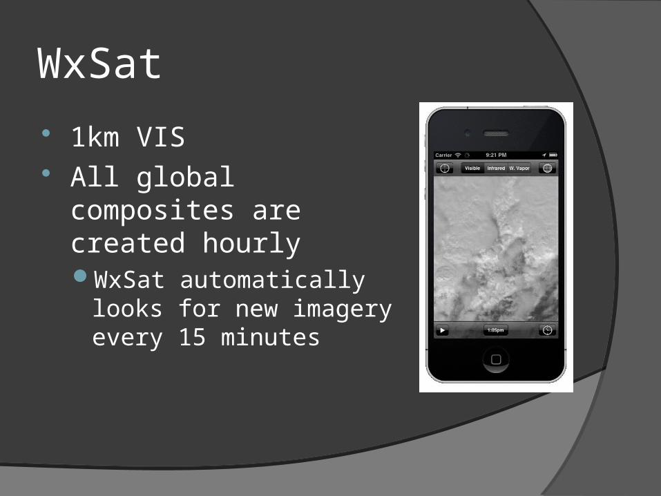
1km VIS All global composites are
created hourlyWxSat automatically looks for
new imagery every 15 minutes
WxSat
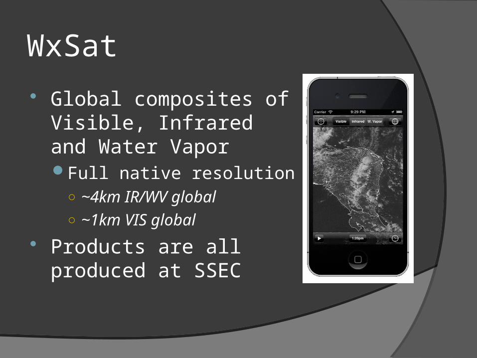
Global composites of Visible, Infrared and Water VaporFull native resolution
○ ~4km IR/WV global○ ~1km VIS global
Products are all produced at SSEC

WxSat
SSEC WMS backendWeb Map ServiceVery flexible product
cataloging and servingInfrastructure for ingest and
maintenanceOver 250 products currentlyThis App is one of many ways
to view the imagery
Summary
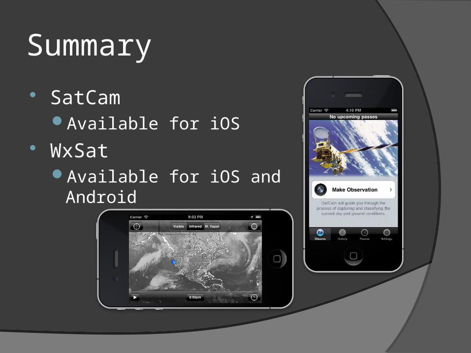
SatCamAvailable for iOS
WxSatAvailable for iOS and Android
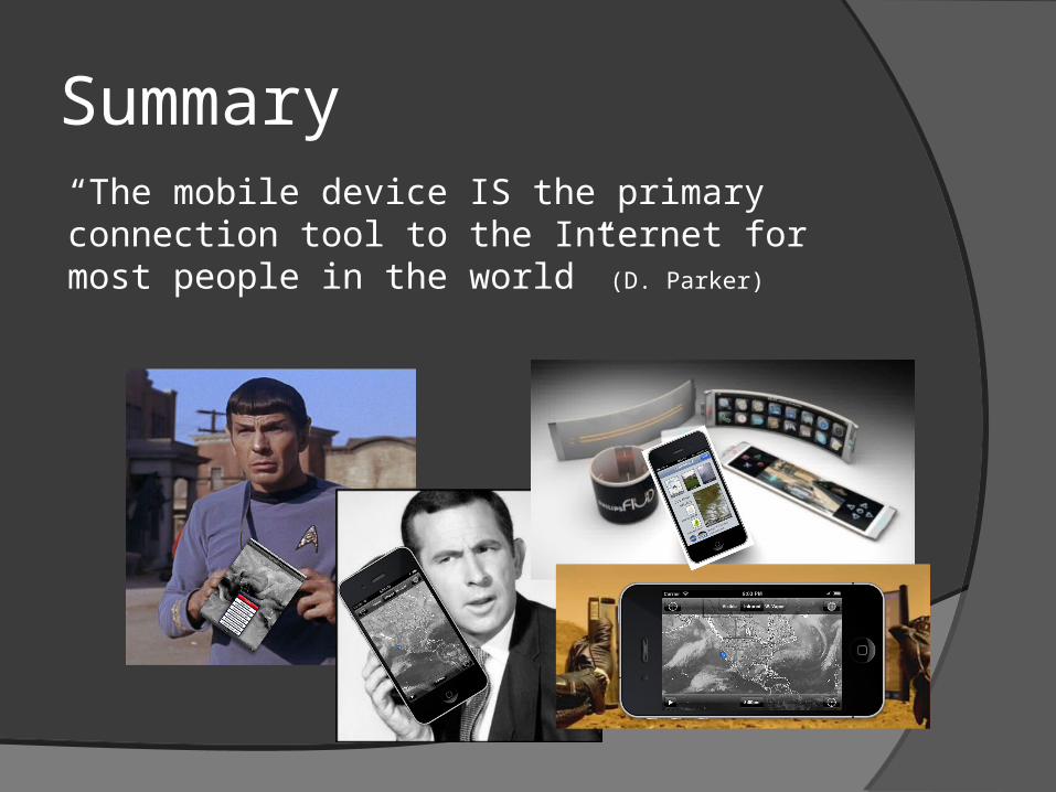
Summary“The mobile device IS the primary connection tool to the Internet for most people in the world” (D. Parker)