danish meteorological institute, ice charting and remote sensing division “siku” sea ice mapping...
Post on 19-Dec-2015
220 views
TRANSCRIPT
Danish Meteorological Institute, Ice Charting and Remote Sensing
Division
“SIKU”Sea Ice Mapping System
The DMI Approach
Henrik Steen Andersen
Danish Meteorological Institute
Danish Meteorological Institute, Ice Charting and Remote Sensing
Division
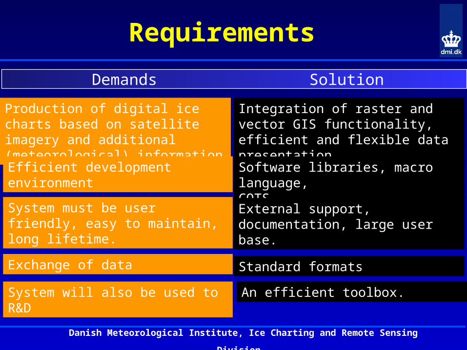
Requirements
Production of digital ice charts based on satellite imagery and additional (meteorological) information
Efficient development environment
System must be user friendly, easy to maintain, long lifetime.
Exchange of data
System will also be used to R&D
Integration of raster and vector GIS functionality, efficient and flexible data presentation.
Software libraries, macro language,COTS.
External support, documentation, large user base.
Standard formats
An efficient toolbox.
Demands Solution
Danish Meteorological Institute, Ice Charting and Remote Sensing
Division
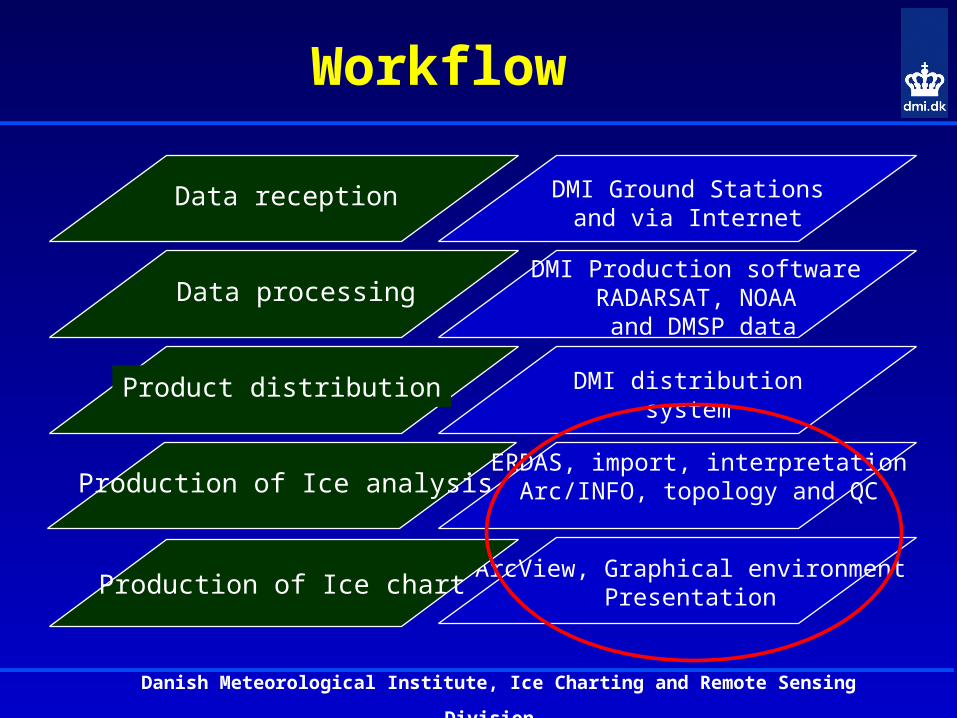
Workflow
Data processing
Product distribution
Production of Ice analysis
Data reception DMI Ground Stationsand via Internet
DMI Production softwareRADARSAT, NOAA
and DMSP data
DMI distributionsystem
ERDAS, import, interpretationArc/INFO, topology and QC
ArcView, Graphical environmentPresentationProduction of Ice chart
Danish Meteorological Institute, Ice Charting and Remote Sensing
Division
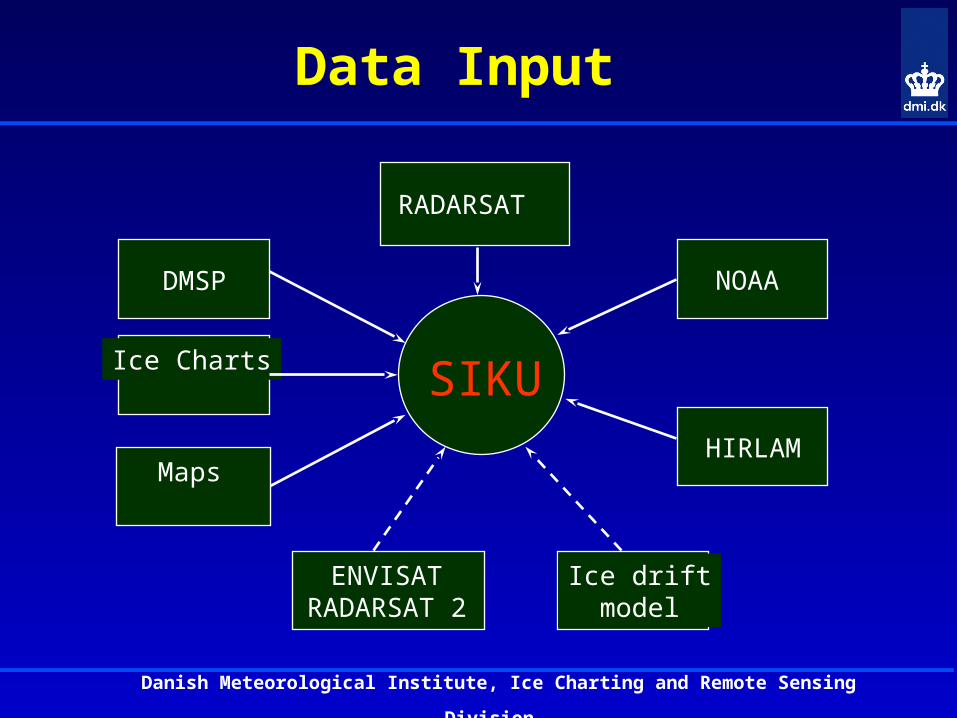
Data Input
RADARSAT
NOAADMSP
Ice Charts
Maps
SIKUHIRLAM
Ice driftmodel
ENVISATRADARSAT 2
Danish Meteorological Institute, Ice Charting and Remote Sensing
Division
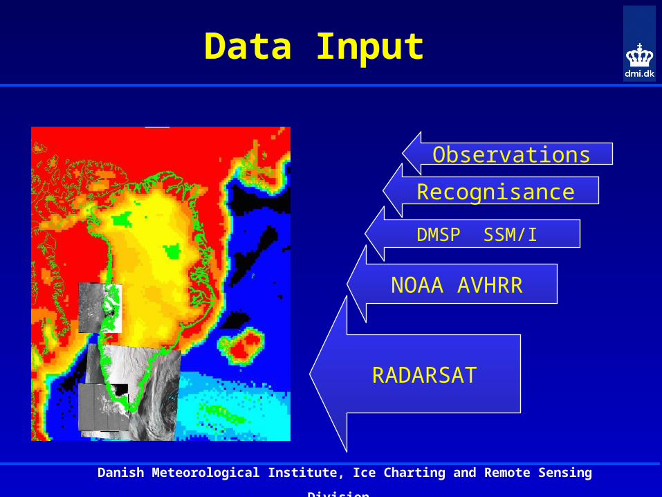
Data Input
Observations
Recognisance
NOAA AVHRR
RADARSAT
DMSP SSM/I
Danish Meteorological Institute, Ice Charting and Remote Sensing
Division
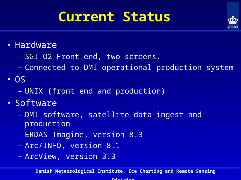
Current Status
• Hardware– SGI O2 Front end, two screens.– Connected to DMI operational production system
• OS– UNIX (front end and production)
• Software– DMI software, satellite data ingest and production– ERDAS Imagine, version 8.3– Arc/INFO, version 8.1– ArcView, version 3.3
Danish Meteorological Institute, Ice Charting and Remote Sensing
Division
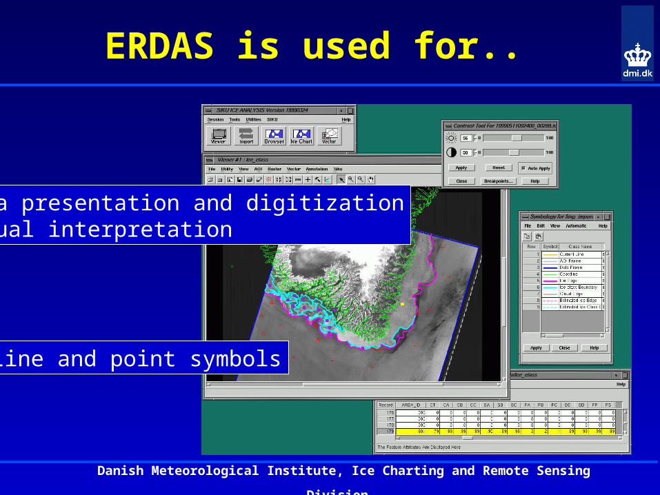
ERDAS is used for..
Data presentation and digitizationVisual interpretation
Line and point symbols
Danish Meteorological Institute, Ice Charting and Remote Sensing
Division
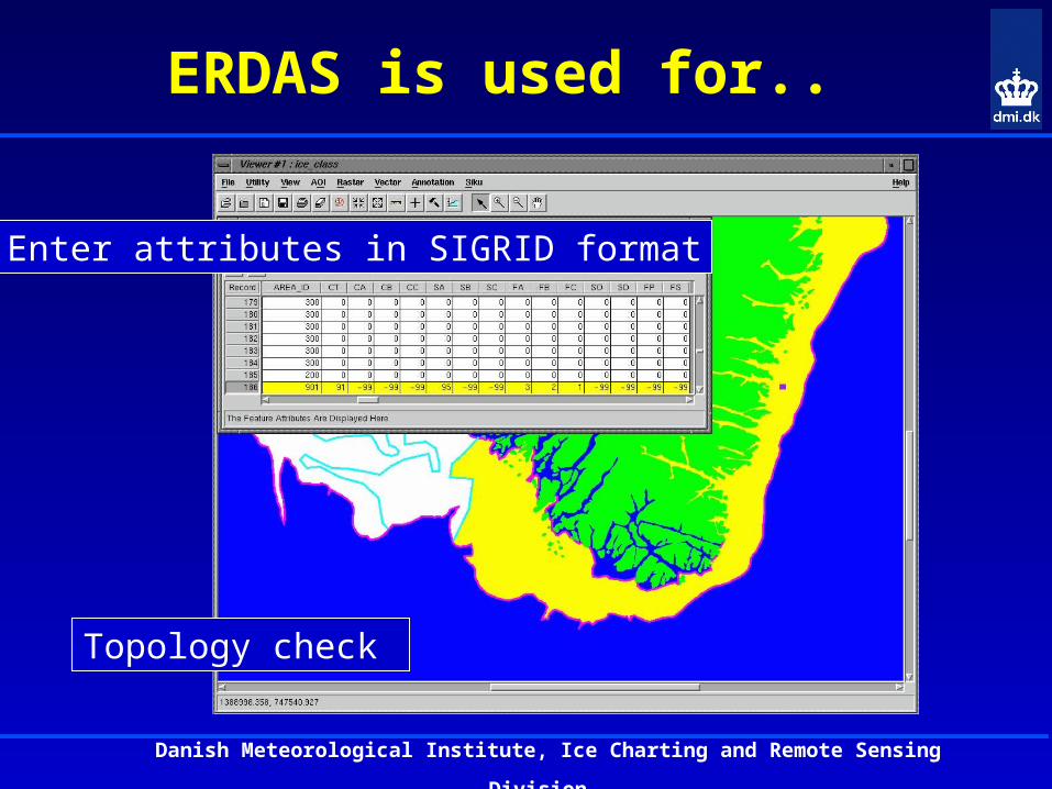
ERDAS is used for..
Enter attributes in SIGRID format
Topology check
Danish Meteorological Institute, Ice Charting and Remote Sensing
Division
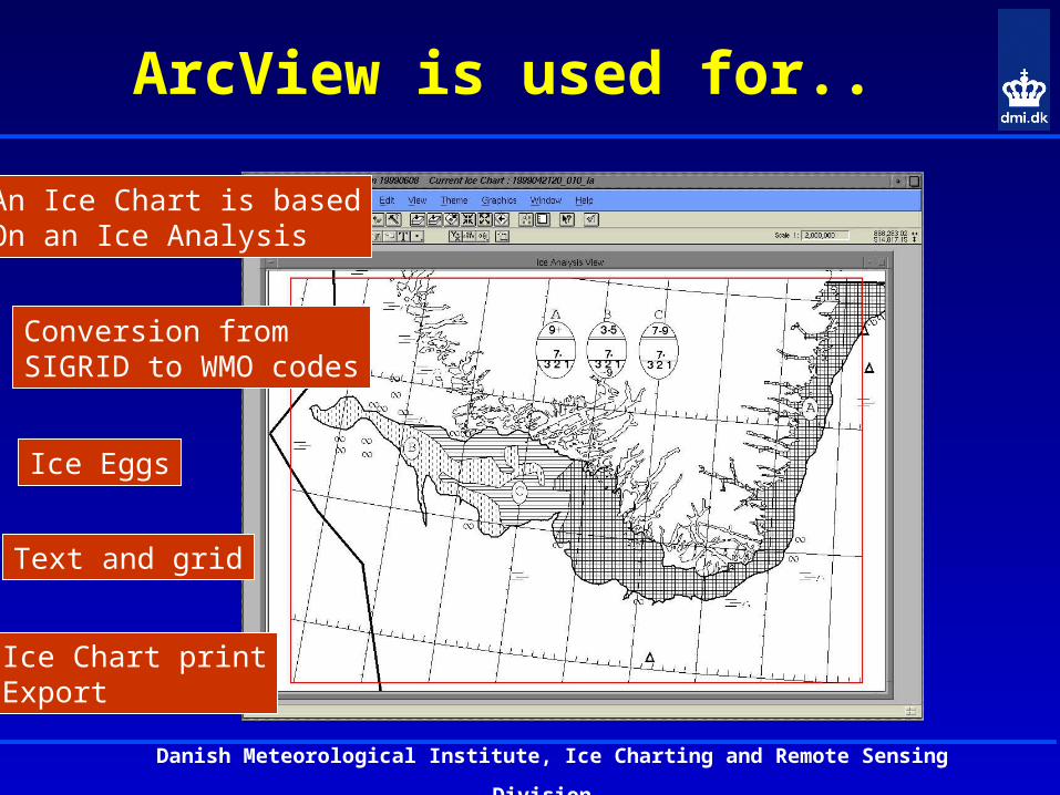
ArcView is used for..
Ice Chart printExport
Text and grid
Ice Eggs
Conversion fromSIGRID to WMO codes
An Ice Chart is basedOn an Ice Analysis
Danish Meteorological Institute, Ice Charting and Remote Sensing
Division
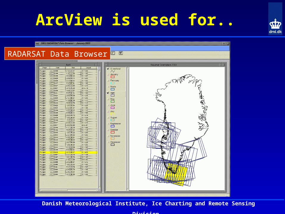
ArcView is used for..
RADARSAT Data Browser
Danish Meteorological Institute, Ice Charting and Remote Sensing
Division
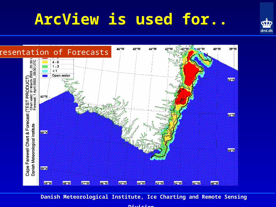
ArcView is used for..
Presentation of Forecasts
Danish Meteorological Institute, Ice Charting and Remote Sensing
Division
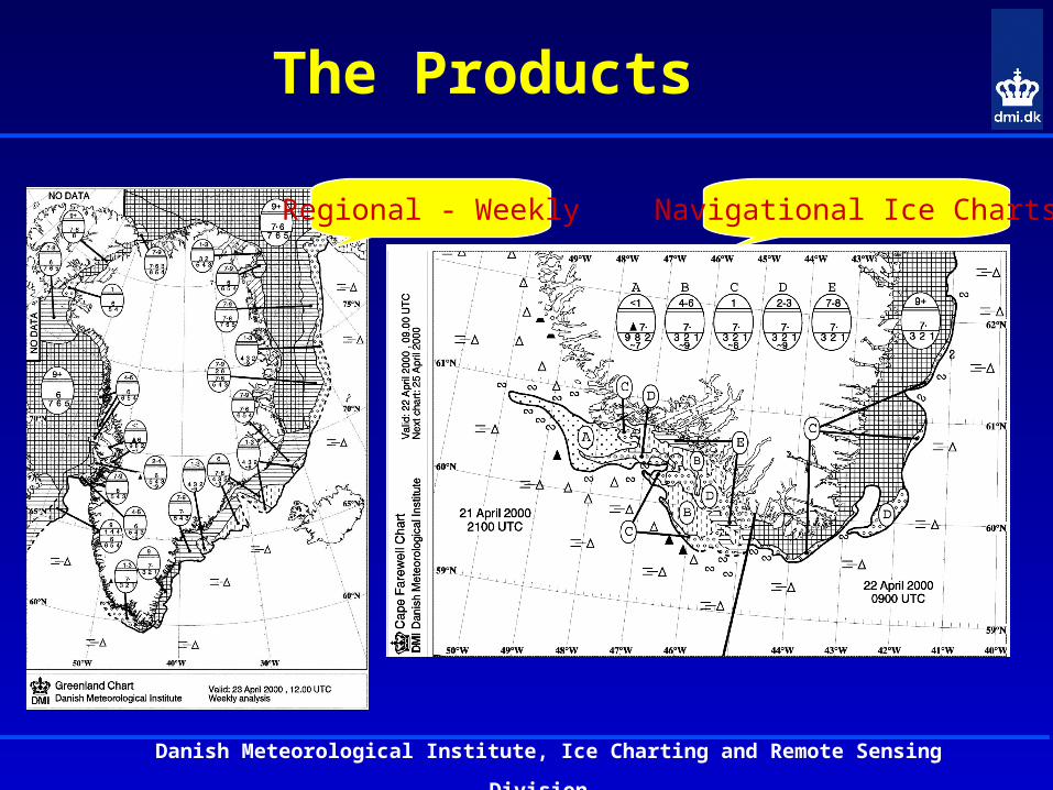
The Products
Regional - Weekly Navigational Ice Charts
Danish Meteorological Institute, Ice Charting and Remote Sensing
Division
What’s New ?
• The current version of SIKU has been working operationally since 1999
• The front end hardware is from 1998
• Only minor changes have been made since
Danish Meteorological Institute, Ice Charting and Remote Sensing
Division
Are the Ice Analysts Happy ?
• The ice analysts find SIKU satisfactory– The system is stable– The workflow is logical– Normally the system is not the limiting factor– We are getting the job done
Danish Meteorological Institute, Ice Charting and Remote Sensing
Division
Are the Ice Analysts Happy ?
• On the other hand ..– Basic functionality should be improved
• Easier selection of lines and symbols• A better way to enter area attributes• Optimize the digitization process
– Faster hardware would be nice– Add new information layers
Danish Meteorological Institute, Ice Charting and Remote Sensing
Division
Maintenance and Development
• The struggle between new ideas and resources– The system is customizable – The knowledge is available– We have plenty of new ideas– BUT human and economic resources are limited
Danish Meteorological Institute, Ice Charting and Remote Sensing
Division
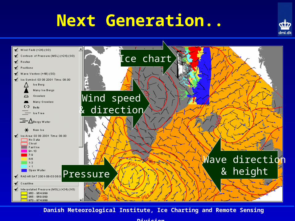
Next Generation..
Ice chart
Wind speed& direction
Pressure
Wave direction& height
Danish Meteorological Institute, Ice Charting and Remote Sensing
Division
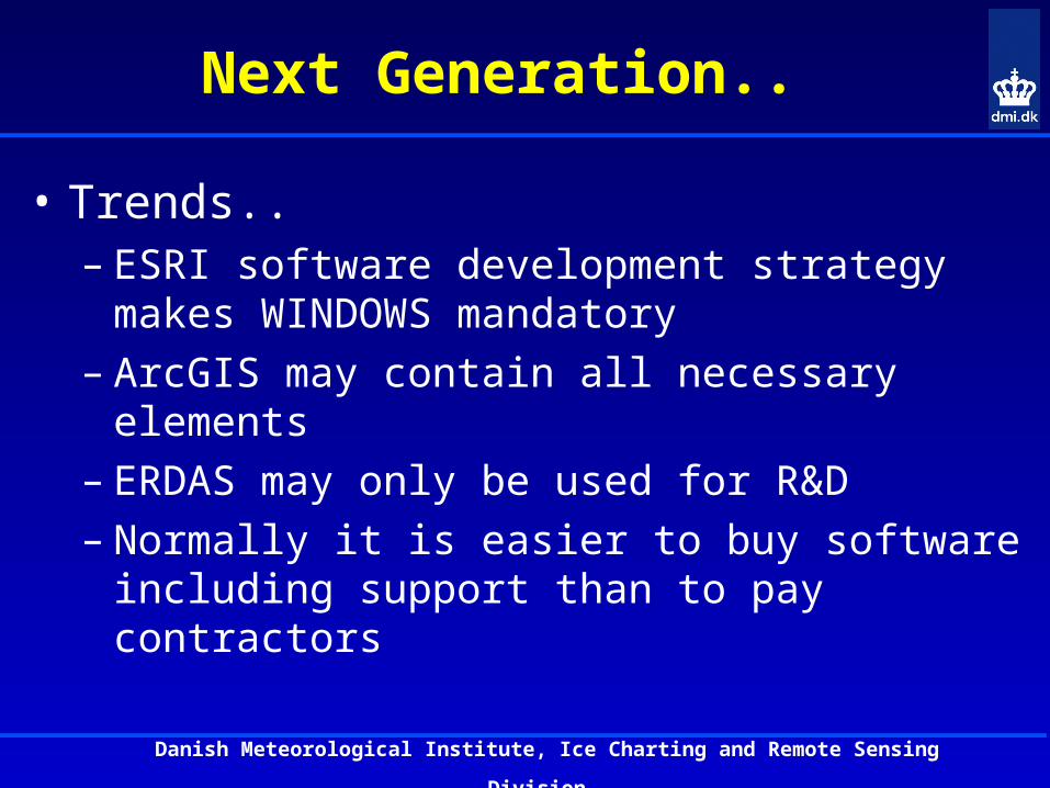
Next Generation..
• Trends..– ESRI software development strategy makes
WINDOWS mandatory – ArcGIS may contain all necessary elements – ERDAS may only be used for R&D– Normally it is easier to buy software including
support than to pay contractors
Danish Meteorological Institute, Ice Charting and Remote Sensing
Division
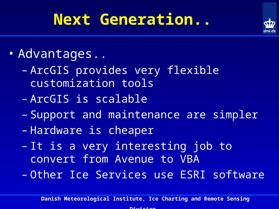
Next Generation..
• Advantages..– ArcGIS provides very flexible customization tools– ArcGIS is scalable – Support and maintenance are simpler – Hardware is cheaper– It is a very interesting job to convert from Avenue
to VBA– Other Ice Services use ESRI software
Danish Meteorological Institute, Ice Charting and Remote Sensing
Division
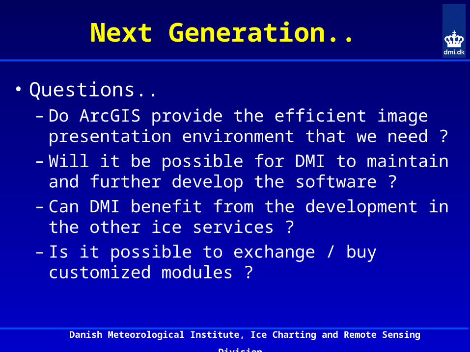
Next Generation..
• Questions..– Do ArcGIS provide the efficient image
presentation environment that we need ?– Will it be possible for DMI to maintain and further
develop the software ?– Can DMI benefit from the development in the
other ice services ?– Is it possible to exchange / buy customized
modules ?
Danish Meteorological Institute, Ice Charting and Remote Sensing
Division
The Way Forward..
• DMI most upgrade HW / SW within 1-2 years.
• Major DMI development efforts must be financed by external sources.
• Customized (front end) modules based on COTS could be a very interesting alternative.
• DMI possess the necessary technical skills to maintain the software and implement interfaces