dams and the environment an overview - 123eng and the environm… · · 2008-05-04dams and the...
TRANSCRIPT

DAMS AND THE ENVIRONMENT AN OVERVIEW

■ Dam construction evolved quite independently in East Asia.■
In 240 BC a stone crib was built across the Gukow River in China; this structure was 98 feet high and about 985 feet long. ■
Many earthen dams of moderate height (in some cases, of great length) were built by the Sinhalese in Sri Lanka after the 5th century BC to form reservoirs or tanks for extensive irrigation works. An Ancient dam, east from
Avdat, The Middle East
Dams: The historical perspective

Dams and Environment: In ancient civilization
•
Eight thousand years ago-
•
Sumerians built an irrigation based civilization between the Tigris and Euphrates rivers.
•
And then……
•
Lost it to the salinization that now plagues some 20% of Iraq’s arable territory

Dams-the present day global status
Today, most of the world’s large rivers are dammed
“Large” Dams: 40,000
Smaller Dams: 800,000(Source: International Commission on Large Dams)
Hoover Dam(1936) on Colorado River in Black Canyon, USA
John Day Dam,USA

What Dams do?
•
Anthropogenic alterations that disrupt dynamic processes and so impact on the ecological integrity of natural systems.
•
Dams disrupt the river continuum and cause upstream and downstream shifts in abiotic and biotic parameters and processes.
•
Rapid advancement in the irrigational projects, thereby rapid jump in the agricultural production, clean hydroelectricity power generation, navigation, aquaculture, recreational mega parks etc.
So,Benefits and detriments of dams have locked opponents and proponents in hot debate.
Recent decision in USA to decommission 51 dams has further aggravated the matter.

Impact Orders of Dams on the Environment

Impact Orders of Dams on the Environment
First order impactsImmediate abiotic effects that occur simultaneously with dam closure and influence the transfer of energy, and material, into and within the downstream river and connected ecosystems (e.g. changes in flow,
water quality and sediment load).
Second order impacts Changes in channel and floodplain morphology, changes in plankton, macrophytes
and periphyton. results from the modification of first order impacts These changes may take place over many years.
Third order impacts Long-term, biotic, changes resulting from the integrated effect of all the first and second order changes, e.g. changes in invertebrate communities and fish, birds and mammals. Complex interactions may take place over many years before a new “ecological equilibrium”
is achieved.

Case history:
The Nile River and its damming
■
Stretching over 800 miles, world's longest river, the Nile brought fresh water to all within reach of its valleys.
■
It delivered fertile silt from the steppes of Ethiopia to the coastal delta of the Mediterranean Sea.
■
Its seasonal flooding fertilizes and cleanses the surrounding lands allowing inhabitants to farm what would otherwise be non-arable acreage. Without this flooding, only 15,000 of the 383,000 square miles of arid Egyptian land would be able to support human life.
■
To survive, flood control and irrigation were the basis of the
earliest civilizations within Egypt. Thus, the planning for the Aswan Dam began.

■
Proposed in 1948, Soviet-
Egypt led construction began on January 9, 1960. and completed on January 15, 1971
■ It required a work force of fifty thousand people.
■ A final expense of $1
billion.
■ The High Aswan Dam , the world's biggest, is a rock-fill dam, made from several layers of packed sand, gravel, dirt and rubble.
■ The resulting dam is 364 feet (111 m) high, with a crest length of 12,562 feet
(3,830 m) and a volume of 57,940,000 cubic yard
s (44,300,000 cubic m).
The Aswan Dam

Aswan Dam: the positive sides
Flood control
Hydroelectricity: 180 water gates and 12 power generating units provide over 2.1 million kW of electric power. Every city, town and village within Egypt receive electrical power
Industrialization: Steel and chemical fertilizer plants were built around the Aswan dam
Land Irrigation : Additional two million acres within Egypt another five million acres within The Sudan
Additional Jobs: Increased agricultural economy increased crop production, created additional jobs within Egypt improving country welfare

Aswan Dam: Its detrimental sides
■
Massive scale of eviction: Over 120,000 people were forced to leave their homeland
■
Temples,ancient
tombs,beautiful
artifacts
and other archaeological sights had to be moved or quickly recovered. One such sight, Abu
Simbel took over $40 million and 4 years to save.
■
Elimination of the seasonal floods.
■
Aswan trapping 98% of the silt that travels down the Nile from Ethiopia
■
Down the Nile, delta receding and coastal farmland disintegrating
■
Salt water creeping up from the ocean into the ground water
■
Severe increase of schistosomiasis, a ‘still-water’ disease

What is schistosomiasis?
Schistosomiasis or bilharzia (after Theodor Bilharz, who first described the cause of urinary schistosomiasis in 1851)is a ‘still water’ disease, caused by a flatworm that lives within snails along the river and its canals, it infects the urinary tract and small
intestine. Sometimes, also referred to as snail fever, infection
is caused through direct contact with water carrying these microscopic organisms.
Prior to the building of the dam in Egypt, the canals would dry out killing the worms. With the newly created lake the water within the canals does not dry up and the worms are able to survive and as a result, the disease has spread very quickly through the nomadic tribes.

Life
cycle of Schistosomiasis

Hydro power potential: Indian scenarioIndia ranks 5th on Global scenario in terms of exploitable hydro potential.
Thus, in total Indiais endowed withhydro-potentialof about 2,50,000 MW
Hydro potentialexploited so far 29,500 MW
____________ Balance hydropower potentialto be harnessed: 2, 20,500 MW
That means, 88% of the potential is yet to be harnessed.
540 MW Chamera
Power Station (Himachal
Pradesh) Stage I. The Damsite

Dams: Indian scenario
The whole country seems to have a garland of dams.
Irrigational
potential: 4 fold increase from 22.6 million hectares in 1951 to about 89.6 million hectares by 1997.
Food grain production:36.8% of the increase from the irrigated area and 24.5% of the total increase came from areas irrigated by large dams.

SARDAR SAROVAR PROJECT (SSP)•
Sardar Sarovar Dam is on Narmada River in Gujarat
Narmada main canal and branch canalshttp://www.narmada.org/sardarsarovar.html

http://www.narmada.org/sardarsarovar.html

SARDAR SAROVAR DAM•
1210 m. length of concrete wall •
capacity of reservoir to impound-139 m. above sea level•
Middle section of the dam –
146.5 m.•
Advantages:•
Irrigation of 1.8 Million hectares of command area in Gujarat•
Irrigation of 75000 Hectares of command area in
Rajasthan•
Power generation capacity -
1450 Megawatts.•
Drinking water availability to around 2.35 million people in 8235 villages and 135 towns of Gujarat.
•
Disadvantages:•
Rehabilitation:Over 1 million people will lose land•
91000 acres of Gujarat, Madhya Pradesh and Maharashtra will be flooded.
•
Other problems-loss to national parks and sanctuaries ,destruction of natural environment, ecological imbalance, change in river hydrology and regime and can lead to imbalance in water
cycle etc.

Financial Cost•
No firm estimates for the total financial cost of SSP•
In 1985, the World Bank calculated the values of different parameters at which the project's net financial benefit would become zero.
Total cost +15% Total benefits -13% Power benefits -38% Dam implementation period +22% Irrigated yield -15%
•
World Bank agreed to lend $450 million for SSP in 1985. •
In 1991, to review the resettlement and environment components of the project- World Bank commissioned a team of experts.
•
Due to strong criticism of the report and increasing international pressure-
World Bank withdrawn from the project on March30, 1993.
•
This withdrawal under the pressure of Public awareness was first of its kind –in the history of the World Bank sponsored big dam projects.

How to Meet Gujarat's Water Needs ???
Ashvin Shah, a Gujarati scientist working with ASCE says-
•
SSP’s
planning has failed to benefit from the past four decades of experience with irrigation and water conservation schemes in India and elsewhere .
•
He claims, 34.5 billion cubic meters of rainwater could be collected within Gujarat each year, 50% more than the amount of water supposed to be made available by SSP
In spite of all scientific arguments going against SSP,the
authorities are not able to get rid
of the one track mindset of increasing the height of the dam in SSP.

Geography, Geomorphology and Seismicity for dams in Indian perspective
3 Major parts of India
•
Himalayan Region•
Indo-Gangetic Plains•
Peninsular India
Any project related to the construction of big dams should be considered by three different perspectives i.e. geographic, geomorphology and seismicity

Himalayan Region
•
Geographical view-extreme north of J & K to Arunachal Pradesh.
•
Geomorphological view- extensive rainfall (due to glaciers and snow –melting) which controls the fluvial characteristics and hydrology of the river regimes in the area.
•
Seismic view-
tectonically very active zone(refer tectonic map of India)
GPS studies have shown that due to geodynamic processes (i.e. plate movements) -different stress pattern have developed within the surface causing large magnitude earthquakes
in the Himalayan region.
Geoscientist have proved that large scale anthropogenic interventions by storing huge volume of water within the mountainous gorges can influence those plate and geodynamic movements.

Himalayan Region Contd….
Dam and Earthquakes
•
Dam induced seismicity has already been proved by the geoscientists in some of the low magnitude earthquakes (in Himalayan region)
•
Influence of active faults on big dams is sometimes catastrophic
–that may results into cracks, sippage and ultimately causing flash floods and total destruction.

Indo-Gangetic Plains
•
Geographical view-Its between two seismically active zones i.e. Himalayan region and the peninsular region.
•
Geomorphological view -Himalayan Rivers transport huge volume of sediments every year due to floods which leads to:
Maintenance of fertility of soil and Flushing of toxic material.
So environmentalists have taken flood in a positive way rather than taking it as a natural hazard.
•
Now scientists has started emphasizing over the need of planned flooding rather than confining the rich sediments at a fixed place by constructing dams in the way of river regimes.
•
Seismic view- tectonically stable corridor as compared to other two (as shown in the tectonic map of India)
•
Kosi
river in Bihar, a highly avulsive
river of Indo-gangetic plains •
Q-Whether this avulsive movement is due to tectonics , floods or something else???
•
In that situation, studies should be done with proper attentionto the tectonic aspects of Dams and causes of clogging as well.
Indo-Gangetic Plains Contd….

Peninsular India•
Geographical view- Falls under tropical climate (refer climate map of India)
•
Geomorphological view-This region holds a very important position in India-
as far as crop production is concered.•
Seismic view-The recent earthquakes shows -
region is tectonically very active. (refer tectonic map of India)
Some Facts about the region-•
Needs a lot of water -modern farming practices for higher crop
production
•
Water disputes between states should be solved to fulfill the water-
demand. (Example-Kaveri water disputes)
•
Implementation of river-networking project is important to meet out the water needs of the region. (so many Dams and canals)
So due to construction of so many dams and reservoirs, the seismicity of this already seismically active zone would increase.
•
Again in that situation, studies should be done with proper attention to the tectonic aspects of Dams as well as reservoirs.

http://www.mapsofindia.com/

http://www.mapsofindia.com/


Hydro potentialin the NE IndiaUntapped hydro potential in theBrahmaputra river Basin.
66,065 MW Planned capacity addition by NHPC in North Eastern Sector in XIth
and XIIth
plan.22,300MW
Projects runningSubansiri
Lower(2000 MW) is supposed to be completed by September 2010Detailed projects under preparation1. Subansiri
Middle (1600 MW) and & Subansiri
Upper (2000 MW)2. Dibang (3000 MW)3. Siang Lower (1600 MW)Projects under survey & investigation for preparation of feasibility reportSiang Upper/Intermediate
Stage-I site (11000 MW), Arunachal Pradesh
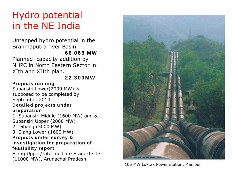
105 MW Loktak Power station, Manipur

Difficulties in hydro potential exploration in NE India1. Environment & Forest clearance.Investment decision and implementation of many projects are delayed due to non receipt of clearances in time.2. Rehabilitation and Resettlement (R&R)Projects get delayed due to opposition from environmentalist and
Project Affected People (PAPs) from the project in respect of finalisation of R& R package. Recently a National Policy on R&R has been issued by Ministry of Rural Development in Feb'04.3. Land AcquisitionRequires large areas of land for infrastructure works as well as
for project's components including submergence. The process of land acquisition is quite cumbersome and requires simplification of procedures.4. Law and orderMost of the Projects of NHPC in North Eastern States are badly affected with militancy and insurgency. Due to inadequate safety for persons working at the sites, projects like Loktak Down stream H.E. Project in Manipur are delayed. 5. Geological SurprisesBulk of the balance hydro power potential is available in the Himalayan region. Geological surprises especially in underground works are common in this area which result in time and cost over-run.6. Inter-State River Disputes.7. Natural CalamitiesAs Hydropower projects are located in hilly terrains, land slides, hill slope collapses & road blocks, flood and cloud burst cause severe set backs in construction schedules.
(Source: Annual Report 2003-2004, NHPC)

Why the state is in a hurry to exploit hydro potential of NE India?Peak hour power need for the whole of the Assam state ~
900 MW Power need for the entire NE region <2000 MW. Massive future planning for industrial growth in the NE region? NoThen, why the state is in a hurry?
Subansiri
Lower(2000 MW)The Damsite.
Availability Based Tariff system (ABT), Electricity Act, 2003, Continued Accelerated Power Development and Reform Programmes (APDRP), antitheft legislation, one time settlement scheme with SEBs and new Power Tariff Policy etc. Electricity Act, 2003 has widespread implications for entire power sector. Notably, the Act opens up the opportunities in generation, transmission and distribution & trading of power. The Act provides an option to the power producers to sell their electricity whereby they are not required to route their power through SEBs.
(Source: Annual Report 2003-2004, NHPC)

Big dam business: How profitable It is?
The Annual Report of the NHPC shows the profit margin as 34%. Interest and financing charges show around 19%. After a couple of years, once the bills of these charges are cleared, the amount of profit can obviously reach a whooping slice of 50% plus. The long term intention of the state is obvious. Use public money to build up the infrastructure. Then gradually hand it over to the big private houses.

Experience from a recent field study
(Power et al., 1998)


Experience from a recent field study..
•
This presents a small instance of how little concern is shown towards geological considerations when big civil constructions are undertaken.
•
Especially, detailed fault mapping must be done thoroughly before going for constructions like big dams. (if dam is proposed in a seismically active zone )

Do we really need big dams?
To realize the gravity of the question following 11 points should be kept in mind:
■1. Dams constitute obstacles for longitudinal exchanges
along fluvial systems and as such result in the fragmentation (i.e. reduced connectivity) of ecosystems.
■2. Drastic change in sediment and nutrient regimes
and altered water temperature and chemistry.
■3.
A significant impact on transport rates and retention
within the river system.
■4. Permanent destruction of terrestrial ecosystems
through inundation.
■5. Large reservoirs and associated infrastructure (e.g. roads, pipelines and powerlines etc.) may disrupt natural migration corridors.

Do we really need big dams? (continued)
■ 6. Terrestrial ecosystems are replaced
by lacustrine littoral and sublittoral habitats and pelagic mass water circulations replace riverine flow patterns. There is usually a decline in the total number of species
■ 7. The most common downstream effect
of large dams is reduction of flood peaks, thereby reducing the frequency, extent and duration of floodplain inundation.
Reduction of channel-forming flows reduces channel migration.
■ 8. Truncated sediment transport (i.e. sedimentation within the reservoir) results in complex changes in degradation and aggregation below the dam.
■ 9. The temporal pattern of flooding is altered by regulation affecting ultimately the ecological integrity
of river ecosystems.
■ 10. Besides all these techno-scientific aspects, the massive scale of eviction
associated with each successive stages of barrage construction is simply mind
boggling. Say for example, Aswan Dam related eviction -
over 120,000 people
■ 11. Historical sights and relics, the priceless symbols of civilization are also affected. One such sight in Egypt, Abu Simbel took over $40 million and 4 years to save while Aswan Dam was being constructed and many others were lost beneath the waters and the increasing layers of silt.

Big Dams : A social activist’s standpoint
Himangshu
Thakkar, a social thinker observes:What have India achieved in the process of spending over Rs.80,000 crores, 51 years and the various alternative development opportunities that have been lost in the process?
Drought prone area has gone up.Flood prone area has gone up.No. of habitations without adequate source of safe drinking water is still very large.Water-logged and salinised areas have gone up.We have managed to convert major areas into grey and dark in terms ofgroundwater availability.We have managed to destroy a very rich tradition of communitytechnologies and institutions of local water harvesting.Most importantly, we have managed to destroy the very sense ofbelongingness of the communities to their water resources.

Alternative Example: Israel
• Semi-arid, Mediterranean climate
•
Since the 1980s,using drip irrigation and micro-sprinkle technique to expand crop output (vegetables and fruit trees).
•
Computerized irrigation systems; depend on plant moisture sensors to operate the system automatically.
•
Also, these techniques were combined with the use of water- efficient crops and other dry farming techniques.
•
Resulting irrigation efficiency: 90 percent, compared to the 64 percent efficiency of a furrow irrigation system.
• Between 1975 and 1998, water requirements fell
from 2.85 acre-feet/acre to 1.78 acre-feet/acre.
•
While water efficiency increased and water use continued to decrease, agricultural output increased twelve fold.

Conclusion:
■
The days of big dams are over. The big dams have already served their purpose.
■
A number of alternatives are there to derive the same advantages we get from the big dams.Some of the alternatives are:
□ More equitable sharing of the available water□ Water harvesting□ Water conservation□ Making existing water supply and irrigation
schemes more efficient □ Restoration of degraded watershed vegetation and,□ Making farming practices less water and energy
intensive.

Conclusion (continued):
In the Indian context,
■
There is ample scope to exploit wind, solar, tidal and biomass energy resources.
■
If hydroelectricity is found to be the best alternative for some
places, thorough geo-scientific investigations should be carried out and optimum size of the dams should be fixed accordingly.
■
For any dam to construct, public debate should be encouraged. Mega profit for some selective corners should not be labeled as" Public welfare”
■
Taking queue from the ‘small is beautiful’, smaller dams, much less risky than the mega dam projects, should be given
preference over big dams.

Thank You