dahod - smart cities missionsmartcities.gov.in/.../uploadfiles/files/annexures_dahod.pdfchhab talab...
TRANSCRIPT

Smart City Annexures
Dahod

Smart City Proposal (SCP) template Annexure 2: Self Assessment Form
P a g e | 1
A N N E X U R E 2 : S E L F - A S S E S S M E N T F O R M ( D A H O D )
A B C D E F G H I J K
Feature Definition Scenario 1 (BASE)
Scenario 2 Scenario 3 Scenario 4 (ADVANCED)
Self-assessment of the city (for Pan-City solution) or area (for Area-based development), with regard to each feature
Basis for assessment, and /or quantitative indicator Optional) – only if data exists
Projection of “where the city wants to be” with regard to the feature/indicator
Input/initiative that would move the city/area from its current status to Advanced status (Scenario 4)
1 Citizen participation
A smart city constantly shapes and changes course of its strategies incorporating views of its citizen to bring maximum benefit for all. (Guideline 3.1.6)
The City begins identifying priorities and projects to pursue without consulting citizens.
City undertakes citizen participation with some select stakeholders. The findings are compiled and incorporated in some projects or programme. Very few major decisions are shared with citizen until final projects are unveiled.
City conducts citizen engagement at city level and local area level with most stakeholders and in most areas. The findings are compiled and incorporated in projects or programs.
City constantly conducts citizen engagement with people at each ward level to incorporate their views and these shape priorities and development projects in the city. Multiple means of communication and getting feedback such, both face-to-face and online are utilised. The effectiveness of city governance and service delivery is constantly enhanced on the basis of feedback from citizen.
Scenario 2
As of now, Dahod ULB
conducts discussions with
Elected Representatives,
Nagar Palika officials,
Standing Committee and with
stakeholders from the
respective field of decision to
be taken.
Once any project is finalized,
citizens are made aware from
the website and city-wide
advertisement hoardings.
More details about particular
decision is availed to citizen
on requests.
Scenario 4
1. As a pan city initiative, Dahod
Smart City will offer a “One
Stop Shop” application
platform, CONNECTED
DAHOD, comprising web /
app/ KIOSK mediums, for
anything about city and its
citizens. There will be a section
of comments on each of the
application page to enable
citizens give direct feedback to
any department’s working and
its service delivery. This will
enable government make
ground reality check about any
department performance in all
area the city.
2. Also, as part of the same pan
city initiative, CONNECTED
DAHOD will be offering user
forums. Where citizens will be
able to speak loud about any
new initiative to be taken in
their city or improving any
existing area of interest.
3. Institutional initiative: A public
consultation cell would be
established in DNP as part of
Intelligent Command and
Control Centre (I3C) of
CONNECTED DAHOD, to
invite, record, compile,
categorise and analyse the
public inputs and forward it to
concerned departments/
authorities. Databank of such
inputs should be properly
stored on DNP website and
updated and made available to
all departments for cross
referencing.
4. Also the platform will enable
online public-hearing meeting
for upcoming projects and
discussions to make
improvements for the citizens
and cooperation required.
5. The CONNECTED DAHOD
will directly be integrated with
various social media platforms.

Smart City Proposal (SCP) template Annexure 2: Self Assessment Form
P a g e | 2
A B C D E F G H I J K
Feature Definition Scenario 1 (BASE)
Scenario 2 Scenario 3 Scenario 4 (ADVANCED)
Self-assessment of the city (for Pan-City solution) or area (for Area-based development), with regard to each feature
Basis for assessment, and /or quantitative indicator Optional) – only if data exists
Projection of “where the city wants to be” with regard to the feature/indicator
Input/initiative that would move the city/area from its current status to Advanced status (Scenario 4)
2 Identity and culture
A Smart City has a unique identity, which distinguishes it from all other cities, based on some key aspect; its location or climate; its leading industry, its cultural heritage, its local culture or cuisine, or other factors. This identity allows easy answer to the question “why in this city and not somewhere else”. A Smart City celebrates and promotes its unique identity and culture. (Guideline 3.1.7)
There are few architectural monuments, symbols and festivals that emphasise the unique character of the city. Built, natural and cultural heritage is not preserved and utilised or enhanced through physical, management and policy structures.
Historic and cultural resources are preserved and utilised to some extent but limited resources exist to manage and maintain the immediate surroundings of the heritage monuments. New buildings and areas are created without much thought to how they reflect the identity and culture of the city.
Historic and cultural resources are preserved and utilised and their surroundings are well-maintained. Public spaces, public buildings and amenities reflect the cultural identity of the city.
Built, natural and intangible heritage are preserved and utilised as anchors of the city. Historical and cultural resources are enhanced through various mediums of expression. Public spaces, open spaces, amenities and public buildings reflect local identity and are widely used by the public through festivals, events and activities.
Scenario 1
1. Dahod is situated in the
tribal heartland of Gujarat.
And with its location near
border of two state make
Dahod a city with different
culture, inclined towards
tribal community culture.
2. Dhol mela of tribal,
Gaykuri festival are
identity to this area apart
from all festivals of
Gujarat.
3. A Shiva temple belonging
to the 12th Century and
Aurangazeb Fort are
historical monuments in
and around the city.
4. Chhab Talab is also an
important recreational
point due to its central
location. There is a garden,
small amusement park and
a food joint.
5. Despite having all this,
none of them are well
maintained and there is
almost no tourism out of it.
Scenario 3 1. Complete cleaning of the
historical Chab Talab Lake has
been taken with various
initiatives like jogging and
cycling tracks in order to
restore and maintain this
unique identity point of Dahod.
2. Development of Tribal
Museum is identified as an
initiative for ABD proposal.
Apart from this, an Exhibition
Centre dedicated to Bhil tribes
is also a part of ABD.
3. To encourage the cottage
industry, a digital marketplace
has been taken as pan city
initiative.
4. With use of advanced
technological pan city solution,
Dahod will certainly maintain
its identity as Medical Centre
for citizens of 1000+ tribal
villages around Dahod. And
this is also sustain the faith of
people in medical systems of
Dahod.
3 Economy and employment
A smart city has a robust and resilient economic base and growth strategy that creates large-scale employment and increases opportunities for the majority of its citizens. (Guideline 2.6 & 3.1.7 & 6.2)
There are some job opportunities in the city but they do not reach all sections of the population. There are a high number of jobs in the informal sector without sufficient facilities.
There is a range of job opportunities in the city for many sections of the population. The city attempts to integrate informal economic activities with formal parts of the city and its economy.
There are adequate job opportunities for all sections of society. But skill availability among residents can sometimes be a challenge.
There are adequate job opportunities for all sections of income group and skill levels. Job-oriented skill training supported by the city and by industry. Economic activities are suited to and build on location and other advantages of the city.
Scenario 2
1. Dahod is the major market
place for border districts of
Rajasthan, Madhya
Pradesh and Gujarat.
Economy of the city is
driven by Agriculture and
Agro based products.
2. APMC Market of Dahod is
second largest in Gujarat.
Among working
population 85% are
engaged in tertiary sectors.
3. DNP under GULM
provides i-card for
vendors, skill training,
placement & financial
assistance for urban areas.
Scenario 4
1. Digital initiates are planned for
increasing the influence of
GULM in providing training &
placement opportunities and
financial assistance, to enable
women and tribal be more self-
sustain and also earn better
livelihood.
2. Creation of Transit Hub and
promoting the Agro based
Industries will increase the
employment within the City
and the benefits will further
enhance with the
implementation of GST.
3. Integration of all skill
development centre with
industries will enabled
balanced generation of skill-set
with actual skill demand. This
will enable skill resource find
right job quickly and industry
find right resource well in time.
Smart City Proposal (SCP) template Annexure 2: Self Assessment Form
P a g e | 3
A B C D E F G H I J K
Feature Definition Scenario 1 (BASE)
Scenario 2 Scenario 3 Scenario 4 (ADVANCED)
Self-assessment of the city (for Pan-City solution) or area (for Area-based development), with regard to each feature
Basis for assessment, and /or quantitative indicator Optional) – only if data exists
Projection of “where the city wants to be” with regard to the feature/indicator
Input/initiative that would move the city/area from its current status to Advanced status (Scenario 4)
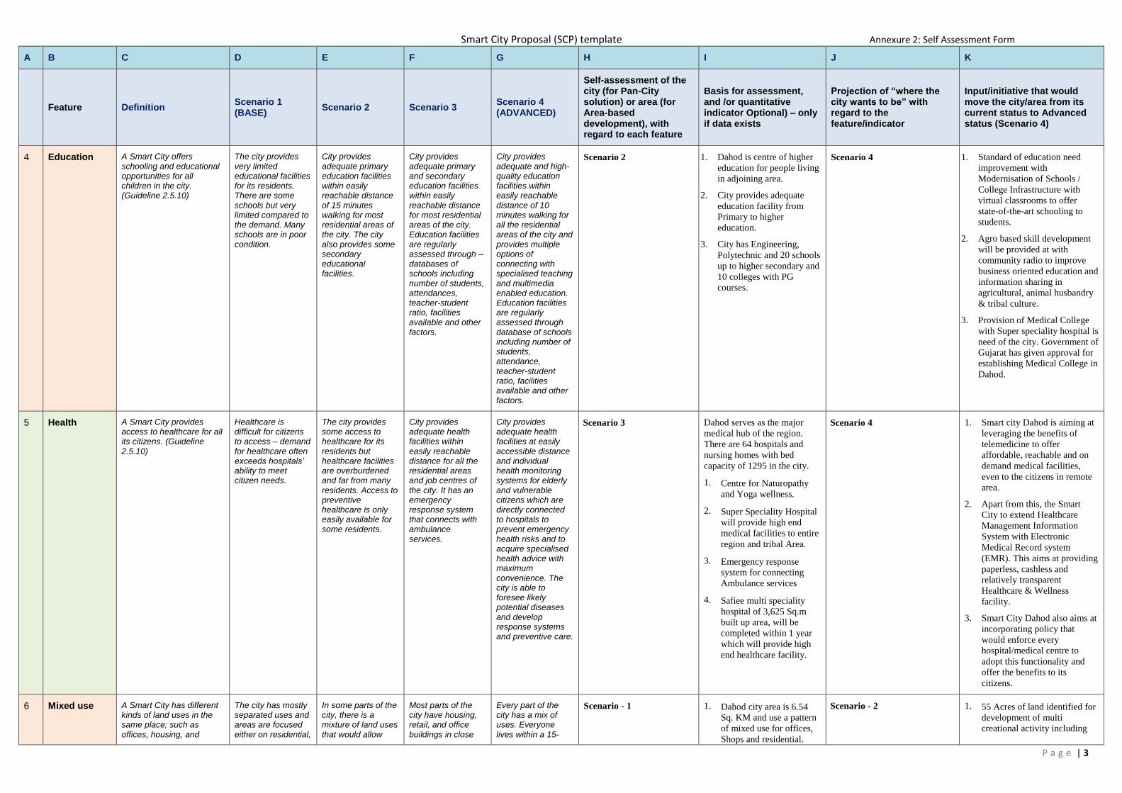
4 Education A Smart City offers schooling and educational opportunities for all children in the city. (Guideline 2.5.10)
The city provides very limited educational facilities for its residents. There are some schools but very limited compared to the demand. Many schools are in poor condition.
City provides adequate primary education facilities within easily reachable distance of 15 minutes walking for most residential areas of the city. The city also provides some secondary educational facilities.
City provides adequate primary and secondary education facilities within easily reachable distance for most residential areas of the city. Education facilities are regularly assessed through – databases of schools including number of students, attendances, teacher-student ratio, facilities available and other factors.
City provides adequate and high-quality education facilities within easily reachable distance of 10 minutes walking for all the residential areas of the city and provides multiple options of connecting with specialised teaching and multimedia enabled education. Education facilities are regularly assessed through database of schools including number of students, attendance, teacher-student ratio, facilities available and other factors.
Scenario 2
1. Dahod is centre of higher
education for people living
in adjoining area.
2. City provides adequate
education facility from
Primary to higher
education.
3. City has Engineering,
Polytechnic and 20 schools
up to higher secondary and
10 colleges with PG
courses.
Scenario 4
1. Standard of education need
improvement with
Modernisation of Schools /
College Infrastructure with
virtual classrooms to offer
state-of-the-art schooling to
students.
2. Agro based skill development
will be provided at with
community radio to improve
business oriented education and
information sharing in
agricultural, animal husbandry
& tribal culture.
3. Provision of Medical College
with Super speciality hospital is
need of the city. Government of
Gujarat has given approval for
establishing Medical College in
Dahod.
5 Health A Smart City provides access to healthcare for all its citizens. (Guideline 2.5.10)
Healthcare is difficult for citizens to access – demand for healthcare often exceeds hospitals’ ability to meet citizen needs.
The city provides some access to healthcare for its residents but healthcare facilities are overburdened and far from many residents. Access to preventive healthcare is only easily available for some residents.
City provides adequate health facilities within easily reachable distance for all the residential areas and job centres of the city. It has an emergency response system that connects with ambulance services.
City provides adequate health facilities at easily accessible distance and individual health monitoring systems for elderly and vulnerable citizens which are directly connected to hospitals to prevent emergency health risks and to acquire specialised health advice with maximum convenience. The city is able to foresee likely potential diseases and develop response systems and preventive care.
Scenario 3
Dahod serves as the major
medical hub of the region.
There are 64 hospitals and
nursing homes with bed
capacity of 1295 in the city.
1. Centre for Naturopathy
and Yoga wellness.
2. Super Speciality Hospital
will provide high end
medical facilities to entire
region and tribal Area.
3. Emergency response
system for connecting
Ambulance services
4. Safiee multi speciality
hospital of 3,625 Sq.m
built up area, will be
completed within 1 year
which will provide high
end healthcare facility.
Scenario 4
1. Smart city Dahod is aiming at
leveraging the benefits of
telemedicine to offer
affordable, reachable and on
demand medical facilities,
even to the citizens in remote
area.
2. Apart from this, the Smart
City to extend Healthcare
Management Information
System with Electronic
Medical Record system
(EMR). This aims at providing
paperless, cashless and
relatively transparent
Healthcare & Wellness
facility.
3. Smart City Dahod also aims at
incorporating policy that
would enforce every
hospital/medical centre to
adopt this functionality and
offer the benefits to its
citizens.
6 Mixed use A Smart City has different kinds of land uses in the same place; such as offices, housing, and
The city has mostly separated uses and areas are focused either on residential,
In some parts of the city, there is a mixture of land uses that would allow
Most parts of the city have housing, retail, and office buildings in close
Every part of the city has a mix of uses. Everyone lives within a 15-
Scenario - 1
1. Dahod city area is 6.54
Sq. KM and use a pattern
of mixed use for offices,
Shops and residential.
Scenario - 2
1. 55 Acres of land identified for
development of multi
creational activity including

Smart City Proposal (SCP) template Annexure 2: Self Assessment Form
P a g e | 4
A B C D E F G H I J K
Feature Definition Scenario 1 (BASE)
Scenario 2 Scenario 3 Scenario 4 (ADVANCED)
Self-assessment of the city (for Pan-City solution) or area (for Area-based development), with regard to each feature
Basis for assessment, and /or quantitative indicator Optional) – only if data exists
Projection of “where the city wants to be” with regard to the feature/indicator
Input/initiative that would move the city/area from its current status to Advanced status (Scenario 4)
shops, clustered together. (Guidelines 3.1.2 and 3.1.2)
commercial, or industrial, with little co- existence of uses. The average resident cannot walk to the closest market or shop near his or her home. For almost everyone, going to work or going shopping for basic needs requires a journey by automobile or bus of more than 15 minutes. Land use regulations prevent putting commercial or office locations in residential neighbourhoods and vice versa.
someone to live, work, and shop in close proximity. However, in most areas, there are only small retails stores with basic supplies near housing. Most residents must drive or use public transportation to access a shop for food and basic daily needs. Land use rules support segregating housing, retail, and office use, but exceptions are made when required.
proximity. Some neighbourhoods have light industrial uses within them, (e.g. auto repair, craft production). Land use rules allow for mixed uses.
minute trip of office buildings, markets and shops, and even some industrial uses. Land use rules require or encourage developers to incorporate a mixture of uses in their projects.
Major streets are walk
able and approachable
from every corner of the
city.
2. 15 Nos. of Small Paver
blocks for Parking are
planned and work is
going on.
commercial, truck parking and
hospitality.
2. The location identified for
developing affordable
housing, sports complex and
new shops are on the same
street. Special emphasis was
on ensuring that all this
utilities are easily walkable
and should reachable in
maximum 5 minutes.
3. The new Nagar Palika
building and Sabji Mandi
building are comprising of
office space, commercial
space, Sabji Mandi and
parking facility.
7 Compact A Smart City encourages development to be compact and dense, where buildings are located close to one another and are ideally within a 10-minute walk of public transportation, forming concentrated neighbourhoods. (Guidelines 2.3 and
5.2)
The city is expanding rapidly at its periphery into undeveloped land, rural or natural areas, or along industrial corridors - both formally and informally. Formal new development is occurring in a way that is "sprawling," meaning that the buildings spread across a wide area and are far from one another. Residents or tenants find it easier or safer to travel by automobile because it takes a long time to walk between destinations and there are busy roads separating buildings. Large pockets of land in the inner-city are vacant. New developments at the periphery tend to be large-scale residential developments, often enclosed with a gate
The city has one or two high density areas - such as the city centre, or historic areas, where buildings are concentrated together and where people can walk easily from building to building and feel as though they are in centre of activity. Most of the city consists of areas where buildings are spread out and difficult to walk between, sometimes with low-density per hectare. Regulations tend to favour buildings that are separated from one another, with lots of parking at the base and set-back from the streets. The city likely has some pockets of under- utilized land in the centre. New formal developments at the periphery tend to be large-scale residential developments, often
The city has multiple high density clusters that are easy to walk around where buildings are close together. However, the city actively encourages development to occur on under-utilized parcels of land into high-density, walkable areas. When new formal large-scale development projects happen at the periphery, they are encouraged to be dense and compact, with buildings that are close together and line the streets. The city actively encourages or incentivizes re-development of under- utilized parcels in the inner-city, especially those located close to public transportation.
The city is highly compact and dense, making the most of land within the city. Buildings are clustered together, forming walkable and inviting activity centres and neighbourhoods. Regulations encourage or incentivize re-development of under- utilized land parcels in the city centre. Buildings are oriented to the street - - and parking is kept to a minimum, located below ground or at the back of buildings. Public transport and walking connects residences to most jobs and amenities. Residential density is at an optimal with affordable housing available in most areas.
Scenario – 3
1. The city has two high
density areas - such as the
area near bus stand and
old city area, where
buildings are concentrated
together and where people
can walk easily from
building to building and
in close proximity of
Market.
2. The city is compact in
nature, due to the
surrounding land
acquisition prohibitions.
The city is spread around
1600 acres and hosts
96000 population. The
travel distance from north
end of the city to south
end is not more than 5
km.
3. City cannot have
horizontal growth because
of smaller municipal
boundary, so city growth
is vertical & compact.
Scenario -3
1. Compact housing and
commercial planned at the
identified location will further
encourage compact nature of
the city.
2. The envisaged ABD initiatives
are formulated to make sure
that the new Verticulture parks
are created at the existing
gardens. Also the existing
recreational space will be
appended with
jogging/walking spaces and
cycling tracks so that the
compact city identity can be
sustained easily.
3. There are 4 smart eco-friendly
buses which will be covering
the four city end points and
area in between, two more
eco-friendly smart mini buses
will be used for connecting
citizens with the industrial
area in the vicinity of the city
and farmers with city activity.
Two more eco-friendly buses
has been identified which will
be shared between schools to
help child reach to the schools
easily and offer hassle-free
ride.

Smart City Proposal (SCP) template Annexure 2: Self Assessment Form
P a g e | 5
A B C D E F G H I J K
Feature Definition Scenario 1 (BASE)
Scenario 2 Scenario 3 Scenario 4 (ADVANCED)
Self-assessment of the city (for Pan-City solution) or area (for Area-based development), with regard to each feature
Basis for assessment, and /or quantitative indicator Optional) – only if data exists
Projection of “where the city wants to be” with regard to the feature/indicator
Input/initiative that would move the city/area from its current status to Advanced status (Scenario 4)
and oriented to the automobile.
enclosed with a gate and oriented to the automobile.
8 Public open spaces
A Smart City has sufficient and usable public open spaces, many of which are green, that promote exercise and outdoor recreation for all age groups. Public open spaces of a range of sizes are dispersed throughout the City so all citizens can have access. (Guidelines 3.1.4 & 6.2)
The city has very few usable public open spaces and very few usable green spaces. Available recreational spaces are located far away and are dispersed at long distances around the city. The few available public open spaces offer a limited variety of experiences for all sections of population and age groups such as places for sport, places for rest, and places for play.
A variety of public open spaces is available in some neighbourhood, but is not available in all the areas of the city or is located far away from residential areas. Many of the open spaces have access restrictions, or are not well- maintained. A variety of types of public open spaces may be lacking, such as natural areas, green areas, parks, plazas, or recreation areas.
Most areas of the city have some sort of public open space. There is some variety in the types of public spaces in the city. However, public spaces are sometimes not within easy reach or access of more vulnerable populations and are more restricted in poorer neighbourhoods.
Public open spaces are well dispersed throughout the city. Every residential area and work space has access to open space within
10 minutes walking distance. Open spaces are of various types - natural, green, plazas, parks, or recreation areas - which serve various sections of people. Public spaces tend to truly reflect the natural and cultural identity of the city.
Scenario -2
1. A variety of public open
spaces is available in
some neighbourhood,
such as Chaab Talav,
Gardens.
2. As of now 3% of the city
area has green cover.
3. There are total of 3
gardens in the city apart
from Chab Talav area.
Scenario -4
1. More green Spaces need to be
developed all over city.
Development of the Chaab
Talav for providing more
green Spaces, Cycle track and
Pedestrian Facility need to be
developed. Chab Talav area
covers almost 15-17% of the
city area.
2. Development of vertical farms
(verticulture) will further
expand the green cover of the
city.
3. Development & new gardens
at Plot No 93 and Plot No 92
will increase the green cover
to 8%.
9 Housing and inclusiveness
A Smart City has sufficient housing for all income groups and promotes integration among social groups. (Guidelines 3.1.2)
Housing is very limited and highly segregated across income levels. Population growth far exceeds the creation of new housing. The poor live in informal settlements with limited to no access to basic services, and are concentrated in a few areas. The wealthy live in separate enclaves. Those in the middle have few, if any options.
Housing is available at most income levels but is highly segregated across income levels. Population growth slightly exceeds the creation of new housing. The wealthy and the middle class have housing that meets their needs at costs appropriate to their income. The poor live in informal settlements.
Housing is available at all income levels, but is segregated across income levels. The growth of supply of housing almost meets the rate of population growth. Increasingly, lower and middle-income people can find housing in areas that are conveniently located.
A wide range of housing is available at all cost levels. The supply of housing is growing at pace with population. Affordable, moderate, and luxury housing are found clustered together in many areas of the city
Scenario -3
1. City has 14 notified
Slums and are receiving
city services without any
discretion to the area.
2. Total household in slum
are 4130.
3. Total Slum population is
20650.
4. 480 units are ready as per
IHSDP, draw will be held
before end of March
Scenario -4
1. Construction of EWS Housing
on Indore highway for 1100
slum dwellers under PPP/
Pradhanmantri Awas Yojana
for Slum areas of Talav
Bhilwad and Harijanwas.
2. Converting ABD area slum
free and the same is extended
to pan city subsequently.
10 Transport A Smart City does not require an automobile to get around; distances are short, buildings are accessible from the sidewalk, and transit options are plentiful and attractive to people of all income levels. (Guidelines 3.1.5 & 6.2)
Personal automobile centric city with very few modal options. Long trip lengths for daily commute to work and education. Accessing various areas by walking or cycling is difficult. Women and vulnerable sections find it very difficult to move independently
The street network system is elaborate but public transport choices are restricted. Public transport can be too expensive or unaffordable for the poor. Pedestrian infrastructure is only available in select areas. The majority of investments focus
Network of streets are fairly complete. Public transport covers most areas of the city. However last mile connectivity remains incomplete and affects transport options. Foot paths are accessible in most areas, whereas concerns
Street network is complete and follows a clear structure. Public transportation network covers the entire city and intensity of connection relates with the demand. Plenty of options of public transport are available and
Scenario -1
1. The major roads in the
city are radial in character
and the minor roads
follow a grid pattern.
2. All the important roads
radiate from the centre of
the town outwards to the
respective regional
destinations.
Scenario – 4 1. Area based interventions like
pedestrian walkways,
encroachment free roads,
smart parking and intelligent
traffic management system
with proper use of modern
technologies.
2. The city has 72 km of road
and out of which 15 km long
road has been identified as the
smart road.

Smart City Proposal (SCP) template Annexure 2: Self Assessment Form
P a g e | 6
A B C D E F G H I J K
Feature Definition Scenario 1 (BASE)
Scenario 2 Scenario 3 Scenario 4 (ADVANCED)
Self-assessment of the city (for Pan-City solution) or area (for Area-based development), with regard to each feature
Basis for assessment, and /or quantitative indicator Optional) – only if data exists
Projection of “where the city wants to be” with regard to the feature/indicator
Input/initiative that would move the city/area from its current status to Advanced status (Scenario 4)
in the city. There is limited public transport. Vehicles cause high air and noise pollution levels in the city. Vehicles dominate public spaces and affect their effective functioning.
on reducing traffic congestion through the creation of more roads.
of safe crossings and security throughout the day remain. Parking zones are demarcated but absence of pricing increases over utilization of parking lots.
affordable for all sections of the society. There is multi-modal integration at all mass transit stations and organized-priced on street and off street parking. Walking and cycling is prevalent.
3. There is no public
transport available in the
city.
4. Movement of any vehicle
other than two wheelers
create traffic problem.
The town needs removal
on the basis of
decongestion and better
accessibility.
3. 40 eco-friendly buses will be
added to the transportation
option.
4. 8 eco-friendly buses will be
running out of which 4 will be
running pan city, 2 will be
utilized as eco-friendly school
buses. The rest two will be
running in vicinity of the city
and provide easy commute to
the farmers, tribal and women
from the vicinity and it can
also be kept as a spare bus.
5. Construction of over bridge on
Dudhimati River (for
connecting APMC market
with NH59) and isolating
heavy goods carrier vehicles
entering into City area.
6. 15 Nos. of Small Paver blocks
for Parking are planned and
work is going on to decongest
roads.
11 Walkable A Smart City's roads are designed equally for pedestrians, cyclists and vehicles; and road safety and sidewalks are paramount to street design. Traffic signals are sufficient and traffic rules are enforced. Shops, restaurants, building entrances and trees line the sidewalk to encourage walking and there is ample lighting so the pedestrian feels safe day and night. (Guidelines 3.1.3 & 6.2)
The city is designed mainly for the automobile. Daily life without a car requires long bus rides. Walking is difficult and often dangerous; there are few pavements, existing pavements need repair and lack trees to provide shade for pedestrians, and marked pedestrian crossings are rare. New buildings have their main entrances set-back from the street, sometimes with large driveways or parking lots separating them from the street, and sometimes are enclosed by gates. Traffic signals are often disobeyed
Older areas of the city see a mix of pedestrians, cyclists, and vehicles but newer areas are focused mainly on the automobile. In the new areas, there are few pavements and main entrances to new buildings are not accessible from the front of the street. Large driveways or parking lots often separate them from the street, and sometimes are enclosed by gates. In these areas, traffic signals are disobeyed.
The city has a good network of pavements and bike lanes. Buildings in most areas of the city are easily accessible from the pavement. However, traffic signals are sometimes disobeyed and it can feel difficult to cross the street.
The city is highly walkable. Pavements exist on every street and are maintained. Trees line many sidewalks to provide shade for pedestrians. Buildings in most areas of the city are easily accessible from the sidewalk. Traffic signals control the flow of automobiles and are enforced. A network of bike lanes exists to promote cycling as a means of transport. Traffic rules are followed and enforced with great seriousness.
Scenario -2
Dahod is spread up in 6.6 Sq.
KM. City Centre is walk able,
approachable from every
corner of the city.
Scenario -4
1. Construction of pathways
along major roads and
increase from 8Km coverage
to 18 Km.
2. Doulatganj Bazar-
Nagarpalika-MG Road-Talav
Janta Chowk & Sardar
Chowk-Netaji Bazar-
Nagarpalika-Manik Chowk-
Bhagini Samaj road, from
Railway station to Godra road
via Kabrasthan for Exit of Bus
.(icluding utility duct,
footpath, cycle track with solar
canopy, smart pole, ditigal
signages -15 kms approx)
3. The smart road will also be
offering special cycle tracks.
12 IT connectivity
A Smart City has a robust internet network allowing high-speed connections to
City has no major plans to bring increased high
The city has made plans to provide high speed internet
The city makes has high speed internet connectivity
The city offers free wifi services to provide opportunity
Scenario -2
Broadband internet
connectivity in the city is
moderate. City has plans to
Scenario -4
1. Dedicated trenches for Optical
fiber Cables. Laying of city’s

Smart City Proposal (SCP) template Annexure 2: Self Assessment Form
P a g e | 7
A B C D E F G H I J K
Feature Definition Scenario 1 (BASE)
Scenario 2 Scenario 3 Scenario 4 (ADVANCED)
Self-assessment of the city (for Pan-City solution) or area (for Area-based development), with regard to each feature
Basis for assessment, and /or quantitative indicator Optional) – only if data exists
Projection of “where the city wants to be” with regard to the feature/indicator
Input/initiative that would move the city/area from its current status to Advanced status (Scenario 4)
all offices and dwellings as desired. (Guideline 6.2)
speed internet connectivity to the public.
connectivity through the existing framework.
available in most parts of the city.
for all the citizens to connect with high speed internet across the city.
provide high speed internet
connectivity through existing
framework.
own fiber network for City
Services.
2. Pan City initiatives to increase
City wide WiFi connectivity
for city services.
3. With 100 smart poles, 100
public Wi Fi end points will
also be covered and thus this
will make the entire of the city
a wifi enabled city. Making it
easily accessible.
4. Furthermore, affordable wifi
plans will further encourage
citizens to use high speed
internet.
13 ICT-enabled government
services
A Smart City enables easy interaction (including through online and telephone services) with its citizens, eliminating delays and frustrations in interactions with government. (Guidelines 2.4.7 & 3.1.6 & 5.1.4 & 6.2)
Essential Government services are not linked with online platforms. Paper intensive interactions with the local Government continues. Receiving services and response to citizen complaints take a long time. There is limited availability of data to monitor service delivery.
Some of the public services are provided online and infrastructure for total digitalization is not in place. Service delays occur regularly in some sectors. Responses to citizen inquiries or complaints are often delayed. No integration between services and billing.
Most of the services are provided online and offline. Data transparency helps monitoring. Systems and processes to better coordinate between various Government agencies are being developed.
All major services are provided through online and offline platforms. Citizens and officials can access information on accounting and monitor status of projects and programs through data available on online system. Robust data infrastructure system shares information and enhances internal governmental coordination.
Scenario -2
DNP has its website and
information on website.
www.dahodnagarpalika.co.in
Scenario -4
1. Development of e-Governance
module for all municipal
services online, online bill
payment, applications,
building plan sanction, Birth
Certificate, etc.
2. Development of a “one stop
shop” for all citizen services.
It will be named as
CONNECTED DAHOD and
would comprise mobile, web
application platform and
KIOSK interface to offer all e-
government services to its
citizens.
3. With the inclusion of
Intelligent Command and
Control Center would, in real
time, monitor the city
condition. This will be
offering improved service
delivery and vigilant service
monitoring.
14 Energy supply
A Smart City has reliable, 24/7 electricity supply with no delays in requested hookups. (Guideline 2.4)
There is only intermittent electricity supply with regular power shedding. Many residents have to plan their days around when power is available.
Electricity supply and loads are managed as per demand and priority for various functions with clear scheduling, with electricity being available in many areas for most hours of the day.
Electricity is available in most parts of the city for most hours of the day but some areas are not so well-served. Smart metering exists in some parts of the city but not all.
Electricity is available 24 x 7 in all parts of the city with smart metering linked to online platforms for monitoring and transparency.
Scenario -2
1. Dahod has one 132 KV
substation in Panchmahal
District.
2. There is 4 hours in a week
load shading for
scheduled maintenance.
Scenario -4
1. To provide 24X7 power, with
IPDC scheme, redundant 132
kV feeder for main substation
is planned.
2. Smart Energy is proposed in
this SCP, which will have:
Ring main Unit, Self Healing
Grid, SCADA for Remote
Monitoring & Control of

Smart City Proposal (SCP) template Annexure 2: Self Assessment Form
P a g e | 8
A B C D E F G H I J K
Feature Definition Scenario 1 (BASE)
Scenario 2 Scenario 3 Scenario 4 (ADVANCED)
Self-assessment of the city (for Pan-City solution) or area (for Area-based development), with regard to each feature
Basis for assessment, and /or quantitative indicator Optional) – only if data exists
Projection of “where the city wants to be” with regard to the feature/indicator
Input/initiative that would move the city/area from its current status to Advanced status (Scenario 4)
Electric distribution System.
Underground electrical
Cabling.
3. Self-healing Grid System for
Distribution Substation for
automatically identification
and fault correction. This will
improve the reliability of
power supply and reduce
unscheduled outages. Remote
monitoring & Control
Solutions for Distribution
System.
15 Energy source
A Smart City has at least 10% of its electricity generated by renewables. (Guideline 6.2)
The city does not have any renewable sources of energy and there is no commitment to promote this for the forseeable future.
The city is preparing plans for ensuring that it gets more energy from renewable sources and is in the process of making commitments in this regard.
Some energy consumed in the city is produced through renewable sources. There are long term targets for higher renewable energy capacities and the city is making plans to achieve these.
At least 10% of the energy used in the city is generated through renewable sources. The city is undertaking long-term strategic projects to tap renewable sources of energy in its region/beyond to increase the percentage of renewable energy sources.
Scenario -1
100% power from Grid. No
renewable energy source.
Solar water heaters are used
by 50% population
Scenario -4
1. Installation of Solar Panels on
Government Buildings,
schools, hospitals, etc. is
proposed as part of ABD. This
identified area will cater to 1.2
MW generation (18% of Total
Consumption).
2. Solar canopy on 15km long
smart road is also proposed in
this SCP.
3. Apart from this, Development
of Solar based Electrical
crematorium (Smashan
Bhumi) at Plot No. 231 & 221
is also proposed in this SCP.
16 Water supply A Smart City has a reliable, 24/7 supply of water that meets national and global health standards. (Guidelines 2.4 & 6.2)
The city has a poor water supply system with limited water availability. There are no clear targets to achieve higher quality and optimal quantity standards. Unaccounted water loss is above 40%
The city has intermittent water supply and availability. However it is setting targets and processes in place to try to improve its water supply. Unaccounted water loss is less than 30%.
The city has 24 x 7 water supply in most areas but the quality of water does not meet international health standards. Unaccounted water loss is less than 20%.
The city has 24 x 7 treated water supply which follows national and global standards and also available in sufficient quantity and affordable across all sections of the society. Unaccounted loss less than 15%.
Scenario -1
1. Presently DNP is supplying
100 LPCD potable water.
Scenario -2
1. LPCD to increase from 100 to
140 LPCD(40%) by
establishing a new water
source & treatment plant
(Kadana Water Base); to be
completed by August, 2017.
2. The treated water supply will
be increased by 423% (33
MLD from 7.8) by Aug, 2017.
3. Coverage of water supply
connection: increased from
68% to 85% of households.
4. Reduction in NRW: The NRW
is reduced marginally from
35% to 28% by supplying at
low-to-medium pressure in
order to reduce the water
leakage and improve NRW.

Smart City Proposal (SCP) template Annexure 2: Self Assessment Form
P a g e | 9
A B C D E F G H I J K
Feature Definition Scenario 1 (BASE)
Scenario 2 Scenario 3 Scenario 4 (ADVANCED)
Self-assessment of the city (for Pan-City solution) or area (for Area-based development), with regard to each feature
Basis for assessment, and /or quantitative indicator Optional) – only if data exists
Projection of “where the city wants to be” with regard to the feature/indicator
Input/initiative that would move the city/area from its current status to Advanced status (Scenario 4)
17 Water management
A Smart City has advanced water management programs, including smart meters, rain water harvesting, and green infrastructure to manage storm water runoff. (Guideline 6.2)
The city does not measure all its supply. It does not recycle waste water to meet its requirements and rain water harvesting is not prevalent. Flooding often occurs due to storm water run-off.
The city has meters for all its water supply but lacks mechanisms to monitor. Water wastage is very high. Some, but not much, rainwater harvesting exists.
The city has meters for all its water supply with some smart mechanisms to monitor. Rainwater harvesting systems are installed and storm water is collected and stored in water bodies. However, recycling of waste water and re-usage of storm water is limited.
The city has meters for all its water supply. It includes smart mechanisms to monitor remotely. Rainwater harvesting systems are installed and utilised through the city and storm water is collected and stored in water bodies and treated for usage. Recycled waste water is supplied for secondary uses.
Scenario -1
1. At present there are no
water meters and water
supply is intermittent.
2. Water charges are also
standard rates and are not
charged per the usage.
Scenario -4
1. Smart water meters has been
identified as the pan city
initiative of this SCP: Water
network & GSR, ESR
augmentation, SCADA system
to monitor the supply. This
initiative aims at: Coverage
from 80 to 100%, NRW from
30% to 10%, Metering 0% to
100%, Collection efficiency
from 50% to 90%. 24x7 water
supply and usage based
charges.
2. The smart water meter will
also make sure that the city
offers equitable water supply
to every citizen. Before end of
this year, there will be almost
400% increase in treated water
supply with adding “Kidana
Water Treatment” plant.
3. Rain water harvesting for
existing govt buildings,
schools, Hospitals and New
Buildings will be permitted
only with rain water
Harvesting.
18 Waste water
management
A Smart City treats all of its sewage to prevent the polluting of water bodies and aquifers. (Guideline 2.4)
The city is unable to treat all its sewage. Many local sewer lines open on to water bodies and open ground and pollute the environment.
Most waste water is collected and treated before disposal. However the treated water does not meet standards and is not recycled for secondary uses.
All the waste water is collected and treated before disposal. It is also treated to a high standard and some is recycled.
The city has zero waste water because all the waste water is collected, treated and recycled. It meets standards and reduces the need for fresh water.
Scenario -1
1. The city has open
drainage system.
2. Underground sewerage
network is constructed by
GWSSB for 80%
coverage. Out of which,
60% is operational.
Scenario -3
1. STP of 17.4 MLD capacity is
identified as the ABD project
for this SCP.
2. 100% coverage for
underground Sewerage
network which will be
connected to STP.
3. 100% Sewerage will be
treated and reuse of treated
water for Mega GIDC,
flushing, gardening and
Agricultural use.
19 Air quality A Smart City has air quality that always meets international safety standards. (Guideline 2.4.8)
City does not have plans, policies or programs to improve the air quality. Systems to monitor air quality are absent.
City has programs and projects to monitor air quality and spatialising the data to ascertain reasons for degrees of pollution in the air. A few strategies to decrease air pollution have been implemented.
City has programs and projects to monitor air quality and spatialising the data to ascertain reasons for degrees of pollution in the air. Pollution levels are acceptable.
The city has clean air by international standards. Live Air quality monitoring cover the entire city and data of air quality are mapped.
Scenario -1
Dahod is not covered under
national air monitoring
programme.
Scenario -4
1. With this SCP, city is aiming
at having 100 smart poles
which would be sufficient to
cover the entire of the city. It
will be having environment
sensors mounted on same.
With the help of data feeder,
live environment status will be
sent to the Intelligent
Command and Control Center,

Smart City Proposal (SCP) template Annexure 2: Self Assessment Form
P a g e | 10
A B C D E F G H I J K
Feature Definition Scenario 1 (BASE)
Scenario 2 Scenario 3 Scenario 4 (ADVANCED)
Self-assessment of the city (for Pan-City solution) or area (for Area-based development), with regard to each feature
Basis for assessment, and /or quantitative indicator Optional) – only if data exists
Projection of “where the city wants to be” with regard to the feature/indicator
Input/initiative that would move the city/area from its current status to Advanced status (Scenario 4)
where it will be monitored in
real time. Which will enabled
government to be active and
reactive in the case of
environmental emergency or
issues to citizens.
2. Use of sharing e-Auto
Rickshaws, and eco-friendly
buses are also proposed in this
SCP. Which will be
contributing in low generation
of carbon footprint.
20 Energy efficiency
A Smart City government uses state-of-the-art energy efficiency practices in buildings, street lights, and transit systems. (Guideline 6.2)
City has no programs or controls or incentive mechanisms to promote or support energy efficiency in buildings
The city promotes energy efficiency and some new buildings install energy efficiency systems that track and monitor energy use and savings.
Most new public buildings install energy efficiency systems and some older buildings are also retrofitted to be more energy efficient. Local government conducts counselling and outreach with developer, businesses and residents to adopt energy efficiency strategies
All the existing old and new public buildings employ energy efficiency principles in development and operation and apply for energy rating by national and international forums. Many non-public buildings are also energy efficient because the government promotes energy efficiency through incentives and regulations.
Scenario -1
1. Renewable energy
generation in the city is
nil.
2. Solar water heaters are
used in 50% of the
houses.
Scenario -2
1. The smart city aims at having
solar panels and LED lights at
all new buildings which are
getting developed as part of
ABD area.
2. It will be having meters to
understand how much of the
energy is getting supplied
back to the GRID.
3. Apart from that, the smart city
also encourages its citizen to
take maximum benefits of the
Solar Roof Top policy from
the Ministry of New and
Renewable Energy,
Government of India.
21 Underground electric Wiring
A Smart City has an underground electric wiring system to reduce blackouts due to storms and eliminate unsightliness. (Guideline 6.2)
City does not have plans for underground electric wiring system.
More than 40% of the city has underground electric wiring system.
More than 75% of the city has underground electric wiring system.
More than 90% of the city has underground electric wiring system.
Scenario -1
1. At present all the
distribution line are over
ground and transformers
are installed on road side
creating traffic
congestions and
obstructing foot path
creation.
Scenario -2
1. Converting the over ground
electricity distribution line to
Underground for ABD Area.
22 Sanitation A Smart City has no open defecation, and a full supply of toilets based on the population. (Guidelines 2.4.3 & 6.2)
Many parts of the city do not have access to sanitation infrastructure and facilities.
Sanitation facilities are available to 70% of the city's population.
Sanitation facilities are available to 90% of the city's population.
Sanitation facilities are available to 100% of the city's population.
Scenario -3
1. 100% ODF.
2. Census data and
discussions with DNP
officials.
Scenario -4
1. Awareness campaign under
Swachya Bharat Abhiyan for
construction of individual
toilets.
2. Construction of 10 public e-
toilets are proposed in this
SCP at sustaining the city’s
Open Defecation Free status.
This is very much required as
Dahod sees over 25K floating
population/visitors daily.

Smart City Proposal (SCP) template Annexure 2: Self Assessment Form
P a g e | 11
A B C D E F G H I J K
Feature Definition Scenario 1 (BASE)
Scenario 2 Scenario 3 Scenario 4 (ADVANCED)
Self-assessment of the city (for Pan-City solution) or area (for Area-based development), with regard to each feature
Basis for assessment, and /or quantitative indicator Optional) – only if data exists
Projection of “where the city wants to be” with regard to the feature/indicator
Input/initiative that would move the city/area from its current status to Advanced status (Scenario 4)
23 Waste management
A Smart City has a waste management system that removes household and commercial garbage, and disposes of it in an environmentally and economically sound manner. (Guidelines
2.4.3 & 6.2)
Waste collection systems do not pick up waste on a frequent basis and waste often enters into water bodies.
Waste generated is usually collected but not segregated. Recycling is attempted but difficult to implement.
Waste is segregated, collected, recycled and disposed in an environmentally sound manner.
The city reduces land fill caused by waste so that it is minimal. All the solid waste generated is segregated at source and sent for recycling. Organic waste is sent for composting to be used for gardening in the city. Energy creation through waste is considered.
Scenario -2
1. Nagar Palika makes door
to door collection at
morning and dump the
MSW in dumping ground
of about 6 to 7 acres,
about 6Km outside the
city. Average MSW from
the city is 35 TPD.
2. There is no segregation,
composting and recycling
treatment.
Scenario -4
1. As a pan city solution, smart
waste collection is identified
and in ABD, the waste to
wealth plant been identified.
2. As a part of smart waste
collection, Segregation at
source with two bins (RFID
embedded) for dry waste and
wet waste has been
considered. The GPS based
VTS system to track the waste
collection vehicle has been
identified too.
3. In ABD, bio degradable waste
(60%) will be composted at
waste to wealth plant and
recyclable is sold to recycling
vendor (20%) and only 20%
will be disposed of at Landfill
site.
24 Safety and security
A Smart City has high levels of public safety, especially focused on women, children and the elderly; men and women of all ages feel safe on the streets at all hours. (Guideline 6.2)
The city has low levels of public safety - most groups of residents feel insecure during most parts of the day in many parts of the city.
The city has medium levels of public safety - some more vulnerable groups feel insecure during some points of the day and in some parts of the city
The city has high levels of public safety - all citizens including women, children and the elderly feel secure in most parts of the city during most time in the day.
The city has very high levels of public safety - all residents feel safe in all parts of the city during all hours of the day.
Scenario -2
1. The city has medium
levels of public safety -
some more vulnerable
groups feel insecure
during some points of the
day and in some parts of
the city. The incidences
such as chain stanching
are happening in the city.
2. All newly approved
buildings have mandatory
fire protection systems.
3. The fire protection system
works on 24x7x365 basis
and has a response time of
2.3-3 minutes.
Scenario -4
1. With this SCP, city is aiming
at having 100 smart poles
which would be sufficient to
cover the entire of the city. It
will be having CCTV cameras,
panic button, SOS telephone
for improving safety and
security conditions in the city.
With the help of live data
feeder, the Intelligent
Command and Control Center
ensures real time surveillance
and takes pre-emptive action
whenever required.
2. There are 2 CCTV camera
mounted on every single smart
pole.
3. Also the CONNECTED
DAHOD app will also be
having easy to use panic
button in case of any
emergency required. This soft
panic button will be integrated
in the KIOSK, web and
mobile app to expand the
reachability of the emergency
response system.
4. Installation of Panic Buttons
and providing 24X7

Smart City Proposal (SCP) template Annexure 2: Self Assessment Form
P a g e | 12
A B C D E F G H I J K
Feature Definition Scenario 1 (BASE)
Scenario 2 Scenario 3 Scenario 4 (ADVANCED)
Self-assessment of the city (for Pan-City solution) or area (for Area-based development), with regard to each feature
Basis for assessment, and /or quantitative indicator Optional) – only if data exists
Projection of “where the city wants to be” with regard to the feature/indicator
Input/initiative that would move the city/area from its current status to Advanced status (Scenario 4)
Emergency Response
Systems.

City Profile1
Population Growth
(In thousands)
1991 2001 2011 2017
66.5
79.2
94.5 98+
Crime rate: 39% reduction overall; 20% in
cognizable case; 8% in traffic accidents
24*7 Suryeylance: 11 CCTV
Police & citizen: 1 Policeman : 1500 citizens;
national average 1:813
Energy consumption: 5-9 MW
Availability: Weekly 4 Hr.
planned scheduled outages
T & D loss 9%
Revenue collection: 80%
Connectivity: 81% tar road
Pedestrian pathways: 15%
Local transport: Shared auto
Capacity: 85 LPCD aggregate water to
140 LPCD by Q2 end
Treated water: 400% increase
Supply network: 70% to 85%
NRW: 45%(2014) to 30%(2017)
100% door-to-door daily garbage collection.
99% Bio/medical waste collection certified by
GPCB, 16 vehicles.
Schemes: Total 3249 forms filled
up for Pradhan Mantri Awas
Yojana, 480 houses under IHSDP
Property tax collection: 76%
Online tax collection: by
March end
Railway Station Fort of Ghaddi Chab Talav APMC Circle

Activities Suggestion:
12500+
Forum: 1
Poll: 1
Visually Challenged
Citizen’s Feedback
in Braille:
300+
Likes:
10800+
Forums:
600+Physical Forms:
35000+
Suggestions on DNP
website: 17500+
Citizen
Consultation
Workshops: 15
Ward level meetings &
door to door suggestion form collection.
Extended use of
physical and print
media
Focus group discussions with various citizen groups
and associations including
visual impairment citizens
Discussion threads and
opinion polls using on-line
portals like MyGov, DNP
Website and social media
channels
Holy Joly Happy Street
events to promote filling of forms through online
and offline mediums
Citizen Engagement2
Challenges Solutions
Employement
Skill Development
Quality of LifeParel Railway Workshop
Women Empowerment
Telemedicine
eHealthcare
Medical Hub
APMC
Tribal Empowerment
Local Market
WaterSecurity
Parking
Transit Hub
MigrationCulture & Harmony
Location
Eastern Gateway to Gujarat
Tribal Heartland
Better LivelihoodChab Talav
PHASE 1 PHASE 2 PHASE 3
Overall citizens
contribution
80%1.
2.
3.
4.
5. 21%18% 17% 16%
14% 14%
Roads &Transportation
Safety &Security
BetterEducation
EmployementOppertunities
Better WaterSupply
RecreationalSpaces
19%
14%
21%
16%18%
12%
Smart Road Women/TribalEmpowerment
CONNECTEDDAHOD
Smart TransitHub/Facilities
IntelligentCommand &
Control Center
Chab Talav &Riverfront

Citizen Engagement2
Competitions in School
Consultation Process
Newspaper Ads
Phase Offline Online Total
1251513.04%
90279.40%
2154222.44%
3330034.69%
1823018.99%
5153053.68%
3590037.40%
4080042.50%
7670079.90%
Phase Offline Online Total
Phase 1
Phase 2
Phase 3

Eastern Gateway to Gujarat
Medical hub for 70+ tribal villages
2nd biggest APMC of Gujarat
Swachh City
Compact City
Skilled Human Capital
Cultured City
Strength
SMART CITY SWOT, VISION & GOALS3
City
Vision
"Dahod, a model city from the tribal heartland of Gujarat that provides good
quality of life and empowers youth, women and tribal through skill
development, by generating employment via logistics and agro-based
industries!"
Sustain The
City’s
Economy
Through Skill
Development
Resilient physical infrastructure to cater increasing
urban density
The compact city with state-of-the-art facilities
and better livable environment
Providing
Sustainable
And Quality
Infrastructure
Enable transparent, diligent and participatory
governance
Simple and accessible one stop shop for all citizen
services
Assiduous
Urban
Governance
Focus Area
Empower women and tribal to achieve economic
self-sustenance.
Channelized skill development activities.
Capitalize on GST & improve ease of doing
business for sustainable economic ecosystem.
Goals
Inefficient Urbanization
Lack of Employment Opportunities
Lack of urban transit system
Industrial Water Scarcity
Lower Literacy
Safety & Security
Lack of Tourism
Weakness
Improve Social Inclusivity
Agro/food-industry hub
Logistics hub (with GST)
Promote Ecotourism
Advanced healthcare
Transparent Governance
Model smart city from tribal heartland
Opportunity
City can only grow vertically
Increasing migration from the city
High crime rate in vicinityThreat

Proposed ABD Area4
Nagar Palika New Building Sabji Mandi New Building e-APMC Shops & godown at 531/A and 531/B Storm water network Sewerage Treatment Plant of 17.4 MLD. Underground Utilities Smart Energy
Roof top solar Rain Water Harvesting Development of dormitory at bus stand 15KM wide smart road Sports Complex Widening of Road. Solar based Electrical crematorium Chab Talav & Dudhimati River front
Development Slum Rehabitation Tribal Museum, Cultural Hall, Exhibition Center Green Space & Garden Smart Transit Hub Overbridged on Dudhimati River
Area includes
1. TP Scheme
2. APMC Market
3. Bus Stand
4. Chab Talav
5. Dudhimati River
6. Indore Highway
ABD Area
860 Acres - Retrofit
47%Citizen chose this area.

AREA BASED PROJECTS5
Area includes
1. TP Scheme
2. APMC Market
3. Bus Stand
4. Chab Talav
5. Dudhimati River
6. Indore Highway
CHAB TALAB DEVELOPMEN
T
SMART ROAD
TRIBAL MUSEUM
DAHOD NAGAR PALIKA BUILDING REDEVLOPMENT
OVERBRIDGE TO CONNECT WITH S.H-
58
STP AREA
AFFORDABLE HOUSINGTRANSIT HUB & GO DOWNS
SPORTS COMPLEX
SMART ROAD
S.H 56
N.H 47S.H 58
ABD Area
860 Acres - Retrofit

ABD Initiative 1 – Lakefront & Riverfront Development6
Area includes
1. TP Scheme
2. APMC Market
3. Bus Stand
4. Chab Talav
5. Dudhimati River
6. Indore Highway
ABD Area
860 Acres - Retrofit
The LAKE FRONT DEVELIOPMENT is proposed at the periphery of the Chab Talav. It comprises of jogging track, paved pedestrian walkways, street furniture with landscaped tree avenue & activity areas. The proposed development will bring the connectivity with water body making it more user-friendly and green.
REFERENCE IMAGE: WALKWAYS
REFERENCE IMAGE: STEP GHAT AREA REFERENCE IMAGE: WATERFRONT
REFERENCE IMAGE: WATERFRONT
MAIN ENTRY
WALKWAY
GHAT AREA
JOGGING TRACK
CHAB TALAB WATERFRONT EDGEWALKWAY
STEPS/GHAT JOGGINGTRACK
PEDESTRIAN WALKWAY
GHAT AREA

ABD Initiative 2 – DNP & Sabji Mandi Development7
Area includes
1. TP Scheme
2. APMC Market
3. Bus Stand
4. Chab Talav
5. Dudhimati River
6. Indore Highway
ABD Area
860 Acres - Retrofit
The DAHOD NAGAR PALIKA & SABJI MANDI BUILDING REDEVLOPEMENT is proposed at existing Nagar Palika building site.
KEY PLAN
TOP 2 FLOORS
FOR NAGAR PALIKA OFFICE
COMMERCIAL SPACE FOR RENT IN 1ST^& 2ND
FLOOR
PUBLIC UTILITY & PARKING ON GROUND FLOOR
SIDE ENTRANCE FOR PARKING
PEDESTRIAN CONNECTOR ON 2ND FLOOR LEVEL
SUBZI MANDI BUILDING
NAGAR PALIKA BUILDING

PAN City Initiatives8
CONNECTED
DAHOD
For Good
Governance
@OPEN

Pan City Map View9
Eco Friendly
Smart Mini
Bus
Intelligent
Command &
Control Center
Virtual
Classroom
Smart Waste
Collection
Trucks
OFC Network
Farmer
Polled Truck
Smart Poles
Telemedicine
Center
Digitally
Empowered
Women
Citizen Availing
Urban Service
From Mobile App
Smart Water
Distribution
Smart
Governance
KIOSK

INTELLIGENT COMMAND & CONTROL CENTER (I3C)
One of the essential focus of CONNECTED DAHOD is it’s capability to
Maintain Low & Order Connect With Citizen
24x7x365 CCTV Surveillance Seamless Wi Fi Connectivity
Monitoring Live City Performance Mass Communication via Speaker
Prompt Emergency Response Digital Sign Boards & Display Boards
• I3C to obtain live data through a) Smart Poles and b) CONNECTED DAHOD citizen
platform.
• I3C to be operational 24x7x365 to help citizens with any suggestion, help or addressing
issues.
• I3C to be the Single Point of Contact (SPOC) for anything related to city and its
performance.
• I3C to be considered as the middle layer between city, citizen and governance.
• I3C to have all the state-of-the-art analytics, data mining and real-time alerting
capabilities.
LED Smart Street Light
24x7 CCTV Camera
Public Wi Fi endpoint
Mass Connect Speaker
CONNECTED DAHOD Display Board
• Advertisement
• General e-Gov Announcements
• Urgent Broadcasts
• Live Traffic Status
• Weather Information
Panic Button
SOS Telephone
Data Feeder To ICCC
Point to OFC Network
Environment Sensor
PAN City Initiative 110
SMART POLE

SMART CITY HEATHCARE
Advanced . Reachable .
Affordable
Dahod, already serves as the medical hub for 1200+ villages spread across 150 Km area of the city. These villages are home for tribal families.Considering their financial conditions, a more reachable and affordable healthcare should enable city healthcare system with large number of patients. For this, Smart City Dahod will be hosting TELEMEDICINE Hub for the area and build Spokes in the tribal heartland:
• Smart City Dahod to transform existing 18 PHC to telemedicine
• A team of 12 doctors to provide 24x7 medical consultation (3 shifts, each of min. 4 doc) from remote.
• 4 Telemedicine vans to roam around the entire of the tribal heartland to extend its reach to farmers.
The city wide healthcare system already has adopted HMIS as part of its practise. The Smart City to extend its limits with inclusion of Electronic Medical Record (EMR) platform.
• Smart City Dahod to offer scalable and secured platform for information sharing as part of EMR.
• Also with this means, Dahod is planning to sustain its identify as the medical hub.
• This EMR system to also be linked with newly launched Aadhar Pay Service by central government.
PAN City Initiative 211

Get upClean Water
Go to Schhol/CollegeEco friendly smart mini buses
Special Learning/StudyVirtual classrooms
General Health checkups
Telemedicine
Parks & GardensGarden/Recreational Activities
Get back homeSafety and security via
smart poles
Catchup with friendswifi connectivity
Study through virtual classroom
Continuous Electricity
06:00
09:00
09:30
16:00
18:00
19:00
21:00
20:30
A day in life12Garbage collectionSmart Waste Management (RFID Bins & GPS Trucks)
Send kids to schoolEco friendly smart mini buses
Advanced Skill DevelopmentDigital Skill Development
Notification About Child VacinationTelemedicine
Earn Livelihood From HomeDigital Marketplace
Get back homeSafety and security via smart
poles, ICCC & survelliance
Catchup community happening/ relevant
govt servicesConnected Dahod
Better livelihoodCashless payment
received of produce sold
07:00
08:00
09:00
12:00
15:00
18:00
21:00
20:30
Take bath early morning, have breakfast and take medicinesGood Water Availability
Pursue hobbies – gardeningClean environment, solid waste management
Follow newsExcellent wired and wireless connectivity
Travel to community center/social gatheringRecreation spaces, eco friendly buses
Notification about government serviceLifestyle Management System
Visiting hospitalPaperless medical history
Walk back to homeSafety and security via
smart poles
Reads book at night24x7 Electricity
07:00
07:30
09:00
10:00
11:00
15:30
20:30
17:00
Get up
Affordable housing
Go to OfficeBetter work opportunities
A fallen tree has blocked wayConnected Dahod App
Get back homeEcofriendly buses
Unwinding
Recreation space, sports complex
Knowledge & learningCommunity hall, exhibition
center
Gets a joining letterEmployment opportunities
ReskillingDigital skill development
06:00
09:00
09:30
18:00
19:00
20:30
21:30
21:00

Implementation plan - 113
2017 2018 2019 2020 2021
1
Digital Empowerment For Women & Tribal:
2
Smart Water Supply System:
3
Smart Waste Collection:
4
Eco-friendly urban transport:
5
Digital Transit Facilities:
6
Ease of doing business portal:
7
Smart governance backend:
8
OFC Network:
9
Intelligent Command and Control Center
(I3C):
10
City Smart poles:
11
Connected Dahod Citizen Interface:
12
Telemedicine:
13
Extended use of HMIS:
14 Virtual Classroom:
15 Self-sanitizing e-toilets

Implementation plan132017 2018 2019 2020 2021
16
NagarPalika New Building with (G+5) with
Interconnection to Sabji Mandi
17
Sabji Mandi with G+5 same as Nagarpalika building
18
Shops & godown at 531/A and 531/B
19
Storm water network in the city and recharging the
Chhab Talav
20
STP of 17.4 MLD, Sewer Pumping Station, Automation
& SCADA System for STP, Sewer network, Recycle
water Pumping Station, TTP,
21
Underground Utilities:
22
Smart Energy: Ring main Unit, Self Healing Grid,
SCADA for Remote Monitoring & Control of Electric
distribution System. Underground electrical Cabling.
23
Roof Top Solar: Solar panel will be installed on
Government Buildings, Schools, Hospitals etc. in ABD
Area 1.2 MW Solar Power
24
Rainwater Harvesting: Rainwater Harvesting for
Government offices, Hospitals and educational
institutes (Covers 130 Acers)
25 Development of dormitary at GSRTC bus stand.
26 Smart Road:
27
Sports Complex at Plot No. 513 & 514 for indoor
Games and training facility for Children

Implementation plan13
2017 2018 2019 2020 2021 2023
28
Development of Solar based Electrical crematorium
Smashan Bhumi at Plot No. 231 & 221
29
Chab Talav & Dudhimati River front Development:
Cycle track, Jogging Track along Chab Talav,
Gardens, Water arination, beautification
30
Slum Re habitation:
31
Tribal Museum cum Cultural Hall & Exhibition Center
32
Green Space & Verticulture Garden
33
Smart Transit Hub:
34
Overbridge on Dudhimati River
35
e-APMC operations
36
Waste to Wealth

Human Resource Plan & Institutional Arrangement of SPV14
Project Management Unit (PMU) for, Project Formulation Detailed Project Report (DPR) Procurement Implementation Monitoring
MD, GUDC District Collector, Dahod Superintendent of Police (SP), Dahod Executive Engineer, R & B Dept., Dahod
President, Dahod Nagar Palika Chief Officer (CO) – DNP Chairman Standing Committee, DNP One Independent Director
Board of Directors
Chief Executive Officer (CEO)
Project
Director
Chief Financial
Officer (CFO)
Head Of
Department,
Road & Transport
Head Of
Department,
Water Supply &
Network
Head Of
Department,
Health & Wellness
Head Of
Department,
Cleanliness
Head Of
Department,
Housing &
Lifestyle
Chief Executive Officer (CEO)
Senior Engineer
Junior Engineer

Chairman: District Collector - DahodCEO/MD – Chief Officer, Dahod - ULBMD - GUDCDept. Secretary – UDDExecutive Engineer – R & B (Dahod)President - Dahod - ULBSuperintendent of Police – DahodNominee - GUDM1 Independent Director
Governing Board
Dahod Municipal
Corporation
PPP – Partners
Project Execution and
revenue sharing with
SPV
Elected Reprentatitive: MPs, MLA, Mayor’s and
Others • Provide Guidance on
Governance and Policies
• Support during the project Implementation
•
State Government Authorities and
Agencies• Facilitate co-
ordination with state, center and other bodies
• Provide Guidance on Governance and Policies
Vendors (SI’s & OEM)
Dahod Smart City SPV
Project Management
Consultant (PMC) for
Smart City Project
Stakeholder Relationships15

Impact of Smart City16
“The smart city seems exciting and I am waiting for that day when it becomes reality. My dream city has ample amount of gardens, parks and recreational spaces so that me and my friends can easily play with each other, my parents should never have to worry about me if I come alone from these parks or school. One of my friend in Vadodara told me that her classroom has a big TV and I am wondering is smart city can bring it here in Dahod!”
- Radha Damor
“You have come up with a good list of initiatives which, in a way, ensures that every section of society feels special when the city itself is trying to attend the special treatment of smartness. It is good that you are taping on right strengths of city. When you explained us about the benefits your initiatives could give us, I believed that this time nothing can stop Dahod from becoming smart city. Thank you for your interest in my city Dahod. “I Love Smart City Dahod.”
- Rajiv Ojha
“Thank you for considering those initiatives which ensures better security, safety, livelihood, education, skill development and transit system. With this smart city work, I believe, Dahod will continue to be the finest place to live than any other city. Me and my group of SHG would surely benefit from these initiatives and also with internet bound technology, the governance would be more robust and reachable.
- Ramila Devi
“This list is promising. I now hope that Dahod will be and can be a smart city. The best thing which I liked about your initiatives is it is making sure that no section of society should feel left out. I loved your smart pole concept and operation center. ”
- Person Name, Identity
Renewable Source 1.2MV
Recycling of treated sewage
80% Green Cover 8%
Rainwater Harvesting 15%
Smart Water Supply Increase
100%Women Per Capita 2000PM
Segregation of municipal solid waste
90%Continuity in water supply 24x7 No. of public
toilets 18
Established urban transport
48Truck Utilization per hour
95%Cashless Tax Collection 200%
Governance Efficiency 99.9%
CCTV Camera 211
Real-time city condition monitoring
$
99.9%improved
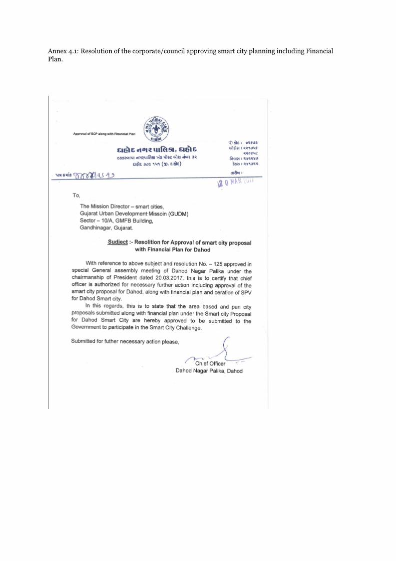
Annex 4.1: Resolution of the corporate/council approving smart city planning including Financial
Plan.

Annexure 4.2: Resolution of the corporate/council for setting up Special Purpose Vehicle.

Annexure 4.3: MoU with SAHAJ (NGO)


Annexure 4.4: MoU with Saifee Hospital


Annexure 4.5: MoU with GIDC


Annexure 4.6: MoU with HDFC Bank.

Annexure 4.7: MoU with APMC


Annexure 4.8: MoU with Wholesale Merchant’s Association

Annexure 4.9: Pradhan Mantri Aavays Yojana Certificate

Annexure 4.10: Minutes of meeting HPSC.


Annexure 4.11: Letter from Mission Director (Smart Cities), GUDM

Annexure 4.12: Funding arrangement between state and central government for Dahod Nagar Palika.

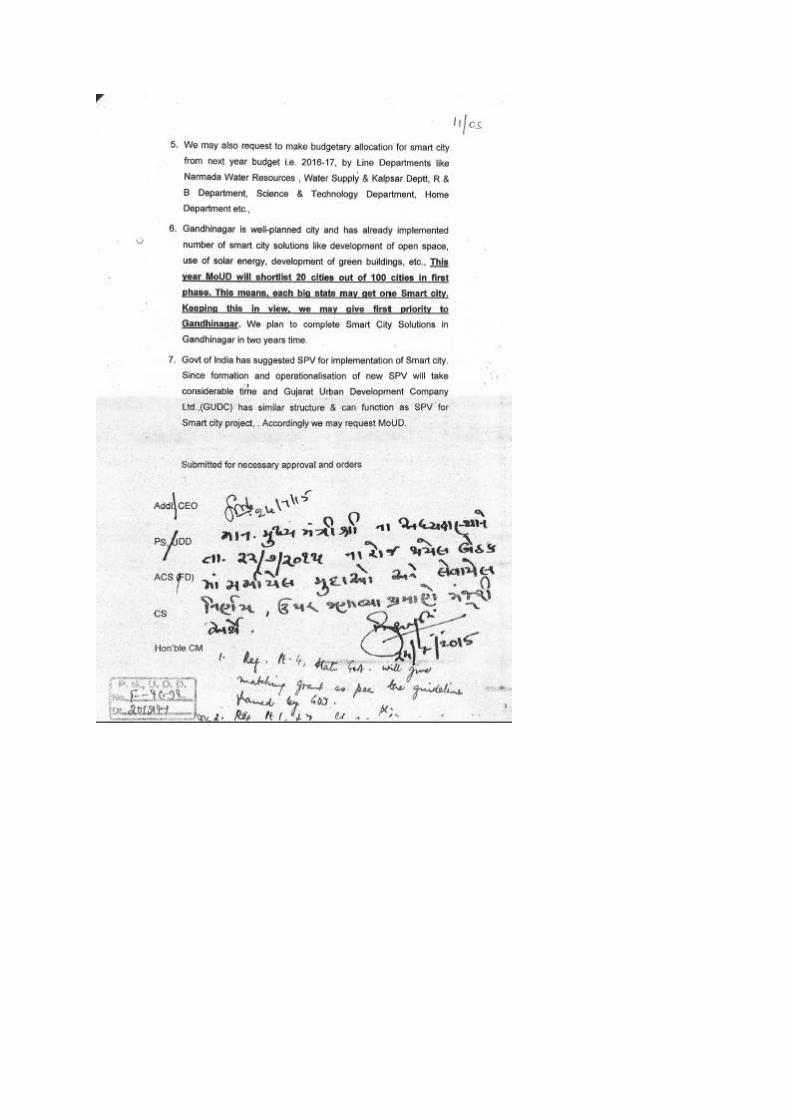

Annexure 4.13: Financial Summary:
(All figures in Rs. Cr)
Amount Y1 Y2 Y3 Y4 Y5 Y6 Y7 Y8 Y9 Y10
Grant from GoI 488.0 194.0 194.0 100.0 - - - - - - -
Grant from State
Government 488.0 194.0 194.0 100.0 - - - - - - -
PPP Finance 5.0 3.0 2.0 - - - - - - - -
Convergence
funds 46.8 12.3 13.2 12.4 8.9 - - - - - -
Commercial
loan - - - - - - - - - - -
O&M cost 131.0 0.3 4.4 9.6 13.8 14.9 15.8 16.8 17.6 18.5 19.5
Interest cost - - - - - - - - - - -
Revenues 149.2 0.8 6.9 15.4 15.9 16.6 17.2 18.0 18.7 19.5 20.3
CAPEX for Pan
City Initiatives 172.2 118.2 50.0 4.0 - - - - - - -
CAPEX for Area
Based
Development
Initiatives
856.9 285.0 353.2 208.6 10.1 - - - - - -
Annexure 4.14: Capital expenditure: Pan city and ABD projects

S. No
Name of Initiative (All figures in Rs.Cr.)
Total Y1 Y2 Y3 Y4 Y5 Y6 Y7 Y8 Y9 Y10
Pan city projects
1. Digital Empowerment For
Women & Tribal 3.0 3.0 - - - - - - - - -
2. Smart Water Supply
System 36.0 21.0 15.0 - - - - - - - -
3. Smart Waste Collection 10.0 8.0 2.0 - - - - - - - -
4. Eco-friendly urban
transport 12.0 12.0 - - - - - - - - -
5. Digital Transit Facilities 1.0 1.0 - - - - - - - - -
6. Ease of doing business
portal 2.0 2.0 - - - - - - - - -
7. Smart governance
backend 44.0 29.0 15.0 - - - - - - - -
8. OFC Network 9.0 6.0 3.0 - - - - - - - -
9. Intelligent Command and
Control Center (I3C) 14.0 14.0 - - - - - - - - -
10. City Smart poles 15.0 6.0 5.0 4.0 - - - - - - -
11. Connected Dahod Citizen
Interface 2.0 2.0 - - - - - - - - -
12. Telemedicine facility 18.0 9.0 9.0 - - - - - - - -
13. Extended use of HMIS 2.0 2.0 - - - - - - - - -
14. Virtual Classroom 2.5 2.0 0.5 - - - - - - - -
15. Self-sanitizing e-toilets 1.0 1.0 - - - - - - - - -
Total CAPEX for Pan City Initiative by Smart City SPV
170.5 117.00 49.50 4.00 - - - - - - -
Total - Pan City Initiative on PPP
- - - - - - - - - - -
Total CAPEX for Pan City Initiatives (Including IEC @ 1%)
172.2 118.2 50.0 4.0 - - - - - - -
Area Based Proposals

S. No
Name of Initiative (All figures in Rs.Cr.)
Total Y1 Y2 Y3 Y4 Y5 Y6 Y7 Y8 Y9 Y10
1. NagarPalika New Building
with with Interconnection
to Sabji Mandi
22.0 14.7 7.3 - - - - - - - -
2. Sabji Mandi 9.6 5.0 4.6 - - - - - - - -
3. Shops & godown at 531/A
and 531/B 12.0 4.0 4.0 4.0 - - - - - - -
4. Storm water network in
the city and recharging
the Chhab Talav
31.0 5.0 10.0 16.0 - - - - - - -
5. STP of 17.4 MLD, Sewer
Pumping Station,
Automation & SCADA
System for STP, Sewer
network, Recycle water
Pumping Station, TTP,
Recycled water pipeline to
Mega GIDC.
36.0 12.0 12.0 12.0 - - - - - - -
6. Underground Utilities 180.0 0.0 120.0 60.0 - - - - - - -
7. Smart Energy initiative 63.0 15.0 15.0 33.0 - - - - - - -
8. Roof Top Solar panels 8.3 5.0 3.3 - - - - - - - -
9. Rainwater Harvesting 10.0 5.0 2.5 2.5 - - - - - - -
10. Development of
dormitary at GSRTC bus
stand.
5.0 3.0 2.0 - - - - - - - -
11. Smart Road 140.0 23.0 68.0 49.0 - - - - - - -
12. Sports Complex at Plot
No. 513 & 514 for indoor
Games and training
facility for Children
32.0 15.0 10.0 7.0 - - - - - - -
13. Development of Solar
based Electrical
crematorium Smashan
Bhumi at Plot No. 231 &
221
5.0 3.0 2.0 - - - - - - - -
14. Chab Talav & Dudhimati
River front Development 98.0 60.0 35.0 3.0 - - - - - - -

S. No
Name of Initiative (All figures in Rs.Cr.)
Total Y1 Y2 Y3 Y4 Y5 Y6 Y7 Y8 Y9 Y10
15. Slum Rehabitation 110.0 50.0 30.0 20.0 10.0 - - - - - -
16. Tribal Museum cum
Cultural Hall & Exhibition
Center
5.0 5.0 - - - - - - - - -
17. Green Space & Garden 8.0 8.0 - - - - - - - - -
18. Smart Transit Hub 2.5 1.5 1.0 - - - - - - - -
19. Overbridge on Dudhimati
River 30.0 20.0 10.0 - - - - - - - -
20. e-APMC operations 10.0 10.0 - - - - - - - -
21. Waste to Wealth 31.0 18.0 13.0 - - - - - - - -
Total CAPEX for Area Based Development initiatives by Smart City SPV
843.4 279.2 347.7 206.5 10.00 - - - - - -
Total - Area Based Development on PPP
5.0 3.00 2.00 - - - - - - - -
Total CAPEX for ABD Initiatives
848.4 282.17 349.71 206.50 10.00 - - - - - -
Total CAPEX for ABD Initiatives including 1% IEC cost
856.9 285.0 353.2 208.6 10.1 - - - - - -
TOTAL CAPEX (ABD + Pan City),
1,029.1 403.2 403.2 212.6 10.1 - - - - - -
Annexure 4.15: Operations and maintenance cost: Pan city and ABD projects
S. No
Name of Initiative (All figures in Rs.Cr.)
Total Y1 Y2 Y3 Y4 Y5 Y6 Y7 Y8 Y9 Y10
Pan city projects
1. Digital
Empowerment For
Women & Tribal
4.8 0.0 0.0 0.6 0.6 0.6 0.6 0.6 0.6 0.6 0.6
2. Smart Water
Supply System 16.3 0.0 1.4 2.7 1.8 1.8 1.8 1.8 1.8 1.8 1.8

S. No
Name of Initiative (All figures in Rs.Cr.)
Total Y1 Y2 Y3 Y4 Y5 Y6 Y7 Y8 Y9 Y10
3. Smart Waste
Collection 4.2 0.0 0.2 0.5 0.5 0.5 0.5 0.5 0.5 0.5 0.5
4. Eco-friendly urban
transport 5.4 0.0 0.2 0.3 0.4 0.5 0.6 0.7 0.8 0.9 1.0
5. Digital Transit
Facilities 0.1 - - - - - - - - - -
6. Ease of doing
business portal 3.4 0.0 0.2 0.4 0.4 0.4 0.4 0.4 0.4 0.4 0.4
7. Smart governance
backend 10.6 0.0 0.6 1.3 1.3 1.3 1.3 1.3 1.3 1.3 1.3
8. OFC Network 2.0 0.0 0.0 0.3 0.3 0.3 0.3 0.3 0.3 0.3 0.3
9. Intelligent
Command and
Control Center
(I3C)
5.9 0.0 0.4 0.7 0.7 0.7 0.7 0.7 0.7 0.7 0.7
10. City Smart poles 6.8 0.3 0.6 0.8 0.8 0.8 0.8 0.8 0.8 0.8 0.8
11. Connected Dahod
Citizen Interface 0.8 0.0 0.0 0.1 0.1 0.1 0.1 0.1 0.1 0.1 0.1
12. Telemedicine
facility 6.8 0.0 0.4 0.8 0.8 0.8 0.8 0.8 0.8 0.8 0.8
13. Extended use of
HMIS 1.70 0.0 0.1 0.2 0.2 0.2 0.2 0.2 0.2 0.2 0.2
14. Virtual Classroom 2.00 0.0 0.0 0.3 0.3 0.3 0.3 0.3 0.3 0.3 0.3
15. Self-sanitizing e-
toilets 0.9 0.0 0.1 0.1 0.1 0.1 0.1 0.1 0.1 0.1 0.1
Area Based Proposals
22. Nagar Palika New
Building with with
Interconnection to
Sabji Mandi
- - - - - - - - - - -
23. Sabji Mandi - - - - - - - - - - -
24. Shops & godown
at 531/A and
531/B
- - - - - - - - - - -

S. No
Name of Initiative (All figures in Rs.Cr.)
Total Y1 Y2 Y3 Y4 Y5 Y6 Y7 Y8 Y9 Y10
25. Storm water
network in the city
and recharging the
Chhab Talav
2.31 - - - - 0.30 0.33 0.36 0.40 0.44 0.48
26. STP of 17.4 MLD,
Sewer Pumping
Station,
Automation &
SCADA System for
STP, Sewer
network, Recycle
water Pumping
Station, TTP,
Recycled water
pipeline to Mega
GIDC.
18.97 - - - 2.00 2.20 2.42 2.66 2.93 3.22 3.54
27. Underground
Utilities 5.20 - - - 0.58 0.63 0.65 0.72 0.79 0.87 0.96
28. Smart Energy
initiative 9.00 - - - 0.80 1.00 1.20 1.50 1.50 1.50 1.50
29. Roof Top Solar
panels 0.05 - - 0.01 0.01 0.01 0.01 0.01 0.01 0.01 0.01
30. Rainwater
Harvesting 0.07 - - - - - 0.02 - - - 0.05
31. Development of
dormitary at
GSRTC bus stand.
2.74 - - 0.24 0.26 0.29 0.32 0.35 0.39 0.43 0.47
32. Smart Road 5.84 - - - 0.62 0.68 0.75 0.82 0.90 0.99 1.09
33. Sports Complex at
Plot No. 513 & 514
for indoor Games
and training
facility for
Children
3.42 - - - 0.36 0.40 0.44 0.48 0.53 0.58 0.64
34. Development of
Solar based
Electrical
crematorium
Smashan Bhumi at
Plot No. 231 & 221
0.96 - - 0.08 0.09 0.10 0.11 0.12 0.14 0.15 0.16
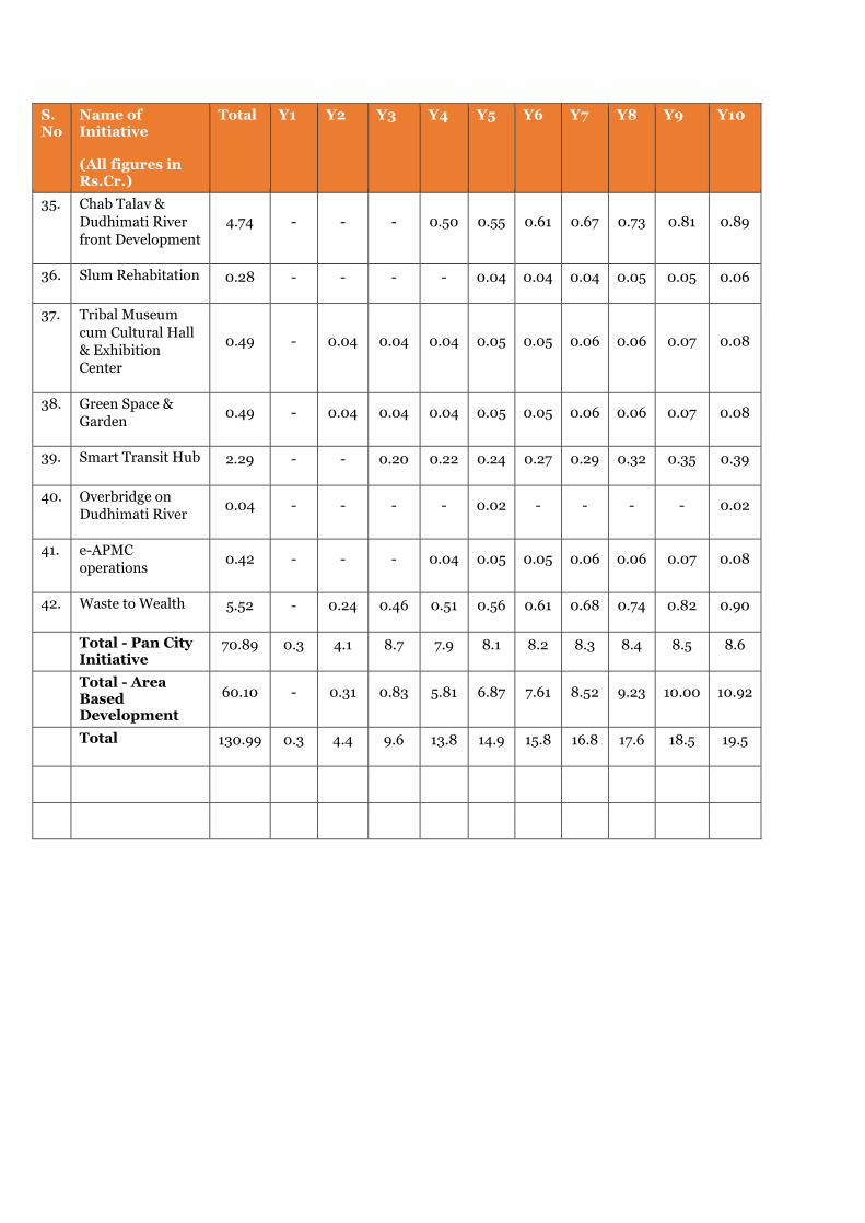
S. No
Name of Initiative (All figures in Rs.Cr.)
Total Y1 Y2 Y3 Y4 Y5 Y6 Y7 Y8 Y9 Y10
35. Chab Talav &
Dudhimati River
front Development
4.74 - - - 0.50 0.55 0.61 0.67 0.73 0.81 0.89
36. Slum Rehabitation 0.28 - - - - 0.04 0.04 0.04 0.05 0.05 0.06
37. Tribal Museum
cum Cultural Hall
& Exhibition
Center
0.49 - 0.04 0.04 0.04 0.05 0.05 0.06 0.06 0.07 0.08
38. Green Space &
Garden 0.49 - 0.04 0.04 0.04 0.05 0.05 0.06 0.06 0.07 0.08
39. Smart Transit Hub 2.29 - - 0.20 0.22 0.24 0.27 0.29 0.32 0.35 0.39
40. Overbridge on
Dudhimati River 0.04 - - - - 0.02 - - - - 0.02
41. e-APMC
operations 0.42 - - - 0.04 0.05 0.05 0.06 0.06 0.07 0.08
42. Waste to Wealth 5.52 - 0.24 0.46 0.51 0.56 0.61 0.68 0.74 0.82 0.90
Total - Pan City Initiative
70.89 0.3 4.1 8.7 7.9 8.1 8.2 8.3 8.4 8.5 8.6
Total - Area Based Development
60.10 - 0.31 0.83 5.81 6.87 7.61 8.52 9.23 10.00 10.92
Total 130.99 0.3 4.4 9.6 13.8 14.9 15.8 16.8 17.6 18.5 19.5
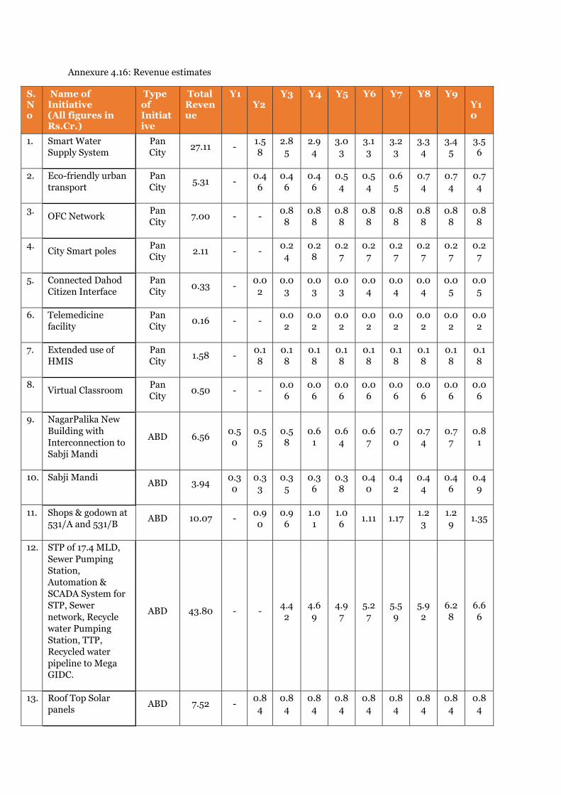
Annexure 4.16: Revenue estimates
S. No
Name of Initiative (All figures in Rs.Cr.)
Type of Initiative
Total Revenue
Y1 Y2
Y3 Y4 Y5 Y6 Y7 Y8 Y9 Y10
1. Smart Water
Supply System
Pan
City 27.11 -
1.5
8
2.8
5
2.9
4
3.0
3
3.1
3
3.2
3
3.3
4
3.4
5
3.5
6
2. Eco-friendly urban
transport
Pan
City 5.31 -
0.4
6
0.4
6
0.4
6
0.5
4
0.5
4
0.6
5
0.7
4
0.7
4
0.7
4
3. OFC Network
Pan
City 7.00 - -
0.8
8
0.8
8
0.8
8
0.8
8
0.8
8
0.8
8
0.8
8
0.8
8
4. City Smart poles
Pan
City 2.11 - -
0.2
4
0.2
8
0.2
7
0.2
7
0.2
7
0.2
7
0.2
7
0.2
7
5. Connected Dahod
Citizen Interface
Pan
City 0.33 -
0.0
2
0.0
3
0.0
3
0.0
3
0.0
4
0.0
4
0.0
4
0.0
5
0.0
5
6. Telemedicine
facility
Pan
City 0.16 - -
0.0
2
0.0
2
0.0
2
0.0
2
0.0
2
0.0
2
0.0
2
0.0
2
7. Extended use of
HMIS
Pan
City 1.58 -
0.1
8
0.1
8
0.1
8
0.1
8
0.1
8
0.1
8
0.1
8
0.1
8
0.1
8
8. Virtual Classroom
Pan
City 0.50 - -
0.0
6
0.0
6
0.0
6
0.0
6
0.0
6
0.0
6
0.0
6
0.0
6
9. NagarPalika New
Building with
Interconnection to
Sabji Mandi
ABD 6.56 0.5
0
0.5
5
0.5
8
0.6
1
0.6
4
0.6
7
0.7
0
0.7
4
0.7
7
0.8
1
10. Sabji Mandi ABD 3.94
0.3
0
0.3
3
0.3
5
0.3
6
0.3
8
0.4
0
0.4
2
0.4
4
0.4
6
0.4
9
11. Shops & godown at
531/A and 531/B ABD 10.07 -
0.9
0
0.9
6
1.0
1
1.0
6 1.11 1.17
1.2
3
1.2
9 1.35
12. STP of 17.4 MLD,
Sewer Pumping
Station,
Automation &
SCADA System for
STP, Sewer
network, Recycle
water Pumping
Station, TTP,
Recycled water
pipeline to Mega
GIDC.
ABD 43.80 - - 4.4
2
4.6
9
4.9
7
5.2
7
5.5
9
5.9
2
6.2
8
6.6
6
13. Roof Top Solar
panels ABD 7.52 -
0.8
4
0.8
4
0.8
4
0.8
4
0.8
4
0.8
4
0.8
4
0.8
4
0.8
4

S. No
Name of Initiative (All figures in Rs.Cr.)
Type of Initiative
Total Revenue
Y1 Y2
Y3 Y4 Y5 Y6 Y7 Y8 Y9 Y10
14. Development of
dormitary at
GSRTC bus stand.
ABD 2.01 - 0.1
8
0.1
9
0.2
0
0.2
1
0.2
2
0.2
3
0.2
4
0.2
6
0.2
7
15. Smart Road ABD 12.58 -
1.3
5 1.36
1.3
7
1.3
8
1.3
9 1.41
1.4
2
1.4
4 1.46
16. Smart Transit Hub ABD 8.31 -
0.3
2
0.7
0
0.7
7
0.8
5
0.9
3
1.0
2 1.13
1.2
4 1.36
17. Waste to Wealth ABD 10.35 -
0.2
0 1.27
1.2
7
1.2
7
1.2
7
1.2
7
1.2
7 1.27 1.27
Total - Pan City
Initiative 44.10 -
2.2
4
4.7
0
4.8
4
5.0
0
5.1
0
5.3
2
5.5
2
5.6
3 5.75
Total - Area Based
Development 105.15
0.8
0
4.6
7
10.
66
11.1
1
11.5
9
12.1
0
12.
65
13.
23
13.
84
14.5
0
Total 149.25
0.8
0
6.9
0
15.3
6
15.
95
16.
59
17.
21
17.
96
18.
74
19.
47
20.
25
Annexure 4.17: Cash Flow Statement

Cash Flow Statement (All figures in Rs.Cr.)
Total
Year 1
Year 2
Year 3
Year 4
Year 5
Year 6
Year 7
Year 8
Year 9
Year 10
Cash Inflows
Convergence funds for
Pan City Initiatives 4 3 1 - - - - - - - -
Convergence funds for
Area Based
Development
Initiatives
43 9 12 12 9 - - - - - -
GoI Grant for SMART
CITY PROJECT 488 194 194 100 - - - - - - -
State Equity Inflow for
SMART CITY 488 194 194 100 - - - - - - -
ULB Equity Inflow
(Capital) - - - - - - - - - - -
Commercial Loan
inflow - - - - - - - - - - -
Net Cash accruals =
(PAT+depreciation) 18 1 2 6 2 2 1 1 1 1 1
Total Inflows
1,04
1 401 404 218 11 2 1 1 1 1 1
Cash Outflows
CAPEX
1,01
4 396 397 211 10 - - - - - -
Interest during
construction - - - - - - - - - - -
Debt repayment - - - - - - - - - - -
Total outflows
1,01
4 396 397 211 10 - - - - - -
Net cash inflow 27 5 6 8 1 2 1 1 1 1 1
Annexure 4.18: Preliminary human resource plan for SPV.


Annexure 4.19: Swachhata Certificate