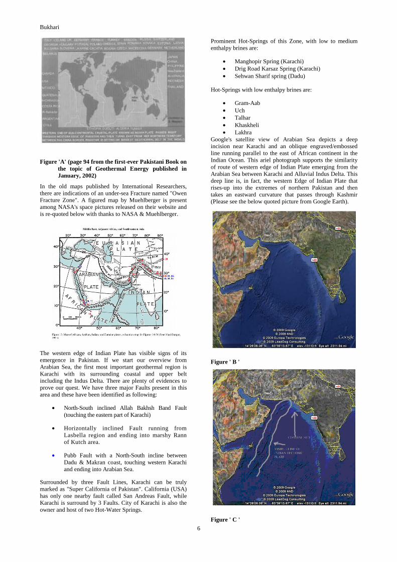
country update paper on pakistan · country update paper on pakistan sayyed hossein shah bukhari...
TRANSCRIPT

Proceedings World Geothermal Congress 2010 Bali, Indonesia, 25-29 April 2010
1
Country Update Paper on Pakistan
Sayyed Hossein Shah Bukhari
P. O. Box: 3287 Gulberg Colony, Lahore-54660, Pakistan
E-mail: [email protected]
Keywords: seismo-tectonic routes of Pakistan
INTRODUCTION
Geology:
If seen through the eyes of a Geologist, Pakistan is a huge museum of Geological formations changing from region to region and holding an immense diversity in rocks varieties from many ages. These geological period are:
Pre-Cretaceous Age -- about 110 million years ago, when Indian masses were still buckled with Africa.
Late Cenozoic age -- 45 million years ago, when Indian Plate collided with Eurasian mass, forming the huge chains of mountains in North & North West of sub-continent namely Himalayas, Karakorum & Hindukush. These Ranges are still considered among the geologically active areas of world.
There are two Volcanic Arcs extended from Eurasian Masses called Chaghi Arc (Baluchistan) & Kohistan Arc (above Hazara in Northern Pakistan). Here rocks and formations belong to Paleozoic, Mesozoic to Cenozoic Eras belonging from early to late ages. Rocks from Pre-Cambrian Eras have also been found in Northern Punjab belt. Precambrian to Territary ages formations are present in the South Eastern deserts of Pakistan.
110 types of Sedimentary Formations have been identified in various regions of Pakistan by GSP (Geological Survey of Pakistan) hence, many areas still remain un-investigated. Patterns of Sedimentary formation in Pakistan are unique, e.g. Sedimentary deposits of Salts in the "Salt Range" of northern Punjab are holding miles of layers with estimated deposits of 220 million tons of edible salts. Similar are huge metamorphic deposits of Onyx, marble & Limestone in Baluchistan & FATA. World's 5th biggest formation of coal deposits in Thar Desert is lying in an area of 10,000 kilometer bearing 12 to 170 meters depth with estimated deposits of 175 billion tonnes. Then there are substantial variety of minerals and natural resources; Gold & Copper Deposits in Baluchistan. Precious stones deposits of Baluchistan, Swat, Kohistan and adjacent Regions are among just a very few geological wonders to be mention here.
Similarly Pakistan is not lacking behind in Geothermal Resources with some identified Faults & Seismic zones as well as hot springs scattered over the four main geological zones of Pakistan. These hot springs are gushing out low to high enthalpy brines.
Northern Pakistan is among heavily glaciated region on earth after the North & South Poles. Three different chains of mountains meet and separate in Pakistan. Rakaposhi, a beautiful mountain, is also said to be the most steepest place on Earth. World's 2nd highest peak K2 and 54 out of 109 highest peaks of South Asia are situated in Pakistani territory. Fumarole of pure Dry-Steam is emitting from the foot-hills of panoramic Nanga Parbat, i.e. 9th highest mountain in world's
ranking. This Dry Steam source of Nanga Parbat is among the few rare geothermal resources of world of its kind.
Countless igneous and granitic sites in the country are waiting to be exploited as deep-seated HDR geothermal resource. Country is sitting on one of the biggest seismo-tectonic geothermal belt of the world.
GEOLOGICAL BACKGROUND:
Geological regions in Pakistan can be divided into four zones:
Exhibit # Zone Areas covered Geological Setting
01 Northern Pakistan
Frontier Pronvince (Pakhtoonkhaw), Gilgit, Chitral, Kohistan Regions & Kashmir Regions.
Rocks of various ages including Lithological layers blocks, consisted of:• Igneous• Granite• Metamorphic• Granodiorite• Quartz• Phyllite• Chlorite• Conglomerate• Dolomite• Schist• Sandstone• Plutonic• Pelite• Pegmatite• Aplite
02 Baluchistan Baluchistan Province
Rocks of pyroclastic volcanism consisted from various ages of : Permean , Oligocene, Pleistocene, Triassic, Eocene, Miocene late to early ages:• Igneous• Granitic• Porphyritic• Phyllite• Granodiorite• Chlorite• Schist• Pyrite• Quartz• Metamorphic• Sedimentary
03Indus Basin & Western Sind
Indus Basin Region from Karachi extended up to Dadu is a part of Southern Kirthar Range
Predominantly Sedimentary formation along with Granitic Boulders & huge Blocks
04South Western & Northern Punjab
South Western Punjab's Sedimentary formation on west of Indus River & Elevated Northern Region known as Pothowar + Salt Range
Rocks from Pre-Cambrian & Early to Late Permian ages mostly of:• Gypsum• Dolomite• Sedimentary • Metamorphic• Granitic Boulders

Bukhari
2
MAPS OF FOUR GEOLOGICAL ZONES OF PAKISTAN
EXHIBIT 01: NORTH & NORTH WESTERN PAKISTAN
EXHIBIT 02: NORTH & SOUTH BALUCHISTAN ZONE
EXHIBIT 03: ZONE OF INDUS BASIN (KARCHI REGION) & WESTERN SIND
EXHIBIT 04: PUNJAB ZONE (SOUTH WESTERN & NORTHERN PUNJAB)
Source: Google maps
GEOTHERMAL RESOURCES AND POTENTIAL
Congruent to Geological Regions, Pakistan's geothermal resources (see 4 Nos. of Exhibits) are also located into four prominent zones, i.e.:
1- Entire Northern Pakistan: Naturally available Hot spring resources with brine's temperature of high and modest levels.
2- North Western Baluchistan: With Hot spring resources bearing high temperatures brines and South Baluchistan resources with brines of modest temperature.
3- Zone of Indus Basin & Western Sind: Resources with modest to low brine's temperature.
4- South Western & Northern Punjab: Resources with low brine's temperature.
EXHIBIT: 05
Map Figures (Exhbits 01 to 05) amended & prepared by S. Hossein

Bukhari
3
A GENERAL OVERVIEW OF NATURALLY AVAILABLE HOT SPRING RESOURCES WITH GEOLOGICAL BACKGROUND:
# Name of ResourceLocation on
geological map
Resource Character- istic
Geological Background
01 Murtazabad Springs Hunza Region, Northern Shallow
02 Budelas Valey SpringsHunza Region, Northern Pakistan
Shallow
03 Dasu Springs, Kohistan Region Shallow
04 Mushkin Spring, Northern Pakistan Shallow
05 Tatta Pani, Astor River area, Northern Pakistan
Deep
06 Sassi. Sakardu Region, Northern Pakistan
Deep
07 Gram Chashma Chitral DeepKarakorum Block with rocks of Ordovician ages
08 Karsaz Spring Karachi, Sind Shallow
09 Manghopir Spring Karachi, Sind Shallow
10Kharan & Kohe-Sultan Springs
Kharan & Chaghi Regions, Baluchistan Shallow from Quaternary age
11
Medium & Low Thermal Gradient Springs of:• Sehwan• Talhar• Khaskheli• Garm Ab
Indus Basin &Western Sind Shallow
Late Jurassic to Late Cretaceous Era rocks
12
Medium & Low Thermal Gradient Springs of:• Taunsa• Bhakkar• Uch
Northern Punjab Pothowar Region &
South Western PunjabShallow
Pre-Cambrian times from Proterozoic to early Paleozoic ages rocks
Area of MMT (Main Korakorum Thrust) from Pre-Cambrian ages, and consisted of Cenozoic and Mesozoic in nature.
A unique arc among the surrounding geological formation, the area is known as Kohistan Island Arc and is from cretaceous in age and holds the Rocks from early Paleozoic periods
Receding chain of Baluchistan elevations is Kirthar Range divided into Northern & Southern Kirthar Ranges. Southern Kirthar is extended into Sind up to Karachi.

Bukhari
4
Estimated Data of Springs(Geothermal Utilization):
Table 3-6
Direct Heat Availability
AS OF 31.12 2009 (other than heat pumps)
Maximum Utilization Capacity3 Annual Utilization
# Spring's Locality
Type1)
Flow Rate Ave. Flow Energy4) Capacity
(kg/s)
Inlet Outlet Inlet Outlet (MWt) (kg/s) (TJ/yr) Factor5)
01 Murtazabad Springs, Hunza Region B 20 237 92 90 1839.91 20 1837.161 0.031662629
02 Budelas Valey Springs, Hunza Region B 03 159 46 43 137.957 03 136.6438 0.031408151
03 Dasu Springs, Kohistan Region B 22 200 71 68 1561.932 22 1559.855 0.031667839
04 Mushkin Spring, Astor River B 01 90 57 56 56.944 01 55.23376 0.030757631
05 Tatta Pani, Sakardu Region B 26 200 83 81 2157.919 26 2155.445 0.031673649
06 Sassi. Sakardu Region B 23 200 54 52 1241.948 23 1240.36 0.031669452
08 Karsaz Spring, Karachi B 05 45 40 224.96 05 223.7384 0.031537805
09 Manghopir Spring, Karachi K, B 25 55 50 1374.95 25 1373.423 0.031674783
10 Kharan Region & Kohe-Sultan Springs B 25 170 150 32 25 799.975 25 799.2115 0.031679736
TOTAL 141 1236 535 505 9396.495 141 9381.072 0.283731676
Source: Geological Survey of Pakistan
Besides the 9 Regions mentioned here, there are more spots where single or multiple geothermal springs exist.
Thermal gardient springs with no specific available data are taken into account here. Geological Survey has issued a list
of 12 Regions investigated (Ref. Paper of Mr. Sikandar Bakht for WGC 2000). Among the rare geo-pressured
Dry Steam Geysers of world, one was discovered in the foothills of Nanga Parbat during September,1996 by the team of
Newzealand & US explorers. By author's point of view, it is most exiting and extraordinary news with reference to
geothermal resources of Pakistan.
Total Five Nos. of geothermal springs on western Hunza valley.
Total Three Nos. of geothermal springs on both banks of Budelas River within 7-12 Km distance
Total Five Nos. of geothermal springs in Sakardu Region.
Springs of these remote areas are considered most perspective because these regions are situated in the volcanic belt.
Data available from the old British Record subsequently confirmed by Geological Survey of Pakistan
(Reference Paper of Bakht for WGC 2000), Enthalpy of Kohe-Sultan Spring ranges from 25ºC to 32ºC
Table Format (Proforma "utilize3--06") in Blank is provided by Geo-Heat Centre USA
Reservoir
Temp. (oC) Enthalpy2) (kJ/kg)
TABLE 3. UTILIZATION OF GEOTHERMAL ENERGY FOR DIRECT HEAT

Bukhari
5
Table: 4-8: Direct Heat Uses:
TABLE 4-08 SUMMARY TABLE OF GEOTHERMAL DIRECT HEAT USES(AS OF 31.12.2009)
# Use Installed Capacity1) Annual Energy Use2) Capacity Factor3)
(MWt) (TJ/yr = 1012 J/yr)
01 Individual Space Heating4) None None -
02 District Heating 4) None None -
03 Air Conditioning (Cooling) N.A. N.A. -
04 Greenhouse Heating None None -
05 Fish Farming None None -
06 Animal Farming
07 Agricultural Drying5) None None -
08 Industrial Process Heat6) None None -
09 Snow Melting None None -
10 Bathing and Swimming7)
11 Other Uses (specify) N.A. N.A. - -
Geothermal Heat Pumps N.A. N.A. TOTAL
2) Other than heat pumps 3) Includes drying or dehydration of grains, fruits and vegetables 6) Excludes agricultural drying and dehydration 9) Includes balneology
Blank Table Format (Proforma "utilize4-08") is provided by Geo-Heat Centre USA
8,550.52 8535.8608 0.25205194
1374.95 1373.423 0.03167478
8,021.55 8,007.65 0.28373861
Hot springs usually fall in the category of shallow resources. It is evident from above tables that a good capacity of hot brines is available to the country but its utilization is very low. Therefore, most of the hot water is got wasted. While the world is utilizing most of its available under-ground heated water, Pakistan is simply wasting it. The writer deems this wastage equivalent to the wastage of oil.
DISCUSSION:
Table 3-6 of this abstract is indicative of an unusual discovery of Dry-Steam Source in the foothills of Nanga Parbat mountain that is the 9th highest peak of world. This dry steam zone is releasing vapors only. The water originating on the slopes of Majestic Nanga Parbat is hosted by the magmatic Hot Dry Rocks buried deep about 3-6 Km bearing temperatures ranging from 340° to 450°C and converting the trickling water into hot vapors.
Partial details of discovery appeared into public through internet on the website of sciencedirect.com. Abstract are written by Dave Craw of New-Zealand along with his fellows: P.O. Koons, D. Winslow, C.P. Chamberlain, P. Zeitler.
It is worth mentioning here that Dry-Steam Geothermal Resources are rare on earth and found in few countries of world.
Nanga Parbat (Photo by Gulraiz Ghouri)
SEISMO-TECTONIC ROUTES:
In 2001 this author had pointed out in his book “Geothermal Energy for All” (Refer page 97) that Pakistan is sitting on the largest part of overall Seismo-Tectonic Indian Plate.
Bukhari
6
Figure 'A' (page 94 from the first-ever Pakistani Book on the topic of Geothermal Energy published in January, 2002)
In the old maps published by International Researchers, there are indications of an under-sea Fracture named "Owen Fracture Zone". A figured map by Muehlberger is present among NASA's space pictures released on their website and is re-quoted below with thanks to NASA & Muehlberger.
The western edge of Indian Plate has visible signs of its emergence in Pakistan. If we start our overview from Arabian Sea, the first most important geothermal region is Karachi with its surrounding coastal and upper belt including the Indus Delta. There are plenty of evidences to prove our quest. We have three major Faults present in this area and these have been identified as following:
• North-South inclined Allah Bakhsh Band Fault (touching the eastern part of Karachi)
• Horizontally inclined Fault running from Lasbella region and ending into marshy Rann of Kutch area.
• Pubb Fault with a North-South incline between Dadu & Makran coast, touching western Karachi and ending into Arabian Sea.
Surrounded by three Fault Lines, Karachi can be truly marked as "Super California of Pakistan". California (USA) has only one nearby fault called San Andreas Fault, while Karachi is surround by 3 Faults. City of Karachi is also the owner and host of two Hot-Water Springs.
Prominent Hot-Springs of this Zone, with low to medium enthalpy brines are:
• Manghopir Spring (Karachi) • Drig Road Karsaz Spring (Karachi) • Sehwan Sharif spring (Dadu)
Hot-Springs with low enthalpy brines are:
• Gram-Aab • Uch • Talhar • Khaskheli • Lakhra
Google's satellite view of Arabian Sea depicts a deep incision near Karachi and an oblique engraved/embossed line running parallel to the east of African continent in the Indian Ocean. This ariel photograph supports the similarity of route of western edge of Indian Plate emerging from the Arabian Sea between Karachi and Alluvial Indus Delta. This deep line is, in fact, the western Edge of Indian Plate that rises-up into the extremes of northern Pakistan and then takes an eastward curvature that passes through Kashmir (Please see the below quoted picture from Google Earth).
Figure ' B '
Figure ' C '

Bukhari
7
Figures 'B' & 'C' downloaded from Google Earth website, with thanks to Google & their sponsors Europa Technologies & Lead Dog Consulting.
Figure "D" downloaded from wikipedia pages
As mentioned above that visible line in the sea-water is the border-route of western end of Sub-Continental Indian plate which is also known as Indo-Australian Tectonic Plate. By studying the present route of river Indus, this author strongly believes that, originally, waters of the River Indus had once naturally adopted the course created by this western tectonic border-line of Indian Plate. The river was once completely flowing over this route. But, because the change in a river's course is a natural phenomenon, therefore, present course of River Indus is not exactly now over the border-line of Indian Tectonic Plate. However, it is near around to its original course. So locating this western edge of Indian Plate is not an ambiguous task for our Researchers. This entire border-line of Indian Plate is in fact a seismic zone and a very potential area holding the best prospectus of tapping out Geothermal Energy. Therefore, our Geologist at GSP still has the task to mark-out (mile-to-mile basis) the exact route of western-edge of Indian Plate.
There are indications of many sub-tectonic routes spread over in Baluchistan, Frontier Province and in Northern areas of Pakistan. Almost 75% area of the country is prone to earthquakes. Many active faults are broadly distributed around, at the west and north of the plate's border-line, especially where the continental plates come into contact with each other. Pakistan has almost every known formation of Faults (Up-Thrust type, Joint type, vertical or inclined type, trans-current type, Left-lateral & Right-lateral Strike-slip type, Wrench type, Reverse Faults, Spiral Faults). Up-Thrust-Faults are present in the entire northern mountainous belt that came into existence due to MFT (Main Frontal Thrust), MCT (Main Central Thrust), MBT (Main Boundary Thrust), and MMT (Main Mantle Thrust). The exact numbers of Thrust Faults in northern areas is still to be determined.
When Lithospheric Plates move and interact at their boundaries, these Faults release the under-lying crust' stress. In general Fault is a wonderful phenomenon, indicating that geological structure is shifting from one type of rock formation to another type.
Besides the 3 Faults of Karachi, few other known and worth mentioning Faults/seismic regions spreads over in Pakistan are:
• Karakorum Fault & Central Karakorum Fault
• Tirch Mir Fault in Northern Pakistan
• Muzaffarabd Fault & Tanda Fault in Kashmir (responsible for 2005 devastating earthquake)
• 1000 Km long Chaman Fault of Baluchistan ending into Arabian Sea around Ormara, Makran.
• Faults of Kohat Plateau
• Faults of folded Suleiman Range
• Faults of Pothowar (Folded Belt of Salt Range Thrust above Jhelum river)
• Kohistan-Indus areas Faults
• Faults within the Kirthar Range
Along the 400 kilometer coastal belt from Lasbella & Makran, ending up to the Iranian border has many faults visible from Satellites' Ariel photographs released through Google Earth.
There are lot of papers written by Pakistani & Foreign Geologists/Researchers about the Faults and the seismic zones of Pakistan. After mentioning about these seismo-tectonic areas, Pakistani Geologists/Researchers have identically issued only one conclusion/warning that Pakistanis should built their future cities and dwellings more and more earth-quake-proof. This single conclusion is making Pakistani people worrisome and fearful. But being a geothermist, my only concern is that why we are not taking the benefit of these remarkable features of our mother-land. Accumulating earth energy beneath these Faults and border line of Indian Plate is gradually coming up through these seisomo-tectonic routes, is "why not" being tapped via geothermal-technologies. All these Seismo-tectonic routes are the potential areas where Geothermal Energy can be tapped-out. This extra-ordinary potential of geothermal resources can be utilized for:
1- Generating electricity -- Power is direly short in the country and not only costing heavily to the national exchequer against the import of crude oil, but also a net loss of billion of dollars is born by the citizens of Pakistan each year due to electrical load shedding. (While this paper was completed in May 2009, the total electrical break-down time per day has reached to 14 hours in the country).
Here is chart depicting the status of electrical production in Pakistan, prepared on the format provided by Geo-Heat Centre USA:

Proceedings World Geothermal Congress 2010 Bali, Indonesia, 25-29 April 2010
8
TABLE 1. PRESENT AND PLANNED PRODUCTION OF ELECTRICITY
Geothermal Fossil Fuels Hydro Nuclear Other Renewables Total (Wind)
Power Production Capac- Gross Capac- Gross Capac- Gross Capac- Gross Capac- Gross Capac- GrossPlants/Facilities ity Prod. ity Prod. ity Prod. ity Prod. ity Prod. ity Prod.
MWe MWh/yr MWe MWh/yr MWe MWh/yr MWe MWh/yr MWe MWh/yr MWe MWh/yrIn operation in December 2009 21,593 12,580 6463 462 6 19,511
Under constructionin December 2009 3600 1000
Funds committed,but not yet underconstruction inDecember 2009
Total projected 10063 1462 50,000use by 2015
Last figures issued in 2007 and no subsequent addition in production was made.all the figures are mentioned here in MWh/Yr (Source: http://wapda.gov.pk)Source: Plicy for Renewable Energy Resources 2006 by Ministry of Power
Table "utilize 1-05" provided by Geo-Heat Centre, USA
There is a great opportunity to generate electricity by exploiting geothermal resources of the country in the following way:
Shallow resources: Those are immediately available around the hot springs of the country.
Deep (HDR) Resources: Those are scattered in all the 4 zones mentioned above with a wide choice of selectivity.
2- District Heating System (DHS) – DHS are strongly required to save the precious wood resources and keep the roads open during winter in the northern areas. Almost 94% of Northern Pakistan remains under heavy snow for 4-6 months' period and then roads are blocked and Woods are massively cut. This unavoidable wood-cutting has dangerously imbalanced the Eco-system of the entire area. It is strange that when the naturally heated geothermal waters are present in the country, why we cannot develop District Heating System for our towns and cities.
COMPARISON OF COST:
Geothermal based electrical generation and its comparison with the fossil fuel generated energy is no more point of discussion t present in Pakistan, because of the astonishing fact, that our government has not utilized the wonderful source of Green Geothermal energy.
POLICIES:
1. An Overview of Government Policies & Interest:
Government of Pakistan had finally set its First Policy for the Development of Renewable Energy for Power Generation, during 2006, whereupon interest in the major Renewable Energy Resources were shown by name, thereby, mentioning each resource' potential and status in the country during 2006. The Policy however, did not mention anything about Geothermal Energy. Neither the word "Geothermal" was seen in this report, nor any subsequent revision of the Policy is made by the Govt. of Pakistan till to-date (while this paper was being written).
2. Leading Governmental Agencies:
a- Ministry of Water & Power
b- Alternate Energy Development Board under the Ministry of Water & Power. (This subsidiary department is under the administrative control of Ministry of Power, and had once recognized the geothermal Energy as a potential source in their own brochure, hence never matured anything practical)
3. Local Policies/Legislation/Regulatory Framework:
In the Policy of Govt. of Pakistan, each renewable source is mentioned category-wise on page 5 & 6 by name but without mentioning anything about Geothermal as a source of Renewable Energy, therefore, legislation for regulation of geothermal energy may remain absent or ambiguous by a developer's point of view. In fact, it should be the first step by any Government that she should play a legislative role to stipulate necessary regulatory frame-work for providing a

Bukhari
9
guideline under which the local and foreign investors may come ahead to work. Due to absence of "any word" about geothermal in renewable energy policy of Pakistan, there are apprehensions that under the present status, if any governmental Body issues a "geothermal development permit", to anybody, it may then dictate the regulations at their own interpretations. This situation is nothing but a hindrance for local or foreign investors to come ahead for the development of geothermal energy in Pakistan.
4. Environment Regulations:
Policy for Renewable Energy for Power Generation 2006 is containing clause 4.4 at Page 7 and a Carbon Credits clause 8.3.3 at Page 12 & 13 for Environmental Protection.
FUTURE DEVELOPMENT & INSTALLATIONS:
In Pakistan, there is no definite plan "so far", to develop any geothermal energy project(s). However, there are strong chances that private sector may soon come ahead for the utilization of shallow geothermal resources for cooling or heating utilization.
CONCLUDING REMARKS:
IGA has gradually become a prestigious platform for Geothermists worldwide. Organizing an international level congress after every 5 year is a remarkable achievement and a splendid job of IGA.
Pakistani geothermists/activists are still busy in portraying or emphasizing over the potential of country's geothermal resources. In fact the world is already convinced about the geothermal potentials of this country. It is only Govt. of Pakistan that is not convinced. Pakistan is now too late to act at par with other countries. Even the later comers like African States & Iran have now crossed Pakistan in the field of geothermal energy. This author is waging a campaign in this regard since the last 8-10 years and is now exhausted. The day when it would be realized and adopted by Pakistan's leaders, the world will see the rise of a large number of geothermal related manpower, contributing technical papers on their practical experiences in geothermal fields. That's what author wish to see happening in his life.
ACKNOWLEDGEMENT:
Though never met personally but acknowledgements are made by this author to:
• All the Pakistani geologists at GSP for continuously exposing the geological data of Pakistan.
• To the strenuous efforts of Mr. Orhan Mertoglu -- ORME Jeotermal Inc. Turkey – (I met him once for a short-while) who has physically visited several geothermal springs of Pakistan and is trying his best to convince Govt. of Pakistan for starting a geothermal energy project, or at least a district heating/cooling project in the country.
REFERENCES CITED:
Chemical Geology, Volume 142, Issues 1-2, 1 October 1997, Pages11-22 D. Craw, C. P. Chamberlain, P. K. Zeitler, P. O. Koons. Abstracts published at: http://www.sciencedirect.com/science?_ob=ArticleListURL&_method=list&_ArticleListID=968757097&_sort=r&view=c&_acct=C000050221&_version=1&_urlVersion=0&_userid=10&md5=0fb30bc8d98d0accae200f9efbd8eceb
1. Malik Sikandar Bakht, Proceeding Geothermal Congress 2000, Kyushu, Tohoku, Japan, May 28-June 10, 2000 http://www.geothermal-energy.org/pdf/WGC/2000/R0707.PDF
Muehlberger, W.R., 2001, "Plate Tectonics - The Basics." http://eol.jsc.nasa.gov/handbooks/arabianpages/plate-title.htm (8 Nov. 2001).
http://en.wikipedia.org/wiki/Indian_Plate
http://en.wikipedia.org/wiki/File:Earthquake_Information_for_Pakistan.gif
Investment Oriented Study on Minerals & Mineral Based Industries published in April 2004 by Expert Advisory Cell, Ministry of Industries & Production, Govt. of Pakistan (Reference Pages: 26 to 45 & 165 to 169).
www.buildasia.net/conference2007/Mineral_Resources_of_Baluchistan.pdf
http://wapda.gov.pk/vision2025/htmls_vision2025/kkhp.html
http://google-earth-fak-url-for-links.google.com/http://earth.esa.int/cgi-bin/satimagessql.pl7show_url=210
http://www.gsp.gov.pk/pakistan/index.html