coordinate systems. review what term can we use to define the true shape and size of the earth? what...
TRANSCRIPT
Coordinate systemsCoordinate systems

ReviewReview
• What term can we use to define the true shape and size of the earth?
• What do we use to in place of this shape because it’s simpler to use?
• How do we link the two (i.e., link real locations to the ellipsoid)?
• What are projections used for?– Keep in mind that the term “projection
change” is often synonymous with changing datum etc. because a GIS treats this as one step
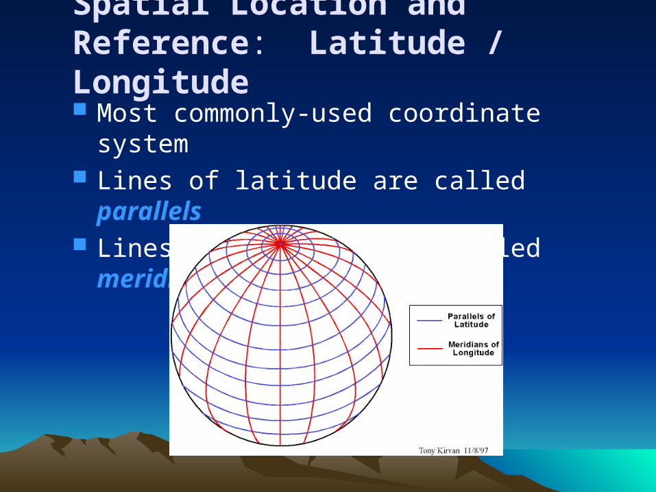
Spatial Location and Reference: Latitude / Longitude Most commonly-used coordinate system Lines of latitude are called parallels Lines of longitude are called meridians

Latitude / Longitude
Prime Meridian & Equator are the reference points used to define latitude and longitude
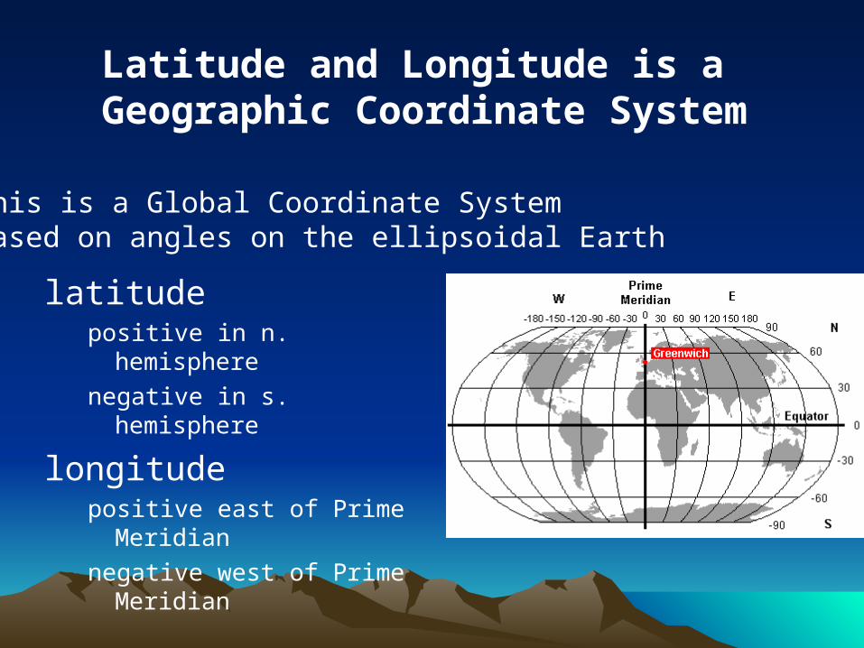
latitudepositive in n. hemispherenegative in s. hemisphere
longitudepositive east of Prime
Meridiannegative west of Prime
Meridian
Latitude and Longitude is a Geographic Coordinate System
• This is a Global Coordinate System• Based on angles on the ellipsoidal Earth

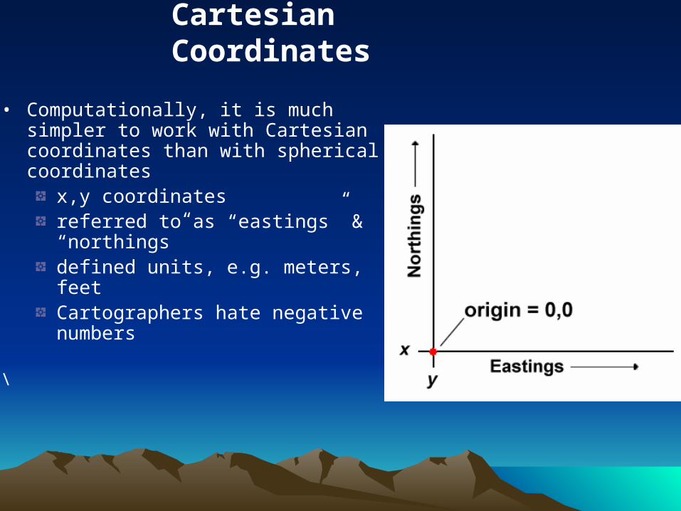
Cartesian Coordinates
• Computationally, it is much simpler to work with Cartesian coordinates than with spherical coordinates
x,y coordinatesreferred to as “eastings” & “northings”defined units, e.g. meters, feetCartographers hate negative numbers
\

ExamplesExamples
• Common coordinate systems:– Universal Transverse Mercator
• Applicable nearly world-wide
– Country-wide coordinate systems:• US – the State Plane Coordinate System• UK – Ordnance Survey National Grid
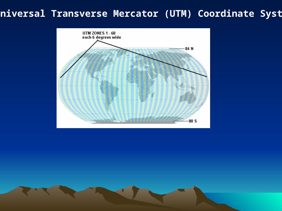
Universal Transverse Mercator (UTM) Coordinate System
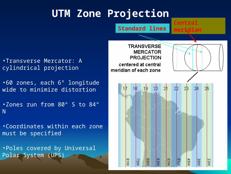
•Transverse Mercator: A cylindrical projection
•60 zones, each 6° longitude wide to minimize distortion
•Zones run from 80° S to 84° N
•Coordinates within each zone must be specified
•Poles covered by Universal Polar System (UPS)
UTM Zone ProjectionCentral meridian
Standard lines

Projection Aspects
cylindrical
conical
planar
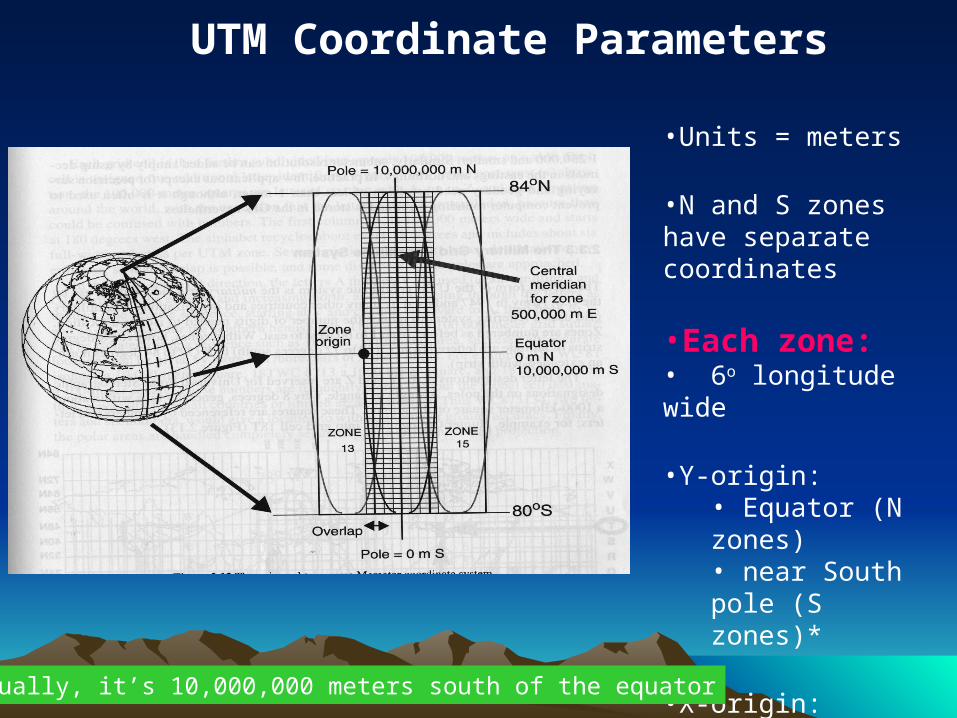
UTM Coordinate Parameters
•Units = meters
•N and S zones have separate coordinates
•Each zone:• 6o longitude wide
•Y-origin:• Equator (N zones)• near South pole (S zones)*
•X-origin:•500,000 m west of central meridian* Actually, it’s 10,000,000 meters south of the equator

Universal Transverse Universal Transverse MercatorMercator
• Each zone looks like this.
• North or South must be specified (i.e. we are currently in UTM zone 17N, not just zone 17)
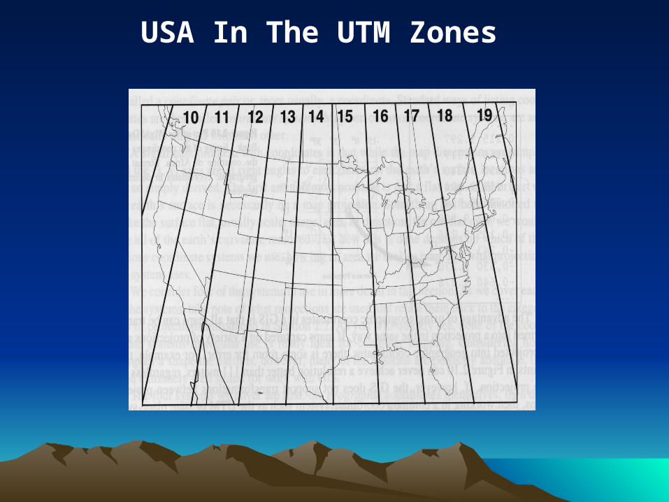
USA In The UTM Zones

UTMUTM• What do you do when the area of interest
crosses UTM zones?• This problem is certain to occur with areas that
are wider than 6° of longitude, but on some occasions even a narrower area of interest will happen to be bisected by the edge of a UTM zone
• All features need to be encoded using a consistent coordinate system it is customary to assign the coordinates to the more predominant zone that contains the majority of the area of interest
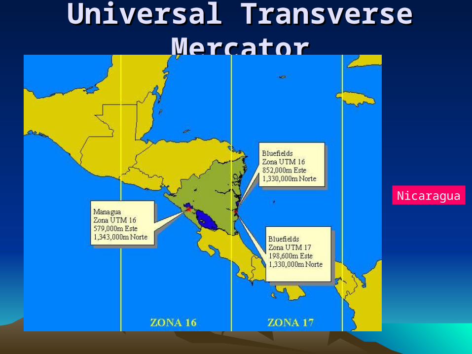
Universal Transverse Universal Transverse MercatorMercator
Nicaragua
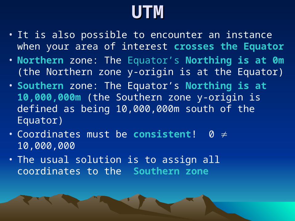
UTMUTM• It is also possible to encounter an instance when
your area of interest crosses the Equator• Northern zone: The Equator’s Northing is at
0m (the Northern zone y-origin is at the Equator) • Southern zone: The Equator’s Northing is at
10,000,000m (the Southern zone y-origin is defined as being 10,000,000m south of the Equator)
• Coordinates must be consistent! 0 10,000,000
• The usual solution is to assign all coordinates to the Southern zone
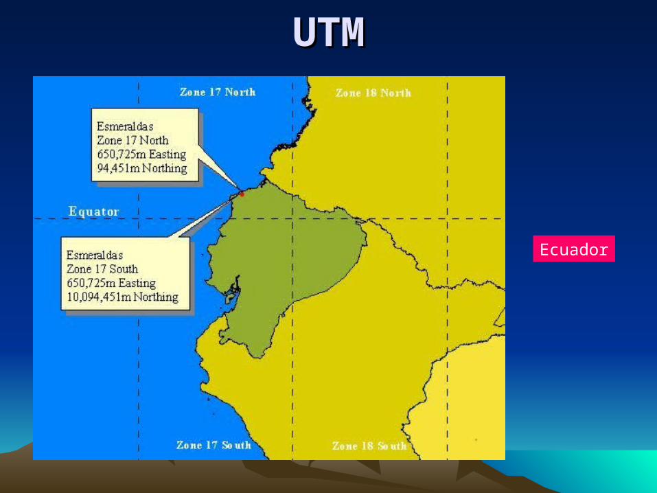
UTMUTM
Ecuador

State Plane Coordinate State Plane Coordinate SystemSystem• The State Plane
Coordinate System (SPCS) is only defined and used in the United States
• Like UTM, it is divided into zones, but here zones are fully contained within states
• Some larger states contain multiple zones
• Original units are feet, many states are now switching to meters

Map Projections for State Plane Coordinate System
N-S zones: Transverse Mercator Projection
E-W zones: Lambert conformal conic projection
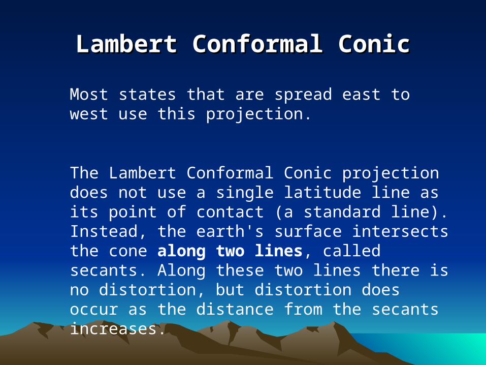
Lambert Conformal ConicLambert Conformal Conic
Most states that are spread east to west use this projection.
The Lambert Conformal Conic projection does not use a single latitude line as its point of contact (a standard line). Instead, the earth's surface intersects the cone along two lines, called secants. Along these two lines there is no distortion, but distortion does occur as the distance from the secants increases.

Lambert Conformal ConicLambert Conformal Conic
Distortion increases as you move away from the secant (standard) lines

SPCSSPCS• The origin for each zone is placed outside the
zone to the southwest (a false origin)• X-origin:
– Transverse Mercator (N-S) Zones ~ 500,000 feet west of the furthest point west
– Lambert Conformal Conic (E-W) Zones ~ 2,000,000 feet west of the furthest point west
• Y-origin is not a specific distance to the south (varies by state and zone)

UTM vs SPCSUTM vs SPCS• SPCS
– More accurate than UTM– used primarily for engineering applications, e.g.
utility companies, local governments to do accurate surveying of facilities network (sewers, power lines)
– Used for small areas– Difficult to use over larger areas (when multiple
zones are necessary)
• UTM– allows overlap between zones for mapping
purposes– The UTM system is global
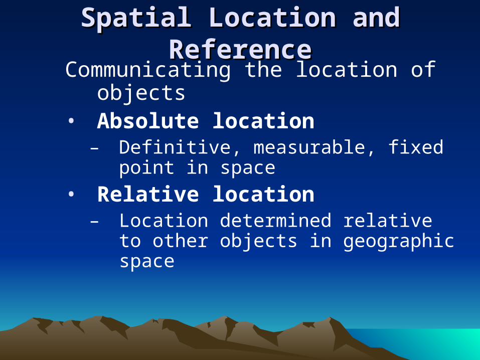
Spatial Location and Spatial Location and ReferenceReference
Communicating the location of objects
• Absolute location– Definitive, measurable, fixed point
in space• Relative location
– Location determined relative to other objects in geographic space

Class SurveyClass Survey
• Please take a piece of paper and write answers to the following questions
• 1) What do you like about this class?
• 2) What would you change if you could?